Why Mapleton Falls National Park stands out
Mapleton Falls National Park is best known for its dramatic waterfall, which drops 120 metres in a single cascade that is visible from designated viewing platforms. The park protects a section of the Blackall Range's forested slopes, preserving subtropical rainforest and tall eucalypt forest in a region that has seen significant development. The waterfall and surrounding forest create a distinctive scenic attraction within the Sunshine Coast hinterland.
Mapleton Falls National Park history and protected-area timeline
The waterfall and surrounding area were first protected as a forest reserve in 1938, reflecting early recognition of the site's natural values. This initial protection placed the area under forest management regulations intended to sustainably manage timber resources and protect watersheds. In 1973, the reserve was elevated to national park status, providing stronger protection under Queensland's national park legislation. This designation reflected growing understanding of the area's significance for biodiversity conservation and its value as a scenic asset for the region. The Queensland Parks and Wildlife Service has managed the park since its establishment as a national park, maintaining walking tracks and visitor facilities while protecting the natural values.
Mapleton Falls National Park landscape and geographic character
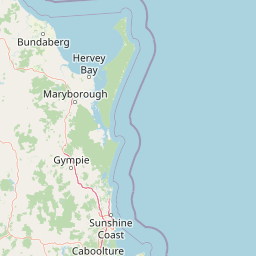
The park sits on the undulating terrain of the Blackall Range, a series of forested ridges and valleys that form part of the Great Dividing Range's northern extension. The landscape is characterized by steep slopes descending into the creek valleys, with the most dramatic feature being the 120-metre drop of Mapleton Falls where Pencil Creek crosses a basalt cliff. The surrounding forest covers the slopes in dense vegetation, creating a lush backdrop to the waterfall. Views from the park extend outward across the hinterland to the coastal plain below, illustrating the range's position as a transition between the Sunshine Coast lowlands and the elevated interior. The combination of tall forest, steep terrain, and prominent waterfall creates a classically Australian scenic landscape.
Mapleton Falls National Park ecosystems, habitats, and plant life
The park protects subtropical rainforest communities in the deeper valleys and on southerly aspects, where moisture-loving species dominate. Tall eucalypts form the more open canopy on ridges and drier slopes, creating a mosaic of forest types across the park's small area. The combination of elevation, moisture, and protection from clearing has allowed the forest to develop a diverse understory of ferns, palms, and shade-tolerant shrubs. These forest communities provide habitat for a range of bird species, including rainforest-specialist birds that are characteristic of South East Queensland's montane forests. The creek system supports aquatic life and provides seasonal water flow to the waterfall.
Mapleton Falls National Park wildlife and species highlights
The forest environments within the park support populations of native birds, including species typical of South East Queensland's wet eucalypt and rainforest habitats. Visitors to the park may encounter a variety of honeyeaters, parrots, and forest birds moving through the canopy. The tall trees provide nesting habitat for larger bird species, while the understory supports smaller birds that prefer dense cover. The creek and waterfall area attracts waterbirds and provides habitat for aquatic species. The intact forest connections to surrounding vegetation allow wildlife to move through the landscape, though the small size of the park means it functions as part of a broader regional ecosystem rather than a self-contained wildlife reserve.
Mapleton Falls National Park conservation status and protection priorities
Mapleton Falls National Park represents a protected remnant of the Blackall Range's original forest cover, much of which has been cleared for farming, rural residential development, and tourism infrastructure. The park preserves examples of subtropical rainforest and wet eucalypt forest that were once more widespread across the range. Protection of the waterfall and its catchment ensures the maintenance of water quality and the scenic values that attract visitors. The national park designation provides legal protection against clearing, logging, and other destructive activities, securing the forest's long-term future. The park contributes to the regional network of protected areas that together conserve the Blackall Range's biodiversity.
Mapleton Falls National Park cultural meaning and human context
The Mapleton area lies within the traditional country of the Gubbi Gubbi people, the Aboriginal group that inhabited the Sunshine Coast and Blackall Range region prior to European settlement. The waterfall and surrounding forest would have held significance for local Aboriginal people, though detailed historical documentation of traditional uses is limited. European settlement of the Blackall Range began in the mid-19th century, with early settlers clearing forest for agriculture and establishing small farms on the fertile slopes. The town of Mapleton grew as a service center for the surrounding agricultural district, later developing as a destination for visitors seeking mountain scenery and cooler temperatures.
Top sights and standout views in Mapleton Falls National Park
The 120-metre Mapleton Falls is the undoubted highlight, with viewing platforms providing dramatic views of the cascade. The walking tracks range from short walks to the falls viewpoint to longer sections of the Sunshine Coast Hinterland Great Walk, which passes through the park. The forest environment surrounding the waterfall offers a contrasting experience to the more developed coastal areas of the Sunshine Coast. The park provides a relatively accessible nature experience within reasonable reach of Brisbane, making it popular for day visitors seeking a forest walk and waterfall view.
Best time to visit Mapleton Falls National Park
The waterfall flows year-round due to the creek's permanent water source, though flow is strongest in the wet season from November to March when rainfall is highest in the catchment. The cooler months from May to September often provide more comfortable conditions for walking, with milder temperatures on the elevated range. Summer thunderstorms can create spectacular waterflow through the falls but may also make track conditions less favorable. The forest is attractive in all seasons, with different wildflowers and bird species visible throughout the year.