


Mori Atlas logo
Biosphere reserveMassif de Ziama

Analyzing the geological structure, forested mountain ridges, and regional watershed context of the massif.

Massif de Ziama Biosphere Reserve: Mapped Protected Landscapes in the Nzerekore Region of Guinea

(Réserve de biosphère du massif de Ziama)

Massif de Ziama represents a critical montane forest landscape in southeastern Guinea, serving as a designated biosphere reserve within the Nzerekore Region. This mountain chain features a distinct north-east to south-west trending relief, acting as the vital headwaters for both the Saint-Paul and Lofa river systems. By examining the mapped boundaries and topographical features of these protected forested slopes, the atlas provides a clear understanding of the massif's role as a biological refuge and an essential element of the regional hydrologic network.

biosphere reservemontane forestGuinean ecoregionforested mountainsimportant bird areaclassified forest
A digital illustration showing a mountainous, forested landscape with a central waterfall flowing into a river valley, framed by tall tropical-style trees.

Massif de Ziama

Biosphere reserve

Park overview

Structured park overview, official facts, and landscape profile for Massif de Ziama

Massif de Ziama park facts, protected area profile, and essential visitor context

Review the core facts for Massif de Ziama, including designation, size, terrain, visitor scale, habitats, and operating context in one park-focused overview.

About Massif de Ziama

Massif de Ziama is a wooded mountain range in the Nzérékoré region of southeastern Guinea, forming part of a forested highland landscape that straddles the border with Liberia. South of the international boundary the same structural chain continues under the name Kpo Range, indicating that the massif is part of a wider geological and ecological corridor rather than an isolated Guinean feature.

The terrain is shaped by deeply dissected hills, rounded ridges, and rocky summits interspersed with plateaus, valleys, granite cliffs, and exposed granite outcrops. The eastern flanks are drained by the Saint-Paul River, while the western flanks feed the Lofa River; both rivers then travel southwestward across Liberia before reaching the Atlantic Ocean. This drainage pattern places the massif at the headwaters of two significant regional river systems.

Ecologically, Massif de Ziama belongs to the Guinean montane forest ecoregion and retains plant and animal communities that differ markedly from those of the surrounding lowlands. Conservationists describe the area as a relic of the formerly much more extensive Upper Guinean forest belt, a landscape that has been heavily reduced elsewhere in West Africa. Today the massif is protected through multiple overlapping designations, including UNESCO Man and the Biosphere Reserve status granted in 1980, a national Classified Forest designation, and recognition as an Important Bird Area, giving the area a layered conservation profile that combines international, national, and biodiversity-specific protections.

Quick facts and research context for Massif de Ziama

Massif de Ziama lies in the Nzérékoré region of southeastern Guinea, close to the Liberian border. It is a north-east to south-west trending mountain chain, the Guinean portion of a structure that continues into Liberia as the Kpo Range.

The massif has held UNESCO Man and the Biosphere Reserve status since 1980, is classified as a Classified Forest under Guinean law, and is listed as an Important Bird Area. The landscape combines valleys, plateaus, rounded ridges, rocky peaks, granite cliffs, and outcrops, with the highest elevations reaching close to 1,400 meters. The eastern slopes are drained by the Saint-Paul River and the western slopes by the Lofa River, both of which flow southwestward through Liberia to the Atlantic Ocean.

Protection and recognition

Official protected area designation records and UNESCO biosphere status

Massif de Ziama Protection Status and International Recognition Data

Massif de Ziama holds documented conservation status and official UNESCO biosphere reserve recognition within global environmental datasets. Structured records compile available protection data and international framework listings for this protected landscape.

International recognition

Protection details

Designated year
1980
WDPA ID
29066
Core area
411.6 km²
Buffer area
778.59 km²
Park context

Deeper park guide and search-rich context for Massif de Ziama

Massif de Ziama history, landscape, wildlife, and travel context

Explore Massif de Ziama through its history, landscape character, ecosystems, wildlife, conservation priorities, cultural context, and seasonal travel timing in a structured park guide built for atlas discovery and search intent.

Why Massif de Ziama stands out

Massif de Ziama is best known as one of the last surviving remnants of Upper Guinean montane rainforest, and as the host of a UNESCO Biosphere Reserve that has protected these forests since 1980. The massif stands out for its combination of Guinean montane forest ecoregion status, a high diversity of plants and animals concentrated in a forested mountain setting, and its long-standing recognition as both an Important Bird Area and a national Classified Forest. Its position at the headwaters of the Saint-Paul and Lofa river systems adds to its broader regional ecological importance.
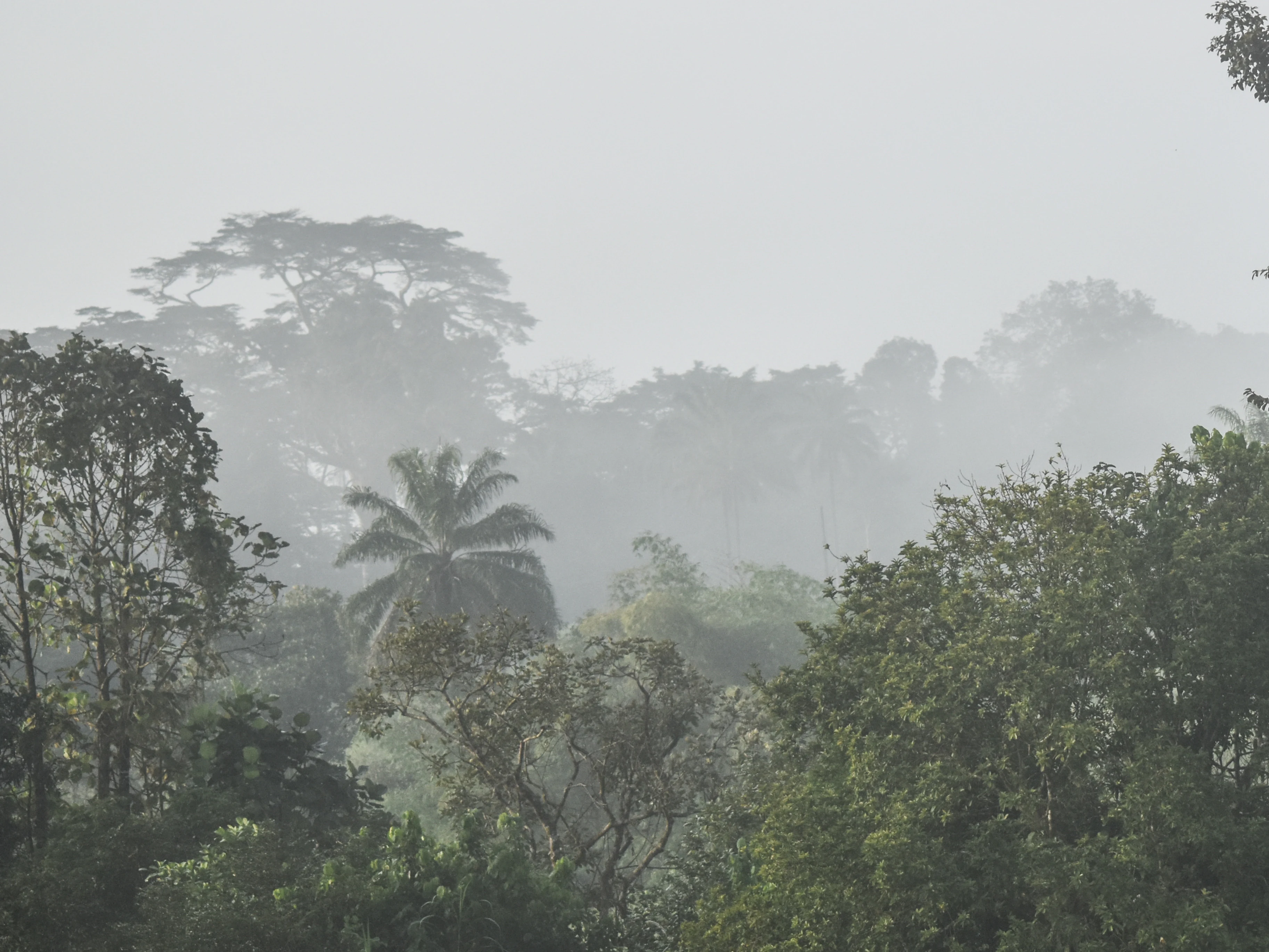
A thick, misty rainforest canopy in Guinea with various tree heights and palm silhouettes visible through the fog.
Misty view over the dense lowland rainforest of Massif de Ziama.

Massif de Ziama history and protected-area timeline

The protected status of Massif de Ziama dates back to 1980, when the area was inscribed on UNESCO's Man and the Biosphere Programme network of biosphere reserves. This early international recognition reflected concern about the broader retreat of forest cover across the Upper Guinean region and established the massif as a reference site for montane forest conservation in West Africa.

In addition to its international designation, the area carries a national Classified Forest status under Guinean law, embedding the site within domestic forest protection frameworks. Over time the massif has also been recognized as an Important Bird Area, progressively reinforcing its role as a priority site for biodiversity conservation. Together these overlapping layers of protection have shaped the modern identity of the massif as both a national and an internationally significant conservation territory.

Massif de Ziama landscape and geographic character

The physical landscape of Massif de Ziama is dominated by a forested mountain chain that runs from the northeast to the southwest, mirroring the structural grain that continues into Liberia as the Kpo Range. The relief is varied, combining deeply cut valleys, broad plateaus, rounded ridge crests, rocky peaks, steep cliffs, and exposed granite outcrops.

The highest points of the Guinean portion approach 1,400 meters, giving the massif enough elevation to support a true montane forest character. The eastern and western slopes are organized around two major drainage basins: the Saint-Paul River to the east and the Lofa River to the west. Both rivers descend from the massif and flow southwestward across Liberia, ultimately reaching the Atlantic Ocean, a pattern that ties the local scenery to a much wider regional hydrology.
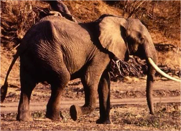
A full-grown African elephant walking through a dry, forested environment with prominent tusks visible.
An African elephant walking through the Massif de Ziama forest region.

Massif de Ziama ecosystems, habitats, and plant life

Massif de Ziama belongs to the Guinean montane forest ecoregion, a vegetation type characterized by closed-canopy rainforest adapted to higher elevations and to the cooler, wetter conditions found on forested mountains in West Africa. The ecoregion supports a flora and fauna that is distinct from the lowland forests surrounding the massif, contributing to the site's reputation as a biogeographically distinctive landscape.

The massif harbors a notably rich biota, with documented counts of more than 1,300 plant species and over 500 animal species occurring within its forested slopes. This concentration of species within a relatively restricted mountain setting is one of the defining ecological features of the site and underlies its overlapping designations as a Classified Forest, an Important Bird Area, and a UNESCO Biosphere Reserve.
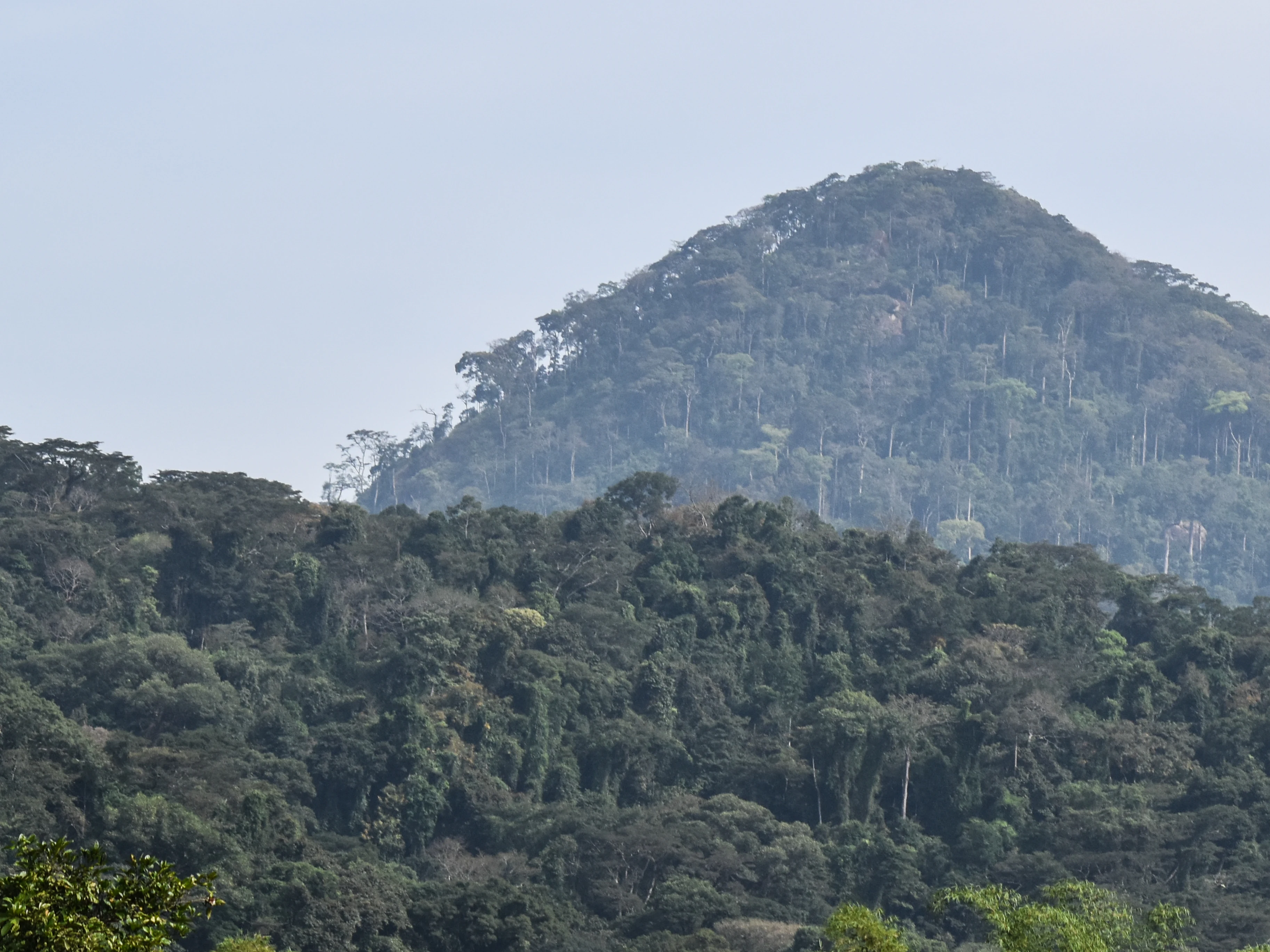
A hazy, green-forested mountain rises against a pale sky in the Ziama Massif.
A forested mountain peak in the Ziama Massif.

Massif de Ziama wildlife and species highlights

The forests of Massif de Ziama support a diverse animal community typical of the Guinean montane forest ecoregion, with more than 500 recorded animal species inhabiting the massif. Among the most emblematic large mammals associated with the Ziama forest are forest elephants, which are regularly noted as a flagship species of the protected area.

The site's designation as an Important Bird Area reflects the importance of the massif for avian conservation, with the montane forests providing habitat for forest-dependent bird species that are tied to this particular ecoregion. The combination of large mammals, a rich bird community, and the broader faunal diversity gives the massif a strong profile as a wildlife refuge within Guinea's forest region.

Massif de Ziama conservation status and protection priorities

Conservation importance is the central reason Massif de Ziama is recognized at multiple levels. The massif has held UNESCO Man and the Biosphere Reserve status since 1980, placing it among the longest-standing biosphere reserves in West Africa and embedding it within UNESCO's international ecological network.

At the national level, the area is protected as a Classified Forest, giving it a formal legal status within Guinea. It is also recognized as an Important Bird Area, providing an additional layer of biodiversity-specific protection. Conservation groups regard Massif de Ziama as one of the last surviving vestiges of the Upper Guinean forest formation, giving the site outsized regional significance for forest cover, watershed integrity, and biodiversity conservation in the broader West African context.

Massif de Ziama cultural meaning and human context

The massif lies within Guinea's forest region, often referred to as Guinée forestière, a culturally distinct zone in the southeastern part of the country. While the available source material does not detail specific indigenous or community governance arrangements, the long-standing use of the area as a Classified Forest indicates a recognized relationship between local communities, national authorities, and the forested mountain landscape that surrounds them.

Top sights and standout views in Massif de Ziama

Massif de Ziama stands out for its UNESCO Biosphere Reserve status, which it has held continuously since 1980, and for its layered system of national and biodiversity-specific protections. Its identity as a Guinean montane forest ecoregion site makes it one of the rare forested mountain landscapes in West Africa where elevational gradients produce a distinct ecological zone.

The massif's role as a refuge for forest elephants and for a rich bird community has helped define its conservation profile, while its position at the headwaters of the Saint-Paul and Lofa river systems connects it ecologically to neighboring Liberia and to the wider Atlantic watershed.

Best time to visit Massif de Ziama

Because the massif falls within the wet, forested climate zone of southeastern Guinea, conditions remain green and biologically active throughout much of the year. The montane forest character means that the landscape retains its forested appearance across seasons, with cooler and often mistier conditions at higher elevations. Visitors interested in lush forest scenery and active forest wildlife conditions will generally find that periods following the main rainy season offer stable atmospheric conditions, while drier interludes provide easier access on forest trails.

Monthly climate preview

Long-term temperature and precipitation records across representative park coordinates

Massif de Ziama Climate Normals and Monthly Weather Patterns

Massif de Ziama exhibits a recorded annual temperature rhythm ranging from mean lows near 22 degrees Celsius to highs exceeding 35 degrees Celsius alongside distinct shifts in monthly precipitation. Examining the complete twelve-month climate profile reveals comprehensive long-term averages sampled from representative park elevations.
Annual mean24 °C
22 °C25 °C
Jan23°
Feb25°
Mar25°
Apr25°
May25°
Jun24°
Jul23°
Aug22°
Sep23°
Oct24°
Nov24°
Dec23°
Warmest month
March

25.5 °C

Coolest month
August

22.2 °C

Wettest month
August

13.6 mm/day

Driest month
December

0.3 mm/day

Park location guide

Geography guide, regional context, and park location map for Massif de Ziama

Massif de Ziama park geography, regions, and map view in Guinea

Understand where Massif de Ziama sits in Guinea through a broader geographic reading of the surrounding landscape, nearby location context, and its mapped position within the national park landscape.

How Massif de Ziama fits into Guinea

Guinea is a West African country with a population of approximately 14 million people. The country achieved independence from France in 1958 and is known for its diverse geography ranging from coastal lowlands to highland plateaus. Conakry serves as both the capital and largest city. Guinea is a member of the United Nations, ECOWAS, the African Union, and La Francophonie.

Wider geography shaping Massif de Ziama in Guinea

Guinea is located on the West African Atlantic coast, bordered by Guinea-Bissau to the northwest, Senegal to the north, Mali to the northeast, Ivory Coast to the southeast, and Sierra Leone and Liberia to the south. The country is divided into four geographic regions: Maritime Guinea along the Atlantic coast, the Fouta Djallon highlands in Middle Guinea, the Upper Guinea savanna in the northeast, and the forested Guinea region in the southeast.

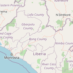
Map view of Massif de Ziama

Use this park location map to pinpoint Massif de Ziama in Guinea, understand its exact geographic position, and read its mapped placement within the surrounding landscape more clearly.

Pigeon | © OpenStreetMap contributors

Location context for Massif de Ziama

Nzerekore Region

Visual reference for the montane forest terrain, habitats, and protected ecosystems of Guinea

Massif de Ziama Photos and Landscapes: Exploring the Protected Mountain Scenery

Visual documentation captures the rugged mountain terrain, dense canopy formations, and steep river valleys that define the protected landscape. Examining these field photographs reveals the ecological character of the surviving forest habitats and regional topography.

A thick, misty rainforest canopy in Guinea with various tree heights and palm silhouettes visible through the fog.

A thick, lush canopy of tropical trees covering a hillside in the Massif de Ziama region.

A full-grown African elephant walking through a dry, forested environment with prominent tusks visible.

A hazy, green-forested mountain rises against a pale sky in the Ziama Massif.

Park atlas

Compare regional forested mountain landscapes and transboundary conservation zones.

Other Parks and Protected Areas Near Massif de Ziama

Browsing other protected areas near Massif de Ziama reveals connected forest ecosystems across the wider Guinean montane ecoregion. Expanding the regional comparison helps trace continuous wildlife habitats and broader river basin geography.
Nature reservePréfecture de Yomou
About 113 km away#1 closest

Southeast

Réserve forestière de Diécké: Protected Forest Geography and Landscape Features

A critical lowland rainforest zone in Guinea

The Réserve forestière de Diécké protects 64,000 hectares of primary and secondary dense forest in southeastern Guinea. Its rugged, hilly terrain and river-carved lowlands support a closed-canopy ecosystem, providing a vital model for zoned forest conservation in the West African region.

Area
640 km²
Relief
Upland
Climate
Tropical
Scope
Terrestrial
National parkLiberia
About 124 km away#2 closest

Southwest

Gola Forest National Park: Geography and Protected Boundaries in Western Liberia

Primary tropical rainforest and Upper Guinea forest landscapes

Located in Western Liberia, Gola Forest National Park encompasses a major expanse of primary tropical rainforest. This protected area acts as a cornerstone of the Upper Guinea forest ecosystem, featuring undulating terrain, river-threaded drainage systems, and dense closed-canopy vegetation that remains essential for regional biodiversity and transboundary ecological connectivity.

Area
979.75 km²
Established
2003
IUCN
II
Relief
Mixed relief
Protected areaNimba County
About 128 km away#3 closest

Southeast

Nimba National Forest: Protected Mountain Landscape & Bird Area in Nimba County

Explore mapped boundaries and regional geographic context.

Nimba National Forest, a protected area of approximately 187 square kilometers, is defined by its mountainous terrain in Nimba County, Liberia. Situated at the tri-border region with Guinea and Ivory Coast, this forest is recognized for its importance as a habitat for diverse bird species and its role in regional conservation efforts. Discover its mapped landscape, its position within the Nimba Range, and its ecological significance within West Africa's protected natural areas.

Area
187 km²
IUCN
VI
Access
Access unknown
Scope
Terrestrial
Protected areaGbarpolu County
About 131 km away#4 closest

Southwest

Kpelle National Forest: Protected Area Identity and Geographic Exploration

Explore Gbarpolu County's protected landscape.

Kpelle National Forest is a key protected area offering a unique glimpse into Liberia's natural geography. This atlas-driven exploration focuses on understanding its specific boundaries, regional placement within Gbarpolu County, and the broader landscape context. Discover the protected area's identity and its significance for geographic comprehension, enabling detailed map-based exploration and regional comparison.

Area
1,748 km²
Established
1961
Relief
Mountain
Climate
Tropical
National parkLiberia
About 163 km away#5 closest

Southwest

Gola Forest National Park: Mapping the Protected Landscapes of Liberia

A critical forest sanctuary and regional geographic landmark in West Africa.

Gola Forest National Park functions as a key protected area within Liberia, defined by its expansive forest ecosystems. This resource illuminates the park geography and spatial distribution, providing a clear understanding of its role in regional conservation and West African environmental mapping.

National parkEastern Province
About 192 km away#6 closest

Southwest

Gola Rainforest National Park: Sierra Leone's Premier Rainforest Protected Area

Explore mapped boundaries and biodiversity in Eastern Province's vast tropical rainforest.

Gola Rainforest National Park is Sierra Leone's second national park and the largest intact rainforest landscape in the country, located in the Eastern Province. As part of the Upper Guinea Forest biodiversity hotspot, it is renowned for its exceptional wildlife, including western chimpanzees and pygmy hippopotamuses. This protected area's mapped extent covers over 71,000 hectares, contributing significantly to regional conservation and providing a vital natural resource for both wildlife and local communities.

Area
710.7 km²
Established
2010
IUCN
II
Relief
Lowland
National parkNimba County
About 194 km away#7 closest

Southeast

Gio National Forest National Park: A Protected Landscape in Nimba County

Mapping the geographic boundaries and regional context of Gio National Forest.

Gio National Forest National Park serves as a key protected area within Liberia's Nimba County. This destination facilitates detailed exploration of its specific geographic footprint and its contribution to the regional atlas. Users can investigate the park's natural landscape context, mapped terrain, and its role as a protected conservation zone. Understand where this significant natural area fits within the broader geographic framework of West Africa.

Area
327 km²
Established
1960
IUCN
IV
Relief
Upland
Protected areaLiberia
About 215 km away#8 closest

Southwest

Gola National Forest Protected Area: Geographic Identity and Atlas Exploration

Liberia's protected landscape and mapped natural terrain.

Gola National Forest represents a vital protected area within Liberia, offering a distinct geographic identity for atlas-based exploration. This entry focuses on understanding its mapped boundaries and its significance as a protected landscape. Delve into the regional geography surrounding Gola National Forest to appreciate its natural context and its place within the broader conservation efforts of West Africa, presented with clear geographic and mapped data.

Area
2,069.9 km²
Established
1960
Climate
Tropical
Scope
Terrestrial

Common questions about visiting, size, designation, and location context for Massif de Ziama

Massif de Ziama FAQs for park facts, access, geography, and protected area context

Find quick answers about Massif de Ziama, including protected-area facts, park geography, trail and visitor context, and how the park fits into its surrounding country and regional landscape.
MoriAtlas Explorer

Continue Your Protected Areas Search Across the Global Atlas

Deepen your exploration by continuing the structured search for national parks and protected areas worldwide. Utilize the comprehensive filtering capabilities to compare different conservation landscapes and refine your understanding of global park geography. Discover more about the distribution and characteristics of protected natural areas.

Global natural geography
