
Why Monumento Natural Arístides Rojas stands out
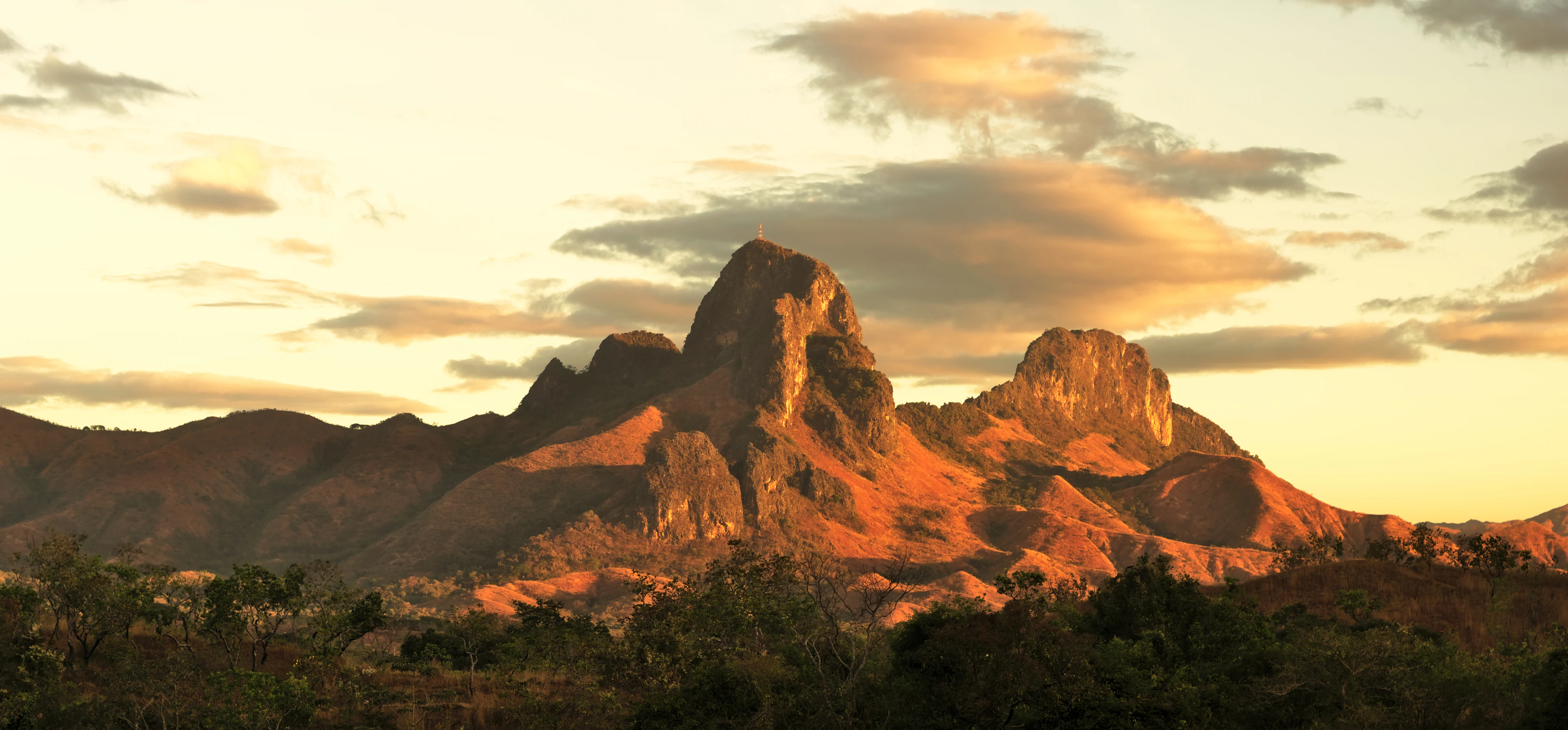
The monument is best known for Los Morros de San Juan, a group of steep, tooth-shaped limestone hills that rise dramatically from the surrounding plains. These formations, composed of ancient reef limestone deposited by a sea that covered the region tens of millions of years ago, give the protected area its distinctive silhouette and regional identity. The site is also recognized for offering panoramic views of San Juan de los Morros from its highest points, and for the network of small caves formed within the limestone. Together, the dramatic relief, the Paleocene geology, and the proximity to a regional capital make this one of the most characteristic natural landmarks of central Venezuela.
Monumento Natural Arístides Rojas history and protected-area timeline
Monumento Natural Arístides Rojas was officially declared a natural monument on November 11, 1949, making it one of the early protected geological sites established under Venezuela's evolving system of natural area conservation. Its designation reflected a recognition of the singular geological character of the limestone hills, known locally as Los Morros de San Juan, which dominate the outskirts of San Juan de los Morros.
The name of the monument honors Arístides Rojas, a Venezuelan naturalist and geologist associated with the documentation of the country's natural heritage. By placing the morros under formal protection, the state aimed to preserve their scientific and scenic value for future generations and to anchor the identity of the region around one of its most recognizable natural landmarks.
Since its establishment, the monument has been administered by the Instituto Nacional de Parques, the national agency responsible for managing Venezuela's protected areas. Over the decades, the site has come to function as both a geological reference point and a cultural emblem of Guárico state, even as broader environmental and institutional pressures have affected protected-area management across the country.
Monumento Natural Arístides Rojas landscape and geographic character
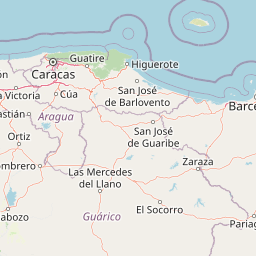
The landscape of the monument is dominated by a tight cluster of steep limestone hills known as morros, which rise abruptly above the surrounding plains near San Juan de los Morros. Their jagged, tooth-like profiles create a striking contrast with the flatter terrain that characterizes much of central Venezuela and the llanos region to the south.
The tallest elevation in the group, Paurario, also called Morro del Faro, reaches approximately 1,060 meters and serves as the visual anchor of the area. A second hill, Tucunuma, lies beside the locality of Apuraría and represents an intermediate scale within the formation, while a more isolated peak known as Papelón stands apart from the main cluster. Together, these hills shape a compact but visually powerful relief that defines the horizon above San Juan de los Morros.
Between and within the rocky outcrops, numerous small caves have formed through the dissolution and weathering of the limestone. These cavities add texture to the terrain and contribute both to the scenic diversity of the monument and to its interest for visitors who explore beyond the main ridges. From the highest points, the landscape opens onto expansive views of the city and the surrounding countryside, reinforcing the sense of the morros as both a natural monument and a regional landmark.
Monumento Natural Arístides Rojas ecosystems, habitats, and plant life
The ecological character of Monumento Natural Arístides Rojas is closely tied to its geology. Because the protected area centers on rugged limestone hills rising from a broader plain, its vegetation and habitat patterns reflect the transition between the dry tropical environments typical of central Venezuela and the more specialized conditions found on rocky, well-drained substrates.
The slopes and crevices of the morros support plant communities adapted to thin soils, intense sun exposure, and limited water retention, while the surrounding lowlands extend into drier savanna-type landscapes characteristic of the transition toward the llanos. This combination creates a sharp ecological gradient over a short distance, contributing to the site's biodiversity interest despite its relatively modest size of around 2,775 hectares.
The small cave systems within the limestone add another ecological dimension, offering sheltered microhabitats for specialized species. Although the available sources do not provide a detailed species inventory, the combination of rocky terrain, caves, and surrounding plains gives the monument a meaningful role as a refuge within an otherwise predominantly open and seasonally dry regional landscape.
Monumento Natural Arístides Rojas wildlife and species highlights
The wildlife profile of the monument reflects the broader ecological context of central Venezuela, where rocky outcrops meet transitional savanna environments. The morros and their associated cavities provide habitat for species adapted to cliff, scrub, and dry-forest conditions, while the lower plains surrounding the hills host fauna typical of the region's dry tropical landscapes.
Cave environments within the limestone can shelter bats and other cave-dwelling organisms, while the slopes and rocky outcrops offer nesting and perching sites for a variety of birds. The proximity to the llanos further increases the potential for seasonal presence of migratory and wide-ranging species associated with that ecosystem.
Although the available source material does not provide a detailed wildlife inventory, the protected area's combination of elevation, rock cover, caves, and surrounding plains gives it ecological relevance beyond its geological importance.
Monumento Natural Arístides Rojas conservation status and protection priorities
Monumento Natural Arístides Rojas is significant from a conservation perspective primarily because it safeguards a rare and visually dramatic geological formation within an otherwise predominantly flat regional landscape. By protecting the limestone morros, the monument preserves not only scenery but also a record of the Paleocene marine environment that once covered this part of Venezuela.
The site's ichnofossils and Paleocene strata give it scientific value for studies of regional sedimentary history, reef development, and paleoenvironmental change. Protecting these exposures within a national monument framework helps ensure that the formation remains accessible for study and appreciation rather than being degraded by urban expansion, quarrying, or unregulated access.
The protected area also contributes to broader landscape-level conservation by maintaining patches of natural rocky habitat and cave environments amid a region where habitat conversion is a persistent pressure. Administered by the Instituto Nacional de Parques since its establishment in 1949, the monument represents one of the early commitments by the Venezuelan state to conserving geological heritage as a component of natural-area protection.
Monumento Natural Arístides Rojas cultural meaning and human context
The morros are deeply embedded in the regional identity of San Juan de los Morros and Guárico state. They serve as a visual landmark visible from the city and surrounding areas and function as a symbol of local pride and natural heritage. The site's formal name honors Arístides Rojas, a notable Venezuelan naturalist and geologist, linking the monument to the country's tradition of scientific exploration and documentation of its natural wealth.
In everyday life, the hills are integrated into the routines and image of the city: residents and visitors alike associate San Juan de los Morros with the silhouette of Los Morros, and the panoramic views from the upper slopes are part of the local cultural landscape. Occasional guided hikes to the summit reflect the ongoing relationship between the community and the monument, blending outdoor activity with appreciation of geological and scenic heritage.
Top sights and standout views in Monumento Natural Arístides Rojas
The principal highlight of the monument is the dramatic skyline of Los Morros de San Juan themselves: jagged, reef-limestone hills that rise sharply from the surrounding plains and define the visual identity of central Venezuela's Guárico state. Among them, Paurario stands as the tallest, Tucunuma occupies a central place near Apuraría, and the more isolated Papelón extends the formation's reach.
Equally compelling is the panoramic view of San Juan de los Morros from the upper slopes of the morros, a perspective that links the monument to the life of the regional capital. The network of small caves within the limestone, the Paleocene geological context, and the site's early 1949 protection as a natural monument collectively make Arístides Rojas a compact but rich destination for those interested in geology, scenery, and the natural heritage of Venezuela.
Best time to visit Monumento Natural Arístides Rojas
The monument's character shifts with the seasonal rhythm of central Venezuela, where a dry season and a wet season shape both the surrounding landscape and the experience of visiting the hills. During the wet season, vegetation in the lower areas greens up and temperatures may feel more moderate, while the wetter conditions can affect trail conditions on the rocky slopes.
In the dry season, clearer skies tend to favor panoramic views from the upper morros, and the contrast between the bare, sunlit limestone and the surrounding plains becomes especially striking. Cooler early mornings are generally well suited to climbing and to enjoying the vistas over San Juan de los Morros, while midday heat can be intense on the exposed rock. Visitors interested in photography, geology, and broad landscape views typically find the dry season particularly rewarding.