Mori Atlas logo
National parkMosi-oa-Tunya National Park

Discover the mapped boundaries and regional setting of this significant protected area in Zambia's Southern Province.

Mosi-oa-Tunya National Park: Protected National Park Landscape and Geographic Context

Mosi-oa-Tunya National Park represents a key protected landscape within Zambia's Southern Province, offering a distinct entry into the nation's atlas of natural areas. This page provides essential geographic context for the park, detailing its mapped boundaries and its place within the regional terrain. Users can explore the foundational geography of this national park, understanding its unique role as a protected area and its contribution to the wider mapped natural landscapes of the region.

UNESCO World Heritage SiteWaterfallRiverine ForestMiombo WoodlandSafariZambezi River

Mosi-oa-Tunya National Park

National park

Park overview

Structured park overview, official facts, and landscape profile for Mosi-oa-Tunya National Park

Mosi-oa-Tunya National Park park facts, protected area profile, and essential visitor context
Review the core facts for Mosi-oa-Tunya National Park, including designation, size, terrain, visitor scale, habitats, and operating context in one park-focused overview.

About Mosi-oa-Tunya National Park

Mosi-oa-Tunya National Park occupies a remarkable position at the gateway to one of Africa's most iconic natural wonders. The park stretches along the Zambezi River from the Songwe Gorge below Victoria Falls, extending northwestward in an arc that encompasses approximately 20 kilometers of riverbank. This positioning gives the park a unique dual character: one section protects the immediate vicinity of Victoria Falls themselves, while another larger wildlife section encompasses riverine forest, miombo woodland, and grassland habitats. The park's boundary effectively forms the southwestern edge of Livingstone, Zambia's historic tourist gateway city, creating both opportunities and challenges for conservation. The falls themselves represent a geological marvel, where the Zambezi River plunges into a series of narrow gorges known as the Batoka Gorges, creating a spectacle that has drawn visitors since the mid-19th century when Scottish explorer David Livingstone became the first European to witness the cascade. The park's UNESCO designation recognizes both the extraordinary natural beauty of the waterfall and the geological significance of the gorges system that carries the river away after its dramatic descent. Beyond the immediate falls area, the park provides crucial habitat for large mammals and serves as a corridor for elephants moving between Zambia and Zimbabwe.

Quick facts and research context for Mosi-oa-Tunya National Park

Mosi-oa-Tunya National Park covers 66 square kilometers along the Zambezi River in Southern Province, Zambia, near the city of Livingstone. The park is a UNESCO World Heritage Site designated in 1989 under criteria vii and viii for its outstanding natural beauty and geological significance. It protects the Zambian half of Victoria Falls, one of the largest and most famous waterfalls in the world, which drops into the Batoka Gorges below. The park is managed by the Zambia Wildlife Authority and is part of discussions for inclusion in the five-nation Kavango-Zambezi Transfrontier Conservation Area, which would connect protected areas across multiple countries.

Park context

Deeper park guide and search-rich context for Mosi-oa-Tunya National Park

Mosi-oa-Tunya National Park history, landscape, wildlife, and travel context
Explore Mosi-oa-Tunya National Park through its history, landscape character, ecosystems, wildlife, conservation priorities, cultural context, and seasonal travel timing in a structured park guide built for atlas discovery and search intent.

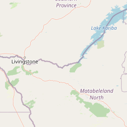
Why Mosi-oa-Tunya National Park stands out

Mosi-oa-Tunya National Park is most famous for protecting the Zambian half of Victoria Falls, known locally as "The Smoke that Thunders" for the massive spray that rises from the 1,708-meter-wide waterfall. The falls create the world's largest curtain of falling water, particularly impressive during the rainy season when the Zambezi River swells. Beyond the falls, the park is known for its dramatic riverine forest ecosystem sustained by the constant spray, which supports rare plant species including pod mahogany, ebony, ivory palm, and wild date palm. The wildlife section features populations of African elephants that cross between Zambia and Zimbabwe, along with giraffes, zebras, buffalo, and a small population of southern white rhinos that were introduced from South Africa.

Aerial photograph of multiple elephants walking across a dry, hilly terrain with scattered trees and shrubs
Aerial view of elephants traversing the dry landscape of Mosi-oa-Tunya National Park

Mosi-oa-Tunya National Park history and protected-area timeline

Mosi-oa-Tunya National Park was established to protect the Zambian portion of Victoria Falls and the surrounding natural environment. The park gained UNESCO World Heritage Site status in 1989, recognized under criteria vii for outstanding natural beauty and criterion viii for geological significance. The area has historical significance beyond its natural features, containing the Old Drift Cemetery where early European settlers were buried after establishing a camp near the river. These settlers suffered from a mysterious fatal illness they incorrectly attributed to the distinctive yellow-and-green-barked fever trees, when the actual cause was malaria carried by mosquitoes. The settlement eventually moved to higher ground, leading to the establishment of the town of Livingstone, which remains the park's primary access point. In November 2005, a new statue of David Livingstone was erected within the park, complementing the more famous statue on the Zimbabwean side. A plaque was also unveiled on Livingstone Island to mark the spot from which the famous explorer first viewed the falls in 1855. The park's wildlife population has faced challenges, particularly during droughts since 2000, and conservation efforts have included the introduction of southern white rhinos from South Africa, though these face ongoing poaching threats.

Mosi-oa-Tunya National Park landscape and geographic character

The landscape of Mosi-oa-Tunya National Park is defined by the dramatic encounter between the Zambezi River and the ancient basalt plateau that creates Victoria Falls. The river flows broad and powerful before encountering a series of gorges that slice deep into the landscape, with the falls themselves dropping into the first of these narrow gorges known as the First Gorge. Below the falls, a series of steep-sided gorges cascade downstream, carved by the river's relentless erosion over millennia. The terrain varies significantly between the two main sections of the park: the wildlife section features gentle undulating terrain covered in miombo woodland and grassland, interspersed with riverine forest along watercourses, while the falls section drops sharply toward the river gorge. The riverine forest in the falls area is a unique ecosystem created by the constant spray from the waterfall, supporting lush vegetation that contrasts sharply with the surrounding savanna. The Batoka Gorges below the falls are characterized by sheer cliff faces that provide nesting habitat for numerous raptor species and create dramatic viewpoints accessible by footpaths and the historic Knife-Edge Bridge.

Mosi-oa-Tunya National Park ecosystems, habitats, and plant life

The nature of Mosi-oa-Tunya National Park encompasses two distinct ecological systems that reflect the dramatic environmental gradients created by the waterfall. The rainforest surrounding the falls is a unique micro-ecosystem sustained entirely by the perpetual spray from the cascading water, creating conditions for plant species that are rare elsewhere in the region. This narrow zone supports pod mahogany, ebony, ivory palm, wild date palm, and numerous climbing vines and lianas that create a dense green canopy. The underlying geology of basalt gorges and the river itself create additional habitats, while the broader wildlife section encompasses miombo woodland, a characteristic southern African forest type dominated by Brachystegia trees, interspersed with grasslands that support diverse herbivore communities. The park sits within a broader landscape that forms part of potential transfrontier conservation initiatives connecting protected areas across five southern African nations.

Mosi-oa-Tunya National Park wildlife and species highlights

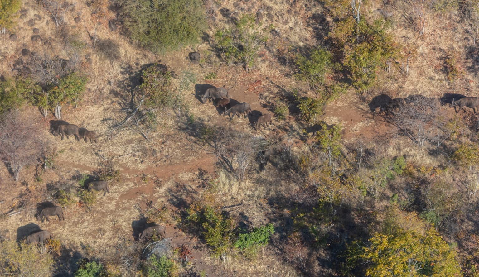
The wildlife section of Mosi-oa-Tunya National Park supports populations of large and small mammals characteristic of southern African savanna ecosystems. The park is home to Angolan giraffes, Burchell's zebras, African buffalo, impalas, warthogs, and sable antelopes that move through the miombo woodland and grassland habitats. African elephants are frequently observed crossing the Zambezi River between the Zambian and Zimbabwean sides of the falls during the dry season, while hippopotamuses and crocodiles inhabit the river channels. Smaller primates including vervet monkeys and baboons are common throughout the park. The park maintains a small population of southern white rhinos, which were introduced from South Africa as the indigenous black rhino had been extirpated from the area. The rhino population faced significant challenges including poaching incidents in 2007 but has grown to approximately ten individuals by 2022 under intensive protection. The cliff-top areas and gorges below the falls support populations of klipspringers, African clawless otters, and at least 35 species of raptors including Taita falcon, Verreaux's eagle, peregrine falcon, and augur buzzard that nest in the steep gorge walls.

Mosi-oa-Tunya National Park conservation status and protection priorities

Mosi-oa-Tunya National Park represents an important conservation node within southern Africa's protected area network, recognized internationally through its UNESCO World Heritage Site designation. The park's dual function of protecting both a world-famous waterfall and the surrounding wildlife habitat creates conservation challenges, particularly around balancing visitor access with ecological protection. The introduction of southern white rhinos represents an ambitious conservation initiative, though the challenges of protecting these valuable animals from poaching demonstrate the ongoing threats facing wildlife in the region. The park is being considered for inclusion in the Kavango-Zambezi Transfrontier Conservation Area, a five-nation initiative that would connect protected areas across Botswana, Namibia, Zambia, Zimbabwe, and Angola to create larger wildlife corridors. The small elephant crossing point near where the river plunges over the falls represents a particularly sensitive area where development pressures conflict with wildlife movement needs.

Mosi-oa-Tunya National Park cultural meaning and human context

Mosi-oa-Tunya National Park occupies a landscape that has been significant to local communities for centuries, with the Kololo and Lozi peoples giving the falls its powerful name. The name "The Smoke that Thunders" captures the dramatic visual and auditory impact of Victoria Falls, where the falling water creates a constant roar and a rising mist that can be seen from many kilometers away. The park contains the Old Drift Cemetery, marking the location where early European explorers and settlers established a camp near the river, the first Europeans to attempt permanent settlement in the area. The park is intimately connected with the legacy of David Livingstone, the Scottish explorer who first brought international attention to the falls in the mid-19th century, and the 2005 statue addition within the park continues this historical connection. The modern city of Livingstone provides the human context for the park, serving as both the primary access point for visitors and the community most directly connected to the park's management and economic benefits from tourism.

Top sights and standout views in Mosi-oa-Tunya National Park

The defining highlight of Mosi-oa-Tunya National Park is undeniably the opportunity to view Victoria Falls from the Zambian side, where the full width of the waterfall can be appreciated and the famous Knife-Edge Bridge provides dramatic views of the Rainbow Falls and the First Gorge. The wildlife section offers a different experience, with game drives through miombo woodland providing encounters with giraffes, zebras, buffalo, and elephants in a more typical safari setting. The riverine rainforest near the falls provides a unique botanical environment where visitors can walk through lush vegetation sustained by the constant spray, a striking contrast to the surrounding savanna. The knife-edge bridge and footpaths to the Boiling Pot offer access to views of the gorges that few other protected areas can match. The presence of white rhinos, though not native to the area, provides a rare opportunity to observe these endangered animals in a national park setting.

Best time to visit Mosi-oa-Tunya National Park

The best time to visit Mosi-oa-Tunya National Park depends on what visitors hope to experience. The dry season from April to October offers easier wildlife viewing as animals congregate around water sources, and the reduced water volume makes the falls less overwhelming, though still impressive. The wet season from November to March brings the Zambezi River to its highest levels, creating the most spectacular waterfall display when the full width of the falls cascades into the gorge, though the resulting spray can be intense and visibility may be reduced in some areas. The transitional periods of April-May and October-November often provide a balance between good waterfall viewing and favorable wildlife conditions. The park can be visited year-round, though visitors should be prepared for the tropical climate and the possibility of heavy rains during the wet season.

Park location guide

Geography guide, regional context, and park location map for Mosi-oa-Tunya National Park

Mosi-oa-Tunya National Park park geography, regions, and map view in Zambia
Understand where Mosi-oa-Tunya National Park sits in Zambia through a broader geographic reading of the surrounding landscape, nearby location context, and its mapped position within the national park landscape.

How Mosi-oa-Tunya National Park fits into Zambia

Zambia is a landlocked nation in Southern Africa with a population of approximately 20 million people. The country is bordered by eight countries and features diverse geography ranging from the Zambezi River to vast plateaus. Lusaka serves as the capital and largest city, while the Copperbelt Province in the north drives much of the economy through copper mining.

Wider geography shaping Mosi-oa-Tunya National Park in Zambia

Zambia is located in Southern Africa and is landlocked, bordered by eight countries: Democratic Republic of the Congo to the north, Tanzania to the northeast, Malawi to the east, Mozambique to the southeast, Zimbabwe and Botswana to the south, Namibia to the southwest, and Angola to the west. The country features varied terrain including the Zambezi River plain in the south, plateaus in the central and northern regions, and the Muchinga Mountains in the northeast. Lake Tanganyika forms part of the northern border.

Map view of Mosi-oa-Tunya National Park

Use this park location map to pinpoint Mosi-oa-Tunya National Park in Zambia, understand its exact geographic position, and read its mapped placement within the surrounding landscape more clearly.

Pigeon | © OpenStreetMap contributors

Location context for Mosi-oa-Tunya National Park

Southern Province

Visualize the varied terrain, iconic Victoria Falls, and unique riverine ecosystems that define this Zambian protected area.

Mosi-oa-Tunya National Park: Visual Landscapes of Victoria Falls and Riverine Habitats
Explore the visual essence of Mosi-oa-Tunya National Park with photographs showcasing its iconic Victoria Falls, dramatic Zambezi River gorges, and lush riverine forest habitats. These park images offer essential insights into its unique micro-ecosystems, varied terrain, and the distinct protected-area character of this Zambian conservation landscape.

Aerial photograph of multiple elephants walking across a dry, hilly terrain with scattered trees and shrubs

Park atlas

Trace the broader protected landscapes and unique ecosystems across Southern Africa, comparing waterfall parks and wildlife habitats.

Discover National Parks Near Mosi-oa-Tunya National Park and the Zambezi River Region
Explore other national parks and protected areas situated within the Zambezi River basin and surrounding Southern African region, offering diverse landscapes from miombo woodlands to dramatic gorges. Compare adjacent conservation efforts, mapped terrain, and distinct wildlife habitats to deepen your geographic understanding beyond Mosi-oa-Tunya National Park.
National parkZimbabwe

Victoria Falls National Park: A Protected Landscape Within Zimbabwe's Geography

Atlas exploration of park boundaries and natural terrain.

Victoria Falls National Park is a key component of Zimbabwe's protected natural areas. This page provides structured information ideal for atlas-based exploration, detailing the park's geographic position and mapped landscape features. Understand its significance as a national park and its contribution to the region's conservation geography.

Area
23.4 km²
IUCN
II
Relief
Mixed relief
Climate
Tropical
National parkHwange District

Zambezi National Park: National Park within Hwange District's Geographic Landscape

Explore mapped boundaries and protected area context.

Delve into Zambezi National Park, a designated national park situated in Hwange District. This entry provides foundational geographic and landscape context, highlighting the park's protected status and its position within the regional terrain. Understand the atlas significance and mapped features of this conservation landscape for informed discovery.

Area
560 km²
Established
1979
Relief
Lowland
Climate
Subtropical
National parkZimbabwe

Kazuma Pan National Park: Zimbabwe National Park Atlas and Protected Landscape Exploration

Unique plains landscape with reliable dry-season wildlife viewing.

Kazuma Pan National Park offers a rare glimpse into Zimbabwe's expansive grassy plains and vital pans, creating a unique protected landscape. This national park is critical for understanding regional wildlife migrations and the geographic context of conservation areas in northwestern Zimbabwe, providing an essential entry point for atlas-based exploration of its terrain and ecological significance.

Area
313 km²
Established
1975
IUCN
II
Relief
Lowland
National parkBotswana

Chobe National Park: Botswana National Park Atlas and Mapped Landscape Explorer

Discover Botswana's diverse protected areas and unique savanna wetlands.

Chobe National Park represents a cornerstone of protected land discovery in Botswana, offering an unparalleled glimpse into a landscape shaped by dynamic water systems and iconic wildlife. This national park is not merely a destination; it is a vital ecosystem supporting vast elephant populations and showcasing a remarkable variety of terrain from riverine floodplains to savanna marshes. Understanding Chobe National Park through its mapped boundaries and regional geographic context reveals its significance as a protected natural area with diverse habitats supporting critical conservation efforts.

Area
11,700 km²
Established
1967
IUCN
II
Relief
Mixed relief
National parkZambia

Kafue National Park: Zambia's Key National Park for Geographic and Protected Area Exploration

Mapped boundaries and landscape context in southern Africa.

Kafue National Park represents a vital component of Zambia's protected lands, offering a distinct perspective for atlas-driven geographic exploration. This national park's identity is tied to its extensive mapped boundaries and its contribution to the regional landscape of southern Africa. Users engaging with this entry can uncover the protected area's specific geographic context and map-based details, enhancing their understanding of conservation landscapes.

Area
22,400 km²
IUCN
II
Relief
Lowland
Climate
Tropical
National parkCaprivi Region

Mudumu National Park National Park: Discover its Protected Landscape and Geographic Boundaries

Mapping the protected area and regional landscape context in Caprivi Region.

Navigate the protected geography of Mudumu National Park, a designated national park situated within the Caprivi Region. This entry provides a structured atlas view of its mapped boundaries and landscape context. Gain a clear understanding of its protected status and its place within the regional geographic framework, offering essential detail for map-based exploration of natural areas in Namibia.

Area
737 km²
Established
1990
Relief
Lowland
Climate
Tropical
National parkNamibia

Nkasa Rupara National Park: A Protected Landscape within Namibia's Geography

Explore the mapped protected area and its regional landscape context.

Nkasa Rupara National Park represents a distinct protected landscape within Namibia. This entry provides detailed geographic context, focusing on the park's mapped boundaries and its role as a national park. Understand how this protected area contributes to the broader regional geography, offering a focal point for atlas-based exploration of Namibia's natural lands.

Area
320 km²
Established
1990
IUCN
II
Relief
Lowland
National parkZimbabwe

Chizarira National Park: Zimbabwe's Remote Protected Landscape on the Zambezi Escarpment

Explore rugged mountains, deep gorges, and unique woodland ecosystems.

Chizarira National Park offers an unparalleled exploration of wilderness and dramatic geography within Zimbabwe. Situated along the imposing Zambezi Escarpment, its landscape is characterized by a 600-meter drop, rugged mountains, and deep river gorges carved by perennial streams. This protected area, known for its remote appeal and rich leopard populations, provides a distinct view of miombo and mopane woodlands, contributing to its unique ecological identity within the regional geography.

Area
2,000 km²
Established
1975
IUCN
II
Relief
Mountain

Common questions about visiting, size, designation, and location context for Mosi-oa-Tunya National Park

Mosi-oa-Tunya National Park FAQs for park facts, access, geography, and protected area context
Find quick answers about Mosi-oa-Tunya National Park, including protected-area facts, park geography, trail and visitor context, and how the park fits into its surrounding country and regional landscape.
MoriAtlas Explorer

Continue Your Protected Areas Search Across the Global Atlas

Deepen your exploration by continuing the structured search for national parks and protected areas worldwide. Utilize the comprehensive filtering capabilities to compare different conservation landscapes and refine your understanding of global park geography. Discover more about the distribution and characteristics of protected natural areas.

Global natural geography