

Mori Atlas logo
Nature reserveMount Gibson Sanctuary

Mapping the transitional geography between Wheatbelt woodlands and the arid interior rangelands

Mount Gibson Sanctuary Protected Nature Reserve and Ecological Landscape in Western Australia

Mount Gibson Sanctuary spans over 1,300 square kilometres of diverse terrain in mid-west Western Australia, marking a critical transition between cleared agricultural lands and the arid interior. This nature reserve protects extensive eucalypt woodlands, rocky ranges, and ephemeral salt lakes that define the regional ecological character. Researchers and nature enthusiasts use this data to understand the sanctuary's role in wildlife conservation, landscape rehabilitation, and habitat restoration.

nature reserveAustralian Wildlife ConservancyWheatbeltrangelandsemi-arideucalypt woodland

Mount Gibson Sanctuary

Nature reserve

Park overview

Structured park overview, official facts, and landscape profile for Mount Gibson Sanctuary

Mount Gibson Sanctuary park facts, protected area profile, and essential visitor context

Review the core facts for Mount Gibson Sanctuary, including designation, size, terrain, visitor scale, habitats, and operating context in one park-focused overview.

About Mount Gibson Sanctuary

Mount Gibson Sanctuary is one of the largest private nature reserves in Australia and one of the Australian Wildlife Conservancy's flagship properties in the mid-west of Western Australia. Covering 1,305 square kilometres, the sanctuary lies in a landscape of real geographic importance: the transition zone between the Wheatbelt, where most native vegetation has been cleared for agriculture, and the relatively intact rangelands further inland. This position gives the reserve an unusually rich floristic and faunal character, blending southwestern woodland species with arid-zone counterparts.

Physically, the sanctuary is a mosaic of rocky ranges, broad floodplains, claypans, salt lakes, and sandplains. Vegetation is dominated by eucalypt woodlands reminiscent of the Wheatbelt, including large stands of salmon gum, York gum, and gimlet, all of which have become rare at a regional scale because of historic land clearing. The site's floristic richness is underlined by the presence of more than 100 native bee species recorded on the property.

Mount Gibson's wildlife is similarly shaped by its transitional position. Red kangaroos and western grey kangaroos share the landscape, while mammals such as Mitchell's hopping mouse and the little long-tailed dunnart occur alongside characteristic bird species including malleefowl, Major Mitchell's cockatoo, and regent parrot. The sanctuary has also expanded its conservation role through the reintroduction of western quolls in 2023 and 2024.

As a working conservation property, Mount Gibson combines active ecological management, including feral animal control, habitat rehabilitation, and wildfire management, with research and species recovery programs. Its combination of ecological contrast, conservation ambition, and large spatial scale makes it an important stronghold of Western Australia's natural heritage.

Quick facts and research context for Mount Gibson Sanctuary

Mount Gibson Sanctuary lies on the northern fringe of the Western Australian Wheatbelt, where cleared agricultural land gives way to uncleared rangeland. The sanctuary covers 1,305 square kilometres and sits at the transition between the south-west and arid-zone biomes, along the mulga-eucalypt line. Established in 2001, it is owned and managed by the Australian Wildlife Conservancy as a flagship private conservation property. Together with the neighbouring Charles Darwin Reserve, it forms a significant BirdLife International Important Bird Area, recognized for malleefowl, western corellas, and other arid- and mallee-restricted species.

Protection and recognition

Terrestrial protected area governance and recognition records

Mount Gibson Sanctuary Protection Status and Conservation Framework

Mount Gibson Sanctuary maintains documented terrestrial protection status within a dedicated conservation framework. Structured records outline the governing management scope and official administrative parameters for the reserve.

Protection details

Protection scope
Terrestrial
Transboundary protection
No
Park context

Deeper park guide and search-rich context for Mount Gibson Sanctuary

Mount Gibson Sanctuary history, landscape, wildlife, and travel context

Explore Mount Gibson Sanctuary through its history, landscape character, ecosystems, wildlife, conservation priorities, cultural context, and seasonal travel timing in a structured park guide built for atlas discovery and search intent.

Why Mount Gibson Sanctuary stands out

Mount Gibson is best known for protecting extensive stands of Wheatbelt eucalypt woodland, such as salmon gum, York gum, and gimlet, in a landscape where these vegetation types have been heavily cleared elsewhere. The sanctuary is also recognized for its transitional wildlife communities, where red and western grey kangaroos overlap and species typical of both the south-west and the arid zone coexist. Its bird values are likewise significant, with malleefowl, Major Mitchell's cockatoo, regent parrot, and western corellas among the species of conservation interest. Recent reintroductions of western quolls have further strengthened the sanctuary's profile as a private conservation property combining ecological restoration, predator control, and species recovery.

Mount Gibson Sanctuary history and protected-area timeline

Mount Gibson was first established as a pastoral lease in 1915 and was used primarily for sheep grazing for much of the twentieth century. Over time, and especially in its later pastoral years, the property came to be recognised and managed for its environmental values rather than purely as grazing country. In 2001, the Australian Wildlife Conservancy acquired Mount Gibson, transforming it from a working pastoral property into a dedicated conservation reserve.

Since the acquisition, AWC has run ongoing ecological management programs at Mount Gibson. These include the removal and control of feral animals, active rehabilitation of degraded parts of the landscape, and structured wildfire management aimed at safeguarding both native vegetation and resident wildlife. The sanctuary's conservation direction was further consolidated in the early 2020s with the reintroduction of western quolls, a marsupial predator that had been lost from the broader region, with releases in 2023 and 2024 extending the sanctuary's role into active species recovery.

Mount Gibson Sanctuary landscape and geographic character

Mount Gibson Sanctuary lies in a region of strong topographic and ecological contrast. The reserve incorporates rocky ranges that rise above broader lowland systems, giving way to wide seasonal floodplains, shallow claypans, salt lakes typical of the Australian arid zone, and extensive sandplains. Together these landforms create a patchwork of habitats that shift dramatically across relatively short distances.

The climate is semi-arid, with rainfall concentrated in the winter months and hot, dry summers that strongly influence the rhythm of the landscape. Average annual rainfall sits between roughly 250 and 300 millimetres, shaping both vegetation cover and the episodic flooding and drying of the floodplains and claypans. This combination of variable rainfall and diverse terrain defines the visual character of the sanctuary and underpins its ecological richness.

Mount Gibson Sanctuary ecosystems, habitats, and plant life

Floristically, Mount Gibson is defined by its position along the mulga-eucalypt line, the broad biogeographic boundary where southwestern eucalypt woodlands grade into more arid mulga-dominated vegetation. This transitional setting means the reserve carries elements of both the south-west region and the arid zone in a single landscape.

Much of the sanctuary is dominated by Wheatbelt flora that has been extensively cleared elsewhere in the region, particularly open eucalypt woodlands. Notable components include salmon gum, which forms distinctive pale-barked stands, York gum woodlands typical of the broader Wheatbelt, and gimlet eucalypts with their characteristic smooth, shiny trunks. The mix of woodland types creates a diverse vegetation structure with patches of denser tree cover interspersed with more open shrubland and grassy understorey. Importantly, the property hosts more than 100 recorded native bee species, providing a strong indicator of floristic richness and pollinator diversity.

Mount Gibson Sanctuary wildlife and species highlights

The sanctuary's wildlife reflects its transitional geography, with many species drawn from both the south-west and arid zones. Two species of large macropod occur together here: the red kangaroo, an arid-zone specialist, and the western grey kangaroo, more typical of southern and southwestern Australia. Their co-occurrence on the same landscape is a clear signal of Mount Gibson's position at the meeting point of two biogeographic regions.

Other mammals of conservation and ecological interest include Mitchell's hopping mouse, a small native rodent adapted to dry inland conditions, and the little long-tailed dunnart, a tiny marsupial predator of the region's shrublands and woodlands. Beginning in 2023 and continuing in 2024, western quolls, a spotted marsupial carnivore historically lost from much of its former range, have been reintroduced to parts of the sanctuary outside the feral-predator-free area, marking a significant step in regional species recovery.

Birdlife is a particular strength of Mount Gibson. The reserve supports significant populations of malleefowl, a ground-dwelling bird of semi-arid shrublands, as well as Major Mitchell's cockatoo, with its distinctive pink and white plumage, and the brightly coloured regent parrot, a species of conservation concern that depends on mature eucalypt woodlands. Beyond these signature species, the sanctuary and adjacent Charles Darwin Reserve together form a recognised Important Bird Area, also notable for western corellas and other arid- and mallee-restricted species.

Mount Gibson Sanctuary conservation status and protection priorities

Mount Gibson Sanctuary is a conservation property of national significance, both because of its size and because of its position within a landscape that has otherwise been heavily modified. Roughly 1,305 square kilometres of contiguous habitat at the northern edge of the Wheatbelt represents a substantial refuge for Wheatbelt woodlands and species that have declined across most of their original distribution.

The sanctuary is owned and managed by the Australian Wildlife Conservancy, a private conservation organisation that runs the property as part of a wider national network of sanctuaries. Active management programs include systematic feral animal control, ongoing rehabilitation of degraded areas, and structured wildfire management. These interventions are designed to maintain ecosystem function across the reserve's range of habitat types, from rocky woodland ranges to floodplains and claypans.

Mount Gibson's conservation role extends to threatened species recovery, most visibly through the reintroduction of western quolls, a species that has been lost from much of its former mainland range. Combined with recognition as part of a BirdLife International Important Bird Area alongside the neighbouring Charles Darwin Reserve, Mount Gibson functions simultaneously as a woodland refuge, a species-recovery site, and an arid-zone research and management landscape.

Mount Gibson Sanctuary cultural meaning and human context

Mount Gibson has a layered history of human land use. Before its conservation acquisition, the property had been a working pastoral lease since 1915, with sheep grazing shaping much of its twentieth-century character. Earlier Aboriginal land use in this part of the Wheatbelt and rangeland transition zone has long been part of the broader cultural landscape of mid-west Western Australia, though the sanctuary's contemporary profile is shaped primarily by its grazing heritage and, more recently, its conservation role.

Top sights and standout views in Mount Gibson Sanctuary

Mount Gibson Sanctuary stands out for the scale and ecologic contrast of its landscape, spanning rocky ranges, floodplains, claypans, salt lakes, and sandplains within a single reserve. Its position on the mulga-eucalypt line gives it a uniquely transitional flora, including extensive stands of salmon gum, York gum, and gimlet eucalypts that have been largely cleared elsewhere in the Wheatbelt.

Wildlife is equally central to the sanctuary's identity, with overlapping red and western grey kangaroo populations, a significant bird community including malleefowl, Major Mitchell's cockatoo, and regent parrot, and a growing conservation role highlighted by the reintroduction of western quolls. Joint recognition of Mount Gibson and the neighbouring Charles Darwin Reserve as an Important Bird Area further reinforces the sanctuary's importance at a regional and national scale.

Best time to visit Mount Gibson Sanctuary

The sanctuary's semi-arid climate, with winter rainfall and long, hot dry summers, shapes much of the seasonal experience. Winter and spring tend to bring cooler temperatures, more reliable access conditions, and the most active vegetation growth, when wildflowers, leaf cover, and wildlife activity are at their peak. Summer is hot and dry, and access is generally less comfortable, though the sparse vegetation draws animals to remaining water sources and can produce memorable wildlife sightings. Any visit is best framed around cooler months if the goal is broader landscape appreciation, while arid-zone wildlife observation can be rewarding whenever conditions remain mild.
Monthly climate preview

Long-term representative point measurements and twelve-month climate baseline data

Mount Gibson Sanctuary Climate Normals, Annual Temperature and Precipitation Rhythms

Historical data records wide temperature swings and measured monthly precipitation patterns across the representative coordinate at Mount Gibson Sanctuary. Examining the complete twelve-month climatology profile reveals comprehensive long-term averages for average minimum and maximum temperatures throughout the year.
Annual mean20 °C
12 °C29 °C
Jan29°
Feb29°
Mar26°
Apr21°
May16°
Jun13°
Jul12°
Aug13°
Sep15°
Oct19°
Nov23°
Dec27°
Warmest month
January

29.2 °C

Coolest month
July

11.7 °C

Wettest month
July

1.4 mm/day

Driest month
October

0.4 mm/day

Park location guide

Geography guide, regional context, and park location map for Mount Gibson Sanctuary

Mount Gibson Sanctuary park geography, regions, and map view in Australia

Understand where Mount Gibson Sanctuary sits in Australia through a broader geographic reading of the surrounding landscape, nearby location context, and its mapped position within the national park landscape.

How Mount Gibson Sanctuary fits into Australia

Australia is a constitutional monarchy and federal parliamentary democracy comprising six states and ten territories. With a population of nearly 28 million, it is one of the world's most urbanised countries, with most people concentrated on the eastern seaboard. The country has a high Human Development Index and is known for its cultural diversity, ancient Aboriginal heritage, and unique wildlife.

Wider geography shaping Mount Gibson Sanctuary in Australia

Australia occupies the entire Australian continent, the island of Tasmania, and numerous smaller islands. It is the world's flattest and driest inhabited continent, featuring vast deserts in the interior (the Outback), tropical rainforests along the eastern coast, and a coastline bordering the Indian and Pacific Oceans.

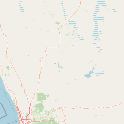
Map view of Mount Gibson Sanctuary

Use this park location map to pinpoint Mount Gibson Sanctuary in Australia, understand its exact geographic position, and read its mapped placement within the surrounding landscape more clearly.

Pigeon | © OpenStreetMap contributors

Location context for Mount Gibson Sanctuary

Western Australia
Park atlas

Compare adjacent rangeland reserves and regional conservation areas

Exploring Parks Near Mount Gibson Sanctuary and Surrounding Protected Landscapes

Browse protected areas and regional reserves located near Mount Gibson Sanctuary across Western Australia. Continuing into surrounding conservation landscapes reveals broader patterns in semi-arid terrain and native eucalypt woodlands.
Nature reserveWestern Australia
About 25 km away#1 closest

Northwest

Charles Darwin Reserve: Protected Woodland and Heathland Mapping in Western Australia

Ecological transition zone between South West and Eremean provinces

Located in the north-eastern Wheatbelt, Charles Darwin Reserve is a privately managed nature reserve defined by its extensive eucalypt woodland and sand-plain heath. The area serves as a critical refuge for wildlife, characterized by mature York and salmon gums that offer rare, hollow-dependent shelter in a landscape largely modified by agriculture.

Area
686 km²
Established
2003
Relief
Lowland
Climate
Mediterranean
National parkMid West
About 66 km away#2 closest

North

Mungada Ridge National Park: National Park Geography and Protected Landscape Details

Mapped boundaries and regional landscape context.

Delve into the protected landscape identity of Mungada Ridge National Park, a significant national park located in Australia's Mid West. This resource provides detailed information on its geographic positioning, mapped boundaries, and the natural terrain it encompasses, contributing to a structured understanding of protected areas within the region and the broader national atlas.

Area
10.31 km²
Established
2022
Relief
Upland
Climate
Arid
National parkWestern Australia
About 124 km away#3 closest

Southwest

Watheroo National Park National Park: Mapping Protected Landscapes in Western Australia

Explore regional geography and mapped park boundaries.

Watheroo National Park represents a key protected landscape within the vast state of Western Australia. This detail page offers focused insight into the park's specific geographic character, its mapped boundaries, and its role within the regional atlas of protected areas. Understand the natural terrain and landscape context that defines this Australian national park.

Area
444.81 km²
Established
1969
IUCN
II
Relief
Upland
National parkWestern Australia
About 147 km away#4 closest

West

Alexander Morrison National Park: Discover Its Protected Landscape and Regional Geography

Mapped protected area boundaries and landscape context in Western Australia.

Alexander Morrison National Park represents a core protected natural landscape within Western Australia. As a national park, its identity is deeply tied to its mapped geographic extent and its role in the regional atlas. This destination provides a focused lens on a specific protected area, enabling users to understand its unique landscape features and its contribution to the conservation estate of Western Australia. Delve into its protected status and geographic orientation within Australia's largest state.

Area
85 km²
Established
1970
IUCN
II
Relief
Upland
National parkWestern Australia
About 155 km away#5 closest

West

Tathra National Park: Protected Landscape Identity and Mapped Geographic Boundaries

Western Australia national park exploration and regional context.

Delve into the protected landscape of Tathra National Park, a significant entity within Western Australia's network of natural areas. This detail provides a structured overview of its geographic position, mapped outlines, and ecological context, serving as a vital entry point for understanding Australia's diverse protected lands and regional geography.

Area
43.22 km²
Established
1970
IUCN
II
Relief
Upland
National parkWestern Australia
About 177 km away#6 closest

Southwest

Badgingarra National Park: Mapped Boundaries and Protected Landscape Exploration

Explore its national park designation and regional geography.

Delve into the protected landscape identity of Badgingarra National Park, a designated national park situated in Western Australia. This entry provides detailed atlas-level information, focusing on the park's geographic scope, mapped boundaries, and its significance as a protected natural area. Understand its terrain and regional context for a deeper appreciation of Western Australia's conservation landscapes.

Area
131.08 km²
Established
1973
IUCN
II
Relief
Mixed relief
National parkWestern Australia
About 189 km away#7 closest

West

Lesueur National Park: Detailed National Park Atlas and Geographic Context

Explore the mapped protected landscape in Western Australia.

Lesueur National Park is a key protected area within the expansive geography of Western Australia. This resource provides detailed information on its national park status, mapped boundaries, and its significance within the regional atlas. Engage with the specific landscape identity of this protected territory and understand its role in the broader geographic context of Australia.

Area
272.35 km²
Established
1992
IUCN
II
Relief
Upland
National parkWestern Australia
About 201 km away#8 closest

Southwest

Moore River National Park: National Park Protected Landscape and Geographic Context

Mapped boundaries and natural terrain in Western Australia.

Investigate Moore River National Park, a distinct national park located in Western Australia. This detailed view provides insight into the park's protected landscape character, its unique geography, and its role within the regional context. Understand the mapped boundaries and natural terrain that define this significant protected area for atlas and geographic exploration.

Area
172.54 km²
Established
1969
IUCN
II
Relief
Lowland

Common questions about visiting, size, designation, and location context for Mount Gibson Sanctuary

Mount Gibson Sanctuary FAQs for park facts, access, geography, and protected area context

Find quick answers about Mount Gibson Sanctuary, including protected-area facts, park geography, trail and visitor context, and how the park fits into its surrounding country and regional landscape.
MoriAtlas Explorer

Continue Your Protected Areas Search Across the Global Atlas

Deepen your exploration by continuing the structured search for national parks and protected areas worldwide. Utilize the comprehensive filtering capabilities to compare different conservation landscapes and refine your understanding of global park geography. Discover more about the distribution and characteristics of protected natural areas.

Global natural geography