
Mori Atlas logo
Protected landscapeNaturpark Insel Usedom

Mapping the distinct mosaic of dunes, beech forests, and lagoon habitats in northeastern Germany

Naturpark Insel Usedom: An Integrated Protected Landscape of the German Baltic Coast

Naturpark Insel Usedom serves as a vital protected area covering the German portion of Usedom Island within Mecklenburg-Vorpommern. This expansive landscape brings together sandy Baltic beaches, steep coastal cliffs, and a complex system of shallow lagoons known as bodden. Beyond the coastline, the terrain features a diverse mix of freshwater lakes, alder swamps, and dune pine forests, creating a tightly connected habitat mosaic that supports significant bird populations and regional biodiversity.

Baltic coastisland landscapebodden and lagooncoastal cliffsdunesseaside resort
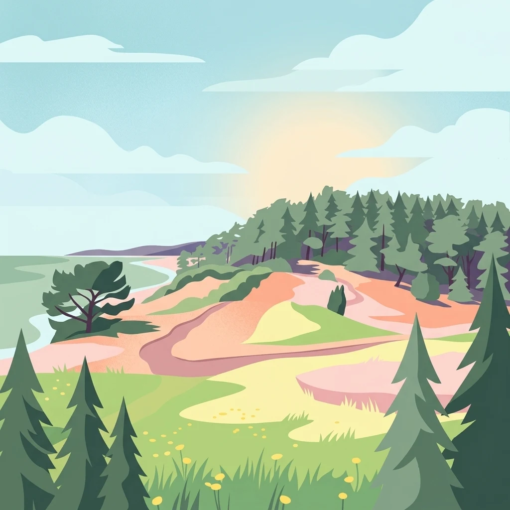
A flat-style digital illustration showing a coastal landscape with green pine trees in the foreground, rolling sandy dunes, and a forest bordering a beach under a soft sunset sky.

Naturpark Insel Usedom

Protected landscape

Park overview

Structured park overview, official facts, and landscape profile for Naturpark Insel Usedom

Naturpark Insel Usedom park facts, protected area profile, and essential visitor context

Review the core facts for Naturpark Insel Usedom, including designation, size, terrain, visitor scale, habitats, and operating context in one park-focused overview.

About Naturpark Insel Usedom

Naturpark Insel Usedom represents one of the most distinctive coastal nature parks in northeastern Germany. It straddles the eastern part of Mecklenburg-Vorpommern along the Baltic Sea, protecting not only the sandy and cliffed shoreline of the island but also the brackish bodden waters that surround it. The Achterwasser, the Peenestrom, and the northern portions of the Stettiner Haff are integral parts of the park, along with shallow Baltic waters near the mouth of the Peene and a mainland fringe along the western bank of the Peenestrom.

The park was formally established in December 1999 as a large-scale cultural landscape area, continuing a longer history of conservation on the island. As early as 1925, the Peenemünder Haken in the north was designated as the oldest nature reserve of the former Pomeranian region. Additional areas followed in 1938 and, between 1957 and 1971, several further reserves including the Gothensee and Streckelsberg were protected. From 1990 onward, an expanded series of nature reserves was added, and in 1993 the surrounding landscape protection area was extended to match today's natural park boundaries.

What makes Usedom stand out is the way very different ecosystems sit almost side by side. Sandy beaches, steep coastal cliffs, dunes, shallow inland waters, lakes, drained lowland mires, alder swamp forests, dune pine woods, beechwoods, meadows, fields, small villages, and traditional seaside resorts all fall within the park. The result is a place where Baltic coast, bodden coast, forest, and farmed land interlock across short distances. About a quarter of the park is forested, nearly half is open water, and the remainder is agricultural land, settlements, and the celebrated seaside resorts along the island's northern coast.

Quick facts and research context for Naturpark Insel Usedom

Naturpark Insel Usedom is located in the Landkreis Vorpommern-Greifswald in the German state of Mecklenburg-Vorpommern, covering the German sector of Usedom Island up to the Polish border.

The park includes the Achterwasser, the Peenestrom, the northern part of the Stettiner Haff, and the shallow Baltic waters near the mouth of the Peene, as well as a strip of mainland between Lubmin and the Lassaner Winkel. Officially designated as a Naturpark in December 1999, it functions as a large-scale cultural landscape protection area rather than a strict nature reserve, although numerous smaller nature reserves lie within its boundaries.

Protection and recognition

Examine the documented conservation scope and territorial management framework.

Naturpark Insel Usedom Protection Status and Territorial Designation

Naturpark Insel Usedom maintains a documented terrestrial protection scope within its regional conservation framework. Official records compile the recorded management status and baseline designation details for structured atlas analysis.

Protection details

Protection scope
Terrestrial
Transboundary protection
No
Park context

Deeper park guide and search-rich context for Naturpark Insel Usedom

Naturpark Insel Usedom history, landscape, wildlife, and travel context

Explore Naturpark Insel Usedom through its history, landscape character, ecosystems, wildlife, conservation priorities, cultural context, and seasonal travel timing in a structured park guide built for atlas discovery and search intent.

Why Naturpark Insel Usedom stands out

Naturpark Insel Usedom is especially known for the unusually high concentration of distinct habitat types found across a small area. Within one compact coastal territory, visitors can encounter Baltic sandy beaches, steep cliffs, dunes, inland bodden and lake waters, moors, alder swamps, pine forests on dunes, beech forests, open meadows, and traditional villages. The island is also widely recognized as one of the bird-richest regions in Germany. Breeding populations of white-tailed eagle, white stork, common crane, and grey heron, as well as major staging and resting areas for migratory waterbirds on the shallow eutrophic lakes like the Gothensee and Schmollensee, give the park a particularly strong ornithological identity.
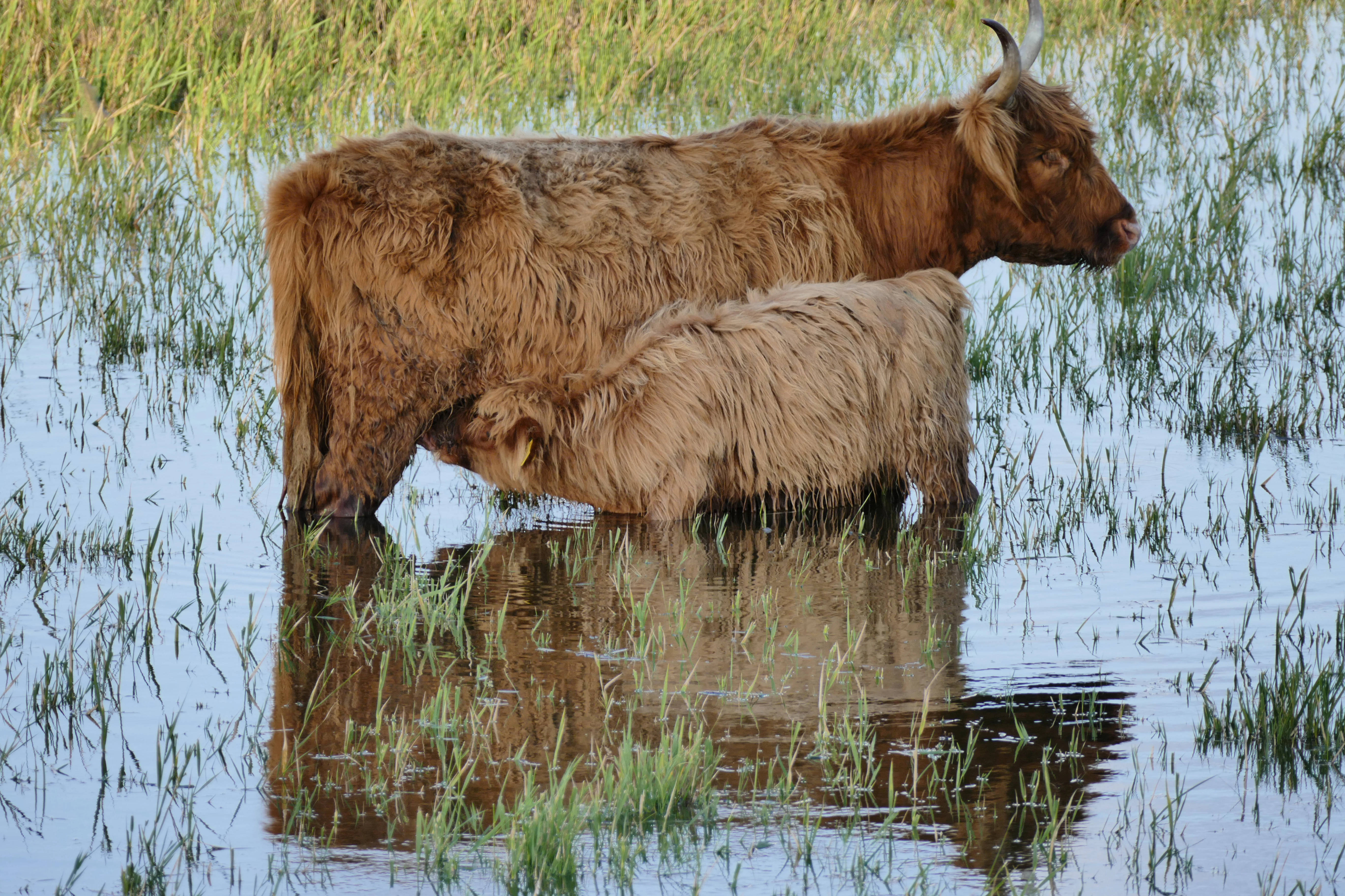
A shaggy brown Highland cow and her calf standing in shallow water in a marshy landscape.
A Highland cow nursing her calf in the flooded pastures of the Naturpark Insel Usedom.

Naturpark Insel Usedom history and protected-area timeline

The history of nature conservation on Usedom stretches back nearly a century. In 1925, the Peenemünder Haken at the northern tip of the island became the first official nature reserve of the Pomeranian region. In 1938, the Zerninsee near Swinemünde followed as the second protected area. Between 1957 and 1971, additional reserves were designated, including the Gothensee, the Streckelsberg, and the Mümmelkensee; together these early reserves covered roughly two thousand hectares.

From 1990 onward, a wave of new designations substantially expanded protection. Important reserves added during this period included the Großer Wotig, the southern tip of Gnitz, the Halbinsel Cosim, the Vogelinseln Böhmke and Balmer Werder, the Mellenthiner Os, the Kleiner Krebssee, and the island of Görmitz. By the late 1990s, the total area of nature reserves within the park had grown to nearly five thousand five hundred hectares.

Earlier, in 1966, large parts of Usedom had already been declared a landscape protection area; in 1993 this zone was extended to match the area later covered by the natural park. In December 1999, the region was formally designated as the Naturpark Insel Usedom, marking a shift from isolated reserves toward an integrated, large-scale cultural landscape approach. The park's information center, the Ruth-und-Klaus-Bahlsen-Haus, was developed within a cross-border INTERREG project and completed in 2005 in the historic station building on the Bäderstraße in the town of Usedom.

Naturpark Insel Usedom landscape and geographic character

The landscape of Naturpark Insel Usedom is exceptionally diverse for such a compact area. The northern and eastern edges are defined by the Baltic Sea, with long sandy beaches backed by dunes. Inland from the beach, the terrain rises in places into steep coastal cliffs and moraine remnants, such as the Streckelsberg near Koserow with its prominent cliff-edge dune and the Golm, the highest point on the island at around seventy meters.

Behind this coastal fringe lies a mosaic of inland waters. The Achterwasser, the Peenestrom, and the northern Stettiner Haff together create a wide belt of shallow brackish lagoons, while smaller lakes such as the Gothensee, Schmollensee, Wockninsee, Balmer See, and Zerninsee add freshwater and transitional habitats. Former lowland mires, now largely drained and used for agriculture, still influence soil patterns and vegetation across much of the interior.

Forests form another major element of the landscape. Pine woods rooted in old dune sands, beech forests on richer soils, and alder swamp woodlands in wet ground all occur within short distances of each other. Villages, farm fields, meadows, and the historic seaside resorts of the island are woven between these natural features, producing a coastal cultural landscape where settlement and ecology are tightly connected.

Naturpark Insel Usedom ecosystems, habitats, and plant life

Ecologically, the park is shaped by the meeting of Baltic marine influence, brackish coastal lagoons, freshwater lakes, and formerly swampy inland basins. This combination produces a wide array of habitats in close proximity, from open dune and beach communities along the Baltic shore to reed belts, wet meadows, and alder swamp forest along the inner coasts.

The shallow, nutrient-rich inland lakes of the Achterwasser and the island's interior, such as the eutrophic Gothensee and Schmollensee, are particularly important for aquatic vegetation and waterbird ecology. Salz-wiesen vegetation appears on smaller islands like the Großer Wotig, and remnant mires with bog and transitional species survive in places around the Zerninsee and Thurbruch. Forests range from dry dune pine stands to moister beech woodland, while small fragments of drained lowland mire remain as a reminder of the original wetland landscape.

The result is an unusually rich ecological gradient within a small area. Visitors moving only a few kilometers can pass from open Baltic beach and dune communities through coastal cliffs and reed belts, into freshwater lakes and alder swamps, and finally into closed forest and cultivated land, experiencing several of the characteristic ecosystem types of the southern Baltic coast in a single outing.

Naturpark Insel Usedom wildlife and species highlights

Usedom is widely regarded as one of the bird-richest regions in Germany, and birdlife is the most prominent wildlife theme of the park. The combination of large open water bodies, shallow eutrophic lakes, reed belts, meadows, and forest patches supports both breeding and migrating species in notable numbers.

Among the breeding species regularly associated with the park are white-tailed eagle, white stork, common crane, and grey heron. The rich mosaic of habitats also supports a wide variety of waterbirds, songbirds, and woodland species. The shallow inland lakes, particularly the Gothensee and Schmollensee, function as important resting and breeding sites, while the salt meadows and small lagoon islands such as the Großer Wotig and Görmitz are especially significant for waders and waterfowl.

Beyond birds, the park's mix of forest, farmland, and wetland provides habitat for typical northeastern German mammal and fish communities, including species adapted to the bodden landscape and its brackish waters. Highland cattle are used in parts of the park as part of landscape management, reflecting the close integration between wildlife conservation and traditional land use.

Naturpark Insel Usedom conservation status and protection priorities

Conservation on Usedom has a long and layered history. The first protection measures date back to 1925, and successive waves of nature reserve designation in 1938, the late 1950s through the 1960s, and again from 1990 onward have built up a network of protected core areas within a broader landscape protection framework. By the late 1990s, total nature reserve coverage approached five thousand five hundred hectares.

The natural park concept, adopted in 1999, places these nature reserves within a wider cultural landscape strategy. Rather than treating protection as isolated fenced areas, the park aims to maintain the entire mosaic of habitats, traditional land uses, and settlements that together form the island's character. The many nature reserves within the park are complemented by FFH and EU Birds Directive sites that extend protection to additional habitats and species.

The conservation significance of the park extends beyond Usedom itself. The Achterwasser, the Peenestrom, and the adjacent Baltic shallows are important nodes on wider regional bird migration routes, while the freshwater lakes and remaining mires support specialist species of conservation concern. Maintaining this combination of coastal, freshwater, woodland, and farmland habitats within one protected framework is the central conservation goal of the Naturpark Insel Usedom.

Naturpark Insel Usedom cultural meaning and human context

Usedom has long been shaped by its role as a Baltic seaside destination. The imperial seaside resorts along the island's northern coast, including Heringsdorf with its constituent districts of Ahlbeck, Heringsdorf, and Bansin, form a culturally distinctive strand of architecture and tourism history that is closely tied to the natural setting of beaches, dunes, and forest.

The interior of the island retains a different cultural pattern of small farming villages, fields, meadows, and forests, reflecting the older rural Pomeranian landscape. Historic features such as the Slavic earthwork Mellenthiner Os, a Slavic defensive hill, add an older archaeological dimension to the landscape, while the park's information center in the former station building of the town of Usedom shows how shipping, rail, and resort history have all shaped the island's identity. Cross-border cooperation with neighboring Poland is also part of the park's cultural framework, expressed through joint projects such as the INTERREG-funded visitor and administration center.

Top sights and standout views in Naturpark Insel Usedom

The park's standout quality is the way an unusually wide range of habitats are compressed into one coastal territory. Baltic beaches and dunes sit close to steep cliff coasts, inland bodden waters, freshwater lakes, alder swamps, dune pine forests, beechwoods, meadows, and traditional villages, all within the boundaries of a single natural park.

Equally distinctive is the area's wildlife profile, especially its birdlife. The combination of large open waters, shallow nutrient-rich lakes, and varied land habitats makes Usedom one of the bird-richest areas in Germany, with notable breeding populations of raptors, storks, cranes, and herons as well as important sites for migratory waterbirds. The long layered history of nature protection, from the 1925 Peenemünder Haken reserve to the 1999 natural park designation, adds another distinctive dimension to the place.

Best time to visit Naturpark Insel Usedom

The park can be appreciated across the year, with each season emphasizing different qualities of the landscape. Spring and early summer bring the most active birdlife, with breeding season for storks, cranes, herons, and many waterbirds, while flowering meadows and fresh green forest create a vivid inland scene. Autumn is often particularly rewarding for observing migratory birds on the shallow lakes and bodden waters, and it brings quieter conditions along the Baltic coast. Winter offers a calmer atmosphere, with reduced visitor numbers, frost effects on the dunes and reeds, and opportunities to see wintering waterfowl on the open inland waters. Visitors sensitive to peak resort activity may prefer the quieter shoulder seasons, while those interested in traditional Baltic seaside atmosphere often favor the warmer months.

Monthly climate preview

Long-term monthly temperature and precipitation data for Mecklenburg-Vorpommern

Naturpark Insel Usedom Climate Normals and Annual Temperature Rhythm

Representative coordinate records show average monthly temperatures ranging from near freezing in winter to peak warmth during summer months alongside consistent daily precipitation. Reviewing these multi-year climate normals provides essential baseline context for the ecological patterns sustained across the protected landscape.
Annual mean9 °C
0 °C18 °C
Jan
Feb
Mar
Apr
May12°
Jun16°
Jul18°
Aug18°
Sep15°
Oct10°
Nov
Dec
Warmest month
August

18.5 °C

Coolest month
January

0.2 °C

Wettest month
July

2.4 mm/day

Driest month
April

1.2 mm/day

Park location guide

Geography guide, regional context, and park location map for Naturpark Insel Usedom

Naturpark Insel Usedom park geography, regions, and map view in Germany

Understand where Naturpark Insel Usedom sits in Germany through a broader geographic reading of the surrounding landscape, nearby location context, and its mapped position within the national park landscape.

How Naturpark Insel Usedom fits into Germany

Germany is a federal republic in Western and Central Europe with a population of over 83 million across sixteen constituent states. It is Europe's largest economy by nominal GDP and a major global exporter and importer. The capital is Berlin, and the country borders Denmark, Poland, Czech Republic, Austria, Switzerland, France, Luxembourg, Belgium, and the Netherlands.

Wider geography shaping Naturpark Insel Usedom in Germany

Germany is located in Western and Central Europe, spanning 357,022 km². It borders Denmark to the north, Poland and the Czech Republic to the east, Austria and Switzerland to the south, and France, Luxembourg, Belgium, and the Netherlands to the west. The country has coastlines on the Baltic Sea and North Sea to the north, with the Alps located in the southern region.

Map view of Naturpark Insel Usedom

Use this park location map to pinpoint Naturpark Insel Usedom in Germany, understand its exact geographic position, and read its mapped placement within the surrounding landscape more clearly.

Pigeon | © OpenStreetMap contributors

Location context for Naturpark Insel Usedom

Mecklenburg-Vorpommern

Visual reference for coastal terrain, lagoons, and diverse habitats

Naturpark Insel Usedom Photos and Landscape Scenery

Photographic collections reveal the complex terrain of Naturpark Insel Usedom, showing steep Baltic cliffs, shifting dunes, and shallow brackish lagoons in sharp detail. Visual documentation helps researchers understand how pine forests, coastal wetlands, and open water intersect across the protected island landscape.

A shaggy brown Highland cow and her calf standing in shallow water in a marshy landscape.

A grassy trail winds through a coastal landscape with a small forested hill and reeds near the water under a clear blue sky.

Park atlas

Compare adjacent Baltic landscapes and regional nature reserves

Parks Near Naturpark Insel Usedom and Surrounding Coastal Protected Areas

Browse protected areas and coastal nature reserves situated near Naturpark Insel Usedom across the broader regional landscape. Comparing adjacent habitats offers deeper context on the diverse ecosystems shaping the German Baltic shoreline.
Protected areaZachodniopomorskie
About 16 km away#1 closest

Southeast

Ujście Odry i Zalew Szczeciński: Protected Area Geography and Estuarine Landscape Mapping

Coastal lagoons, riverine deltas, and island habitats in Zachodniopomorskie.

This extensive protected area offers a comprehensive view of the Oder estuary as it meets the Baltic Sea. The landscape comprises broad lagoons, branching river channels, and coastal islands that provide crucial habitat for migratory waterbirds and sustain a rare brackish water ecosystem. Use this geographic entry to analyze the boundaries, terrain, and interconnected waterways of this major Polish nature site.

Area
526.12 km²
Established
2008
Relief
Lowland
Scope
Mixed
A soft watercolor painting depicting a calm shoreline with rolling hills and trees in the distance.
Nature reservePoland
About 16 km away#2 closest

Northeast

Ostoja na Zatoce Pomorskiej: Mapping the Pomeranian Bay Marine Nature Reserve

Extensive marine protected landscape in the Baltic Sea

Ostoja na Zatoce Pomorskiej encompasses over 243,000 hectares of the southern Baltic Sea, serving as a primary marine nature reserve for the Polish coast. The sanctuary is defined by complex underwater features such as shallow sandy banks, gravel plains, and the prominent Odrzańska Ławica, which collectively support essential migratory waterbird populations and protected aquatic species within the European ecological network.

Area
2,430.59 km²
Established
2009
Relief
Lowland
Scope
Marine
Watercolor painting depicting mountains, rivers, and green terrain
National parkWest Pomeranian Voivodeship
About 21 km away#3 closest

East

Wolin National Park: Coastal Protected Landscape and Glacial Terrain in West Pomeranian Voivodeship

Explore Poland's first marine national park and its dynamic geography.

Wolin National Park offers a profound look into Poland's protected coastal geography. This national park in the West Pomeranian Voivodeship is distinguished by its high sea cliffs, inclusion of Baltic Sea and Szczecin Lagoon waters as Poland's first marine protected area, and a landscape sculpted by glacial moraines. Discover the park's complex delta systems, ancient forests, and the mapped terrain that supports significant bird migration, providing a rich focus for atlas exploration.

Area
109.37 km²
Established
1960
IUCN
II
Visitors
1.5M annual
National parkZachodniopomorskie Voivodeship
About 21 km away#4 closest

East

Woliński Park Narodowy: Atlas Overview of Protected Coastal and Marine Environments

Examining moraine landscapes and marine park boundaries.

Woliński Park Narodowy stands as a critical protected area in the Zachodniopomorskie Voivodeship, blending terrestrial moraine ridges with marine ecosystems. This atlas entry provides geographic context for its coastal cliffs, inland lake district, and the expansive river delta that supports rare avian species.

Area
109.37 km²
Established
1960
Visitors
1.5M annual
Relief
Upland
Protected areaZachodniopomorskie
About 41 km away#5 closest

Southeast

Łąki Skoszewskie Protected Area: Geography, Mapped Terrain, and Wetland Landscapes

Coastal marshland and bird sanctuary in Zachodniopomorskie

Located along the Szczecin Lagoon, Łąki Skoszewskie consists of extensive wet meadows, alder carrs, and Scots pine forests. This protected area provides a detailed look at the hydrological networks and coastal transition zones that define the unique natural landscape of northwestern Poland.

Area
90.834 km²
Established
2004
Relief
Lowland
Climate
Temperate
Protected areaZachodniopomorskie
About 42 km away#6 closest

Southeast

Park Natury Zalewu Szczecińskiego: Protected Coastal Landscape and Regional Geography Atlas

A pioneer in active Natura 2000 conservation and lagoon habitat preservation

Situated in the West Pomeranian region, Park Natury Zalewu Szczecińskiego covers a mosaic of coastal pastures, reed-bordered lagoons, and pine forests. This protected area stands out for its active management approach, integrating traditional grazing into a modern conservation model that sustains the biological integrity of the Szczecin Lagoon shorelines and adjacent woodland mosaics.

Area
40 km²
Established
2005
Relief
Lowland
Scope
Mixed
A horizontal watercolor painting showing rolling green hills and a dense forest line against a pale, light-colored sky background.
Protected landscapeWest Pomeranian Voivodeship
About 44 km away#7 closest

Southeast

Puszcza Goleniowska Protected Landscape: Geographic Profile and Mapped Boundaries

A large-scale lowland forest complex in West Pomeranian Voivodeship.

Puszcza Goleniowska represents a critical protected woodland in Poland, spanning 630 square kilometers of post-glacial plains. This forest complex is characterized by its pine-dominated canopy, widespread bog and marshland habitats, and a series of rivers and lakes that form the backbone of its regional drainage. The area encompasses numerous nature reserves and Natura 2000 sites, offering a comprehensive look at the lowland ecological structure of the West Pomeranian Voivodeship.

Area
630 km²
Established
1349
Relief
Lowland
Climate
Temperate
Watercolor painting of a green and pink abstract landscape featuring rolling hills and forested areas.
Protected landscapeWest Pomeranian Voivodeship
About 44 km away#8 closest

Southeast

Puszcza Wkrzańska Protected Landscape: Regional Forest Geography and Mapped Terrain Atlas

Transboundary pine-beech woodland and wetland ecosystems in West Pomeranian Voivodeship.

The Puszcza Wkrzańska forest complex represents a major protected landscape in northwestern Poland. Its geography is characterized by glacial sandy uplands, river-carved valleys, and vital wetland reserves. This atlas entry provides a detailed look at the forest boundaries, the surrounding hydrography, and the distinct natural terrain defining this essential Pomeranian wilderness.

Area
1,550 km²
Relief
Upland
Climate
Temperate
Access
Easy access

Common questions about visiting, size, designation, and location context for Naturpark Insel Usedom

Naturpark Insel Usedom FAQs for park facts, access, geography, and protected area context

Find quick answers about Naturpark Insel Usedom, including protected-area facts, park geography, trail and visitor context, and how the park fits into its surrounding country and regional landscape.
MoriAtlas Explorer

Continue Your Protected Areas Search Across the Global Atlas

Deepen your exploration by continuing the structured search for national parks and protected areas worldwide. Utilize the comprehensive filtering capabilities to compare different conservation landscapes and refine your understanding of global park geography. Discover more about the distribution and characteristics of protected natural areas.

Global natural geography