

Mori Atlas logo
Marine protected areaNingaloo Marine Park

Examining the seafloor habitats and migratory corridors of this Western Australian marine landscape

Ningaloo Marine Park: An Essential Marine Protected Area and Geographic Atlas Entry

(Ningaloo Marine Park (Commonwealth waters))

Ningaloo Marine Park protects a vital segment of the North-west Marine Parks Network, extending through Commonwealth waters off the Western Australian coast. This marine protected area encompasses a diverse range of seafloor features, including continental shelves, reef slopes, and intricate terrace systems that support critical foraging grounds for whale sharks, manta rays, and humpback whales. Its geographic role as a migratory pathway and ecological refuge provides essential insights into the resilience of oceanic environments within the Central Western Shelf Transition.

marine parkcoral reefwhale shark habitatmanta ray habitathumpback whale migrationmarine turtles

Ningaloo Marine Park

Marine protected area

Park overview

Structured park overview, official facts, and landscape profile for Ningaloo Marine Park

Ningaloo Marine Park park facts, protected area profile, and essential visitor context

Review the core facts for Ningaloo Marine Park, including designation, size, terrain, visitor scale, habitats, and operating context in one park-focused overview.

About Ningaloo Marine Park

Ningaloo Marine Park is an Australian marine park situated in Commonwealth waters offshore from the Ningaloo Coast of Western Australia. The park sits west of the celebrated Ningaloo Reef, one of the longest fringing coral reefs in the world, and serves as a federally managed extension of the broader coastal and marine protection system that characterises the region. Together with the adjacent state-managed marine reserve directly to its east, the park helps form a continuous conservation corridor along this iconic stretch of the Western Australian shoreline.

The marine park plays a central ecological role in safeguarding the seascape that supports Ningaloo's global reputation. Its waters contain shallow shelf environments, deeper slope habitats, and distinctive pinnacle and terrace seafloor formations that are typical of the Central Western Shelf Transition provincial bioregion. These varied underwater landscapes support rich biological communities and offer shelter, feeding opportunities, and migration routes for a wide spectrum of marine life.

Perhaps more than anything, Ningaloo Marine Park is recognised internationally as a critical habitat for large pelagic species. Whale sharks visit the area seasonally in large numbers, manta rays aggregate in the lagoons and outer reef zones, and humpback whales travel through the park as part of their annual migration along the Western Australian coast. Marine turtles also use the region for foraging and nest on nearby beaches. By protecting this combination of reef, shelf, and open-water environments, the park helps secure one of Australia's most ecologically dynamic marine domains.

Quick facts and research context for Ningaloo Marine Park

Ningaloo Marine Park is a Commonwealth marine reserve in Western Australia, established in 1987 and later redesignated under the Environment Protection and Biodiversity Conservation Act. It covers roughly 2,435 square kilometres of ocean and is administered by Parks Australia as part of the North-west Marine Parks Network.

The park sits offshore from the Ningaloo Coast, one of the country's most iconic reef systems, and is internationally recognised for its seasonal marine wildlife encounters. It functions as a dedicated habitat and species management area, protecting shelf and slope environments, pinnacle and terrace seafloor features, and ecologically important migration corridors used by large pelagic species.

Protection and recognition

Documented marine protection scope, designation history, and recognition sources

Ningaloo Marine Park Protection Status and International Recognition Data

Ningaloo Marine Park maintains a defined marine protection scope within its documented conservation framework. Structured records outline the official designation history and available recognition sources for this protected area.

Protection details

Protection scope
Marine
Transboundary protection
No
Park context

Deeper park guide and search-rich context for Ningaloo Marine Park

Ningaloo Marine Park history, landscape, wildlife, and travel context

Explore Ningaloo Marine Park through its history, landscape character, ecosystems, wildlife, conservation priorities, cultural context, and seasonal travel timing in a structured park guide built for atlas discovery and search intent.

Why Ningaloo Marine Park stands out

Ningaloo Marine Park is best known for providing protected habitat for seasonal gatherings of whale sharks, which feed in the nutrient-rich waters near the reef's outer edge. The marine park's lagoons and outer reef areas are also recognised for their remarkable abundance of manta rays, offering an unusually rich setting for passive encounters with large filter-feeding species. Equally significant is the park's role in safeguarding migratory pathways and foraging grounds for humpback whales and marine turtles, both of which rely on the broader Ningaloo region. Together, these features make the park a globally important refuge for oceanic megafauna along Australia's west coast.
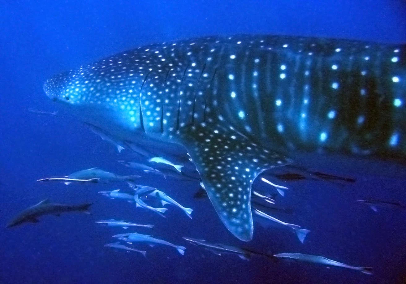
A large whale shark with its characteristic white spots swims underwater, accompanied by a school of smaller fish.
A whale shark swimming through the waters of Ningaloo Marine Park.

Ningaloo Marine Park history and protected-area timeline

Ningaloo Marine Park was first proclaimed on 20 May 1987 under the National Parks and Wildlife Conservation Act 1975 as the Ningaloo Marine Park (Commonwealth Waters), making it one of the long-established marine protected areas in Australia. Its creation reflected growing awareness of the ecological importance of the Ningaloo region and the need for federal protection offshore from the reef.

The park was subsequently proclaimed on 14 December 2013 under the Environment Protection and Biodiversity Conservation Act as a Commonwealth Marine Reserve, aligning it with Australia's broader system of marine environmental legislation. On 9 October 2017, the reserve was officially renamed Ningaloo Marine Park, simplifying the public reference to this protected seascape while retaining its formal heritage as a long-standing Commonwealth marine conservation area.

Ningaloo Marine Park landscape and geographic character

Although Ningaloo Marine Park is defined entirely by water rather than terrestrial terrain, its underwater landscape is remarkable. The marine park encompasses shallow continental shelf environments, deeper slope zones, and a variety of structurally complex seafloor habitats including pinnacles, terraces, and reef features characteristic of the Central Western Shelf Transition.

These varied seabed formations interact with the offshore waters off the Ningaloo Coast to shape a dynamic environment of lagoons, reef edges, and open-water zones. The resulting mosaic of seafloor and water-column habitats distinguishes the park from purely coastal reserves and gives it a unique geomorphological character within Western Australia's marine estate.

Ningaloo Marine Park ecosystems, habitats, and plant life

The nature of Ningaloo Marine Park is defined by productive, structurally diverse marine environments that sit within the Central Western Shelf Transition provincial bioregion. The reserve protects shallow shelf and slope systems, as well as distinctive pinnacle and terrace seafloor communities that together support a rich array of marine organisms.

These habitats create favourable conditions for both resident and migratory species. The combination of reef, sand, and open-water environments supports complex food webs, while the lagoons and outer reef zones are particularly important for filter-feeding species and other large marine animals that depend on plankton-rich waters during certain times of year.

Ningaloo Marine Park wildlife and species highlights

Ningaloo Marine Park is widely celebrated for its exceptional marine fauna. The waters of the park are a key foraging area for whale sharks, which are internationally recognised as vulnerable and migrate through the region in large aggregations during certain seasons. Manta rays are also unusually abundant in both the lagoons and outer reef areas, contributing to the park's global significance for these species.

The reserve protects part of the migratory pathway of humpback whales as they travel along the Western Australian coast, and the broader Ningaloo area includes significant nesting sites for marine turtles, with the park providing adjacent foraging grounds. Together, these features make the park a critical refuge for oceanic megafauna and a focal point for marine wildlife research in Australia.

Ningaloo Marine Park conservation status and protection priorities

Ningaloo Marine Park is recognised as a habitat and species management area, with internationally accepted protected-area classification. Its core conservation role lies in protecting shallow shelf and slope environments, including pinnacle and terrace seafloor communities that are representative of the broader Central Western Shelf Transition provincial bioregion.

The reserve plays an important role in maintaining ecological connectivity between the Ningaloo Reef system, the adjacent state-managed marine park, and the wider North-west Marine Parks Network. It safeguards key foraging areas for whale sharks and manta rays, protects migratory pathways for humpback whales, and supports foraging activity and connectivity with marine turtle nesting sites, all of which contribute to the long-term resilience of this productive marine region.

Ningaloo Marine Park cultural meaning and human context

Ningaloo Marine Park does not have a widely documented standalone cultural context in its official description, but the broader Ningaloo Coast is deeply significant as a long-known coastal region of Western Australia, with strong connections to marine wildlife and Indigenous histories of the area. While the Commonwealth waters of the park themselves are offshore, the identity of the marine reserve is closely tied to the adjacent coastal communities and the regional recognition of the Ningaloo name as a symbol of Western Australia's marine heritage.

Top sights and standout views in Ningaloo Marine Park

A defining highlight of Ningaloo Marine Park is its protection of globally important seasonal feeding grounds for whale sharks, complemented by remarkably high concentrations of manta rays across both lagoon and reef environments. The park also safeguards a section of the humpback whale migratory pathway and provides foraging habitat adjacent to key marine turtle nesting sites along the Ningaloo Coast.

Equally distinctive are the park's varied seafloor environments, which include pinnacles and terraces within the Central Western Shelf Transition that support a wealth of reef, slope, and shelf species. Together, these features make the park a standout location for marine wildlife research, conservation management, and sustainable ocean tourism in Australian waters.

Best time to visit Ningaloo Marine Park

Seasonal conditions strongly influence the character of a visit to the Ningaloo region. Cooler months between roughly autumn and early spring are typically associated with humpback whale migration along the Western Australian coast, while warmer months are widely known for seasonal aggregations of whale sharks and manta rays in the waters offshore from the reef. Local conditions, marine wildlife patterns, and any access information should be confirmed with current visitor guidance from the managing authority before planning a trip.
Monthly climate preview

Measured monthly weather patterns and representative climatology for Western Australia

Ningaloo Marine Park Climate Normals, Long-Term Temperature and Precipitation Rhythm

Representative coordinate records show mean monthly temperatures ranging from 20.52 degrees Celsius to 28.36 degrees Celsius alongside varying precipitation averages across the year. Reviewing the complete twelve-month profile provides deeper analytical context for long-term regional climate trends.
Annual mean24 °C
21 °C28 °C
Jan27°
Feb28°
Mar28°
Apr27°
May24°
Jun22°
Jul21°
Aug21°
Sep22°
Oct23°
Nov24°
Dec26°
Warmest month
March

28.4 °C

Coolest month
July

20.5 °C

Wettest month
June

1.7 mm/day

Driest month
October

0 mm/day

Park location guide

Geography guide, regional context, and park location map for Ningaloo Marine Park

Ningaloo Marine Park park geography, regions, and map view in Australia

Understand where Ningaloo Marine Park sits in Australia through a broader geographic reading of the surrounding landscape, nearby location context, and its mapped position within the national park landscape.

How Ningaloo Marine Park fits into Australia

Australia is a constitutional monarchy and federal parliamentary democracy comprising six states and ten territories. With a population of nearly 28 million, it is one of the world's most urbanised countries, with most people concentrated on the eastern seaboard. The country has a high Human Development Index and is known for its cultural diversity, ancient Aboriginal heritage, and unique wildlife.

Wider geography shaping Ningaloo Marine Park in Australia

Australia occupies the entire Australian continent, the island of Tasmania, and numerous smaller islands. It is the world's flattest and driest inhabited continent, featuring vast deserts in the interior (the Outback), tropical rainforests along the eastern coast, and a coastline bordering the Indian and Pacific Oceans.

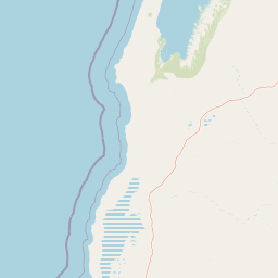
Map view of Ningaloo Marine Park

Use this park location map to pinpoint Ningaloo Marine Park in Australia, understand its exact geographic position, and read its mapped placement within the surrounding landscape more clearly.

Pigeon | © OpenStreetMap contributors

Location context for Ningaloo Marine Park

Western Australia
Recorded earthquake history

Review the Historical Earthquake Catalogue for Ningaloo Marine Park

Access a structured collection of historical seismic records associated with the geography of Ningaloo Marine Park. MoriAtlas provides this objective catalogue to help researchers and enthusiasts examine documented earthquake activity within the regional waters of Western Australia.

Ningaloo Marine Park Earthquake History

Catalogued events

4 events

Strongest magnitude

Magnitude 5.2

Most recent event

Jun 26, 2021

This history includes earthquakes recorded inside the park or within 50 km of its borders

Visual reference for reefs, lagoons, and protected marine habitats

Ningaloo Marine Park Photos and Underwater Landscape Imagery

Visual documentation of Ningaloo Marine Park reveals complex seafloor terrain, shallow lagoons, and diverse coastal shelf environments. Protected area photography allows researchers and visitors to examine the natural habitats, underwater formations, and marine ecosystems of Western Australia.

A large whale shark with its characteristic white spots swims underwater, accompanied by a school of smaller fish.

Park atlas

Compare adjacent marine environments and regional conservation zones in the North West

Explore Other Parks Near Ningaloo Marine Park and Protected Areas in Western Australia

Browse nearby marine reserves and protected coastal waters to understand the broader ecological network surrounding Ningaloo Marine Park. Regional comparisons reveal connected migratory pathways and diverse shelf habitats across the Western Australian marine estate.
Marine protected areaWestern Australia
Park boundaries overlap#1 closest

West

Gascoyne Marine Park: Protected Marine Geography and Seafloor Terrain Map

Marine protected area situated along the Western Australian coast

Gascoyne Marine Park encompasses a significant offshore region defined by its shallow continental shelf and varied seafloor structures. This protected marine area supports vital habitats for migratory species and contributes to the broader ecological network of the North-west Marine Parks system, offering a clear view of specialized aquatic environments through detailed mapping.

Area
81,766 km²
Established
2018
IUCN
IV
Relief
Lowland
National parkAustralia
6.3 km away#2 closest

East

Cape Range (South) National Park: Exploring Australia's Arid Semiarid Landscape Atlas

Mapped protected boundaries and regional terrain in Western Australia.

Cape Range (South) National Park, situated in Western Australia, is a vital protected area safeguarding a significant portion of the Carnarvon xeric shrublands. This national park offers a glimpse into a unique arid-zone landscape defined by low ranges, sandy plains, and characteristic acacia shrubland. Its establishment extends conservation efforts in the Gascoyne region, providing crucial context for mapped geography and the distribution of arid-adapted ecosystems within Australia's broader atlas.

Area
270.72 km²
Established
2020
IUCN
II
Relief
Upland
Watercolor illustration showing a coastal scene with shoreline, water, and landforms
National parkWestern Australia
6.4 km away#3 closest

Northeast

Cape Range National Park: Exploring Western Australia's Protected Landscape Identity

Mapped boundaries and regional geographic context.

Cape Range National Park is a vital protected area located in Western Australia, offering a distinct geographic profile for atlas exploration. This entry focuses on its identity as a national park, detailing its mapped landscape and regional context. Users can discover the park's place within the state's diverse terrain and understand its significance as a mapped conservation area, contributing to a structured understanding of Australia's protected lands.

Area
476.55 km²
Established
1965
IUCN
II
Relief
Highland
National parkGascoyne
156 km away#4 closest

Southeast

Kennedy Range National Park: Explore Its Dramatic Sandstone Plateau and Canyon Geography

Discover the protected landscapes of Gascoyne's arid terrain.

Kennedy Range National Park is a protected area defined by its striking geological formations, including a vast sandstone plateau and deeply incised canyons that create a dramatic mesa landscape. Situated in the Gascoyne region, this national park serves as a significant example of Australia's inland semi-arid environments, offering rich context for mapped terrain exploration. Understand the park's protected boundaries, its unique arid-zone ecosystems, and the visual contrast it presents within the regional geography, providing valuable insights for atlas-driven discovery.

Area
1,416.6 km²
Established
1993
IUCN
II
Relief
Highland
Marine protected areaWestern Australia
176 km away#5 closest

Northeast

Montebello Islands Marine Park: Western Australia Marine Protected Area Atlas

Mapping tropical reefs and archipelago terrain

Montebello Islands Marine Park preserves a significant archipelago and its surrounding tropical marine environment off the Pilbara coast. The area features extensive reef flats, mangrove communities, and deep oceanic waters that provide essential habitat for marine life and nesting sea turtles. Its physical profile includes a unique mix of natural reef-building processes and human history, making it a key component of the Western Australian marine conservation landscape.

Area
583.44 km²
Established
2004
IUCN
II
Relief
Lowland
National parkWestern Australia
215 km away#6 closest

South

Francois Peron National Park: National Park Protected Landscape & Geographic Exploration

Mapped boundaries and regional landscape context in Western Australia.

Delve into the geography of Francois Peron National Park, a designated national park located in Western Australia. This resource provides structured information on its protected landscape, mapped boundaries, and regional setting, offering a clear point of reference for atlas-based geographic discovery. Understand the natural terrain and conservation context of this significant Australian protected area.

Area
525.87 km²
Established
1993
IUCN
II
Relief
Lowland
National parkGascoyne
About 253 km away#7 closest

South

Pimbee National Park: Australian National Park with Gascoyne Regional Geography

Mapped protected boundaries and natural landscape context.

Pimbee National Park represents a key protected area within Australia's vast Gascoyne region. This national park provides a specific geographic focus, allowing for detailed exploration of its mapped boundaries and the surrounding natural landscape. Understanding Pimbee National Park's place within the regional geography of Western Australia is crucial for a comprehensive atlas-driven discovery of the continent's protected lands and their unique terrain.

Established
2023
Climate
Arid
Scope
Terrestrial
National parkAustralia
About 253 km away#8 closest

South

Dirk Hartog Island National Park: Australia's Protected Island Geography and National Park Atlas Entry

Mapped boundaries and regional landscape context for Dirk Hartog Island National Park.

This entry provides detailed geographic context for Dirk Hartog Island National Park, a designated national park in Australia. Understand its mapped protected area status, its place within the Australian continent's geography, and its unique landscape identity. Ideal for atlas exploration, this content offers a structured view of the park's terrain and conservation significance.

Common questions about visiting, size, designation, and location context for Ningaloo Marine Park

Ningaloo Marine Park FAQs for park facts, access, geography, and protected area context

Find quick answers about Ningaloo Marine Park, including protected-area facts, park geography, trail and visitor context, and how the park fits into its surrounding country and regional landscape.
MoriAtlas Explorer

Continue Your Protected Areas Search Across the Global Atlas

Deepen your exploration by continuing the structured search for national parks and protected areas worldwide. Utilize the comprehensive filtering capabilities to compare different conservation landscapes and refine your understanding of global park geography. Discover more about the distribution and characteristics of protected natural areas.

Global natural geography