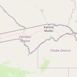
Why Nkasa Rupara National Park stands out
Nkasa Rupara is best known as Namibia's premier wetland protected area, featuring extensive floodplains, reed islands, and channels that support exceptional concentrations of large mammals. The park contains the country's largest buffalo population and serves as a critical trans-boundary corridor for African elephant and buffalo herds migrating between Botswana, Angola, Namibia, and Zambia. Its birdlife is exceptional, with species such as the wattled crane, Pel's fishing-owl, and black-cheeked lovebird drawing ornithological interest. The landscape of islands created by the meandering Kwando-Linyanti River, crowned with distinctive termitaria, creates a visually distinctive environment reminiscent of the Okavango Delta.
Nkasa Rupara National Park history and protected-area timeline
Nkasa Rupara National Park was originally established as Mamili National Park on March 1, 1990, proclaimed alongside the nearby Mudumu National Park as part of Namibia's early post-independence conservation expansion. The park was officially renamed Nkasa Rupara National Park in 2012, adopting a name that reflects the two principal islands within the protected area. The former name Mamili honored a family of traditional leaders from the Mafwe tribe, maintaining cultural connections to the land's indigenous heritage. The new name Nkasa Lupala directly references the Nkasa and Rupara islands at the heart of the park. This renaming reflected a broader movement in Namibian conservation toward using local names that more precisely describe the specific geography of protected areas. The park's establishment in 1990 marked a significant commitment by the newly independent nation to preserve its natural heritage, particularly in the ecologically rich but previously under-protected wetland areas of the Caprivi Strip.
Nkasa Rupara National Park landscape and geographic character
The physical landscape of Nkasa Rupara is defined by the meandering channels of the Kwando-Linyanti River system, which creates a complex terrain of water, islands, and floodplains. The Kwando River enters the park from the north and flows along its western boundary before shifting course to become the Linyanti River along the southeastern edge, giving the park two distinct river names for the same watercourse. The entire area is remarkably flat, with elevation changes measured in meters rather than hundreds of meters. The park consists primarily of narrow permanent main channels surrounded by extensive reed beds, shallow lagoons, and numerous islands of varying sizes. Many islands feature ancient termite mounds that rise above the seasonal flood levels, creating elevated microhabitats that support woodland vegetation. The river's catchment originates in Angola, and the timing and volume of flooding varies considerably from year to year depending on rainfall in the Angolan highlands. Some years bring significant flooding while others result in dry spells that expose larger areas of the floodplain. This dynamic hydrological regime shapes every aspect of the park's ecology and visual character.
Nkasa Rupara National Park ecosystems, habitats, and plant life
Nkasa Rupara contains Namibia's most extensive and ecologically significant wetland complex, representing a unique habitat type within the country. The ecosystem closely parallels the Okavango Delta, with floodplain habitats dominating the landscape and driving ecological processes through seasonal water fluctuations. The vegetation falls within the Caprivi floodplains classification of the broadleaved tree and wood savanna biome. Woody vegetation is confined to higher ground on islands and the edges of permanent channels, where species such as knob thorn, paper-bark acacia, leadwood, and sausage tree form woodland patches above the flood zone. The floodplains themselves support extensive stands of grasses and sedges that provide critical grazing for large herbivores. The termitaria scattered across the islands create microhabitats with distinct vegetation communities, supporting biodiversity patterns not found in the surrounding floodplain. The seasonal nature of flooding means that different parts of the park offer different ecological conditions throughout the year, supporting a diverse community of species adapted to both aquatic and terrestrial environments.
Nkasa Rupara National Park wildlife and species highlights
The wildlife of Nkasa Rupara is exceptional for a Namibian protected area, with the park supporting substantial populations of large mammals that are more typically associated with East African parks. The approximately 1,000 buffalo represent the largest concentration in Namibia, herds that move through the floodplains in impressive formations. Around 560 hippopotamus occupy the permanent channels, while crocodile occur in similar numbers throughout the river system. The park serves as a corridor for all large mammal species moving between Namibia and Botswana, with African elephant and buffalo being particularly notable. Rare antelope species found here include sitatungas adapted to wetland habitats, pukus, red lechwe, reedbucks, and oribis. Predators include lion, leopard, cheetah, spotted hyena, and African wild dog. The bird fauna is outstanding, with roughly 450 species recorded. Notable species include the vulnerable wattled crane, Pel's fishing-owl, black-cheeked lovebird, and yellow-billed oxpecker. The park supports breeding populations of several species that are globally threatened or near-threatened, making it significant for international conservation.
Nkasa Rupara National Park conservation status and protection priorities
Nkasa Rupara plays a central role in regional conservation as part of the Kavango Zambezi Transfrontier Conservation Area, which links protected areas across five countries in one of Africa's largest trans-boundary conservation initiatives. The park forms a critical corridor for elephant, buffalo, roan antelope, and sable antelope moving between Botswana and the ranges extending into Angola and Zambia. This connectivity is essential for maintaining viable populations of large mammals that require extensive ranges to survive. As one of Namibia's protected areas that directly benefits local communities, the park demonstrates how conservation can support rural livelihoods through tourism concessions and community Campsites. The integrated park management approach groups Nkasa Rupara with neighboring Mudumu National Park and surrounding communal conservancies, enabling coordinated law enforcement, anti-poaching efforts, fire management, and wildlife monitoring across boundaries. The NamParks Project has provided significant investment in infrastructure, equipment, and capacity building since 2006, supporting the development of sustainable tourism and effective park management.
Nkasa Rupara National Park cultural meaning and human context
The park lies within the traditional territory of the Mafwe people, one of the ethnic groups of the Zambezi Region. The original name Mamili reflected the presence of a family of traditional leaders from the Mafwe tribe, connecting the protected area to indigenous leadership and historical land claims. The surrounding area includes the Balyewa, Wuparo, and Dzoti communal conservancies, which work in partnership with park management. Sangwali village, located to the north of the park, serves as a nearby community and access point. The Wuparo Conservancy has partnered with the government to develop tourism facilities including a community campsite and the Nkasa Lupala tented lodge, ensuring that local communities benefit from conservation activities. This approach recognizes that sustainable conservation requires meaningful engagement with and benefits for the people who share the landscape with wildlife.
Top sights and standout views in Nkasa Rupara National Park
The defining highlight of Nkasa Rupara is its status as Namibia's largest and most significant wetland protected area, a vast ecosystem of islands, channels, and floodplains supporting remarkable concentrations of wildlife. The buffalo herds, among the largest in the country, create spectacular viewing opportunities as they move across the floodplains. The park's role as a trans-boundary corridor connecting four countries makes it ecologically significant far beyond its 320 square kilometers. The birdlife, particularly the possibility of observing species such as wattled crane and Pel's fishing-owl, attracts ornithologists and nature enthusiasts. The landscape itself, with its maze of channels, reed beds, and termitaria-crowned islands, offers a distinctive visual experience unlike other Namibian protected areas. The relative remoteness and minimal development mean visitors experience a wilderness character that is increasingly rare in accessible African parks.
Best time to visit Nkasa Rupara National Park
The optimal time to visit Nkasa Rupara depends on what visitors hope to experience. The dry season from May to October offers easier access as floodplains recede and wildlife concentrates around remaining water sources, generally providing the best wildlife viewing. However, the park's character changes dramatically with the seasons, and the wet season from November to April transforms the landscape as floodwaters return, creating a vast wetland ecosystem that supports different wildlife viewing opportunities including abundant waterbird activity. The variable flooding from year to year means that the park's character can differ significantly between visits. Visitors should be aware that the park is located in a malaria area and should take appropriate precautions. The minimal facilities mean that self-sufficiency is essential, and four-wheel-drive vehicles are required given the often muddy and waterlogged terrain.