

Mori Atlas logo
Nature reserveNocoleche Nature Reserve

An expansive arid-zone conservation area defined by unregulated river channels, native woodland, and vital migratory waterbird habitats.

Nocoleche Nature Reserve: Mapping Protected Floodplains and Paroo River Landscapes in New South Wales

Nocoleche Nature Reserve encompasses a vast protected landscape in the northwestern outback of New South Wales, centered on a critical stretch of the free-flowing Paroo River. This geography hosts a rare combination of semi-arid floodplains, black box woodlands, and diverse wetland types including lignum swamps and claypans. The reserve serves as a major ecological refuge within the Murray-Darling Basin, providing essential habitat for migratory waterbirds and native fish species in a region defined by its rugged woodland and shifting river corridors.

nature reserveIUCN Category Iawetlandfloodplainarid zoneParoo River
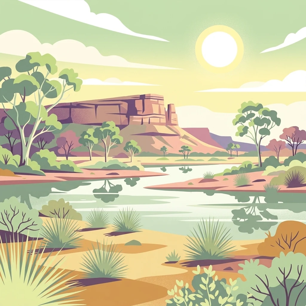
Stylized digital illustration of a desert wetland landscape featuring a calm river in the foreground, sparse vegetation including shrubs and gum trees, and a flat-topped mesa under a bright sun.

Nocoleche Nature Reserve

Nature reserve

Park overview

Structured park overview, official facts, and landscape profile for Nocoleche Nature Reserve

Nocoleche Nature Reserve park facts, protected area profile, and essential visitor context

Review the core facts for Nocoleche Nature Reserve, including designation, size, terrain, visitor scale, habitats, and operating context in one park-focused overview.

About Nocoleche Nature Reserve

Nocoleche Nature Reserve sits in the far northwestern corner of New South Wales, in the remote outback country above the Darling River. The reserve occupies a long stretch of the Paroo River floodplain between Wanaaring and the state's inland border, taking in several tributaries, including Cuttaburra Creek, Sandy Creek, Aarons Creek and Kulkyne Creek. This setting places the reserve within one of the driest and most sparsely populated regions of eastern Australia, where pastoralism has been the dominant land use since the nineteenth century.

The reserve's character is shaped by a mosaic of arid and semi-arid environments. The Paroo River and its tributaries cut through broad floodplains supporting lignum, black box and Eleocharis swamps, while the surrounding uplands carry mulga and white wood vegetation along with scattered poplar box woodlands. This combination of permanent and ephemeral wetlands within otherwise dry landscapes is rare in the region, and the reserve contains the largest single area of floodplain wetland of any protected area in New South Wales.

Ecologically, Nocoleche is significant because the Paroo River remains unregulated. Unlike nearly every other major river in the Murray-Darling Basin, it has not been dammed or extensively diverted, and its natural flood cycles largely persist. These conditions sustain the wetland habitats that plants, waterbirds, frogs, reptiles, fish and invertebrates depend on throughout the year. The reserve is also notable for hosting a large stand of yapunyah, Eucalyptus ochrophloia, which is a rare find outside its core range.

Outside of its ecological significance, Nocoleche has a layered human history. Aboriginal people have lived along the Paroo for at least 14,000 years, and the reserve overlaps the traditional lands of several language groups. In the late nineteenth and early twentieth centuries, the area was part of the sprawling Nocoleche pastoral station, before changing hands repeatedly until it was finally incorporated into the New South Wales conservation estate in 1979.

Quick facts and research context for Nocoleche Nature Reserve

Nocoleche Nature Reserve is a strict nature reserve (IUCN Category Ia) in far northwestern New South Wales, located on the Paroo River near the town of Wanaaring. It was gazetted in 1979 after the former Nocoleche pastoral station was acquired by the NSW National Parks and Wildlife Service. The reserve spans more than 700 square kilometres and represents the largest wetland by area in New South Wales. Approximately 16 percent of the reserve is floodplain wetland, with a mix of claypans, river channels, swamps and waterholes. It is one of the few areas in the Murray-Darling Basin that still contains a major unregulated river, making it ecologically distinctive.

Protection and recognition

Documented terrestrial conservation scope and official designation records

Nocoleche Nature Reserve Protection Status and International Recognition

Nocoleche Nature Reserve maintains a documented terrestrial protection scope without imported international recognition sources or transboundary status. Protected area records outline the formal conservation framework and management classification for the reserve.

Protection details

Protection scope
Terrestrial
Transboundary protection
No
Park context

Deeper park guide and search-rich context for Nocoleche Nature Reserve

Nocoleche Nature Reserve history, landscape, wildlife, and travel context

Explore Nocoleche Nature Reserve through its history, landscape character, ecosystems, wildlife, conservation priorities, cultural context, and seasonal travel timing in a structured park guide built for atlas discovery and search intent.

Why Nocoleche Nature Reserve stands out

Nocoleche is best known for containing the largest wetland area of any nature reserve in New South Wales, and for encompassing a key section of the Paroo River, the last major free-flowing river in the Murray-Darling Basin. The reserve is recognised for its diverse wetland types, including claypans, Eleocharis swamps, lignum swamps and black box swamps, and for supporting large stands of the rare yapunyah eucalyptus. Together, these features make it an important refuge for migratory waterbirds, native fish and arid-zone mammals in a region otherwise dominated by grazing.
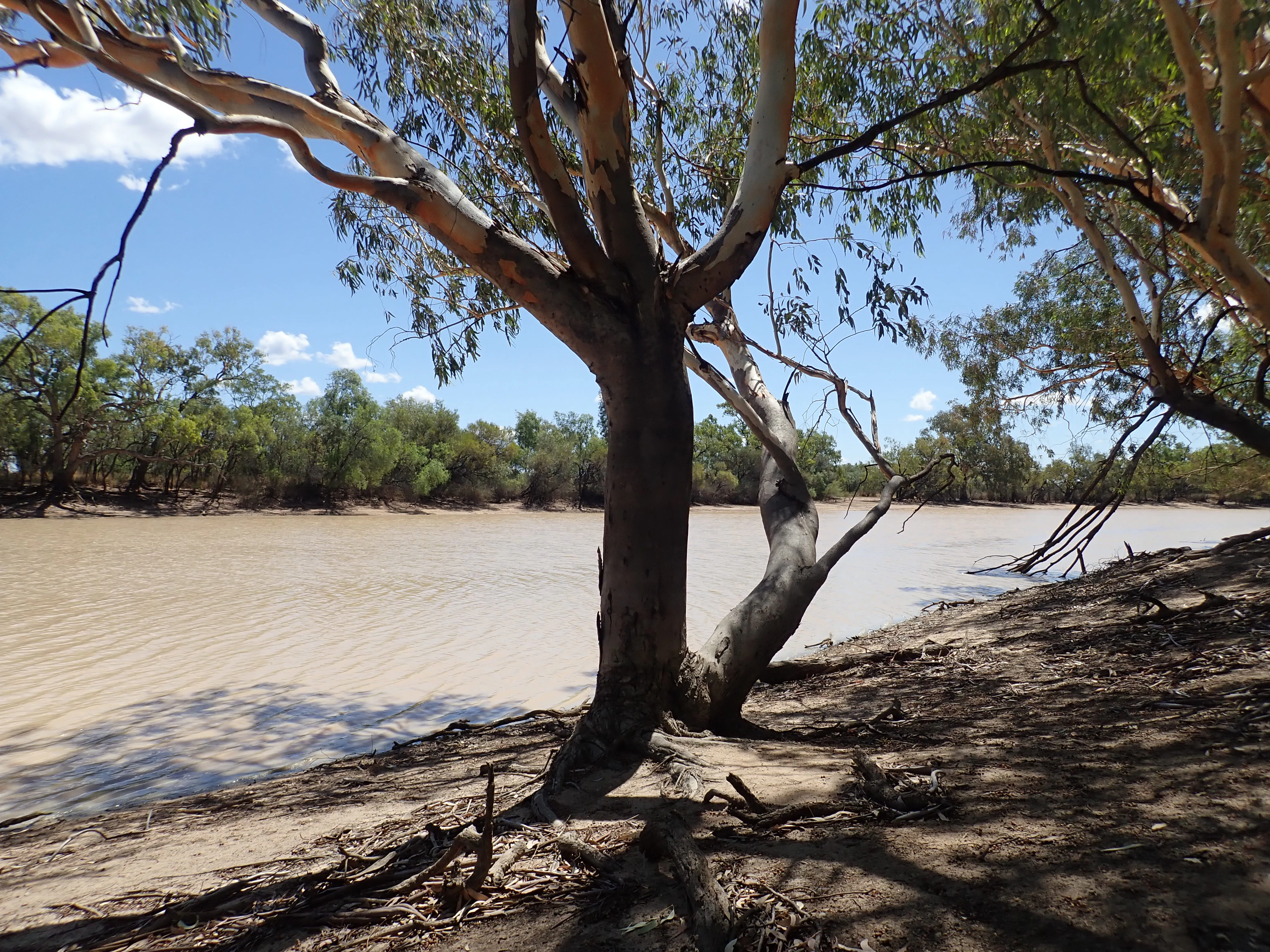
A wide, muddy river flows past a sandy bank shaded by eucalyptus trees with smooth, light-colored trunks.
King Charlie Waterhole, a permanent water body along the Paroo River in Nocoleche Nature Reserve.

Nocoleche Nature Reserve history and protected-area timeline

The Paroo River country has been occupied by Aboriginal peoples for at least 14,000 years. The traditional owners of the Paroo include the Budjair, Kunja and Mardgany in the north and the Paruntiji, meaning people belonging to the Paroo, in the south. Aboriginal people were closely tied to the river and its floodplain resources, and continued to participate in pastoral work in the region while maintaining their cultural practices and attending local ceremonies well into the early twentieth century. From the 1920s, however, government policy increasingly forced Aboriginal people off their traditional lands.

European pastoralism arrived in the 1840s when graziers took up land as squatters along the Paroo. This brought tensions with Aboriginal landowners that continued for several decades. A labour shortage caused by the exodus to the goldfields drew many Aboriginal people into the pastoral workforce from the 1850s. At the same time, the landscape itself was being reshaped. Drought combined with severe overstocking and a wave of rabbit infestation in the late nineteenth and early twentieth centuries caused extensive damage to soils, native plants and wildlife.

The Nocoleche pastoral station was established before 1887 by Frederick William Armytage. By the early twentieth century it had become one of four large runs leased along the Darling River system by Sir Samuel McCaughey, a notable innovator who experimented with heavy ploughs, mechanised shearing and irrigation across roughly 3.2 million acres. The property changed hands eight times between Armytage and the NSW National Parks and Wildlife Service, which took ownership in 1978 and gazetted the area as Nocoleche Nature Reserve the following year.

Nocoleche Nature Reserve landscape and geographic character

Nocoleche Nature Reserve sits on a broad expanse of semi-arid floodplain in the Paroo River catchment, with the river forming much of the eastern boundary of the protected area. The terrain is generally flat to gently undulating, shaped by long-term river and floodplain processes rather than by dramatic relief. The Paroo itself, along with Cuttaburra Creek, Sandy Creek, Aarons Creek and Kulkyne Creek, defines much of the reserve's geographic structure and gives it a strongly linear character along the watercourses.

The reserve contains a rich variety of wetland landscapes for an arid region. Seven different wetland types have been identified across the broader Paroo and Warrego catchments, and Nocoleche hosts most of them. Claypans, river channels and waterholes, Eleocharis swamps, lignum swamps and black box swamps are all present. What Nocoleche notably lacks are the large freshwater or salt lakes found elsewhere in the region, giving it a distinctive floodplain-dominated wetland signature.

Away from the rivers and swamps, the country rises into typical western New South Wales arid woodland. Mulga and white wood vegetation cover much of the uplands, with poplar box woodland scattered across the landscape and black box communities lining low-lying areas. This combination of dry woodland and active floodplain creates a sharp contrast in vegetation over relatively short distances and gives the reserve its characteristic patchwork appearance.
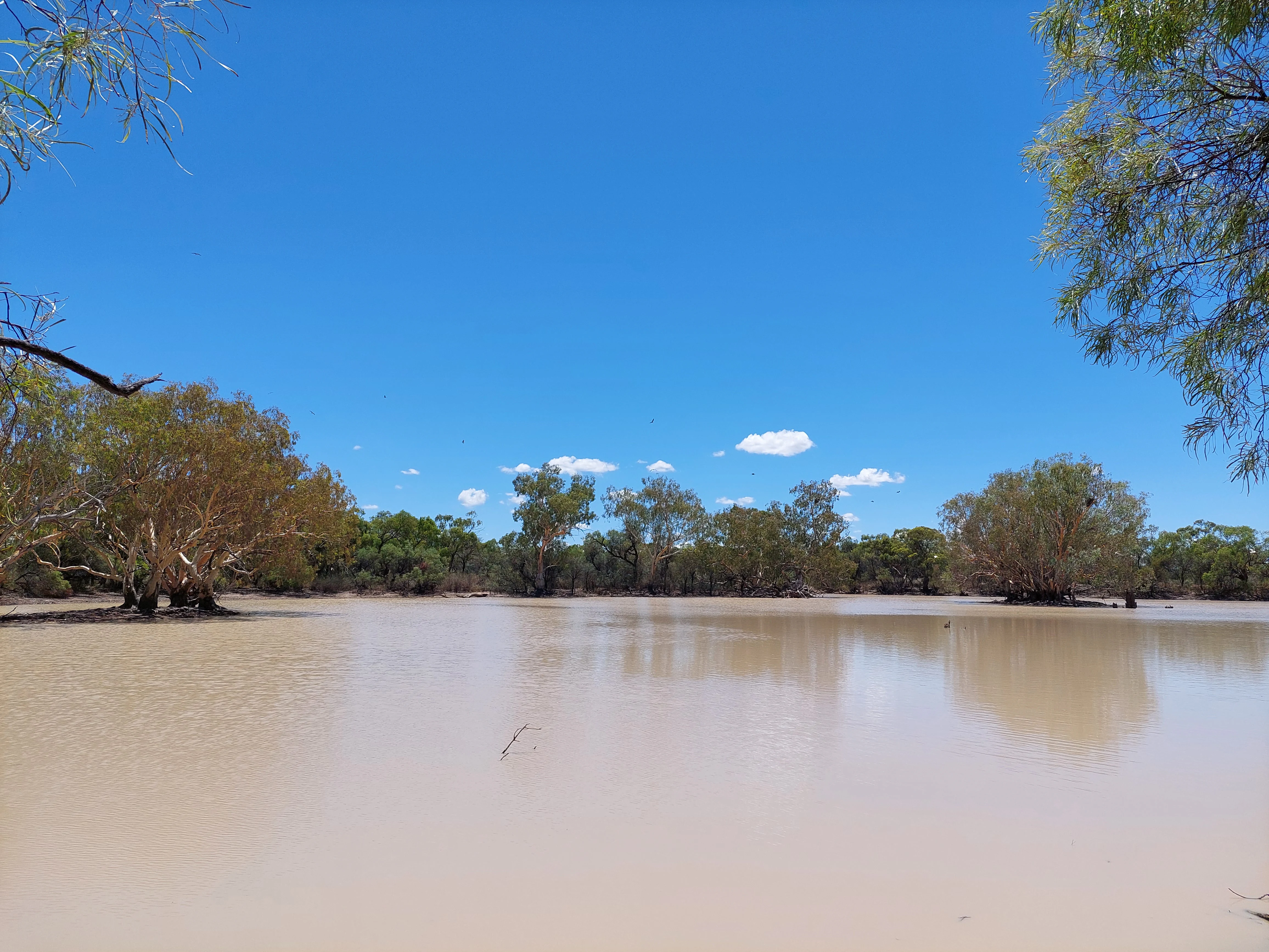
A wide, calm, muddy river channel surrounded by Australian eucalypt trees under a clear blue sky.
The Cuttaburra Channel, a prominent waterway within Nocoleche Nature Reserve.

Nocoleche Nature Reserve ecosystems, habitats, and plant life

Vegetation across Nocoleche Nature Reserve reflects the transition between arid uplands and active floodplain. The dominant upland cover is mulga and white wood, with poplar box forming patches of taller woodland and black box, Eucalyptus largiflorens, occupying the lower, wetter country. River and creek lines support important riparian communities, including a notable stand of the rare yapunyah, Eucalyptus ochrophloia, which is found along the Paroo and Warrego rivers and Cuttaburra Creek.

The wetland systems within the reserve are ecologically rich and varied. Eleocharis swamps, lignum swamps and black box swamps each support different plant and animal communities, while claypans and seasonal waterholes create additional habitat variability. Nocoleche is the only known location in New South Wales for the aquatic plant Aponogeton sp. aff. Queenslandicus and supports the endangered Dentella minutissima. Other plants of conservation interest include the algae Chara braunii, spikegrass Elytrophorus spicatus, downy mother of misery, chariot wheels and silver turkey bush, as well as corkbark Hakea ivoryi.

The persistence of natural flow along the Paroo is central to the reserve's ecological character. Because the river has not been regulated, its flood cycles continue to drive wetting and drying patterns across the floodplain, supporting the diverse wetland habitats and the broader food web that depends on them. This makes Nocoleche an unusually intact example of an arid-zone river-floodplain system in NSW.
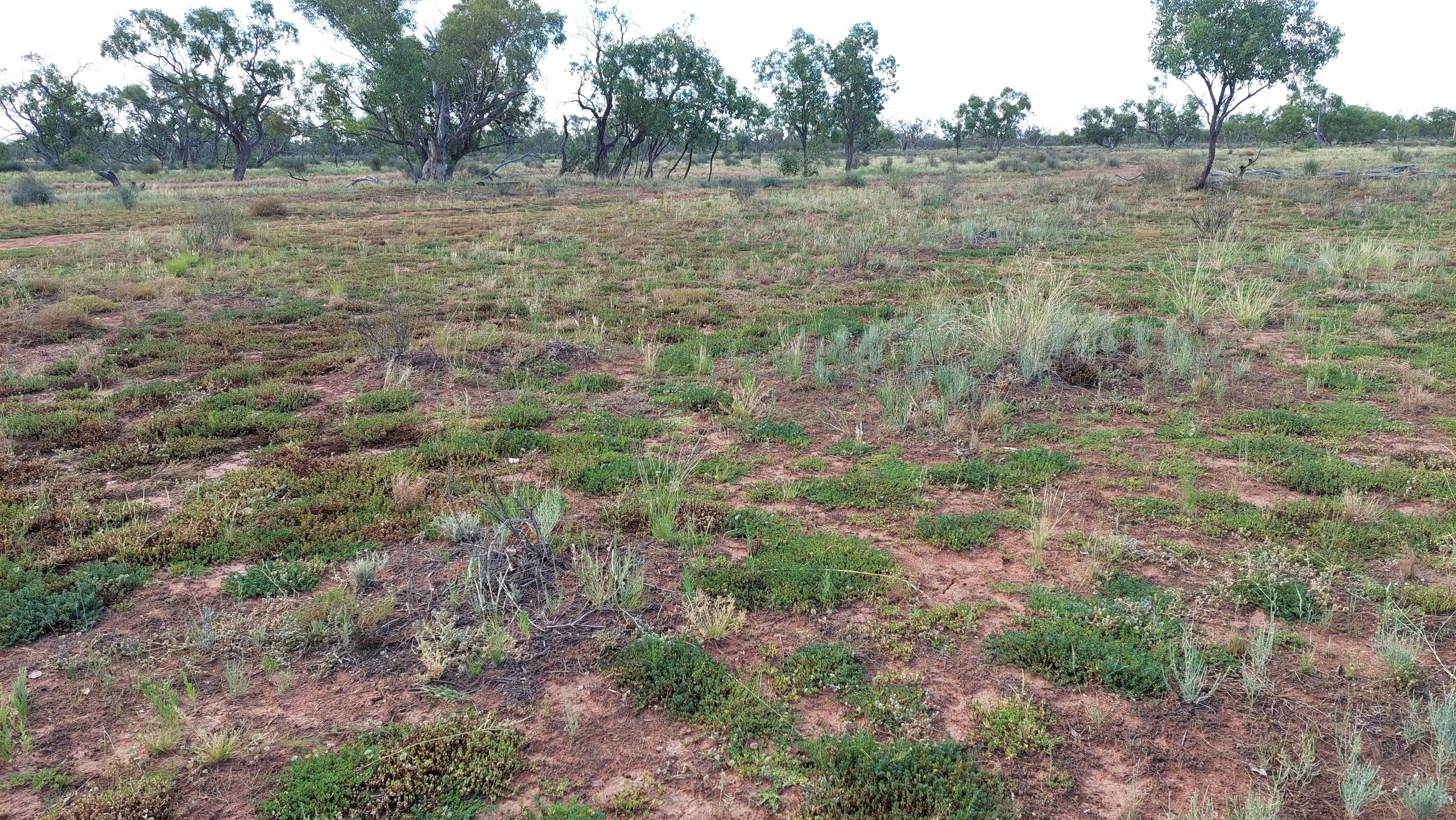
Wide shot of a flat, reddish-brown claypan landscape with low-lying green vegetation and scattered sparse trees in the background.
A claypan habitat in Nocoleche Nature Reserve, featuring arid vegetation and sparse eucalyptus trees.

Nocoleche Nature Reserve wildlife and species highlights

Nocoleche Nature Reserve supports a typical mix of arid-zone and riverine fauna. Large kangaroos are conspicuous throughout the reserve, including red kangaroos, eastern grey kangaroos, western grey kangaroos and common wallaroos. Their populations are healthy across the mosaic of woodland and floodplain habitats, and the reserve is locally important as a refuge in a landscape dominated by grazing leases.

The reserve's wetlands are particularly significant for waterbirds. The Paroo River system is an important stop-over for migratory birds moving along inland flyways, and the variety of wetland types within Nocoleche provides habitat for many different species. The reserve also supports frogs, reptiles and a wide range of invertebrates that depend on the seasonal patterns of flooding and drying.

Fish populations remain in the Paroo and its tributaries within the reserve. Yellowbelly, Murray cod, silver perch and eel-tailed catfish are found in the river and are valued by both recreational and professional fishers. The removal of threats and the ongoing natural flow regime of the Paroo help maintain these native fish communities.

Introduced animals are a recognised pressure on the reserve. Cats, rabbits, goats and foxes all occur within the park and are managed as pests because of their impact on native wildlife and vegetation.
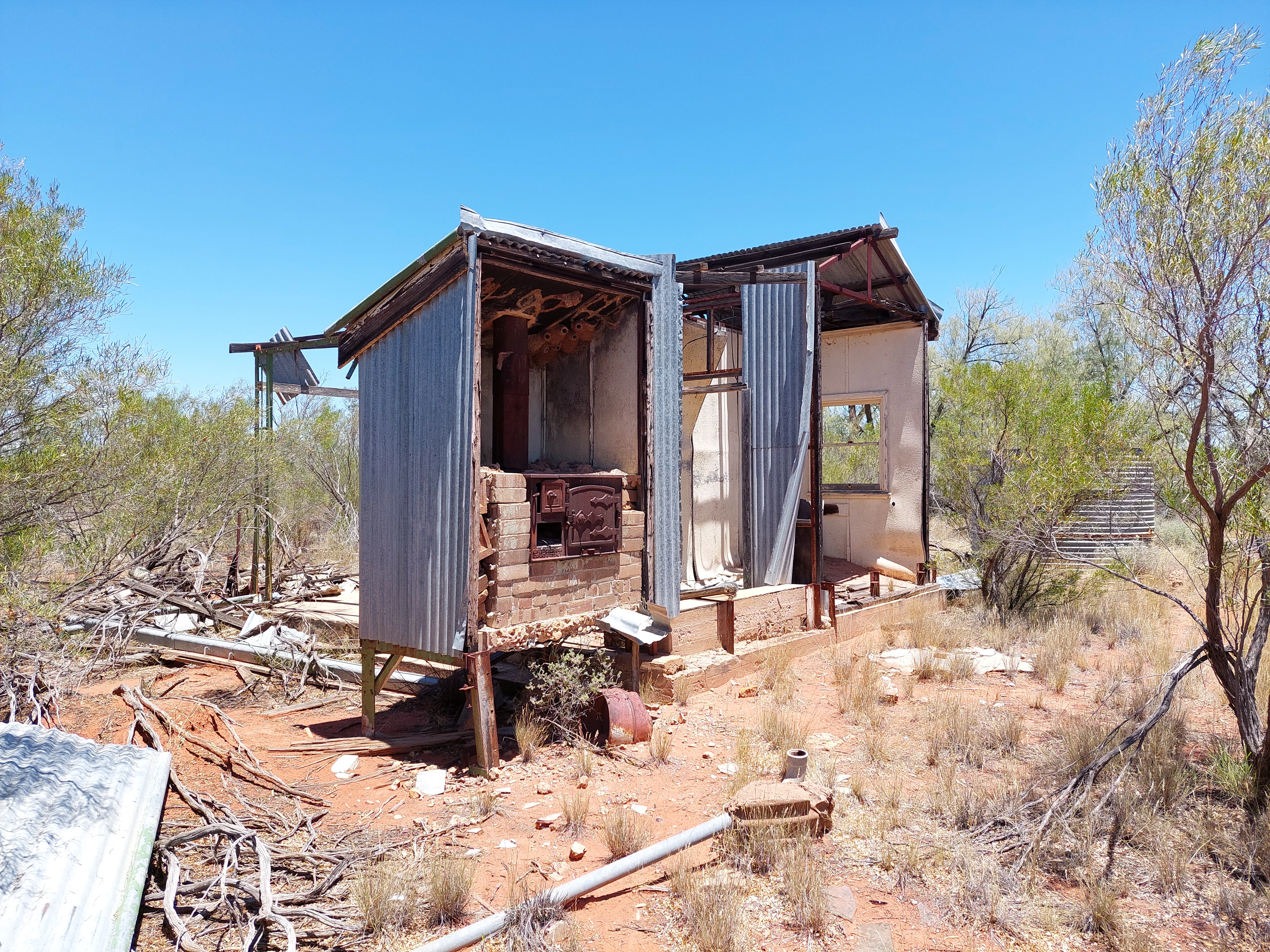
Remains of a small, rustic shed with corrugated metal walls and a brick fireplace, situated in an arid, scrubby environment.
The remains of the Corallia outstation, a structure built in 1954 within Nocoleche Nature Reserve.

Nocoleche Nature Reserve conservation status and protection priorities

Nocoleche's conservation significance lies primarily in the intactness of its river and wetland systems. The Paroo River remains free-flowing and has not been affected by the river regulation and diversions that have reshaped most other rivers in the Murray-Darling Basin. Its floodplains, including those within Nocoleche, retain natural cycles of flooding and drying that drive wetland productivity and sustain waterbird, fish and invertebrate populations.

The reserve and the broader Paroo and Warrego catchments have been assessed as having extremely high conservation value. Nocoleche itself is officially classified as a strict nature reserve, IUCN Category Ia, recognising its role in protecting relatively undisturbed natural ecosystems rather than supporting recreation-focused management. Its size, ranging across more than 700 square kilometres with substantial floodplain wetlands, gives it an unusually large footprint for ecological processes.

Nocoleche also holds botanical significance as the only known New South Wales location for several plant species, including Aponogeton sp. aff. Queenslandicus and the endangered Dentella minutissima. The persistence of rare yapunyah woodlands along the Paroo, Warrego and Cuttaburra Creek adds further conservation weight. Pests such as cats, rabbits, goats and foxes remain an ongoing management concern that influences the long-term condition of these ecosystems.

Nocoleche Nature Reserve cultural meaning and human context

The Paroo River country has been part of Aboriginal life for at least 14,000 years. Traditional owners of the Paroo include the Budjair, Kunja and Mardgany in the north and the Paruntiji in the south, whose identities are tied closely to the river and its floodplains. Aboriginal people continued cultural practices and participated in the pastoral workforce alongside non-Aboriginal graziers for several decades, although government policies from the 1920s progressively displaced Aboriginal communities from their traditional lands.

European pastoral use of what is now the reserve began in the 1840s and intensified after the gold rushes. The Nocoleche pastoral station became one of the most substantial holdings in the region, partly through the ambitions of Sir Samuel McCaughey, who pioneered mechanised and irrigation-based practices across a vast estate. Several heritage buildings from this pastoral era survive within the reserve, including shearers' quarters, cooks' quarters, the shearing overseer's cottage, a store room, a shower room and a toilet block. To date only a small number of Aboriginal sites have been formally recorded from Nocoleche, suggesting that much of the cultural heritage record of the area remains only partially documented.
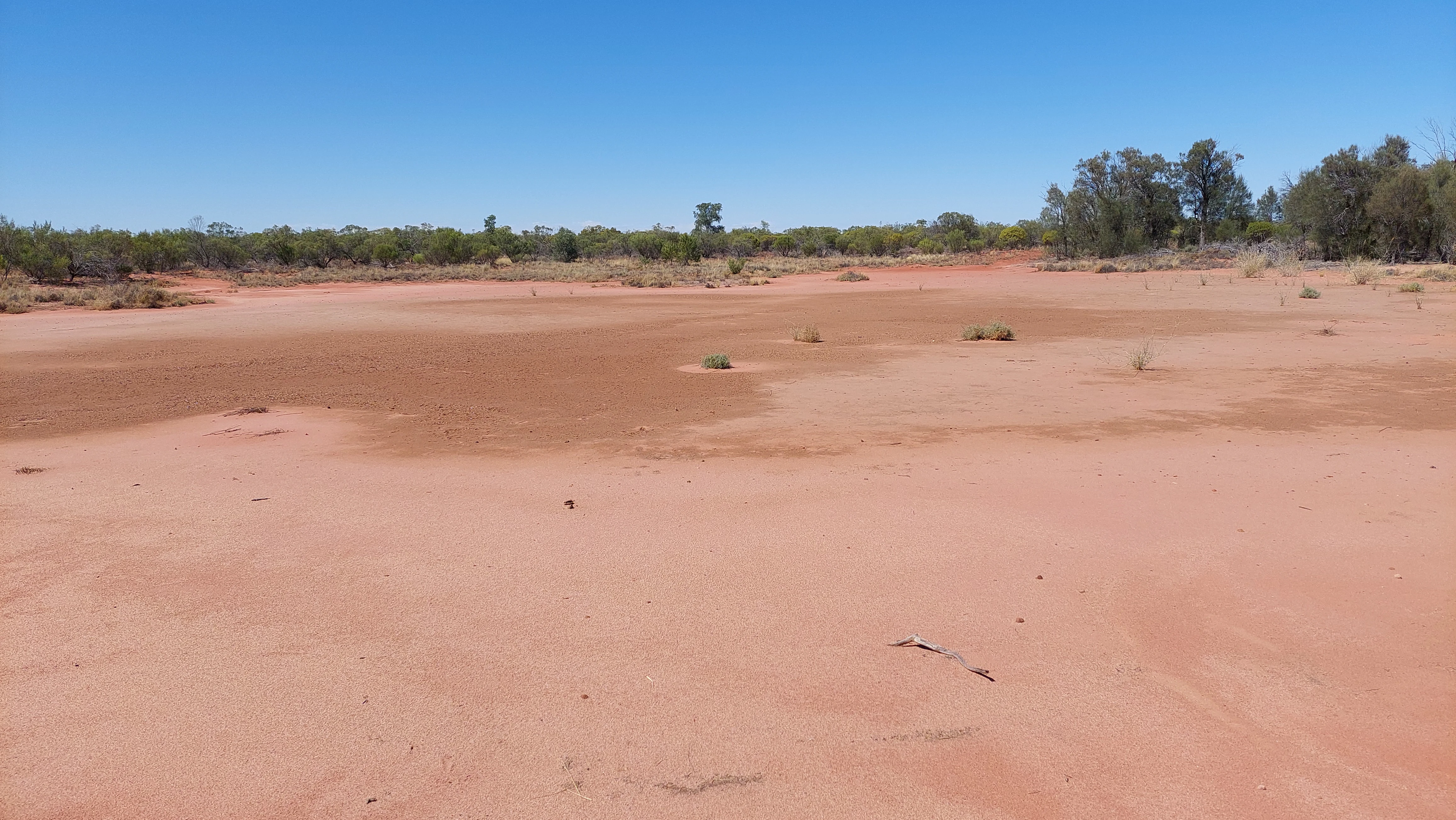
A wide, flat, arid expanse of reddish-brown clay soil under a clear blue sky, with a line of trees in the background.
A dry claypan landscape under a clear sky in Nocoleche Nature Reserve.

Top sights and standout views in Nocoleche Nature Reserve

Nocoleche Nature Reserve stands out as the largest wetland reserve in New South Wales and as a key refuge for an unregulated stretch of the Paroo River, the last major free-flowing river in the Murray-Darling Basin. Its combination of rare yapunyah woodlands, diverse wetland types and healthy populations of kangaroos, waterbirds and native fish gives it a distinctive arid-zone identity. The reserve's sheer size, remote location and history of shifting pastoral ownership add a further layer of character to a protected area that is shaped as much by the rhythms of the Paroo as by the surrounding outback.
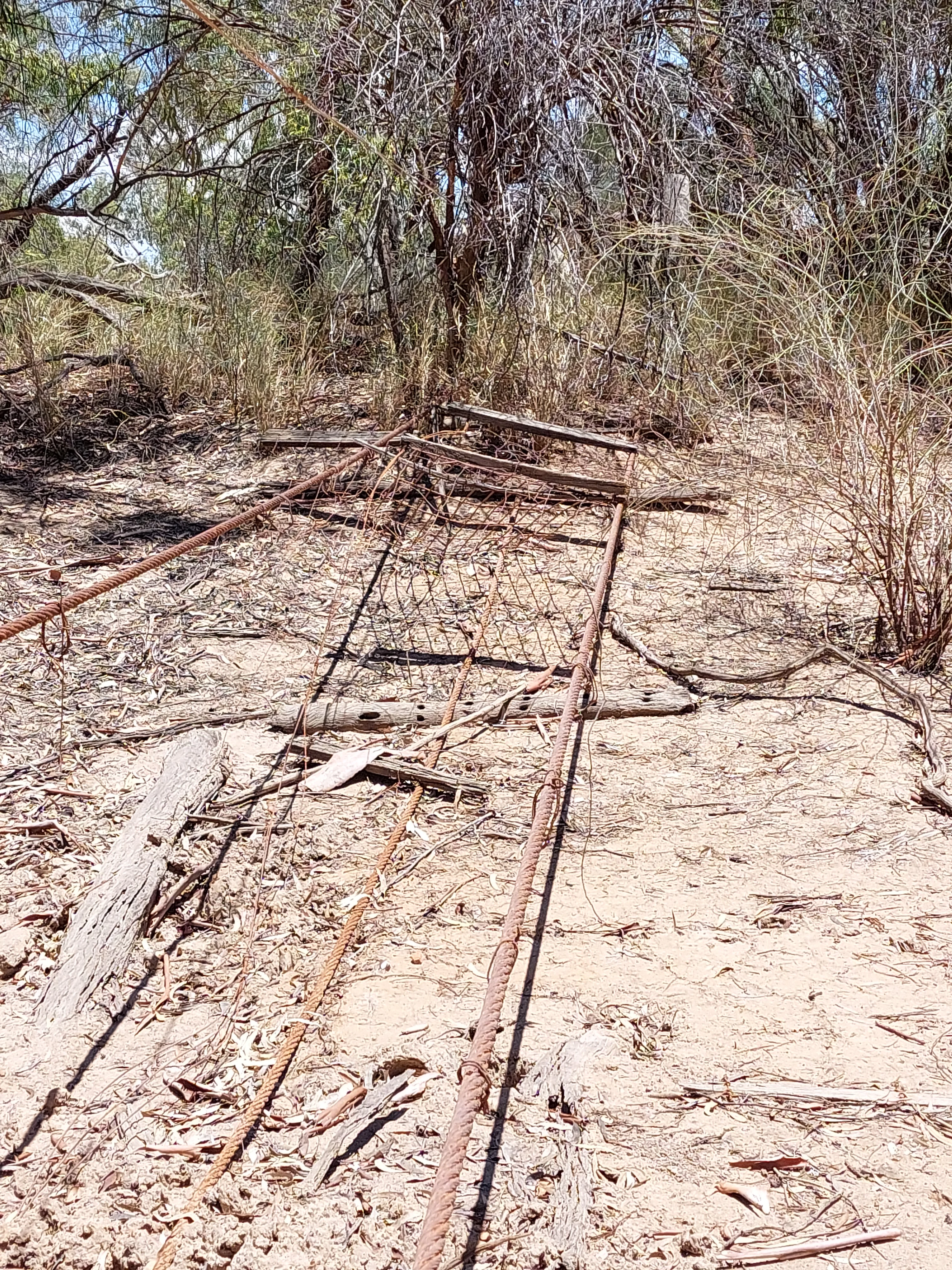
A rusted, dilapidated metal bridge structure lying on the dry, sandy ground of Nocoleche Nature Reserve, surrounded by sparse vegetation and thin trees.
Remnants of the historic suspension bridge, originally built in 1929 to facilitate livestock crossing over the Paroo River.

Best time to visit Nocoleche Nature Reserve

As a remote outback reserve with no real tourism infrastructure and very limited services, Nocoleche is primarily a destination for experienced outback travellers and researchers. Conditions vary dramatically with the seasons. Cooler months, broadly from late autumn through early spring, are generally more comfortable for exploring the reserve, with milder daytime temperatures and clearer nights. Wildlife viewing can be rewarding throughout much of the year, but the character of the floodplains changes visibly with rainfall and river flow, with higher water levels after wet seasons often producing the most active bird and wetland conditions.

Monthly climate preview

Long-term representative temperature ranges and monthly precipitation averages

Nocoleche Nature Reserve Climate Normals and Annual Weather Patterns

Nocoleche Nature Reserve records measured monthly temperature extremes and precipitation averages across a representative baseline period. Examining the complete twelve-month profile provides deeper insight into long-term climate variations and seasonal rhythms across the protected terrain.
Annual mean21 °C
11 °C31 °C
Jan31°
Feb29°
Mar26°
Apr21°
May16°
Jun12°
Jul11°
Aug13°
Sep18°
Oct22°
Nov25°
Dec28°
Warmest month
January

30.6 °C

Coolest month
July

11.2 °C

Wettest month
February

1.5 mm/day

Driest month
August

0.4 mm/day

Park location guide

Geography guide, regional context, and park location map for Nocoleche Nature Reserve

Nocoleche Nature Reserve park geography, regions, and map view in Australia

Understand where Nocoleche Nature Reserve sits in Australia through a broader geographic reading of the surrounding landscape, nearby location context, and its mapped position within the national park landscape.

How Nocoleche Nature Reserve fits into Australia

Australia is a constitutional monarchy and federal parliamentary democracy comprising six states and ten territories. With a population of nearly 28 million, it is one of the world's most urbanised countries, with most people concentrated on the eastern seaboard. The country has a high Human Development Index and is known for its cultural diversity, ancient Aboriginal heritage, and unique wildlife.

Wider geography shaping Nocoleche Nature Reserve in Australia

Australia occupies the entire Australian continent, the island of Tasmania, and numerous smaller islands. It is the world's flattest and driest inhabited continent, featuring vast deserts in the interior (the Outback), tropical rainforests along the eastern coast, and a coastline bordering the Indian and Pacific Oceans.

Map view of Nocoleche Nature Reserve

Use this park location map to pinpoint Nocoleche Nature Reserve in Australia, understand its exact geographic position, and read its mapped placement within the surrounding landscape more clearly.

Pigeon | © OpenStreetMap contributors

Location context for Nocoleche Nature Reserve

New South Wales
Recorded earthquake history

View Historical Earthquake Records for Nocoleche Nature Reserve

Examine the recorded seismic history associated with the geography of Nocoleche Nature Reserve. This catalogue organizes historical earthquake data, including event magnitude and epicentre distance, to provide a clear perspective on seismic patterns within the Paroo River catchment area.

Nocoleche Nature Reserve Earthquake Records

Catalogued events

5 events

Strongest magnitude

Magnitude 5

Most recent event

Sep 29, 2010

This history includes earthquakes recorded inside the park or within 50 km of its borders

Visualizing the floodplains, arid woodlands, and Paroo River habitats of New South Wales

Nocoleche Nature Reserve Photos and Landscape Scenery

Examine detailed Nocoleche Nature Reserve photos to understand the unique terrain, diverse wetland types, and arid floodplain habitats that define this protected area. Visual records reveal the distinct character of free flowing river corridors, rare woodlands, and remote outback ecosystems.

A wide, muddy river flows past a sandy bank shaded by eucalyptus trees with smooth, light-colored trunks.

A medium shot of a Yapunyah tree with a multi-stemmed trunk, showcasing smooth reddish-brown bark contrasting with dark, rough bark at the base and a surrounding dry grassy landscape.

A wide, calm, muddy river channel surrounded by Australian eucalypt trees under a clear blue sky.

Wide shot of a flat, reddish-brown claypan landscape with low-lying green vegetation and scattered sparse trees in the background.

Remains of a small, rustic shed with corrugated metal walls and a brick fireplace, situated in an arid, scrubby environment.

A wide, low-angle shot of a shallow swamp with muddy banks and sparse green shrubbery under a clear blue sky.

A wide, flat, arid expanse of reddish-brown clay soil under a clear blue sky, with a line of trees in the background.

A rusted, dilapidated metal bridge structure lying on the dry, sandy ground of Nocoleche Nature Reserve, surrounded by sparse vegetation and thin trees.

Park atlas

Compare nearby outback reserves and connected arid wetland geography.

Other Parks Near Nocoleche Nature Reserve and Surrounding Protected Areas

Browse protected areas and river floodplains located near Nocoleche Nature Reserve to compare arid-zone ecosystems across the surrounding region. Extending the geographic review helps map regional wildlife refuges and woodland reserves sharing similar outback terrain.
National parkAustralia
75 km away#1 closest

South

Paroo-Darling National Park: Mapped Boundaries and Protected Landscape Geography

Explore the geographic context of this Australian national park.

Paroo-Darling National Park is a protected national park offering insights into Australia's natural geography. This section provides details on its mapped protected area, highlighting the landscape and regional context. Understand the park's geographic footprint and its importance as a conservation landscape within the Australian continent.

Area
1,780.53 km²
Established
2000
IUCN
II
Relief
Upland
State or regional parkNew South Wales
80 km away#2 closest

East

Toorale State Conservation Area: A Landmark Protected Landscape in the Western New South Wales Outback

Floodplain ecosystems and joint-managed riverine wilderness.

Toorale State Conservation Area stands as a major protected region in New South Wales, anchoring critical habitat along the Darling-Baaka River system. This vast, former pastoral landscape features extensive floodplains, arid outback terrain, and elevated lookouts that reveal the scale of the Murray-Darling Basin. As a cooperative conservation area, the land reflects both deep indigenous heritage and focused ecological restoration in a sparsely settled, semi-arid environment.

Area
543.85 km²
Established
2010
Relief
Lowland
Climate
Arid
National parkNew South Wales
97 km away#3 closest

East

Toorale National Park: Inland Floodplain and Wetland Protected Area in New South Wales

Discover its unique geography at the Darling and Warrego River confluence.

Toorale National Park is a critical protected area in the arid interior of New South Wales, Australia, recognized for its expansive inland floodplain and a significant wetland system formed by historic water management. Situated at the convergence of the Darling and Warrego Rivers, the park's terrain is predominantly flat, characterized by riparian floodplains and occasional low ridges. This landscape supports diverse vegetation communities, including river red gum forests and extensive chenopod shrublands, offering a unique insight into inland Australian geography and conservation values. Explore the mapped boundaries and natural context of this important national park.

Area
308.66 km²
Established
2010
IUCN
II
Relief
Lowland
National parkNew South Wales
124 km away#4 closest

Northwest

Narriearra Caryapundy Swamp National Park: National Park Protected Landscape and Geographic Atlas

Explore mapped boundaries and regional context within New South Wales.

Narriearra Caryapundy Swamp National Park is a designated national park focused on preserving its unique protected landscape. This entry provides essential geographic context, detailing the park's mapped boundaries and its role within the regional atlas of New South Wales. Understand the protected natural area's identity and its place within the broader geographic framework for atlas exploration.

Area
1,534 km²
Established
2020
Relief
Lowland
Climate
Arid
National parkNew South Wales
128 km away#5 closest

Southeast

Gundabooka National Park: Australian Protected Landscape Geography

Mapped boundaries and regional context within New South Wales.

Gundabooka National Park serves as a vital national park entity within the Australian protected areas system. This entry focuses on its specific geographic footprint and landscape character, offering a foundation for understanding its role and distribution within New South Wales. Explore the mapped context and regional geography that define Gundabooka National Park as a protected natural landscape.

Area
639.02 km²
Established
1996
IUCN
II
Relief
Mountain
National parkQueensland
About 132 km away#6 closest

North

Currawinya National Park: Queensland's Ramsar Wetland and Mulga Lands National Park

Discover its arid landscape and protected area identity.

Currawinya National Park is a major protected area in Queensland, Australia, recognized for its significant Ramsar-listed wetland system, including Lakes Numalla and Wyara. These ephemeral lakes are vital drought refuges for waterbirds across inland Australia and represent a unique ecological feature within the park's expansive mulga lands landscape. The park also champions conservation initiatives, notably a large predator-exclusion enclosure for the greater bilby, showcasing its commitment to arid-zone biodiversity and landscape preservation.

Area
1,513 km²
Established
1991
IUCN
II
Relief
Lowland
National parkNew South Wales
159 km away#7 closest

West

Sturt National Park National Park: Discover Protected Landscape and Regional Geography in New South Wales

Explore the mapped boundaries and natural terrain of this Australian protected area.

Sturt National Park in New South Wales stands as a key national park within Australia's network of protected landscapes. This page offers detailed geographic context, focusing on the park's mapped boundaries and its role as a distinct natural area. Users can explore how Sturt National Park fits into the broader regional geography of New South Wales, providing an atlas-level view of conservation within the state and continent.

Area
3,253.29 km²
Established
1972
IUCN
II
Relief
Mixed relief
National parkNew South Wales
175 km away#8 closest

Southwest

Mutawintji National Park: New South Wales Protected Area for Atlas Exploration

Mapping rugged outback terrain, gorges, and ancient rock art.

Mutawintji National Park in New South Wales offers a profound exploration of Australia's outback geography, significant Indigenous heritage, and protected landscapes. Discover the park's unique terrain, defined by the Byngnano Range, vibrant gorges, and river red gum-lined creeks, all rich with ancient Aboriginal rock art. This national park is a prime example of mapped protected area discovery, highlighting both natural beauty and critical conservation achievements.

Area
689.12 km²
Established
1998
IUCN
II
Relief
Mountain

Common questions about visiting, size, designation, and location context for Nocoleche Nature Reserve

Nocoleche Nature Reserve FAQs for park facts, access, geography, and protected area context

Find quick answers about Nocoleche Nature Reserve, including protected-area facts, park geography, trail and visitor context, and how the park fits into its surrounding country and regional landscape.
MoriAtlas Explorer

Continue Your Protected Areas Search Across the Global Atlas

Deepen your exploration by continuing the structured search for national parks and protected areas worldwide. Utilize the comprehensive filtering capabilities to compare different conservation landscapes and refine your understanding of global park geography. Discover more about the distribution and characteristics of protected natural areas.

Global natural geography