
Mori Atlas logo
Biosphere reserveNorth Devon's Biosphere Reserve

Mapping the intricate boundaries of sand dunes, river estuaries, and coastal ecosystems

North Devon's Biosphere Reserve: A Comprehensive Geographic Study of Protected Landscapes

North Devon's Biosphere Reserve encompasses a remarkably varied landscape spanning northern Devon, from the expansive sand dune systems of Braunton Burrows to the complex tidal reaches of the Taw and Torridge estuaries. This protected region integrates diverse natural habitats, including culm grasslands, broadleaved woodlands, and significant marine zones surrounding Lundy Island. The reserve functions as a living landscape where conservation and local development coexist within a unique, mapped ecological framework.

biosphere reservesand dunesestuarycoastislandmigratory birds
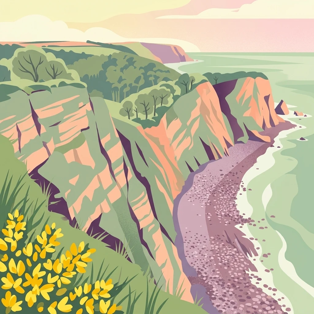
A stylized graphic illustration of a coastal cliffside scene with layered orange cliffs; green clifftop vegetation with bright yellow flowers in the foreground; and a pebble beach meeting the sea below.

North Devon's Biosphere Reserve

Biosphere reserve

Park overview

Structured park overview, official facts, and landscape profile for North Devon's Biosphere Reserve

North Devon's Biosphere Reserve park facts, protected area profile, and essential visitor context

Review the core facts for North Devon's Biosphere Reserve, including designation, size, terrain, visitor scale, habitats, and operating context in one park-focused overview.

About North Devon's Biosphere Reserve

North Devon's Biosphere Reserve is a large, working landscape in the South West of England, set apart as a place where conservation, rural livelihoods, and coastal communities are meant to thrive together. Designated by UNESCO in 1976 and expanded into a new form in 2002, it sits in northern Devon, with most of its territory in the districts of North Devon and Torridge and slivers extending into West and Mid Devon. Its territorial extent runs inland along the catchment basins of the Rivers Taw and Torridge, and reaches out to sea around Lundy Island, about twelve miles offshore.

The reserve's heartland is Braunton Burrows, with its sweeping dune ridges, damp slacks, dune pasture, and adjoining parts of the Taw-Torridge estuary. This is the core area of the biosphere, and around it the rest of the reserve is organised into buffer and transition zones. The North Devon Coast Area of Outstanding Natural Beauty lies at the centre, while the national parks of Dartmoor and Exmoor fringe the reserve's edges, creating a continuous sweep of protected and managed countryside between moorland, farmland, coast, and sea.

Beyond the dunes, the reserve is largely lowland farmland crossed by river valleys, wooded combes, and pockets of culm grassland and broadleaved woodland. Towns such as Barnstaple, Bideford, Ilfracombe, Braunton, Northam, and Great Torrington, along with many smaller villages and hamlets, sit within the buffer area, and around 155,000 people live in this wider zone. Tourism is a major part of the local economy, drawn by beaches, walking routes, and the area's strong natural and cultural character.

The reserve is unusual among protected areas in the United Kingdom for blending so many different kinds of environment within a single boundary. It connects dune systems with estuaries and sea cliffs, lowland farms with remnant ancient woodland, and inland rivers with a deep offshore environment. It is managed by a partnership that includes national agencies, conservation charities, local councils, farmers, fishermen, and educators, working to balance ecological health with the needs of the communities that have lived in this landscape for thousands of years.

Quick facts and research context for North Devon's Biosphere Reserve

North Devon's Biosphere Reserve is a UNESCO biosphere reserve in northern Devon, England, established in 1976 and substantially expanded in 2002. It is centred on Braunton Burrows, England's largest sand dune system, and its boundary follows the catchment of the Rivers Taw and Torridge, extending offshore to include Lundy Island.

The reserve is predominantly lowland farmland, but it also holds 63 Sites of Special Scientific Interest, a Special Area of Conservation, six Local Nature Reserves, and nationally important habitats including culm grassland, broadleaved woodland, estuary, and coastal heathland. It is managed by a partnership of local authorities, national agencies, conservation charities, and community representatives, and was the first of the new-style UK biosphere reserves that emphasise sustainable development alongside conservation.

Protection and recognition

Mixed conservation scope and verified protected area governance records

North Devon's Biosphere Reserve Protection Status and International Recognition

North Devon's Biosphere Reserve maintains a documented mixed protection status reflecting its comprehensive conservation scope and management framework. Detailed records track official designation criteria, administrative boundaries, and international recognition metrics across the protected landscape.

Protection details

Protection scope
Mixed
Transboundary protection
No
Park context

Deeper park guide and search-rich context for North Devon's Biosphere Reserve

North Devon's Biosphere Reserve history, landscape, wildlife, and travel context

Explore North Devon's Biosphere Reserve through its history, landscape character, ecosystems, wildlife, conservation priorities, cultural context, and seasonal travel timing in a structured park guide built for atlas discovery and search intent.

Why North Devon's Biosphere Reserve stands out

The reserve is best known for Braunton Burrows, the largest sand dune system in England, and for the rich mosaic of estuarine and marine environments around it. The dune system runs through a full successional sequence, from mobile yellow dunes stabilised by marram grass through to grey dunes, slacks, scrub, and dune pasture, supporting hundreds of flowering plants and many rare invertebrates. Equally distinctive is the wider setting. The Taw-Torridge estuary is an important feeding ground for long-distance migratory birds, while the waters off Lundy hold a cold-water coral reef with species found nowhere else in Britain. Together with the surrounding culm grasslands, broadleaved woodlands, and coastal heathland, the reserve is recognised as a remarkable concentration of habitat diversity in a lowland British landscape.

A close up view of a small, golden-brown hazel dormouse with large black eyes, gripping a thin, thorny twig.
A hazel dormouse perched on a thorny branch in the North Devon Biosphere Reserve.

North Devon's Biosphere Reserve history and protected-area timeline

The landscape of North Devon has been lived in and shaped by people for many thousands of years. Flint scatters around Baggy Point show human presence from the Mesolithic period, and a Mesolithic shell midden buried in the clays beneath Westward Ho! beach preserves the remains of mussels, cockles, peppery furrow shells, and carpet shells. On Exmoor, late Mesolithic microliths hint at a hunting and gathering way of life, while in the Neolithic period the earliest farmers began clearing woodland and tending livestock.

By the Bronze Age, communities were building barrows and roundhouses, including examples on elevated ground at Bursdon Moor, near Hartland, and on Berry Down near Berrynarbor. Iron Age hill forts such as Hillsborough near Ilfracombe, Embury Beacon, and Clovelly Dykes were raised on prominent coastal and inland positions, reflecting a landscape that was already being organised around defence, agriculture, and access to the sea. Many of the villages and hamlets in the area have Saxon origins and were documented in the Domesday Book of 1086, while Grade I-listed medieval buildings survive in places such as Combe Martin, Berrynarbor, and Stoke near Hartland.

The modern story of the reserve itself begins in 1959, when the North Devon Coast was designated as an Area of Outstanding Natural Beauty, the first in Devon. In 1976, Braunton Burrows became a biosphere reserve under UNESCO's Man and the Biosphere Programme, focused on conservation and research. In 2002 it was expanded into the first of the new-style UK biosphere reserves, designed to integrate conservation with sustainable development, income generation, and reductions in local poverty. Under the revised framework, Braunton Burrows became the formal core area, with surrounding land and sea making up the buffer and transition zones.

Management of the protected landscape evolved alongside the reserve. What began as a Heritage Coast Service in the early 1990s went through several changes in name and remit before the establishment of the North Devon AONB Partnership in 2004 led to a clean split between the North Devon AONB Service and the North Devon Biosphere Service. Today, the Biosphere Reserve Partnership coordinates work across agencies, local authorities, and community groups to deliver UNESCO's three-fold mission of conservation, learning and research, and sustainable development.

North Devon's Biosphere Reserve landscape and geographic character

North Devon's Biosphere Reserve stretches across a varied northern Devon landscape that runs from the open moorland fringes of Exmoor and Dartmoor down through wooded river valleys, patchwork farmland, and coastal cliffs to the dunes, estuaries, beaches, and sea in the west.

The defining landform of the reserve is Braunton Burrows, a vast sand dune system of about 49 square kilometres that includes yellow mobile dunes, stabilised grey dunes, wet dune slacks, dune pasture, and scrub. Its dunes roll inland from the wide, west-facing surf beach of Saunton Sands, where much of the reserve meets the Atlantic. The dune ridges and troughs form a hummocky terrain with sudden shifts between dry sand and damp slacks that flood in heavy rain.

Inland, the landscape softens into the gently rolling lowlands of the Taw and Torridge catchments, crossed by rivers that gather smaller streams from combes and farmland before reaching broad tidal estuaries. Estuaries such as the Taw-Torridge shape wide expanses of mudflat, saltmarsh, and grazing marsh. The coast is marked by cliffs around Hartland and Clovelly, while the offshore zone extends to waters around Lundy Island, about twelve miles from the mainland.

The reserve is framed by the North Devon Coast Area of Outstanding Natural Beauty and bordered to the east and north by the high moorland edges of Exmoor and Dartmoor. Settlements are dispersed through the buffer area rather than concentrated in cities, giving the region a long-standing character of small market towns, coastal villages, and working farms set within a richly textured natural environment.
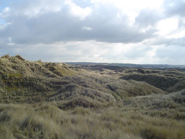
A wide, eye-level view of undulating sand dunes covered in marram grass under a cloudy sky.
Vegetated sand dunes at Braunton Burrows, part of North Devon's Biosphere Reserve.

North Devon's Biosphere Reserve ecosystems, habitats, and plant life

The biosphere reserve supports a remarkable concentration of habitats for a lowland British setting. Among its national priorities are culm grasslands, characterised by purple moor grass and rushes, broadleaved woodlands typical of temperate lowland Britain, estuarine systems where river meets sea, and coastal heathland along the cliff tops and dunes. These habitats sit within a wider matrix of farmland, which the partnership works to manage in ways that maintain ecological function without compromising the rural economy.

The Braunton Burrows core area is one of the richest sand dune ecosystems in the country, carrying the full successional range of dune plant communities. Marram grass stabilises the yellow dunes near the sea, while inland grey dunes add further plant diversity. The dune slacks, damp and sometimes flooded in winter, support round-headed club-rush, sharp rush, and many orchids, while older inland areas have grown into dune pasture and scrub with species such as willow, privet, and common blackberry, alongside introduced sea buckthorn.

Around the estuaries, saltmarshes and tidal flats carry sea purslane, Salicornia species, common reed, and creeping bentgrass, while the floodplain grasslands and grazing marsh support hawthorn, blackthorn, ash, and a mix of native grasses. Behind the dunes, compacted soils host around sixty lichen species, including notable types such as sausage lichen and scrambled-egg lichen. In the offshore zone, the waters around Lundy Island contain a cold-water coral reef whose diversity of corals and associated marine life is unique in British waters.
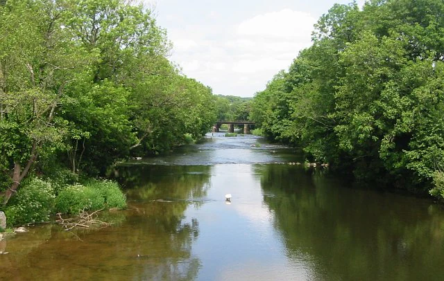
A peaceful river flows through the center of the frame, lined on both sides by dense green deciduous trees. A small road bridge is visible in the distant center of the composition.
The River Taw flowing through a lush, forested corridor at Umberleigh, within the North Devon Biosphere Reserve.

North Devon's Biosphere Reserve wildlife and species highlights

The reserve is alive with wildlife across its mosaic of habitats. Braunton Burrows and the Taw-Torridge estuary together form a major route for bird migration along the west coast of Great Britain, with waterfowl wintering on the estuary's shores and a wide range of breeding species using the dunes. Whitethroats and magpies favour the scrub; skylarks and meadow pipits nest in the grassland; wheatears and shelducks use burrows and holes along more open ground.

The dunes also support an unusually rich invertebrate fauna. About thirty species of terrestrial and freshwater molluscs have been recorded, including the sandbowl snail, which is known from only two sites in the United Kingdom. Butterflies are a notable feature of the wider reserve too, and the marsh fritillary is one of the species of conservation concern recorded here. Below the sand surface, the strandline and strandline-edge habitats add further niches for insects and small animals.

The reserve is also home to mammals of national rarity. Both the common dormouse, the only native dormouse in Britain, and the European otter are present in the area, alongside the broader community of lowland British mammals. The marine environment off Lundy adds a different wildlife dimension, with the cold-water coral reef providing habitat for species and communities found nowhere else in British waters and supporting a wider diversity of fish and invertebrates.

North Devon's Biosphere Reserve conservation status and protection priorities

North Devon's Biosphere Reserve exists to demonstrate how biodiversity conservation and sustainable human activity can be pursued together. UNESCO sets biosphere reserves three core functions: conservation, learning and research, and sustainable development. Within North Devon, these functions are pursued across a landscape where wildlife and everyday life overlap closely, with most of the area in working agricultural use.

Formal protection is concentrated in the core area around Braunton Burrows, with the wider reserve organised into buffer and transition zones that provide increasing room for everyday land uses. The reserve contains 63 Sites of Special Scientific Interest, a Special Area of Conservation, six Local Nature Reserves, and hundreds of County Wildlife Sites, supported by a 10-year Biodiversity Action Plan that sets out practical steps for nature conservation, learning, and monitoring.

The partnership delivers conservation in cooperation with farmers, landowners, and local communities, recognising that the catchment-based boundaries of the reserve mean water quality is a critical concern. Large-scale initiatives focus on reducing diffuse pollution from farmland and urban areas, restoring river habitats by removing barriers to fish movement, and improving the condition of nature improvement areas such as the River Torridge catchment. The unique offshore environment around Lundy, including its cold-water coral reef, forms a distinctive component of the reserve's conservation story.

North Devon's Biosphere Reserve cultural meaning and human context

The cultural history of the reserve stretches deep into prehistory and continues through the everyday life of its present-day communities. Mesolithic flint scatters around Baggy Point and a prehistoric shell midden beneath Westward Ho! speak to early coastal living, while Neolithic farmers began altering the woodland of Exmoor, and Bronze Age communities left barrows at sites such as Bursdon Moor and Berry Down. Iron Age hill forts at Hillsborough, Embury Beacon, and Clovelly Dykes reflect a landscape already marked by territorial strategies and proximity to the sea.

Later generations consolidated this pattern. Many of the area's villages and hamlets have Saxon origins, and the Domesday Book of 1086 records numerous settlements that still exist today. Medieval buildings of the highest grade survive in places such as Combe Martin, Berrynarbor, and Stoke near Hartland, adding a tangible thread of continuity between prehistoric, medieval, and modern communities.

The wider cultural identity of the region is closely tied to its environment. The literary association with Henry Williamson's Tarka the Otter, set along the River Torridge, runs through the reserve, and the North Devon Coast has been recognised for its scenic value since 1959 when it became one of Devon's first Areas of Outstanding Natural Beauty. Today, the reserve frames a working cultural landscape of farms, fishing communities, visitor towns, and walking traditions shaped by long-established trails such as the South West Coast Path and the Tarka Trail.

Top sights and standout views in North Devon's Biosphere Reserve

Among the most distinctive elements of North Devon's Biosphere Reserve are Braunton Burrows, the largest sand dune system in England with over 400 recorded vascular plant species; the cold-water coral reef off Lundy Island, unique in British waters; and the Taw-Torridge estuary, an important feeding area for migratory birds on the west coast of Great Britain.

Equally notable is the way the reserve stitches together so many different designations and landscapes, from a UNESCO biosphere reserve and an Area of Outstanding Natural Beauty to Sites of Special Scientific Interest, a Special Area of Conservation, and the fringe of two national parks. The reserve's blend of dune, estuary, woodland, culm grassland, lowland farmland, and offshore sea makes it a remarkable case study in how a single biosphere boundary can hold a working landscape, a nature conservation resource, and a long cultural history at once.

Best time to visit North Devon's Biosphere Reserve

North Devon's Biosphere Reserve can be visited through the year, with each season giving the landscape a different character. Spring and early summer are particularly rewarding for wildlife, when breeding birds are active across the dunes, estuary, and farmland, and dune plants begin to flower in the slacks and grey dunes. Late spring and early summer are also a good time to see butterflies such as the marsh fritillary in suitable habitat.

Summer brings the warmest conditions and long daylight hours, when the North Devon coast is at its busiest and beaches such as Saunton Sands are popular with visitors. The dune grasslands are at their most floristically diverse in this period, though the busiest weeks can feel crowded in the most visited places. Autumn and winter are quieter, and are often the best time to watch migratory and wintering waterfowl along the Taw-Torridge estuary, with cooler weather bringing a different rhythm to walks along the South West Coast Path and inland trails.

Monthly climate preview

Measured long term temperature and precipitation patterns across representative coordinates

North Devon's Biosphere Reserve Climate Normals and Average Annual Temperatures

Representative coordinate records show average monthly temperatures ranging from 6.28 degrees Celsius to 16.11 degrees Celsius alongside recorded precipitation values between 2.21 mm and 4.25 mm per day. Detailed monthly comparisons provide deeper insights into long term meteorological normals across the protected landscape.
Annual mean11 °C
6 °C16 °C
Jan
Feb
Mar
Apr
May11°
Jun14°
Jul16°
Aug16°
Sep15°
Oct12°
Nov10°
Dec
Warmest month
August

16.1 °C

Coolest month
February

6.3 °C

Wettest month
December

4.3 mm/day

Driest month
May

2.2 mm/day

Park location guide

Geography guide, regional context, and park location map for North Devon's Biosphere Reserve

North Devon's Biosphere Reserve park geography, regions, and map view in United Kingdom

Understand where North Devon's Biosphere Reserve sits in United Kingdom through a broader geographic reading of the surrounding landscape, nearby location context, and its mapped position within the national park landscape.

How North Devon's Biosphere Reserve fits into United Kingdom

The United Kingdom is a parliamentary constitutional monarchy located in northwestern Europe, consisting of four constituent countries: England, Scotland, Wales, and Northern Ireland. As a major global power with over 69 million residents, it maintains significant international influence in politics, economics, and culture.

Wider geography shaping North Devon's Biosphere Reserve in United Kingdom

The United Kingdom is an island nation located in northwestern Europe, surrounded by the Atlantic Ocean, North Sea, English Channel, Celtic Sea, and Irish Sea. It shares a land border with the Republic of Ireland to the west. The territory includes the island of Great Britain, the northeastern portion of Ireland, and most of the smaller British Isles islands.

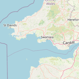
Map view of North Devon's Biosphere Reserve

Use this park location map to pinpoint North Devon's Biosphere Reserve in United Kingdom, understand its exact geographic position, and read its mapped placement within the surrounding landscape more clearly.

Pigeon | © OpenStreetMap contributors

Location context for North Devon's Biosphere Reserve

Devon

Visual exploration of coastal sand dunes, estuaries, and protected habitats

North Devon's Biosphere Reserve Photos, Scenery, and Landscapes

Photographic collections reveal the varied terrain of North Devon's Biosphere Reserve, spanning vast sand dune systems and tidal estuaries. Visual records help researchers examine the protected habitats and coastal environments defining this protected landscape.

A close up view of a small, golden-brown hazel dormouse with large black eyes, gripping a thin, thorny twig.

A high-angle view looking down at a rugged, steep coastline with vegetated cliffs meeting a stony beach and the ocean below.

A wide, eye-level view of undulating sand dunes covered in marram grass under a cloudy sky.

A peaceful river flows through the center of the frame, lined on both sides by dense green deciduous trees. A small road bridge is visible in the distant center of the composition.

Park atlas

Compare regional park geography and adjacent protected areas in South West England

Parks Near North Devon's Biosphere Reserve and Connected Protected Landscapes

Browsing parks near North Devon's Biosphere Reserve reveals connected coastal habitats, moorland fringes, and estuarine environments across the surrounding region. Comparing adjacent protected areas provides deeper geographic context for understanding lowland conservation networks and regional terrain diversity.
Watercolor painting depicting a landscape with rolling hills, a winding road, and distant mountains
National parkUnited Kingdom
About 29 km away#1 closest

East

Exmoor National Park: A Premier Protected Landscape in South West England for Atlas Exploration

Mapped terrain, moorland, and dramatic coastal geography.

Discover Exmoor National Park, a vast protected area in South West England celebrated for its sweeping heather moorland, dramatic coastline with the highest sea cliffs on mainland Britain, and deep, ancient wooded valleys. This national park offers a unique landscape for atlas-based exploration, revealing its distinct geography, mapped boundaries, and rich terrain shaped by centuries of natural processes and human activity.

Area
692 km²
Established
1954
IUCN
V
Visitors
1.4M annual
Watercolor illustration of Dartmoor moorland landscape with rolling hills, grassy vegetation, a stream, and distant mountains.
National parkDevon
About 47 km away#2 closest

Southeast

Dartmoor National Park: Granite Tors and Prehistoric Landscape in Devon

Mapped protected area with significant Bronze Age remains.

Dartmoor National Park represents a distinctive granite upland in Devon, England, characterized by its dramatic tors and expansive moorland. This protected landscape is globally significant for its dense concentration of prehistoric archaeological sites, including stone circles, standing stones, and ancient settlements. Exploring Dartmoor offers a unique insight into Britain's regional geography, mapped terrain, and enduring connection to ancient human history.

Area
954 km²
Established
1951
IUCN
V
Visitors
11M annual
National parkPembrokeshire
About 64 km away#3 closest

Northwest

Pembrokeshire Coast National Park: Mapped Coastal Boundaries and Protected Landscape Atlas

Explore unique seaside terrain and regional geography.

Delve into the Pembrokeshire Coast National Park, a premier protected landscape recognized for its extraordinary coastal formations and diverse natural terrain. This atlas entry details the park's distinct mapped boundaries, from its iconic limestone cliffs and sea stacks to its sheltered estuaries and inland Preseli Hills. Understand how this significant national park contributes to the protected area map of Pembrokeshire and offers unparalleled opportunities for geographic discovery along the Welsh coast.

Area
629 km²
Established
1952
IUCN
V
Relief
Mixed relief
Watercolor illustration of a mountainous landscape with lakes and greenery
National parkWales
About 87 km away#4 closest

Northeast

Brecon Beacons National Park: Explore Wales' Iconic Protected Mountain Landscape

Discover mapped terrain, park boundaries, and regional geography.

Brecon Beacons National Park, officially Bannau Brycheiniog, stands as a premier protected area within Wales, covering over 1,344 square kilometers of striking mountainous terrain. This national park is defined by its dramatic Old Red Sandstone ranges, including Pen y Fan, South Wales' highest peak, and features diverse landscapes from heather moorland to extensive river valleys. Its mapped boundaries encompass unique geological features, significant historical sites, and provide context for regional geographic exploration, making it a key destination for understanding protected lands in the UK.

Area
1,344 km²
Established
1957
IUCN
V
Visitors
4.4M annual
Watercolor painting of a coastline with rolling green cliffs meeting the sea, with small pink flowers in the foreground.
Protected landscapeUnited Kingdom
About 89 km away#5 closest

East

Jurassic Coast Protected Landscape: Geological Mapping and Coastal Atlas

A comprehensive look at sedimentary formations in the United Kingdom

Trace the 96-mile stretch of the Jurassic Coast, a protected landscape revealing Triassic, Jurassic, and Cretaceous rock layers. The terrain serves as a vital record of Earth history, featuring distinctive geomorphological landmarks like Chesil Beach and the towering cliffs of Golden Cap, all defined by the dynamic interaction of land and sea.

Established
2001
Relief
Upland
Climate
Temperate
Access
Easy access
A watercolor illustration featuring soft, abstracted layers of green hills, a light blue horizon, and subtle pink and earthy tones representing land and water.
Protected areaCornwall
About 91 km away#6 closest

Southwest

River Gannel Protected Area: Cornwall Coastal Estuary and Marine Conservation Zone

Mapped tidal channels and coastal landscape geography in Cornwall

River Gannel provides a focal point for understanding the tidal geography of northern Cornwall. From its inland source to the dynamic estuary separating Newquay and Crantock, the area features protected marine habitats, sand dunes, and deep-rooted industrial heritage. This record details the physical boundaries and ecological significance of this coastal landscape as it drains into the Celtic Sea.

Established
2016
Relief
Lowland
Climate
Temperate
Access
Easy access
Watercolor painting of a wetland landscape featuring a winding river, rolling green hills, and soft-focus trees under a light sky.
Protected landscapeSomerset
About 98 km away#7 closest

East

Somerset Levels Protected Landscape: Geographic Mapping and Wetland Terrain Analysis

A low-lying coastal plain and historic wetland basin in Somerset

Examine the distinct topography of the Somerset Levels, where flat horizons, pollarded willows, and ancient drainage channels create a unique English landscape. This protected area offers deep insight into prehistoric archaeology, including preserved Neolithic trackways, alongside modern wetland conservation of international significance within a rural basin.

Area
650 km²
Established
1997
Relief
Lowland
Climate
Temperate
Marine protected areaCornwall
About 124 km away#8 closest

South

The Manacles Marine Protected Area: Coastal Geography and Underwater Reef Map

Detailed geographic analysis of the Lizard Peninsula marine environment

The Manacles serves as a critical marine protected area featuring an intricate layout of jagged rock clusters, maerl beds, and historical shipwreck sites. This atlas entry provides a structured look at the reef geography, submerged terrain characteristics, and the environmental significance of this landmark formation within the waters of Falmouth Bay.

Area
3.5 km²
Established
2013
Relief
Lowland
Climate
Temperate

Common questions about visiting, size, designation, and location context for North Devon's Biosphere Reserve

North Devon's Biosphere Reserve FAQs for park facts, access, geography, and protected area context

Find quick answers about North Devon's Biosphere Reserve, including protected-area facts, park geography, trail and visitor context, and how the park fits into its surrounding country and regional landscape.
MoriAtlas Explorer

Continue Your Protected Areas Search Across the Global Atlas

Deepen your exploration by continuing the structured search for national parks and protected areas worldwide. Utilize the comprehensive filtering capabilities to compare different conservation landscapes and refine your understanding of global park geography. Discover more about the distribution and characteristics of protected natural areas.

Global natural geography