

Mori Atlas logo
National parkNorthumberland Islands National Park

Mapping the protected area boundaries and natural terrain of this Queensland national park.

Northumberland Islands National Park: Protected Landscape and Geographic Context in Queensland

Discover Northumberland Islands National Park, a significant protected area situated within the diverse geography of Queensland, Australia. This page serves as your gateway to understanding the park's specific geographic footprint and its role as a designated national park within the northeastern Australian landscape. Explore the mapped context of its protected boundaries and appreciate its place in the broader regional geography.

island national parkcoastal protected areaNorth QueenslandAustralian national parksQueensland parksisland wilderness

Northumberland Islands National Park

National park

Park overview

Structured park overview, official facts, and landscape profile for Northumberland Islands National Park

Northumberland Islands National Park park facts, protected area profile, and essential visitor context

Review the core facts for Northumberland Islands National Park, including designation, size, terrain, visitor scale, habitats, and operating context in one park-focused overview.

About Northumberland Islands National Park

Northumberland Islands National Park represents a protected island archipelago along the central Queensland coastline. The national park designation provides formal protection to islands within the Northumberland group, preserving their natural landscapes and ecological communities. These islands sit in coastal waters off North Queensland, forming a visible chain that extends along this section of the Australian coast. The protected area encompasses the terrestrial environments of the islands as well as the immediate coastal waters that surround them, recognizing the interconnected nature of island and marine ecosystems. The park contributes to Queensland's network of national parks that protect representative samples of the state's diverse landscapes, from coastal islands to inland savanna and mountainous regions.

Quick facts and research context for Northumberland Islands National Park

Northumberland Islands National Park covers roughly 15 square kilometers of land within a larger island group along the central Queensland coast. The park was established in 1994 and is managed by the Queensland Parks and Wildlife Service. Located in North Queensland, the islands sit within a region characterized by coastal landscapes, offshore archipelago environments, and proximity to the Great Barrier Reef marine ecosystem. The protected area represents one of the island conservation spaces in this section of the Queensland coastline.

Protection and recognition

Documenting the official terrestrial management scope and geographic conservation records

Northumberland Islands National Park Protection Status and Designation

Geographic records detail the terrestrial protection status and formal conservation designations assigned to Northumberland Islands National Park. Analysis of official management boundaries helps explorers and researchers contextualize protected coastal island habitats within the broader geographic network.

Protection details

Protection scope
Terrestrial
Transboundary protection
No
Park context

Deeper park guide and search-rich context for Northumberland Islands National Park

Northumberland Islands National Park history, landscape, wildlife, and travel context

Explore Northumberland Islands National Park through its history, landscape character, ecosystems, wildlife, conservation priorities, cultural context, and seasonal travel timing in a structured park guide built for atlas discovery and search intent.

Why Northumberland Islands National Park stands out

The Northumberland Islands are known for their island wilderness character and the protection they provide to coastal island habitats in central Queensland. The park preserves islands that form part of the broader Northumberland Islands archipelago, a chain of islands running parallel to the mainland coast. These islands support coastal and island ecosystems distinct from the adjacent mainland, with vegetation communities adapted to island conditions and marine environments surrounding the land masses.

Northumberland Islands National Park history and protected-area timeline

The Northumberland Islands were protected as a national park in 1994, when the Queensland government formally declared all or parts of the islands as a protected area. This designation placed the islands under the management framework of the Queensland Parks and Wildlife Service, which administers protected areas throughout the state. The establishment of the national park reflected a growing recognition of the conservation value of coastal island environments in Queensland, many of which had previously remained unprotected or had only limited protection under other tenure categories. The 1994 declaration added the Northumberland Islands to Queensland's developing national park estate, providing permanent protection for the islands' natural values.

Northumberland Islands National Park landscape and geographic character

The Northumberland Islands feature typical coastal island terrain, with islands of varying sizes and topographies forming a chain parallel to the Queensland mainland. The islands rise from coastal waters that are part of the broader marine environment extending from the Queensland coast. The landscape includes beachfringe areas, rocky headlands, and interior terrain supporting vegetation communities typical of island environments in this part of Australia. The islands are positioned within view of the mainland coast, placing them within the broader context of the North Queensland coastal zone that extends between the Great Barrier Reef and the mainland.

Northumberland Islands National Park ecosystems, habitats, and plant life

The islands support vegetation communities adapted to coastal island conditions, including species that thrive in the wind-affected, salt-spray environments typical of offshore islands. The island ecosystems exist in close association with the surrounding marine environment, with coastal waters supporting marine life that interacts with the terrestrial environments of the islands. Birdlife likely utilizes the islands as nesting and resting sites given their position in the coastal zone. The islands exist within a marine region that forms part of the broader tropical and subtropical coastal ecosystem extending along the Queensland coast.

Northumberland Islands National Park wildlife and species highlights

The Northumberland Islands provide habitat for coastal and seabird species that utilize island environments for nesting and feeding. The surrounding marine waters support fish and other marine organisms that inhabit the coastal zone between the islands and the mainland. Island environments in this part of Queensland often support reptile populations adapted to island living, as well as invertebrate communities in beach and woodland habitats. The isolated nature of island environments makes them important for species that require coastal island habitats for their survival.

Northumberland Islands National Park conservation status and protection priorities

The national park designation provides permanent protection to the Northumberland Islands, preserving island ecosystems that would otherwise face pressures from development, introduced species, and other threats common to coastal island environments. Protecting these islands contributes to the conservation of Queensland's coastal biodiversity, with island environments often supporting unique or restricted species that occur nowhere else. The park forms part of a network of marine and coastal protected areas along the Queensland coast, contributing to the broader conservation framework that includes the Great Barrier Reef Marine Park and numerous coastal national parks.

Northumberland Islands National Park cultural meaning and human context

The Northumberland Islands exist within the traditional country of Aboriginal peoples who have long inhabited the coastal regions of central Queensland. The islands and surrounding waters would have held significance for Indigenous communities, with coastal island environments often featuring in traditional stories, resource use, and cultural practices. European exploration and use of the islands has occurred since the early colonial period, with the islands named in reference to the Northumberland region in England, following the naming conventions common in early Queensland exploration.

Top sights and standout views in Northumberland Islands National Park

The Northumberland Islands offer a remote island wilderness experience accessible from the Queensland coast. The park preserves a chain of islands that represent the coastal island environments of central Queensland, providing protected habitat for island-adapted species and preserving landscapes distinct from the nearby mainland. The islands' position within view of the coast while maintaining an isolated island character makes them notable within Queensland's national park system.

Best time to visit Northumberland Islands National Park

The Northumberland Islands can be visited throughout the year, with the dry season from April to October generally offering more comfortable conditions for outdoor activity in North Queensland. The warm, humid summer months from November to March bring higher temperatures and increased rainfall, which influences both the landscape character and access possibilities. Visitors planning trips to island parks in this region should consider seasonal weather patterns and the logistics of reaching island locations along this section of the Queensland coast.

Monthly climate preview

Long-term representative monthly averages for temperature and precipitation patterns

Northumberland Islands National Park Climate Normals and Annual Temperature Rhythm

Representative coordinates record measured monthly temperature and precipitation values across a multi-year baseline for Northumberland Islands National Park. Examining the complete twelve-month climatology profile reveals detailed patterns in thermal ranges and daily precipitation rates.
Annual mean24 °C
21 °C27 °C
Jan27°
Feb27°
Mar27°
Apr25°
May24°
Jun22°
Jul21°
Aug21°
Sep22°
Oct24°
Nov25°
Dec26°
Warmest month
February

27.3 °C

Coolest month
July

20.5 °C

Wettest month
February

6.1 mm/day

Driest month
September

0.6 mm/day

Park location guide

Geography guide, regional context, and park location map for Northumberland Islands National Park

Northumberland Islands National Park park geography, regions, and map view in Australia

Understand where Northumberland Islands National Park sits in Australia through a broader geographic reading of the surrounding landscape, nearby location context, and its mapped position within the national park landscape.

How Northumberland Islands National Park fits into Australia

Australia is a constitutional monarchy and federal parliamentary democracy comprising six states and ten territories. With a population of nearly 28 million, it is one of the world's most urbanised countries, with most people concentrated on the eastern seaboard. The country has a high Human Development Index and is known for its cultural diversity, ancient Aboriginal heritage, and unique wildlife.

Wider geography shaping Northumberland Islands National Park in Australia

Australia occupies the entire Australian continent, the island of Tasmania, and numerous smaller islands. It is the world's flattest and driest inhabited continent, featuring vast deserts in the interior (the Outback), tropical rainforests along the eastern coast, and a coastline bordering the Indian and Pacific Oceans.

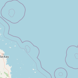
Map view of Northumberland Islands National Park

Use this park location map to pinpoint Northumberland Islands National Park in Australia, understand its exact geographic position, and read its mapped placement within the surrounding landscape more clearly.

Pigeon | © OpenStreetMap contributors

Location context for Northumberland Islands National Park

Queensland
Park atlas

Compare Coastal Protected Areas and Trace Regional Protected Landscape Geography in North Queensland

Explore Nearby National Parks and Protected Areas Beyond Northumberland Islands National Park

Continue your exploration from Northumberland Islands National Park by browsing other national parks and protected areas across North Queensland, discovering their unique island and coastal ecosystems. Compare varied protected landscapes, understand their regional context, and trace the geographic spread of conservation efforts along the Australian coastline.
Marine protected areaQueensland
Park boundaries overlap#1 closest

North

Great Barrier Reef Marine Park: Atlas and Geographic Context for Queensland Protected Waters

Exploring the reef system and marine conservation zones in northeastern Australia

The Great Barrier Reef Marine Park stands as an internationally significant marine protected area. By spanning a massive stretch of the Queensland coast, this protected landscape provides a critical framework for marine governance and reef conservation. Users can examine the unique zoning and distribution of coral reef habitats that define this extensive tropical ecosystem.

Area
343,966 km²
Established
1975
Climate
Tropical
Scope
Marine
National parkQueensland
12 km away#2 closest

South

Broad Sound Islands National Park: Queensland National Park Geographic Atlas

Mapped protected boundaries and landscape context in Queensland.

Broad Sound Islands National Park serves as a vital point of reference for exploring Queensland's protected natural areas. This canonical detail entry provides essential insights into the park's geographic positioning, its role as a national park, and its contribution to the regional atlas. Understand its mapped boundaries and unique landscape characteristics as part of a structured geographic discovery.

Area
16 km²
IUCN
II
Relief
Lowland
Climate
Subtropical
National parkMackay Region
About 15 km away#3 closest

West

Cape Palmerston National Park: Coastal Protected Area and Geographic Context in Mackay Region

Mapped landscape, dune systems, and mangrove ecosystems.

Delve into the protected landscape of Cape Palmerston National Park, a significant national park in Australia's Mackay Region. This page offers detailed insights into its geographic identity, characterized by 28 kilometers of pristine coastline, dynamic sand dunes, and extensive mangrove forests. Understand its position within the Central Mackay Coast bioregion and explore the mapped boundaries of this diverse protected area, from its beaches to the inland woodland habitats and wetland basins, providing essential atlas context for this unique coastal environment.

Area
71.9 km²
Established
1976
IUCN
II
Relief
Mixed relief
National parkQueensland
33 km away#4 closest

Southwest

West Hill National Park: Explore Queensland's National Park Geography and Mapped Protected Boundaries

Central Queensland Protected Landscape and Atlas Context

West Hill National Park represents a key protected area within Queensland's natural environment network. As a national park, it offers insights into the region's geography and landscape character, contributing to a structured understanding of protected lands. Explore the mapped boundaries and discover its specific place within the atlas of Australian parks, providing context for its conservation significance in central Queensland.

Area
10.8 km²
Established
1971
IUCN
II
Scope
Terrestrial
National parkQueensland
37 km away#5 closest

Northwest

Round Top Island National Park: Protected Island Landscape in Queensland

Explore mapped boundaries and regional conservation context.

Round Top Island National Park preserves the natural character of a small coastal island in Queensland's Coral Sea region. This national park offers a clear example of an entire island protected area, contributing to the broader atlas of Australian conservation landscapes. Understanding its mapped boundaries and its place within North Queensland's geography provides insight into the diversity of protected island ecosystems preserved for their ecological significance.

Area
0.19 km²
IUCN
II
Relief
Mixed relief
Scope
Mixed
National parkQueensland
57 km away#6 closest

Northwest

Reliance Creek National Park: Preserving Queensland's Coastal Palm Forest Ecosystem

Mapped protected landscape on Queensland's central coast.

Reliance Creek National Park is a critical conservation site in Queensland, safeguarding the most significant remaining area of coastal palm forest. This compact national park protects a unique subtropical ecosystem that has largely vanished from the surrounding regional landscape. Users can explore its precise location and geographic context, understanding its importance as a preserved natural heritage and a testament to the original coastal plain environment.

Area
0.14 km²
Established
1980
IUCN
II
Access
Remote access
National parkQueensland
61 km away#7 closest

Northwest

Pioneer Peaks National Park: Queensland National Park Geography and Mapped Boundaries

Explore its protected landscape and regional context.

Pioneer Peaks National Park represents a distinct protected area within Queensland, Australia, offering valuable insights into regional geography and mapped natural landscapes. This canonical page focuses on the park's identity as a national park, detailing its geographic setting and the significance of its protected boundaries. It serves as a crucial point for understanding its place within the Australian atlas and the broader context of conservation landscapes.

Area
18.4 km²
Established
1992
IUCN
II
Relief
Mountain
National parkQueensland
About 65 km away#8 closest

North

South Cumberland Islands National Park: Queensland's Dramatic Granite Island Protected Landscape

Explore its unique mapped geography and natural terrain.

South Cumberland Islands National Park, situated in Queensland, Australia, is a remarkable collection of islands characterized by dramatic granite landscapes, steep interior slopes cloaked in tropical rainforest, and surrounding coral fringing reefs. As the largest island, Scawfell Island rises to a prominent 397-metre peak, showcasing the island group's significant geological features and contributing to its distinct protected landscape identity within the Whitsunday region. Understanding this park offers insight into the mapped natural context of Australia's coastal protected areas.

Area
21.8 km²
IUCN
II
Relief
Mountain
Climate
Subtropical

Common questions about visiting, size, designation, and location context for Northumberland Islands National Park

Northumberland Islands National Park FAQs for park facts, access, geography, and protected area context

Find quick answers about Northumberland Islands National Park, including protected-area facts, park geography, trail and visitor context, and how the park fits into its surrounding country and regional landscape.
MoriAtlas Explorer

Continue Your Protected Areas Search Across the Global Atlas

Deepen your exploration by continuing the structured search for national parks and protected areas worldwide. Utilize the comprehensive filtering capabilities to compare different conservation landscapes and refine your understanding of global park geography. Discover more about the distribution and characteristics of protected natural areas.

Global natural geography