Mori Atlas logo
Nature reserveNtchisi Mountain Forest Reserve

Tracing the protected boundaries, elevation gradients, and unique ecological refuges of a highland mountain block

Ntchisi Mountain Forest Reserve: A Detailed Geographic Atlas of Malawi's Montane Forest Enclave

Ntchisi Mountain Forest Reserve acts as a critical nature reserve on the western rim of the East African Rift, safeguarding a distinctive montane rainforest patch that rises above the surrounding miombo woodlands. This compact highland landform provides a vertical gradient of ecosystems, from dry plateau slopes to cool, misty high-elevation forests, making it a significant zoogeographic landmark in Malawi's Central Region.

montane rainforestmiombo woodlandEast African Riftmountain forest reservebirdwatchingbutterfly habitat

Ntchisi Mountain Forest Reserve

Nature reserve

Park overview

Structured park overview, official facts, and landscape profile for Ntchisi Mountain Forest Reserve

Ntchisi Mountain Forest Reserve park facts, protected area profile, and essential visitor context

Review the core facts for Ntchisi Mountain Forest Reserve, including designation, size, terrain, visitor scale, habitats, and operating context in one park-focused overview.

About Ntchisi Mountain Forest Reserve

Ntchisi Mountain Forest Reserve protects one of central Malawi's most distinctive forested uplands, a compact natural area wrapped around a peak that reaches just over 1,700 meters. Located in Ntchisi District and centered east of the town of Ntchisi, the reserve combines a relatively young geological setting on the western shoulder of the East African Rift with an exceptionally well-defined vegetation gradient, from dry miombo woodland at its base to misty montane rainforest near its summit.

The reserve was established in 1924, giving it more than a century of protection and making it one of the older forest reserves in Malawi. Its roughly 97 square kilometers encompass not just forest, but a transition zone of grasslands, shrublands, and woodland that reflects the mountain's elevation range and its exposure to moisture-bearing winds from the rift escarpment. This combination of elevation, isolation, and habitat layering gives the site an ecological profile quite different from the surrounding Central Region Plateau.

Ecologically, Ntchisi's significance is amplified by what surrounds it, or rather what does not. Between the larger highland blocks to the north, around Chipata Mountain, and to the south, around Dedza Mountain and the Kirk Range, the landscape is largely lower and drier. Ntchisi's surviving patch of montane rainforest, although small at roughly 220 hectares, is therefore the only such forest in this entire stretch of central East Africa. That isolation has allowed it to retain species, such as Sharpe's greenbul, whose southern range edge effectively ends on this mountain.

For visitors, the reserve offers a slow-paced, forested mountain experience rather than a dramatic alpine one. The Ntchisi Forest Lodge, an eco-lodge on the southern slope, anchors a small but real nature-tourism presence, supporting birdwatching, forest walks, and quiet breaks in one of Malawi's more unusual high-elevation forest patches.

Quick facts and research context for Ntchisi Mountain Forest Reserve

The reserve lies in central Malawi, in Ntchisi District, and was officially established in 1924. It covers roughly 97 square kilometers around a mountain whose summit reaches 1,702 meters, with several neighboring peaks exceeding 1,600 meters. The protected area sits on the western edge of the East African Rift, where a north-south belt of hills and escarpments separates the rift lowlands from the Central Region Plateau to the west. A compact zone of montane rainforest, around 220 hectares between 1,450 and 1,640 meters elevation, is the reserve's defining ecological feature, surrounded at lower elevations by miombo woodland and at higher elevations by montane grassland and shrubland.

Protection and recognition

Documented terrestrial protection scope and international recognition context

Ntchisi Mountain Forest Reserve Protection Status and Recognition

Ntchisi Mountain Forest Reserve maintains a documented terrestrial protection scope without imported international recognition sources on record. Structured facts outline the baseline administrative designation details and management scope for this protected area.

Protection details

Protection scope
Terrestrial
Transboundary protection
No
Park context

Deeper park guide and search-rich context for Ntchisi Mountain Forest Reserve

Ntchisi Mountain Forest Reserve history, landscape, wildlife, and travel context

Explore Ntchisi Mountain Forest Reserve through its history, landscape character, ecosystems, wildlife, conservation priorities, cultural context, and seasonal travel timing in a structured park guide built for atlas discovery and search intent.

Why Ntchisi Mountain Forest Reserve stands out

Ntchisi Mountain Forest Reserve is best known for harboring a small, geographically isolated enclave of montane rainforest, the only one of its kind in this stretch of central Malawi between Chipata Mountain in the north and the Dedza/Kirk Range area to the south. The reserve is also recognized as a southern range limit for several species, including the songbird Sharpe's greenbul and distinctive butterfly species such as Charaxes ameliae and Hypolycaena hatita, making it a small but zoogeographically significant site within the broader East African mountains.

Ntchisi Mountain Forest Reserve history and protected-area timeline

Ntchisi Mountain Forest Reserve was established in 1924, during the early colonial period of formal forest conservation in Malawi. Its designation reflected an effort to protect one of the few remaining stands of high-elevation forest in central Malawi, where similar habitats had already been heavily reduced by agricultural expansion, firewood harvesting, and shifting settlement patterns on the Central Region Plateau.

Over the following decades, the reserve took on increasing ecological importance as surrounding lowland forests were cleared or degraded, leaving the mountain's montane rainforest enclave as a refuge for species that could no longer survive in the broader landscape. The reserve's boundaries and management emphasis through the later twentieth and early twenty-first centuries have continued to reflect its dual role as both a watershed protection area and a biodiversity refuge.

Today, the 1924 reserve remains the institutional framework behind the protected area, supporting ongoing forest management, small-scale eco-tourism through the Ntchisi Forest Lodge, and continued recognition of the mountain as a key natural heritage site in the Central Region.

Ntchisi Mountain Forest Reserve landscape and geographic character

Ntchisi Mountain rises to 1,702 meters, with several neighboring peaks topping 1,600 meters, forming a compact highland block in an otherwise lower and flatter part of central Malawi. The mountain sits on the western edge of the East African Rift, part of a north-south belt of hills, mountains, and escarpments that marks the western boundary of the rift system. Together, these landforms create a sharp contrast between the rift-influenced eastern slopes leading down toward Lake Malawi and the broader Central Region Plateau, also known as the Lilongwe Plain, to the west.

The terrain itself transitions quickly with elevation. The lower slopes are characterized by typical central Malawian landscapes of miombo woodland on well-drained plateau soils, broken by small valleys and stream lines. Higher up, the slopes steepen and the vegetation becomes denser and greener, eventually giving way to grasses, shrubs, and rocky outcrops near the summit. This gradient, from dry plateau woodland up through moist montane forest to high-elevation grassland, compresses what would otherwise be widely separated ecosystems into a single mountain, producing strong zonation within a relatively short vertical climb.

Climatically, the mountain's eastern position within the rift's rain shadow dynamics helps create the relatively cool, moist conditions that support its surviving rainforest patch, while the western side drains more gradually onto the surrounding plain. The result is a landscape that feels distinctly upland and forested compared with much of the surrounding region, despite its modest absolute height.

Ntchisi Mountain Forest Reserve ecosystems, habitats, and plant life

Ntchisi Mountain Forest Reserve protects an unusually compressed ecological gradient for central Malawi. Its lower elevations are dominated by miombo woodland, the widespread Central Zambezian miombo woodland formation that covers much of the country's plateau areas. As elevation increases, this dry, open woodland gives way to denser, taller, and more humid forest, and eventually to montane grassland and shrubland near the summit.

The reserve's ecological centerpiece is its roughly 220-hectare enclave of montane rainforest, situated between 1,450 and 1,640 meters elevation. This forest, the only patch of montane rainforest between Chipata Mountain to the north and Dedza Mountain and the Kirk Range to the south, is dominated by Aningeria species in the canopy and features a smaller, roughly 30-hectare stand of tall Newtonia buchananii rainforest on the southeastern slope. Strangler figs of the genus Ficus are abundant throughout, contributing to the tangled, multi-layered structure typical of older montane forest stands.

Because the rainforest block is small in area but isolated over a long distance from similar habitats, it functions as a true ecological island, hosting species and microhabitats that do not recur elsewhere in this part of the Rift. Montane grasslands and shrublands extend above the forest belt, adding an open, high-elevation counterpart to the closed-canopy rainforest below and reinforcing the reserve's layered ecological identity.

Ntchisi Mountain Forest Reserve wildlife and species highlights

Ntchisi Mountain Forest Reserve is a small but disproportionally important site for fauna, particularly because its montane rainforest enclave is isolated from similar habitats over a long stretch of central Malawi. The reserve is most renowned among birders for hosting the southern limit of the range of Sharpe's greenbul (Phyllastrephus alfredi), a songbird whose presence here marks the edge of its known distribution in this part of East Africa.

Butterfly diversity gives the reserve additional conservation and ecological interest. Two butterfly species, Charaxes ameliae and Hypolycaena hatita, reach their southern range limits on Ntchisi Mountain, a pattern that mirrors the broader picture of the mountain acting as a southern outpost for species with otherwise more northerly or montane-centered distributions.

Beyond these headline species, the forest's layered structure, with miombo woodland at the base, tall rainforest in the middle belt, and grassland and shrubland higher up, supports a corresponding variety of bird, insect, and small vertebrate communities typical of central Malawian highland forest patches. Although the reserve is not a large mammal destination, its combination of intact canopy, fig resources, and edge habitats between forest and grassland gives it consistent wildlife viewing value, especially for forest-interior species.

Ntchisi Mountain Forest Reserve conservation status and protection priorities

Ntchisi Mountain Forest Reserve holds outsized conservation significance relative to its modest size, primarily because it preserves a habitat type that has effectively disappeared elsewhere in central Malawi. Between larger highland blocks further north and south, the reserve is the sole refugium for montane rainforest in this entire stretch of the East African Rift's western highlands. Its roughly 220-hectare rainforest block, although small by absolute standards, carries regional importance for the long-term survival of species tied to montane forest conditions.

The reserve also contributes to broader landscape-scale conservation in the Central Region, protecting watershed and soil functions on the western edge of the rift where slopes are steep and easily degraded. By buffering the mountain's forest, grassland, and woodland from agricultural expansion and from pressure for fuelwood, the reserve helps maintain the ecological gradients that support its distinctive species mix.

Recognition of Ntchisi as a southern range limit site for species such as Sharpe's greenbul and several butterfly species has helped frame it within national and regional conservation priorities, and its long-standing protected status, dating to 1924, gives it one of the deeper institutional histories among Malawi's forest reserves.

Top sights and standout views in Ntchisi Mountain Forest Reserve

Ntchisi Mountain Forest Reserve stands out for its rare montane rainforest enclave, its role as a southern range-limit site for birds and butterflies, and its layered transition from miombo woodland through tall rainforest to montane grassland on a single compact mountain. Its position on the western rim of the East African Rift, combined with more than a century of formal protection, gives it both ecological and historical weight within Malawi's Central Region.

Best time to visit Ntchisi Mountain Forest Reserve

The reserve is most rewarding when conditions are cooler and the forest is biologically active. The dry season, broadly running from roughly May into October, tends to bring clearer weather, easier walking on trails, and good conditions for viewing montane grassland and forest edges, while bird and butterfly activity remains substantial. The wetter months, generally from November through April, bring lusher forest conditions, more persistent mist at higher elevations, and richer butterfly displays, though trails may be muddier and some forest interior paths less accessible.

Monthly climate preview

Long-term representative temperature and monthly precipitation averages for Central Region

Ntchisi Mountain Forest Reserve Climate Normals and Annual Weather Rhythm

Representative coordinates record measured multi-year temperature variations alongside distinct monthly precipitation shifts across the reserve elevation. Reviewing complete twelve-month climatology records helps trace long-term thermal ranges and precipitation patterns in detail.
Annual mean20 °C
16 °C25 °C
Jan22°
Feb21°
Mar21°
Apr20°
May18°
Jun16°
Jul16°
Aug18°
Sep22°
Oct24°
Nov25°
Dec23°
Warmest month
November

24.7 °C

Coolest month
July

16 °C

Wettest month
January

9.2 mm/day

Driest month
June

0.1 mm/day

Park location guide

Geography guide, regional context, and park location map for Ntchisi Mountain Forest Reserve

Ntchisi Mountain Forest Reserve park geography, regions, and map view in Malawi

Understand where Ntchisi Mountain Forest Reserve sits in Malawi through a broader geographic reading of the surrounding landscape, nearby location context, and its mapped position within the national park landscape.

How Ntchisi Mountain Forest Reserve fits into Malawi

Malawi is a landlocked country in Southeastern Africa. Formerly known as Nyasaland under British colonial rule, it gained independence in 1964 and became a multi-party democracy in 1994. The country is known for Lake Malawi, which comprises about one-fifth of its territory, and is governed as a unitary presidential republic with Lilongwe as its capital.

Wider geography shaping Ntchisi Mountain Forest Reserve in Malawi

Malawi is located in Southeastern Africa within the Great Rift Valley. It is bordered by Zambia to the west, Tanzania to the north and northeast, and Mozambique to the east, south, and southwest. The country features highlands and plateaus in the northern and central areas, with the Great Rift Valley system running through the territory.

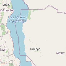
Map view of Ntchisi Mountain Forest Reserve

Use this park location map to pinpoint Ntchisi Mountain Forest Reserve in Malawi, understand its exact geographic position, and read its mapped placement within the surrounding landscape more clearly.

Pigeon | © OpenStreetMap contributors

Location context for Ntchisi Mountain Forest Reserve

Central Region
Park atlas

Compare regional protected areas and discover related highland reserves across central Malawi

Explore Other Parks Near Ntchisi Mountain Forest Reserve and Surrounding Protected Landscapes

Continue geographic discovery by comparing Ntchisi Mountain Forest Reserve with adjacent protected landscapes and regional highland reserves. Expanding the park search reveals connected ecosystems, neighboring mountain environments, and wider regional conservation patterns.
National parkMalawi
About 87 km away#1 closest

Southeast

Lake Malawi National Park: UNESCO Protected Landscape and Endemic Fish Habitat

Discover mapped terrain, island geography, and evolutionary wonders.

Lake Malawi National Park offers unparalleled insight into freshwater biodiversity and landscape dynamics within Malawi's Great Rift Valley. As a UNESCO World Heritage Site, it is celebrated for its spectacular evolutionary radiation of cichlid fish, a phenomenon studied globally. The park's protected territory includes the mountainous Nankumbu Peninsula and thirteen islands, providing a rich context for understanding the interplay between aquatic ecosystems, terrestrial terrain, and unique island geography.

Area
94 km²
Established
1980
IUCN
II
Relief
Mountain
National parkMalawi
About 100 km away#2 closest

Northwest

Kasungu National Park: Protected Landscape and Geographic Atlas of Central Malawi

Explore Miombo woodlands and dambo grasslands across its mapped terrain.

Kasungu National Park is a key protected area in Malawi, offering insights into the geography of Central Malawi's savanna landscapes. This national park, covering over 2,300 square kilometres, is defined by its characteristic Miombo woodland interspersed with dambo grasslands and riverine habitats. Its location near the Zambian border provides a critical conservation corridor, making it an important entity for understanding regional protected land distribution and landscape ecology within the atlas.

Area
2,316 km²
Established
1970
IUCN
II
Relief
Mixed relief
National parkZambia
About 138 km away#3 closest

West

Lukusuzi National Park: Zambia's Protected National Park Geographic Context

Mapped protected area and regional landscape identity for Lukusuzi.

Gain detailed insights into Lukusuzi National Park, a key protected area in Zambia, through its geographic setting and mapped boundaries. This page provides essential context for understanding the park's landscape character and its significance within the national park atlas. Explore the fundamental protected-area geography of this distinct Zambian natural landscape.

IUCN
II
Access
Access unknown
Scope
Terrestrial
Watercolor illustration showing a soft-focus landscape with scattered trees, low scrub, and distant rolling hills in pale green and yellow tones.
Wildlife reserveMalawi
About 150 km away#4 closest

North

Nkhotakota Wildlife Reserve: Protected Geography and Rift Valley Landscapes

A vast, recovering miombo woodland sanctuary in central Malawi.

Nkhotakota Wildlife Reserve represents a massive conservation effort within the Great Rift Valley, protecting 1,800 square kilometres of steep ridges, riverine gorges, and dense woodland patches. This atlas entry details the reserve's unique topography, ranging from high-altitude escarpments down toward Lake Malawi, and its role as a pivotal site for large mammal restoration and bird diversity in Southeastern Africa.

Area
1,800 km²
IUCN
IV
Relief
Mixed relief
Climate
Tropical
Watercolor painting of a tranquil scene featuring soft-hued trees, rolling hills, and a water's edge, characterized by a light and airy artistic style.
Wildlife reserveNorthern Region
About 172 km away#5 closest

North

Chikangawa Forest Reserve: Mapping Malawi's Viphya Mountains Protected Wildlife Landscape

Explore montane forest ecosystems and exotic pine plantations

Chikangawa Forest Reserve stands as a major protected block within Malawi's Northern Region. The area covers extensive mountain ridges where native montane vegetation interweaves with significant man-made pine plantations. This geographic atlas entry provides insight into the reserve's role as a watershed protector and its unique position across the Viphya Plateau.

Area
1,147.8 km²
Established
1948
Relief
Mountain
Climate
Tropical
National parkZambia
About 198 km away#6 closest

Northwest

Luambe National Park: Detailed Geographic and Protected Area Atlas Information

Mapped landscape context within Zambia's natural regions.

This section provides an in-depth look at Luambe National Park, detailing its role as a protected area within the diverse geography of Zambia. Users can explore its mapped boundaries and understand its significance within the country's atlas of natural landscapes. The focus is on providing a concrete geographic perspective, essential for understanding how this national park fits into the regional conservation and landscape context of southern Africa.

Area
300 km²
IUCN
II
Relief
Upland
Climate
Tropical
National parkZambia
About 208 km away#7 closest

West

South Luangwa National Park: Zambia's National Park Geographic Atlas and Protected Landscape

Explore mapped boundaries and regional context within this Zambian protected area.

South Luangwa National Park represents a vital national park within Zambia, offering a distinct focal point for atlas-based geographic exploration. This dedicated entry details the park's mapped area and its integration into the surrounding Zambian geography. Users seeking to understand protected landscapes, regional park distributions, and natural terrain context will find South Luangwa National Park a key reference for detailed mapping and landscape analysis.

Area
9,050 km²
Established
1972
IUCN
II
Relief
Mixed relief
National parkSouthern Region
About 216 km away#8 closest

Southeast

Liwonde National Park: National Park in Malawi's Southern Region

Mapped Protected Area Boundaries and Geographic Context

Liwonde National Park is a designated national park situated in Malawi's Southern Region. This entry provides detailed geographic information, focusing on the park's mapped boundaries and its role within the broader atlas of protected landscapes. Explore the unique regional geography and conservation context that defines this protected area.

Area
548 km²
Established
1973
Relief
Upland
Climate
Tropical

Common questions about visiting, size, designation, and location context for Ntchisi Mountain Forest Reserve

Ntchisi Mountain Forest Reserve FAQs for park facts, access, geography, and protected area context

Find quick answers about Ntchisi Mountain Forest Reserve, including protected-area facts, park geography, trail and visitor context, and how the park fits into its surrounding country and regional landscape.
MoriAtlas Explorer

Continue Your Protected Areas Search Across the Global Atlas

Deepen your exploration by continuing the structured search for national parks and protected areas worldwide. Utilize the comprehensive filtering capabilities to compare different conservation landscapes and refine your understanding of global park geography. Discover more about the distribution and characteristics of protected natural areas.

Global natural geography