Mori Atlas logo
National parkOmar Torrijos "El Cope" National Park

Discover the mapped boundaries and regional natural terrain of this significant Panamanian protected area.

Omar Torrijos "El Cope" National Park: Panama's Protected Landscape Geography & Map Context

Omar Torrijos "El Cope" National Park stands as a vital protected area within Panama's diverse geography. This page offers an atlas-style exploration of the park, focusing on its mapped boundaries, surrounding natural landscapes, and its role within the broader regional context of Panama. Understand the geographic identity of this national park and its place in the country's conservation network through structured, map-driven insights.

Panama parksCentral America protected areasMountain forestsNational parksTropical ecosystemsCoclé province

Omar Torrijos "El Cope" National Park

National park

Park overview

Structured park overview, official facts, and landscape profile for Omar Torrijos "El Cope" National Park

Omar Torrijos "El Cope" National Park park facts, protected area profile, and essential visitor context

Review the core facts for Omar Torrijos "El Cope" National Park, including designation, size, terrain, visitor scale, habitats, and operating context in one park-focused overview.

About Omar Torrijos "El Cope" National Park

Omar Torrijos "El Cope" National Park protects important mountain forest ecosystems in Panama's Central Mountain Range. The park is named in honor of Omar Torrijos, a significant figure in Panamanian history who oversaw the negotiation of the Panama Canal treaties. This protected area plays a role in Panama's environmental conservation efforts, helping to preserve the country's tropical biodiversity and watershed areas.

Quick facts and research context for Omar Torrijos "El Cope" National Park

Omar Torrijos "El Cope" National Park is located in Coclé Province, Panama, within the Central Mountain Range. The park is part of Panama's national protected areas system and helps preserve tropical forest ecosystems in the mountain regions of the country.

Protection and recognition

Verifying the documented terrestrial protection scope and official designations

Omar Torrijos "El Cope" National Park Protected Area Designation and Status

Explorers can trace the official terrestrial protection boundaries and documented conservation status of Omar Torrijos "El Cope" National Park. Verified geographic records clarify the park's designation history, transboundary status, and official standing within global conservation databases.

Protection details

Protection scope
Terrestrial
Transboundary protection
No
Monthly climate preview

Long term representative temperature and precipitation averages across the year

Omar Torrijos El Cope National Park Climate Normals and Monthly Weather Patterns

Representative point records for Omar Torrijos El Cope National Park show measured long term shifts in monthly temperature and precipitation rhythm between 1991 and 2020. Examining the complete twelve month profile provides granular analytical depth regarding annual meteorological variations at this coordinate.
Annual mean25 °C
24 °C26 °C
Jan24°
Feb25°
Mar26°
Apr26°
May26°
Jun25°
Jul25°
Aug25°
Sep25°
Oct24°
Nov24°
Dec24°
Warmest month
April

26.4 °C

Coolest month
January

23.8 °C

Wettest month
September

8.3 mm/day

Driest month
February

0.4 mm/day

Park location guide

Geography guide, regional context, and park location map for Omar Torrijos "El Cope" National Park

Omar Torrijos "El Cope" National Park park geography, regions, and map view in Panama

Understand where Omar Torrijos "El Cope" National Park sits in Panama through a broader geographic reading of the surrounding landscape, nearby location context, and its mapped position within the national park landscape.

How Omar Torrijos "El Cope" National Park fits into Panama

Panama is a presidential republic located at the southern end of Central America in North America. It gained independence from Spain in 1821 and from Colombia in 1903, the latter enabling the construction of the Panama Canal under U.S. supervision between 1904 and 1914. The canal was transferred to Panamanian control in 1999 following the Torrijos-Carter Treaties. With a population of approximately 4.3 million and an area of about 75,400 km², Panama has a high-income economy driven primarily by canal tolls, banking, commerce, and tourism.

Wider geography shaping Omar Torrijos "El Cope" National Park in Panama

Panama is located at the southern end of the Central American isthmus, stretching from the Caribbean coast in the north to the Pacific coast in the south. The country shares land borders with Costa Rica to the west and Colombia to the southeast. The terrain consists of coastal plains, mountain ranges including the Cordillera Central and Cordillera de Talamanca, and river valleys. The Panama Canal bisects the country, connecting the Atlantic and Pacific Oceans.

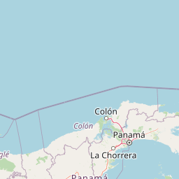
Map view of Omar Torrijos "El Cope" National Park

Use this park location map to pinpoint Omar Torrijos "El Cope" National Park in Panama, understand its exact geographic position, and read its mapped placement within the surrounding landscape more clearly.

Pigeon | © OpenStreetMap contributors
Park atlas

Discover connected protected landscapes and their unique geography within Panama's Central Mountain Range and surrounding regions.

Exploring Nearby Protected Areas and National Parks from Omar Torrijos "El Cope" National Park

Browse additional national parks and protected areas adjacent to Omar Torrijos "El Cope" National Park, covering diverse landscapes within Panama's Coclé province and the Central Mountain Range. Trace the regional spread of tropical ecosystems and mountain forest habitats, gaining valuable context for Panama's broader conservation geography.
National parkHerrera Province
About 64 km away#1 closest

South

Sarigua National Park: A Protected National Park Landscape in Herrera Province

Explore mapped boundaries and regional geographic context.

Sarigua National Park represents a significant protected area within Herrera Province, Panama. This page details its identity as a national park, emphasizing its mapped geography and the regional context it inhabits. Users seeking to understand the specific protected landscape, its boundaries, and its place within the broader atlas of natural areas will find comprehensive discovery-oriented content.

IUCN
II
Relief
Lowland
Climate
Tropical
Access
Access unknown
National parkPanamá Oeste Province
About 72 km away#2 closest

East

Altos de Campana National Park: National Park Protected Landscape and Geographic Context

Mapped boundaries and regional geography in Panamá Oeste Province.

Gain a structured understanding of Altos de Campana National Park, a designated national park located in Panamá Oeste Province. This page details its identity as a protected landscape, offering insights into its geographic placement and mapped boundaries for comprehensive atlas-style exploration. Understand its regional context and its contribution to Panama's network of protected areas.

Area
48.16 km²
Established
1966
IUCN
II
Relief
Mountain
National parkColón Province
About 115 km away#3 closest

Northeast

Soberanía National Park: Panama National Park Atlas, Geography, and Protected Landscape Details

Explore the mapped boundaries and regional geography of this national park.

Investigate Soberanía National Park, a designated national park situated in Panama's Colón Province. This entry offers detailed geographic context, focusing on its mapped protected area, landscape character, and role within regional conservation. Understand the spatial distribution and atlas significance of this protected land, essential for a structured geographic discovery of Panama's natural heritage.

Area
220 km²
Established
1980
IUCN
II
Relief
Lowland
National parkPanama
About 123 km away#4 closest

East

Metropolitan Natural Park: Urban Protected Area and Forest Geography in Panama

Tracing the boundaries of a rare city-based wildlife refuge

Metropolitan Natural Park offers a significant study of urban conservation in Panama, protecting 265 hectares of Pacific tropical dry forest. Situated along the Panama Canal watershed, the terrain provides essential forest connectivity and diverse microhabitats, serving as a critical sanctuary within the dense metropolitan fabric of Panama City.

Area
2.65 km²
Established
1985
IUCN
II
Relief
Upland
Wildlife reservePanama City
About 123 km away#5 closest

East

Metropolitan Natural Park: Protected Tropical Forest in Panama City

Mapping the Pacific watershed and urban wildlife corridors

Metropolitan Natural Park stands as a rare wildlife refuge, protecting a dense secondary tropical dry forest ecosystem inside the capital. The park boundary encompasses forested slopes and ridgelines that look out over the Panama Canal, providing a unique intersection of intact biodiversity and urban geography.

Area
2.65 km²
Established
1985
Relief
Lowland
Climate
Tropical
Wildlife reserveLos Santos Province
About 128 km away#6 closest

Southeast

Isla Iguana Wildlife Refuge: A Protected Island and Coral Reef Sanctuary in Los Santos Province

Mapping the terrestrial and marine boundaries of a key Panamanian wildlife refuge.

Isla Iguana Wildlife Refuge encompasses a unique blend of tropical dry forest and expansive coral reef systems. Located off the coast of the Los Santos Province, the refuge serves as an important Pacific habitat for nesting sea turtles and migratory whales. This detailed overview covers the island's layered coastal topography, reef structures, and its role as a critical protected area within the marine geography of Panama.

Area
0.53 km²
Established
1981
Relief
Lowland
Scope
Mixed
National parkPanama
About 146 km away#7 closest

South

Cerro Hoya National Park: Panama's Protected Landscape with Mapped Geographic Detail

Explore the national park's mapped boundaries and regional atlas context.

Cerro Hoya National Park presents a unique opportunity for geographic discovery, focusing on its role as a protected landscape within Panama. This park detail page allows for an in-depth atlas-style exploration of its mapped boundaries and its contribution to the regional geography of Central America. Understand the protected-area identity and the natural context that defines this significant national park, providing valuable data for landscape analysis and map-based research.

Area
333.4 km²
Established
1984
IUCN
II
Relief
Mountain
National parkPanamá Province
About 149 km away#8 closest

Northeast

Chagres National Park: National Park Protected Landscape Atlas

Discover geographic boundaries and natural terrain context.

Chagres National Park is a crucial protected area situated in Panamá Province, Panama. This page serves as an atlas-style gateway to understanding its specific geographic identity, mapped boundaries, and the surrounding natural terrain. It is designed for users seeking detailed insights into the park's protected landscape and its contribution to regional geography and conservation mapping efforts.

Area
1,290 km²
Established
1985
IUCN
II
Relief
Upland

Common questions about visiting, size, designation, and location context for Omar Torrijos "El Cope" National Park

Omar Torrijos "El Cope" National Park FAQs for park facts, access, geography, and protected area context

Find quick answers about Omar Torrijos "El Cope" National Park, including protected-area facts, park geography, trail and visitor context, and how the park fits into its surrounding country and regional landscape.
MoriAtlas Explorer

Continue Your Protected Areas Search Across the Global Atlas

Deepen your exploration by continuing the structured search for national parks and protected areas worldwide. Utilize the comprehensive filtering capabilities to compare different conservation landscapes and refine your understanding of global park geography. Discover more about the distribution and characteristics of protected natural areas.

Global natural geography