
Mori Atlas logo
Nearby park discovery

Geographic mapping of nearby marine reserves and protected coastal landscapes

Protected Areas and Regional Landscapes Near Padilla Bay National Estuarine Research Reserve

Examine the geographic distribution of protected areas and marine reserves surrounding Padilla Bay National Estuarine Research Reserve. This view clarifies the regional landscape context by tracing the proximity of nearby protected lands across the Salish Sea and coastal Washington. Gain perspective on how this estuarine habitat sits within a wider network of conserved coastal terrain.

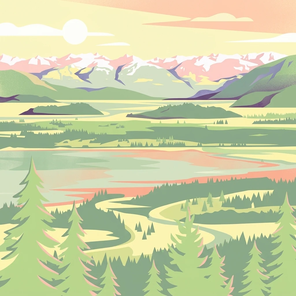
A stylized digital illustration of a scenic estuarine landscape featuring pine trees in the foreground, calm tidal waters, marshlands, and snow-capped mountains under a soft-toned sunset sky.

A protected tidal estuary in the Salish Sea where shallow mudflats, diked farmlands, and Pacific Northwest waters meet.

Padilla Bay National Estuarine Research Reserve

The Padilla Bay National Estuarine Research Reserve is a coastal protected area on the Salish Sea in northwest Washington, dedicated to preserving one of the most important tidal estuaries in the Pacific Northwest. Located in Skagit County between Fidalgo Island, Guemes Island, and the mainland, the reserve centers on a large, shallow bay whose mudflats rise and fall with the tides, creating a dynamic environment where salt and freshwater ecosystems continuously overlap. Established in 1980 as part of the National Estuarine Research Reserve system, the reserve plays a dual role as both a working landscape for scientific research and a public gateway for learning about estuarine ecology. Its mix of natural tidal flats and former diked farmlands reflects both the ecological richness and the agricultural history of the Skagit Valley, making the reserve a textbook example of how a Pacific Northwest estuary has been shaped by both natural processes and human land use. The site is well known for its richness in migratory birds, its accessibility, and the Breazeale Interpretive Center, which introduces visitors to the ecology of the bay through exhibits, aquaria, classrooms, and trails. The reserve also supports graduate research from regional universities, reinforcing its identity as a place where science, conservation, and public education converge around one of Washington's most studied estuaries.

Location
United States of America
Park type
Marine protected area
Established
1980
Area
32 km²
Padilla Bay National Estuarine Research Reserve Atlas
Regional park map

See the ranked park cluster in its geographic setting

Nearby parks around Padilla Bay National Estuarine Research Reserve

This regional map shows the same 20 nearby parks ranked below around Padilla Bay National Estuarine Research Reserve. Select a ranked marker to highlight that park’s boundary where boundary data is available.
Reference park: Padilla Bay National Estuarine Research ReserveRanked nearby park20 nearby parks shown
20 nearby parks

Ranked spatial proximities and directional regional relationships for comparative atlas study

Parks and Protected Areas Geographically Near Padilla Bay National Estuarine Research Reserve

Geographic distance metrics order surrounding protected areas by spatial proximity to Padilla Bay National Estuarine Research Reserve to map regional conservation patterns. Country context and recorded environmental attributes provide structured signals for evaluating adjacent protected landscapes without assuming identical habitats.
A watercolor painting showing a panoramic view of mountain peaks in the distance above green foothills and plains.
Protected landscapeWashington
About 42 km away#1 closest

Southeast

Mount Baker, Snoqualmie National Forest: Mapped Geography and Protected Landscape Analysis

Exploratory atlas of Washington's primary Cascade Range wilderness

Delve into the structural geography of Mount Baker, Snoqualmie National Forest. This protected area corridor serves as a major ecological transition zone between the Puget Sound lowlands and the interior Cascades, characterized by extensive glaciers, wild river systems, and iconic stratovolcanoes that define the regional landscape of Washington state.

Area
6,978 km²
Established
1974
Relief
Mountain
Climate
Alpine
A horizontal watercolor painting showing a range of purple-tinted mountain peaks above a green forest and a light pinkish shoreline.
Wildlife reserveWashington
About 45 km away#2 closest

Northeast

Mount Baker Wilderness: Mapped Volcanic Peaks and Glacial Geography in Washington State

Protected wilderness boundaries in the Northern Cascades

Mount Baker Wilderness encompasses a vast mountain landscape characterized by an active stratovolcano and significant permanent snowfields. The terrain features a vertical gradient from dense west side conifer forests to exposed alpine summits, creating a distinct ecological corridor connected to neighboring protected areas in the Pacific Northwest.

Area
485.58 km²
Established
1984
IUCN
Ib
Relief
Mountain
National parkBritish Columbia
About 48 km away#3 closest

Northwest

Gulf Islands National Park Reserve: British Columbia National Park Protected Area

Mapped boundaries and regional geographic context.

Delve into the protected landscape of Gulf Islands National Park Reserve, a significant national park located in British Columbia. This entry provides detailed insights into its mapped boundaries, regional geographic setting, and its identity as a protected area. Understand the park's place within the natural terrain and atlas of Canada, offering a clear geographic overview for focused discovery and landscape context.

Area
36 km²
Established
2003
IUCN
VI
Visitors
28.4K annual
A watercolor painting showing a range of mountains in the background with soft pink, green, and yellow hues, with forest vegetation in the midground and foreground on a white background.
Protected landscapeWashington
About 54 km away#4 closest

Northeast

Mount Baker National Recreation Area: An Atlas of Washington's Volcanic Terrain

Exploration of a remote, roadless Cascade protected landscape

The Mount Baker National Recreation Area provides a unique geographic window into the volcanic heart of the Pacific Northwest. Characterized by its glacier-clad massif and network of subalpine trails, the area serves as a vital protected habitat for elk, mountain goats, and diverse conifer forests. This record details the park's topography, ranging from deep glacial valleys to high-elevation ridges that overlook the broader North Cascades region.

Area
34.29 km²
Established
1984
Relief
Mountain
Climate
Alpine
A horizontal watercolor painting depicting a soft-toned landscape with green trees, rolling hills, a calm body of water, and distant pale mountains.
State or regional parkBritish Columbia
About 56 km away#5 closest

North

Peace Arch Park: Mapped Geography and Protected Landscapes of the Canada and US Border

Coastal binational protected area in British Columbia

Peace Arch Park is a notable protected landscape positioned directly on the international border. This site acts as a continuous green space between Canada and the United States, offering an unusual study of territorial boundaries and coastal geography. Spanning manicured terrain and historic monument grounds, the park provides an essential vantage point for understanding land-based connectivity in the Pacific Northwest region.

Area
0.17 km²
Established
1939
Visitors
500K annual
Access
Easy access
A watercolor painting showing a panoramic view of rolling mountain ranges and dense evergreen forests with a soft, misty aesthetic.
Protected landscapeWashington
About 66 km away#6 closest

Southwest

Olympic National Forest: Atlas and Geographic Overview of Washington Protected Lands

Temperate rainforests, alpine ridges, and fjord shorelines

Olympic National Forest defines the outer reaches of the Olympic Mountains, featuring a massive expanse of old-growth conifers and high-precipitation temperate rainforests. This protected area connects diverse ecosystems ranging from the brackish waters of Hood Canal to rugged, snow-dusted subalpine ridges. Our detailed geographic mapping highlights the forest's role as a vital buffer and wilderness corridor within the broader Pacific Northwest landscape.

Area
2,541.89 km²
Established
1897
Relief
Mountain
Climate
Temperate
National parkWashington
About 72 km away#7 closest

East

North Cascades National Park: US National Park Protected Landscape and Geographic Context

Explore mapped boundaries and regional Washington geography.

Gain insight into North Cascades National Park, a vital US National Park located in Washington. This entry focuses on its protected land status, mapped geographic extent, and its role within the regional atlas. Users seeking to understand the park's landscape character, natural terrain, and its specific location in Washington will find this an essential point for detailed park geography exploration and protected area discovery.

Area
2,042.26 km²
Established
1968
IUCN
II
Visitors
16.5K annual
Nature reserveBritish Columbia
About 78 km away#8 closest

West

Race Rocks Ecological Reserve: Protected Marine Landscape and Island Geography

Nature reserve in the Strait of Juan de Fuca, British Columbia

Race Rocks Ecological Reserve is a geographically distinct protected area consisting of low-lying rocky islets and surrounding high-current marine waters. Located in the Strait of Juan de Fuca, the reserve is recognized for its intense tidal mixing, which supports productive food webs and diverse marine mammals. This site provides a vital window into the ecological dynamics of the Pacific coast through its role as a dedicated research and conservation zone.

Area
2.27 km²
Established
1980
IUCN
Ia
Relief
Lowland
National parkWashington
About 78 km away#9 closest

Southwest

Olympic National Park National Park: Geographic Atlas and Protected Landscape Discovery

Explore its unique Washington landscape and mapped protected areas.

Olympic National Park serves as a key protected area within Washington, offering rich opportunities for geographic exploration. This detail page provides essential context on its designation as a national park, its mapped boundaries, and its contribution to the regional geography. Understand the park's specific landscape character and its role within the atlas of protected lands, facilitating a structured approach to discovering its natural terrain and geographic significance.

Area
3,733.8 km²
Established
1938
IUCN
II
Visitors
3.7M annual
A watercolor painting showing a soft-focus landscape with rolling green hills, distant mountains, and a central river or water feature.
State or regional parkBritish Columbia
About 81 km away#10 closest

North

Golden Ears Provincial Park: Geographic Atlas and Protected Landscape Overview

Coast Mountains terrain and protected wilderness boundaries

Golden Ears Provincial Park is a major protected wilderness in British Columbia, defined by the twin peaks of the Golden Ears massif and vast glacial lake systems like Alouette and Pitt. This site serves as a vital ecological corridor where lowland forests meet high subalpine ridges. Explore the park through its mapped boundaries and diverse ecological zones within the Pacific Northwest mountain landscape.

Area
609 km²
Established
1967
IUCN
II
Visitors
956.5K annual
A soft watercolor painting of a landscape featuring a lake, low rolling hills in the background, and grassy vegetation along the foreground shoreline under a warm, pale yellow sky.
State or regional parkFraser Valley Regional District
About 82 km away#11 closest

North

Rolley Lake Provincial Park: An Atlas of Protected Landscapes and Regional Geography

Lakeshore forest terrain and protected park geography

Delve into the geographic identity of Rolley Lake Provincial Park, a state-protected landscape in the Fraser Valley Regional District. This documentation traces the park's internal map, including its central freshwater lake, loop trail connectivity, and surrounding second-growth forest topography, providing essential context for understanding this localized wilderness zone.

Area
1.15 km²
Established
1961
IUCN
II
A soft watercolor illustration depicting a range of layered mountain peaks with green slopes and snow-covered summits against a white background.
Wildlife reserveWashington
About 84 km away#12 closest

Southeast

Glacier Peak Wilderness: Mapping the Volcanic and Glaciated Geography of Washington State

A detailed look at one of the most remote volcanic reserves in the Cascade Range.

Defined by the presence of an isolated stratovolcano and extensive glacial systems, Glacier Peak Wilderness represents a significant protected area within the Washington Cascades. This overview details the rugged landscape, from the deeply incised river valleys of the Chiwawa and Suiattle to the high-alpine rock and ice environment at the peak summit, providing essential geographic context for this roadless wilderness.

Area
2,290.75 km²
Established
1960
IUCN
Ib
Relief
Mountain
A soft watercolor painting of a calm river or lake flowing through a green meadow with a forest and mountain range in the background.
Protected landscapeWashington
About 85 km away#13 closest

East

Ross Lake National Recreation Area: A Glacial Reservoir Landscape in Washington

Mapping the Skagit River and North Cascades alpine corridor

Located in the heart of Washington, Ross Lake National Recreation Area preserves a unique landscape of connected reservoirs and deep, glacier-cut valleys. This protected area acts as a vital geographic link within the North Cascades, offering access to high-altitude peaks, riverine forests, and the distinct turquoise waters of Diablo Lake.

Area
475.81 km²
Established
1968
IUCN
V
Visitors
998K annual
A watercolor illustration of a mountain landscape featuring soft rolling hills, evergreen trees, and low-lying vegetation on a white background.
State or regional parkBritish Columbia
About 89 km away#14 closest

North

Pinecone Burke Provincial Park: Coast Mountain Wilderness and Protected Terrain Geography

Mapping a vast ecological corridor in British Columbia

Spanning over 38,000 hectares, Pinecone Burke Provincial Park represents a dramatic transition from the urban proximity of Coquitlam to the remote interiors of the southern Coast Mountains. The landscape is defined by its rugged relief, featuring subalpine meadows, deep freshwater systems, and historically significant forested slopes. This park provides a critical look at the complex topography of the Pacific Northwest, serving as a sanctuary for wildlife and a foundational piece of regional conservation.

Area
380 km²
Established
1995
IUCN
II
Relief
Mountain
A watercolor painting showing a soft, hazy landscape of a lake with green forest along the shore and distant purple mountains under a pale sky.
State or regional parkBritish Columbia
About 90 km away#15 closest

North

Davis Lake Provincial Park: Protected Forest and Lake Geography in British Columbia

Regional protected area with old-growth forest and waterfalls

Davis Lake Provincial Park represents a significant protected area in the Fraser Valley, characterized by its undisturbed Western Hemlock forest and the scenic descent of Murdo Creek into McDonald Falls. The park provides an essential look at the regional geography of southwestern British Columbia, balancing dense coniferous canopy with accessible lake-based terrain in a quiet, natural setting.

Area
0.75 km²
Established
1963
IUCN
II
Relief
Upland
State or regional parkBritish Columbia
About 91 km away#16 closest

Northeast

Kilby Provincial Park: Protected Riverfront Geography and Historic Sites in BC

A unique riparian landscape along the Harrison River

Kilby Provincial Park offers an intimate look at the flood plain geography of the Harrison River. The site features an elevated, boardwalk-linked heritage environment integrated with sandy riverfronts and seasonal wildlife corridors. This protected area stands out for its combination of historical pioneer preservation and river-based ecosystem monitoring within the Upper Fraser Valley region of British Columbia.

Area
0.03 km²
Established
1973
IUCN
II
Relief
Lowland
State or regional parkBritish Columbia
About 94 km away#17 closest

Northeast

Ferry Island Provincial Park: Geography, Riparian Terrain, and Protected River Boundaries

A study of Fraser River alluvial landscapes and provincial park land use

Ferry Island Provincial Park provides a rare protected island setting along the Fraser River in British Columbia. Spanning 29 hectares near the Agassiz-Rosedale Bridge, this Class C park represents an important alluvial riparian ecosystem within the heavily cultivated Fraser Valley, offering key insights into regional river-corridor geography and protected land management.

Area
0.29 km²
Established
1963
IUCN
II
Access
Access unknown
A watercolor painting of a mountain landscape with soft-colored rolling hills, a green forest line, and foreground vegetation on a white background.
Protected landscapeWashington
About 109 km away#18 closest

East

Okanogan, Wenatchee National Forest: A Comprehensive Look at Washington's Protected Mountain Landscapes

Mapping ecological gradients and wilderness boundaries across the eastern Cascade Range

Spanning from the moist coniferous forests of the western Cascades to the arid plateaus of the Okanogan, this massive national forest protects an unmatched diversity of terrain. Explore the intricate geography of river-carved valleys, glacial cirques, and remote wilderness areas that characterize this critical environmental corridor in the Pacific Northwest.

Area
6,066.33 km²
Established
1911
Visitors
397K annual
Relief
Mountain
Wildlife reserveWashington
About 114 km away#19 closest

Southwest

Mount Skokomish Wilderness: Ridge Systems and Alpine Geography in Washington State

Exploration of a protected Olympic Peninsula mountain landscape.

Mount Skokomish Wilderness protects a dramatic stretch of the eastern Olympic Mountains defined by steep ridges and glacial basins. The area serves as a critical headwaters region and offers a dense display of peaks and old-growth forest transitions across its varied elevation profile, providing essential landscape context for the region.

Area
53.79 km²
Established
1984
IUCN
Ib
Relief
Mountain
A watercolor painting showing a horizontal landscape with a green forest in the foreground and soft pink, layered rolling hills in the background.
State or regional parkBritish Columbia
About 118 km away#20 closest

Northwest

Morden Colliery Historic Provincial Park: Heritage Infrastructure and Regional Coal Mining History

Industrial landscape and historic rail corridor in British Columbia

Located near Nanaimo, this heritage site preserves the substantial concrete remains of the Morden Colliery. The park serves as a physical archive of southern Vancouver Island industrial life, contrasting engineering landmarks with local forest environments and interpretive trails along former coal railway alignments.

Area
0.04 km²
Established
1972
Relief
Lowland
Scope
Terrestrial
Distance methodology

Geographic measurements, not driving distances

How nearby park distances are calculated

Distances use park boundaries whenever the available geometry allows it. When one or both boundaries are missing, the mapped park locations provide a clearly labelled estimate. Every value represents straight-line geographic separation and does not use roads or routing.

Boundary distance

Calculated between the nearest points of both park boundaries.

Location-to-boundary estimate

Estimated from one mapped park location to the nearest boundary of the other park.

Mapped-location estimate

Estimated between the mapped locations of both parks.

MoriAtlas Explorer

Map and Analyze Padilla Bay National Estuarine Research Reserve Geography

Deepen your knowledge of the Padilla Bay National Estuarine Research Reserve landscape by studying its tidal boundaries and coastal terrain. MoriAtlas provides structured data to help you investigate the ecological and geographic context of this significant marine protected area in the Pacific Northwest.