
Mori Atlas logo
National parkParc national La Visite

Trace the geography of rare upland pine forests and deeply incised karst limestone terrain.

Parc national La Visite: A Protected Highland Refuge within the Chaîne de la Selle Mountain Massif

Parc national La Visite anchors the conservation of Haiti's southern highlands, protecting critical remnants of Hispaniolan pine forest within the rugged Chaîne de la Selle mountain range. This protected landscape is defined by its karst limestone plateau, which is carved by steep ravines and river gorges reaching toward the Caribbean coastline. By examining the park's boundaries and terrain, users can understand its vital role as a core component of the La Selle transboundary biosphere reserve.

national parkpine forestHispaniolan pinelimestone plateaukarstmountain range
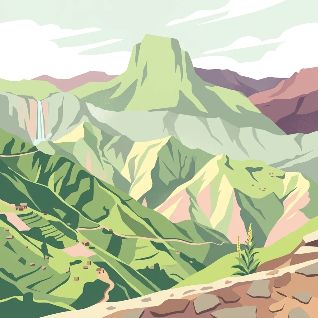
A digital illustration of a mountainous park landscape featuring tiered green slopes, a distant waterfall, and a rocky foreground path.

Parc national La Visite

National park

Park overview

Structured park overview, official facts, and landscape profile for Parc national La Visite

Parc national La Visite park facts, protected area profile, and essential visitor context

Review the core facts for Parc national La Visite, including designation, size, terrain, visitor scale, habitats, and operating context in one park-focused overview.

About Parc national La Visite

Parc national La Visite is the principal national park of Haiti's southern highlands, occupying a section of the Chaîne de la Selle mountains that overlook the southern coast of the country. The range crosses into the Dominican Republic, where it continues as the Sierra de Baoruco, and the two sides together form a single connected highland ecosystem.

The park exists because Haiti recognized, decades ago, that its upland pine forests were disappearing at alarming rates. Created in 1983, La Visite was established to preserve the montane flora and fauna of the massif, particularly the stands of Pin d'Hispaniola that still cling to the upper slopes. While much of Haiti's original forest cover has been lost to charcoal production, agriculture, and settlement pressure, the La Visite area retains enough tree cover and habitat integrity to function as a true refuge.

The setting is dramatically mountainous. The massif combines a broad northern limestone plateau with deeply cut ravines and gorges descending toward the south. From this terrain, rivers flow down toward the Caribbean, and the watersheds anchored by these forests are themselves a central part of what the park protects. The summit of the Pic la Selle, the highest point in Haiti, rises far above the park's core zone and helps define the range's overall geography.

Beyond its national importance, La Visite has taken on an international conservation profile. The Chaîne de la Selle was recognized by UNESCO as a biosphere reserve in 2012, and in 2017 the designation became transboundary under the name La Selle/Jaragua-Bahoruco-Enriquillo, formally linking Haiti's protected massif to the Jaragua, Bahoruco, and Enriquillo reserves on the Dominican side. This recognition underlines how the park is not just a Haitian conservation area, but a critical node in the broader Hispaniolan highland ecosystem.

Quick facts and research context for Parc national La Visite

Parc national La Visite is a protected area in the Chaîne de la Selle mountain range, in the Ouest and Sud-Est departments of southern Haiti. The broader massif is built on limestone geology and culminates at the Pic la Selle, the highest summit in Haiti.

Established in 1983, the park was created specifically to safeguard montane flora and fauna under growing pressure from deforestation. Its native vegetation includes the endemic Pin d'Hispaniola, which remains one of the defining species of the reserve's surviving pine forests.

In 2012 UNESCO designated the Chaîne de la Selle as a biosphere reserve, and in 2017 the status was expanded to a transboundary designation with the Dominican Republic.

Park context

Deeper park guide and search-rich context for Parc national La Visite

Parc national La Visite history, landscape, wildlife, and travel context

Explore Parc national La Visite through its history, landscape character, ecosystems, wildlife, conservation priorities, cultural context, and seasonal travel timing in a structured park guide built for atlas discovery and search intent.

Why Parc national La Visite stands out

Parc national La Visite is best known for protecting one of the last extensive stands of Hispaniolan pine forest in Haiti, set on a rugged limestone plateau carved by deep ravines. The park's identity is tied closely to the Chaîne de la Selle itself, the southern Haitian massif that includes Pic la Selle, the country's highest peak. Its recognition within the La Selle/Jaragua-Bahoruco-Enriquillo transboundary biosphere reserve reflects its role as a Caribbean highland refuge rather than simply a local park. For Haiti, where deforestation has dramatically reshaped most landscapes, the surviving pine forests and watersheds around La Visite represent a rare case of intact montane habitat.
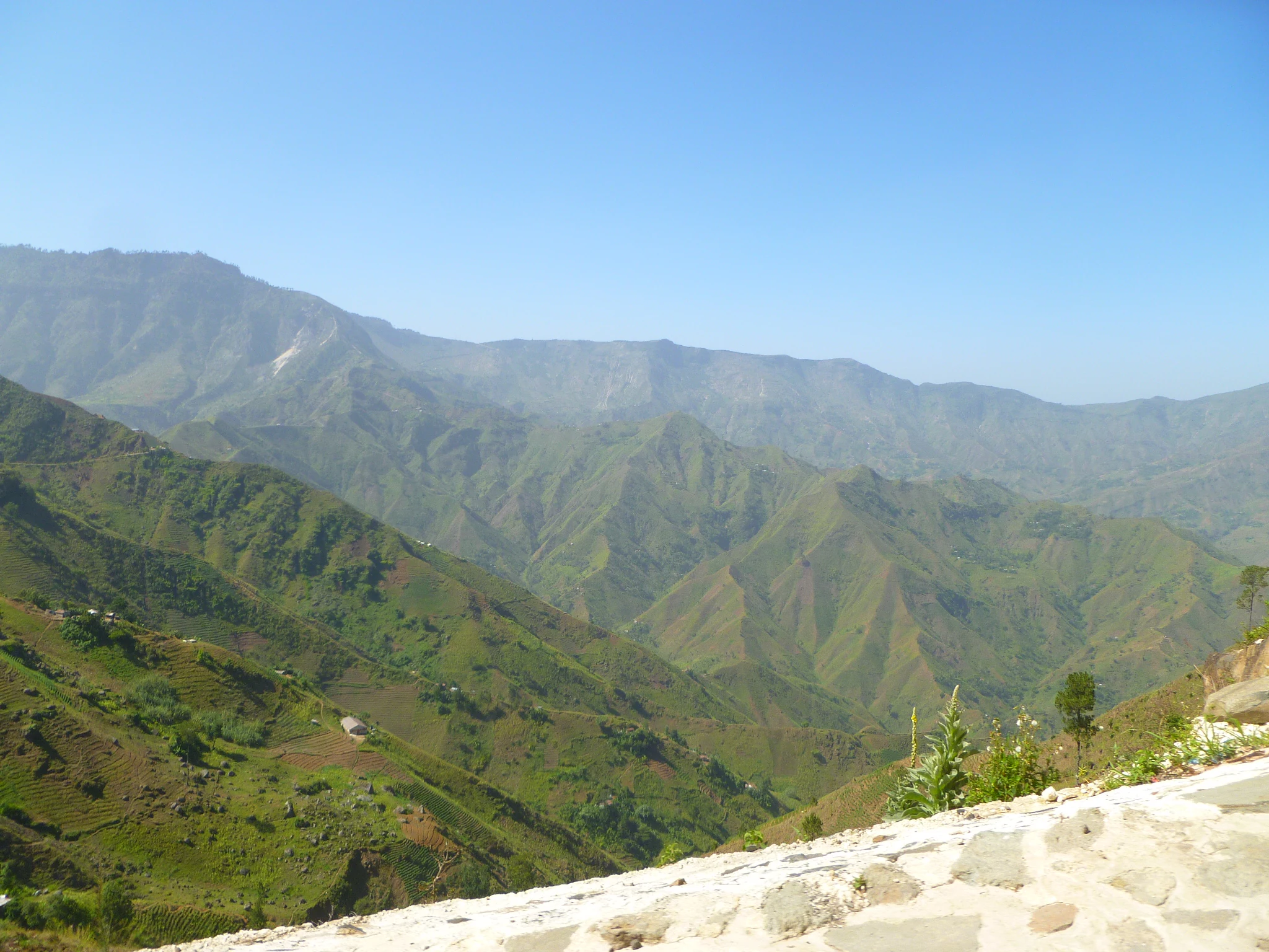
A wide, scenic view looking across a series of deep, green, rugged mountain ridges under a clear blue sky, with a stone-paved edge visible in the immediate foreground.
A wide view of the Massif de la Selle mountain range in Haiti, which includes Parc national La Visite.

Parc national La Visite history and protected-area timeline

Parc national La Visite was established in 1983 as a direct response to the accelerating loss of biodiversity in Haiti's southern mountains. By the early 1980s, large parts of the Chaîne de la Selle had already been affected by deforestation and land conversion, and the national park designation was intended to safeguard the range's remaining populations of montane plants and animals.

The park sits within the broader Chaîne de la Selle, a massif that extends eastward into the Dominican Republic as the Sierra de Baoruco. Despite historic pressure on Haiti's forests, portions of the range remained wooded enough to merit formal protection at La Visite.

In 2012, the UNESCO Man and the Biosphere programme recognized the Chaîne de la Selle as a biosphere reserve, extending international legitimacy to the conservation effort. Five years later, in June 2017, the reserve became transboundary, paired with the Dominican Republic's Jaragua, Bahoruco, and Enriquillo reserves under the joint name La Selle/Jaragua-Bahoruco-Enriquillo. This step formally wove La Visite into a regional conservation framework that recognizes the massif as a single ecological unit divided only by the political border.

Parc national La Visite landscape and geographic character

The landscape of Parc national La Visite is shaped by the Chaîne de la Selle's limestone geology. The massif's northern flank forms a karst plateau, while its southern flank is heavily dissected by rivers that have carved long ravines and canyons down toward the coast.

Elevations climb steeply through the range, culminating above the park at Pic la Selle, Haiti's highest peak at 2,680 metres. From the high plateau, the land drops in dramatic steps through forested slopes, rocky quebradas, and narrow gorges. This combination of upland flatness and deeply incised valleys gives the massif its strongly sculpted character.

The southern orientation of the drainage and the elevation gradients create a range of microhabitats within a relatively compact area, and the views from the higher ridges extend across the surrounding lowlands toward the Caribbean coastline.

Parc national La Visite ecosystems, habitats, and plant life

Ecologically, Parc national La Visite is defined by its surviving montane pine forest. The park's vegetation is dominated by Pin d'Hispaniola, a pine species endemic to the island of Hispaniola, which still forms extensive stands across the Chaîne de la Selle despite extensive deforestation across most of Haiti.

The limestone substrate supports a distinctive mix of dry upland forest types, with vegetation patterns shifting according to slope, exposure, and elevation across the plateau and the ravines that cut into it. The northern plateau preserves broader canopy areas, while the steeper southern slopes host thinner, more fragmented woodland along the gorges.

Because the broader massif retains relatively continuous forest cover at higher elevations, the park functions as a refuge for species and habitats that have largely disappeared from the rest of Haiti's lowlands.

Parc national La Visite wildlife and species highlights

The wildlife value of Parc national La Visite is closely tied to the survival of the upland pine forests and the relative continuity of habitat they provide. While detailed species accounts are limited in publicly available sources, the park is recognized as an important refuge for the fauna of Haiti's southern mountains, increasingly isolated as surrounding lowland forests disappear.

The Hispaniolan pine forests of the Chaîne de la Selle support a range of montane species, with the broader massif functioning as one of the country's most significant strongholds for highland wildlife. The park's elevation gradients, its combination of plateau and ravine habitats, and its position along a flyway across the Caribbean coast make it ecologically relevant beyond its boundaries.

Aside from endemic flora such as Pin d'Hispaniola, the area is known to harbor reptiles, amphibians, and bird species characteristic of Hispaniola's uplands, though detailed inventories are sparse.

Parc national La Visite conservation status and protection priorities

Parc national La Visite represents one of Haiti's most important conservation investments, both because of what it protects and because of what has been lost elsewhere in the country. Most of Haiti's original forest cover has been heavily reduced by charcoal production, small-scale agriculture, and settlement expansion, particularly in lowland and mid-elevation zones. The Chaîne de la Selle's remaining pine forests are therefore disproportionately important at a national scale.

The park's establishment in 1983 was itself a conservation milestone for Haiti, formalizing protection of the massif's biodiversity. The 2012 UNESCO biosphere reserve recognition of the Chaîne de la Selle elevated the area's profile internationally, and the 2017 transboundary expansion of the reserve under the La Selle/Jaragua-Bahoruco-Enriquillo designation integrated the park into a regional conservation network that also protects the Bahoruco, Jaragua, and Enriquillo systems on the Dominican side.

Ecologically, the park's role is anchored in forest preservation, watershed protection, and the maintenance of habitat corridors across the Hispaniolan highlands; the limestone aquifer and rivers that originate in the massif supply water across southern Haiti, giving the park clear relevance to both biodiversity and freshwater systems.

Parc national La Visite cultural meaning and human context

The Chaîne de la Selle has long been a defining landscape feature of southern Haiti, and the massif has shaped settlement, agriculture, and rural life across the Ouest and Sud-Est departments. Traditional relationships with the uplands include subsistence farming on the plateau, seasonal use of forested slopes, and long-standing reliance on the rivers that descend from the range.

Haitian cultural identity is particularly tied to Pic la Selle, the country's highest summit. The mountain appears in local place names, folklore, and rural livelihoods, and visibility of the high peaks from the lowlands has historically made the massif a reference point for communities across the south.

The conservation of the area is therefore not only an ecological concern but also a question about how a shared cultural landscape, long used by rural communities, can continue to function as a protected natural system.

Top sights and standout views in Parc national La Visite

Parc national La Visite anchors the conservation of Haiti's southern highlands, protecting one of the country's last extensive Hispaniolan pine forests within the Chaîne de la Selle massif. Its plateau and ravine system combines karst limestone terrain with deeply cut gorges and river valleys that shape both scenery and habitat.

The park forms the Haitian core of the transboundary La Selle/Jaragua-Bahoruco-Enriquillo biosphere reserve, linking it directly to the Dominican Republic's Bahoruco, Jaragua, and Enriquillo protected areas. Its persistence offers a rare example of intact upland forest in a country where deforestation has dramatically reshaped most other landscapes.

Best time to visit Parc national La Visite

Parc national La Visite's highland climate is shaped by elevation and exposure on the southern slopes of the Chaîne de la Selle. Cooler temperatures and the densest vegetation cover tend to occur during the wetter months, when the karst plateau and ravines are at their greenest and water levels in the rivers and gorges are highest.

Drier periods bring clearer skies and easier visibility of the surrounding peaks and the Caribbean coastline from the higher ridges, while reducing the lushness of the forest understory. Many visitors time their trips to balance scenic clarity with comfortable access to trails crossing the plateau and the deeper quebradas, avoiding the heaviest rainfall when roads and paths become difficult.

Because the park's elevation spans a wide range of altitudes, temperatures can shift quickly with weather and topography, making layering and flexibility more important than any single month-by-month expectation.
Monthly climate preview

Long term representative measurements tracking twelve month weather patterns in Haiti

Parc National La Visite Climate Normals, Annual Temperature and Precipitation

Representative coordinate records show measured monthly temperature ranges and precipitation rates across the protected terrain. Detailed twelve month climate profiles provide deeper analytical context for long term weather variations.
Annual mean25 °C
23 °C27 °C
Jan23°
Feb24°
Mar24°
Apr26°
May26°
Jun26°
Jul27°
Aug27°
Sep26°
Oct26°
Nov25°
Dec23°
Warmest month
August

26.8 °C

Coolest month
January

23.1 °C

Wettest month
May

2 mm/day

Driest month
February

0.5 mm/day

Park location guide

Geography guide, regional context, and park location map for Parc national La Visite

Parc national La Visite park geography, regions, and map view in Haiti

Understand where Parc national La Visite sits in Haiti through a broader geographic reading of the surrounding landscape, nearby location context, and its mapped position within the national park landscape.

How Parc national La Visite fits into Haiti

Haiti is a Caribbean country occupying the western third of Hispaniola Island in the Caribbean Sea. It gained independence from France in 1804 following the Haitian Revolution, becoming the first sovereign state established by a slave revolt and the second independent nation in the Americas. The country is known for its complex political history, economic challenges, and cultural significance in the Caribbean.

Wider geography shaping Parc national La Visite in Haiti

Haiti occupies the western third of Hispaniola Island in the Caribbean, sharing the island with the Dominican Republic. The country is positioned in the Caribbean Sea, east of Cuba and south of the Bahamas. Haiti's terrain is predominantly mountainous, with valleys and coastal plains. The country borders the Caribbean Sea on its western, southern, and southwestern coasts.

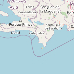
Map view of Parc national La Visite

Use this park location map to pinpoint Parc national La Visite in Haiti, understand its exact geographic position, and read its mapped placement within the surrounding landscape more clearly.

Pigeon | © OpenStreetMap contributors

Explore upland pine forests, limestone plateaus, and mountain terrain across the conservation landscape.

Parc National La Visite Photos and Landscape Scenery Visual Guide

Visual documentation captures the rugged limestone plateau, deep gorges, and surviving pine forests defining the southern highlands. Detailed photography reveals the unique topography, montane habitats, and protected environment of the reserve.

A wide, scenic view looking across a series of deep, green, rugged mountain ridges under a clear blue sky, with a stone-paved edge visible in the immediate foreground.

Park atlas

Compare regional mountain reserves and connected Caribbean highland ecosystems.

Other Parks Near Parc National La Visite and Surrounding Protected Areas

Continue exploring regional protected landscapes and mountain habitats surrounding Parc national La Visite. Compare adjacent highland ecosystems and crossborder conservation zones across the southern uplands.
National parkSud Department
About 3.6 km away#1 closest

South

Forêt des Pins National Park: Geographic Overview of Haiti's Highland Protected Landscapes

Mapping the pine-forested terrain and high-altitude mountain ecosystems of the southern massif.

Explore the expansive geography of Forêt des Pins National Park, which protects the remnants of Haiti's highland Caribbean pine forests. This protected area spans critical high-elevation slopes and mountain watersheds, offering a detailed look at the rugged natural terrain of the southern massif surrounding Pic la Selle.

Area
187.8 km²
Established
1937
National parkHaiti
About 37 km away#2 closest

West

La Visite National Park: Protected Highland Terrain and Endemic Pine Forest Landscape

Explore the geography and mapped park boundaries of Haiti's significant national park.

La Visite National Park is a vital protected area located in Haiti's mountainous Massif de la Selle region. It is distinguished by its rare montane ecosystems, including extensive Hispaniolan pine forests and high-altitude grasslands, creating a unique landscape within the Caribbean. This atlas entry focuses on the park's geographic setting, its mapped protected boundaries, and its ecological significance as a key component of Haiti's natural heritage, offering a detailed look at its distinctive terrain.

Area
30 km²
Established
1983
IUCN
II
Relief
Mountain
A soft watercolor painting depicting a panoramic view of rolling green hills, a forest canopy, and distant mountains under a pale, warm-toned sky.
National parkHaiti
About 37 km away#3 closest

West

Parc national La Visite: Protected Highland Plateau and Pine Forest Geography in Haiti

Mapping the Massif de la Selle mountain ecosystems.

Parc national La Visite occupies a critical position in southeastern Haiti, protecting a rugged highland plateau defined by dense ravines and Haiti's largest surviving pine forest. This protected area offers a distinct geographic window into the cool, montane terrain of the Massif de la Selle, serving as an essential core zone for regional conservation and mountain landscape study.

Area
30 km²
Established
1983
IUCN
II
National parkPedernales Province
About 43 km away#4 closest

Southeast

Jaragua National Park: Dominican Republic National Park Protected Landscape Atlas

Discover the mapped geography and protected boundaries of Jaragua National Park.

Jaragua National Park stands as a crucial national park within the Dominican Republic, located in Pedernales Province. This entry provides an in-depth, atlas-style examination of the park's protected landscape, focusing on its geographic features and mapped extent. Users can explore the park's position within the regional geography and understand its significance as a conservation area.

Area
1,374 km²
Established
1983
IUCN
II
Relief
Mountain
National parkIndependencia Province
About 64 km away#5 closest

East

La Gran Sabana National Park: National Park Identity and Geographic Mapping

Exploring protected landscapes and regional context.

This detail entry focuses on La Gran Sabana National Park, delineating its identity as a protected national park within Independencia Province. It provides essential context for understanding the park's mapped boundaries, its specific geographic setting, and its role within the natural landscape. Users can explore its atlas-relevant features and understand its place in the broader geography of the Dominican Republic.

Area
219.58 km²
Established
2009
IUCN
II
Relief
Lowland
National parkDominican Republic
About 112 km away#6 closest

Northeast

José Armando Bermúdez National Park: Dominican Republic National Park Atlas and Landscape Context

Discover the mapped protected area and geographic setting of this Dominican Republic national park.

Gain an understanding of José Armando Bermúdez National Park as a distinct protected landscape within the Dominican Republic. This entry focuses on its role as a national park, providing geographic context and highlighting its mapped boundaries for atlas exploration. Explore the park's specific terrain and its place within the nation's conservation network.

Area
766 km²
Established
1956
IUCN
II
Relief
Mountain
National parkDominican Republic
About 126 km away#7 closest

East

Valle Nuevo National Park: Nearctic Highland Ecosystem and Glacial Landscapes

Mapped protected area in the Dominican Republic's Cordillera Central.

Valle Nuevo National Park in the Dominican Republic offers a rare glimpse into a Nearctic ecosystem within the Caribbean. Spanning 910 square kilometers in the Cordillera Central, it features dramatic mountain peaks like Loma Alto de la Bandera and distinctive glacial landforms. The park protects extensive Hispaniolan pine forests and cloud forest habitats, supporting remarkable endemic biodiversity and serving as a critical watershed for the region.

Area
910 km²
Established
1996
IUCN
II
Relief
Mountain
A minimalist watercolor painting showing layers of pale green, yellow, and pink hills behind a marshy foreground with grasses and soft brushwork.
National parkNord
About 136 km away#8 closest

North

Parc national historique - Citadelle, Sans Souci, Ramiers: A Caribbean Historic Landscape

Protected mountain terrain and historic fortifications in northern Haiti

This national park protects an expansive mountain massif characterized by the massive Citadelle La Ferrière and the ruins of Sans-Souci Palace. Beyond its architectural significance, the park safeguards essential karst cave networks, natural springs, and forested river corridors that shape the rugged topography of northern Haiti.

Area
252.86 km²
Established
1968
Relief
Mountain
Scope
Terrestrial

Common questions about visiting, size, designation, and location context for Parc national La Visite

Parc national La Visite FAQs for park facts, access, geography, and protected area context

Find quick answers about Parc national La Visite, including protected-area facts, park geography, trail and visitor context, and how the park fits into its surrounding country and regional landscape.
MoriAtlas Explorer

Continue Your Protected Areas Search Across the Global Atlas

Deepen your exploration by continuing the structured search for national parks and protected areas worldwide. Utilize the comprehensive filtering capabilities to compare different conservation landscapes and refine your understanding of global park geography. Discover more about the distribution and characteristics of protected natural areas.

Global natural geography