
Mori Atlas logo
Marine protected areaParininihi Marine Reserve

A detailed look at the underwater terrain and coastal boundaries of the Pariokariwa Reef marine sanctuary.

Parininihi Marine Reserve: Exploring the Protected Marine Landscapes and Reef Geography of New Zealand

Parininihi Marine Reserve serves as a significant ecological sanctuary off the west coast of New Zealand, encompassing 1,800 hectares of diverse seafloor and coastal waters. This protected landscape is defined by the intricate structural complexity of the Pariokariwa Reef, which features hidden underwater canyons, rocky pinnacles, and expansive sponge gardens. By mapping the interaction between these submerged environments and the adjacent North Taranaki Bight, one gains a clearer understanding of this vital marine habitat and its lasting connection to the cultural history of the Ngāti Tama iwi.

marine reservesponge gardensreef ecosystemNorth IslandTaranaki coastrock lobster habitat
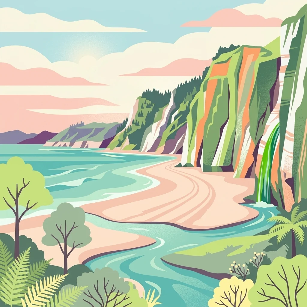
A stylized digital illustration of a coastal landscape with high cliffs, a sandy beach, a stream flowing into the sea, and lush green vegetation.

Parininihi Marine Reserve

Marine protected area

Park overview

Structured park overview, official facts, and landscape profile for Parininihi Marine Reserve

Parininihi Marine Reserve park facts, protected area profile, and essential visitor context

Review the core facts for Parininihi Marine Reserve, including designation, size, terrain, visitor scale, habitats, and operating context in one park-focused overview.

About Parininihi Marine Reserve

Parininihi Marine Reserve lies along the rugged western coast of New Zealand's North Island, in the northern part of Taranaki. The reserve stretches across roughly 1,800 hectares of coastal waters and seafloor, offshore of the New Plymouth District, with New Plymouth serving as the nearest city. The surrounding coastline near Pukearuhe is known for its striking White Cliffs, which rise dramatically above the sea and form a memorable backdrop to the dive sites and reefs below.

At the heart of the reserve is Pariokariwa Reef, a complex underwater landscape extending north from Pariokariwa Point. Most of the reef lies between five and twenty-three metres below the surface, surrounded by fine sediment and mud that contrast sharply with the exposed rocky structures. Parts of the reef form small caves, overhangs, canyons and pinnacles that, once they emerge from the water, become encrusted with colonies of bryozoans, brightly coloured sponges, hydroids, anemones and soft corals. These layered habitats create a sheltered, highly textured environment that supports an extraordinary variety of marine life.

What makes Parininihi especially distinctive is the richness of its sponge communities. The reef supports a colourful carpet of sponges spread along its ledges, including rare and exotic species such as Polymastia pepo. This sponge diversity, combined with extensive bryozoan growth and a healthy fish and lobster population, has earned the reserve a strong reputation among those interested in temperate reef ecology. Alongside its ecological character, the area continues to carry deep cultural meaning for Ngāti Tama, reinforcing the reserve's identity as both a natural and cultural heritage site.

Quick facts and research context for Parininihi Marine Reserve

Parininihi Marine Reserve is located off the west coast of New Zealand's North Island, in the New Plymouth District of Taranaki. It lies within the broader North Taranaki Bight and is administered by the New Zealand Department of Conservation, fitting within the country's system of no-take marine reserves.

Covering approximately 1,800 hectares (4,400 acres), the reserve was legally established in 2006 after years of discussion about protecting its diverse reef ecosystems. The reserve is centred on Pariokariwa Reef, an unusual reef system featuring sponge gardens, bryozoan colonies, and a range of fish and invertebrate species. It also carries cultural and customary significance for Ngāti Tama, reflecting the area's long history as a fishing ground.

Protection and recognition

Examine documented marine protection scope and formal recognition facts.

Parininihi Marine Reserve Protection Status and Governance Data

Parininihi Marine Reserve protection status details bring together documented marine conservation parameters and management scope. Formal recognition data establishes verified governance boundaries without speculative ecological claims.

Protection details

Protection scope
Marine
Transboundary protection
No
Park context

Deeper park guide and search-rich context for Parininihi Marine Reserve

Parininihi Marine Reserve history, landscape, wildlife, and travel context

Explore Parininihi Marine Reserve through its history, landscape character, ecosystems, wildlife, conservation priorities, cultural context, and seasonal travel timing in a structured park guide built for atlas discovery and search intent.

Why Parininihi Marine Reserve stands out

Parininihi Marine Reserve is best known for the ecological richness of Pariokariwa Reef, particularly its extensive sponge gardens and the unusually high diversity of invertebrate life along its ledges and pinnacles. The reef supports large populations of rock lobsters and a broad mix of inshore fish, including blue cod, red moki, snapper, trevally, and kahawai. The reserve has also become recognised as a significant cultural site, as the reef has been important to Ngāti Tama for generations as a traditional fishing ground. This combination of a highly diverse marine ecosystem and a deeply rooted cultural connection distinguishes Parininihi from many other New Zealand marine reserves, making it both an ecological and a heritage-rich coastal site.
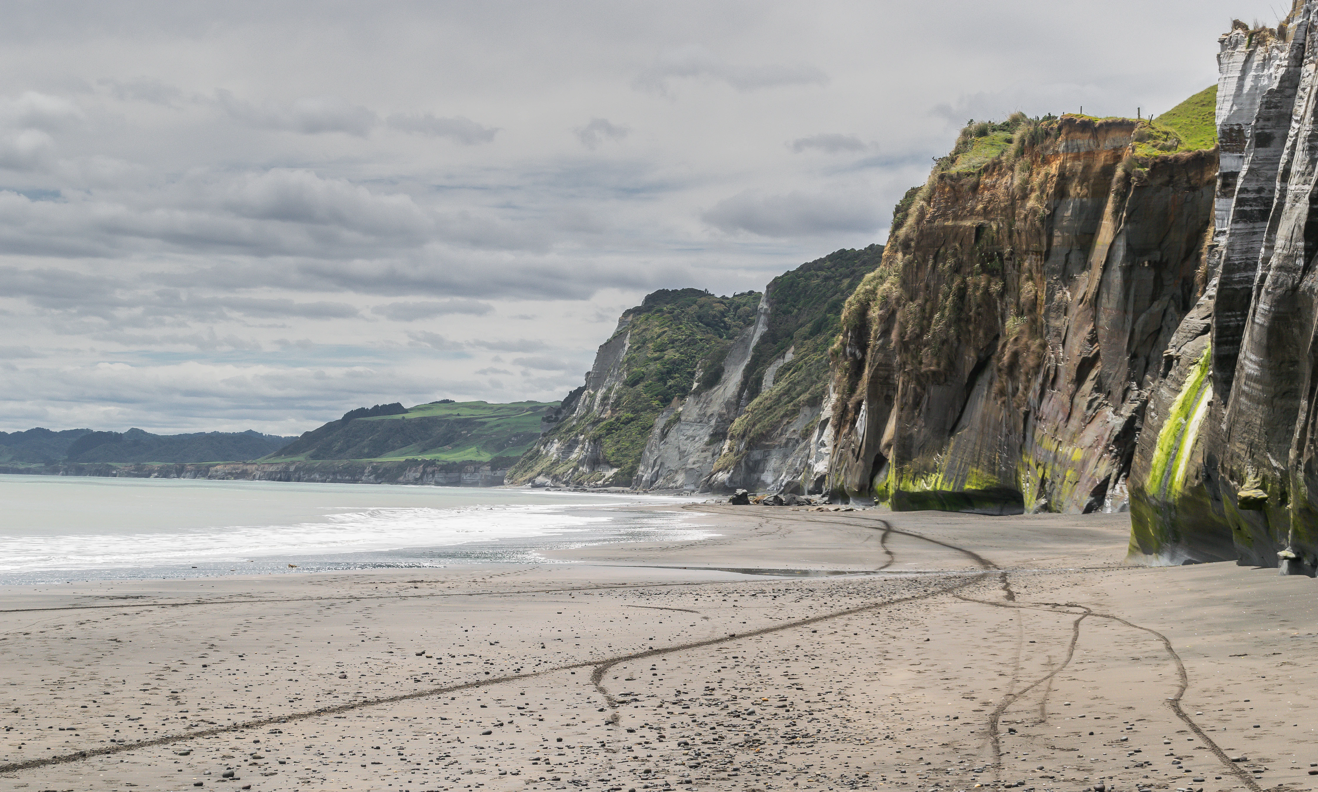
A wide shot of a sandy beach stretching toward towering, vertical coastal cliffs under a cloudy sky.
The dramatic White Cliffs coastline at Parininihi Marine Reserve, New Zealand.

Parininihi Marine Reserve history and protected-area timeline

The reef at the heart of Parininihi Marine Reserve has been important to Ngāti Tama for many generations. Long before any formal protection, the iwi knew this part of the coast as a rich fishing ground and continues to hold customary fishing rights in the broader area.

In December 1998, the New Zealand Conservation Minister Nick Smith confirmed that the reef would become a marine reserve in order to protect its sea sponges and corals. As part of that decision, however, a nearby area containing Waikiekie Reef was excluded from the proposed reserve in response to feedback from the fishing industry. The reserve itself was formally established by order on 11 September 2006, taking legal effect 28 days later on 9 October 2006.

Although the reserve has been in place for nearly two decades, monitoring and management challenges have continued. In April 2015, the Department of Conservation reported receiving information about potential illegal fishing activity within the reserve but was unable to confirm the incidents. In December 2017, a separate report raised concerns that the redevelopment of a section of nearby State Highway 3 could release sediments and other contaminants into reserve waters, highlighting the ongoing link between land-based infrastructure and marine protection along this stretch of coast.

Parininihi Marine Reserve landscape and geographic character

The landscape of Parininihi Marine Reserve is defined by the contrast between dramatic above-water coastal scenery and a varied underwater reef system. The onshore setting is marked by the White Cliffs near Pukearuhe, an iconic stretch of pale coastal cliffs that frame the approach to the reserve and contribute much of its visual identity from land. Below the surface, the seafloor is far more complex than the surrounding open coast might suggest.

Pariokariwa Reef is the dominant underwater landform, extending north from Pariokariwa Point. Much of the reef sits between five and twenty-three metres beneath the water's surface, with fine sediment and mud surrounding the harder rocky structures. Where the reef rises or breaks the surface, it forms small caves, overhangs, canyons and sharp pinnacles. These structural features create sheltered microhabitats and uneven terrain that support dense colonies of invertebrates and a wide variety of fish. The combination of soft muddy seabed and rugged rocky reef gives the underwater landscape a layered, highly textured character.

Parininihi Marine Reserve ecosystems, habitats, and plant life

The marine environment at Parininihi is unusually rich for a temperate coastal reserve, with ecological diversity anchored on Pariokariwa Reef. The reef supports a complex mosaic of habitats, ranging from muddy sediment flats to rocky ledges, caves and vertical structures. Each of these supports a different but interrelated community of marine organisms, contributing to the overall biodiversity of the area.

A defining element of the reserve is the abundance and variety of sponges and bryozoans. Large colonies encrust the reef structures, while rare sponges, such as Polymastia pepo, form colourful carpets along the reef's ledges. Hydroids, anemones and soft corals add further complexity, turning the reef into a layered habitat. This dense invertebrate growth, set against fine sediment and rock, creates a thriving ecosystem that supports a wide range of fish species and large populations of rock lobsters, reinforcing the reserve's ecological importance within the New Zealand marine protected area network.

Parininihi Marine Reserve wildlife and species highlights

Parininihi Marine Reserve supports a diverse community of temperate marine life, particularly around Pariokariwa Reef. The reef's structure and dense invertebrate cover provide excellent habitat for rock lobsters, which are present in large numbers throughout the reserve. These populations are a key part of the reserve's wider food web and contribute to its reputation among those interested in temperate reef ecosystems.

Fish life across the reserve is varied, with common inshore species including blue cod, blue moki, red moki, gurnard, john dory, kahawai, red cod, terakihi, trevally and snapper. These species occupy different parts of the reef and surrounding seafloor, from sediment-rich areas to the more exposed rocky structures. The combination of abundant invertebrate life and a healthy mix of reef and pelagic fish makes Parininihi one of the more biologically productive coastal reserves on the western North Island.

Parininihi Marine Reserve conservation status and protection priorities

Parininihi Marine Reserve was established primarily to protect the reef's exceptional sponge and coral communities, which had become a focal point of ecological concern during discussions about marine protection in the late 1990s. By creating a no-take reserve, the New Zealand government recognised the importance of safeguarding these habitats and the broader reef ecosystem from the effects of fishing and other extractive activities.

The reserve also serves as a refuge for species that depend on healthy reef structure, including rock lobsters, several inshore fish species, and rare sponges such as Polymastia pepo. Protection under the reserve regime allows these communities to develop with minimal direct human interference, supporting long-term resilience and providing a reference point for understanding temperate reef ecology on the North Island's west coast. Beyond ecological preservation, the reserve acknowledges the cultural and customary significance of the reef to Ngāti Tama, integrating natural and cultural values within its conservation purpose.

Parininihi Marine Reserve cultural meaning and human context

The reef and surrounding coastline have deep cultural, spiritual, and historical significance for Ngāti Tama. Generations before marine reserves were formally established, the iwi knew the area as a rich fishing ground and valued the reef as an important source of food and traditional knowledge. Ngāti Tama continues to hold customary fishing rights in the broader region, linking the reserve to long-standing practices that predate formal marine protection.

Recognition of Ngāti Tama's relationship with the reef has shaped both the discussion leading to the reserve's creation and its ongoing management. The customary connection reinforces that the area is more than a purely ecological site, it is also part of an enduring cultural landscape shaped by generations of interaction between the iwi and the sea.

Top sights and standout views in Parininihi Marine Reserve

Parininihi Marine Reserve stands out for the unusual diversity of Pariokariwa Reef and the quality of its sponge gardens, which are among the most distinctive in New Zealand's marine reserve network. The combination of caves, overhangs, canyons and pinnacles with dense bryozoan and sponge colonies gives the reef an almost underwater garden-like character, while the surrounding muddy seabed supports a different but equally important community of species.

Equally notable is the integration of cultural and ecological values within the reserve. Ngāti Tama's longstanding relationship with the reef, the reserve's role in protecting rare sponges and abundant fish populations, and the dramatic White Cliffs coastline nearby together create a coastal site that is both visually striking and ecologically rich.

Best time to visit Parininihi Marine Reserve

Conditions at Parininihi can vary substantially with the seasons and prevailing weather on the west coast of the North Island, where rough seas and reduced visibility are common. Divers and underwater visitors typically find that calmer, clearer conditions allow for a more rewarding experience of the reef's sponge gardens and structural complexity.

For those interested in coastal scenery, the viewing experience from land around the White Cliffs area is enhanced by clearer weather and softer light. Because sea conditions and visibility are variable, flexibility around timing is often more important than any specific season, and visitors should be prepared for changeable west coast conditions throughout the year.
Monthly climate preview

Long term temperature and precipitation records across twelve months

Parininihi Marine Reserve Climate Normals and Annual Weather Patterns

Measured NASA climate records show monthly average temperatures ranging from 9.26 degrees Celsius to 23.96 degrees Celsius alongside varied daily precipitation rates at a representative elevation of 178 meters. Examining the complete twelve month dataset reveals detailed long term meteorological norms and regional weather patterns for Parininihi Marine Reserve.
Annual mean13 °C
9 °C18 °C
Jan17°
Feb18°
Mar16°
Apr14°
May12°
Jun10°
Jul
Aug10°
Sep11°
Oct12°
Nov13°
Dec16°
Warmest month
February

17.6 °C

Coolest month
July

9.3 °C

Wettest month
June

4.4 mm/day

Driest month
January

2.5 mm/day

Park location guide

Geography guide, regional context, and park location map for Parininihi Marine Reserve

Parininihi Marine Reserve park geography, regions, and map view in New Zealand

Understand where Parininihi Marine Reserve sits in New Zealand through a broader geographic reading of the surrounding landscape, nearby location context, and its mapped position within the national park landscape.

How Parininihi Marine Reserve fits into New Zealand

New Zealand is an island nation in the southwestern Pacific Ocean comprising two main islands and numerous smaller islands. Located east of Australia across the Tasman Sea, it features varied topography with the Southern Alps running along the South Island and volcanic terrain on the North Island. The country was settled by Maori people between 1280 and 1350, followed by European exploration beginning in 1642, and became a Dominion in 1907 before gaining full independence in 1947.

Wider geography shaping Parininihi Marine Reserve in New Zealand

New Zealand lies in the southwestern Pacific Ocean, east of Australia across the Tasman Sea. The country consists of two main islands, the North Island and South Island, plus over 600 smaller islands. The North Island features volcanic plateaus and hills while the South Island is dominated by the Southern Alps mountain range. The country has a long coastline and is surrounded by the Pacific Ocean.

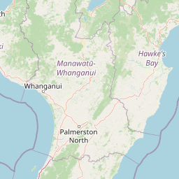
Map view of Parininihi Marine Reserve

Use this park location map to pinpoint Parininihi Marine Reserve in New Zealand, understand its exact geographic position, and read its mapped placement within the surrounding landscape more clearly.

Pigeon | © OpenStreetMap contributors

Location context for Parininihi Marine Reserve

New Plymouth District
Recorded earthquake history

Examine Recorded Earthquake History Near Parininihi Marine Reserve

Access the comprehensive collection of seismic events recorded in the vicinity of Parininihi Marine Reserve. MoriAtlas provides this historical catalogue to help users understand the documented frequency and characteristics of local earthquake activity relative to the marine environment.

Parininihi Marine Reserve Earthquake History

Catalogued events

164 events

Strongest magnitude

Magnitude 6.1

Most recent event

Apr 25, 2025

This history includes earthquakes recorded inside the park or within 50 km of its borders

Visual reference for coastal cliffs, submerged reefs, and marine habitats

Parininihi Marine Reserve Photos, Landscapes, and Protected Scenery

Visual records document the coastal scenery and underwater reef terrain defining Parininihi Marine Reserve. Photographic archives illustrate the contrast between pale coastal cliffs and complex sponge garden habitats.

A wide shot of a sandy beach stretching toward towering, vertical coastal cliffs under a cloudy sky.

Park atlas

Compare coastal ecosystems, temperate reefs, and regional marine reserves across the North Island

Explore Other Parks Near Parininihi Marine Reserve and Surrounding Protected Areas

Browsing other parks near Parininihi Marine Reserve reveals connected coastal ecosystems and protected marine habitats across the surrounding region. Comparing adjacent protected areas provides broader geographic context for temperate reef environments and regional conservation landscapes.
National parkNew Zealand
39 km away#1 closest

Southeast

Whanganui National Park: Protected Wilderness Landscape and Geographic Context

Explore the mapped boundaries and natural terrain of this national park.

Whanganui National Park offers a unique blend of natural wilderness and significant cultural history, centered on the Whanganui River valley. This protected area safeguards one of New Zealand's most extensive lowland forest ecosystems, providing vital habitat and showcasing a landscape deeply intertwined with Māori traditions and historical settlement. Understanding its geographical setting and mapped protected boundaries reveals its importance as a distinct national park.

Area
742 km²
Established
1986
IUCN
II
Relief
Lowland
National parkNew Zealand
48 km away#2 closest

Southwest

Egmont National Park: New Zealand's Distinctive Volcanic National Park

Explore the mapped volcanic terrain and protected landscape of Mount Taranaki.

Egmont National Park represents a significant protected area within New Zealand's North Island, dominated by the iconic stratovolcano, Mount Taranaki. This national park is celebrated for its distinct circular protected boundary, a unique feature against the surrounding pastoral farmlands, and its dramatic volcanic landscape. Visitors can explore a range of natural habitats from dense temperate rainforests to alpine environments, all mapped within this significant conservation landmark.

Area
341.7 km²
Established
1900
IUCN
II
Visitors
400K annual
Protected landscapeWaikato
71 km away#3 closest

East

Pureora Forest Park: Ancient Rainforests and Protected Mountain Landscapes in Waikato

Regional geography and mapped native forest boundaries

Pureora Forest Park represents a significant protected area in the central North Island of New Zealand, defined by its towering podocarp giants and complex volcanic terrain. The park serves as a prime example of an intact rainforest ecosystem, featuring dense broadleaf canopies, deep river valleys, and significant remnants of ancient forest history. Its geography, shaped by both geological upheaval and centuries of growth, provides an essential record of the natural heritage preserved across the Waikato and Manawatu-Whanganui regions.

Area
759.57 km²
Established
1978
Relief
Mountain
Water
Major water bodies
National parkNew Zealand
81 km away#4 closest

Southeast

Tongariro National Park: New Zealand's Premier Volcanic National Park Atlas

Explore mapped terrain, active volcanoes, and unique dual World Heritage values.

Tongariro National Park, situated in New Zealand's North Island, is a globally significant protected area celebrated for its dramatic volcanic landscapes and profound cultural heritage. As the nation's oldest national park, it features three active volcanoes: Mount Ruapehu, Mount Ngauruhoe, and Mount Tongariro, set within a diverse terrain that includes forests, alpine zones, and the Rangipo Desert. Its dual World Heritage status underscores its importance for both natural attributes and its sacred cultural landscape, offering rich opportunities for geographic and atlas exploration.

Area
795.96 km²
Established
1887
IUCN
II
Relief
Mountain
Wildlife reserveWaikato
About 96 km away#5 closest

North

Kārewa / Gannet Island Wildlife Reserve: Waikato Offshore Protected Landscape Mapping

Geological tuff ring remnant and significant seabird sanctuary

Kārewa / Gannet Island serves as a crucial wildlife sanctuary and volcanic marker on the Waikato coast. This ancient tuff ring fragment rises from the seafloor to host an extensive gannet breeding population, offering a concentrated study of offshore geological and biological isolation within New Zealand's protected area network.

Relief
Lowland
Climate
Temperate
Access
Remote access
Scope
Mixed
A wide, panoramic watercolor illustration showing layers of green rolling hills in the foreground, a line of green trees in the mid-ground, and soft purple and pink mountains in the background against a pale yellow sky.
Protected areaNew Zealand
About 107 km away#6 closest

Northeast

Pirongia Forest Park: Mapped Geography and Protected Landscapes in the Waikato Region

Volcanic summits and native podocarp forest boundaries

Gain a deeper understanding of Pirongia Forest Park through its complex volcanic geology and dense native vegetation. This resource outlines the park's fragmented ridges, limestone stream systems, and its role as a biogeographic bridge within the Waikato landscape of New Zealand.

Area
167.7 km²
Established
1971
Relief
Mountain
Climate
Temperate
A minimalist watercolor painting of rolling hills and grassy landscape under a white background.
Protected areaManawatu-Whanganui Region
112 km away#7 closest

East

Kaimanawa Forest Park: A Deep Dive into Protected Forest Terrain and Regional Mountain Geography

Remote backcountry wilderness within the Manawatu-Whanganui Region

Spanning the high country of the Rangitikei District, Kaimanawa Forest Park offers a vast, forested wilderness experience distinct from the surrounding volcanic cones. This atlas entry details the park's structural role as a protected conservation area, tracing its boundaries across rugged mountain ridges and deep valleys that define the heart of New Zealand's central North Island landscape.

Area
759.57 km²
Established
1969
Relief
Mountain
Climate
Temperate
A watercolor painting showing soft, rolling green mountains and forest lines under a bright, light-filled sky.
Protected landscapeHawke's Bay
144 km away#8 closest

East

Kaweka Forest Park: Protected Landscape and Mountain Geography in Hawke's Bay

High-altitude alpine terrain and forest reserve mapping

Kaweka Forest Park represents a massive block of protected country in the central North Island, defined by the Kaweka Range and its prominent 1,724-metre summit. The landscape shifts from managed pine plantations to rugged, dissected mountain ridges, offering a unique study in New Zealand's interior geography, native ecological restoration, and geothermal features like the Mangatutu Hot Springs.

Area
594.26 km²
Established
1972
Relief
Mountain
Climate
Temperate

Common questions about visiting, size, designation, and location context for Parininihi Marine Reserve

Parininihi Marine Reserve FAQs for park facts, access, geography, and protected area context

Find quick answers about Parininihi Marine Reserve, including protected-area facts, park geography, trail and visitor context, and how the park fits into its surrounding country and regional landscape.
MoriAtlas Explorer

Continue Your Protected Areas Search Across the Global Atlas

Deepen your exploration by continuing the structured search for national parks and protected areas worldwide. Utilize the comprehensive filtering capabilities to compare different conservation landscapes and refine your understanding of global park geography. Discover more about the distribution and characteristics of protected natural areas.

Global natural geography