
Mori Atlas logo
Nature reserveParque natural de las Salinas

A detailed look at the marine and terrestrial boundaries of this historic Mediterranean nature reserve.

Parque natural de las Salinas: Coastal Protected Landscapes and Salt Pan Geography in the Balearic Islands

(Parque Natural de las Salinas)

Parque natural de las Salinas encompasses the southern coast of Ibiza, northern Formentera, and the surrounding waters of the Es Freus islets. This protected area preserves a complex mosaic of historic salt pans and high-value Posidonia seagrass meadows, illustrating the ancient connection between coastal human activity and Mediterranean marine biodiversity. The geography spans geometric salt-production basins, low-lying coastal plains, and critical underwater ecosystems.

salt panscoastal wetlandsPosidonia meadowsMediterranean islandsBalearic IslandsIbiza
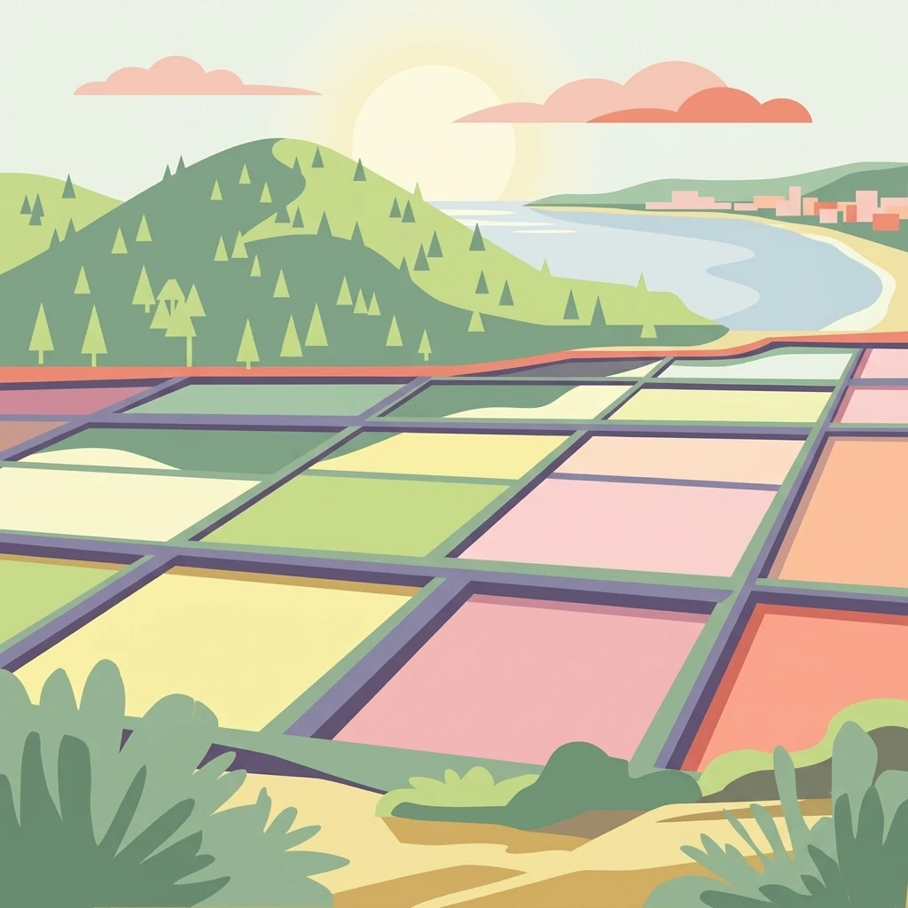
A stylized flat illustration showing a grid of colorful rectangular salt pans in the foreground with a coastal landscape featuring a hill, trees, and sea in the background.

Parque natural de las Salinas

Nature reserve

Park overview

Structured park overview, official facts, and landscape profile for Parque Natural de las Salinas

Parque Natural de las Salinas park facts, protected area profile, and essential visitor context

Review the core facts for Parque Natural de las Salinas, including designation, size, terrain, visitor scale, habitats, and operating context in one park-focused overview.

About Parque Natural de las Salinas

The Parque Natural de las Salinas is a Balearic protected area that bridges two islands and two worlds: the cultural heritage of Mediterranean salt-making and the natural richness of the surrounding shallow sea. Situated at the southern end of Ibiza and the northern part of Formentera, it captures a transitional zone where land, salt pans, dunes, islets, and sea come together in a single, carefully regulated landscape.

The park owes its name and much of its identity to the historical salt pans of the region. Salt harvesting here has been documented since the Phoenician period, and the traditional techniques used in the evaporation ponds have themselves become a defining feature of the local landscape. Over time, these abandoned and active saltworks have evolved into a complex network of shallow lagoons that host specialized vegetation and serve as feeding and resting grounds for many bird species.

The marine component of the park is just as significant. The waters around the small Freus islands between Ibiza and Formentera shelter dense meadows of Posidonia oceanica, a seagrass endemic to the Mediterranean. These meadows stabilize the seabed, clarify the water, and sustain an extraordinary diversity of marine life. Their health directly affects the quality of seawater entering the salt pans, reinforcing the close connection between the cultural and natural values of the site.

As part of the UNESCO World Heritage designation "Ibiza, Biodiversity and Culture," the Salinas park is recognized internationally as an outstanding example of how coastal ecosystems and human history interact. The park stands out not only for its scenic beauty, with white salt flats, turquoise water, and distant islets, but also for the way it preserves a living link between ancient maritime trade routes, traditional island livelihoods, and the conservation of one of the Mediterranean's most prized marine habitats.

Quick facts and research context for Parque Natural de las Salinas

The Parque Natural de las Salinas stretches across the southern tip of Ibiza and the northern part of Formentera, within the Balearic archipelago in the western Mediterranean. It covers a combined terrestrial and marine area, encompassing the historic salt-working landscapes of San José and Formentera as well as extensive shallow marine zones, including the waters around the Es Freus islets.

The park is one of the protected assets of the UNESCO World Heritage site "Ibiza, Biodiversity and Culture," recognized as a mixed cultural and natural property in 1999. Its identity is built on the interplay between traditional salt production, salt-pan ecosystems, and the nearby Posidonia oceanica meadows, which are central to the marine habitat's health.

Protection and recognition

Mixed protection scope and documented conservation recognition details

Parque natural de las Salinas Protection Status and Official Designation Facts

Parque natural de las Salinas maintains a mixed protection scope with structured records covering management guidelines and official designation history. Documented conservation status provides clear reference points for analyzing the environmental framework of the protected territory.

Protection details

Protection scope
Mixed
Park context

Deeper park guide and search-rich context for Parque Natural de las Salinas

Parque Natural de las Salinas history, landscape, wildlife, and travel context

Explore Parque Natural de las Salinas through its history, landscape character, ecosystems, wildlife, conservation priorities, cultural context, and seasonal travel timing in a structured park guide built for atlas discovery and search intent.

Why Parque Natural de las Salinas stands out

The park is most renowned for its traditional salt pans, which have produced salt along this coast since at least the 8th century BCE and still frame the cultural identity of both Ibiza and Formentera. Equally important is the exceptionally well-preserved Posidonia seagrass meadow surrounding the Es Freus islands, a marine habitat widely recognized as one of the most ecologically important in the Mediterranean. These two elements, centuries-old salt-making landscapes and underwater meadows of Posidonia oceanica, are what make the park distinctive. The quality of the traditional salt harvest depends directly on the ecological state of the seagrass, which filters and stabilizes the coastal waters. The result is a tightly intertwined cultural and natural system that has shaped the look, economy, and ecology of the southern Pitiüses for thousands of years.
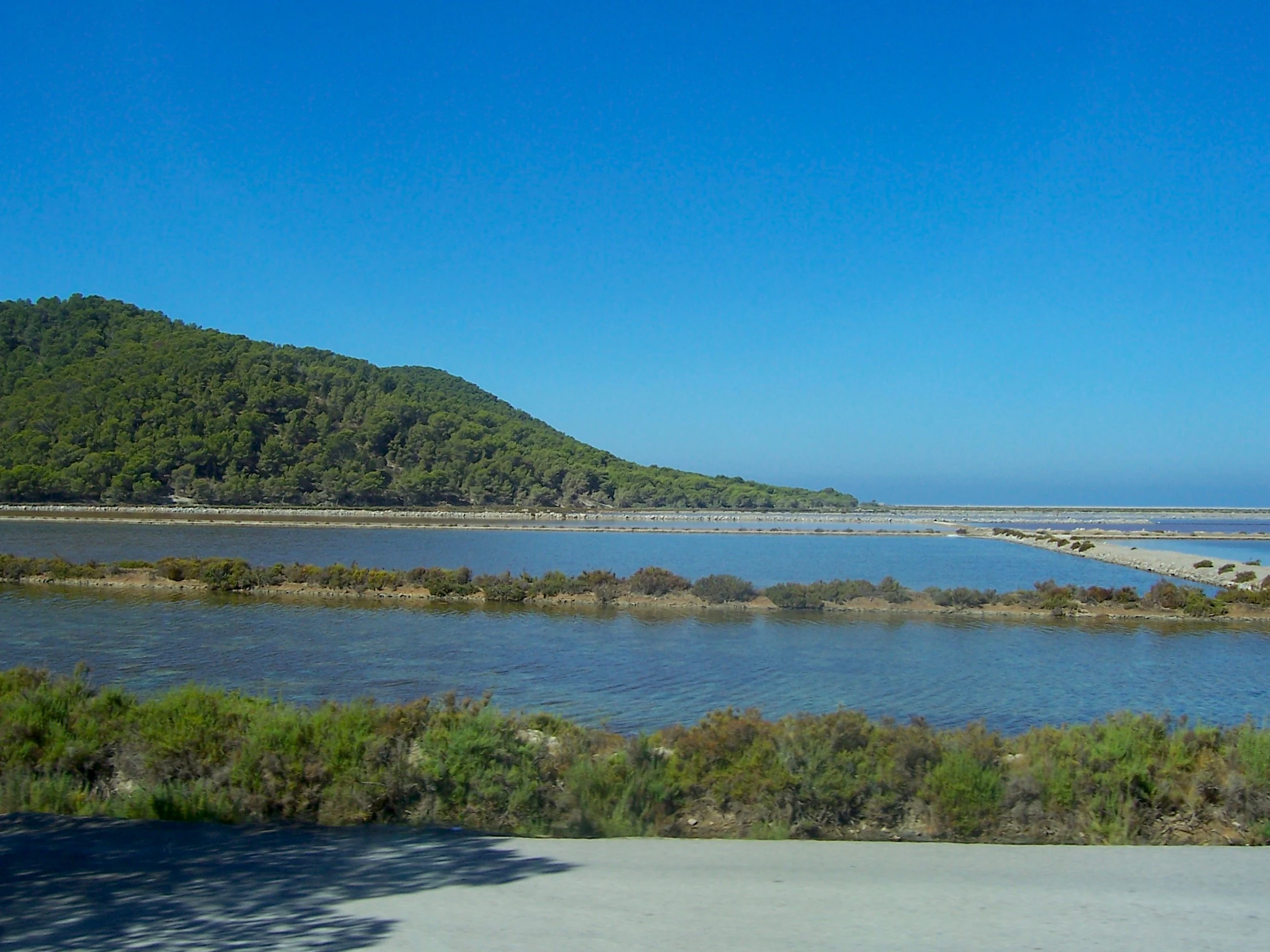
A wide view of calm, shallow salt ponds reflecting the clear blue sky, bordered by low shrubs and a green, tree-covered hillside in the background.
A view of the salt flats at Ses Salines in Ibiza, showcasing the characteristic saline wetlands and surrounding Mediterranean vegetation.

Parque Natural de las Salinas history and protected-area timeline

The Salinas area carries a history that stretches back to antiquity, with salt extraction along the southern coast of Ibiza documented since at least the 8th century BCE. Phoenician settlers recognized both the natural conditions for evaporation and the strategic value of salt as a trade commodity, and the activity continued through Carthaginian, Roman, and later periods of the islands' history.

The importance of this salt trade shaped the broader trajectory of Ibiza. The Phoenician settlement at Sa Caleta, dated to around 650 BCE, is considered the earliest precedent of organized salt commerce in the area. As coastal Ibiza grew in wealth and strategic value, the settlement eventually gave rise to a more substantial fortified town, precursor to the later walled city of Dalt Vila, where layers of Phoenician, Punic, Roman, Islamic, and Catalan occupation accumulated beneath the well-known Renaissance fortifications of the 16th century.

In more recent centuries, the salt pans of San José, on Ibiza, and the northern pans of Formentera continued to operate under traditional methods, preserving a distinctive checkerboard landscape of shallow evaporation basins. The eventual inclusion of the area within the UNESCO World Heritage site "Ibiza, Biodiversity and Culture" in 1999, along with the establishment of the natural park itself, formalized recognition of both the cultural and natural legacy embedded in this working coastal landscape.

Parque Natural de las Salinas landscape and geographic character

The landscape of the Parque Natural de las Salinas is defined by the meeting of low, sun-bleached land and intensely clear Mediterranean water. Along the southern arm of Ibiza and the northern coast of Formentera, the terrain flattens into broad coastal plains where former marshlands and dune fringes remain partly intact. These flatlands host a mosaic of active and inactive salt pans, built as shallow basins separated by low walls, that give the area its characteristic geometric pattern when seen from above.

The islands of Es Freus, scattered between Ibiza and Formentera, form the rocky and low-lying marine front of the park. These small islets and their surrounding waters create a transition zone between the open sea and the more enclosed bays, with sandy bottoms, rocks, and dense underwater meadows. The combination of bright salt flats, pale coastal scrub, and the deep blue-green of the channels between the islands gives the park a strongly Mediterranean coastal character.

Parque Natural de las Salinas ecosystems, habitats, and plant life

Ecologically, the park is structured around two closely linked systems: the terrestrial salt-pan complex on land and the Posidonia-dominated seabed offshore. The salt pans create an unusual gradient of salinities, supporting specialized plant communities adapted to highly saline conditions as well as invertebrates and small crustaceans that in turn attract larger predators, wading birds, and migratory species.

Surrounding the park, the seabed is dominated by the seagrass Posidonia oceanica, whose meadows are considered among the most important in the Mediterranean. These underwater meadows oxygenate the water, stabilize sediments, shelter juvenile fish and invertebrates, and play a critical role in maintaining the clarity and quality of coastal waters. Across the terrestrial part of the park, halo-tolerant vegetation, Mediterranean scrub, and patches of more diversified coastal plant life alternate with the open water surfaces of the evaporation basins.

Parque Natural de las Salinas wildlife and species highlights

The wildlife of the Salinas park reflects its position along a major Mediterranean flyway. The shallow evaporation ponds and coastal lagoons attract a wide variety of waterbirds, including herons, waders, gulls, and terns, as well as seasonal migratory visitors that use the area for resting and feeding during their journeys across the basin.

On land, the mosaic of dunes, scrub, and salt-pan margins supports reptiles, small mammals, and a typical Mediterranean insect fauna. Below the surface, the Posidonia meadows harbor sea urchins, starfish, octopuses, and a wide range of fish, many of which use the meadows as nursery grounds. The interaction between the marine meadows and the salt-pan ecosystem is a defining feature of the park's wildlife, with species moving between habitats as conditions and seasons shift.

Parque Natural de las Salinas conservation status and protection priorities

The Parque Natural de las Salinas is protected for both its cultural and ecological values, with its management reflecting the need to preserve a working salt-making landscape while safeguarding the fragile surrounding marine environment. The park's conservation importance lies largely in the Posidonia meadows, which are increasingly rare elsewhere in the Mediterranean and are central to the ecological balance of the entire south Pitiüses coastline.

Salt-pan maintenance itself is viewed as a conservation tool, because abandoned pans tend to lose their ecological distinctiveness. Traditional harvesting methods preserve a habitat structure that supports specialized flora and fauna. As a component of the UNESCO World Heritage site "Ibiza, Biodiversity and Culture," the park also benefits from international recognition of its role as a model of how long-term human activity can be compatible with the protection of a coastal and marine ecosystem.

Parque Natural de las Salinas cultural meaning and human context

The cultural dimension of the Salinas park is inseparable from its natural one. The name itself reflects a centuries-old economy: salt produced here moved through Phoenician and Carthaginian trade routes, helped sustain later Mediterranean commerce, and shaped the development of Ibiza as a maritime hub. The earliest Phoenician settlement in the islands, at Sa Caleta, is closely tied to the birth of the salt trade, and visible cultural layers from many subsequent eras can be traced in the broader Ibizan landscape.

Equally significant is the continuity of traditional salt-working knowledge passed down through generations of islanders. Methods of channeling seawater, managing evaporation, and coordinating harvests across the San José and Formentera pans form a living cultural heritage, reinforced by the inscription of the area within the UNESCO site. The Freus islets and the southern coast of Ibiza are also closely tied to local identity, combining ancient maritime memory with present-day environmental awareness.

Top sights and standout views in Parque Natural de las Salinas

Among the most distinctive features of the park are the working and historic salt pans of San José and northern Formentera, whose geometric basins have shaped both the economy and the scenery of this coast for millennia. Equally striking is the underwater landscape of Posidonia oceanica meadows encircling the Es Freus islets, an ecosystem that is recognized as one of the Mediterranean's most valuable marine habitats.

The combination of these elements, ancient salt-making, Mediterranean coastal scenery, and a thriving marine ecosystem, gives the park its dual significance. It is both a tangible expression of island cultural heritage and a stronghold of marine and coastal biodiversity, two dimensions that are reflected in its UNESCO recognition and in the continuing importance of salt to the Pitiüses.

Best time to visit Parque Natural de las Salinas

The park has a character that shifts with the seasons, and each period offers a different way to experience it. Spring brings mild weather, lively bird activity, and a fresh greenness to the coastal vegetation, while the still-cool waters of the channel between Ibiza and Formentera are especially clear for observing the marine environment.

Summer offers long days, intense light over the salt flats, and the warmest sea conditions, making it the most popular period for general visits, though it is also when the area is busiest. Autumn softens the light and sees migratory birds passing through, while winter brings quieter conditions, lower visitor numbers, and a more contemplative atmosphere, well suited to observing wildlife and appreciating the cultural landscape without the seasonal crowds.
Monthly climate preview

Long-term representative coordinate measurements for monthly temperature and precipitation patterns

Parque natural de las Salinas Climate Normals and Annual Temperature Rhythm

Recorded baseline data captures the measured annual temperature range and precipitation rhythm across twelve distinct monthly intervals at a representative sample point. Reviewing the complete dataset provides deeper analytical context on long-term temperature averages and monthly precipitation fluctuations.
Annual mean19 °C
13 °C26 °C
Jan13°
Feb13°
Mar14°
Apr16°
May19°
Jun22°
Jul25°
Aug26°
Sep24°
Oct21°
Nov17°
Dec14°
Warmest month
August

26.2 °C

Coolest month
February

12.8 °C

Wettest month
November

2.2 mm/day

Driest month
July

0.2 mm/day

Park location guide

Geography guide, regional context, and park location map for Parque Natural de las Salinas

Parque Natural de las Salinas park geography, regions, and map view in Spain

Understand where Parque Natural de las Salinas sits in Spain through a broader geographic reading of the surrounding landscape, nearby location context, and its mapped position within the national park landscape.

How Parque Natural de las Salinas fits into Spain

Spain, officially the Kingdom of Spain, is a unitary parliamentary constitutional monarchy located in Southern and Western Europe. The country occupies most of the Iberian Peninsula and includes territories in the Mediterranean and Atlantic. With a population of approximately 49.6 million and an area of 506,030 km², Spain is a major European economy and cultural force. Its capital is Madrid, and the country is known for its diverse landscapes ranging from mountainous regions to coastal areas.

Wider geography shaping Parque Natural de las Salinas in Spain

Spain occupies the Iberian Peninsula in Southern and Western Europe. Peninsular Spain is bordered to the north by France, Andorra, and the Bay of Biscay; to the east and south by the Mediterranean Sea and Gibraltar; and to the west by Portugal and the Atlantic Ocean. The territory includes the Canary Islands in the Atlantic Ocean, the Balearic Islands in the Mediterranean Sea, and the autonomous cities of Ceuta and Melilla in mainland Africa. Spain features diverse terrain including the Pyrenees in the northeast, the Sierra Nevada in the south, and the Meseta Central plateau.

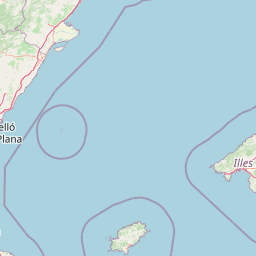
Map view of Parque Natural de las Salinas

Use this park location map to pinpoint Parque Natural de las Salinas in Spain, understand its exact geographic position, and read its mapped placement within the surrounding landscape more clearly.

Pigeon | © OpenStreetMap contributors

Location context for Parque Natural de las Salinas

Islas Baleares

Visual exploration of coastal salt flats, marine meadows, and protected wetland habitats

Parque natural de las Salinas Photos and Landscape Scenery

Visual records capture the striking terrain, traditional salt pans, and clear Mediterranean waters that define the protected landscape of Parque natural de las Salinas. Photographic documentation reveals the intricate coastal environment, wetland habitats, and marine ecosystems supporting the region.

A wide view of calm, shallow salt ponds reflecting the clear blue sky, bordered by low shrubs and a green, tree-covered hillside in the background.

An aerial view showing rectangular salt evaporation ponds divided by levees, next to a coastline and hilly forested terrain.

Park atlas

Compare adjacent Mediterranean coastal landscapes and regional wetland reserves

Parks Near Parque natural de las Salinas and Surrounding Protected Areas

Browse protected areas and coastal reserves situated near Parque natural de las Salinas to examine broader regional ecosystems. Comparing connected marine landscapes provides valuable context on Mediterranean island habitats and wetland geography.
Watercolor painting showing green hills, mountain ranges, and soft pastel skies
Protected areaSpain
About 134 km away#1 closest

East

Cabrera National Park: A Mapped Protected Area in the Balearic Islands

Explore Mediterranean island geography and protected marine ecosystems.

Cabrera National Park, a protected maritime-terrestrial area in Spain's Balearic Islands, offers a unique focus for geographic discovery. This entry details the archipelago's distinct island geography, its mapped coastal and marine ecosystems, and its role within the Mediterranean. Users can explore the park's protected boundaries and understand its place in the regional atlas for a comprehensive view of Spain's island conservation landscapes.

IUCN
II
Scope
Mixed
Water
Water-dominated
Biosphere reserveCatalonia
About 237 km away#2 closest

North

Tierras del Ebro Biosphere Reserve: Geography and Protected Landscapes of Catalonia

A regional atlas of river deltas and mountain massifs

Tierras del Ebro provides a comprehensive look at the environmental variety found in southern Catalonia. From the sediment-rich Ebro Delta to the jagged limestone cliffs of the Ports de Tortosa-Beseit, this region showcases a dramatic transition between riverine plains and Mediterranean mountain terrain within a single protected framework.

Area
3,308 km²
Established
2013
Relief
Mixed relief
Climate
Mediterranean
Watercolor painting showing mountain ranges with snow-capped peaks, green forests, and rolling hills in a scenic landscape
National parkAlgeria
About 306 km away#3 closest

Southeast

Chréa National Park: Algeria's Unique Mountain Landscape and Ancient Cedar Atlas

Explore protected terrain, mapped cedar forests, and unique habitats in the Tell Atlas.

Chréa National Park is a significant protected natural area in Algeria, renowned for its ancient Atlas cedar forests and its position within the mountainous Blidean Atlas range. This national park preserves a unique landscape characterized by dramatic ridgelines, diverse elevations, and critical habitats for species like the Barbary macaque. Its protected status ensures the conservation of these vital ecosystems, offering users a rich resource for understanding Algeria's mountain geography and the distribution of its rare cedar forest ecosystems.

Area
260 km²
Established
1985
IUCN
II
Relief
Mountain
National parkKabylie
About 361 km away#4 closest

Southeast

Djurdjura National Park: A National Park within Algeria's Kabylie Region Landscape

Explore its mapped boundaries and protected area geography.

Djurdjura National Park offers a focused exploration of a key protected landscape in Algeria. As a national park, it serves as a vital point for understanding regional geography and the distribution of conservation lands within Kabylie. Discover the park's mapped extent and its significance as a protected natural area, providing a crucial layer for geographic analysis and atlas exploration.

Area
185 km²
Established
1983
IUCN
II
Visitors
500K annual
National parkAlgeria
About 362 km away#5 closest

South

Théniet El Had National Park: Atlas Cedar Forests in Algeria's Tell Atlas Mountains

Discover protected montane landscape and regional geography.

Théniet El Had National Park represents a significant protected landscape in Algeria, characterized by its towering Atlas cedar forests and dramatic mountainous terrain within the Tell Atlas range. Spanning elevations from 1,200 to over 2,200 meters, this national park offers a distinct example of Mediterranean mountain ecosystems. Its unique forest cover and rugged topography provide crucial habitat and watershed functions, making it a key location for understanding protected area geography and landscape context in North Africa.

IUCN
II
Relief
Mountain
Climate
Mediterranean
Scope
Terrestrial
National parkBéjaïa Province
About 390 km away#6 closest

Southeast

Gouraya National Park: Algeria's Protected Landscape in Béjaïa Province

Discover its mapped boundaries and regional geography.

Gouraya National Park is a designated national park in Algeria, located within the administrative region of Béjaïa Province. This MoriAtlas entry focuses on its protected-area status and geographic identity, providing key details for atlas-driven exploration. Users can understand the park's mapped landscape, its regional context, and its significance as a protected natural area for geographic study and discovery.

Area
20.8 km²
Established
1984
IUCN
II
Visitors
60K annual
Protected areaAndorra
About 393 km away#7 closest

North

Madriu-Perafita-Claror Valley: Geographic Overview of Andorra's Premier Protected Landscape

An examination of glacial landforms and historic mountain heritage.

Spanning nine percent of Andorra, the Madriu-Perafita-Claror Valley remains a rare example of a preserved Pyrenean cultural landscape. This protected area features granite cliffs, glacial cirques, and historic ironworking remnants, offering a deep look into the environmental legacy of mountain societies within a remote, foot-access-only basin.

Area
42.47 km²
Established
2004
Relief
Mountain
Climate
Alpine
Watercolor illustration of a mountainous landscape with a river, green vegetation, and distant peaks under a light sky
National parkProvince of Lleida
About 402 km away#8 closest

North

Aigüestortes i Estany de Sant Maurici National Park: Pyrenean High Mountain National Park Landscape

Explore glacial lakes and winding waterways in Catalonia.

Aigüestortes i Estany de Sant Maurici National Park is a premier national park in the Pyrenees, celebrated for its extensive network of almost 200 glacial lakes and the dramatic natural beauty of the Sant Maurici lake. Its landscape is defined by high mountain terrain, characterized by U-shaped valleys, sharp ridges, and unique hydrological features like the Aigüestortes plain's meandering streams. This protected area in the Province of Lleida offers a rich setting for understanding alpine environments and Pyrenean geography through detailed mapping and atlas exploration.

Area
141 km²
Established
1955
IUCN
II
Visitors
525K annual

Common questions about visiting, size, designation, and location context for Parque Natural de las Salinas

Parque Natural de las Salinas FAQs for park facts, access, geography, and protected area context

Find quick answers about Parque Natural de las Salinas, including protected-area facts, park geography, trail and visitor context, and how the park fits into its surrounding country and regional landscape.
MoriAtlas Explorer

Continue Your Protected Areas Search Across the Global Atlas

Deepen your exploration by continuing the structured search for national parks and protected areas worldwide. Utilize the comprehensive filtering capabilities to compare different conservation landscapes and refine your understanding of global park geography. Discover more about the distribution and characteristics of protected natural areas.

Global natural geography