
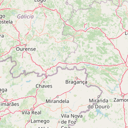
Streams
Park geography
Analyzing the 695.93 square kilometer mountain terrain, forest habitats, and natural features.
Comprehensive Geographic Profile and Mapped Boundaries of Peneda-Gerês National Park in Portugal
The geographic profile for Peneda-Gerês National Park provides a structured overview of this Portuguese protected landscape. It covers the 695.93 square kilometer territory, including recorded mountain peaks like Rocalva, forest habitats, and prominent water features such as the Cascata do Arado and various springs.
Portugal's oldest national park where Atlantic and Mediterranean ecosystems meet beneath dramatic granite peaks
Peneda-Gerês National Park
Peneda-Gerês National Park is Portugal's oldest and only national park, established in 1971 to protect a spectacular mountainous landscape in the country's northern highlands. The park occupies approximately 696 square kilometres spanning the districts of Viana do Castelo, Braga, and Vila Real, forming a natural amphitheatre of granite peaks, deep valleys, and pristine rivers along the border with Spain. Its name derives from the two dominant mountain ranges—Serra da Peneda and Serra do Gerês—that anchor the protected area, complemented by the lesser but equally striking Serra Amarela and Serra do Soajo. The park occupies a remarkable biogeographical crossroads where Atlantic and Mediterranean climate systems converge, creating a zone of exceptional ecological richness. The granitic mountain massifs, formed during the Variscan orogeny between 380 and 275 million years ago, have been sculpted by subsequent glacial activity into the dramatic U-shaped valleys, polished rock surfaces, and moraines visible throughout the highlands. These ancient rocks host a complex of watersheds including the Lima, Cávado, and Homem rivers, whose tributaries cascade through steep valleys creating numerous waterfalls that rank among the park's most beloved features. Beyond its natural significance, the park encompasses a living cultural landscape where approximately 9,000 residents continue traditional agro-pastoral practices in scattered villages that have shaped the terrain for millennia. The region bears traces of human presence dating to 6000 BCE, including remarkable megalithic tombs and the well-preserved Roman road known as the Geira, which once connected the Roman cities of Astorga and Braga across these mountain passes.
- Location
- Portugal
- Park type
- National park
- Established
- 1971
- Area
- 695.9 km²
- Highest point
- 1,545 m
Location overview
Factual national park classification and territorial mapping in Portugal
Geographic Location of Peneda-Gerês National Park in Portugal
Peneda-Gerês National Park is situated entirely within Portugal as a landlocked conservation area. Registered geographic records confirm its status as an inland, non-transboundary protected territory.
- Countries
- Portugal
- Primary location
- Portugal
- Geographic setting
- Inland
Boundary and coordinates
A 258.12 km perimeter frames the park’s stored northern Portugal geometry
Peneda-Gerês National Park boundary maps 695.93 km²
Peneda-Gerês National Park’s entity, fact and boundary-area values all state 695.93 km²; the mapped polygon centres near 41.85047° N, 8.13251° W and extends from 8.39861° to 7.87304° W and 41.67220° to 42.08278° N. Its calculated perimeter is 258.12 km; Agreement between area fields does not turn the atlas geometry into a cadastral or legal survey.
- Boundary area
- 695.9 km²
- Boundary perimeter
- 258.1 km
- Northernmost point
- 42.0828° N
- Southernmost point
- 41.6722° N
- Easternmost point
- 7.873° W
- Westernmost point
- 8.3986° W
- Geographic centre
- 41.8505° N, 8.1325° W
- North–south span
- 45.6 km
- East–west span
- 43.6 km
Elevation and terrain
Recorded vertical relief limits, mountain peaks, streams, and forest features
Peneda-Gerês National Park Elevation Range and Mountain Terrain Geography
Peneda-Gerês National Park features a recorded mountain elevation summary reaching up to 1546 meters across its protected terrain. Linked feature cards provide names, types, measurements, and spatial relationships for recorded natural elements located within the boundaries.
- Maximum elevation
- 1,546 m
- Highest point
- 1,545 m
Selected named natural features
Peaks
Cornos de Candela
1,267 m
Waterfalls
Cascatas de Fecha de Barjas
Forests
Carvalhal do Beredo
Peaks
Alto de Gontim
1,204 m
Streams
Ribeira da Lama Chã
Environmental setting
Temperate climate zones, forest cover, and mountain relief profiles
Peneda-Gerês National Park Environmental Setting and Landscape Classifications
Recorded habitat types and landscape features serve as interpretive categories for reading the physical terrain. Stored environmental classifications link directly to relevant protected area destinations within the atlas.
- Relief
- Mountain
- Climate
- Temperate
- Water
- Major water bodies
- Forest cover
- Mostly forested
- Seasonality
- Year-round
Landscape features
Mountains · Valleys · Forest · Rivers · Waterfalls · Cliffs
Habitat types
Temperate broadleaf forest · Riverine habitat · Wetland · Grassland
Park atlas
Trace Portugal's regional park geography and protected landscapes adjacent to Peneda-Gerês National Park
Explore Other National Parks and Protected Areas Near Peneda-Gerês National Park in Portugal
Browse nearby national parks and protected areas that share the granitic mountain architecture, glacial valleys, and cultural landscapes found around Peneda-Gerês National Park. Compare these diverse protected landscapes to understand the broader Iberian biogeographical frontier and discover how human history shapes its unique natural heritage.
Biosphere reserveGalicia
11 km away#1 closest
Northeast

Área de Allariz Biosphere Reserve: Mapping the Protected Landscapes of Inland Galicia
Exploring the river basins, granitic massifs, and ecological frontiers
The Área de Allariz biosphere reserve serves as a vital transition zone in northwestern Spain, characterized by its flat-floored tectonic basin, the River Limia, and varied highland terrain. This protected area offers an instructive look at the integration of traditional rural land management with large-scale ecological recovery and conservation across its core, buffer, and transition zones.
- Area
- 214.82 km²
- Established
- 2005
- Relief
- Mixed relief
- Scope
- Terrestrial
Protected areaPortugal
36 km away#2 closest
Southeast

Alvão Natural Park Protected Area: Atlas Exploration of Northern Portugal's Mountain Geography
Discover dramatic landscapes and mapped terrain.
Alvão Natural Park is a protected area in northern Portugal distinguished by its stark geological contrasts: upper granite plateaus and steep schist lowlands. This unique geography supports diverse ecosystems and features the impressive Fisgas de Ermelo waterfall. Explore the park's mapped boundaries and its role as a significant protected landscape within the region, offering rich context for any geographic exploration.
- Area
- 72.03 km²
- Established
- 1983
- IUCN
- V
- Visitors
- 29.6K annual
Protected landscapeEsposende
46 km away#3 closest
Southwest
Northern Littoral Natural Park Protected Landscape: Geographic Discovery and Atlas Context
Mapped protected areas and regional landscape discovery near Esposende.
Uncover the geographic identity of Northern Littoral Natural Park, a key protected landscape situated near Esposende. This MoriAtlas entry focuses on its mapped boundaries and regional significance, providing a factual basis for understanding its role within Portugal's network of protected areas. Explore the park's natural terrain and its context within the broader geography of the Norte region for comprehensive atlas-based discovery.
- Area
- 87.62 km²
- Established
- 1987
- IUCN
- V
- Relief
- Lowland
National parkGalicia
47 km away#4 closest
Northwest
Atlantic Islands of Galicia National Park: Protected Archipelagos & Galician Coastline Geography
Explore mapped island ecosystems and protected marine areas.
Uncover the protected landscape of the Atlantic Islands of Galicia National Park, Spain's only national park in Pontevedra province. This atlas entry details the four distinct archipelagos, Cíes, Ons, Sálvora, and Cortegada, across the Rías Baixas. Discover the unique sea-land protected area, its rare bay laurel forests, significant seabird colonies, and the broader regional geography of Galicia.
- Area
- 84.8 km²
- Established
- 2002
- IUCN
- II
- Visitors
- 472.3K annual

Protected landscapeBragança District
56 km away#5 closest
East
Montesinho Natural Park: Protected Landscape in Bragança District, Portugal
Explore mapped boundaries and regional landscape context.
Montesinho Natural Park is designated as a protected landscape in northeastern Portugal, located within the administrative region of Bragança District. This page serves as an entry point to understanding the park's protected area characteristics, its mapped geographic footprint, and its role in the broader natural landscape of the Trás-os-Montes region. Discover the atlas value of this significant protected territory and its relation to surrounding geography.
- Area
- 742.25 km²
- Established
- 1979
- IUCN
- V
- Relief
- Mountain
Biosphere reserveGalicia
90 km away#6 closest
North
Reserva de la biosfera de las Tierras del Miño: Mapped Landscapes and Geographic Overview
Extensive riverine forests and wetland networks in northwestern Spain
Explore the expansive territory of Reserva de la biosfera de las Tierras del Miño, spanning a large portion of the Galician interior. This protected area features a mosaic of wetlands, riparian corridors, and mountainous terrain, offering a deep look into the ecological and cultural geography of the upper Miño river basin.
- Area
- 3,636.69 km²
- Established
- 2002
- Relief
- Lowland
- Scope
- Terrestrial
Biosphere reserveGalicia
101 km away#7 closest
North
Reserva de la biosfera de las Mariñas Coruñesas y Tierras del Mandeo: Regional Geography and Maps
A diverse protected area across Galicia, Spain
This biosphere reserve serves as a vital ecological refuge along the Cantabrian-Atlantic coast. The protected area features a unique mosaic of marine and terrestrial habitats, ranging from rocky coastal cliffs and sandy estuaries to dense Atlantic forest fragments and the mountainous interior of the Sierra de la Cova da Serpe.
- Area
- 1,139.7 km²
- Established
- 2013
- Relief
- Mixed relief
- Climate
- Temperate
Biosphere reserveLugo
114 km away#8 closest
Northeast
Reserva de la Biosfera de Los Ancares Lucenses y Montes de Cervantes, Navia y Becerreá Protected Area Map
Mountainous terrain and river valley geography in Lugo, Spain
This protected area covers the dramatic Sierra de Ancares, featuring steep mountain slopes and deep river valleys that define the geography of Galicia. The reserve spans a significant vertical relief, providing essential habitats for brown bears and capercaillie while preserving traditional rural mountain land use systems and ancient forest ecosystems.
- Area
- 536.64 km²
- Established
- 2006
- Relief
- Mountain
- Climate
- Temperate
MoriAtlas Explorer
Continue Mapping Peneda-Gerês National Park's Geographic and Protected Landscape Context
Delve deeper into the atlas of Peneda-Gerês National Park to understand its unique position within Portugal's geography. Examine the mapped boundaries of this protected landscape, its geological features, and the interplay of its Atlantic-Mediterranean ecosystems. Discover the rich natural and cultural heritage that defines this significant national park, offering a foundation for broader geographic and protected-area exploration.
Browse next
Global natural geography
Explore related park routes
Explore MoriAtlas Global ParksBrowse All MoriAtlas ParksGlobal Park Map DiscoveryMoriAtlas: Browse All CountriesBrowse All MoriAtlas ContinentsNational Park Environment AtlasGrand Canyon National Park AtlasYellowstone National Park AtlasYosemite National Park Atlas and GeographySerengeti National Park AtlasGalápagos National Park Protected LandscapeBanff National Park Geography and AtlasKruger National Park Atlas EntryUluṟu-Kata Tjuṯa National Park AtlasExplore Uluru-Kata Tjuta National Park GeographyPlitvice Lakes National Park AtlasFiordland National Park Protected LandscapeGreat Smoky Mountains National Park AtlasAfghanistan National Parks and Protected AreasAlbania National Parks and Protected AreasAlgeria National Parks and Protected AreasAmerican Samoa National Parks and Protected AreasAndorra National Parks and Protected AreasAngola National Parks and Protected AreasAntarctica National Parks and Protected AreasAntigua and Barbuda Park List