

Mori Atlas logo
Protected areaPoole Harbour

Examining the complex mosaic of mudflats, seagrass meadows, and heathland within this expansive coastal ria system

Poole Harbour Protected Area: Geographic Overview of a Drowned River Valley and Coastal Wetland in Dorset

Poole Harbour is a distinct coastal ria in southern England, formed by the flooding of the River Frome valley. As a critical protected area in Dorset, it features an intricate network of shallow bays, islands, and intertidal zones that support internationally significant wetland habitats. This atlas record provides a comprehensive view of the harbor's unique landscape composition, from the fringe of the Purbeck Hills to its complex estuarine channels.

natural harbourriaestuaryDorset coastsalt marshmudflat
A flat-design vector illustration of a coastal estuary landscape with a forested island in the center, winding channels of water, and surrounding woodlands with ferns in the foreground, under a pale sun.

Poole Harbour

Protected area

Park overview

Structured park overview, official facts, and landscape profile for Poole Harbour

Poole Harbour park facts, protected area profile, and essential visitor context

Review the core facts for Poole Harbour, including designation, size, terrain, visitor scale, habitats, and operating context in one park-focused overview.

About Poole Harbour

Poole Harbour is a coastal inlet on the south coast of England, lying within the county of Dorset and opening eastwards into the English Channel through a narrow entrance between Sandbanks and Studland. The harbour is principally an estuary of the River Frome, with additional inputs from the River Piddle, the Corfe River, and the Sherford River, all of which together drain into a single sheltered system of bays, channels, and tidal flats that spreads inland toward Wareham.

Geologically, the harbour occupies a band of weak gravel and clay between the chalk ridges of the Purbeck Hills and Isle of Wight to the south and the Dorset Downs and South Downs to the north. Before the last ice age the Frome continued east into what is now the Solent, but rising sea levels and changing drainage patterns ultimately severed this connection, leaving Poole Harbour as a high-quality example of a ria, or drowned river valley. The result is a very shallow but expansive harbour, broad enough to give it claims to being among the larger natural harbours in the world, but shallow enough to require careful channel management for navigation.

Ecologically, the harbour is the centre of gravity for its identity. Extensive intertidal mudflats and salt marshes fringe much of the shoreline, while sheltered inlets such as Holes Bay, Lytchett Bay, Arne Bay, Brands Bay, and Newton Bay provide a mosaic of brackish and freshwater-influenced habitats. The southern shore is dominated by open heathland and conifer plantations associated with the Wareham Forest, while the harbour's islands create quieter refuges that support specialist wildlife. Brownsea Island, Furzey Island, Green Island, Long Island, and Round Island each contribute to a network of habitats that the harbour's conservation efforts depend upon.

While the harbour continues to function as a working port with cross-Channel ferry services, fishing activity, and a wide range of recreational boating, the management balance is unusually delicate. The Poole Harbour Commissioners coordinate shipping, dredging, and safety, while a range of conservation bodies oversee the wildlife interest. The result is a place where industrial archaeology, maritime tradition, and large-scale ecological protection coexist on a single piece of coast, making Poole Harbour far more than simply the seaport serving the town of Poole.

Quick facts and research context for Poole Harbour

Poole Harbour covers roughly 36 square kilometres of sheltered coastal water along the Dorset coast of southern England, opening eastward to the English Channel. It is a drowned river valley (ria), formed at the end of the last ice age when sea level rise flooded the lower course of the River Frome and its tributary system. The harbour is exceptionally shallow on average, with a single dredged navigation channel serving the Port of Poole, Brownsea Island ferries, and other commercial traffic.

The harbour has been designated as a Ramsar Wetland of international importance and borders several national nature reserves, including Studland and Godlingston Heath NNR, alongside reserves managed by the National Trust and RSPB. Its intertidal and brackish habitats support internationally important populations of common shelduck, pied avocet, and black-tailed godwit, while the inner islands retain one of the southern English strongholds of the red squirrel. Poole Harbour sits within the broader Poole-Bournemouth conurbation on its northern shore, while its southern and western shores are dominated by open heathland and protected coastal landscapes.

Protection and recognition

Documented conservation status, designation year, and Ramsar wetland listings

Poole Harbour Protection Status and International Recognition Data

Comprehensive protected area records outline the conservation scope, mixed management status, and designated history established in 1999 for Poole Harbour. Verified international recognition sources include official Ramsar wetland listings for the regional boundary.

International recognition

Protection details

Protection scope
Mixed
Designated year
1999
Transboundary protection
No
Park context

Deeper park guide and search-rich context for Poole Harbour

Poole Harbour history, landscape, wildlife, and travel context

Explore Poole Harbour through its history, landscape character, ecosystems, wildlife, conservation priorities, cultural context, and seasonal travel timing in a structured park guide built for atlas discovery and search intent.

Why Poole Harbour stands out

Poole Harbour is best known as a large, shallow, ecologically rich coastal harbour whose combination of mudflats, salt marshes, seagrass meadows, fringing heathlands, and wooded islands make it one of the most important coastal wildlife sites in southern England. It carries an international designation as a Ramsar wetland and supports internationally significant populations of common shelduck, pied avocet, and black-tailed godwit, while its islands shelter one of the region's rare red squirrel populations. The harbour is also well known for being a classic example of a ria, the drowned valley of the River Frome, with an entrance framed by the Sandbanks peninsula and Studland beach. Its quiet waters, dense island complex, and network of bays and channels give it a distinctive character that sets it apart from the more open Poole Bay outside the harbour mouth and from the deep-water harbours further east along the south coast.
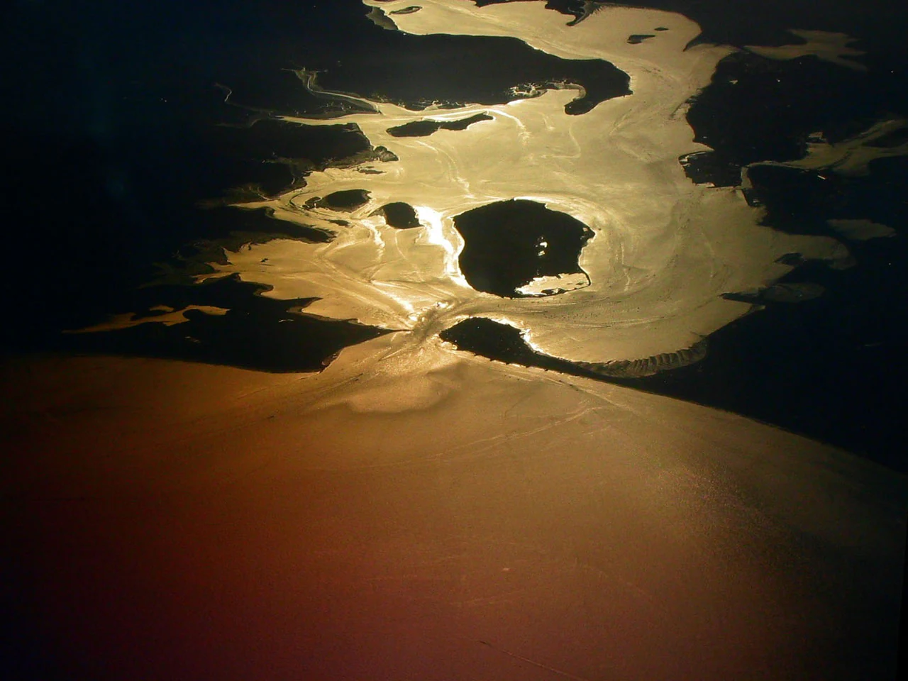
An aerial view of Poole Harbour at sunset, showing reflective waterways and several islands silhouetted against a golden, shimmering water surface.
Aerial view of Poole Harbour at sunset, highlighting its characteristic islands and winding waterways.

Poole Harbour history and protected-area timeline

Poole Harbour has been a focus of human activity for at least two thousand years, well before the medieval expansion of the town of Poole on its shores. In 1964 the waterlogged remains of the Iron Age Poole Logboat were recovered during harbour dredging near Brownsea Island. Dated to around 295 BC and measuring roughly ten metres in length, it is one of the largest logboats ever found in British waters and reflects the early use of the harbour for quiet, sheltered movement in small vessels.

During the Roman period the harbour became an invasion port for the conquest of southern Britain, and a Roman settlement was established at Hamworthy on its western shore. A Roman road ran north from Hamworthy through a fort at Lake Farm toward Badbury Rings, suggesting Poole Harbour sat at the start of an inland route as well as serving as a maritime gateway. By the time of the Norman Conquest the settlement at Poole was still a small fishing village, but its fortunes changed in the medieval period when in 1433 Poole was designated Dorset's Port of the Staple for the export of wool. Medieval Poole traded across a wide arc from the Baltic regions through to Italy.

In the seventeenth century the town began trading with North America, especially Newfoundland, and by the eighteenth century Poole was the principal British port for that trade. At the start of the nineteenth century roughly ninety per cent of Poole's employment was directly dependent on the harbour, but the arrival of railways and the increased use of deep-hulled vessels gradually shifted trade eastwards to Southampton. The harbour retained significance through dredging campaigns, notably a major 2005 deepening of the approach channels, while continuing to host cross-Channel ferries, marina traffic, and an active fishing fleet. The twentieth century also saw military use, including seaplane operations during the Second World War, and the harbour continues to host the RNLI's Poole training school. A notable contemporary event was the significant oil spill in March 2023, involving a pipeline from the Wytch Farm oil field, which was described by the Environment Agency as a major incident.

Poole Harbour landscape and geographic character

Poole Harbour is a shallow, low-lying coastal system viewed against the much higher chalk landscapes that frame it. To the south the chalk ridge of the Purbeck Hills rises above the harbour's southern heathlands, while to the north the chalk of the Dorset Downs and South Downs forms the broader landscape backdrop. The harbour itself lies in a belt of weaker gravels and clays that were preferentially eroded by river and marine action and then flooded at the end of the last ice age.

The surface of the harbour is strikingly flat. Extensive mudflats are exposed at low tide, and banks of salt marsh line many of the inlets. Sandy sediments occur particularly toward the harbour entrance, around Sandbanks and Studland, and there are seagrass meadows in the more sheltered waters. The harbour has an average depth of less than half a metre, and only one main dredged channel runs from the entrance near Sandbanks and Studland inland toward the Port of Poole and Holes Bay.

Within the harbour the landscape is shaped by numerous islands and nested bays. Brownsea Island sits close to the harbour entrance, with Furzey Island and Green Island extending southwards into the harbour. Long Island and Round Island are found near the Arne Peninsula. On the mainland side, Arne Bay, Newton Bay, Brands Bay, and the Wareham Channel create a complex western and southern coastline, while Parkstone Bay and Holes Bay indent the more urbanised northern shore. Lytchett Bay opens off the northern edge of the harbour near Hamworthy, fed by the Sherford River. The combined effect is a landscape where water, mudflat, marsh, heath, and woodland interleave at a relatively small scale, producing a richly varied coastal scenery few other harbours in southern England can match.
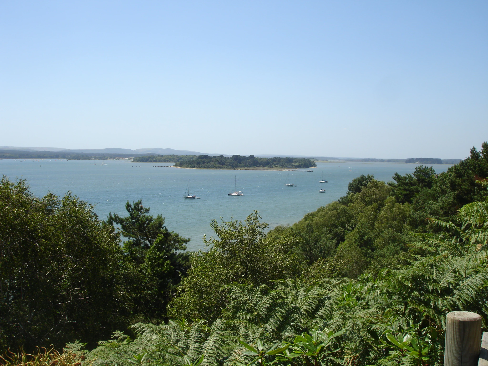
A wide angle view from a wooded hillside looking out over the calm water of Poole Harbour with several small islands and distant low hills under a clear blue sky.
A view across the sheltered waters of Poole Harbour, showing nearby islands and distant mainland coastline.

Poole Harbour ecosystems, habitats, and plant life

The ecological character of Poole Harbour is built around the interplay between open marine water, extensive intertidal sediments, salt marsh, and fringing terrestrial habitats. Its mudflats and salt marshes are among the most extensive on the south coast of England, and they grade into muddy and sandy shores along the more sheltered bays. Seagrass meadows occur in the subtidal zone, providing important habitat structure in the otherwise shallow and often turbid waters.

On land, the harbour is bordered by extensive areas of open heathland, particularly on its southern side around Wytch Heath, Godlingston Heath, and the Arne Peninsula, with conifer plantations forming a more recent land-cover layer around Wareham Forest and along the southern shore. These heathlands grade into the harbour's wetlands at their edges, creating transition zones that are particularly rich in invertebrates and supporting the bird populations for which the harbour is internationally important.

The harbour sits within a wider network of formal conservation designations. It borders three national nature reserves, including the internationally important Studland and Godlingston Heath NNR, and there are numerous local and non-statutory reserves managed by bodies such as the National Trust and the RSPB, notably the Arne RSPB reserve. The harbour itself is a designated Ramsar Wetland, recognising its global significance for waterbirds and wetland habitats. The combination of statutory site protection, practical management by conservation organisations, and integration with active harbour uses makes the ecological system unusually layered, with measures in place to manage recreational pressure and protect sensitive habitats from erosion and disturbance.
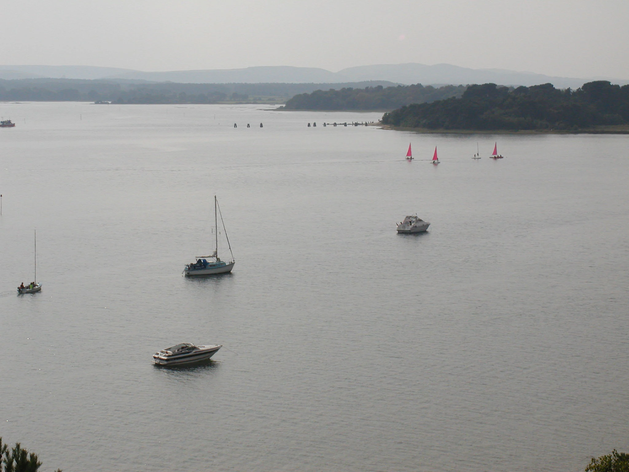
A hazy, elevated view across a large, calm harbour with several sailboats, motorboats, and small red-sailed vessels visible on the water.
A wide view of Poole Harbour featuring various recreational boats on the water.

Poole Harbour wildlife and species highlights

Poole Harbour is internationally renowned for its birdlife, particularly the populations of migratory and wintering waterbirds that depend on its mudflats, salt marshes, and shallow waters. Three species occur here in numbers of international importance: common shelduck, pied avocet, and black-tailed godwit. These form the basis for the harbour's formal recognition as a Ramsar wetland and underpin much of its conservation effort.

Other notable bird visitors and residents add to the harbour's significance for ornithology. Spoonbills occur as seasonal visitors, and Sandwich terns and Eurasian whimbrels are also recorded in important numbers. Little egrets, once a rarity in the region, are now seen regularly and in growing numbers around the harbour. Of particular recent significance is the return of ospreys as breeding birds: in 2022 ospreys nesting in Poole Harbour produced the first egg in southern England in modern times and the first successful hatch in roughly two hundred years, with subsequent breeding activity continuing in later years despite setbacks such as predation at the nest.

Terrestrial wildlife is equally distinctive. The harbour's islands, particularly Brownsea Island and the surrounding smaller islands, support one of the most important red squirrel populations in southern England, isolated from the grey squirrels that dominate further north and east. Heathland species associated with the southern shore include invertebrates, reptiles, and breeding birds typical of lowland heath. Marine and intertidal fauna, including fish, shellfish, and the diverse invertebrate communities of the mudflats, sustain both the ecosystem and the small-scale fishing activity that still operates from the harbour.
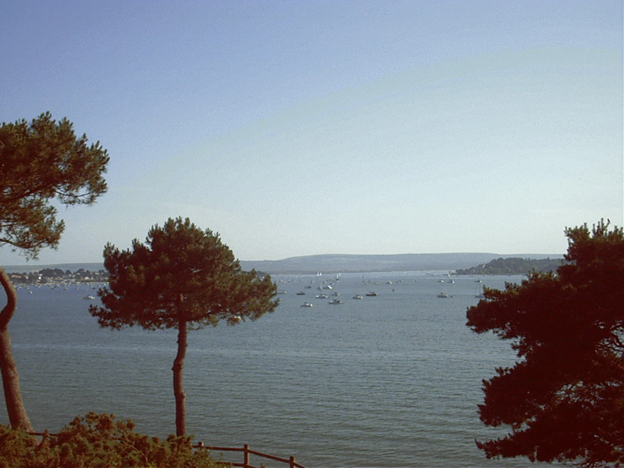
A wide view across a large harbour filled with small boats, framed by pine trees in the foreground, with rolling hills in the background.
A view across the waters of Poole Harbour with distant hills on the horizon.

Poole Harbour conservation status and protection priorities

As a formally designated Ramsar Wetland since 22 July 1999, Poole Harbour sits within a small group of British coastal sites recognised as being of international importance for waterbird conservation. The Ramsar designation reflects the harbour's combination of size, habitat diversity, and internationally significant species populations, and is the principal marker of the harbour's standing in international conservation policy.

The harbour's protected status is reinforced by an unusually dense network of surrounding nature reserves. It borders three national nature reserves, including Studland and Godlingston Heath NNR, and is encircled by a series of local and non-statutory reserves managed by the National Trust, the RSPB, and other conservation organisations, with the Arne RSPB reserve a particularly prominent example. The islands within the harbour also receive focused conservation attention, especially for their red squirrel population. National and local planning policy, along with the work of the Poole Harbour Commissioners, integrates habitat protection with harbour navigation and ports operations.

Key conservation themes include managing the impact of recreational pressure around popular wildlife sites, balancing oil and gas infrastructure at Wytch Farm with wetland protection, and maintaining water quality and intertidal habitat integrity. The 2023 oil spill from the Wytch Farm field highlighted the vulnerability of this balance and underlined the importance of the harbour's protected status as a tool for driving remediation and accountability. Long-term concerns include rising sea levels, which threaten low-lying gravel features such as Stone Island and the integrity of the harbour's intertidal habitats, alongside continuing pressures from tourism, watersports, and urban expansion around the northern shore.

Poole Harbour cultural meaning and human context

Poole Harbour has shaped human settlement along this part of the Dorset coast for at least two millennia. The Iron Age Poole Logboat demonstrates that people were already using the harbour for local water transport long before any town emerged on its shores, and the Roman choice of Hamworthy as a port of invasion reflects the strategic value of its sheltered, easily defended shoreline.

The harbour is deeply woven into the identity of Poole itself. The town's medieval designation as Dorset's Port of the Staple, its seventeenth and eighteenth-century role as a leading British port trading with North America, and its present-day identity as a yachting centre all derive from this relationship with the water. The harbour's fishing traditions, ferry links, and marina culture remain active threads of local cultural life, alongside rowing and sailing clubs, RNLI operations, and heritage trails laid out by Poole Tourism. Wartime memory also runs through the harbour's story, with the Second World War seaplane bases and later naval activity leaving a less visible but still significant cultural imprint.

Top sights and standout views in Poole Harbour

Among the most distinctive features of Poole Harbour is its status as one of the clearest examples of a coastal ria in southern England, a drowned river valley whose broad, shallow waters are framed by chalk ridges inland and by low-lying islands and spits at its mouth. The harbour's mosaic of mudflats, salt marshes, seagrass meadows, heathland, and woodland gives it an unusually rich habitat diversity for a single coastal unit.

Its wildlife highlights are considerable: international populations of shelduck, avocet, and godwit; a recovered breeding population of ospreys; and one of southern England's most important red squirrel refuges. Its human highlights include the historic Port of Poole, Brownsea Island and its ferry connections, the active network of sailing and yacht clubs, and the long sequence of maritime heritage from Iron Age logboat to twenty-first century cross-Channel ferry.

Best time to visit Poole Harbour

Poole Harbour offers a different character through the year, and the most rewarding times to visit reflect the seasonal cycles of its wildlife and landscape. Late spring and summer bring active breeding bird seasons, including the ospreys that have nested in the harbour in recent years, alongside warmer conditions suitable for sailing, ferry crossings, and exploring the islands and heathland on foot.

Autumn and winter are perhaps the most significant periods for the harbour's ornithological identity. It is during the colder months that the internationally important populations of common shelduck, pied avocet, and black-tailed godwit are present in their highest numbers, and the soft light over the exposed mudflats emphasises the harbour's natural character. Migrant species such as spoonbill and whimbrel are also more likely to be encountered at these times. Throughout the year, weather and tidal conditions shape access to low-lying paths and exposed mudflats, and the most rewarding visits generally align with calm conditions on the water and softer light over the open landscape.

Monthly climate preview

Long-term representative point measurements tracking monthly temperature and precipitation rhythms in Dorset

Poole Harbour Climate Normals and Measured Annual Temperature Patterns

Long-term representative records for Poole Harbour document a measured temperature range spanning mean monthly lows around 7 degrees Celsius and highs reaching 21 degrees alongside shifting daily precipitation rates. Examining the full twelve-month profile provides complete historical averages for month-by-month temperature and precipitation comparisons.
Annual mean12 °C
7 °C17 °C
Jan
Feb
Mar
Apr
May12°
Jun14°
Jul17°
Aug17°
Sep16°
Oct14°
Nov11°
Dec
Warmest month
August

17.2 °C

Coolest month
February

7.1 °C

Wettest month
November

3.4 mm/day

Driest month
July

1.6 mm/day

Park location guide

Geography guide, regional context, and park location map for Poole Harbour

Poole Harbour park geography, regions, and map view in United Kingdom

Understand where Poole Harbour sits in United Kingdom through a broader geographic reading of the surrounding landscape, nearby location context, and its mapped position within the national park landscape.

How Poole Harbour fits into United Kingdom

The United Kingdom is a parliamentary constitutional monarchy located in northwestern Europe, consisting of four constituent countries: England, Scotland, Wales, and Northern Ireland. As a major global power with over 69 million residents, it maintains significant international influence in politics, economics, and culture.

Wider geography shaping Poole Harbour in United Kingdom

The United Kingdom is an island nation located in northwestern Europe, surrounded by the Atlantic Ocean, North Sea, English Channel, Celtic Sea, and Irish Sea. It shares a land border with the Republic of Ireland to the west. The territory includes the island of Great Britain, the northeastern portion of Ireland, and most of the smaller British Isles islands.

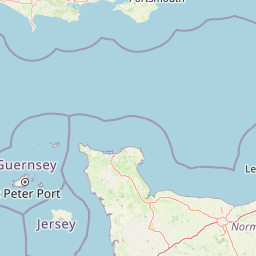
Map view of Poole Harbour

Use this park location map to pinpoint Poole Harbour in United Kingdom, understand its exact geographic position, and read its mapped placement within the surrounding landscape more clearly.

Pigeon | © OpenStreetMap contributors

Location context for Poole Harbour

DorsetEngland
Recorded earthquake history

Browse the Historical Earthquake Catalogue for Poole Harbour

Investigate the documented seismic history of the Poole Harbour region through this structured catalogue of recorded events. These data points provide insight into past activity near the coastline, allowing for focused exploration of regional earthquake records tracked by distance from the harbour.

Poole Harbour Earthquake History

Catalogued events

2 events

Strongest magnitude

Magnitude 3.8

Most recent event

May 19, 2019

This history includes earthquakes recorded inside the park or within 50 km of its borders

Explore visual records of intertidal mudflats, salt marshes, and protected wetland terrain.

Poole Harbour Photos and Landscape Scenery: Visualizing Coastal Habitats

Visual documentation captures the complex coastal topography of Poole Harbour, detailing intertidal mudflats, salt marshes, and fringing heathlands across the Dorset coastline. Photographic records illustrate the distinctive morphology of this drowned river valley, offering clear insight into its protected wetland environments.

An aerial view of Poole Harbour at sunset, showing reflective waterways and several islands silhouetted against a golden, shimmering water surface.

A low, tree-covered island sits in the middle of calm harbor water under a clear blue sky, with visible sandy banks along the waterline.

A wide angle view from a wooded hillside looking out over the calm water of Poole Harbour with several small islands and distant low hills under a clear blue sky.

A hazy, elevated view across a large, calm harbour with several sailboats, motorboats, and small red-sailed vessels visible on the water.

A wide view across a large harbour filled with small boats, framed by pine trees in the foreground, with rolling hills in the background.

Park atlas

Compare adjacent wetland habitats, lowland heathlands, and regional coastal reserves

Exploring Parks Near Poole Harbour and Surrounding Coastal Protected Areas

Browse nearby national parks and protected landscapes to examine how southern England coastal ecosystems compare to the sheltered tidal mudflats of Poole Harbour. Extending geographic analysis across adjacent river valleys and chalk ridge reserves uncovers broader regional conservation patterns.
Protected areaEngland
Park boundaries overlap#1 closest

West

Dorset Heaths: Protected Lowland Landscapes and Regional Geography in Southern England

A comprehensive look at the Poole Basin heathland mosaic.

Spanning the Poole Basin, the Dorset Heaths offer a distinct geographic profile of acidic sands and diverse ecological mosaics. This protected area includes rare valley mires and coastal dunes, providing a clear window into the natural landscape history and ongoing conservation efforts within southern England's coastal regions.

Area
616.62 km²
Established
1998
Relief
Lowland
Water
Major water bodies
Watercolor painting of a coastline with rolling green cliffs meeting the sea, with small pink flowers in the foreground.
Protected landscapeUnited Kingdom
2 km away#2 closest

West

Jurassic Coast Protected Landscape: Geological Mapping and Coastal Atlas

A comprehensive look at sedimentary formations in the United Kingdom

Trace the 96-mile stretch of the Jurassic Coast, a protected landscape revealing Triassic, Jurassic, and Cretaceous rock layers. The terrain serves as a vital record of Earth history, featuring distinctive geomorphological landmarks like Chesil Beach and the towering cliffs of Golden Cap, all defined by the dynamic interaction of land and sea.

Established
2001
Relief
Upland
Climate
Temperate
Access
Easy access
Watercolor painting showing a landscape with green and purple vegetation, a body of water, and distant hills.
National parkEngland
17 km away#3 closest

Northeast

New Forest National Park: Historic Protected Landscape and Regional Geography in England

Mapped heathland, ancient woodlands, and pastoral traditions.

Explore New Forest National Park, a nationally significant protected area in England renowned for its unique blend of ancient royal forest history, traditional pastoral practices, and biologically rich lowland habitats. This page provides an atlas-focused view of its mapped boundaries, distinctive terrain, and geographic context within England, highlighting its value as a living landscape shaped by centuries of common grazing rights and supporting rare wildlife.

Area
566 km²
Established
2005
IUCN
V
Visitors
14.8M annual
Natural monumentIsle of Wight
About 24 km away#4 closest

East

The Needles Natural Monument: Coastal Chalk Geography and Protected Marine Landscapes

Geological formations and chalk headland terrain on the Isle of Wight

The Needles represents a unique geological intersection of vertical chalk strata and maritime history at the edge of the Isle of Wight. This protected area encompasses dramatic sea stacks, clifftop heathland, and critical marine habitats, offering a window into the complex coastal landscape of the English Channel and the regional geology of southern England.

Relief
Upland
Climate
Temperate
Access
Easy access
Scope
Mixed
Watercolor illustration of a coastal landscape featuring green hills, white cliffs, and a body of water
National parkSouth East England
54 km away#5 closest

East

South Downs National Park: A Distinctive Chalk Landscape in South East England's Atlas

Iconic chalk downland, coastal cliffs, and mapped terrain.

South Downs National Park is a premier protected landscape in South East England, celebrated for its unique chalk downland terrain and dramatic coastal formations. This page provides detailed geographic context for the park, highlighting its rolling hills, dry valleys, and ancient woodlands. Discover the park's mapped boundaries and its significance within England's protected areas, offering a structured atlas view for landscape exploration.

Area
1,627 km²
Established
2010
IUCN
V
Visitors
18M annual
Watercolor painting of a wetland landscape featuring a winding river, rolling green hills, and soft-focus trees under a light sky.
Protected landscapeSomerset
57 km away#6 closest

Northwest

Somerset Levels Protected Landscape: Geographic Mapping and Wetland Terrain Analysis

A low-lying coastal plain and historic wetland basin in Somerset

Examine the distinct topography of the Somerset Levels, where flat horizons, pollarded willows, and ancient drainage channels create a unique English landscape. This protected area offers deep insight into prehistoric archaeology, including preserved Neolithic trackways, alongside modern wetland conservation of international significance within a rural basin.

Area
650 km²
Established
1997
Relief
Lowland
Climate
Temperate
Watercolor painting depicting a landscape with rolling hills, a winding road, and distant mountains
National parkUnited Kingdom
95 km away#7 closest

Northwest

Exmoor National Park: A Premier Protected Landscape in South West England for Atlas Exploration

Mapped terrain, moorland, and dramatic coastal geography.

Discover Exmoor National Park, a vast protected area in South West England celebrated for its sweeping heather moorland, dramatic coastline with the highest sea cliffs on mainland Britain, and deep, ancient wooded valleys. This national park offers a unique landscape for atlas-based exploration, revealing its distinct geography, mapped boundaries, and rich terrain shaped by centuries of natural processes and human activity.

Area
692 km²
Established
1954
IUCN
V
Visitors
1.4M annual
Marine protected areaWest Sussex
About 104 km away#8 closest

East

Kingmere Marine Conservation Zone: Protected Marine Geography and Chalk Reef Landscapes

Submerged chalk cliff systems and rocky reefs in West Sussex

The Kingmere Marine Conservation Zone protects an unusual underwater landscape of chalk ridges and rocky outcrops within the English Channel. Stretching between Littlehampton and Worthing, this area serves as a vital spawning ground and exhibits some of the finest chalk reef features in European waters.

Area
47 km²
Established
2013
Relief
Lowland
Climate
Temperate

Common questions about visiting, size, designation, and location context for Poole Harbour

Poole Harbour FAQs for park facts, access, geography, and protected area context

Find quick answers about Poole Harbour, including protected-area facts, park geography, trail and visitor context, and how the park fits into its surrounding country and regional landscape.
MoriAtlas Explorer

Continue Your Protected Areas Search Across the Global Atlas

Deepen your exploration by continuing the structured search for national parks and protected areas worldwide. Utilize the comprehensive filtering capabilities to compare different conservation landscapes and refine your understanding of global park geography. Discover more about the distribution and characteristics of protected natural areas.

Global natural geography