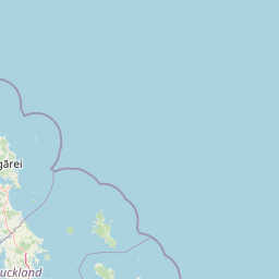
Why Poor Knights Islands stands out
The Poor Knights Islands are best known for their extraordinary marine environment, where warm subtropical currents meet the deep offshore setting of northern New Zealand. The waters around the islands support an unusual mix of temperate and tropical species, dramatic drop-offs, arches, and caves that have made the area one of the most celebrated dive sites in the Southern Hemisphere. Equally distinctive is the island landscape itself: towering cliffs, natural sea arches, and Rikoriko Cave, the largest sea cave by volume in the southern hemisphere. Above the tide line, the islands are recognized as a globally important seabird breeding site and as the natural home of the Poor Knights lily, one of New Zealand's most striking native plants.
Poor Knights Islands history and protected-area timeline
The Poor Knights Islands were earlier inhabited by Māori of the Ngāti Wai and Ngāti Toki tribes, who cultivated crops on the islands and used them as a base for fishing and trade. The islands were part of an active coastal economy in which goods were exchanged between iwi across the wider Northland region.
This era ended abruptly in December 1823. While the islands' warriors were away on a fighting expedition to the Hauraki Gulf alongside the Ngā Puhi chief Hongi Hika, a chief named Waikato of the Hikutu tribe led an attack on the undefended islands. Many of those who remained jumped from the high cliffs rather than be taken as slaves, and the survivors were evacuated to Rawhiti in the Bay of Islands. The islands were declared tapu and never permanently resettled, leaving them uninhabited from the 1820s onward.
The ecological recovery and modern protection of the islands followed slowly. Feral pigs, which had roamed Aorangi throughout the uninhabited period, were eradicated in 1936. The islands themselves were formally protected as a nature reserve in 1975, and the surrounding waters were later designated as the Poor Knights Islands Marine Reserve. Today landings are restricted, and the islands are managed primarily for conservation and scientific research.
Poor Knights Islands landscape and geographic character
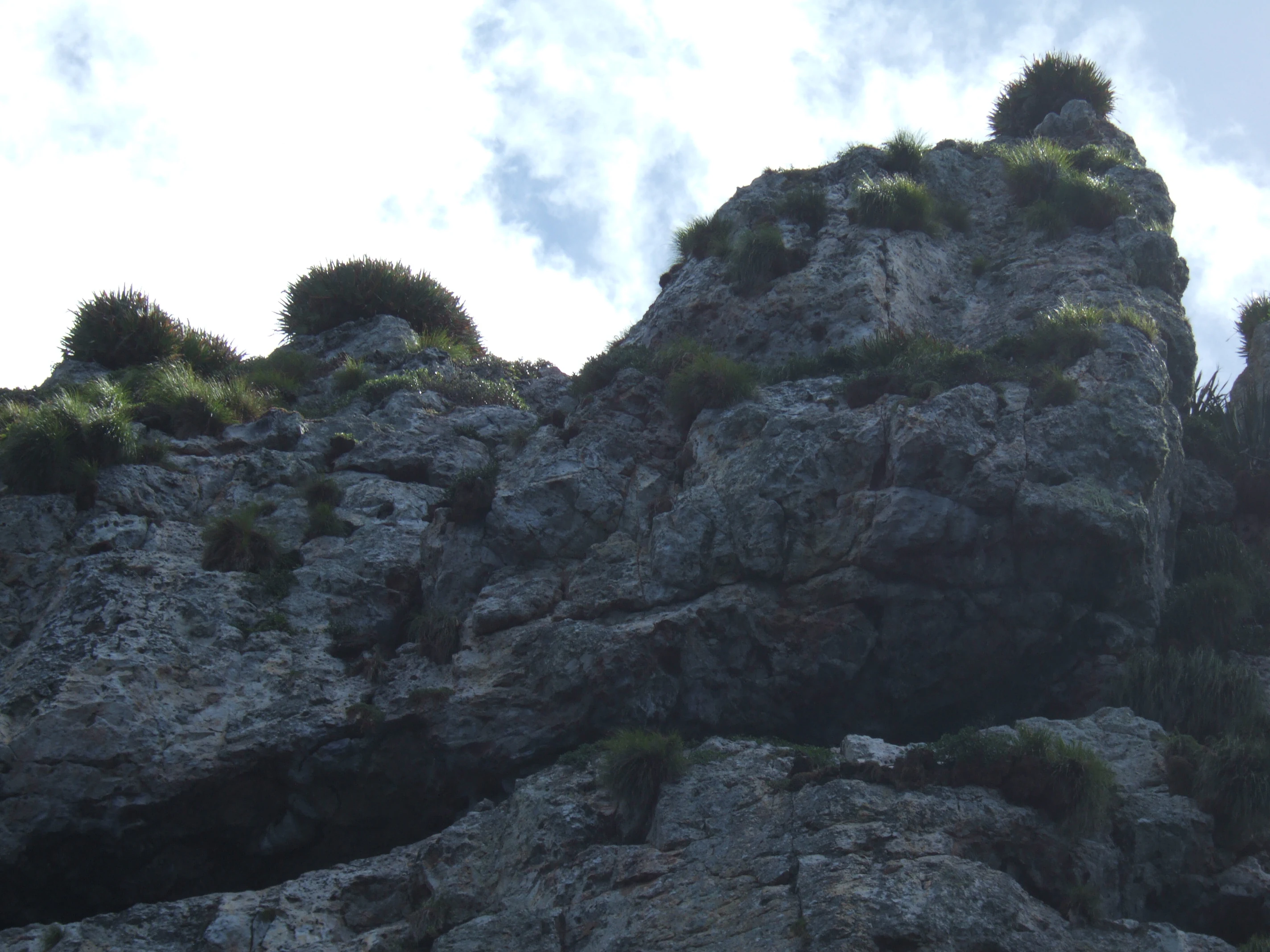
The Poor Knights Islands rise sharply from deep offshore water as a chain of rugged, cliff-bound land masses. Their profiles are dominated by steep sea cliffs, narrow ridges, and rocky shorelines shaped by long exposure to wind and ocean. Between and around the main islands lie smaller features such as Archway Island, Aorangaia, and Ngoio Rock, all of them carved into dramatic shapes by waves and erosion.
The volcanic origin of the chain is the key to its scenery. Built from rhyolitic eruptions around 10 million years ago, the original shield volcano is estimated to have reached roughly 1,000 meters in height and 25 kilometers in diameter. What remains today is its deeply eroded core, expressed in the cliffs, pinnacles, arches, and amphitheater-like bays that draw divers, naturalists, and tour boats.
The most striking individual landscape features are the natural arches and sea caves. Rikoriko Cave, with its vast chamber and wide entrance, is the largest sea cave by volume in the southern hemisphere. Nearby, the Northern Arch, Middle Arch, and Maomao Arch on Tawhiti Rahi, together with the Cathedral Arch on Archway Island, create a landscape where the islands themselves feel almost like portholes between open ocean and sheltered water.
Poor Knights Islands ecosystems, habitats, and plant life
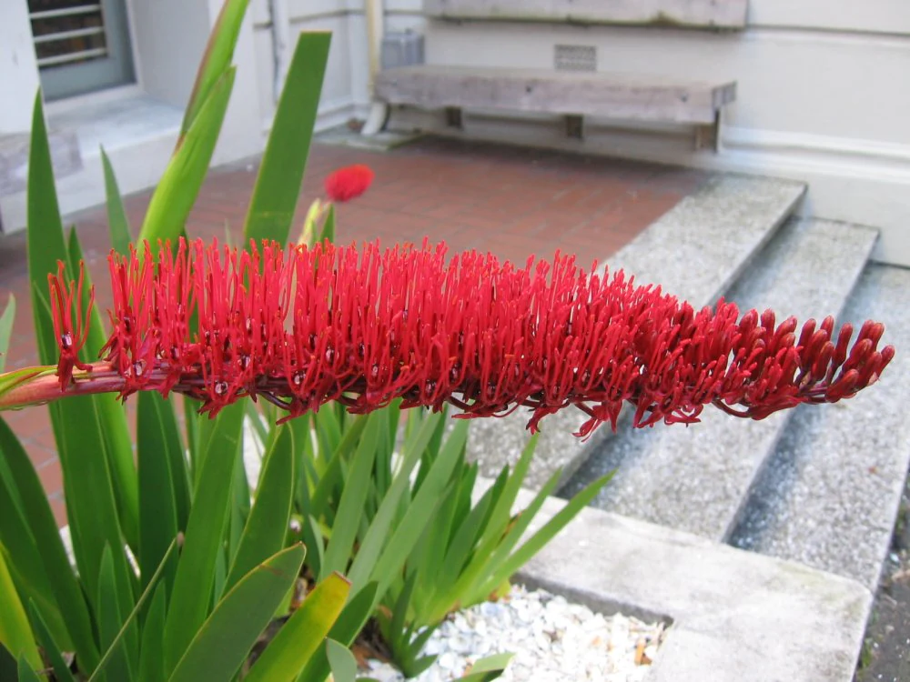
The isolation and protection of the Poor Knights Islands have shaped an unusually intact island ecosystem. Vegetation covers the more sheltered slopes and ridges, while cliffs and exposed rock fall away directly into the sea. A notable native species anchored to the islands is the Poor Knights lily, a spectacular flowering plant with brush-like red inflorescences that has become emblematic of the islands' botanical identity and is widely cultivated beyond its native range.
Feral pigs once trampled parts of Aorangi for more than a century after the Māori departure, but their removal in the mid-twentieth century allowed vegetation to recover. Today the islands' habitat mosaic supports nesting seabirds, forest remnants on sheltered slopes, and coastal plant communities that grow in a climate influenced by warm offshore currents.
The marine environment surrounding the islands is equally natural in character, since the Poor Knights Islands Marine Reserve extends protection below the tide line. Deep water, strong internal tides, and clean oceanic flushing support kelp forests, sponge gardens, and reef communities influenced by subtropical species that rarely venture further south around the New Zealand coast.
Poor Knights Islands wildlife and species highlights
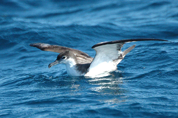
The Poor Knights Islands are recognized internationally as an Important Bird Area by BirdLife International, primarily because of their enormous breeding colony of Buller's shearwaters. An estimated 200,000 pairs nest on the islands, making the chain one of the most significant seabird breeding sites in the wider Australasian region. Other seabirds also frequent the cliffs and rocky slopes, contributing to a sustained presence of pelagic birdlife around the islands year-round.
The marine reserve is the other pillar of the islands' wildlife significance. The convergence of deep water, internal tidal waves, and subtropical influences creates habitat for fish, invertebrates, and reef species that might otherwise be absent from this latitude. The mix of temperate and tropical marine life is one of the reasons the Poor Knights have become so closely associated with New Zealand's underwater biodiversity.
Mammal life on the islands themselves is minimal, reflecting more than two centuries without human occupation and the active removal of introduced species like pigs. The very low level of disturbance helps explain why the islands can support such dense seabird colonies and such well-recovered vegetation patterns.
Poor Knights Islands conservation status and protection priorities
The Poor Knights Islands sit at the center of one of New Zealand's most layered conservation efforts. The land area is administered as a strict nature reserve, classified under IUCN Category Ia, with landings requiring a permit and generally limited to scientific research. Feral pigs were removed from Aorangi in 1936, allowing the vegetation to recover, and the islands have since been managed to maintain low disturbance and high habitat integrity.
Marine conservation is equally central to the islands' identity. The Poor Knights Islands Marine Reserve protects the waters immediately around the chain, extending the reserve concept below the tide line. Together, the island reserve and the marine reserve form a combined refuge covering land, seabird breeding habitat, kelp forest communities, and deep reef systems that would otherwise be exposed to fishing pressure.
International recognition reinforces this protection. The islands' status as a BirdLife International Important Bird Area reflects their global importance for Buller's shearwaters, while the broader marine reserve has drawn scientific attention because of the unusual presence of subtropical species in temperate waters. The combined result is a protected area whose conservation value lies as much below the water as it does above it.
Poor Knights Islands cultural meaning and human context
For the Māori iwi of the Northland coast, the Poor Knights Islands — known as Tawhiti Rahi — hold a deep and sometimes painful place in regional memory. They were once a habitat and a home, supporting cultivation, fishing, and intertribal trade, particularly for the people of Ngāti Wai and Ngāti Toki. The islands were closely tied to mainland iwi through kinship, trade routes, and seasonal fishing expeditions.
The events of December 1823, when Waikato of the Hikutu tribe attacked the undefended islands, marked a turning point. Many residents chose to leap from the cliffs rather than be enslaved, and those who survived were evacuated. The islands were declared tapu, and although the geological landforms still bear their Māori names, the islands have never been permanently inhabited again.
Today the islands are part of an evolving Northland coastal identity, in which natural heritage, marine tourism, and continuing iwi connections to the wider coast coexist. Dive operations depart from nearby Tutukaka, and the islands are often discussed as a meeting point between natural values and the long history of human presence along this stretch of the North Island.
Top sights and standout views in Poor Knights Islands
The Poor Knights Islands combine volcanic landforms, marine wilderness, and seabird colonies in a setting that is unusually compact and unusually well preserved. The cliffs of Tawhiti Rahi and Aorangi, framed by large arches and massive sea caves, give the chain its unmistakable silhouette, while the marine reserve below extends the sense of wilderness into the water itself.
The islands' biological highlights are equally distinctive. The Poor Knights lily has become a botanical emblem of the chain, and the sheer numbers of Buller's shearwaters breeding on the islands give the Poor Knights a global profile among bird researchers. Below the surface, divers encounter walls, arches, and caves populated by a striking mix of temperate and subtropical marine species.
Above all, what sets the Poor Knights apart is the feeling of an entire island ecosystem that has been allowed to recover and persist. Two centuries without permanent human habitation, combined with active pest control and a long-standing reserve status, have produced a place that feels both remote and ecologically vivid.
Best time to visit Poor Knights Islands
The Poor Knights Islands can be experienced through diving and boat tours departing primarily from Tutukaka, and conditions vary with the seasons in ways that shape both the above-water scenery and the underwater experience. Summer tends to bring the calmest seas, warmest surface water, and the longest days for photography, diving, and exploring arches and caves by boat.
Outside the peak summer months, cooler water temperatures and more variable weather are typically offset by softer light, fewer visitors, and notable seasonal seabird activity. Divers in particular often favor shoulder periods when underwater visibility can remain exceptionally high. Because landings are restricted, virtually all visits are weather-dependent boat excursions, and most travelers plan around settled sea conditions rather than any specific calendar month.