Mori Atlas logo
National parkPort Royal National Park

Discover the mapped boundaries and unique geographic context of this National Park.

Port Royal National Park: Protected Landscape Atlas and Regional Geography on Roatán

Port Royal National Park represents a significant protected area on the island of Roatán, Honduras. As a designated National Park, its boundaries are mapped to delineate a distinct natural landscape within the region. This page serves as an entry point for understanding the park's geographic identity, its place within Roatán's broader terrain, and its role in the structured atlas of protected lands.

Caribbean IslandsNational ParkCoastal Protected AreaTropical ForestHondurasRoatán

Port Royal National Park

National park

Park overview

Structured park overview, official facts, and landscape profile for Port Royal National Park

Port Royal National Park park facts, protected area profile, and essential visitor context
Review the core facts for Port Royal National Park, including designation, size, terrain, visitor scale, habitats, and operating context in one park-focused overview.

About Port Royal National Park

Port Royal National Park occupies a coastal position on the eastern end of Roatán, the largest island in Honduras' Bay Islands archipelago. This Caribbean island, situated approximately 65 kilometers from the mainland Honduran coast, features a landscape shaped by tropical processes and Caribbean environmental conditions. The park's 5-square-kilometer extent includes coastal terrain and extends inland from the southern shoreline.

Roatán's geography is characterized by a mountainous interior rising from coastal plains, with the island reaching elevations of over 200 meters above sea level in some areas. The surrounding marine environment benefits from proximity to the Mesoamerican Barrier Reef, which runs along the Caribbean coast of Central America. This reef system creates productive waters around the island that support diverse marine life and contribute to the ecological significance of coastal protected areas like Port Royal.

The national park designation provides legal protection for the natural landscapes within its boundaries, establishing it as part of Honduras' network of protected areas. The park contributes to national conservation goals while offering potential for environmental education and sustainable recreation. Roatán itself has developed as a destination for scuba diving and snorkeling due to its reef access, and the presence of protected areas like Port Royal supports the long-term health of these marine resources.

Quick facts and research context for Port Royal National Park

Port Royal National Park spans 5 square kilometers on the south shore of Roatán island's eastern end in Honduras. The park was established in 2010 and holds IUCN protected area category II designation as a national park. Roatán is the largest of the Bay Islands archipelago located in the Caribbean Sea off Honduras' northern coast. The park protects a section of the island's tropical coastline and associated inland areas.

Park context

Deeper park guide and search-rich context for Port Royal National Park

Port Royal National Park history, landscape, wildlife, and travel context
Explore Port Royal National Park through its history, landscape character, ecosystems, wildlife, conservation priorities, cultural context, and seasonal travel timing in a structured park guide built for atlas discovery and search intent.

Why Port Royal National Park stands out

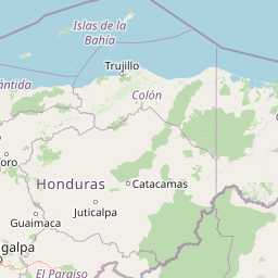
Port Royal National Park is known for protecting a segment of Roatán's tropical island landscapes within Honduras' Bay Islands region. The park encompasses coastal ecosystems along the island's southern shore, where Caribbean tropical forests meet the reef-rich marine environment. It represents one of Honduras' designated national parks on its Caribbean islands, contributing to the country's system of protected areas that include both mainland and island environments.

Port Royal National Park history and protected-area timeline

Port Royal National Park was established in 2010, making it one of the more recent additions to Honduras' national park system. The park's creation reflected growing recognition of the ecological value of Honduras' Caribbean island environments and the need to designate protected areas that could preserve both terrestrial and coastal ecosystems.

Honduras has progressively expanded its protected areas network since the mid-20th century, with national parks and other protected categories being established across diverse environmental regions ranging from cloud forests on the mainland to coastal and marine areas. The designation of Port Royal as a national park in 2010 placed it within the IUCN Category II framework, indicating management objectives focused on ecosystem conservation alongside opportunities for visitor enjoyment of natural landscapes.

The selection of Roatán's eastern end for the protected area acknowledged the concentration of natural values in that portion of the island. The park's location along the southern shore places it in an area where coastal processes, marine influences, and terrestrial environments interact to create distinctive island ecosystems.

Port Royal National Park landscape and geographic character

Port Royal National Park encompasses the tropical coastal landscape characteristic of Roatán's eastern end. The terrain transitions from the shoreline, where Caribbean waves meet the island's coast, into interior areas that support tropical vegetation. The landscape reflects the combination of geological processes that formed the island and the ongoing influence of tropical climate and marine conditions.

Roatán's underlying geology consists largely of volcanic and metamorphic bedrock, with the island forming part of the larger geological structure of the Bay Islands. Coastal areas feature beaches and rocky shores depending on local conditions, while the inland areas rise into rolling terrain with vegetation cover typical of Caribbean tropical forests. The park's position on the southern coast exposes it to maritime influences from the Caribbean Sea.

The visual character of the landscape combines the deep greens of tropical vegetation with the blue tones of Caribbean waters. Coastal views from the park extend across the sea toward the horizon, while inland trails would pass through forest environments typical of the island's eastern region. This tropical island scenery represents the natural heritage that the protected area helps to preserve.

Port Royal National Park ecosystems, habitats, and plant life

The natural environment within Port Royal National Park reflects the Caribbean island ecosystem context of Roatán. Tropical forests cover much of the island's interior, with species compositions adapted to the warm, humid conditions of the Caribbean lowlands. The proximity to the Mesoamerican Barrier Reef links the park's terrestrial and marine environments, creating an ecological continuum from coastal vegetation through nearshore waters.

Roatán supports biodiversity characteristic of Caribbean islands, including numerous bird species, reptiles, and invertebrates adapted to island environments. The surrounding reef waters contain fish, corals, and other marine organisms that depend on the protected coastal zone indirectly through habitat connectivity. Mangrove areas, where they occur along the coast, provide important ecological functions including shoreline stabilization and nursery habitat for marine species.

The park's protection of coastal and interior areas ensures that representative examples of the island's natural systems remain in relatively natural condition. This conservation approach supports ecological processes and species populations that depend on intact habitats, contributing to the broader goal of maintaining Caribbean island biodiversity.

Port Royal National Park wildlife and species highlights

Wildlife in and around Port Royal National Park reflects the Caribbean island biota of Roatán. The island supports resident bird species including various songbirds, parrots, and seabirds that utilize the diverse habitats found on Roatán. The forest interior provides nesting and foraging habitat for avian species, while coastal areas attract birds associated with marine environments.

Reptiles including anoles and other lizards are present in the island's terrestrial habitats, along with amphibians adapted to the tropical conditions. Invertebrate diversity includes numerous insect species and other arthropods that fill ecological roles throughout the island's ecosystems. The surrounding marine environment supports reef fish, invertebrates, and occasional marine turtles that may approach the coast.

The wildlife community represents a subset of Central American and Caribbean species adapted to island conditions. Isolation has shaped the evolution of island species, creating distinctive populations that differ somewhat from mainland relatives. Conservation of areas like Port Royal helps maintain the habitats these species require.

Port Royal National Park conservation status and protection priorities

Port Royal National Park contributes to Honduras' conservation framework by protecting a portion of the country's Caribbean island natural heritage. The national park designation provides legal recognition of the area's ecological values and establishes management objectives focused on preservation of natural landscapes and biodiversity.

The park exists within a broader context of protected areas across Honduras, which includes numerous national parks, wildlife refuges, and other designations across the country's varied environmental regions. From the Moskitia rainforest in the east to the cloud forests of the western highlands, Honduras maintains a system of protected areas addressing diverse ecosystems. Port Royal represents the island component of this network, protecting coastal and terrestrial environments that differ from the mainland protected areas.

Conservation of Caribbean island environments addresses specific challenges including development pressure, tourism expansion, and the need to balance economic use with environmental protection. Protected areas like Port Royal provide anchor points for conservation while allowing for sustainable use of natural resources where appropriate. The park's coastal location also implies connections to marine conservation, as island ecosystems are intimately linked between terrestrial and marine components.

Port Royal National Park cultural meaning and human context

Roatán, where Port Royal National Park is located, has a cultural history shaped by its position in the Caribbean. The island has been influenced by indigenous peoples, colonial powers, and more recent waves of development. The name Port Royal itself reflects historical naming practices in the region, with various Caribbean locations carrying names referencing naval or colonial associations.

The Bay Islands have a distinctive cultural character influenced by English-speaking populations, reflecting historical connections to British Honduras and the broader English-speaking Caribbean. This cultural dimension distinguishes Roatán from the Spanish-speaking mainland of Honduras and contributes to the island's unique identity. The local population includes both long-resident families and more recent arrivals, creating a community with mixed cultural influences.

Traditional land uses on Roatán have included agriculture, fishing, and more recently tourism development. The establishment of protected areas like Port Royal represents a modern approach to balancing use of natural resources with conservation of areas considered to have exceptional natural value. This reflects broader trends in environmental protection while acknowledging the importance of natural environments to both ecological function and community identity.

Top sights and standout views in Port Royal National Park

Port Royal National Park preserves a representative sample of Roatán's tropical island landscapes along the Caribbean coast of Honduras. The park's 5-square-kilometer extent includes coastal areas where Caribbean waters meet the island's shoreline, transitioning into interior tropical forests. Established in 2010, it represents a relatively recent addition to Honduras' national park system and reflects growing recognition of the value of island protected areas. The park's location on the southern coast of Roatán's eastern end positions it within the broader ecological context of the Mesoamerican Barrier Reef region. Visitors to the area encounter Caribbean island scenery distinct from mainland Central America, with combinations of coastal, forest, and marine environments that characterize this part of Honduras.

Best time to visit Port Royal National Park

Port Royal National Park can be visited year-round given its tropical island location in the Caribbean. The warm climate of Roatán provides relatively consistent conditions throughout the year, with temperatures typically ranging from the mid-20s to low 30s Celsius. The island experiences a wet season generally from October through February and a drier period during the summer months, though rainfall can occur in any season.

Visitor experience may vary with seasonal conditions, with the drier months potentially offering more consistent outdoor conditions while the green season brings lush vegetation and different visual character to the landscape. The summer months coincide with higher tourist activity on Roatán due to school holiday periods in North America, while the shoulder seasons may offer fewer crowds. Marine activities in the surrounding Caribbean waters are generally possible year-round, with water temperatures remaining warm throughout the year.

Park location guide

Geography guide, regional context, and park location map for Port Royal National Park

Port Royal National Park park geography, regions, and map view in Honduras
Understand where Port Royal National Park sits in Honduras through a broader geographic reading of the surrounding landscape, nearby location context, and its mapped position within the national park landscape.

How Port Royal National Park fits into Honduras

Honduras, officially the Republic of Honduras, is a Central American nation with a predominantly Mestizo population. It gained independence in 1821 and operates as a unitary presidential republic. The country faces significant economic challenges, with over 70% of its population living in poverty, though it possesses valuable natural resources including minerals, coffee, and tropical fruits.

Wider geography shaping Port Royal National Park in Honduras

Honduras is located in Central America, bordering Guatemala to the west, El Salvador to the southwest, Nicaragua to the southeast, the Pacific Ocean to the south at the Gulf of Fonseca, and the Caribbean Sea to the north at the Gulf of Honduras. The terrain includes mountainous regions and coastal lowlands.

Map view of Port Royal National Park

Use this park location map to pinpoint Port Royal National Park in Honduras, understand its exact geographic position, and read its mapped placement within the surrounding landscape more clearly.

Pigeon | © OpenStreetMap contributors

Location context for Port Royal National Park

Roatán
Park atlas

Browse other national parks and protected areas, tracing the unique Caribbean island ecosystems of Roatán and Honduras' Bay Islands.

Explore National Parks and Protected Areas Near Port Royal National Park, Roatán
From Port Royal National Park, browse other national parks and protected areas across Roatán, the wider Bay Islands, and the Caribbean coastal regions of Honduras. Gain essential geographic context by comparing similar island ecosystems and protected landscapes, tracing the regional spread of conservation efforts within the Mesoamerican Barrier Reef.
National parkColón Department

Capiro Calentura National Park: Honduran National Park Atlas and Protected Landscape

Discover mapped geography and protected area context in Colón Department.

Access detailed geographic information and mapped boundaries for Capiro Calentura National Park, a key protected area within Honduras' Colón Department. This entry offers an atlas-style perspective on the park's landscape and its regional setting, supporting structured discovery of national parks and conservation lands.

Area
80.82 km²
Established
1992
IUCN
II
Climate
Tropical
National parkHonduras

Jeannette Kawas National Park: A Protected Landscape within Honduran Geography

Explore the mapped boundaries and regional setting of this national park.

Jeannette Kawas National Park is a vital protected area whose geographic identity is central to understanding the natural landscape of Honduras. This page serves as a detailed exploration point, focusing on the park's mapped boundaries and its role within the country's protected lands atlas. Discover the unique aspects of this national park's terrain and its contribution to regional geographic context, providing a factual basis for atlas-driven learning.

Area
781.62 km²
Established
1994
IUCN
II
Relief
Highland
National parkAtlántida Department

Punta Izopo National Park: Honduran National Park with Defined Protected Boundaries

Explore the geographic setting of this protected landscape.

Punta Izopo National Park is a protected natural area situated within the Atlántida Department of Honduras. As a national park, it represents a significant entity for exploring Honduran geography and mapped conservation lands. This park detail page provides context on its protected boundaries and its role within the regional landscape atlas.

Area
112 km²
Established
1992
IUCN
II
Relief
Lowland
National parkLa Unión

La Muralla National Park: Honduras National Park Geography and Mapped Boundaries

Explore the protected landscape and regional context.

La Muralla National Park represents a significant protected landscape within Honduras, offering valuable geographic data for atlas exploration. As a national park, its mapped boundaries and regional setting are key to understanding its conservation significance. This entry provides structured insight into the park's physical characteristics and its place within the broader Honduran geography, ideal for detailed landscape analysis.

Area
210.35 km²
Established
1993
IUCN
II
Scope
Terrestrial
National parkHonduras

Sierra de Agalta National Park: National Park within Honduras's Protected Landscape Atlas

Explore mapped boundaries and natural terrain details.

Sierra de Agalta National Park is a protected national park in Honduras, offering valuable insight into the country's natural geography and conservation efforts. As a key entity within the broader atlas of protected lands, this park's mapped boundaries and surrounding terrain provide a foundation for understanding its ecological significance and regional context. Discover the geographic identity of Sierra de Agalta National Park and its contribution to Honduras's protected areas.

Area
207.85 km²
Established
1987
IUCN
II
Relief
Mountain
National parkHonduras

Montaña de Yoro National Park: Honduran National Park Atlas and Protected Landscape Exploration

Understanding its mapped boundaries and regional geography.

This card details Montaña de Yoro National Park, a designated national park in Honduras, offering a focused look at its protected landscape. It provides essential geographic context, helping users to understand the park's mapped boundaries and its significance within the broader atlas of Honduran protected areas. Explore the specific terrain and regional setting that define Montaña de Yoro National Park.

Area
154.8 km²
Established
1987
IUCN
II
Relief
Mountain
National parkHonduras

Pico Pijol National Park: National Park within the Honduran Geographic Atlas

Explore its mapped boundaries and protected landscape context.

Pico Pijol National Park stands as a protected area within Honduras, offering critical insight into the nation's natural landscapes. This detail page provides essential context for understanding its geographic positioning and mapped boundaries, serving as a foundational element for broader atlas-based exploration of protected regions in Central America. Discover the park's unique identity as a national park and its contribution to regional geographic understanding.

Area
122.1 km²
Established
1987
IUCN
II
Relief
Mountain
National parkHonduras

Cusuco National Park: Protected Landscape and Geographic Atlas in Honduras

Explore mapped boundaries and regional natural terrain.

Cusuco National Park represents a crucial protected area within Honduras, offering rich detail for geographic exploration. This entry focuses on its identity as a national park, detailing its mapped boundaries and its contribution to the broader landscape context of Central America. Users can discover the specific protected lands and natural terrain that characterize this significant conservation site, building a foundational understanding for atlas-based study.

Area
234.4 km²
Established
1959
IUCN
II
Relief
Mountain

Common questions about visiting, size, designation, and location context for Port Royal National Park

Port Royal National Park FAQs for park facts, access, geography, and protected area context
Find quick answers about Port Royal National Park, including protected-area facts, park geography, trail and visitor context, and how the park fits into its surrounding country and regional landscape.
MoriAtlas Explorer

Continue Your Protected Areas Search Across the Global Atlas

Deepen your exploration by continuing the structured search for national parks and protected areas worldwide. Utilize the comprehensive filtering capabilities to compare different conservation landscapes and refine your understanding of global park geography. Discover more about the distribution and characteristics of protected natural areas.

Global natural geography