
Mori Atlas logo
Biosphere reservePsiloritis Natural Park

Trace the dramatic karstic evolution and mountainous terrain of the Idaean massif and surrounding highlands.

Psiloritis Natural Park: Geological Heritage and Protected Landscapes in Central Crete, Greece

Psiloritis Natural Park represents a profound integration of geological heritage and traditional mountain culture across the central region of Crete. Spanning from the towering heights of Mount Ida down to the northern foothills, the protected area showcases a complex karstic landscape defined by deep limestone caves, extensive sinkholes, and resilient alpine steppes. This protected region offers a clear view into the ancient geological processes that continue to shape the Cretan mountains and their associated Mediterranean ecosystems.

geoparkUNESCO Global Geoparkkarst landscapecavesmountainsMount Ida
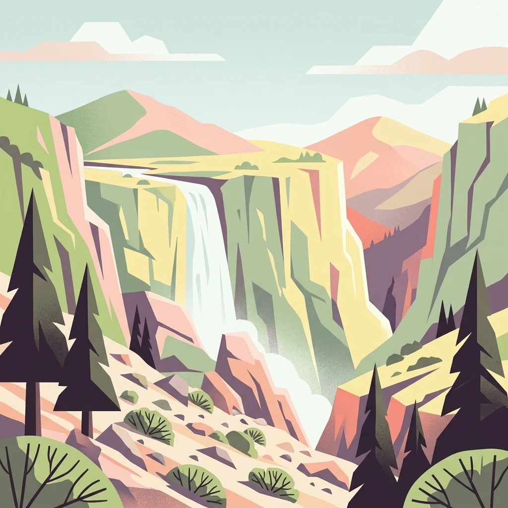
A graphic illustration of a waterfall cascading down a canyon between steep rocky cliffs, surrounded by pine trees under a clear sky.

Psiloritis Natural Park

Biosphere reserve

Park overview

Structured park overview, official facts, and landscape profile for Psiloritis Natural Park

Psiloritis Natural Park park facts, protected area profile, and essential visitor context

Review the core facts for Psiloritis Natural Park, including designation, size, terrain, visitor scale, habitats, and operating context in one park-focused overview.

About Psiloritis Natural Park

Psiloritis Natural Park occupies a large swathe of central Crete, anchored on the Psiloritis mountain range and extending northwards to the Cretan Sea. The territory is one of substantial scale, encompassing the majority of the Mount Ida massif and the traditional communities nestled within its slopes and northern foothills. As a UNESCO Global Geopark, the park is conceived not only as a landscape reserve but as an integrated territory where geological heritage, natural ecosystems, and human rural culture are managed together.

The defining feature of the park is Mount Ida itself, the highest mountain in Crete and one of the most prominent elevations in the whole of the Greek islands. The massif is built from limestone formations shaped over millions of years, giving rise to a deeply sculptured karstic terrain. Pools of meltwater dissolve pathways through the rock, producing extensive cave systems, vertical shafts, and surface sinkholes known locally as ponors. The Idaean Cave, attached to the mythological cult of Zeus and long a site of cultural importance, sits among these features.

Above the tree line, the high flanks of Mount Ida support an unusual form of high-altitude karstic steppe, a sparse, rocky vegetation community shaped by wind, snow, and thin soils. At lower elevations, the park's foothills hold a mosaic of pine woodlands, oak formations, garrigue shrublands, traditional agricultural terraces, and pastoral grazing land. This vertical and ecological gradient, from Mediterranean coast to alpine steppe, gives the park exceptional environmental diversity within a relatively compact territory.

Alongside its natural and geological character, Psiloritis Natural Park is a working cultural landscape. The villages of the Psiloritis region, with Anogeia as a central hub, maintain traditions of shepherding, weaving, and small-scale farming that have defined the area for centuries. The park's management approach intentionally links this cultural heritage to conservation and sustainable development through geotourism, ecotourism, and agrotourism, treating the human presence in the mountains as an integral part of the geopark's identity rather than a feature to be excluded.

Quick facts and research context for Psiloritis Natural Park

Psiloritis Natural Park covers roughly 1,159 square kilometers of central Crete, making it one of the largest geopark territories in Greece. It lies across the administrative boundaries of the Rethymno and Heraklion prefectures, with its headquarters based in the mountain municipality of Anogeia.

The park has been part of the European Geoparks Network since 2001 and is formally recognized as a UNESCO Global Geopark. Its protected geological features include extensive karst systems, caves, and ponors on Mount Ida, the Idaean Cave among them, while its educational and tourism programs attract university field trips from around the world.

Protection and recognition

Examine terrestrial protected area designations and management scope

Psiloritis Natural Park Protection Status and Conservation Recognition

Psiloritis Natural Park maintains a documented terrestrial protection scope within its regional landscape. Structured records outline official conservation measures, administrative boundaries, and international recognition details where available.

Protection details

Protection scope
Terrestrial
Transboundary protection
No
Park context

Deeper park guide and search-rich context for Psiloritis Natural Park

Psiloritis Natural Park history, landscape, wildlife, and travel context

Explore Psiloritis Natural Park through its history, landscape character, ecosystems, wildlife, conservation priorities, cultural context, and seasonal travel timing in a structured park guide built for atlas discovery and search intent.

Why Psiloritis Natural Park stands out

Psiloritis Natural Park is best known for the exceptional karstic geology of the Psiloritis massif, the towering Mount Ida range that forms the spine of central Crete. The park's engraved landscape of caves, sinkholes, dolines, and high-altitude steppes is central to its identity as a UNESCO Global Geopark. It is also recognized for the Idaean Cave, the mythological birthplace of Zeus, and for blending geological heritage with the living cultural landscape of mountain villages, shepherd traditions, and terraced land use. The combination of dramatic altitude, classic Mediterranean mountain ecosystems, and deep geological time recorded in its limestone terrain gives the park its distinctive scientific and educational significance.
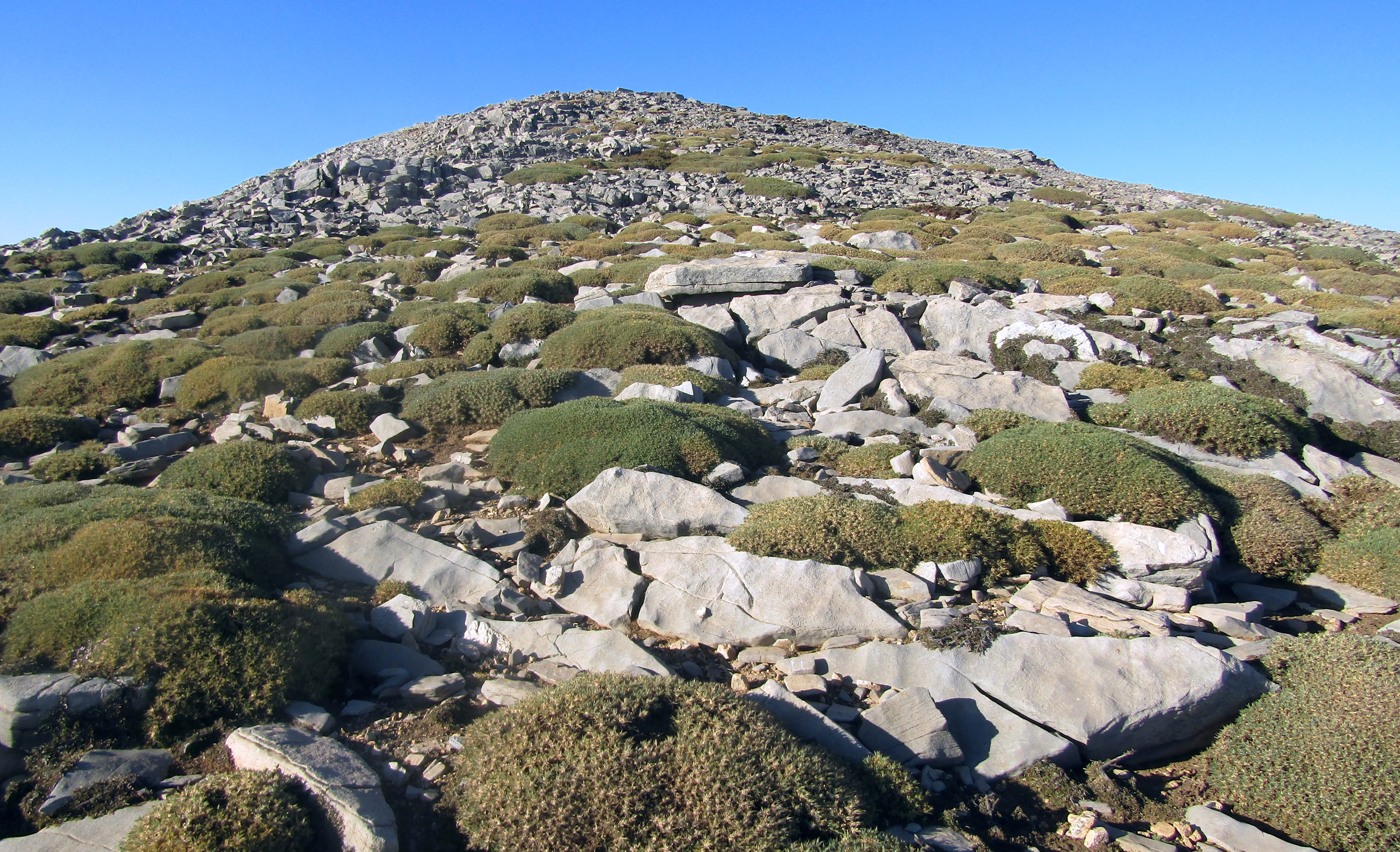
A rocky, high altitude mountain slope covered in low-lying, rounded, green shrubbery under a clear blue sky.
A high altitude karstic landscape near Mount Agathias in Psiloritis Natural Park.

Psiloritis Natural Park history and protected-area timeline

The Psiloritis Natural Park was formally established in 2001 as part of the European Geoparks Network, an early and influential member of the broader UNESCO Global Geoparks Network. Its creation was driven by local authorities in Crete who sought a coordinated framework to protect, interpret, and develop the geological and cultural assets of the Mount Ida region.

From the outset, the park has been managed by AKOMM Psiloritis S.A., a development agency under local government, with the Natural History Museum of the University of Crete serving as scientific advisor. This partnership brought academic and curatorial expertise into the governance of the territory, giving the park a strong research and educational dimension alongside its conservation role.

Although the formal institution of the park is relatively recent, the cultural significance of the Psiloritis landscape is ancient. The Idaean Cave, deep within the mountain, was venerated in Minoan and later classical Greek religion as a sanctuary associated with the birth and upbringing of Zeus. The pastoral and agricultural traditions of the mountain villages stretch back centuries and continue to shape the contemporary identity of the park's territory.

The early twenty-first century has seen steady development of the park's geotourism and educational programs. University groups from across Europe and beyond now use the site for geological fieldwork, drawn by the accessibility and diversity of classic karstic landforms in a Mediterranean mountain setting.

Psiloritis Natural Park landscape and geographic character

The landscape of Psiloritis Natural Park is dominated by the Psiloritis massif, whose summit region rises above most other points in Crete. The massif forms a continuous high spine through the center of the island, layered with deep limestone that has been gradually dissolved and reshaped by water over geological time. The result is a landscape of sharp relief, exposed rock, deep gorges, and intricate underground drainage.

Karstic processes are the defining sculpting force across the park. Water entering fissures in the limestone has carved out an extensive network of caves, including the Idaean Cave, along with vertical shafts, collapsed dolines, and surface ponors where streams vanish underground. The bare, weathered ridgelines and grey-white rock walls of the upper slopes give the high Psiloritis a starkly alpine feel that contrasts with the gentler foothills below.

Lower in the park, the terrain softens into a mosaic of terraces, fields, oak and pine woodland, and scattered villages clinging to the hillsides. The northern edge of the park drops toward the Cretan Sea, providing a sharp transition from high mountain to coastal lowland within a single protected territory and giving the park wide topographical variety within a relatively compact footprint.
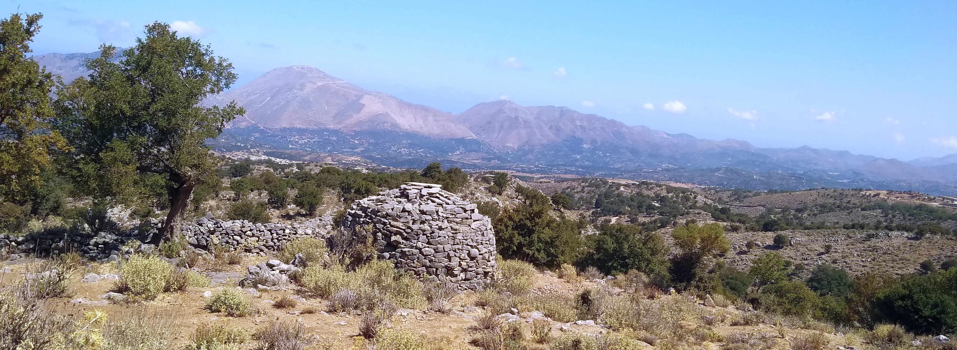
A circular stone structure, possibly a shepherd's hut, sits in a sparse, rocky mountain landscape under a clear sky, with distant mountain ranges visible.
A traditional dry stone shepherd's hut in the rural landscape near Livadia, with the peaks of the Psiloritis range in the background.

Psiloritis Natural Park ecosystems, habitats, and plant life

Ecologically, Psiloritis Natural Park stretches across an unusually wide altitudinal range for a Mediterranean island, supporting a layered sequence of habitats. The highest elevations of Mount Ida carry a strikingly austere high-altitude karstic steppe, where thin soils, persistent wind, and heavy winter snow limit vegetation to scattered cushion plants, low shrubs, and rocky pasture. This open steppe is unusual in the eastern Mediterranean and gives the park a characteristic alpine feel far above sea level.

Below the summits, the mid slopes give way to montane forests dominated by pine, particularly the Cretan and Aleppo pines, often intermixed with evergreen oaks, cypresses, and aromatic Mediterranean shrubs. Moving further down, this forest cover gradually opens into traditional agricultural land, terraced fields, pastures, and orchard remnants that reflect centuries of careful land management.

In the northern fringe of the park, where the foothills approach the Cretan Sea, the vegetation shifts into more typical coastal Mediterranean habitats of garrigue, phrygana scrub, and maquis formations. The result is a vertical ecological gradient, from coast to alpine steppe, concentrated within one protected landscape, which is a key reason the area has attracted scientific and educational interest.

Psiloritis Natural Park wildlife and species highlights

Wildlife in Psiloritis Natural Park adapts to a landscape that shifts rapidly from coastal Mediterranean scrub to high-altitude rocky steppe. The park's forests and shrublands support typical Cretan mountain fauna, including wild mammals such as the Cretan wild goat, the wildcat, and small carnivores and rodents that inhabit the rocky terrain and woodland edges.

The park's raptor populations are among its most distinctive wildlife assets. The cliffs and open ridges of Mount Ida provide nesting and hunting habitat for large eagles and other birds of prey that rely on the vertical relief and visibility of the massif. Lower slopes and agricultural edges host songbirds, owls, and a wide variety of smaller passerines that occupy the mosaic of woodland, terraces, and scrubland.

Reptiles and insects are abundant in the warmer, exposed zones of the park, including endemic Cretan forms associated with the island's long evolutionary isolation. Seasonal streams, sinkholes, and the karstic aquifer system further support amphibians and aquatic invertebrates that depend on the underground drainage of the limestone massif.

Psiloritis Natural Park conservation status and protection priorities

As a UNESCO Global Geopark, Psiloritis Natural Park is recognized at an international level for the conservation value of its geological heritage, particularly its karstic landforms and cave systems. The formal protection framework emphasizes the preservation of surface and underground features that document millions of years of Mediterranean geological history.

Conservation in the park is inseparable from cultural heritage. The management approach explicitly links the protection of geological sites with the maintenance of traditional land use, including pastoralism, terraced agriculture, and small-scale forestry, which are seen as integral to the long-term health of the landscape. Erosion control, sustainable grazing, and the preservation of vernacular rural architecture all fall within the park's broader conservation remit.

Through AKOMM Psiloritis S.A., supported by the Natural History Museum of the University of Crete, the park coordinates scientific monitoring, public education, and geotourism programs designed to give the protected area both an active research role and a sustainable economic future. Field visits from universities across Europe anchor this conservation work in ongoing scientific engagement.

Psiloritis Natural Park cultural meaning and human context

The cultural context of Psiloritis Natural Park is anchored in the deep human history of Mount Ida, most famously through the Idaean Cave, which classical Greek tradition identifies as the birthplace and childhood refuge of Zeus and which had already served as a sacred site in Minoan religion. The mountain has been a place of myth, pilgrimage, and ritual significance for millennia.

Beyond mythology, the park territory carries a continuous tradition of mountain rural life. Villages such as Anogeia and other Psiloritis settlements have long been associated with shepherding, weaving, and a fierce sense of local identity, including notable roles in modern Cretan history. Stone-built shepherd huts, terraced fields, and dry-stone walls remain visible across the park and form part of the cultural landscape that the geopark actively preserves.

In the contemporary era, the park has become a focal point for the revival of geotourism and agrotourism in central Crete, allowing visitors to engage directly with traditional crafts, local food, and the enduring practice of pastoral life on the mountain.

Top sights and standout views in Psiloritis Natural Park

At the heart of Psiloritis Natural Park stands Mount Ida, the highest massif in Crete, with its classic karstic landscapes of caves, sinkholes, and high-altitude steppe. The Idaean Cave adds a layer of ancient mythological significance to an already exceptional geological setting, making the park a meeting point of deep time and deep cultural memory.

Equally distinctive is the park's blend of large-scale geological heritage with a living landscape of mountain villages, terraced fields, and pastoral traditions. The combination of UNESCO recognition, strong university-led science, and grassroots Cretan culture gives Psiloritis Natural Park an unusually layered identity among European geoparks.

Best time to visit Psiloritis Natural Park

Late spring and early autumn are widely considered the most rewarding periods to experience Psiloritis Natural Park. In spring, the mid-elevation forests and scrublands come alive with wildflowers, and snow still lingers on the higher ridges, contrasting with green lowland pastures. Temperatures at lower elevations remain comfortable for walking, while the cooler air at altitude makes higher routes more accessible than in the heat of midsummer.

Early autumn brings quieter trails, warm sea-level weather on the nearby Cretan coast, and harvest activity in the mountain villages, offering a vivid sense of the working agricultural landscape the park protects. Winter transforms the upper massif into a snowy alpine environment, dramatic but more demanding for visitors, while high summer can be intensely hot and dry, especially on the exposed steppes and karstic ridgelines above the tree line.
Monthly climate preview

Long-term representative monthly averages and annual weather patterns for Crete

Psiloritis Natural Park Climate Normals, Temperature, and Precipitation Rhythm

Representative coordinate measurements record monthly mean temperatures ranging from 11.46 to 26.63 degrees Celsius alongside distinct precipitation variations across the year. Exploring the complete twelve-month climatology profile reveals detailed temperature ranges and monthly precipitation averages.
Annual mean19 °C
11 °C27 °C
Jan12°
Feb11°
Mar13°
Apr16°
May20°
Jun24°
Jul26°
Aug27°
Sep24°
Oct21°
Nov17°
Dec13°
Warmest month
August

26.6 °C

Coolest month
February

11.5 °C

Wettest month
December

3.3 mm/day

Driest month
July

0.1 mm/day

Park location guide

Geography guide, regional context, and park location map for Psiloritis Natural Park

Psiloritis Natural Park park geography, regions, and map view in Greece

Understand where Psiloritis Natural Park sits in Greece through a broader geographic reading of the surrounding landscape, nearby location context, and its mapped position within the national park landscape.

How Psiloritis Natural Park fits into Greece

Greece, officially the Hellenic Republic, is a country in Southeast Europe occupying the southern Balkans. It borders Albania, North Macedonia, Bulgaria, and Turkey, with coastlines on the Aegean, Ionian, and Mediterranean seas. The country has over 10 million people and is renowned for its ancient Greek heritage, philosophy, democracy, and the Olympic Games.

Wider geography shaping Psiloritis Natural Park in Greece

Greece occupies the southern tip of the Balkan peninsula in Southeast Europe. It shares land borders with Albania to the northwest, North Macedonia and Bulgaria to the north, and Turkey to the east. The Aegean Sea lies to the east of the mainland, the Ionian Sea to the west, and the Sea of Crete and Mediterranean Sea to the south. The country spans thousands of islands across nine traditional geographic regions and has the longest coastline in the Mediterranean basin.

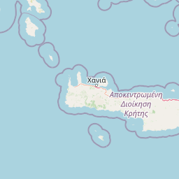
Map view of Psiloritis Natural Park

Use this park location map to pinpoint Psiloritis Natural Park in Greece, understand its exact geographic position, and read its mapped placement within the surrounding landscape more clearly.

Pigeon | © OpenStreetMap contributors

Location context for Psiloritis Natural Park

Crete

Visualizing the terrain, habitats, and geological formations of the protected area

Psiloritis Natural Park Photos and Landscape Scenery

Visual records capture the rugged topography, limestone massifs, and diverse habitats that define the protected landscape. Examining these photographs helps observers understand the environmental character and scale of the mountain terrain.

A rocky, high altitude mountain slope covered in low-lying, rounded, green shrubbery under a clear blue sky.

High angle shot of a rocky alpine basin on Mount Ida with scattered patches of low-lying vegetation and a small depression in the ground surface.

A circular stone structure, possibly a shepherd's hut, sits in a sparse, rocky mountain landscape under a clear sky, with distant mountain ranges visible.

Park atlas

Compare regional geography, mountain terrain, and adjacent protected areas.

Explore Other Parks Near Psiloritis Natural Park and Protected Landscapes

Continue browsing other parks near Psiloritis Natural Park to examine related Mediterranean mountain terrain and karstic protected landscapes. Comparing adjacent regional geography provides deeper context into the surrounding protected-area network.
A watercolor painting showing a panoramic landscape with green hills, distant mountains, and water, set against a plain white background.
National parkGreece
About 81 km away#1 closest

West

Samaria National Park: Geological Landscape and Protected Area Atlas in Crete, Greece

Mapping the dramatic White Mountain canyon and coastal descent

Samaria National Park stands as a major protected landmark in Greece, defined by a tectonic gorge that bisects the White Mountains. This atlas entry covers the park boundary, the distinct vertical limestone cliffs of the Iron Gates, and the transition from mountain plateau to the Mediterranean coastline.

Area
4.848 km²
Established
1962
Relief
Mountain
Climate
Mediterranean
A horizontal watercolor painting depicting a pale blue coastal landscape with low green vegetation in the foreground and soft mountainous ridges in the distance.
Protected areaLasithi
About 88 km away#2 closest

Southeast

Chrysi Protected Area: Mapping the Juniper Forests and Beaches of Lasithi, Greece

A coastal island sanctuary in the Libyan Sea

Chrysi presents a distinct landscape characterized by a mature juniper forest and golden-sand beaches. Situated within the Lasithi regional unit, this island remains a primary example of a protected Mediterranean woodland environment, preserving a unique set of coastal terrain, shallow sea ecosystems, and archaeological history on a small geographic footprint.

Area
4.743 km²
Relief
Lowland
Climate
Mediterranean
Access
Easy access
A soft watercolor illustration of green rolling hills and flat land against a pale, hazy background, representing a coastal island environment.
Nature reserveCrete
About 91 km away#3 closest

West

Agioi Theodoroi Nature Reserve: Protected Island Landscapes off the Coast of Crete

A vital wildlife sanctuary and historical island terrain

The nature reserve of Agioi Theodoroi comprises two small, rocky islands off the northwestern shore of Crete. Known for a long-established population of the rare kri-kri wild goat and breeding colonies of Eleonora's falcons, these islets maintain strict conservation status. Explore the mapped boundaries of this unique protected area and its significance within the coastal geography of the Chania region.

Area
0.697 km²
Established
1930
Relief
Upland
Climate
Mediterranean
A watercolor painting of a rolling mountainous landscape in Crete, featuring soft green hills, wildflowers, and pale mountain outlines against a light sky.
Biosphere reserveCrete
About 120 km away#4 closest

East

Sitia Nature Park: Geographic Atlas of Crete's Eastern Protected Mountain Landscapes

Mapping gorges, karst caves, and the eastern Cretan coastline.

Sitia Nature Park represents a vast protected territory across eastern Crete, characterized by its complex mountain spine and profound geological formations. This atlas entry provides geographic insights into the park's canyon systems, including the Valley of the Dead, and the karst caves that define its UNESCO Global Geopark status and regional natural terrain.

Established
2015
Relief
Mountain
Climate
Mediterranean
Access
Moderate access
Watercolor painting of a coastal landscape featuring green rolling hills, distant landmasses, and stylized shrubs and trees in the foreground against a white background.
Nature reserveCrete
About 120 km away#5 closest

West

Elafonisi Nature Reserve: Geography and Protected Landscape Analysis in Crete

Coastal dunes and limestone formations in southwestern Crete.

Elafonisi is a protected nature reserve situated in the southwestern reaches of Crete. This site encompasses a complex landscape of sand dunes, juniper-covered scrub, and rugged limestone terrain. By providing a clear look at the area, this atlas entry helps users understand the geographic setting, the ecological significance of the island, and the natural boundaries of this noteworthy Mediterranean conservation area.

Area
1.5 km²
Relief
Lowland
Climate
Mediterranean
Access
Easy access
A horizontal watercolor illustration showing soft, stylized green and pink layers representing rolling hills and distant land over a light foreground of scrubby vegetation.
Protected areaLasithi
About 121 km away#6 closest

East

Dionysades Protected Area: An Atlas Guide to the Islands of Northeastern Crete

Geography and protected island landscapes in Lasithi

The Dionysades archipelago comprises four rocky islets isolated in the shallow waters of the northeastern Cretan shelf. This protected area functions as a key seabird stronghold in the Aegean, characterized by its dramatic maritime silhouette, deep-water surroundings, and significant cultural history reaching back to classical antiquity.

Area
5.25 km²
Relief
Upland
Climate
Mediterranean
Access
Remote access
National parkCrete
About 128 km away#7 closest

East

Vai Aesthetic Forest National Park: Geographic and Protected Landscape Overview

Coastal palm woodland and regional Cretan geography

Investigate the landscape composition of Vai Aesthetic Forest, a protected national park in northeastern Crete. This site preserves a rare Mediterranean wetland ecosystem and a significant population of endemic date palms, offering deep insights into the region's geological and ecological heritage within the Sitia UNESCO Global Geopark framework.

Area
0.2 km²
Established
1985
Relief
Lowland
Climate
Mediterranean
National parkGreece
About 279 km away#8 closest

North

Sounio National Park: Protected Coastal Geography and Mediterranean Terrain in Greece

A rugged maritime landscape on the Attica headland

Sounio National Park occupies the dramatic southernmost tip of the Attica peninsula in Greece. The protected area features vertical limestone cliffs, scrub-covered coastal hills, and a strategic headland overlooking the Aegean. This atlas entry provides a detailed look at the park boundaries, surrounding maritime geography, and the unique integration of classical heritage sites within an exposed Mediterranean conservation zone.

Area
0.75 km²
Established
1974
Relief
Upland
Climate
Mediterranean

Common questions about visiting, size, designation, and location context for Psiloritis Natural Park

Psiloritis Natural Park FAQs for park facts, access, geography, and protected area context

Find quick answers about Psiloritis Natural Park, including protected-area facts, park geography, trail and visitor context, and how the park fits into its surrounding country and regional landscape.
MoriAtlas Explorer

Continue Your Protected Areas Search Across the Global Atlas

Deepen your exploration by continuing the structured search for national parks and protected areas worldwide. Utilize the comprehensive filtering capabilities to compare different conservation landscapes and refine your understanding of global park geography. Discover more about the distribution and characteristics of protected natural areas.

Global natural geography