
Mori Atlas logo
Nature reservePunta dell'Acquabella

Mapping the cliff habitats and protected coastal terrain of the Abruzzo region in Italy

Punta dell'Acquabella Nature Reserve: A Detailed Geographic Atlas of the Adriatic Coast

Punta dell'Acquabella represents a vital coastal nature reserve set along the Adriatic shoreline of Abruzzo. This protected area showcases a transition between rugged cliff faces and traditional Mediterranean landscapes, featuring pebble beaches, Aleppo pine woods, and historic watchtowers. Gain insight into the regional geography and mapped boundaries that define this unique stretch of the Italian coastline.

coastal reserveAdriatic coastCosta dei TrabocchiMediterranean scrubAleppo pinecliff habitat
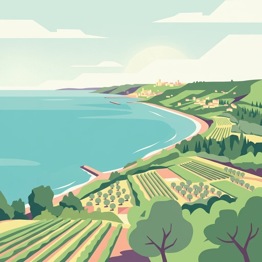
A flat vector-style illustration showing an Adriatic coastline with cultivated fields, olive groves, and a distant coastal town along a curving sandy beach.

Punta dell'Acquabella

Nature reserve

Park overview

Structured park overview, official facts, and landscape profile for Punta dell'Acquabella

Punta dell'Acquabella park facts, protected area profile, and essential visitor context

Review the core facts for Punta dell'Acquabella, including designation, size, terrain, visitor scale, habitats, and operating context in one park-focused overview.

About Punta dell'Acquabella

Punta dell'Acquabella is a small but characterful protected natural area located on the central Adriatic coast of Italy, in the Abruzzo region, within the province of Chieti. Administratively, it belongs to the municipality of Ortona and has been managed locally by the comune since its formal establishment in March 2007. The reserve occupies a narrow but varied strip of coastline, combining a low promontory with a beach that stretches across roughly one hundred meters of shoreline.

Geographically, the reserve is positioned between the port of Ortona to the north and the coast of San Vito Chietino to the south. This places it firmly within one of Italy's most distinctive coastal cultural landscapes, the Costa dei Trabocchi, named after the trabocchi, traditional wooden fishing machines whose silhouettes extend from the cliffs over the water. Punta dell'Acquabella shares the geological character of this coast, with rocky cliffs that rise above the sea and beaches composed of a mixture of sand and rounded pebbles.

Ecologically, the reserve straddles the boundary between marine-influenced coastal habitat and inland agricultural land. Toward the sea, Aleppo pines form scattered stands and patches of Mediterranean maquis grow along the cliffs, while the interior transitions into a cultivated countryside of olive groves, fruit orchards, and vineyards planted with traditional varieties such as Trebbiano and Montepulciano, interspersed with small family vegetable plots. This combination of wild coastal vegetation, working agricultural landscape, and a protected shoreline gives the area a layered, lived-in character that distinguishes it from larger national parks in Abruzzo.

The reserve also carries significant cultural weight. Inland from the promontory stand the ruins of a small fishing hamlet that was home to around ten families until the 1970s, after which the settlement was abandoned. Historically, the bay at Acquabella served as a landing point for Ottoman pirates, which led the Spanish viceroy of Naples in the sixteenth century to order the construction of coastal watchtowers. At the mouth of the nearby Moro River, the ruined Torre del Moro still marks this defensive effort. Further inland lie the remains of a ninth-century Lombard basilica dedicated to San Marco, while the nearby Moro River Canadian War Cemetery preserves the memory of the Allied soldiers who fought in the Battle of Ortona in December 1943. Together, these elements make Punta dell'Acquabella a place where Abruzzo's natural coastline, medieval history, and twentieth-century memory intersect in a very compact setting.

Quick facts and research context for Punta dell'Acquabella

Punta dell'Acquabella is a coastal natural reserve in Abruzzo, southern Italy, managed by the municipality of Ortona. It was established on 30 March 2007 and extends over roughly twenty-eight hectares between the port of Ortona to the north and San Vito Chietino to the south.

The reserve sits on the Costa dei Trabocchi, the Trabocchi Coast, a stretch of the Adriatic known for its traditional wooden fishing platforms. The protected area combines a small promontory, a beach of mixed sand and pebbles, Aleppo pine vegetation toward the sea, and an inland agricultural landscape of olive groves, vineyards, and orchards.

Protection and recognition

Documented protection history and international recognition framework metrics

Punta dell'Acquabella Protection Status and Designated Conservation Scope

Punta dell'Acquabella maintains a mixed protection scope governed by structured conservation frameworks and established administrative boundaries. Detailed records outline the official status, designation metrics, and documented recognition sources associated with the protected landscape.

Protection details

Protection scope
Mixed
Transboundary protection
No
Park context

Deeper park guide and search-rich context for Punta dell'Acquabella

Punta dell'Acquabella history, landscape, wildlife, and travel context

Explore Punta dell'Acquabella through its history, landscape character, ecosystems, wildlife, conservation priorities, cultural context, and seasonal travel timing in a structured park guide built for atlas discovery and search intent.

Why Punta dell'Acquabella stands out

Punta dell'Acquabella is best known for being a compact Adriatic coastal reserve where unusually clear water meets a Mediterranean cliff landscape along the Costa dei Trabocchi. The reserve's defining identity lies in the contrast between its small, accessible beach and promontory and the broader cultural and natural richness of the surrounding Trabocchi coast. It is also recognized for the presence of the Torre del Moro, a sixteenth-century coastal watchtower erected during the Spanish viceroyalty of Naples to defend against incursions, and for the nearby Moro River Canadian War Cemetery, a memorial site connected to the 1943 Battle of Ortona. These layers of history, alongside Aleppo pine woods and Mediterranean scrub, give the reserve a distinctive blend of nature, heritage, and wartime memory.
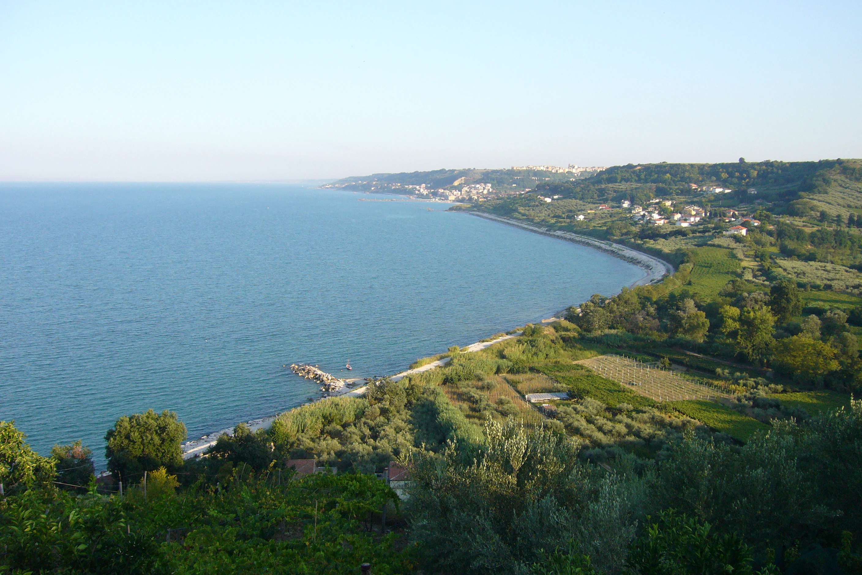
A wide angle view looking down from a high vantage point over a curved coastline meeting the Adriatic Sea, with agricultural land and vegetation in the foreground and a distant town along the shore.
A panoramic view of the Adriatic coastline at Punta dell'Acquabella.

Punta dell'Acquabella history and protected-area timeline

Punta dell'Acquabella's documented history stretches across several centuries and reflects the wider story of the Abruzzo Adriatic coast. During the sixteenth century, the bay at Acquabella functioned as a landing point for Turkish pirates active in the Adriatic. In response, the viceroy of Naples ordered the construction of a network of coastal watchtowers across the Kingdom of Naples, one of which, the Torre del Moro, was erected near the mouth of the Moro River at Acquabella. The tower today survives only in ruined form.

Inland, slightly removed from the coast, the remains of a Lombard-era basilica dedicated to San Marco, dating from the ninth century, stand as a further marker of the area's early medieval history. The surviving walls and the layout of three naves divided by columns attest to the religious and architectural presence of the Lombards in the coastal hinterland.

The promontory itself preserves the abandoned ruins of a small fishing hamlet. Until the 1970s, around ten families lived here, sustaining themselves through fishing. After their departure, the settlement was gradually abandoned, leaving behind evocative ruins that today form part of the reserve's cultural landscape.

In the twentieth century, the area became linked to one of the most significant episodes of the Italian campaign of the Second World War. The Battle of Ortona, fought between 20 and 28 December 1943, saw fierce combat between Canadian and German forces for control of the town and its approaches. North of the reserve, near the mouth of the Moro River, the Moro River Canadian War Cemetery commemorates the Allied soldiers who fell in this battle.

In more recent times, the area's natural and cultural value led to its formal protection. Punta dell'Acquabella was established as a nature reserve on 30 March 2007, confirming its status as a protected coastal landscape under municipal management by the comune of Ortona.

Punta dell'Acquabella landscape and geographic character

The landscape of Punta dell'Acquabella is defined by a small Adriatic promontory and an adjacent beach, set between the working port of Ortona to the north and the cliffs of San Vito Chietino to the south. The shoreline consists of a roughly one-hundred-meter stretch of beach made up of sand mixed with pebbles, fronting a coast where cliffs rise directly from the sea.

The reserve belongs to the broader Trabocchi Coast, a stretch of Abruzzo shoreline famous for the trabocchi, wooden fishing platforms perched on stilts above the water. The cliffs of Punta dell'Acquabella share the geological character of this coast, with sections of rock face that have historically suffered from landslides and collapses, occasionally disrupting access to the beach.

Inland, the coastal cliffs give way to a softer agricultural landscape. Olive groves, vineyards planted with local varieties, fruit orchards, and small family vegetable plots cover the gently sloping terrain, creating a visual transition between wild Mediterranean coast and cultivated countryside that is typical of central Adriatic Abruzzo.

Punta dell'Acquabella ecosystems, habitats, and plant life

The reserve's natural environment reflects the ecological character of the central Adriatic coast. The interface between sea and land is marked by Mediterranean scrub vegetation typical of warm-temperate coastal climate zones, with patches of Aleppo pine growing toward the sea and broader maquis communities along the rocky slopes.

Mixed woodland and scrubland fringe the cliffs, while the interior supports a mosaic of small cultivated fields that contribute to habitat diversity. The combination of rocky coast, low scrub, scattered pines, and agricultural patches creates a heterogeneous but compact ecological setting typical of the Costa dei Trabocchi. Sea-facing cliffs and the clear waters below the promontory define the reserve's most distinctive environmental feature, the clarity of the water itself having given rise to the name Acquabella.

Punta dell'Acquabella wildlife and species highlights

Wildlife at Punta dell'Acquabella reflects the coastal birdlife typical of Mediterranean scrub and Adriatic shoreline environments. Seabirds associated with the Mediterranean maquis, including gull species, are characteristic inhabitants of the cliffs and surrounding waters.

The reserve's small size limits its capacity to support large terrestrial fauna, but its mosaic of cliffs, scrub, pines, and cultivated fields provides habitat for a range of common coastal and rural birdlife typical of Abruzzo. The marine environment offshore is also part of the protected setting, with clear waters supporting the broader coastal ecosystem along the Trabocchi coast.

Punta dell'Acquabella conservation status and protection priorities

Punta dell'Acquabella was formally established as a nature reserve on 30 March 2007, placing roughly twenty-eight hectares of coastal land and adjacent sea-facing terrain under protection and management by the municipality of Ortona.

The conservation significance of the reserve lies in its role as a protected fragment within the larger Costa dei Trabocchi, a coastline of high natural and cultural value. While smaller than the region's major national parks, Punta dell'Acquabella contributes to the preservation of Mediterranean coastal vegetation, cliff habitats, and the transitional landscape between wild shoreline and inland agriculture.

Conservation challenges at the site include coastal instability. In 2016, landslides and collapses along the cliff face, shared with the neighboring Punta Ferruccio area to the north, affected access and highlighted the fragility of the rocky coastline. Managing the balance between preserving natural processes, maintaining safe public access, and protecting cultural heritage sites such as the Torre del Moro and the nearby war cemetery remains central to the reserve's ongoing significance.

Punta dell'Acquabella cultural meaning and human context

Punta dell'Acquabella sits within a coastal region of Abruzzo where human presence has shaped the shoreline for centuries. The Trabocchi coast to which it belongs reflects a long tradition of fishing using wooden platforms built out from the cliffs, a cultural practice that continues to define the local identity.

Earlier layers of history are visible in the area's defensive architecture. The sixteenth-century Torre del Moro, built under Spanish viceregal rule to counter pirate raids, marks the strategic importance of the Abruzzo coast in the early modern period. Inland, the ruins of the ninth-century Lombard basilica of San Marco point to an even older religious and architectural heritage along the Adriatic.

More recent history is preserved at the Moro River Canadian War Cemetery, established in memory of the soldiers who fought in the Battle of Ortona in December 1943. The abandoned fishing hamlet on the promontory, deserted after the 1970s, provides a more intimate glimpse of twentieth-century rural life on the Abruzzo coast.

Top sights and standout views in Punta dell'Acquabella

Punta dell'Acquabella's standout qualities lie in the combination of unusually clear Adriatic waters, a compact Mediterranean coastal reserve, and a dense layering of cultural history within a very small area. Its position on the Costa dei Trabocchi connects visitors to one of Italy's most iconic traditional coastlines.

Cultural highlights include the ruined Torre del Moro at the mouth of the Moro River, the remains of the medieval Basilica of San Marco, the abandoned cliffside fishing hamlet, and the nearby Moro River Canadian War Cemetery, each of which adds depth to the natural setting.

Best time to visit Punta dell'Acquabella

Seasonal conditions along the Abruzzo Adriatic coast strongly influence the experience of Punta dell'Acquabella. Late spring and early summer typically bring warm, stable weather, calm seas, and the clearest conditions for appreciating the water clarity that gives the reserve its name, while also offering the most active birdlife along the cliffs.

Late summer and early autumn remain attractive for sea and shoreline conditions, although coastal cliff instability has historically affected access at certain times of year. Winter visits can offer quieter, more contemplative conditions but are generally less suited to enjoying the beach and the surrounding Trabocchi coastline, when weather and sea conditions tend to be more variable.

Monthly climate preview

Long-term temperature ranges and precipitation patterns across representative coordinates

Punta dell'Acquabella Climate Normals and Monthly Weather Records

Representative coordinates for Punta dell'Acquabella record a measured annual rhythm ranging from cooler winter minimums to warmer summer maximums alongside steady precipitation rates. Reviewing the complete twelve-month temperature and precipitation profile provides deeper insight into long-term climate normals.
Annual mean17 °C
10 °C26 °C
Jan10°
Feb10°
Mar11°
Apr14°
May18°
Jun23°
Jul25°
Aug26°
Sep22°
Oct18°
Nov14°
Dec11°
Warmest month
August

25.7 °C

Coolest month
February

9.7 °C

Wettest month
November

3.1 mm/day

Driest month
July

1.3 mm/day

Park location guide

Geography guide, regional context, and park location map for Punta dell'Acquabella

Punta dell'Acquabella park geography, regions, and map view in Italy

Understand where Punta dell'Acquabella sits in Italy through a broader geographic reading of the surrounding landscape, nearby location context, and its mapped position within the national park landscape.

How Punta dell'Acquabella fits into Italy

Italy is a unitary parliamentary republic in Southern and Western Europe, located on the Italian Peninsula with the Alps to the north. It borders France, Switzerland, Austria, Slovenia, Vatican City, and San Marino, and shares maritime boundaries with several Mediterranean countries. The country has approximately 59 million residents and uses the Euro as its currency.

Wider geography shaping Punta dell'Acquabella in Italy

Italy occupies a boot-shaped peninsula in southern Europe, bordered by the Alps to the north. It shares land borders with France, Switzerland, Austria, Slovenia, Vatican City, and San Marino. The country includes the Mediterranean islands of Sicily and Sardinia, along with approximately 800 smaller islands.

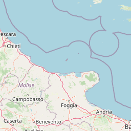
Map view of Punta dell'Acquabella

Use this park location map to pinpoint Punta dell'Acquabella in Italy, understand its exact geographic position, and read its mapped placement within the surrounding landscape more clearly.

Pigeon | © OpenStreetMap contributors

Location context for Punta dell'Acquabella

Abruzzo

Visualizing the Mediterranean cliffs and clear Adriatic waters of the Trabocchi coast

Punta dell'Acquabella Photos and Coastal Landscape Scenery

Visual records reveal the dramatic limestone cliffs, pebble shores, and native Aleppo pine vegetation defining this protected coastal reserve along the Adriatic. Examining these field photographs helps researchers and travelers understand the distinct topography, habitat zones, and coastal character of the region.

A wide angle view looking down from a high vantage point over a curved coastline meeting the Adriatic Sea, with agricultural land and vegetation in the foreground and a distant town along the shore.

Park atlas

Compare surrounding coastal reserves and protected landscapes across the Abruzzo region.

Parks Near Punta dell'Acquabella and Related Protected Areas Along the Adriatic Coast

Browse protected areas and coastal habitats situated near Punta dell'Acquabella along the scenic Adriatic shoreline. Extending your geographic comparison across neighboring reserves reveals the wider ecological and cultural patterns of the local coastal terrain.
Watercolor painting showing mountains, forests, and a body of water in a scenic landscape
National parkAbruzzo
About 26 km away#1 closest

Southwest

Maiella National Park: Abruzzo's Protected Landscape and Regional Geography

Explore mapped park boundaries and natural terrain.

Delve into the protected landscape of Maiella National Park, situated within the Abruzzo region of southern Italy. This page offers detailed atlas-level insights into its mapped boundaries, allowing for a clear understanding of its geographic setting. Discover how this national park contributes to the regional natural terrain and protected area context, providing a foundation for structured geographic exploration.

Area
628.38 km²
Established
1991
IUCN
II
Relief
Mountain
A wide panoramic watercolor painting showing a landscape with a body of water in the foreground, green grasses and trees on the banks, and layers of purple and pink hills in the distance under a pale sky.
Nature reserveAbruzzo
About 37 km away#2 closest

Southeast

Riserva naturale regionale Marina di Vasto: Coastal Nature Reserve in Abruzzo, Italy

Mapping protected Adriatic dune and wetland ecosystems

This nature reserve protects a vital 3-kilometer strip of the Adriatic coastline in Abruzzo, acting as a rare sanctuary for specialized flora and fauna. By managing a delicate ecotone of shifting sand dunes and brackish wetland basins, the area maintains a high degree of ecological significance within the regional landscape. The geography provides an important look at integrated coastal conservation at the meeting point of urbanized hinterlands and the Adriatic sea.

Area
0.57 km²
Established
2007
Relief
Lowland
Climate
Mediterranean
Watercolor painting of mountains, green valleys, and a river
National parkItaly
About 46 km away#3 closest

West

Gran Sasso and Monti della Laga National Park: Italy's National Park Geographic Context

Mapped protected areas and regional natural landscape details.

Delve into the geography of Gran Sasso and Monti della Laga National Park, a prominent national park in Italy. This resource provides essential context for understanding its protected landscape, mapped boundaries, and integration within the regional geography. Ideal for users seeking detailed atlas-style information on protected areas and their natural terrain, it serves as a foundational point for exploring the park's unique geographic character and landscape significance.

IUCN
II
Watercolor painting showing a landscape with rolling green hills, a river, and scattered trees
National parkItaly
About 78 km away#4 closest

Southwest

Abruzzo, Lazio and Molise National Park

Protected landscape in Italy's Apennines.

Explore the mapped boundaries and protected status of Abruzzo, Lazio and Molise National Park. This historic Italian national park offers a detailed look at Apennine mountain geography and landscape.

Established
1923
IUCN
II
Watercolor illustration of a tree, green hills, and distant water view
National parkApulia
About 81 km away#5 closest

Southeast

Gargano National Park: Apulia's Protected Landscape and Regional Geographic Context

Mapped boundaries and natural terrain of a key Italian national park.

Delve into Gargano National Park, a designated national park situated in the Apulia region of Italy. This protected landscape offers valuable insights into the geography of the Gargano promontory. Through MoriAtlas, users can explore its mapped boundaries, understand its terrain, and connect it to the broader regional geography of southern Italy, providing a solid foundation for protected-area discovery.

Area
1,181.44 km²
Established
1991
IUCN
II
Relief
Mixed relief
Watercolor painting of a mountainous landscape with green and yellow terrain, distant mountains, and forests
National parkMarche
About 105 km away#6 closest

Northwest

Monti Sibillini National Park: National Park with Regional Geographic Context in Marche

Explore protected landscape boundaries and terrain.

Monti Sibillini National Park serves as a vital national park within the Marche region, offering a distinct natural landscape for geographic study. This entry provides essential context for understanding the park's mapped protected area status and its integration into the regional geography of central Italy. Delve into the park's specific setting, discovering how its terrain and protected status contribute to the atlas of Italian natural landscapes.

Area
697.22 km²
Established
1993
IUCN
II
Relief
Mountain
Watercolor illustration showing a coastal landscape with green hills, trees, and water body
National parkItaly
About 157 km away#7 closest

Southwest

Circeo National Park: Protected Landscape of Italy's Lazio Coast

Explore mapped terrain and Mediterranean ecosystem boundaries.

Circeo National Park offers a distinct protected landscape anchored by the striking Monte Circeo limestone promontory and its associated coastal dunes and island environments. As one of Italy's earliest national parks, it preserves a vital mosaic of Mediterranean ecosystems, providing a unique subject for geographic study and atlas-based navigation of protected areas. Users can explore its mapped context and the interplay between karst geology, coastal terrain, and diverse natural habitats.

IUCN
II
Watercolor illustration of a mountainous landscape with green hills, a valley with a river, and distant mountains under a pink and yellow sky
National parkCampania
About 162 km away#8 closest

South

Vesuvius National Park: Protected Volcanic Landscape in Campania, Italy

Explore mapped boundaries and regional geography.

Discover Vesuvius National Park, a vital protected area safeguarding Italy's iconic active volcano. This page provides essential geographic context, detailed mapped terrain, and insights into the park's unique volcanic landscape within the Campania region. It serves as a key entry point for understanding the park's protected status and its geological significance for structured atlas exploration.

Area
72.59 km²
Established
1995
IUCN
II
Relief
Mountain

Common questions about visiting, size, designation, and location context for Punta dell'Acquabella

Punta dell'Acquabella FAQs for park facts, access, geography, and protected area context

Find quick answers about Punta dell'Acquabella, including protected-area facts, park geography, trail and visitor context, and how the park fits into its surrounding country and regional landscape.
MoriAtlas Explorer

Continue Your Protected Areas Search Across the Global Atlas

Deepen your exploration by continuing the structured search for national parks and protected areas worldwide. Utilize the comprehensive filtering capabilities to compare different conservation landscapes and refine your understanding of global park geography. Discover more about the distribution and characteristics of protected natural areas.

Global natural geography