
Mori Atlas logo
National parkQueulat National Park

Discover mapped protected boundaries and dramatic Andean terrain in Aysén del General Carlos Ibáñez del Campo Region.

Queulat National Park: Patagonian Wilderness and Glacier Landscapes in Chile

Queulat National Park represents a significant protected wilderness within the Aysén del General Carlos Ibáñez del Campo Region of southern Chilean Patagonia. This national park offers a unique window into a dramatic Andean landscape where glacier-capped peaks dramatically rise above ancient evergreen forests. As a key protected area, Queulat provides essential insight into the region's least-altered ecosystems, making it a crucial point of discovery for understanding Patagonia's mapped natural heritage and unique geography.

Glacier landscapesTemperate rainforestsPatagonian AndesHanging glaciersWaterfallsNational parks
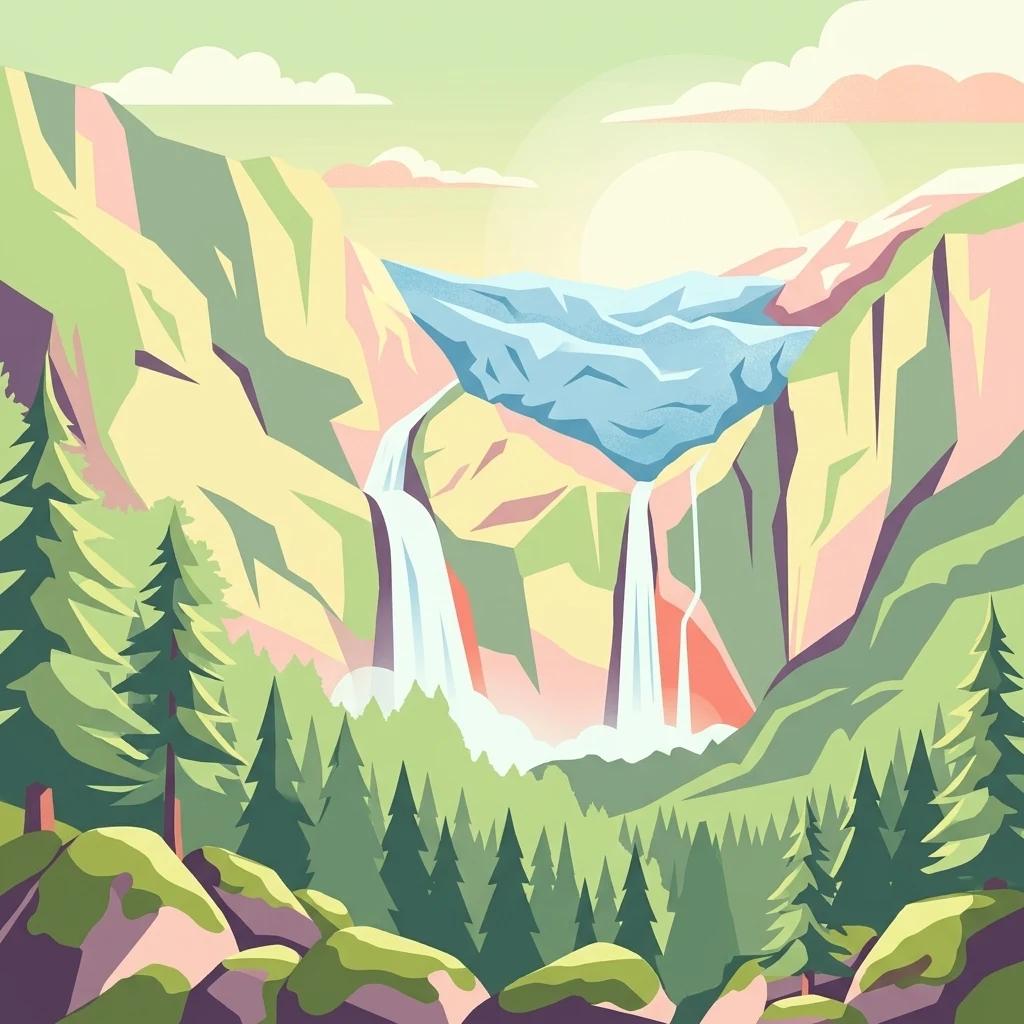
Illustration of a hanging glacier with two waterfalls surrounded by mountains and coniferous forest

Queulat National Park

National park

Park overview

Structured park overview, official facts, and landscape profile for Queulat National Park

Queulat National Park park facts, protected area profile, and essential visitor context

Review the core facts for Queulat National Park, including designation, size, terrain, visitor scale, habitats, and operating context in one park-focused overview.

About Queulat National Park

Queulat National Park stands as one of Chilean Patagonia's crown jewels, protecting a wilderness where towering glaciers descend into ancient rainforests carved by glacial valleys. The park's landscape is dominated by the Patagonian Andes, with elevations exceeding 2,000 meters forming a dramatic backdrop to the ice fields and forests below. The Puyuhuapi Volcanic Group intrudes into the northern portion of the park, adding geological complexity to the terrain. The Carretera Austral (Route 7) traverses the park's center, passing through the famous Cuesta Queulat hairpin turn section where travelers can witness the full spectrum of altitudinal vegetation zones in a single overlook. Beyond the glaciers, the park contains numerous other attractions including the Cascada de Ventisquero Colgante waterfall, Queulat Sound, the Témpanos River valley, and distinctive geological features like Piedra del Gato (Cat's Stone). The park is divided between the communes of Cisnes and Lago Verde, representing one of Chile's most important protected areas for temperate rainforest conservation.

Quick facts and research context for Queulat National Park

Queulat National Park lies in the Aysén Region of Chile, roughly midway between the towns of Puerto Puyuhuapi and Puerto Cisnes along the famous Carretera Austral highway. The park features two significant ice fields, with the Queulat ice cap spanning approximately 80 square kilometers and containing the park's iconic hanging glacier. Elevations within the park exceed 2,000 meters, with the highest peaks reaching around 2,255 meters. The area experiences heavy precipitation, with some portions receiving up to 4,000 millimeters of rainfall annually, supporting the dense temperate rainforests that characterize the landscape.

Protection and recognition

Documenting the official management scope and conservation frameworks of the Patagonian wilderness.

Queulat National Park Protection Status and Conservation Designations

Registered environmental records outline the documented protection status and mixed management scope of Queulat National Park within the regional conservation network. Analyzing designated park boundaries and official classifications provides essential geographical context for understanding protected Patagonian landscapes.

Protection details

Protection scope
Mixed
Transboundary protection
No
Park context

Deeper park guide and search-rich context for Queulat National Park

Queulat National Park history, landscape, wildlife, and travel context

Explore Queulat National Park through its history, landscape character, ecosystems, wildlife, conservation priorities, cultural context, and seasonal travel timing in a structured park guide built for atlas discovery and search intent.

Why Queulat National Park stands out

Queulat National Park is best known for its spectacular hanging glacier (Ventisquero Colgante), a massive ice mass that cascades from the mountain and feeds a dramatic waterfall dropping into the Témpanos River. The park's defining character comes from the contrast between steep glacier-capped peaks and the lush Valdivia-type temperate rainforests that cloak the lower slopes. The famous Cuesta Queulat stretch of the Carretera Austral provides visitors with stunning views of this vertical environmental transition, showcasing altitudinal vegetation zones from valley forests to alpine terrain.
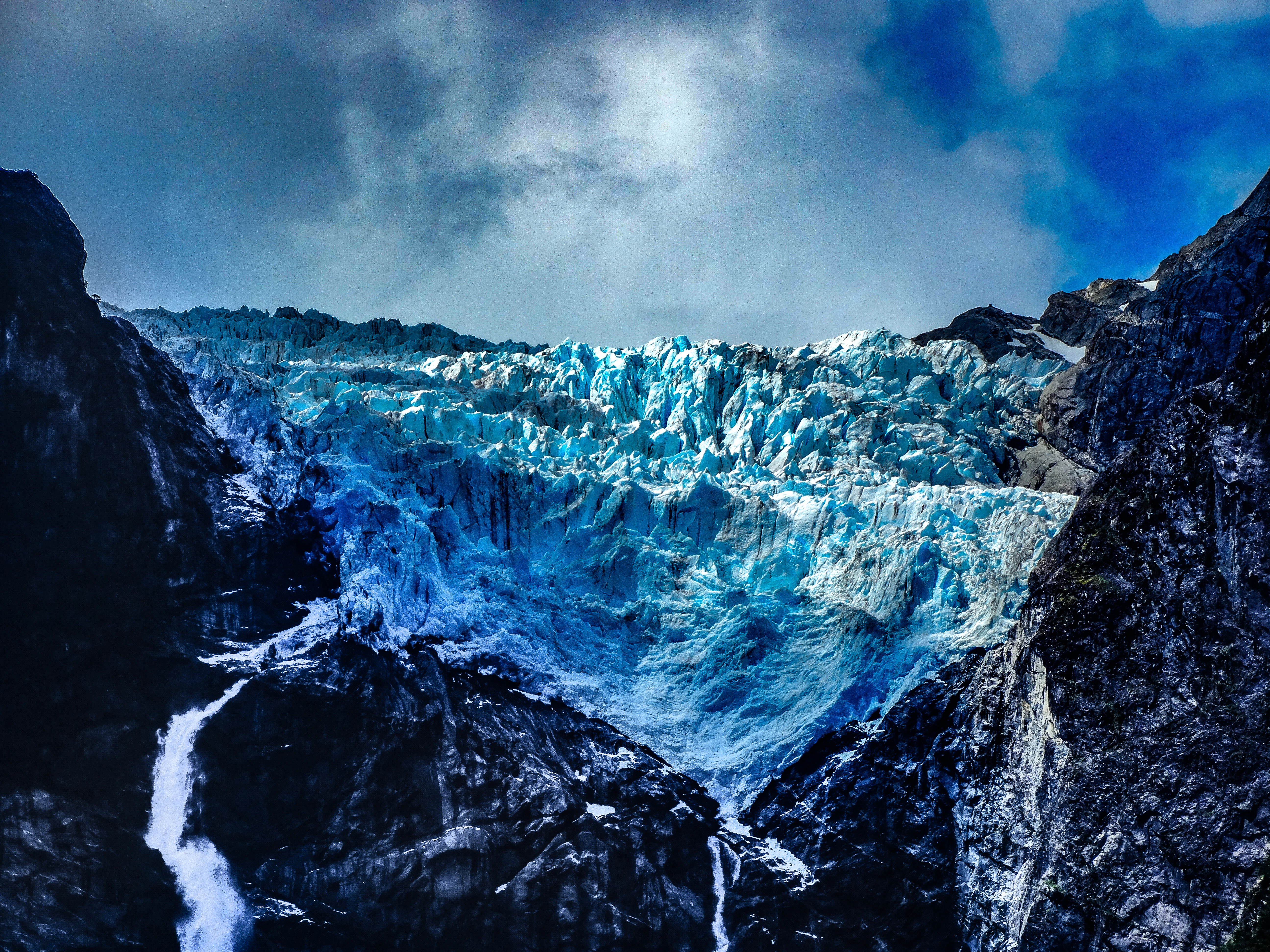
A large blue glacier cascading down between dark rocky cliffs with waterfalls flowing from its base under a partly cloudy sky
Queulat Hanging Glacier between rocky cliffs under a partly cloudy sky

Queulat National Park history and protected-area timeline

The region now protected by Queulat National Park has a long history of exploration dating back to 1766, when Jesuit Father José García Alsue ventured into the area searching for the legendary City of the Caesars. This early expedition marks the first documented European contact with the landscapes that would later become protected. The park was officially established in 1983, creating a protected framework for the extraordinary glacial and forest ecosystems of this Patagonian valley. In 1989, the Chilean government further strengthened protection by designating the park as a place of scientific interest for mining purposes through Supreme Decree N°133, adding subsurface protection to the surface conservation measures. The park is administered by the Corporación Nacional Forestal (CONAF), Chile's national forest service, which manages the protected area and facilitates visitor access while maintaining conservation objectives.

Queulat National Park landscape and geographic character

The physical landscape of Queulat National Park presents a textbook example of glacial alpine terrain. The park contains two distinct ice fields, the larger being the Queulat ice cap covering approximately 80 square kilometers at around 1,889 meters elevation, and a second ice field of about 40 square kilometers centered on an unnamed summit. Glaciers extending from these ice caps can reach lengths of up to 12 kilometers. The terrain is characterized by steep-walled valleys carved by ancient glaciers, with the Queulat Hanging Glacier serving as the park's most dramatic glacial feature where ice descends from high cliffs in a spectacular vertical curtain. The landscape includes the Puyuhuapi Channel's northernmost arm called Ventisquero Sound, which borders the main ice cap. Volcanic elements from the Puyuhuapi Volcanic Group add further topographical variation, particularly south of Lake Risopatrón. The park encompasses a complete vertical sequence from sea level at the sound and rivers to peaks exceeding 2,000 meters.
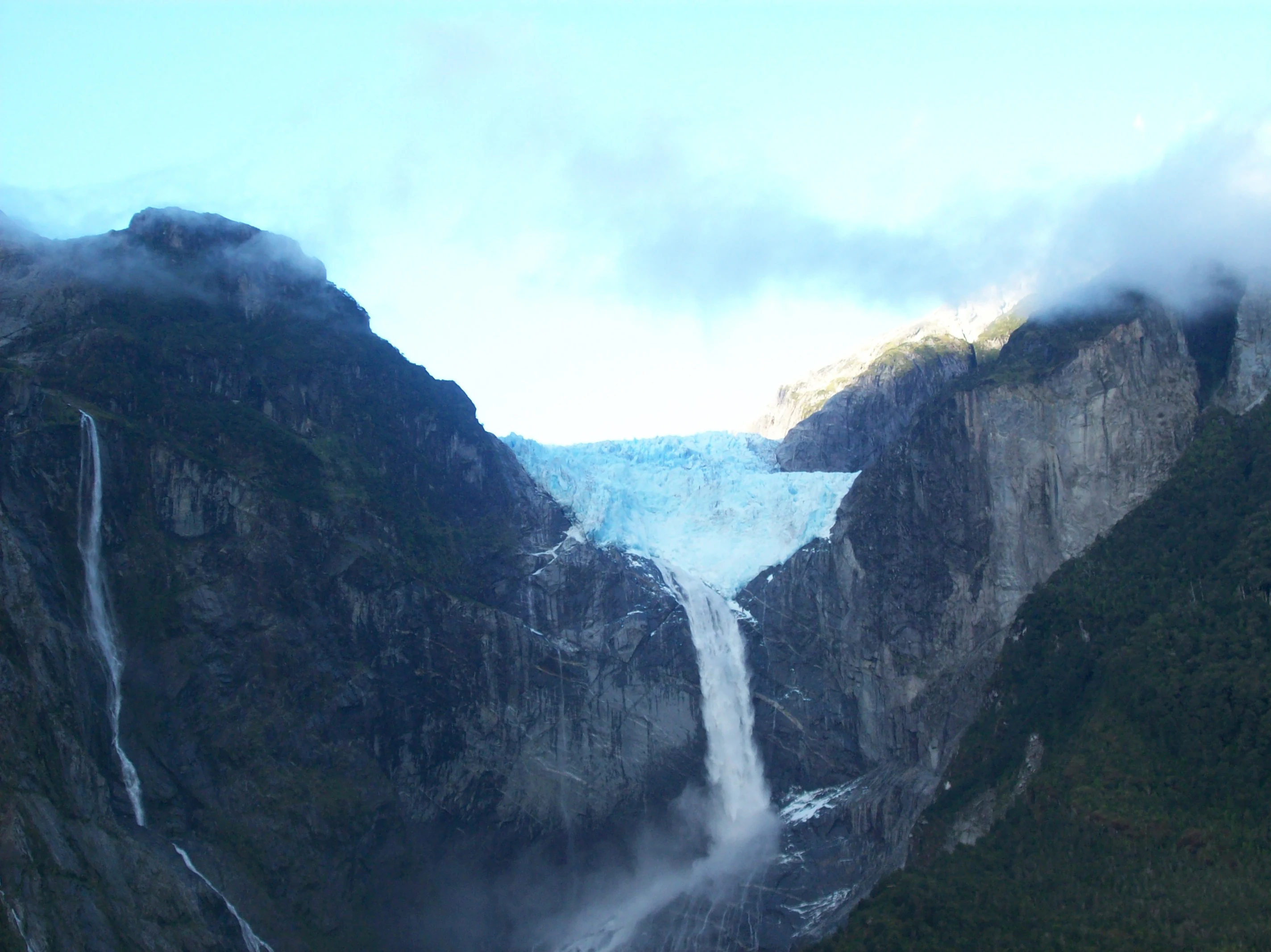
Hanging glacier in Queulat National Park, surrounded by steep rocky mountains with waterfalls cascading down under a partly cloudy sky
Hanging glacier in Queulat National Park with waterfalls and surrounding mountains

Queulat National Park ecosystems, habitats, and plant life

The ecological character of Queulat National Park is defined by the presence of the Chilean-side Valdivia temperate rain forests, one of the world's rarest forest types. These forests thrive in the extraordinary moisture regime, with some areas receiving up to 4,000 millimeters of annual precipitation. The forest composition varies with elevation: lower slopes feature coihue (Nothofagus dombeyi) and tepa (Laureliopsis philippiana) in a dense understory of tepú, quila bamboo, chilco, and the massive-leaved nalca. Higher elevations transition to cold-tolerant species including coigüe de Magallanes (Nothofagus betuloides) and lenga (Nothofagus pumilio), often draped in mosses and lichens. The Carretera Austral corridor provides a natural transect through these vegetation zones, allowing observation of the complete altitudinal sequence from valley-floor rainforests to subalpine forests.

Panoramic view of a winding road through dense green vegetation with snow-capped mountains in the distance, a car on the road, and a person walking
Carretera Austral highway passing through Queulat National Park with mountainous backdrop

Queulat National Park wildlife and species highlights

The wildlife population of Queulat National Park reflects the diversity of its habitats, from the Andean forests to the wetlands and waterways. In the southern mountain pass area, notable mammals include the pudú, one of South America's smallest deer species, and the kodkod (guigna), a small wild cat. The bird community is particularly rich, with species including chucao tapaculo, Chilean pigeon, Magellanic woodpecker, black-throated huet-huet, and thorn-tailed rayadito inhabiting the forest zones. The northern wetlands and lake areas support a different assemblage focused on aquatic species, including southern river otter and coypu. Waterfowl concentrations feature Magellan goose, Chiloe wigeon, yellow-billed pintail, red shoveler, flying steamer duck, rosy-billed pochard, and red-gartered coot. Herons including great egret, cocoi heron, and black-crowned night heron hunt along the shores, while torrent ducks inhabit the fast-flowing streams.
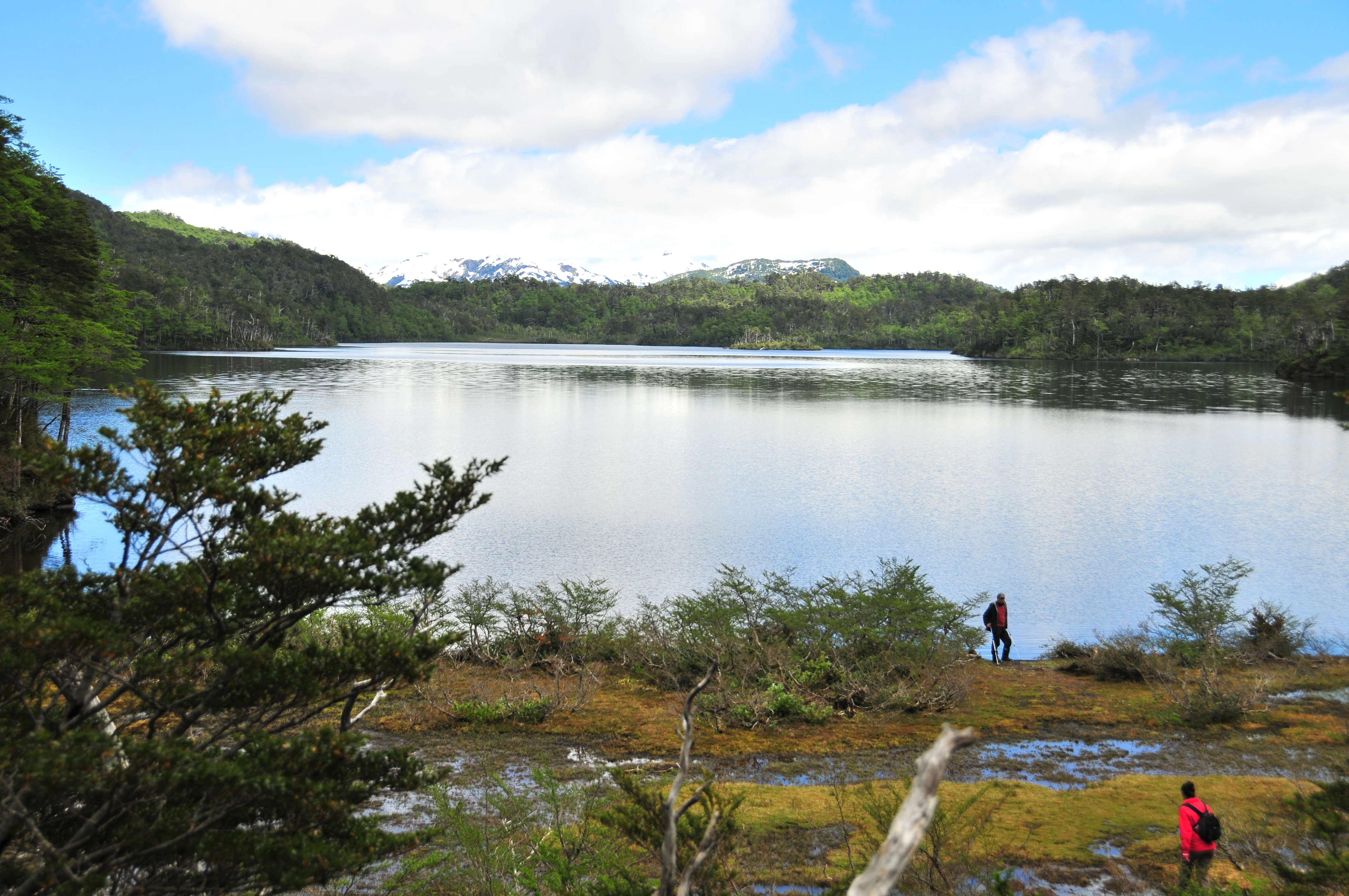
A lake surrounded by forested hills with mountains in the background. Two people are standing near the water's edge.
View of Laguna El Puma in Queulat National Park

Queulat National Park conservation status and protection priorities

Queulat National Park protects some of the most intact temperate rainforest ecosystems in all of Patagonia, representing a conservation priority for Chile and the broader global environment. The park's designation as IUCN Category II reflects its management objective of protecting outstanding natural landscapes while allowing controlled visitor access. Beyond its surface protection, the park received additional legal recognition in 1989 through designation as a place of scientific interest for mining purposes, providing subsurface protection rare among Chilean protected areas. The park forms an important ecological corridor connecting with adjacent Lago Rosselot National Reserve, creating a larger contiguous protected zone that supports viable populations of forest-dependent species. The temperate rainforests here store significant carbon stocks and provide watershed protection for the Cisnes River basin.

Queulat National Park cultural meaning and human context

The name Queulat originates from the Chono language, an extinct language family formerly spoken by the indigenous Chono people of southern Chilean Patagonia. The original name Queolat translates to 'sound of waterfalls,' a reference to the park's abundant water features and the thundering voice of the hanging glacier's meltwater descending the cliffs. This linguistic heritage connects the protected landscape to the indigenous peoples who inhabited this region before European settlement. The park lies within territory traditionally associated with the Chono, who were historically nomadic marine hunters of the Patagonian channels and islands. The modern park administration by CONAF maintains the protected status that preserves both natural values and the cultural memory embedded in this landscape's toponymy.
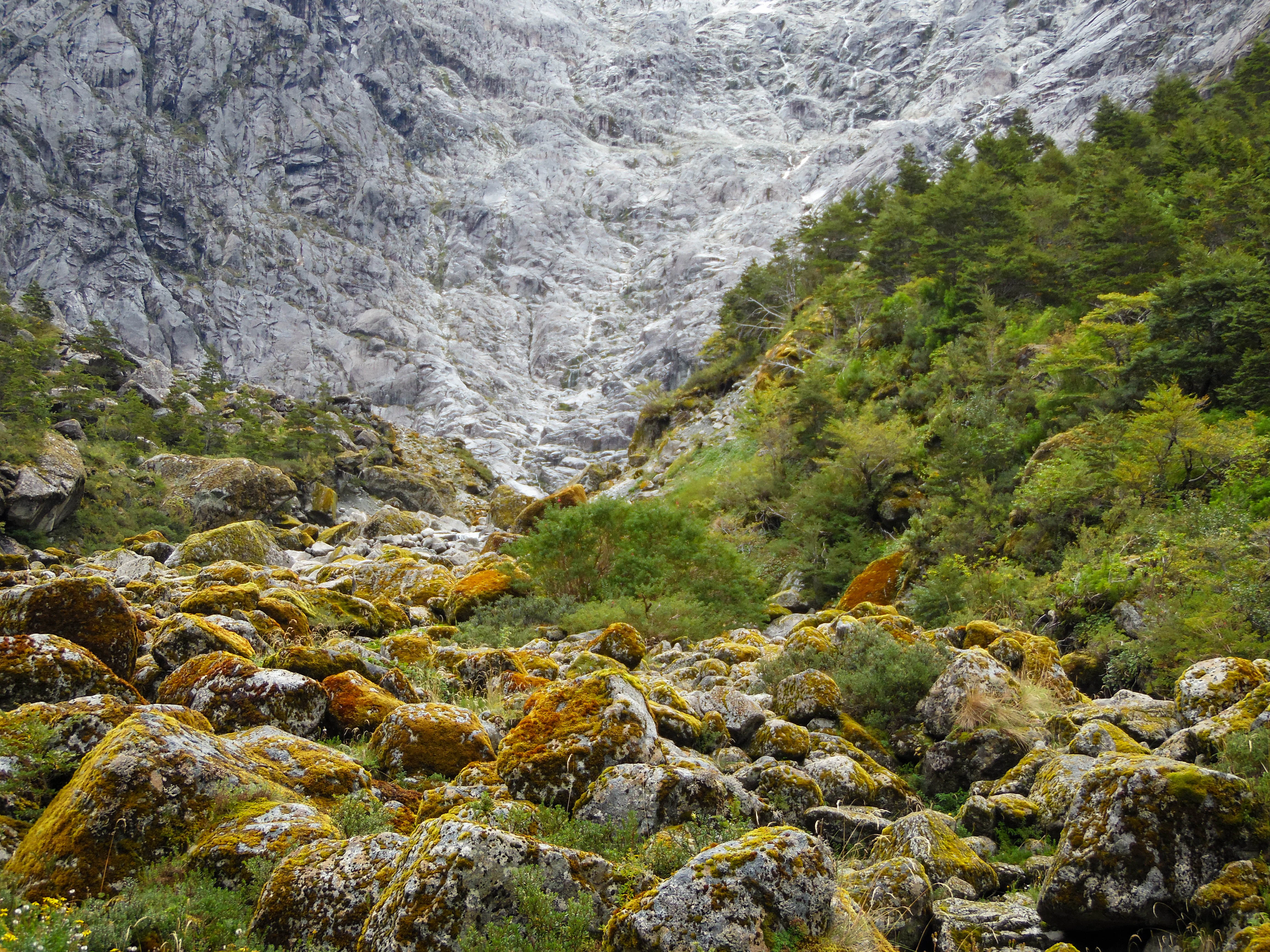
A valley with moss-covered rocks and forested hillsides leading to a mountain face with a glacier
Moss-covered rocks and forested mountains with the Queulat Hanging Glacier in the background in Queulat National Park

Top sights and standout views in Queulat National Park

The Ventisquero Colgante (Queulat Hanging Glacier) stands as the park's most iconic feature, a massive glacier dangling from cliffs that feeds a dramatic waterfall dropping into the Témpanos River. The Cuesta Queulat section of the Carretera Austral offers one of the most spectacular driving experiences in all of Patagonia, with hairpin turns providing sweeping views of the glacier and forest landscape. TheEnchanted Forest (Bosque Encantado) trail at Portezuelo Queulat leads visitors through pristine old-growth rainforest. Other notable features include the Cascada del Padre García waterfall exceeding 30 meters in height, the rocky monolith of Piedra del Gato overlooking the Cisnes River, and the Laguna Témpanos with its distinctive green-hued waters.
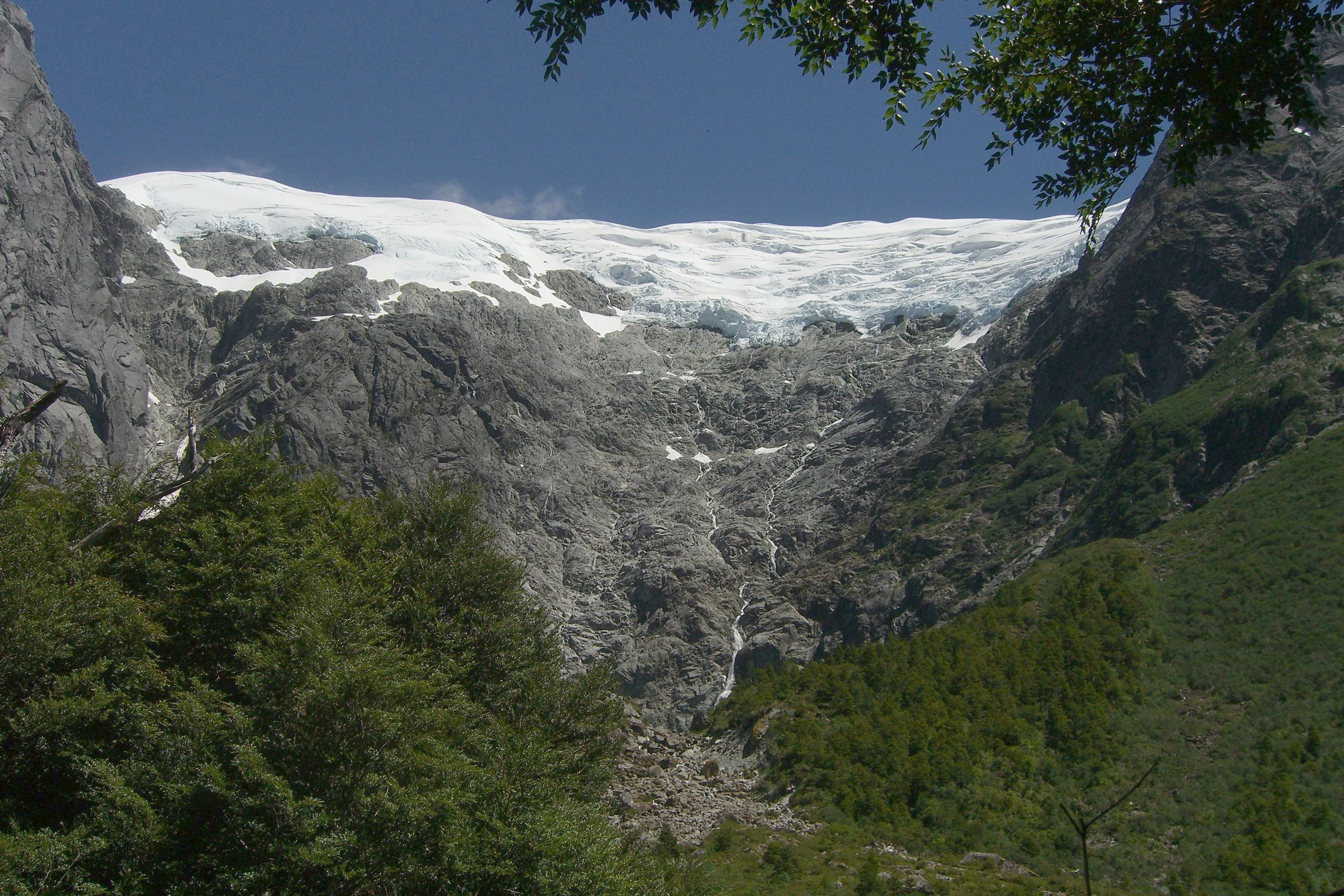
Glacier descending between rocky mountain cliffs with dense green forest in the foreground and clear blue sky
View of Queulat Hanging Glacier from Enchanted Forest trail

Best time to visit Queulat National Park

The most favorable season for visiting Queulat National Park runs from late spring through early autumn, roughly November through March in the southern hemisphere, when weather conditions are most stable and daylight hours are longest. Summer months typically offer the best combination of manageable temperatures and reduced precipitation, though Patagonia's weather remains unpredictable and rain can occur in any season. The winter months (June through August) bring heavy snowfall to higher elevations and reduced access to many park areas, though the snow-covered glaciers present their own stark beauty. Visitors should note that much of the Carretera Austral remains unpaved (ripio), and road conditions can change rapidly with weather events, regardless of season.
Monthly climate preview

Historical temperature averages and monthly precipitation patterns in Aysén

Queulat National Park Climate Preview and Annual Weather Normals

Long term climate data at 677 meters elevation shows mild summers peaking near 10 degrees Celsius and cold winters averaging 1 degree Celsius, with precipitation staying high year-round. Accessing the full monthly breakdown reveals detailed temperature spreads and daily rainfall cycles across all seasons in the Aysén Region.
Annual mean6 °C
1 °C10 °C
Jan10°
Feb10°
Mar
Apr
May
Jun
Jul
Aug
Sep
Oct
Nov
Dec
Warmest month
February

10.2 °C

Coolest month
July

1 °C

Wettest month
June

6.3 mm/day

Driest month
February

3 mm/day

Park location guide

Geography guide, regional context, and park location map for Queulat National Park

Queulat National Park park geography, regions, and map view in Chile

Understand where Queulat National Park sits in Chile through a broader geographic reading of the surrounding landscape, nearby location context, and its mapped position within the national park landscape.

How Queulat National Park fits into Chile

Chile is a presidential republic in western South America, extending as a narrow strip along the western edge of the continent between the Andes Mountains and the Pacific Ocean. It is the southernmost country in the world and the closest to Antarctica. The country is bordered by Peru, Bolivia, and Argentina, and administers several Pacific islands including Easter Island. Chile is a major copper producer and has a population of approximately 19.6 million.

Wider geography shaping Queulat National Park in Chile

Chile occupies a narrow strip of land along the western edge of South America, extending approximately 4,300 km north to south but only about 350 km east to west at its widest point. The country is sandwiched between the Andes Mountains to the east and the Pacific Ocean to the west. It shares borders with Peru to the north, Bolivia to the northeast, and Argentina to the east. Southern Chile borders the Drake Passage. Chile also administers several Pacific islands including Juan Fernández Islands, Isla Salas y Gómez, Desventuradas Islands, and Easter Island, plus the Chilean Antarctic Territory.

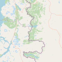
Map view of Queulat National Park

Use this park location map to pinpoint Queulat National Park in Chile, understand its exact geographic position, and read its mapped placement within the surrounding landscape more clearly.

Pigeon | © OpenStreetMap contributors

Location context for Queulat National Park

Aysén del General Carlos Ibáñez del Campo Region
Natural feature types

Browse the Geographic Features and Natural Landscapes of Queulat National Park

Continue your geographic exploration by examining the natural features associated with Queulat National Park. This structured index allows you to trace glaciers, forests, and alpine terrain, providing a deeper understanding of the environmental context across the park boundaries.
Recorded earthquake history

Explore the Historical Earthquake Catalogue for Queulat National Park

Review recorded seismic events occurring near Queulat National Park through this consolidated historical dataset. Powered by MoriAtlas, this resource maps individual earthquake occurrences to their respective locations, providing a clear reference for the regional seismic history surrounding these protected lands.

Queulat National Park Earthquake History

Catalogued events

4 events

Strongest magnitude

Magnitude 5.4

Most recent event

Mar 13, 2015

This history includes earthquakes recorded inside the park or within 50 km of its borders

Experience the park's distinct visual identity, showcasing iconic hanging glaciers and lush Valdivian temperate rainforest ecosystems.

Queulat National Park Landscapes and Scenery: Visual Exploration of Patagonia's Glaciers and Forests

Explore a detailed collection of Queulat National Park photos to understand its unique Patagonian terrain, including its dramatic glacier-carved valleys, towering peaks, and extensive temperate rainforests. These images provide crucial visual context for the park's diverse ecosystems and conservation landscapes, offering a deeper perspective on its protected environment.

A large blue glacier cascading down between dark rocky cliffs with waterfalls flowing from its base under a partly cloudy sky

A hanging glacier with two waterfalls flowing down steep rocky cliffs, surrounded by dense green forest

Hanging glacier in Queulat National Park, surrounded by steep rocky mountains with waterfalls cascading down under a partly cloudy sky

Panoramic view of a winding road through dense green vegetation with snow-capped mountains in the distance, a car on the road, and a person walking

A lake surrounded by forested hills with mountains in the background. Two people are standing near the water's edge.

Black entrance sign for Queulat National Park displaying 'Sector Angostura' text and activity icons, surrounded by green vegetation and hills

A valley with moss-covered rocks and forested hillsides leading to a mountain face with a glacier

Glacier descending between rocky mountain cliffs with dense green forest in the foreground and clear blue sky

Mountainous landscape with a hanging glacier, waterfalls, and turquoise lake surrounded by dense green forests.

Park atlas

Trace the Patagonian Andes, discovering adjacent glacier landscapes and temperate rainforests across the Aysén region.

Explore More National Parks and Protected Areas Beyond Queulat National Park

Expand your atlas exploration from Queulat National Park to find other national parks and protected areas across the diverse Patagonian Andes and Aysén region. Compare glacier-capped peaks, ancient forests, and unique landscapes to understand the broader conservation geography of southern Chile and its significant protected zones.
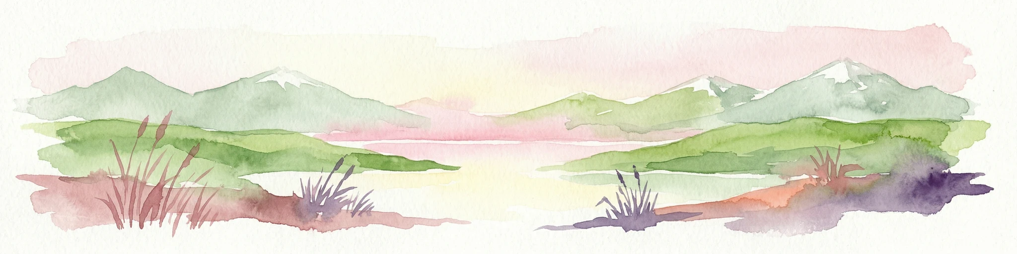
Watercolor illustration of a mountainous landscape with green fields and forests under a pale sky
National parkAysén Region
Park boundaries overlap#1 closest

Northwest

Melimoyu National Park: A Key Protected National Park within Chile's Aysén Region

Explore Melimoyu National Park's mapped boundaries and regional geography.

Melimoyu National Park stands as a distinct protected natural area, offering a focused lens for geographic discovery. As a national park situated in the Aysén Region, its mapped boundaries and regional landscape context are crucial for understanding its atlas significance. This entry provides specific details about the park's protected status and its contribution to the mapped terrain of southern Chile, enabling detailed exploration for atlas enthusiasts.

Area
1,055 km²
Established
2018
IUCN
II
Relief
Mixed relief
National parkAysén del General Carlos Ibáñez del Campo Region
6.3 km away#2 closest

Southwest

Isla Magdalena National Park: Protected Area and Regional Geography Context

Discover the mapped landscape of this national park.

Delve into the protected landscape of Isla Magdalena National Park, a key national park situated in the Aysén del General Carlos Ibáñez del Campo Region of Chile. This entry provides essential geographic context, focusing on the park's mapped boundaries and its role within the Patagonian environment. Understand its distinct identity as a protected area for structured atlas exploration.

Area
1,576 km²
Established
1983
IUCN
II
Relief
Mountain
National parkChile
7.3 km away#3 closest

North

Corcovado National Park, Chile: Protected Volcanic Landscapes and Glacial Wilderness Atlas

Detailed geography of Chile's remote coastal wilderness and marine estuaries

Corcovado National Park stands as a significant protected area in southern Chile, encompassing dramatic volcanic peaks and an extensive collection of glacial lakes. Its mapped boundaries reveal a remote wilderness where pristine temperate rainforests transition into the brackish estuaries of the Gulf of Corcovado, supporting vital marine ecosystems and critical blue whale populations.

Area
2,096 km²
Established
2005
IUCN
II
Relief
Mixed relief
Watercolor painting depicting mountains, a lake, and grassy shoreline
National parkArgentina
112 km away#4 closest

North

Los Alerces National Park: Ancient Alerce Forests and Glacial Terrain in Argentina

Discover the park's protected landscape and regional geography.

Los Alerces National Park in Argentina is a globally significant protected area, celebrated for its ancient alerce forests, some of the longest-living trees on Earth. This national park showcases a dramatic landscape shaped by glaciers, featuring a series of interconnected lakes and rugged Andean terrain. Explore the unique ecosystem and mapped geography of this UNESCO World Heritage site to understand its profound natural and conservation value.

Area
2,599 km²
Established
1937
IUCN
II
Relief
Mountain
National parkAysén del General Carlos Ibáñez del Campo Region
117 km away#5 closest

South

Cerro Castillo National Park: Dramatic Granite Peaks and Patagonian Protected Landscape

Mapped geography and huemul conservation in Chile's Aysén Region.

Cerro Castillo National Park is a premier protected area in southern Chile, celebrated for its iconic Cerro Castillo granite mountain that dominates the landscape. This national park, spanning over 1,700 square kilometers in the Aysén del General Carlos Ibáñez del Campo Region, showcases a dynamic Patagonian terrain shaped by glaciers and rivers. Its significance extends to being a vital corridor for endangered huemul, offering critical habitat within a broader regional conservation strategy and the famous Route of Parks.

Area
1,795.5 km²
Established
1970
IUCN
II
Relief
Mountain
National parkAysén del General Carlos Ibáñez del Campo Region
188 km away#6 closest

Southwest

Laguna San Rafael National Park: Explore its Mapped Boundaries and Patagonian Landscape

A National Park within Aysén del General Carlos Ibáñez del Campo Region.

Laguna San Rafael National Park stands as a key protected area within the vast geography of the Aysén del General Carlos Ibáñez del Campo Region. This entry provides an atlas-focused perspective, detailing the park's geographic significance, mapped natural landscapes, and its role as a vital conservation territory. Understand how this national park fits into the broader context of Patagonia's unique terrain and protected areas.

Area
17,420 km²
Established
1959
IUCN
II
Relief
Mountain
National parkChile
About 194 km away#7 closest

West

Isla Guamblin National Park: A Protected Landscape Within Chile's Geography

Explore the mapped terrain and boundaries of this national park.

Isla Guamblin National Park provides essential context for understanding protected lands in Chile. This detail page offers a focused view on its geographic features and mapped natural landscape, crucial for atlas-based exploration and regional conservation studies. Discover the specific identity of this national park and its contribution to the mapped protected areas of South America.

Area
106.25 km²
Established
1967
Relief
Lowland
Climate
Temperate
National parkLos Lagos Region
199 km away#8 closest

Northwest

Chiloé National Park: National Park Discovery and Mapped Boundaries in Los Lagos Region

Explore its unique protected landscape and regional geography.

Chiloé National Park represents a significant protected natural area within the Los Lagos Region of Chile. This detailed page offers an atlas-centric view, focusing on the park's mapped boundaries, its place in the regional geography, and the overall protected landscape character. Gain structured insight into this important component of southern Chile's conservation lands, ideal for geographic exploration and atlas context.

Area
430.57 km²
Established
1983
IUCN
II
Visitors
33.6K annual

Common questions about visiting, size, designation, and location context for Queulat National Park

Queulat National Park FAQs for park facts, access, geography, and protected area context

Find quick answers about Queulat National Park, including protected-area facts, park geography, trail and visitor context, and how the park fits into its surrounding country and regional landscape.
MoriAtlas Explorer

Continue Your Protected Areas Search Across the Global Atlas

Deepen your exploration by continuing the structured search for national parks and protected areas worldwide. Utilize the comprehensive filtering capabilities to compare different conservation landscapes and refine your understanding of global park geography. Discover more about the distribution and characteristics of protected natural areas.

Global natural geography