
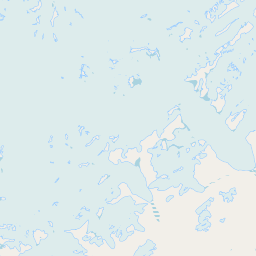
Peaks
Park geography
Structured data on mountain relief, glacial systems, and coastal landscape characteristics.
Geographic Profile of Quttinirpaaq National Park: Boundaries, Terrain and Arctic Landscapes
Quttinirpaaq National Park in Nunavut, Canada, spans 37775 square kilometers of polar wilderness. This geographic analysis outlines the park boundary, records a peak elevation of 2616 meters, and catalogs major natural features including glaciers, mountain ranges, and cape systems within the tundra landscape.
Related tags
Arctic wildernessPolar desertIce caps and glaciersNorthernmost parksHigh Arctic tundra
The top of the world: Canada's most northerly national park on Ellesmere Island
Quttinirpaaq National Park
Quttinirpaaq National Park occupies the northeastern corner of Ellesmere Island in the Qikiqtaaluk Region of Nunavut, Canada, making it the second most northerly protected area on Earth after Northeast Greenland National Park. The park's name, derived from Inuktitut, translates to "top of the world," a fitting description for this remote Arctic wilderness that sits at the apex of the continent. Established in 1988 as Ellesmere Island National Park Reserve and redesignated under its current name in 1999 when Nunavut was created, the park encompasses approximately 37,775 square kilometers of polar desert, ice caps, glaciers, and rugged mountain terrain. This vast protected area represents one of Canada's most significant Arctic wilderness reserves, preserving a landscape of exceptional scientific and ecological importance where extreme polar conditions support uniquely adapted ecosystems and where the midnight sun and polar night create dramatic seasonal transitions.
- Location
- Canada
- Park type
- National park
- Established
- 1988
- Area
- 37,775 km²
- Highest point
- 2,616 m
Location overview
Island park geography in the Qikiqtaaluk Region of Nunavut
Geographic Setting of Quttinirpaaq National Park in Canada
Quttinirpaaq National Park is located in Canada within the Nunavut territory and the Qikiqtaaluk Region. As an island park, the protected area operates under a single country jurisdiction.
- Countries
- Canada
- Regions
- Nunavut, Qikiqtaaluk Region
- Primary location
- Nunavut
- Geographic setting
- Island
Boundary and coordinates
Mapped geographic perimeter and calculated spatial dimensions
Quttinirpaaq National Park Boundary Map and Spatial Extent
The interactive boundary outline provides complete spatial context for the protected area. Accompanying facts detail the recorded area, coordinate limits, centre coordinates, and regional geographic spans.
- Boundary area
- 37,857.9 km²
- Boundary perimeter
- 836.1 km
- Northernmost point
- 83.1511° N
- Southernmost point
- 81.1677° N
- Easternmost point
- 62.5175° W
- Westernmost point
- 79.0394° W
- Geographic centre
- 82.1323° N, 71.6463° W
- North–south span
- 221.5 km
- East–west span
- 250.9 km
Elevation and terrain
Mountain relief metrics and recorded natural features
Quttinirpaaq National Park Terrain and Elevation Summary
Explore the recorded elevation maximum reaching 2616 meters across this mountain protected landscape. Individual feature records detail peaks, glaciers, bays, and cliffs situated within the protected territory.
- Maximum elevation
- 2,616 m
- Highest point
- 2,616 m
Selected named natural features
Cliffs
Cape Clear
Bays
M'Clintock Inlet
Cliffs
Distant Cape
Bays
Disraeli Fiord
Glaciers
Adams Glacier
Environmental setting
Polar climate zones, glacial relief, and tundra habitats across rugged terrain
Quttinirpaaq National Park Environmental and Landscape Classifications
Recorded landscape features, habitat types, and relief categories outline the physical setting of Quttinirpaaq National Park. Stored classifications connect individual environmental traits to broader atlas destinations across the protected area.
- Relief
- Mountain
- Climate
- Polar
- Water
- Major water bodies
- Forest cover
- No forest cover
- Seasonality
- Strongly seasonal
Landscape features
Mountains · Glacier · Desert · Lakes · Valleys · Coast
Habitat types
Tundra habitat · Desert habitat · Glacial habitat · Lacustrine habitat
Park atlas
Browse an atlas of vast protected landscapes, tracing Arctic geography and polar wilderness regions near Nunavut.
Explore Related National Parks and Protected Areas Near Quttinirpaaq National Park
Continue your park discovery beyond Quttinirpaaq National Park to explore other protected areas across Canada's Arctic Cordillera and beyond. Compare their unique polar desert landscapes, extensive ice caps, and remote wilderness features within a wider geographic context of High Arctic conservation.
National parkGreenland
17 km away#1 closest
East

Northeast Greenland National Park: Arctic Wilderness and Protected Landscape Atlas
Explore the world's largest national park and its mapped terrain.
Northeast Greenland National Park represents an extraordinary expanse of Arctic wilderness, renowned as the largest protected area globally. This national park protects a diverse landscape, from the interior Greenland Ice Sheet to dramatic glacial fjords and ice-free polar desert regions. Discover its extensive mapped boundaries and its significance as a sanctuary for vital Arctic megafauna, offering a profound case study in large-scale protected landscape geography.
- Area
- 972,000 km²
- Established
- 1974
- IUCN
- II
- Relief
- Mixed relief
National parkNunavut
672 km away#2 closest
Southwest

Qausuittuq National Park: Explore Nunavut's Protected National Park Landscape and Geography
Mapped protected area boundaries and regional geographic context.
Delve into Qausuittuq National Park, a key protected area in Nunavut offering rich opportunities for geographic exploration. This destination provides detailed mapping of its protected boundaries and a comprehensive overview of its landscape context within the Arctic region. Discover how Qausuittuq National Park contributes to the mapped protected lands of Canada, ideal for users seeking structured geographic data and atlas-style discovery.
- Area
- 11,000 km²
- Established
- 2015
- IUCN
- II
- Relief
- Upland
National parkNunavut
About 925 km away#3 closest
South
Sirmilik National Park: Nunavut National Park Atlas and Protected Landscape Map
Explore the geographic boundaries and regional context of Sirmilik National Park.
This entry provides detailed insights into Sirmilik National Park, a designated national park situated in Nunavut, Canada. It serves as a focal point for understanding the park's specific geography, its mapped protected landscape, and its role within the regional atlas. Users can explore the park's defined boundaries and its contribution to the broader landscape context of Nunavut, making it an essential destination for detailed geographic discovery.
- Area
- 22,200 km²
- Established
- 2001
- IUCN
- II
- Visitors
- 6 annual
National parkNorthwest Territories
1,179 km away#4 closest
West
Aulavik National Park: Northwest Territories National Park Protected Landscape and Geographic Context
Explore the mapped boundaries and regional park geography.
Gain a clear understanding of Aulavik National Park's protected status and its placement within the Northwest Territories. This detail page offers focused atlas exploration of the park's geographic identity, mapped features, and its significance as a National Park within Canada's northern geography. Discover the unique landscape context of this protected area for in-depth geographic study and discovery.
- Area
- 12,200 km²
- Established
- 1992
- IUCN
- II
- Visitors
- 34 annual
National parkSvalbard
1,205 km away#5 closest
Northeast

Nordvest-Spitsbergen National Park: Protected Arctic Landscape and Geographic Atlas
Explore unique hot springs, glacial terrain, and polar expedition history.
Nordvest-Spitsbergen National Park, a protected national park in Norway's Svalbard archipelago, showcases dramatic Arctic geography. This page details its mapped landscapes, from volcanic terrains and glacial valleys to its famed northernmost hot springs. Discover the park's protected area status, its role in regional geography, and its historical significance for polar exploration, providing a rich context for atlas-based exploration.
- Area
- 9,914 km²
- Established
- 1973
- IUCN
- II
- Relief
- Mixed relief
Wildlife reserveNorthwest Territories
1,206 km away#6 closest
West
Zugvogelschutzgebiet Banks Island No. 2: Protected Tundra and River Valley Geography
High Arctic wildlife reserve in the Northwest Territories
This wildlife reserve protects the Thomsen River valley and coastal estuary, serving as a primary moulting ground for Arctic waterfowl. Its geography defines a unique convergence of riverine and upland tundra habitats within the broader protected landscape of the Canadian Northwest Territories.
- Area
- 170 km²
- Established
- 1961
- IUCN
- Ia
- Relief
- Lowland
Wildlife reserveNunavut
1,268 km away#7 closest
South
Ninginganiq National Wildlife Area: Geographic Overview and Protected Landscape Mapping
A vital Arctic wildlife reserve on Baffin Island, Nunavut.
Ninginganiq National Wildlife Area stands as a cornerstone of Arctic conservation, encompassing the fog-defined shores of Isabella Bay. This protected area on Baffin Island serves as a critical seasonal feeding ground for bowhead whales and protects a vast expanse of tundra, marine inlets, and coastal ecosystems. Its establishment reflects a cooperative stewardship model between the federal government and Inuit communities, grounding this reserve in both ecological importance and cultural history.
- Area
- 3,362 km²
- Established
- 2010
- IUCN
- Ib
- Relief
- Lowland
National parkRussia
1,335 km away#8 closest
Northeast

Russian Arctic National Park: Russia's Premier Northernmost Protected Landscape
Arctic Islands, Glacial Terrain, and Marine Mammal Habitats
Russian Arctic National Park preserves some of the planet's most remote and pristine Arctic environments across the Novaya Zemlya and Franz Josef Land archipelagos. This protected area offers unparalleled insight into Arctic geography, showcasing dramatic glacial landscapes, extensive seabird colonies, and critical feeding grounds for polar bears and bowhead whales. Explore the park's unique protected landscape and its significance within the broader atlas of global conservation efforts.
- Area
- 14,260 km²
- Established
- 2009
- IUCN
- II
- Relief
- Lowland
MoriAtlas Explorer
Continue Exploring Quttinirpaaq National Park's Mapped Geography and Protected Landscape
Delve deeper into the atlas and map-based discovery of Quttinirpaaq National Park. Understand its precise boundaries and its unique position within the Nunavut regional geography. This park's protected landscape offers a valuable point of reference for exploring the vastness of the Canadian arctic and its conservation areas through structured geographic data.
Browse next
Global natural geography
Explore related park routes
Explore MoriAtlas Global ParksBrowse All MoriAtlas ParksGlobal Park Map DiscoveryMoriAtlas: Browse All CountriesBrowse All MoriAtlas ContinentsNational Park Environment AtlasGrand Canyon National Park AtlasYellowstone National Park AtlasYosemite National Park Atlas and GeographySerengeti National Park AtlasGalápagos National Park Protected LandscapeBanff National Park Geography and AtlasKruger National Park Atlas EntryUluṟu-Kata Tjuṯa National Park AtlasExplore Uluru-Kata Tjuta National Park GeographyPlitvice Lakes National Park AtlasFiordland National Park Protected LandscapeGreat Smoky Mountains National Park AtlasAfghanistan National Parks and Protected AreasAlbania National Parks and Protected AreasAlgeria National Parks and Protected AreasAmerican Samoa National Parks and Protected AreasAndorra National Parks and Protected AreasAngola National Parks and Protected AreasAntarctica National Parks and Protected AreasAntigua and Barbuda Park List