
Mori Atlas logo
Nature reserveRéserve naturelle nationale de la presqu'île de la Caravelle

A comprehensive geographic analysis of ancient geological formations and rare Caribbean coastal ecosystems.

Réserve naturelle nationale de la presqu'île de la Caravelle: Mapping Protected Coastal Landscapes in Martinique

The Réserve naturelle nationale de la presqu'île de la Caravelle preserves a distinct Atlantic headland shaped by some of the oldest geological arcs in the Lesser Antilles. This protected area on the eastern coast of Martinique supports rare dry forest habitats, extensive mangrove systems, and vital seabird nesting grounds across rugged rocky terrain. Mapping this peninsula reveals the ecological contrast between its exposed Atlantic cliffs and the more humid volcanic interior of the wider region.

CaribbeanMartiniqueAtlantic coastcoastal reservepeninsulamangrove
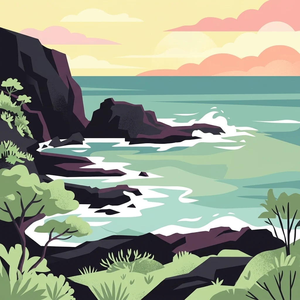
A stylized digital illustration of a rocky coastline meeting the ocean at sunset, featuring dark cliffs, crashing waves, and coastal vegetation.

Réserve naturelle nationale de la presqu'île de la Caravelle

Nature reserve

Park overview

Structured park overview, official facts, and landscape profile for Caravelle Peninsula National Nature Reserve

Caravelle Peninsula National Nature Reserve park facts, protected area profile, and essential visitor context

Review the core facts for Caravelle Peninsula National Nature Reserve, including designation, size, terrain, visitor scale, habitats, and operating context in one park-focused overview.

About Caravelle Peninsula National Nature Reserve

The Caravelle Peninsula National Nature Reserve sits at the far eastern end of the Caravelle Peninsula, a narrow promontory of land that juts out into the Atlantic Ocean on the northern side of Martinique. Although the reserve covers only a few hundred hectares, it concentrates an exceptional range of coastal and marine habitats within a compact area: exposed Atlantic cliffs, sheltered bays, mangrove fringes, dry scrub woodlands, small uninhabited islets, and rocky offshore formations.

Because the peninsula belongs to the first arc of Caribbean island formation, dating to the early Oligocene approximately 25 million years ago, its geology differs fundamentally from the younger, more volcanic landscapes that dominate the rest of Martinique. This gives the reserve a distinctive sense of terrain: ancient sedimentary and volcanic rocks shaped by long exposure to Atlantic waves and trade winds. The Table du Diable, a flat rocky plateau at the peninsula's tip, is one of the most recognizable features of this older landscape.

Ecologically, the reserve is significant both for rarity and for habitat concentration. It protects the only mature mangrove of Pterocarpus officinalis, known locally as Mangle médaille, on the island of Martinique, and it supports breeding seabird colonies that depend on the small islets and cliffs along the Atlantic edge. Several terrestrial species of high biogeographic interest also occur here, most notably the White-breasted Thrasher, which exists in Martinique only within this protected area. The mix of habitats in such a small surface area gives the reserve an outsized conservation value relative to its size.

The reserve is administered by the Martinique Regional Natural Park, which signed a formal management agreement with the French Ministry of Ecology in 1981. Major subsequent milestones include the acquisition in 1988 of the former Le Galion agricultural estate, which accounted for the majority of the reserve's land area, and the development in the 1990s of interpretation trails for public visitors. Despite this protected status, the reserve also faces one of the strongest visitor pressures of any protected area in Martinique, in part because it contains the ruins of Château Dubuc, the island's most visited historic monument.

Quick facts and research context for Caravelle Peninsula National Nature Reserve

The reserve was created on 2 March 1976 by ministerial decree and is part of the Martinique Regional Natural Park. It lies on the Atlantic coast of Martinique, within the commune of La Trinité, and extends across the eastern end of the Caravelle Peninsula and several offshore islets, including the Îlet du Trésor, Îlet Lapin, the Table du Diable plateau, and small rocks near Pointe Caracoli. Its IUCN management category is IV (habitat or species management area). The site protects the only known stand of Pterocarpus officinalis mangrove in Martinique and supports important colonies of Caribbean seabirds.

Protection and recognition

Structured conservation scope and documented protected area records

Protection Status and International Recognition for Réserve naturelle nationale de la presqu'île de la Caravelle

Recorded data compiles the mixed protection status and administrative records for Réserve naturelle nationale de la presqu'île de la Caravelle. Official database references outline the designated scope, providing clear context for geographical analysis.

Protection details

Protection scope
Mixed
WDPA ID
83290
Park context

Deeper park guide and search-rich context for Caravelle Peninsula National Nature Reserve

Caravelle Peninsula National Nature Reserve history, landscape, wildlife, and travel context

Explore Caravelle Peninsula National Nature Reserve through its history, landscape character, ecosystems, wildlife, conservation priorities, cultural context, and seasonal travel timing in a structured park guide built for atlas discovery and search intent.

Why Caravelle Peninsula National Nature Reserve stands out

The reserve is best known for protecting one of the oldest geological formations in the Lesser Antilles and for its concentration of rare Caribbean birdlife, including the only known population of the White-breasted Thrasher (Ramphocinclus) and breeding colonies of sooty terns, bridled terns, brown noddies, and red-billed tropicbirds. It is equally known for the scenic and historic character of the Caravelle Peninsula itself: rocky Atlantic shores, the dramatic Table du Diable plateau, mangrove-fringed bays such as the Baie du Trésor, and the ruins of Château Dubuc, the most visited historic site in Martinique.
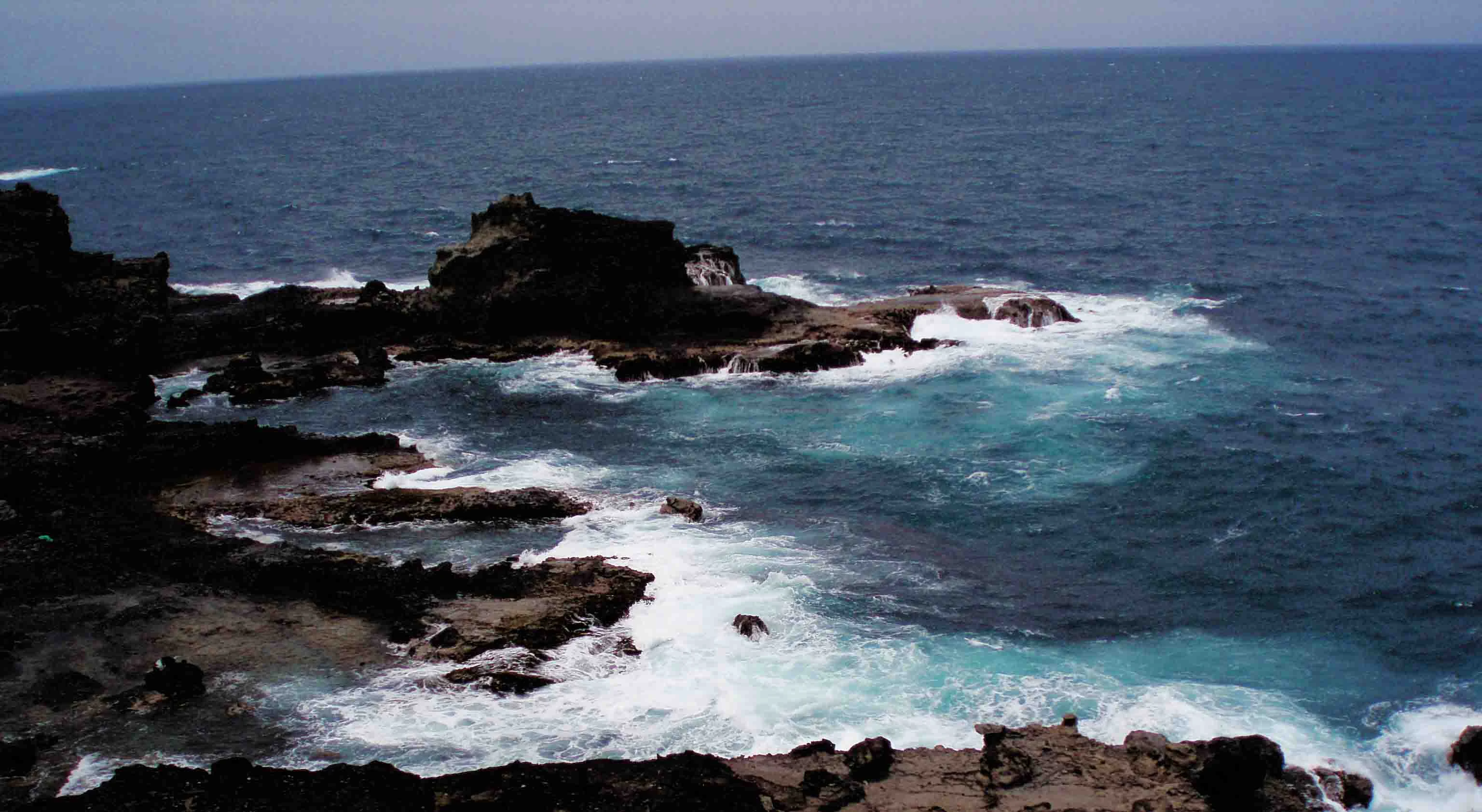
A high-angle view of rugged dark volcanic rocks along a coastline with white sea foam breaking against the shore in the Atlantic Ocean.
Waves crashing against the rocky coastline of the Caravelle peninsula in Martinique.

Caravelle Peninsula National Nature Reserve history and protected-area timeline

The protection of the Caravelle Peninsula was first proposed in 1973, when a report and accompanying ornithological studies highlighted the area's exceptional natural importance, particularly the exclusive presence on the peninsula of the White-breasted Thrasher, the only species of the genus Ramphocinclus.

The reserve was formally created by ministerial decree on 2 March 1976. A prefectural order on 5 June of the same year established the initial management committee. In 1981, a management convention was signed between the Martinique Regional Natural Park and the French Ministry of Ecology, giving the regional park formal responsibility for day-to-day administration.

A decisive turning point came on 6 October 1988, when the Conservatoire du littoral acquired the Le Galion agricultural estate, a 257-hectare holding that represented the majority of the reserve's surface area. This purchase transformed land ownership within the protected area and ended the threat of agricultural conversion across most of the peninsula. In 1994, two interpretation trails were created and visitor facilities were built to manage public access, and in 1998 a legal procedure led to the removal of approximately 34 hectares of privately owned land from the reserve's perimeter. Since then, the reserve has continued to operate within the framework of successive management plans, including the 2013 to 2017 plan that remains a primary reference document.

Caravelle Peninsula National Nature Reserve landscape and geographic character

The landscape of the reserve is shaped by its position at the tip of a narrow Atlantic promontory and by its unusually ancient geological origin. The peninsula belongs to the first arc of Caribbean formation, dating to the early Oligocene roughly 25 million years ago, making it significantly older than the volcanic spine of central Martinique. The result is a coastline of rugged cliffs, weathered rock platforms, and exposed Atlantic headlands rather than the lush volcanic slopes found elsewhere on the island.

The Table du Diable, a flat, raised rocky plateau at the peninsula's tip, is one of the most striking natural features. Around it, the shoreline alternates between steep cliff faces, small sandy coves, and mangrove-lined inlets. The Baie du Trésor is one of the most emblematic embayments, sheltered on its landward side by mangrove and fringed by the small Îlet du Trésor offshore. To the northeast, the Îlet Lapin and the smaller rocks off Pointe Caracoli complete the seaward edge of the reserve.

Inland, the terrain consists of dry coastal vegetation on thin soils, with low woodland and scrub adapted to wind, salt spray, and seasonal drought. The contrast between this open Atlantic-facing landscape and the humid volcanic interior of Martinique is one of the clearest visible distinctions in the island's geography.

Caravelle Peninsula National Nature Reserve ecosystems, habitats, and plant life

The habitats protected by the reserve are unusually concentrated for such a small area. The single most important habitat feature is a 15-hectare mangrove of Pterocarpus officinalis, known locally as Mangle médaille, recognized as a Zone naturelle d'intérêt écologique, faunistique et floristique. This is the only known station of this mangrove type on the island of Martinique, making the reserve the definitive location for the conservation of this habitat in French Martinique.

Marine and coastal habitats form the other major component of the protected area. The small offshore islets, exposed rocky shores, and cliffs provide specialist nesting conditions for seabirds, while the sheltered bays support mangrove communities of regional ecological significance. The dry coastal woodland and scrub vegetation communities inland represent the broader vegetation matrix that connects these specialized habitats.

Together, these habitats create a compact mosaic of Caribbean coastal environments: mangrove, cliff, rocky islet, sandy cove, and xeric scrub, all within an area of less than 400 hectares. This habit density, rather than the spatial extent, is what gives the reserve its biodiversity significance.

Caravelle Peninsula National Nature Reserve wildlife and species highlights

The reserve's wildlife significance is dominated by birds, both terrestrial and marine. The single most important species is the White-breasted Thrasher (Ramphocinclus), which exists in Martinique only inside the reserve. It is the only species in its genus, giving it strong biogeographic importance beyond its simple rarity.

On the offshore islets, the reserve supports significant breeding colonies of Caribbean seabirds. The Sooty Tern nests densely on the upper parts of Îlet Lapin, with densities of three to four nests per square meter in purslane-dominated habitats and one to two nests per square meter in denser herbaceous vegetation. The Bridled Tern favors the rock crevices and irregularities of the islet for sheltering its chicks. The northwest-facing cliffs of the islet provide nesting habitat for Brown Noddies. A small eastern cove also serves as a nesting site for the Red-billed Tropicbird and Caribbean martins (Hirondelle à ventre blanc).

The combination of a globally rare terrestrial passerine and several regionally important seabird breeding colonies makes the reserve one of the most ornithologically significant protected areas in the Lesser Antilles.

Caravelle Peninsula National Nature Reserve conservation status and protection priorities

The principal conservation value of the reserve lies in its role as the last refuge in Martinique for several species and habitats that have disappeared or become rare elsewhere on the island. The Pterocarpus officinalis mangrove it protects is unique to the reserve within Martinique, and the White-breasted Thrasher population it harbors represents an important share of the species' global range. Both of these conservation responsibilities would be lost entirely if the reserve were degraded.

The reserve is classified as IUCN Category IV, recognizing it as a habitat and species management area. Its conservation significance is reinforced by overlap with the Martinique Regional Natural Park, the acquisition of the dominant Le Galion estate by the Conservatoire du littoral in 1988, and formal recognition of the mangrove as a Zone naturelle d'intérêt écologique, faunistique et floristique. The management framework has been developed and documented through successive management plans, including the 2013 to 2017 plan that remains a primary reference document.

At the same time, the reserve faces a significant tension between conservation and public use. The presence of Château Dubuc within its perimeter makes it the most visited natural protected site in Martinique, with visitor numbers on the order of 400,000 per year. Managing the ecological impact of this level of visitation is itself one of the central conservation challenges of the site.

Caravelle Peninsula National Nature Reserve cultural meaning and human context

The most prominent cultural feature of the reserve is Château Dubuc, a colonial-era ruin located within the protected perimeter. The ruins are classified as a historic monument and form the most visited historic site in Martinique, drawing hundreds of thousands of visitors each year. The site's attraction has both shaped public access to the reserve and created the central management challenge of balancing tourism with habitat protection.

More broadly, the reserve lies within the cultural geography of Martinique's Atlantic coast, in the commune of La Trinité, a region shaped by colonial agriculture, fishing economies, and the legacies of plantation land use. The 1988 acquisition of the former Le Galion estate marks a major moment in that history, representing a transition of large-scale agricultural land into long-term conservation ownership through the Conservatoire du littoral.

Top sights and standout views in Caravelle Peninsula National Nature Reserve

The Caravelle Peninsula National Nature Reserve concentrates within a small surface area some of the most distinctive natural and cultural features of Martinique. The reserve protects the island's only known Pterocarpus officinalis mangrove, the most dramatic expression of the island's older geological arc at the Table du Diable, and the only Martinique population of the White-breasted Thrasher. It also shelters seabird breeding colonies of high regional importance on Îlet Lapin and other small offshore islets.

The presence of the classified ruins of Château Dubuc within the reserve adds a major historic dimension and makes it one of the most visited natural sites in Martinique, providing both a unique opportunity for public engagement and a continuing conservation challenge tied to high visitor numbers.

Best time to visit Caravelle Peninsula National Nature Reserve

The reserve sits in a tropical Caribbean climate, so seasonal variation in temperature is limited and the year can broadly support visits. The dry season, generally running from roughly January through April, tends to offer the most rewarding conditions: calmer seas, clearer weather, better visibility for coastal viewpoints, and more comfortable conditions for walking the interpretation trails. During the wetter months, vegetation is more lush, but Atlantic swells and rougher seas can affect shoreline viewing and boat access to the small offshore islets.

Birding interest is relatively strong year-round, since the reserve's significance depends on resident species such as the White-breasted Thrasher rather than on seasonal migrants. However, seabird breeding activity on Îlet Lapin is concentrated in defined nesting seasons, so visitors interested in this aspect should plan around the documented tern and noddy breeding periods. Visitors interested primarily in the historic ruins of Château Dubuc face fewer seasonal constraints than those interested in the wildlife and coastal habitats.

Monthly climate preview

Long term average temperature and monthly precipitation patterns sampled at a representative coordinate

Réserve naturelle nationale de la presqu'île de la Caravelle Climate Normals and Weather by Month

Representative baseline measurements reveal the enduring annual temperature and precipitation rhythm across Réserve naturelle nationale de la presqu'île de la Caravelle. Detailed monthly breakdowns provide complete historical averages for researchers analyzing long term environmental conditions at this protected location.
Annual mean27 °C
26 °C28 °C
Jan26°
Feb26°
Mar26°
Apr26°
May27°
Jun28°
Jul28°
Aug28°
Sep28°
Oct28°
Nov27°
Dec27°
Warmest month
September

28.2 °C

Coolest month
February

25.7 °C

Wettest month
September

5.2 mm/day

Driest month
February

1.4 mm/day

Park location guide

Geography guide, regional context, and park location map for Caravelle Peninsula National Nature Reserve

Caravelle Peninsula National Nature Reserve park geography, regions, and map view in France

Understand where Caravelle Peninsula National Nature Reserve sits in France through a broader geographic reading of the surrounding landscape, nearby location context, and its mapped position within the national park landscape.

How Caravelle Peninsula National Nature Reserve fits into France

France is a unitary semi-presidential republic and one of the world's largest economies. It borders Belgium, Luxembourg, Germany, Switzerland, Italy, Monaco, Andorra, and Spain, with a maritime border to the United Kingdom. The country is known for its cultural influence, art, cuisine, and political history spanning centuries.

Wider geography shaping Caravelle Peninsula National Nature Reserve in France

France is located in Western Europe. Metropolitan France extends from the Rhine to the Atlantic Ocean and from the Mediterranean Sea to the English Channel and North Sea. The country borders Belgium, Luxembourg, Germany, Switzerland, Italy, Monaco, Andorra, Spain, and has a maritime border with the United Kingdom.

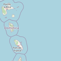
Map view of Caravelle Peninsula National Nature Reserve

Use this park location map to pinpoint Caravelle Peninsula National Nature Reserve in France, understand its exact geographic position, and read its mapped placement within the surrounding landscape more clearly.

Pigeon | © OpenStreetMap contributors

Location context for Caravelle Peninsula National Nature Reserve

Martinique

Visual exploration of coastal cliffs, mangrove habitats, and ancient volcanic terrain

Réserve naturelle nationale de la presqu'île de la Caravelle Photos and Landscapes

Visual records capture the rugged Atlantic shoreline, weathered rock platforms, and dense mangrove inlets defining the protected peninsula. Photographic documentation highlights rare coastal habitats and distinct geological formations across the Caribbean reserve.

A high-angle view of rugged dark volcanic rocks along a coastline with white sea foam breaking against the shore in the Atlantic Ocean.

Park atlas

Compare nearby protected areas and regional coastal landscapes

Other Parks Near Réserve naturelle nationale de la presqu'île de la Caravelle

Browsing other parks near Réserve naturelle nationale de la presqu'île de la Caravelle reveals wider patterns in regional geography and protected coastal landscapes. Comparing adjacent habitats allows travelers to evaluate coastal reserves and island ecosystems across the surrounding territory.
Marine protected areaFrance
About 0.2 km away#1 closest

Northeast

Sanctuaire Agoa: Exploring the Marine Protected Landscapes of the French Antilles

Regional marine mammal sanctuary and Caribbean oceanic geography

Sanctuaire Agoa represents a significant marine protected area spanning 143,000 square kilometers across the Caribbean. The sanctuary provides vital protection for humpback whales, dolphins, and various marine mammals while serving as a hub for regional cooperation in the Lesser Antilles. Mapping the sanctuary reveals a complex maritime space that stretches from shallow reef-fringed volcanic islands to deep ocean pelagic waters.

Area
143,256 km²
Established
2010
Climate
Tropical
Access
Access unknown
Nature reserveMartinique
About 37 km away#2 closest

West

Réserve naturelle régionale marine du Prêcheur - Albert Falco: Martinique Marine Protected Area Atlas

Coastal habitat protection and seabed geography in the French Caribbean.

This protected area encompasses over 600 hectares of seabed and water column along the Le Prêcheur coastline. It represents a significant conservation effort within the Lesser Antilles, preserving coral reefs and nearshore marine structures situated beneath the volcanic terrain of northern Martinique. Named after the oceanographer Albert Falco, the reserve maintains a distinct connection to the maritime heritage of the island.

Area
6.03 km²
Established
2014
IUCN
IV
Scope
Marine
National parkDominica
About 68 km away#3 closest

Northwest

Morne Trois Pitons National Park: Dominica's Volcanic Protected Area Atlas

Explore its unique geothermal terrain and mapped natural boundaries.

Morne Trois Pitons National Park represents a core protected area within Dominica, renowned for its dramatic volcanic landscapes and rich geothermal activity. This national park features steep volcanic cones, deep canyons, and diverse terrain shaped by intense geological forces. The park's mapped boundaries encompass unique natural wonders, offering a focused study of volcanic geography and protected ecosystems. Discover the contours of this significant Caribbean landscape and its inherent natural value.

Area
68.57 km²
Established
1975
IUCN
II
Relief
Mountain
National parkDominica
About 98 km away#4 closest

Northwest

Morne Diablotin National Park: Dominica National Park Geographic Atlas Exploration

Mapped protected areas and regional landscape context.

Morne Diablotin National Park serves as a vital national park within Dominica, offering specific insights into its protected terrain and geographic setting. Explore its mapped boundaries and understand its role as a distinct natural landscape within the island's atlas, providing focused discovery for those interested in protected areas and their regional context.

Area
33.35 km²
Established
2000
Relief
Mountain
Climate
Tropical
National parkDominica
About 110 km away#5 closest

Northwest

Cabrits National Park: Protected Landscape and Geographic Context in Dominica

Explore Dominica's volcanic terrain and mapped protected areas.

Delve into the protected landscape of Cabrits National Park, a key component of Dominica's natural heritage. This entry provides an atlas-focused view of the park, detailing its geographic setting and mapped boundaries within the island nation. Understand how Cabrits National Park contributes to the regional geography of the Lesser Antilles and appreciate its significance as a protected natural area for structured discovery.

Area
5.3 km²
Established
1986
IUCN
II
Relief
Upland
Watercolor painting of mountains, a lake, and green hills
National parkGuadeloupe
About 159 km away#6 closest

Northwest

Guadeloupe National Park: Volcanic Rainforest and Protected Landscape Identity

Explore mapped boundaries and regional geography.

Guadeloupe National Park stands as a significant protected landscape, primarily defined by the dramatic volcanic terrain of Basse-Terre. This atlas entry focuses on the park's vital role in preserving one of the Caribbean's most extensive tropical rainforest ecosystems, centered around the active La Soufrière volcano. Understand its mapped boundaries, unique geographic setting within the Lesser Antilles, and its importance as a national park and UNESCO biosphere reserve.

Area
173 km²
Established
1989
IUCN
II
Relief
Mountain
Watercolor painting of a coastal landscape with green hills, trees in the foreground, and a calm sea, featuring a light and airy artistic style.
National parkAntigua and Barbuda
About 265 km away#7 closest

North

Nelson's Dockyard National Park: Protected Maritime Heritage and Caribbean Coastal Geography

Mapped terrain, historical dockyards, and Antiguan coastal trails

Nelson's Dockyard National Park preserves a critical maritime hub in Antigua and Barbuda, defined by the interplay between a natural hurricane-shelter harbour and the rugged hills of the south coast. The protected site encompasses substantial stone naval architecture from the Georgian era alongside a network of trails that trace the dry forest ridges above English Harbour. This geography offers a distinct perspective on how human historical impact and natural tropical landscape preservation coexist in the Caribbean Lesser Antilles.

Relief
Lowland
Scope
Mixed
Water
Major water bodies
National parkAntigua and Barbuda
About 275 km away#8 closest

North

Green Castle Hill National Park: Volcanic Landscapes and Archaeological Sites in Antigua

A preserved hilltop ridge within the Shekerley Mountains of Antigua.

Green Castle Hill preserves a significant volcanic landscape in the southwest of Antigua. Renowned for its circle of ancient standing stones and its status as the first national park within the Shekerley range, the site offers a unique intersection of cultural heritage and mountain geography. Access map-driven insights into the protected boundaries and regional terrain that define this Caribbean hilltop.

Established
2008
Relief
Mountain
Climate
Tropical
Scope
Terrestrial

Common questions about visiting, size, designation, and location context for Caravelle Peninsula National Nature Reserve

Caravelle Peninsula National Nature Reserve FAQs for park facts, access, geography, and protected area context

Find quick answers about Caravelle Peninsula National Nature Reserve, including protected-area facts, park geography, trail and visitor context, and how the park fits into its surrounding country and regional landscape.
MoriAtlas Explorer

Continue Your Protected Areas Search Across the Global Atlas

Deepen your exploration by continuing the structured search for national parks and protected areas worldwide. Utilize the comprehensive filtering capabilities to compare different conservation landscapes and refine your understanding of global park geography. Discover more about the distribution and characteristics of protected natural areas.

Global natural geography