
Mori Atlas logo
Nature reserveRéserve naturelle nationale du Vallon de Bérard

Mapping high-altitude glacial terrain and migratory corridors in the French Alps

Réserve naturelle nationale du Vallon de Bérard: A Protected Alpine Landscape in Haute-Savoie

Réserve naturelle nationale du Vallon de Bérard stands as a significant protected nature reserve within the Haute-Savoie department, showcasing a dramatic transition from subalpine forest to rugged glaciated summits. Encompassing the northern flank of the Aiguilles Rouges massif, the area protects essential alpine habitats including rhododendron thickets, sedge meadows, and precarious hanging glaciers. This high-mountain corridor serves as a vital ecological link for regional migratory wildlife between the French and Swiss sides of the Rhône Valley.

alpine landscapesmountain reserveAiguilles Rougesglacial heritagealpine floraalpine wildlife
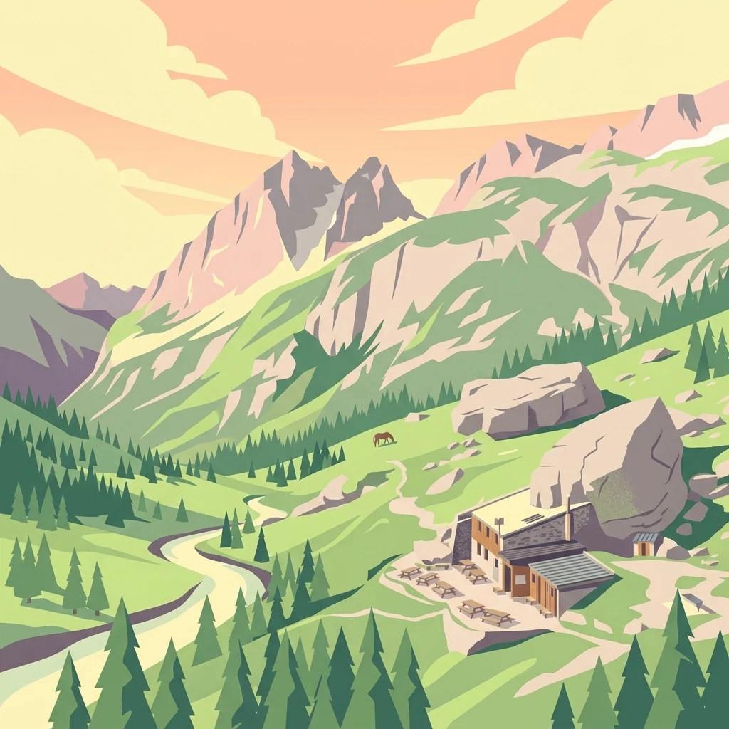
A digital illustration showing a mountain landscape with a small stone refuge building, a winding river, pine trees, and jagged mountain peaks at sunset.

Réserve naturelle nationale du Vallon de Bérard

Nature reserve

Park overview

Structured park overview, official facts, and landscape profile for Vallon de Bérard National Nature Reserve

Vallon de Bérard National Nature Reserve park facts, protected area profile, and essential visitor context

Review the core facts for Vallon de Bérard National Nature Reserve, including designation, size, terrain, visitor scale, habitats, and operating context in one park-focused overview.

About Vallon de Bérard National Nature Reserve

The Vallon de Bérard National Nature Reserve occupies one of the more quietly spectacular corners of the French Alps, tucked into the northern side of the Aiguilles Rouges massif directly above the village of Vallorcine. Though small in area, the reserve stretches across an impressive vertical range, beginning near the rushing Eau de Bérard torrent and rising past forested slopes, alpine meadows, and shattered rock faces to high summits crowned with ice. Because of this, it condenses several distinct mountain environments into a single protected unit.

The valley has long been a route for mountaineers, particularly because it offers the standard ascent route to the Mont Buet and provides access to the Refuge de la Pierre à Bérard, a well-known mountain hut. This dual character, an accessible gateway for hikers and climbers as well as a sanctuary for wildlife, has shaped how the area has been managed and protected. Establishing the reserve in 1992 was partly a way to safeguard the natural values of the valley in the face of growing pressure from tourism, summer and winter recreation, and infrastructure projects elsewhere in the Chamonix valley.

Today, the Vallon de Bérard reserve is an important component of the broader Aiguilles Rouges protected-area system, functioning as a smaller but ecologically complementary neighbor to the larger Aiguilles Rouges National Nature Reserve, with which it shares most of its border. It exemplifies the French approach of protecting alpine landscapes through small, targeted national nature reserves that anchor larger conservation strategies in some of the country's most heavily visited mountain terrain.

Quick facts and research context for Vallon de Bérard National Nature Reserve

The Vallon de Bérard National Nature Reserve is a French national nature reserve located entirely within the commune of Vallorcine in Haute-Savoie, in the Auvergne-Rhône-Alpes region. It lies on the right bank of the Eau de Bérard torrent, on the northern edge of the Aiguilles Rouges massif, and is surrounded by the larger Aiguilles Rouges National Nature Reserve.

The protected area was formally classified by decree on 17 September 1992 and is administered by ASTERS, the Haute-Savoie Conservatoire d'espaces naturels. Its altitude ranges from approximately 1,700 meters near the valley floor to 2,965 meters at the summit of the Aiguille du Belvédère, placing most of its territory in the alpine and nival vegetation zones highly characteristic of the Mont Blanc region's high mountain ecology.

Protection and recognition

Documented terrestrial protection scope and baseline conservation dataset metrics

Protection Status and International Recognition for Réserve naturelle nationale du Vallon de Bérard

Terrestrial protection status and designation records for Réserve naturelle nationale du Vallon de Bérard outline the documented regulatory framework governing the landscape. Official database entries provide verified baseline conservation metrics without implying external international recognition sources.

Protection details

Protection scope
Terrestrial
Transboundary protection
No
WDPA ID
62716
Park context

Deeper park guide and search-rich context for Vallon de Bérard National Nature Reserve

Vallon de Bérard National Nature Reserve history, landscape, wildlife, and travel context

Explore Vallon de Bérard National Nature Reserve through its history, landscape character, ecosystems, wildlife, conservation priorities, cultural context, and seasonal travel timing in a structured park guide built for atlas discovery and search intent.

Why Vallon de Bérard National Nature Reserve stands out

The reserve is best known for protecting a compact, high-quality slice of the Aiguilles Rouges massif, from forested valley bottoms up to glaciated summits above 2,900 meters. Small suspended glaciers clinging to the cliffs are among the few remaining visible reminders of the area's glacial past. The reserve also stands out for hosting a major north-south migratory flyway that channels birds and insects between the Swiss and French sides of the Rhône Valley, a feature that gives it ecological importance well beyond its modest size. Its iconic geological landmarks include the freestanding Aiguilles de Mesure, Morris and Martin, viewed from the historic Refuge de la Pierre à Bérard. These sharp crystalline spikes, together with the sedimentary rock outliers along the Belvédère to Col de Salenton ridge, give the reserve a distinctive combination of rugged Alpine topography, varied geology, and biologically rich high-mountain habitats.
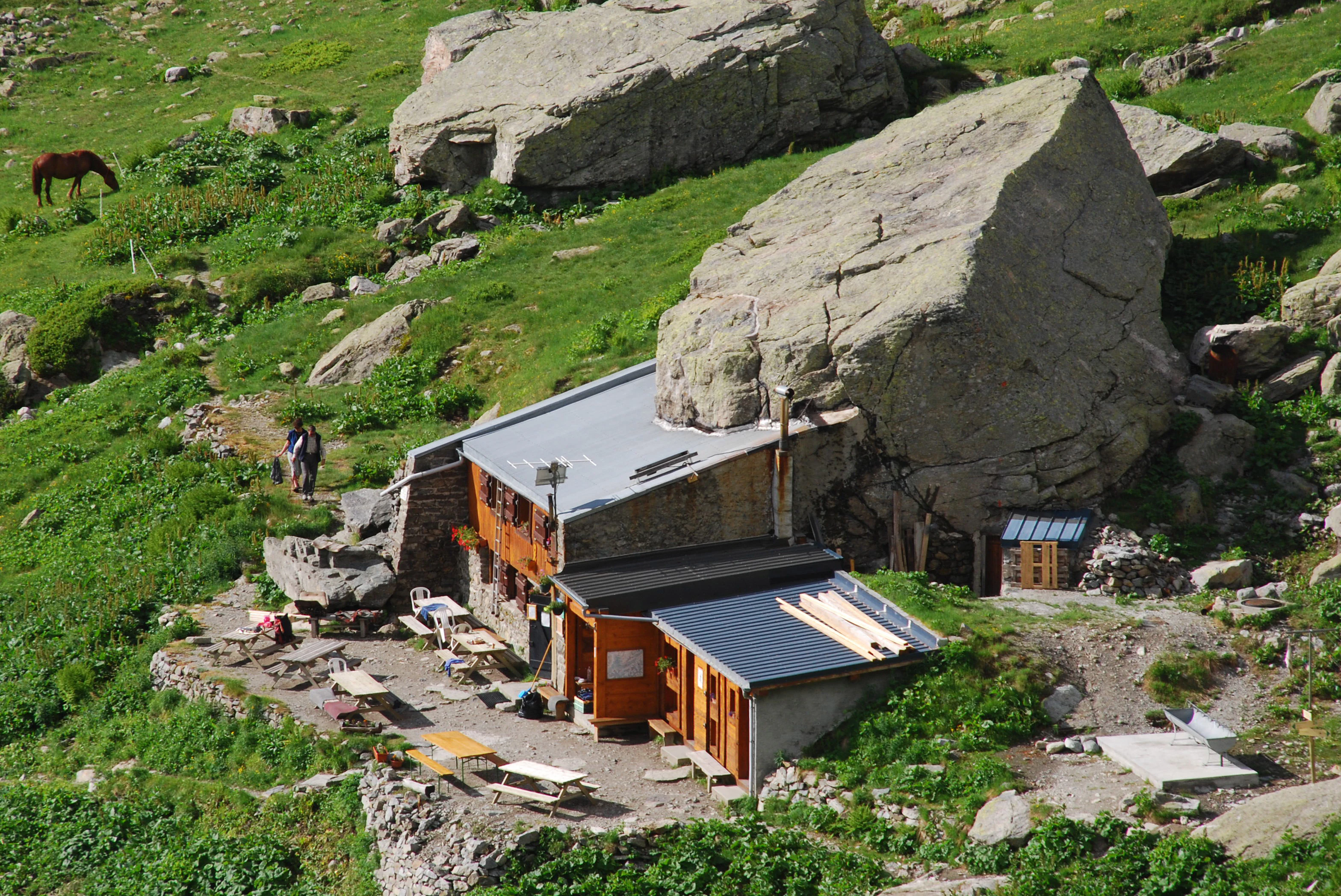
High angle shot of a wooden and stone mountain refuge built directly beneath a massive boulder in a lush green alpine meadow, with a horse grazing nearby.
The Refuge de la Pierre à Bérard, a mountain hut nestled against a large boulder in the Vallon de Bérard nature reserve.

Vallon de Bérard National Nature Reserve history and protected-area timeline

The reserve was formally created by ministerial decree on 17 September 1992, after a period of growing awareness about the pressures facing the Aiguilles Rouges massif. Its establishment was closely tied to the history of the neighboring Aiguilles Rouges National Nature Reserve, which covers a far larger territory directly to the south. The Vallon de Bérard was classified as a national nature reserve as part of compensatory measures linked to the development of a track at the Col de Balme, an Alpine pass that connects France with Switzerland.

From the outset, the reserve has been managed by ASTERS, the Conservatoire d'espaces naturels de Haute-Savoie, an organization that oversees many of the department's protected natural sites. Since its creation, the reserve has functioned as both a conservation area and a regulated Alpine space, with rules restricting activities such as plant collecting, fossil collecting, bivouacking, dog walking, and low-altitude aircraft overflights, while still allowing traditional seasonal uses such as alpine pasturing and access to mountain refuges.

Though the legal framework of the reserve is relatively recent, the Bérard valley itself has a deeper human history. The Refuge de la Pierre à Bérard, situated at the edge of the reserve, has long served travelers, alpinists, and shepherds, and the Mont Buet, which dominates the head of the valley, was historically climbed by early mountaineers and naturalists studying the Mont Blanc region's glaciers and botany. The reserve now protects both the natural and the cultural landscape layers that have built up around this long-standing valley corridor.

Vallon de Bérard National Nature Reserve landscape and geographic character

The Vallon de Bérard is a textbook example of an Alpine U-shaped glacial valley, deeply incised into the northern edge of the Aiguilles Rouges massif. Its floor is defined by the Eau de Bérard torrent, which flows in a steep, sometimes violent mountain course through the right bank of the valley, while the surrounding walls rise in a series of dramatic forested slopes, cliff bands, and high crests. The terrain rapidly transitions from subalpine woodland near the valley bottom to bare rock, ice, and snow at the highest elevations.

The reserve's skyline is shaped by a series of sharp, isolated rock needles. The Aiguilles de Mesure, Morris, and Martin form a distinctive cluster of crystalline pinnacles, while the Aiguille du Belvédère marks the high point of the protected area at nearly 3,000 meters. Between Belvédère and the Col de Salenton, the ridge carries scattered blocks of sedimentary rock resting on the ancient erosion surface of the crystalline basement, a striking geological contrast that adds visual variety to the long traverse along the crest.

Glacial heritage is visible throughout the upper reserve. A handful of small hanging glaciers still cling to favored cirques and shaded cliffs, representing the last remnants of the much larger ice cover that once filled the valley during the Pleistocene. The lower flanks carry characteristic glacial polish, erratic boulders, and morainic deposits, while avalanche chutes cut clean lines through the slopes during winter and spring, reshuffling rock and vegetation in patterns that maintain the dynamic processes typical of high mountain landscapes.

Vallon de Bérard National Nature Reserve ecosystems, habitats, and plant life

Most of the reserve falls within the alpine and nival vegetation belts, reflecting its high elevation. This gives the protected area a distinctly open, rocky, and often harsh character, with thin soils, large expanses of bare rock, and a vegetation tapestry that responds closely to relief, slope, exposure, and snow cover. Despite its small footprint, the valley holds a remarkable diversity of habitats compressed into a short vertical distance.

On the better-watered and more sheltered slopes, dense thickets of rhododendron brush form a characteristic subalpine layer, laced with ericaceous dwarf shrubs. Higher up, landines dominated by bog whortleberry create low, spreading mats that mirror the harsh conditions of the upper slopes. Above them, the plant cover transitions into alpine grassland communities in which curved sedge is a defining species, tough enough to colonize wind-exposed ridges and stony soils. The most dynamic habitats are the avalanche corridors, where green alder colonizes disturbed ground in long, narrow bands following the fall lines of recurring snow slides.

Beyond its plant communities, the reserve also supports a striking mosaic of substrates, from siliceous crystalline rocks to isolated patches of sedimentary material. These varied geologies, combined with sharp gradients of altitude, slope, and humidity, give the valley a relatively high concentration of rare and protected plant species for an area of its size, with around twenty rare or protected species documented, including six that hold national protection status in France.

Vallon de Bérard National Nature Reserve wildlife and species highlights

Wildlife in the Vallon de Bérard follows the classic pattern of the high Western Alps. The reserve's cliffs and ledges provide refuge for ibex, which move along the steep rock bands above the valley, while chamois range more widely across the alpine meadows and broken ground at mid-elevations. Ptarmigan, an emblem of high-altitude birdlife in the Alps, are present in the upper rocky and sparsely vegetated zones where their cryptic plumage blends with the stones and dwarf shrubs.

The valley's significance, however, goes beyond its resident species. Its position between the Swiss Rhône Valley in Valais and the French Rhône Valley gives it an outsized role as a migratory corridor, and the reserve is recognized as a key passage for both birds and insects crossing this high mountain barrier. This migratory function adds a seasonal dimension to its wildlife value, with movement pulses during the spring and autumn passages influencing what observers can encounter in the valley at different times of year.

Other typical Alpine species make use of the mosaic of forest, scrub, rock, and meadow within the reserve, creating a relatively intact high-mountain food web for so small a protected area. The combination of resident ungulates, hardy mountain birds, and migratory species reinforces the reserve's role as both a refuge and a stepping stone for biodiversity in the broader Mont Blanc region.

Vallon de Bérard National Nature Reserve conservation status and protection priorities

The reserve's principal conservation value lies in the protection of a representative and largely intact sequence of high-mountain habitats in one of the most heavily visited Alpine regions of Europe. By safeguarding the watershed of the Eau de Bérard, its associated forest, alpine and nival ecosystems, and the steep rocky terrain that connects them, the reserve maintains ecological processes like avalanches, glacier melt, and seasonal migrations that are central to the identity of Alpine nature.

Its designation contributes to a wider conservation network that includes the much larger Aiguilles Rouges National Nature Reserve, essentially functioning as a buffer and complementary territory on the northern flank of the massif. Together, the two reserves protect a continuous block of high-mountain landscape against the encroachments of urbanization, ski development, mining, and infrastructure that have affected other parts of the Chamonix valley.

The reserve also plays a role in the protection of rare and legally protected flora. With around twenty rare or protected plant species documented, including six species with national protection status, the Vallon de Bérard acts as a small but important reservoir of high-altitude botanical diversity. Its strict regulations, prohibiting plant collection, fossil collecting, dog walking, bivouacking, and low-level aircraft overflights, are designed to maintain these sensitive features while allowing traditional uses such as alpine pasturing, forestry, and access to mountain refuges to continue under controlled conditions.

Vallon de Bérard National Nature Reserve cultural meaning and human context

The Vallon de Bérard sits within a long-standing Alpine cultural landscape, where pastoralism, mountaineering, and transboundary travel have shaped local life for centuries. The valley's link to the Col de Balme, the pass that for generations connected the Chamonix valley with the Swiss Valais, has historically made Vallorcine and its surrounding valleys a place of exchanges, migrations, and seasonal movement between communities.

Mountain huts and pastoral infrastructure are part of this heritage. The Refuge de la Pierre à Bérard, nestled on the edge of the reserve, has served alpinists, naturalists, and travelers exploring the Aiguilles Rouges and the Mont Buet for well over a century. The Mont Buet itself was climbed by some of the early European scientists and mountaineers who came to study the Mont Blanc region's glaciers and botany, leaving an imprint of early Alpine scientific exploration that is still visible in the area's identity.

The reserve's management reflects the cultural importance of balancing protection with continuing traditional uses. While modern restrictions safeguard fragile ecosystems, the valley's pastures are still grazed in summer, forests still managed for their timber and protective functions, and the historic network of footpaths and refuges continues to support a living mountain culture rather than turning the valley into an exclusive wilderness, leaving contemporary visitors to experience an Alpine landscape shaped by both nature and centuries of human presence.

Top sights and standout views in Vallon de Bérard National Nature Reserve

Among the reserve's strongest distinguishing features are its sharp granite needles, the Aiguilles de Mesure, Morris, and Martin, which rise directly above the historic Refuge de la Pierre à Bérard and define the visual identity of the valley. Equally notable are its surviving hanging glaciers, modest in size but significant as relicts of the regional glacial past and as indicators of ongoing climate-driven change at high altitudes.

The reserve also stands out for the way it concentrates a wide range of Alpine habitats into a very compact area. Within only a few kilometers of horizontal distance, visitors move from subalpine rhododendron brush, through bog whortleberry landines and curved sedge alpine grasslands, up to avalanche corridors colonized by green alder and, finally, into bare rock and nival terrain. Adding in its function as a cross-border migratory corridor between the French and Swiss sides of the Rhône Valley, the Vallon de Bérard offers a disproportionately rich biodiversity profile relative to its modest area, making it a particularly rewarding destination for naturalists interested in high-mountain ecology.

Best time to visit Vallon de Bérard National Nature Reserve

The Vallon de Bérard is at its most accessible in the heart of the Alpine summer, roughly from late June through early September, when the snow has melted from the trails leading to the Refuge de la Pierre à Bérard and toward the Mont Buet. This period offers relatively stable conditions for hiking, the clearest views of the surrounding aiguilles, and the richest display of alpine wildflowers across the meadows and rock ledges.

Outside this peak window, conditions become much more demanding. In spring, lingering snow in the upper valley and on the high ridges can make higher routes strenuous and avalanche-prone, while in autumn, dropping temperatures and early snowfall can quickly limit access to the higher elevations. Winter visitors should be prepared for a serious mountaineering environment, with the reserve then functioning more as a snowy alpine space punctuated by the dormant refuge than as a hiking destination. For those interested in observing migratory birds and insects, late spring and early autumn are the most rewarding windows, while mid-summer is best for observing resident high-mountain species such as ibex, chamois, and ptarmigan on the open slopes and rock bands.

Monthly climate preview

Long-term temperature ranges and monthly precipitation patterns at representative elevations

Réserve naturelle nationale du Vallon de Bérard Climate Normals and Weather by Month

Historical NASA Power measurements for Réserve naturelle nationale du Vallon de Bérard outline a measured annual cycle of freezing minimums and moderate peak temperatures alongside steady precipitation rates. Reviewing the complete twelve-month climatology profile provides deeper insight into long-term meteorological trends across the coordinate.
Annual mean3 °C
-7 °C13 °C
Jan-7°
Feb-6°
Mar-3°
Apr
May
Jun11°
Jul13°
Aug13°
Sep
Oct
Nov-1°
Dec-5°
Warmest month
July

12.8 °C

Coolest month
January

-6.6 °C

Wettest month
December

3.6 mm/day

Driest month
April

2.6 mm/day

Park location guide

Geography guide, regional context, and park location map for Vallon de Bérard National Nature Reserve

Vallon de Bérard National Nature Reserve park geography, regions, and map view in France

Understand where Vallon de Bérard National Nature Reserve sits in France through a broader geographic reading of the surrounding landscape, nearby location context, and its mapped position within the national park landscape.

How Vallon de Bérard National Nature Reserve fits into France

France is a unitary semi-presidential republic and one of the world's largest economies. It borders Belgium, Luxembourg, Germany, Switzerland, Italy, Monaco, Andorra, and Spain, with a maritime border to the United Kingdom. The country is known for its cultural influence, art, cuisine, and political history spanning centuries.

Wider geography shaping Vallon de Bérard National Nature Reserve in France

France is located in Western Europe. Metropolitan France extends from the Rhine to the Atlantic Ocean and from the Mediterranean Sea to the English Channel and North Sea. The country borders Belgium, Luxembourg, Germany, Switzerland, Italy, Monaco, Andorra, Spain, and has a maritime border with the United Kingdom.

Map view of Vallon de Bérard National Nature Reserve

Use this park location map to pinpoint Vallon de Bérard National Nature Reserve in France, understand its exact geographic position, and read its mapped placement within the surrounding landscape more clearly.

Pigeon | © OpenStreetMap contributors

Location context for Vallon de Bérard National Nature Reserve

Haute-Savoie
Recorded earthquake history

Review Recorded Seismic Events Near Réserve naturelle nationale du Vallon de Bérard

Examine the historical catalogue of seismic events identified in the vicinity of this alpine reserve. This MoriAtlas resource allows for the inspection of recorded magnitude and epicentre proximity for each event, offering a clear view into regional seismic history.

Réserve naturelle nationale du Vallon de Bérard Earthquake History

Catalogued events

98 events

Strongest magnitude

Magnitude 4.6

Most recent event

Jan 12, 2026

This history includes earthquakes recorded inside the park or within 50 km of its borders

Visualizing alpine terrain, glacial remnants, and high-mountain protected habitats

Réserve naturelle nationale du Vallon de Bérard Photos and Landscape Scenery

Visual records capture the rugged alpine topography and varied ecosystems of Réserve naturelle nationale du Vallon de Bérard, spanning from forested valley torrents to jagged crystalline summits. Examining field photography helps researchers interpret glacial landforms, dramatic rock needles, and high-altitude habitats across the protected area.

High angle shot of a wooden and stone mountain refuge built directly beneath a massive boulder in a lush green alpine meadow, with a horse grazing nearby.

A wide shot of steep, green, and rocky alpine mountain slopes under a clear blue sky with light clouds.

Park atlas

Compare nearby mountain reserves and protected landscapes across the surrounding region

Parks Near Réserve naturelle nationale du Vallon de Bérard and Regional Protected Areas

Browse adjacent high-altitude protected areas and alpine nature reserves situated close to Réserve naturelle nationale du Vallon de Bérard. Comparing these neighboring mountain ecosystems reveals broader patterns in regional geography and glacial terrain conservation.
Watercolor painting of a soft green alpine landscape with rolling hills, a central body of water, and evergreen trees against a light mountain background.
Nature reserveSavoie
About 36 km away#1 closest

Southwest

Réserve naturelle régionale de la tourbière des Saisies - Beaufortain - Val d'Arly Protected Area Map

High-altitude peatland geography in the Savoie department.

Investigate the complex topography and conservation significance of the Réserve naturelle régionale de la tourbière des Saisies - Beaufortain - Val d'Arly. This protected area stands as a unique alpine landmark, recognized for its subalpine boreal vegetation, rich bird populations, and critical role as a regional peatland sanctuary within the Savoie mountain range.

Area
2.93 km²
Established
2013
IUCN
IV
Watercolor illustration depicting green valleys, forests, and distant mountain peaks
National parkItaly
42 km away#2 closest

Southeast

Gran Paradiso National Park: Italy's National Park Protected Landscape Atlas

Mapped boundaries and regional geography for a key Italian protected area.

Gran Paradiso National Park is a distinct national park entity within Italy, offering rich potential for atlas-driven geographic discovery. This MoriAtlas profile focuses on its protected landscape identity, providing essential context for understanding its mapped boundaries and its role within the regional geography of Italy. Explore the structured geographic details that make Gran Paradiso National Park a valuable component of any mapped landscape analysis.

Area
703 km²
Established
1922
IUCN
II
Relief
Mountain
Watercolor painting depicting mountains, a river, and trees under a light sky
National parkSavoie
47 km away#3 closest

South

Vanoise National Park: Explore France's Original National Park in the Savoie Alps

Mapped Alpine geography, glacial terrain, and protected landscape.

Vanoise National Park is France's pioneering national park, a protected landscape of immense alpine beauty situated in the Savoie department. Renowned for its dramatic glacial terrain, over 100 peaks above 3,000 meters, and the iconic Alpine ibex, this park offers a profound geographic context. Explore its mapped boundaries and discover the unique atlas-level insights into France's mountainous protected areas and their ecological significance.

Area
534 km²
Established
1963
IUCN
II
Relief
Mountain
A horizontal watercolor painting depicting a gentle mountain silhouette behind a forested shoreline sloping toward the water.
Nature reserveFrance
About 54 km away#4 closest

West

Roc de Chère Nature Reserve: Mapping the Botanical Diversity and Geological Features of Haute-Savoie

A protected alpine promontory bordering Lake Annecy

Roc de Chère stands as a distinct geological landmark where limestone and sandstone soils create sharp microclimate contrasts. This protected reserve provides a critical habitat for diverse plant species and rare dragonflies within a small, defined area of the French Alps. The site acts as a key element of the Lake Annecy landscape, offering insight into the post-glacial environmental history of the Savoie region through its protected cliffs and hollows.

Area
0.69 km²
Established
1977
Relief
Mountain
Climate
Temperate
A soft, horizontal watercolor painting depicting a winding river flowing through a lush, green landscape with distant hills and sparse trees.
Nature reserveVaud
About 62 km away#5 closest

Northwest

Chanivaz, Delta de l’Aubonne: Geography, Map, and Protected Landscape Context

A rare glacial geotope and river delta on Lake Geneva.

Chanivaz, Delta de l’Aubonne provides a rich look at the alluvial fan of the River Aubonne. Explore its layered terrace terrain, protected reedbeds, and riparian forests in the canton of Vaud, representing one of the best-preserved natural river mouths remaining on the northern shore of Lake Geneva.

Area
3 km²
Established
2003
Relief
Lowland
Climate
Temperate
A watercolor landscape painting showing green hills, trees, and marshy river banks.
Nature reserveGeneva
About 67 km away#6 closest

West

Naturschutzgebiet Moulin de Vert: Protected Wetland and Forest Geography in Geneva

Detailed nature reserve map and regional landscape context

The Naturschutzgebiet Moulin de Vert nature reserve protects a mosaic of riverside woodland, meadows, and managed pond systems along the Rhône in the Canton of Geneva. Spanning approximately 132 hectares, this conservation area is recognized for supporting extensive biodiversity, from nesting peregrine falcons to diverse amphibian populations. Access this detailed geographic perspective to visualize the park boundaries, internal terrain features, and its ecological connection to the broader Swiss river landscape.

Area
1.32 km²
Established
2001
IUCN
IV
Wildlife reserveBourgogne-Franche-Comté
79 km away#7 closest

Northwest

Tourbières et lacs de la montagne jurassienne: Mapping High-Altitude Wetlands and Glacial Landscapes

A vast protected wildlife reserve in the Bourgogne-Franche-Comté region

Covering more than 12,000 hectares, this wildlife reserve forms a crucial conservation benchmark for peatland and glacial lake systems in the Jura Massif. The landscape encompasses deep combes, broad plateaus, and clear-water basins like Lac de Saint-Point, providing a vital habitat mosaic for diverse flora and fauna across the French highlands.

Area
121.56 km²
Established
2021
Relief
Mountain
Climate
Temperate
A watercolor painting showing a panoramic view of layered rolling hills and mountains in purple, green, and yellow hues against a white background.
Protected landscapeSwitzerland
About 82 km away#8 closest

Northeast

Diemtigtal: Protected Alpine Landscape in the Bernese Oberland, Switzerland

Mapped valley geography and mountain terrain context

Explore the structured geography of Diemtigtal, a regional nature park in the Bernese Oberland. This valley landscape is defined by its enclosed U-shaped topography, the Niesenkette skyline, and a network of traditional settlements nested between mountain ridges and alpine streams. Gain insight into the protected boundaries and the distinctive terrain of this Swiss Alpine region.

Established
2009
Relief
Mountain
Climate
Alpine
Scope
Terrestrial

Common questions about visiting, size, designation, and location context for Vallon de Bérard National Nature Reserve

Vallon de Bérard National Nature Reserve FAQs for park facts, access, geography, and protected area context

Find quick answers about Vallon de Bérard National Nature Reserve, including protected-area facts, park geography, trail and visitor context, and how the park fits into its surrounding country and regional landscape.
MoriAtlas Explorer

Continue Your Protected Areas Search Across the Global Atlas

Deepen your exploration by continuing the structured search for national parks and protected areas worldwide. Utilize the comprehensive filtering capabilities to compare different conservation landscapes and refine your understanding of global park geography. Discover more about the distribution and characteristics of protected natural areas.

Global natural geography