Mori Atlas logo
Nature reserveRéserve naturelle régionale de la clairière forestière de Bresolettes

A diverse protected area mosaic featuring ancient woodland, historic ponds, and riparian corridors within the Perche hills.

Réserve naturelle régionale de la clairière forestière de Bresolettes: Mapping Forest and Wetland Landscapes in Normandy

This protected area captures the distinct ecological character of the Perche forest, blending mature woodland stands with rare mire clearings and wetland meadows. Located in the Orne department, the site traces a unique geographic transition between dense forest matrices and the hydrological network of the Avre river valley. Visitors can examine the interplay of natural habitats and historical land use, including ponds shaped by centuries of regional metallurgical activity.

forest reservewetlandsponds and poolsriver valleywoodland birdsbats

Réserve naturelle régionale de la clairière forestière de Bresolettes

Nature reserve

Park overview

Structured park overview, official facts, and landscape profile for Bresolettes Forest Clearing Regional Nature Reserve

Bresolettes Forest Clearing Regional Nature Reserve park facts, protected area profile, and essential visitor context

Review the core facts for Bresolettes Forest Clearing Regional Nature Reserve, including designation, size, terrain, visitor scale, habitats, and operating context in one park-focused overview.

About Bresolettes Forest Clearing Regional Nature Reserve

The Bresolettes Forest Clearing Regional Nature Reserve lies in the southern part of the Orne department, in the rolling wooded hills of the Perche, a traditional landscape region that straddles Normandy and the Centre-Val de Loire. Created in 2010 after several years of preparation by local and national partners, the reserve represents a deliberate effort to formalize protection for one of the most ecologically varied portions of the domanial forest of Perche and Trappe. Although the surrounding region has long been valued for its landscapes, villages, and rural character, this particular site stands out because its forest cover is interrupted by a network of ponds, clearings, wet meadows, and watercourses that create ecologically rich interfaces rather than a uniform block of woodland.

From an administrative standpoint, the reserve is a French Réserve naturelle régionale, a protected-area designation awarded by the regional council and managed through a partnership between regional and national bodies. In this case, the two co-managers are the Parc naturel régional du Perche, a public entity that coordinates conservation, education, and rural development across the broader Perche landscape, and the Office national des forêts, the national forestry agency responsible for state-owned forest lands. Their collaboration reflects the dual nature of the site: it is at once a managed production forest and a biodiversity refuge where natural processes and rare habitats are given room to persist.

The reserve's significance is amplified by its location near the boundary between Normandy and the broader Loire basin, with the small Avre river serving as one of the defining hydrological features of the area. This river, along with the ponds and damp clearings associated with it, creates conditions for wetland habitats, mire vegetation, and freshwater fauna that contrast sharply with the drier upland forest around them. For visitors, the landscape reads as a layered story of land use: ancient forest, historic industrial activity around water, and modern ecological conservation. The site is also crossed by the GR 22 long-distance footpath, which provides one of the principal means for the public to experience the reserve, although some parcels remain in private hands and are not publicly accessible.

Quick facts and research context for Bresolettes Forest Clearing Regional Nature Reserve

The Bresolettes Forest Clearing Regional Nature Reserve covers about 780 hectares within the domanial forest of Perche and Trappe, in the Orne department of the Normandy region of northwestern France. It is classified as a Regional Nature Reserve (Réserve naturelle régionale), a category of French protected area managed at the regional level, with an IUCN management category of IV (habitat and species management area). The reserve was created by regional deliberation on October 22, 2010, and is jointly administered by the Parc naturel régional du Perche and the Office national des forêts (ONF).

The territory spans the communes of Bresolettes, Bubertré, Prépotin, and Randonnai, and is centered on the Avre river, a small Normandy watercourse that gives the site much of its hydrological character. Forest is the dominant land cover, with the remaining area made up of ponds, wet meadows, mires, and associated clearings. The reserve is also crossed by the GR 22 long-distance footpath, which provides public access to much of the landscape while some privately owned portions remain closed to visitors.

Protection and recognition

Examine documented protection status and official database records for this protected area.

Réserve naturelle régionale de la clairière forestière de Bresolettes Protection Status

Comprehensive protected area records detail the official designation framework and administrative database tracking for Réserve naturelle régionale de la clairière forestière de Bresolettes. Structured conservation data provides reliable insight into international registry listings and recognized geographic boundaries.

Protection details

WDPA ID
555514358
Park context

Deeper park guide and search-rich context for Bresolettes Forest Clearing Regional Nature Reserve

Bresolettes Forest Clearing Regional Nature Reserve history, landscape, wildlife, and travel context

Explore Bresolettes Forest Clearing Regional Nature Reserve through its history, landscape character, ecosystems, wildlife, conservation priorities, cultural context, and seasonal travel timing in a structured park guide built for atlas discovery and search intent.

Why Bresolettes Forest Clearing Regional Nature Reserve stands out

The reserve is best known for the remarkable concentration of habitats packed into a relatively small area of the Perche forest landscape, where mature woodland, ponds, wet meadows, and mire clearings coexist in close proximity. This mosaic, combined with the presence of the Avre river, creates conditions suited to species that are often scarce in heavily forested lowlands of northwestern France, including a rich community of bats, six species of woodpeckers, and several protected wetland plants such as round-leaved sundew and water clover. It is also recognized as a valuable example of how a long-established working forest, with centuries of managed land use including historic ironworking activity, can simultaneously serve as a refuge for specialized flora and fauna. The evident traces of former metallurgical works around the ponds give the site an unusual combination of natural and cultural heritage that distinguishes it from many purely ecological reserves.

Bresolettes Forest Clearing Regional Nature Reserve history and protected-area timeline

The protection of the Bresolettes forest clearing was the result of a multi-year initiative led jointly by the Parc naturel régional du Perche and the Office national des forêts. Their proposal built on growing recognition that the mosaic of forest, ponds, and wetlands around the village of Bresolettes held exceptional ecological value within the broader Perche forest, and after a process of consultation and inventory work, the site was formally classified as a Regional Nature Reserve by deliberation on October 22, 2010. Since that date, the two partner organizations have functioned as co-managers of the reserve.

The first management plan for the reserve covered the period from 2013 to 2020, establishing a structured framework for ongoing conservation work, monitoring, and public engagement. The institutional structure has therefore been relatively stable since the reserve's creation, with the partnership between the regional park and the national forestry office providing administrative continuity.

Beneath the modern conservation framework, the landscape itself carries a much older human story. The numerous ponds scattered through the forest and their immediate surroundings preserve visible traces of metallurgical activity that took place in the region from the late seventeenth century through the early nineteenth century. These historical ponds and ironworking sites, now embedded within a managed nature reserve, give the site a layered cultural dimension, blending industrial heritage with ecological recovery. The former industrial features have themselves become habitats of interest, illustrating how past land use can shape present-day biodiversity patterns in forest landscapes.

Bresolettes Forest Clearing Regional Nature Reserve landscape and geographic character

The landscape of the Bresolettes reserve is shaped by the gentle relief of the Perche hills, where rolling uplands give way to small valleys carved by streams and former watercourses. Forest dominates the scenery, covering roughly 88 percent of the territory in continuous blocks of woodland that form part of the larger domanial forest of Perche and Trappe. The dominant impression is one of a mature, well-structured forest landscape, with tall canopy, understory layers, and clearings that break up the woodland into a varied mosaic.

Within this forested matrix, the most striking landscape features are the numerous ponds and wetland clearings that punctuate the terrain. These open areas, often fringed by wet meadows and mire vegetation, create visual and ecological contrasts with the surrounding woodland. The ponds themselves owe their existence in part to historical land use: many of them are associated with former metallurgical works from the late seventeenth to early nineteenth centuries, and their embankments and surroundings still bear traces of that industrial past.

The hydrological backbone of the reserve is the Avre river, a small Normandy watercourse whose valley draws together many of the ponds, wet meadows, and damp clearings. The river corridor amplifies habitat diversity along its banks and provides the wet conditions that support mire plant communities and freshwater fauna. Together, the forest stands, the historical ponds, the Avre valley, and the surrounding clearings define a layered, readable landscape in which natural processes and centuries of human activity have left their marks side by side.

Bresolettes Forest Clearing Regional Nature Reserve ecosystems, habitats, and plant life

Ecologically, the Bresolettes reserve is significant because it concentrates an unusually high diversity of habitat types within a relatively small area of northwestern France. The site supports extensive forest ecosystems, open water in the form of ponds, wet meadows, and mire-like wetland zones, drier heath-like clearings, and the riparian corridor of the Avre river. This combination of habitats means that species associated with closed forest, open ground, and wetland environments all find suitable conditions within a short distance of one another.

The forest itself forms the structural backbone of the reserve, with mature stands that provide nesting cavities, dead wood, and dense canopy cover. The presence of large old trees and decaying wood is ecologically important, supporting insects, fungi, and the cavity-nesting birds for which the reserve is particularly noted. Around the edges of the woodland, the transitions into clearings and meadows create ecotones where light-demanding plants and invertebrates can thrive alongside forest species.

The wetland and aquatic habitats introduce a strongly different ecological character. The ponds, mires, and riverbanks support plant communities typical of nutrient-poor, acidic wetland conditions, including carnivorous and aquatic species such as round-leaved sundew, water clover, and small bladderworts. These sensitive habitats are among the most fragile components of the reserve and are central to its conservation interest, as several of the plant species present are uncommon or protected at the regional or national level in France.

Bresolettes Forest Clearing Regional Nature Reserve wildlife and species highlights

Despite its modest size, the Bresolettes reserve supports a rich and varied fauna that reflects the diversity of its habitats. Inventories have documented fourteen species of bats, including Daubenton's bat, the brown long-eared bat, the common pipistrelle, Leisler's bat, and Nathusius's pipistrelle, indicating that the site is an important foraging and roosting area for woodland and water-associated bat species.

The avian community is one of the most distinctive features of the reserve, with fifty-four bird species recorded. Among these, the presence of all six French woodpecker species is particularly notable: the grey-headed, black, great spotted, middle, lesser spotted, and European green woodpeckers all occur on the site. Additional species of conservation interest include the European honey buzzard, the European nightjar, and the black stork, the last being a notably sensitive species in this part of France.

Amphibians and reptiles are also well represented, reflecting the importance of the ponds and wetland zones. Recorded species include the fire salamander, the great crested newt, the palmate newt, the alpine newt, the agile frog, and the adder. The freshwater fauna is highlighted by the presence of the white-clawed crayfish in the Avre river, a species of strong conservation concern across much of its former range in France, along with the European brook lamprey. Entomological surveys have further recorded nearly two hundred insect species, including the large goldface grasshopper of clearings, the mercury bluet damselfly, and the biting rhagium beetle, contributing to a fuller picture of invertebrate diversity across the reserve's habitats.

Bresolettes Forest Clearing Regional Nature Reserve conservation status and protection priorities

From a conservation standpoint, the Bresolettes reserve is significant as one of the relatively few formally protected sites aimed specifically at preserving a representative sample of the Perche forest's natural heritage. Its mosaic of forest, ponds, and wetlands provides habitat for several species and plant communities that are uncommon or in decline across northwestern France, particularly those associated with old-growth woodland features and with nutrient-poor, acidic wetland systems.

The site holds particular importance for bat conservation, for breeding woodland birds reliant on mature trees, and for freshwater species such as the white-clawed crayfish, whose populations have collapsed in many parts of France due to habitat degradation and the spread of related invasive species. The protected status of the reserve, together with active management by the Parc naturel régional du Perche and the Office national des forêts, provides a measure of long-term security for these species that would not be guaranteed in the surrounding working forest landscape.

The reserve's IUCN management category reflects its purpose as a habitat and species management area, where conservation objectives are pursued alongside continued forestry use. This dual mandate shapes the practical conservation tools applied on the ground, including habitat monitoring, management planning through multi-year plans such as the 2013 to 2020 framework, and targeted actions to maintain pond and wetland conditions that support the most sensitive species recorded on the site.

Bresolettes Forest Clearing Regional Nature Reserve cultural meaning and human context

The Bresolettes reserve carries a distinctive cultural layer rooted in the historical industrial use of the Perche forest. The many ponds scattered across the site are not purely natural features: they were created or expanded in connection with metallurgical activity that took place in the region from the late seventeenth century through the early nineteenth century. Traces of forges, furnace sites, and associated earthworks remain visible around several of the ponds, giving the landscape a tangible connection to the region's pre-industrial economy.

The forest itself has long been part of the wider identity of the Perche, a rural region known for its traditional landscapes, hilltop villages, and well-wooded countryside. The domanial forest of Perche and Trappe, within which the reserve sits, has been managed as state forest for many generations, shaping local land use patterns and contributing to the rural character that visitors still encounter today.

In the modern era, the reserve is also part of the broader cultural and educational mission of the Parc naturel régional du Perche, which links natural heritage, rural development, and public engagement. The GR 22 long-distance footpath, which crosses the reserve, connects the site to a wider network of walking routes and gives the protected area a role in regional outdoor and cultural life.

Top sights and standout views in Bresolettes Forest Clearing Regional Nature Reserve

The reserve's strongest points of distinction include its unusually rich habitat mosaic, its complete set of six French woodpecker species, and its mix of protected wetland plants such as round-leaved sundew and bladderworts set against a backdrop of mature Perche forest. Its ponds, many of them legacies of historic ironworking, add a distinctive cultural-natural dimension that makes the site stand out from purely ecological reserves in the region.

Best time to visit Bresolettes Forest Clearing Regional Nature Reserve

The reserve can be explored in any season, but spring and early summer typically offer the richest experience for visitors, as woodland birds are most actively singing and easier to detect, amphibians are concentrated around the ponds for breeding, and wetland plants along the Avre and the mire clearings are at their most visible. Late spring through early summer is also when many insects recorded on the site, such as damselflies and grasshoppers, are most active.

Autumn brings its own character to the Perche forest, with changing leaf colours across the broadleaf stands and a quieter atmosphere that suits observation of fungi, late-season bats, and migrant bird activity. Winter visits, while colder and often wetter underfoot in the wetland zones, can still be rewarding for tracking mammals, observing woodpecker activity in the bare canopy, and appreciating the broader contours of the forest landscape. Because parts of the reserve lie in private ownership, visitors should plan to focus their walks on the GR 22 sections and other publicly accessible areas regardless of the season.
Monthly climate preview

Long-term temperature and precipitation normals from representative point measurements

Réserve naturelle régionale de la clairière forestière de Bresolettes Climate Profile

Representative coordinates record annual temperature swings between freezing minimums and warm summer maximums alongside steady monthly precipitation levels. Analyzing the full twelve-month dataset clarifies long-term meteorological normals across the protected terrain.
Annual mean10 °C
3 °C19 °C
Jan
Feb
Mar
Apr
May13°
Jun16°
Jul19°
Aug19°
Sep15°
Oct11°
Nov
Dec
Warmest month
August

18.6 °C

Coolest month
January

3.2 °C

Wettest month
December

2.5 mm/day

Driest month
August

1.6 mm/day

Park location guide

Geography guide, regional context, and park location map for Bresolettes Forest Clearing Regional Nature Reserve

Bresolettes Forest Clearing Regional Nature Reserve park geography, regions, and map view in France

Understand where Bresolettes Forest Clearing Regional Nature Reserve sits in France through a broader geographic reading of the surrounding landscape, nearby location context, and its mapped position within the national park landscape.

How Bresolettes Forest Clearing Regional Nature Reserve fits into France

France is a unitary semi-presidential republic and one of the world's largest economies. It borders Belgium, Luxembourg, Germany, Switzerland, Italy, Monaco, Andorra, and Spain, with a maritime border to the United Kingdom. The country is known for its cultural influence, art, cuisine, and political history spanning centuries.

Wider geography shaping Bresolettes Forest Clearing Regional Nature Reserve in France

France is located in Western Europe. Metropolitan France extends from the Rhine to the Atlantic Ocean and from the Mediterranean Sea to the English Channel and North Sea. The country borders Belgium, Luxembourg, Germany, Switzerland, Italy, Monaco, Andorra, Spain, and has a maritime border with the United Kingdom.

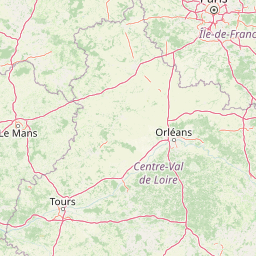
Map view of Bresolettes Forest Clearing Regional Nature Reserve

Use this park location map to pinpoint Bresolettes Forest Clearing Regional Nature Reserve in France, understand its exact geographic position, and read its mapped placement within the surrounding landscape more clearly.

Pigeon | © OpenStreetMap contributors

Location context for Bresolettes Forest Clearing Regional Nature Reserve

Normandie
Park atlas

Compare surrounding Perche forest reserves and regional woodland protected areas

Parks Near Réserve naturelle régionale de la clairière forestière de Bresolettes

Browsing other protected areas near Réserve naturelle régionale de la clairière forestière de Bresolettes reveals connected lowland forest ecosystems and wetland habitats across Normandy. Regional landscape comparisons provide deeper context on woodland conservation and river valley reserves throughout the surrounding hills.
A watercolor painting showing a soft, pastoral landscape with green rolling hills, light yellow grasslands, and a tranquil pond in the foreground against a light, hazy sky.
Nature reservePays de la Loire
About 37 km away#1 closest

Southwest

Réserve naturelle régionale du coteau et plateau de Tessé: Protected Limestone Geography

Calcareous grassland landscapes in the Sarthe department

Examine the geography of this regional nature reserve in Pays de la Loire. The site preserves a compact parcel of limestone plateau and slopes, offering a concentrated look at dry calcareous habitat conservation and the distinct geology of the Rutin valley area.

Area
0.056 km²
Established
2009
IUCN
IV
Relief
Upland
Nature reserveFrance
About 43 km away#2 closest

West

Réserve naturelle régionale géologique de Normandie-Maine: Geological Nature Reserve

A protected Ordovician limestone site in the Armorican Massif

Located in northwestern France, this reserve focuses on the geological preservation of the Carrière des Vaux. It is an essential site for understanding Paleozoic biostratigraphy, featuring well-exposed limestone sequences and significant microfossil deposits that allow for precise dating of regional strata within the Normandie-Maine landscape.

Area
0.006 km²
Established
2009
Relief
Lowland
Climate
Temperate
A pale watercolor landscape painting showing rolling green hills and distant mountain ridgelines against a white background.
Nature reservePays de la Loire
About 61 km away#3 closest

West

Réserve naturelle régionale Mont des Avaloirs: Protected Landscape and Geographic Overview

Upland heath and summit geography of the Armorican Massif

Investigate the unique physical geography of Réserve naturelle régionale Mont des Avaloirs. This area acts as a biodiversity stronghold in northwestern France, defined by a dramatic interplay of stony blockfields, sheltered valley brooks, and protected peatland basins that create atypical ecological conditions across the Mayenne countryside.

Area
3.211 km²
Established
2020
IUCN
IV
Relief
Mountain
A watercolor illustration of a rural landscape with rolling green fields and distant trees, framed by delicate foliage in the foreground.
Nature reserveCentre-Val de Loire
About 65 km away#4 closest

East

Réserve naturelle régionale de la Vallée des Cailles: Protected Area Map & Geography

Ecological landscape features in the Centre-Val de Loire

The Réserve naturelle régionale de la Vallée des Cailles encompasses forty-five hectares of calcareous chalk valley. This protected space preserves rare orchid species and diverse botanical communities shaped by a unique combination of flint geology, north-facing slopes, and long-running traditional land management practices.

Area
0.45 km²
Established
1999
IUCN
IV
Relief
Upland
A watercolor illustration of a soft, rolling landscape with green hills, a winding path or stream, and hints of pink flora in the foreground, set against a light background.
Nature reservePays de la Loire
About 71 km away#5 closest

West

Réserve naturelle régionale des landes et tourbière des Égoutelles Geographic Overview

Protected peat bog and wet heathland in Pays de la Loire

Located in Villepail, this nature reserve occupies a sheltered quarry depression in the Mayenne countryside. The site is a study in ecological resilience, featuring approximately one hundred plant species and a diverse fauna of dragonflies and amphibians that thrive in this compact, waterlogged habitat.

Area
0.013 km²
Established
2009
IUCN
IV
Relief
Lowland
A horizontal watercolor painting depicting a soft-toned landscape with a rocky scree slope in the foreground and rolling hills under a pastel sunset sky.
Nature reserveNormandie
About 77 km away#6 closest

West

Réserve naturelle régionale des pierriers de Normandie: Geographic Scree Slope Atlas

Examining rocky protected terrain in Normandy, France

The Réserve naturelle régionale des pierriers de Normandie protects one of the most distinctive natural scree slopes in northwestern Europe. This site preserves fragile rocky debris fields that support specialized vegetation and invertebrate communities. Our atlas data offers a close look at the boundaries and geological character of this significant protected landscape in the Orne department.

Area
0.009 km²
Established
2018
IUCN
IV
Scope
Terrestrial
A watercolor painting showing a soft, stylized landscape with rolling green hills, small clusters of trees, and a winding waterway, with tall grass and flowers in the foreground.
Nature reservePays de la Loire
About 80 km away#7 closest

South

Réserve naturelle régionale du bas-marais tourbeux de la Basse-Goulandière: Regional Wetland Mapping

A rare alkaline lowland peatland within the Pays de la Loire administrative region

Examine the mapped terrain and habitat structure of this protected peatland near Le Mans. This site preserves an uncommon alkaline mire environment, serving as an essential ecological bridge within the Roule-Crottes stream valley and demonstrating the significant conservation value of small, high-quality wetland pockets in agricultural landscapes.

Area
0.38 km²
Established
2011
IUCN
IV
Watercolor painting of a river flowing through a valley with gentle green hills and trees on the banks.
Nature reserveCalvados
About 86 km away#8 closest

West

Rochers des Parcs Nature Reserve: A Detailed Atlas and Protected Landscape Overview

Geographic boundaries and cliff terrain in Calvados, Normandy.

The Rochers des Parcs nature reserve features dramatic Cambrian conglomerate cliffs rising above the Orne river in the Calvados department. This site is defined by its steep wooded slopes, rare plant species, and established network of hiking paths. It represents a vital area of conservation, protected for its geological interest and ecological value, providing a clear window into the rugged terrain of the Suisse normande landscape.

Area
0.36 km²
Established
1977
Relief
Upland
Scope
Terrestrial

Common questions about visiting, size, designation, and location context for Bresolettes Forest Clearing Regional Nature Reserve

Bresolettes Forest Clearing Regional Nature Reserve FAQs for park facts, access, geography, and protected area context

Find quick answers about Bresolettes Forest Clearing Regional Nature Reserve, including protected-area facts, park geography, trail and visitor context, and how the park fits into its surrounding country and regional landscape.
MoriAtlas Explorer

Continue Your Protected Areas Search Across the Global Atlas

Deepen your exploration by continuing the structured search for national parks and protected areas worldwide. Utilize the comprehensive filtering capabilities to compare different conservation landscapes and refine your understanding of global park geography. Discover more about the distribution and characteristics of protected natural areas.

Global natural geography