Mori Atlas logo
Nearby park discovery

Explore the geographic distribution of protected natural terrain in the surrounding landscape

Protected Landscapes and Regional Nature Reserves Near Réserve naturelle régionale des gorges de la Loire

Identify natural areas, regional reserves, and protected landscapes situated within the geographic vicinity of the Réserve naturelle régionale des gorges de la Loire. This map-based perspective reveals the regional distribution of protected terrain across the Auvergne-Rhône-Alpes landscape. Compare nearby environmental features and examine how these protected zones form a wider network within the Loire valley.

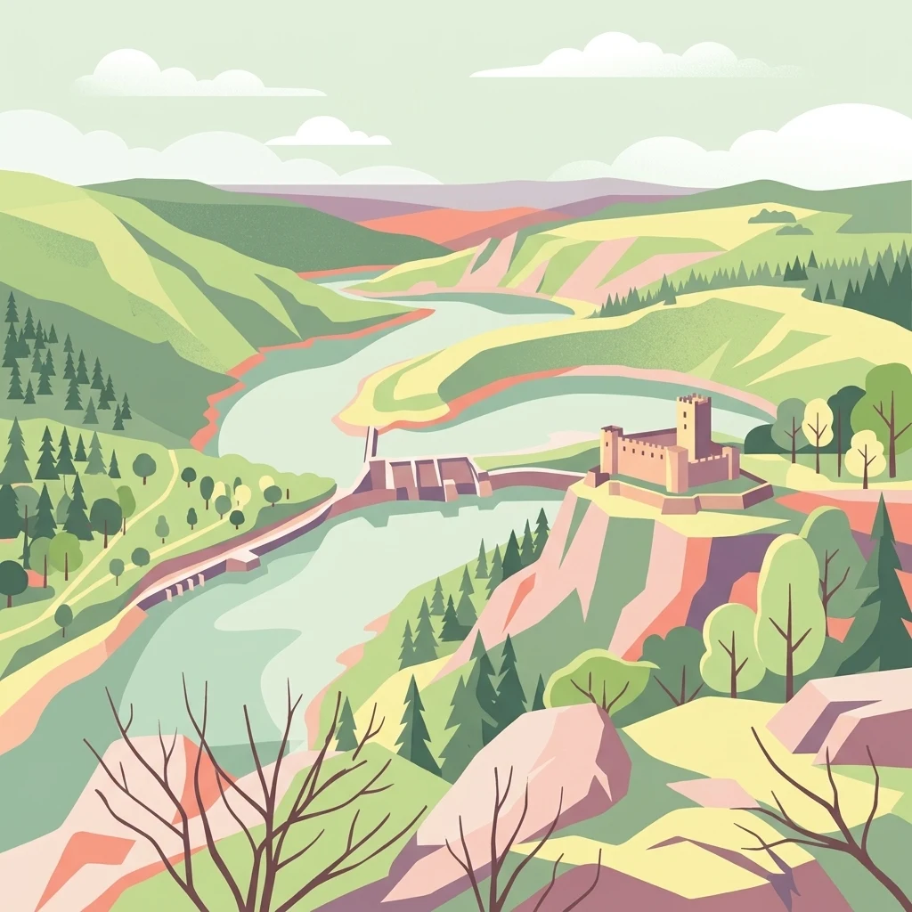
A stylized flat vector illustration of the Loire River gorge landscape, including rolling green hills, a dam, and a medieval-style castle on a cliff.

A regional nature reserve protecting the rugged gorges of the upper Loire near Saint-Étienne.

Réserve naturelle régionale des gorges de la Loire

The Réserve naturelle régionale des gorges de la Loire is a French regional nature reserve situated in the southern part of the Loire department, within the Auvergne-Rhône-Alpes region. It lies along the deeply incised gorges of the upper Loire River, downstream of the Lac de Grangent and within easy reach of the city of Saint-Étienne. The reserve protects a particularly rugged stretch of the Loire valley, where steep slopes, rocky outcrops, dry grasslands, heaths, prairies, small valleys, and forests create a mosaic of habitats unusually rich for an area located so close to a major urban center. This patchwork of environments supports a remarkable diversity of plant and animal species, including birds, butterflies, amphibians, reptiles, and insects. Originally created in 1988 as a voluntary nature reserve, the area was reclassified as a regional nature reserve in 2012 to provide stronger long-term protection and to help limit urban sprawl into the gorges. Today it serves as a conservation site, a place for environmental education, and a publicly accessible natural area crossed by a network of marked trails.

Location
France
Park type
Regional park
Established
1988
Area
3.6 km²
Réserve naturelle régionale des gorges de la Loire Geography
Regional park map

See the ranked park cluster in its geographic setting

Nearby parks around Réserve naturelle régionale des gorges de la Loire

This regional map shows the same 20 nearby parks ranked below around Réserve naturelle régionale des gorges de la Loire. Select a ranked marker to highlight that park’s boundary where boundary data is available.
Reference park: Réserve naturelle régionale des gorges de la LoireRanked nearby parkSelected boundary: Réserve naturelle régionale des gorges de la Loire20 nearby parks shown
20 nearby parks

Ranked distance relationships and regional conservation context across surrounding landscapes

Parks and Protected Areas Geographically Near Réserve Naturelle Régionale des Gorges de la Loire

Geographic separation metrics order surrounding protected areas by linear proximity to Réserve naturelle régionale des gorges de la Loire for structured spatial comparison. Regional park geography and recorded environmental data highlight broader conservation patterns across adjacent terrain.
A soft watercolor painting of a rolling landscape with green fields, distant purple hills, and patches of yellow and pink vegetation.
Nature reserveAuvergne-Rhône-Alpes
37 km away#1 closest

Northwest

Réserve naturelle régionale des Jasseries de Colleigne Protected Area and Landscape Atlas

High-altitude moorlands and glacial geography in the Monts du Forez

This regional nature reserve provides a critical look at the Hautes Chaumes du Forez, an upland plateau in the Massif Central characterized by open grasslands and peat bogs. The site serves as a vital case study for the conservation of rare montane habitats maintained through traditional pastoral farming practices. Map the glacial Chorsin valley and explore the diverse botanical landscape contained within these protected high-altitude boundaries.

Area
2.85 km²
Established
1985
IUCN
IV
Relief
Mountain
A watercolor illustration of a serene landscape with rolling hills, a meandering river, and soft light.
Regional parkAuvergne-Rhône-Alpes
42 km away#2 closest

South

Parc naturel régional des Monts d'Ardèche: Protected Landscapes and Geographic Map Context

Volcanic highland terrain within the Auvergne-Rhône-Alpes region

Covering over 248,000 hectares, Parc naturel régional des Monts d'Ardèche represents a significant protected area in the southern Massif Central. The region is marked by its distinctive volcanic sucs, including Mont Gerbier-de-Jonc, and a complex network of Cévenol river valleys. It remains a focal point for understanding the transition between high volcanic plateaus and traditional terraced agricultural slopes in southeastern France.

Area
2,280 km²
Established
2001
IUCN
V
Nature reserveAuvergne-Rhône-Alpes
44 km away#3 closest

Southwest

Réserve naturelle régionale du lac de Malaguet: Regional Nature Reserve and Wetland Atlas

Mapped protected landscapes in Haute-Loire, Auvergne-Rhône-Alpes

This protected area centers on a 14th-century artificial lake that now functions as a rich ecological sanctuary. Explore the confluence of medieval water infrastructure, riparian forests, and meadow zones that support diverse upland fauna. The site offers a clear example of long-term landscape transformation from industrial utility to a protected biodiversity refuge within the eastern Massif Central.

Area
0.542 km²
Established
2014
IUCN
IV
Relief
Upland
Nature reserveAuvergne-Rhône-Alpes
About 46 km away#4 closest

Northeast

Réserve naturelle régionale de la mine du Verdy: A Subterranean Protected Area in France

Mapping the ecological geography of the Monts du Lyonnais.

The Réserve naturelle régionale de la mine du Verdy stands as France's smallest nature reserve, protecting an intricate network of abandoned mining galleries beneath the surface of the Monts du Lyonnais. This site serves as a crucial underground sanctuary for diverse bat species and cave-dwelling invertebrates, showcasing how repurposed industrial landscapes can harbor significant biodiversity within the Auvergne-Rhône-Alpes region.

Area
0.001 km²
Established
1990
IUCN
IV
Relief
Upland
A soft watercolor painting of a wetland landscape featuring a central pond, surrounding reeds, and distant rolling hills in pale green and pink hues.
Nature reserveAuvergne-Rhône-Alpes
About 72 km away#5 closest

East

Réserve naturelle régionale de l'étang de Saint-Bonnet: Wetland Atlas and Map Discovery

Examining protected wetland geography in the Isère department

This protected area centers on the étang de Saint-Bonnet, a wetland habitat defined by dense reedbeds and pond-centered ecosystems. It provides a distinct example of nature conservation situated between major urban corridors, showcasing how amphibians and diverse bird communities thrive within a small, managed lowland basin.

Area
0.514 km²
Established
1987
IUCN
IV
Relief
Lowland
Nature reserveAuvergne-Rhône-Alpes
About 88 km away#6 closest

West

Réserve naturelle régionale du Puy de Marmant: Volcanic Geography and Protected Terrain

Regional nature reserve in the Auvergne-Rhône-Alpes landscape.

This protected site preserves a prominent volcanic hill and its surrounding dry grasslands within the Limagne basin. The reserve serves as an ecologically significant island, maintaining specialized thermophilous plants and rare geological formations composed of basalt and peperite. It remains an essential reference for understanding the volcanic heritage and unique botanical diversity of the Puy-de-Dôme department.

Area
0.203 km²
Established
1985
IUCN
IV
Relief
Upland
A soft watercolor painting of a wide, rolling landscape with green hills, pale mountain silhouettes in the background, and a faint reddish-brown foreground, presented on a white background.
Natural monumentAuvergne-Rhône-Alpes
92 km away#7 closest

West

Chaîne des Puys - faille de Limagne: Mapping Volcanic and Tectonic Protected Landscapes

Geological exploration of the Auvergne-Rhône-Alpes volcanic chain

Spanning a rhythmic skyline of roughly eighty volcanoes, the Chaîne des Puys - faille de Limagne represents a premier site for studying continental rifting and volcanic landforms. This protected monument offers a clear view into the interplay between the ancient mountain basement, the massive Limagne fault, and the resulting volcanic edifices that define the regional identity of the Auvergne-Rhône-Alpes area.

Area
242.23 km²
Established
2018
Relief
Mountain
Climate
Temperate
A wide watercolor illustration showing a river flowing through a green valley with distant purple mountains and a large reddish rock formation on the right bank.
Protected areaFrance
About 95 km away#8 closest

South

Ripisylve et lit majeur de l'Ardèche: Protected Area and Alluvial River Geography

A vital riparian corridor in the French Ardèche valley.

This protected area centers on the active Ardèche river channel and its adjacent floodplain. The site features a rich diversity of humid habitats, ranging from quiet pools and side channels to sediment rich gravel deposits. It serves as an ecologically significant corridor for riparian woodland, providing a habitat structure that is central to the environmental health of the region.

Area
2.87 km²
Established
1999
Relief
Lowland
Climate
Temperate
A soft watercolor painting depicting rolling green hills and distant faint mountains under a light sky.
Nature reservePuy-de-Dôme
About 96 km away#9 closest

West

Réserve naturelle nationale du rocher de la Jaquette Protected Area and Volcanic Landscape

Explore rocky cliffs and rare entomological habitats in the Puy-de-Dôme region.

Situated on the flanks of a volcanic outcrop above the Rentières valley, this nature reserve protects a diverse habitat mosaic within the Massif Central. The site provides essential breeding grounds for protected raptors and represents one of the most significant insect sites in central France, offering a clear view into regional volcanic ecology and mountain-valley geography.

Area
0.362 km²
Established
1976
IUCN
IV
Relief
Mountain
Nature reserveAuvergne-Rhône-Alpes
About 96 km away#10 closest

East

Réserve naturelle régionale des étangs de Mépieu: Atlas and Geographic Protected Area Overview

Wetlands, peatlands, and dry grasslands in northern Isère

The Réserve naturelle régionale des étangs de Mépieu offers a striking study in ecological contrast. This protected landscape contains a dense mosaic of five ponds and marshy terrain set directly against sun-exposed dry grasslands and heathland slopes. The site serves as a vital corridor for migratory birds and rare flora within the rolling countryside of the Auvergne-Rhône-Alpes region.

Area
1.618 km²
Established
2008
IUCN
IV
Relief
Lowland
Nature reservePuy-de-Dôme
106 km away#11 closest

Northwest

Réserve naturelle régionale des cheires et grottes de Volvic: Volcanic Landscapes and Bat Habitats

A regional nature reserve within the Puy-de-Dôme volcanic terrain

This protected area captures the geological signature of the Puy de la Nugère, where trachy-andésite lava flows form a stark surface landscape known as cheires. Beneath these flows, an extensive network of abandoned quarries provides stable cavities for diverse bat species, creating a dual-layered ecological site within the Chaîne des Puys.

Area
0.613 km²
Established
2014
IUCN
IV
Visitors
100K annual
A soft watercolor painting depicting a wide river flowing through a lush green landscape with distant rolling purple hills in the background.
Nature reserveAuvergne-Rhône-Alpes
About 106 km away#12 closest

East

Rhône du Pont de Groslée à Murs-et-Gélignieux: Alluvial Nature Reserve & River Geography

Protected riparian habitat in Auvergne-Rhône-Alpes, France.

Analyze the complex fluvial dynamics of the Rhône du Pont de Groslée à Murs-et-Gélignieux nature reserve. This site features a well-preserved landscape of alder and ash floodplain forests, isolated side channels, and marshy meadows that provide an essential ecological corridor through the Rhône river valley.

Area
21.05 km²
Relief
Lowland
Scope
Terrestrial
Water
Water-dominated
Nature reserveAuvergne-Rhône-Alpes
About 107 km away#13 closest

Southeast

Réserve naturelle régionale du réseau de grottes à chauves-souris en Drôme et en Ardèche: Protected Area Overview

Subterranean habitat protection within the Auvergne-Rhône-Alpes regional geography.

This regional nature reserve secures vital karst cavities serving as essential refuges for multiple bat species. By bridging administrative boundaries in southeastern France, the protected area demonstrates a precise focus on underground ecology and the preservation of irreplaceable subterranean environments across the departments of Drôme and Ardèche.

Area
0.49 km²
Established
2019
IUCN
IV
Relief
Mixed relief
Watercolor illustration of green fields, a river, and mountains under a soft pink and yellow sky
National parkOccitanie
109 km away#14 closest

South

Cévennes National Park: Explore its Mapped Terrain and Protected Landscape in Occitanie

Discover the unique geographic context and park boundaries.

Cévennes National Park, situated in Occitanie, France, offers a rich exploration of mid-mountain Mediterranean geography. As a protected landscape, its mapped terrain features dramatic limestone plateaus, deep river gorges, and distinct granite massifs. This entry provides essential geographic context for Cévennes National Park, highlighting its unique natural features and its significance as a protected area within the broader regional atlas.

Area
937 km²
Established
1970
IUCN
V
Visitors
800K annual
Watercolor painting of a soft, hazy mountain landscape with rolling green fields and a distant forest, set against a light, warm, pale background.
Nature reserveAuvergne-Rhône-Alpes
110 km away#15 closest

West

Réserve naturelle régionale des tourbières du Jolan et de la Gazelle: Geographic Overview

A vital wetland protected area in the Auvergne volcanic highlands.

Located in the Cantal department, the Réserve naturelle régionale des tourbières du Jolan et de la Gazelle features a unique collection of peatland habitats, trembling mires, and acidic grasslands. This area sits within the broader volcanic terrain of the Parc naturel régional des Volcans d'Auvergne, offering a protected catchment for diverse marshland flora and fauna.

Area
1.558 km²
Established
2018
IUCN
IV
Relief
Highland
A soft watercolor painting showing a wide, panoramic view of rolling green hills, distant ridges, and gentle scrub vegetation against a white background.
Regional parkAuvergne-Rhône-Alpes
About 112 km away#16 closest

South

Réserve naturelle régionale des Grads de Naves: Regional Park and Limestone Plateau Geography

Mediterranean habitat in the southern Ardèche region of France

Situated near Les Vans, the Réserve naturelle régionale des Grads de Naves is a small but biologically significant limestone plateau. This protected area demonstrates the natural reclamation of former cultivated farmland, now featuring a dense community of Mediterranean flora, breeding birds, and butterfly species within an iconic garrigue and oak-scrub landscape.

Area
0.12 km²
Established
1981
IUCN
IV
Relief
Upland
A watercolor illustration showing a soft, panoramic view of a calm lake surrounded by gentle, rolling green mountains.
Nature reserveAuvergne-Rhône-Alpes
116 km away#17 closest

East

Réserve naturelle régionale du lac d'Aiguebelette: Protected Lake and Forest Geography

Regional nature reserve landscape in the Savoie Prealps

This protected area encompasses the glacial basin of Lake Aiguebelette and the forested slopes of the Montagne de l'Épine. Discover a terrain defined by the contrast between deep mountain water and upland ridgelines, representing a critical habitat and species management zone within the Auvergne-Rhône-Alpes region.

Area
8.442 km²
Established
2015
IUCN
IV
Relief
Mountain
A watercolor painting of a soft, rolling landscape with green hills, light forest cover, and wild grasses in the foreground, rendered in a light, atmospheric style.
Nature reserveAuvergne-Rhône-Alpes
About 117 km away#18 closest

Southeast

Réserve naturelle régionale de la grotte des Sadoux: Protected Cave and Forested Hills

Regional Nature Reserve in the Drôme department of France

The Réserve naturelle régionale de la grotte des Sadoux encompasses a 30-hectare forested coteau above the Courance valley. This site is defined by its subterranean karstic gallery and surrounding woodland edge, creating a focused conservation landscape for threatened bat species within the Auvergne-Rhône-Alpes region.

Area
0.3 km²
Established
2010
IUCN
IV
Relief
Upland
A soft watercolor painting depicting a winding river through a lush green valley with distant hills in the background.
Nature reserveAuvergne-Rhône-Alpes
About 119 km away#19 closest

East

Réserve naturelle régionale des Isles du Drac: Braided River Landscape and Regional Map Context

A vital riverine conservation corridor in the Auvergne-Rhône-Alpes region of France

The Réserve naturelle régionale des Isles du Drac occupies an expansive alluvial floodplain where the river transitions into a braided system. This reserve preserves dynamic gravel bars and woodland habitats that support exceptional biodiversity within the northern Alpine landscape. It offers a detailed look at how riverine corridors persist alongside significant hydroelectric and industrial infrastructure in the Grenoble area.

Area
8.048 km²
Established
2009
IUCN
IV
Relief
Lowland
A soft, panoramic watercolor illustration of rolling hills, mountains, and trees in pastel shades of green, yellow, and pink.
Nature reserveAuvergne-Rhône-Alpes
About 119 km away#20 closest

Northeast

Réserve naturelle nationale de la grotte de Hautecourt: Jura Mountain Cave Geography

Protected subterranean landscapes in the Ain department of France.

This nature reserve protects a complex underground environment characterized by a vertical 36-meter cave system and rich invertebrate biodiversity. Located on the flank of Mont Rosset in the Auvergne-Rhône-Alpes region, the area provides a crucial habitat that balances delicate subterranean passages with surface limestone ridges and dry grassland ecosystems.

Area
0.102 km²
Established
1980
IUCN
IV
Distance methodology

Geographic measurements, not driving distances

How nearby park distances are calculated

Distances use park boundaries whenever the available geometry allows it. When one or both boundaries are missing, the mapped park locations provide a clearly labelled estimate. Every value represents straight-line geographic separation and does not use roads or routing.

Boundary distance

Calculated between the nearest points of both park boundaries.

Location-to-boundary estimate

Estimated from one mapped park location to the nearest boundary of the other park.

Mapped-location estimate

Estimated between the mapped locations of both parks.

MoriAtlas Explorer

Explore the Mapped Landscapes of Réserve naturelle régionale des gorges de la Loire

Examine the detailed geographic layout and protected boundaries of the Réserve naturelle régionale des gorges de la Loire. Use this MoriAtlas entry to understand the terrain, river valley habitats, and regional context of this French nature reserve in the Auvergne-Rhône-Alpes department.