
Mori Atlas logo
Nature reserveRéserve naturelle régionale des landes et tourbière des Égoutelles

A rare natural recovery of peat bog and wet heathland in the Mayenne department of France

Réserve naturelle régionale des landes et tourbière des Égoutelles Protected Landscape and Map

(Réserve naturelle régionale des landes et tourbière des Égoutelles (RNR213))

The Réserve naturelle régionale des landes et tourbière des Égoutelles offers a specialized look at post-industrial ecological restoration within the Pays de la Loire region. This compact protected area transforms a former Armoricain sandstone quarry into a vibrant mosaic of acid-loving wetland flora, diverse amphibian habitats, and sheltered heathland terrain. Discover the geographic boundaries and unique hydrological conditions that define this essential botanical and conservation refuge.

regional nature reservepeat bogwet heathlandquarry recoveryMayennePays de la Loire
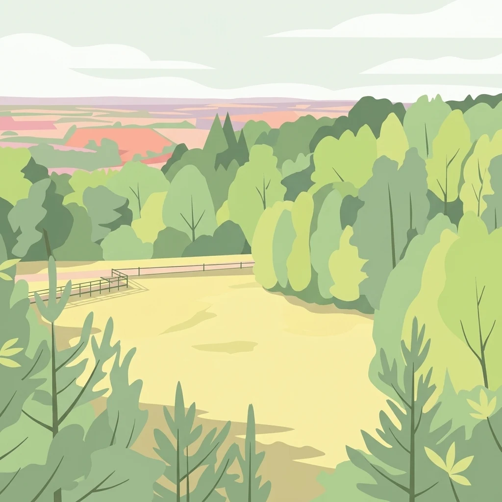
A flat-style digital illustration showing a clearing framed by green trees, with a distant landscape in the background.

Réserve naturelle régionale des landes et tourbière des Égoutelles

Nature reserve

Park overview

Structured park overview, official facts, and landscape profile for Réserve naturelle régionale des landes et tourbière des Égoutelles

Réserve naturelle régionale des landes et tourbière des Égoutelles park facts, protected area profile, and essential visitor context

Review the core facts for Réserve naturelle régionale des landes et tourbière des Égoutelles, including designation, size, terrain, visitor scale, habitats, and operating context in one park-focused overview.

About Réserve naturelle régionale des landes et tourbière des Égoutelles

The Réserve naturelle régionale des landes et tourbière des Égoutelles is one of France's smallest regional nature reserves, but it occupies an ecologically meaningful niche in the Pays de la Loire. Located on the commune of Villepail, near the borders of the Orne and Sarthe river valleys, the reserve protects a site whose character is defined by what it once was and what it has become.

Originally an extraction site for Armoricain sandstone, the quarry was abandoned and gradually transformed by ecological succession. Water accumulated, sphagnum and other peat-forming vegetation took hold, and a small peat bog emerged amid surrounding wet heathland and acid grassland. The site was recognized for its natural value in the years leading up to formal protection, and a boardwalk on stilts was installed in 2005 to allow visitors to experience the fragile habitat without damaging it.

Formal protection arrived on 14 December 2009, when the Regional Council of Pays de la Loire officially classed the site as a regional nature reserve under the code RNR213. The classification is granted for a renewable term of six years and is backed by a separate prefectural biotope protection order, reinforcing the legal framework for the conservation of species and habitats. Since then, the reserve has functioned both as a conservation site and as a small-scale pedagogical gateway to the ecology of peatlands and wet heaths in an area where such habitats are otherwise scarce.

Quick facts and research context for Réserve naturelle régionale des landes et tourbière des Égoutelles

The reserve sits in the northeastern part of the Mayenne department, close to where the Orne and Sarthe river basins meet. It is administered by the Communauté de communes de Villaines-la-Juhel and classified as an IUCN Category IV protected area.

Created on 14 December 2009 by a deliberation of the Regional Council, the reserve carries the code RNR213 and corresponds to WDPA entry 555559603. Its core protection covers 1.25 hectares of former quarry land that has developed into active peatland and wet heath, with the site also protected by a prefectural biotope order (FR3800312, "Lande humide des Egoutelles - Villepail").

Protection and recognition

Documented terrestrial protection scope and management records

Protection Status and International Recognition for Réserve naturelle régionale des landes et tourbière des Égoutelles

Terrestrial protection status records outline the administrative classification assigned to Réserve naturelle régionale des landes et tourbière des Égoutelles. Official database identifiers track the conservation framework and regional designation details.

Protection details

Protection scope
Terrestrial
Transboundary protection
No
WDPA ID
555559603
Park context

Deeper park guide and search-rich context for Réserve naturelle régionale des landes et tourbière des Égoutelles

Réserve naturelle régionale des landes et tourbière des Égoutelles history, landscape, wildlife, and travel context

Explore Réserve naturelle régionale des landes et tourbière des Égoutelles through its history, landscape character, ecosystems, wildlife, conservation priorities, cultural context, and seasonal travel timing in a structured park guide built for atlas discovery and search intent.

Why Réserve naturelle régionale des landes et tourbière des Égoutelles stands out

The reserve is best known for being a peat bog that has developed naturally within a former Armoricain sandstone quarry. This former extraction site, abandoned and left to ecological recovery, now supports a compact but ecologically rich mosaic of bog, wet heathland, and acid-loving plant communities. It is also recognized for the unusual combination of industrial heritage and natural recovery: the watermarks of its quarrying past, including a water catchment infrastructure, remain part of the protected perimeter and quietly contribute to the wet conditions that sustain the bog today.
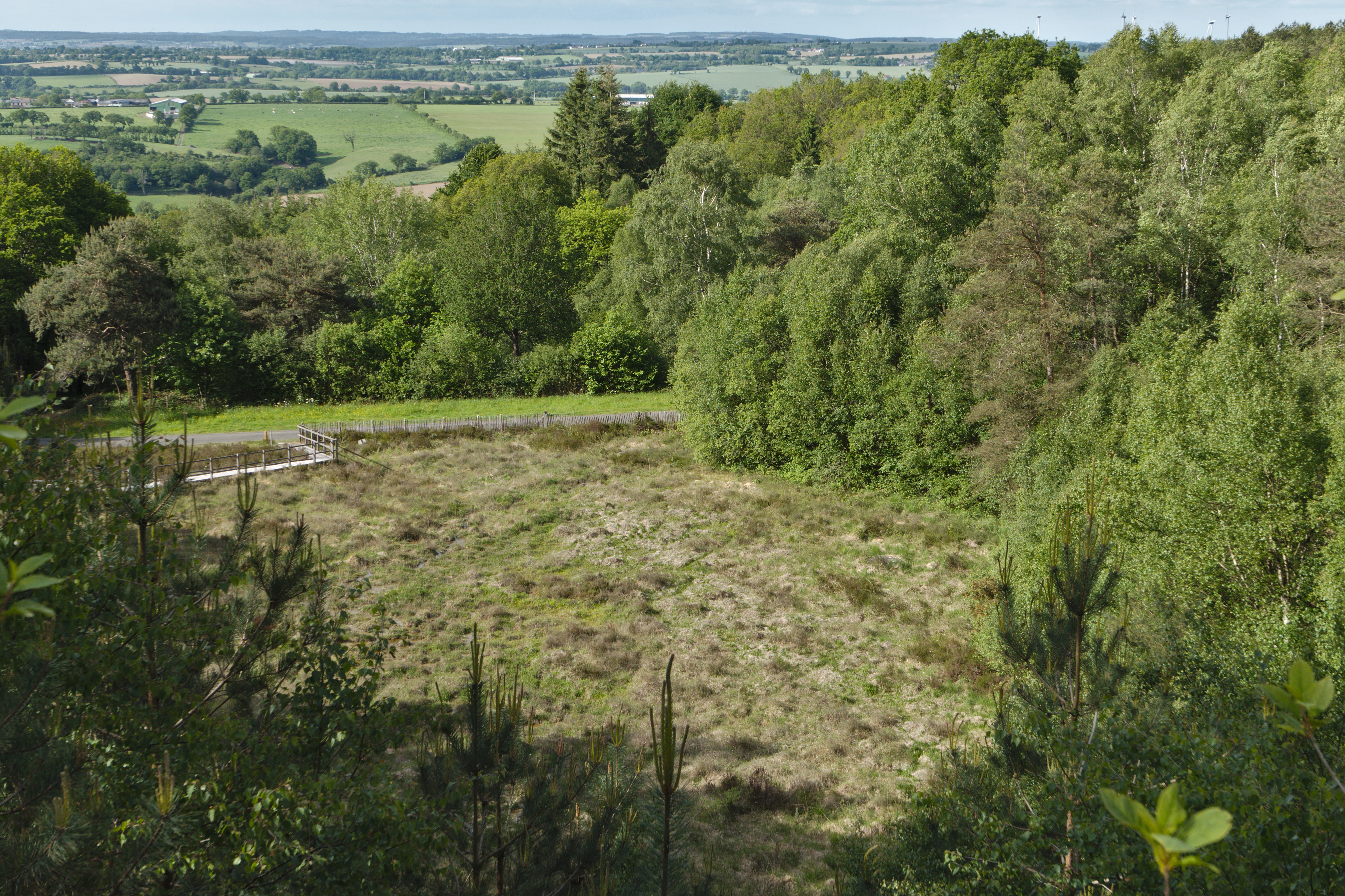
A high-angle view of a nature reserve featuring a clearing of low vegetation and marshy ground bordered by a dense forest, with a small trail and a distant view of rolling countryside.
A wide view overlooking the open land and surrounding woodland of the Réserve naturelle régionale des landes et tourbière des Égoutelles.

Réserve naturelle régionale des landes et tourbière des Égoutelles history and protected-area timeline

The site predates its protected status by centuries of industrial use: the quarry was once worked for Armoricain sandstone, a regionally important building stone. After extraction ceased, the quarry was left to natural regeneration rather than being backfilled or redeveloped.

The transitional decades between abandonment and protection shaped the site's character. As water filled the worked ground and vegetation progressed through the typical stages of post-industrial succession, peat-forming plants established themselves and the bowl of the quarry gradually turned into a functioning peat bog, flanked by wet heath vegetation. By the early 2000s, the ecological interest of the site was evident enough to warrant a boardwalk for visitors in 2005 and, ultimately, formal regional protection on 14 December 2009.

Réserve naturelle régionale des landes et tourbière des Égoutelles landscape and geographic character

The reserve occupies a low-lying, sheltered bowl within a former quarry in the rolling Mayenne countryside. The quarrying process created a depression that now hosts a small, soft, waterlogged terrain quite unlike the surrounding dry agricultural plateau.

Within this compact space the landscape is composed of three interlocking elements: the central active peat bog, surrounded by wet heathland (landes humides) on the slopes and edges, and the drier margins where quarry spoil and natural soil meet. A water catchment lies within the perimeter and contributes to the hydrological conditions that sustain the bog. The scene is quiet and enclosed, defined less by dramatic elevation than by textures: moss, bog cotton, ferns, low heather, and still, dark water.

Réserve naturelle régionale des landes et tourbière des Égoutelles ecosystems, habitats, and plant life

The ecological heart of the reserve is a small, acid peat bog sheltered within old quarry workings, ringed by wet heathland of the kind more typically associated with the larger moorlands of western France. Despite its modest size, the site carries an unusual concentration of ecological niches, from open water to saturated peat to drier acidic margins.

The vegetation reflects this gradient. Floral inventories have identified around a hundred plant species, including seven fern species and twenty moss species. Among the most notable botanical inhabitants are the Portuguese sundew (Grassette du Portugal) and the inundated clubmoss (Lycopode inondé), both specialists of nutrient-poor, waterlogged bog environments. The presence of these species is what gives the reserve its particular botanical cachet.

Réserve naturelle régionale des landes et tourbière des Égoutelles wildlife and species highlights

Faunal interest at the Égoutelles is rich relative to its size because of the diversity of microhabitats packed into a small area. The reserve hosts a meaningful community of amphibians, with at least five species recorded: the common toad, the fire salamander, the palmate newt, the midwife toad, and the common frog.

Birds associated with wet woodland and bog margins are present, including the common grasshopper warbler, the black woodpecker, and the hen harrier. Invertebrate diversity is also notable: the wetland supports dragonflies such as the blue orthetrum, and the surrounding heathland hosts the bloody-mouthed cricket (Criquet ensanglanté) among its orthopterans, a species valued as a marker of well-preserved dry and semi-dry heath vegetation.

Réserve naturelle régionale des landes et tourbière des Égoutelles conservation status and protection priorities

The Égoutelles reserve is a textbook example of how very small protected areas can deliver disproportionate ecological value when they conserve rare habitat types. Its peat bog and wet heathland support plant and animal communities that have largely disappeared from the surrounding intensively farmed Mayenne countryside.

Protection rests on a dual legal foundation. The reserve itself was classed by the Regional Council of Pays de la Loire in 2009 and is renewable every six years, while a separate prefectural biotope protection order (Arrêté préfectoral de protection de biotope) reinforces conservation of the wet heathland. The site's management by the Communauté de communes de Villaines-la-Juhel also embeds the reserve in a network of local stakeholders familiar with the territory. The presence of a water catchment within the perimeter adds a hydrological dimension to the conservation challenge, making careful water management part of long-term site care.

Réserve naturelle régionale des landes et tourbière des Égoutelles cultural meaning and human context

The reserve carries a layered human story. Before becoming a nature reserve, the land was a working quarry producing Armoricain sandstone, a material tied to the regional building tradition of western France. The transition from extraction site to ecological refuge is not unique in Europe but is locally meaningful, reflecting how post-industrial land in rural Mayenne has been allowed to recover into semi-natural habitat.

The site's identity today is shaped by both this industrial legacy and the modern stewardship work of the intercommunal authority, the regional council, and local naturalists. The boardwalk installed in 2005 is a small but symbolic expression of the reserve's role in public education about peatland ecology in a department where such landscapes are otherwise nearly absent.

Top sights and standout views in Réserve naturelle régionale des landes et tourbière des Égoutelles

A compact peat bog and wet heathland recovering inside a former Armoricain sandstone quarry on the borderlands of the Orne and Sarthe valleys in Mayenne.

Notable botanical presence of the Portuguese sundew and inundated clubmoss, supported by approximately one hundred recorded plant species, seven ferns, and twenty mosses.

A protected amphibian community of five species and a varied bird and invertebrate fauna, all within a 1.25-hectare site classed in 2009 and reinforced by a prefectural biotope order.

Best time to visit Réserve naturelle régionale des landes et tourbière des Égoutelles

The reserve's wet bog and heathland habitats have a quiet, year-round character, but the warmer months of late spring and summer are typically when wetland vegetation is most active and amphibian and dragonfly life is easiest to observe from the boardwalk on stilts. In spring, ferns and mosses are at their freshest, while late summer brings the flowering of heathers and grasses on the surrounding landes.

Because the site is small and low-lying, visitors should expect an intimate experience focused on textures and small-scale ecology rather than panoramic views; sturdy footwear is helpful given the wet ground, though the boardwalk itself allows close observation even when surrounding peat is saturated.
Monthly climate preview

Long-term monthly temperature averages and precipitation patterns measured at representative coordinates

Annual Climate Normals and Temperature Rhythms for Réserve naturelle régionale des landes et tourbière des Égoutelles

Historical data recorded between 1991 and 2000 reveals a steady annual cycle of temperatures and daily precipitation rates across the landscape. Reviewing the complete twelve-month profile provides deeper context on long-term climate variations and regional meteorological baselines.
Annual mean10 °C
4 °C18 °C
Jan
Feb
Mar
Apr
May13°
Jun16°
Jul18°
Aug18°
Sep15°
Oct11°
Nov
Dec
Warmest month
August

18.1 °C

Coolest month
January

3.5 °C

Wettest month
December

2.6 mm/day

Driest month
March

1.7 mm/day

Park location guide

Geography guide, regional context, and park location map for Réserve naturelle régionale des landes et tourbière des Égoutelles

Réserve naturelle régionale des landes et tourbière des Égoutelles park geography, regions, and map view in France

Understand where Réserve naturelle régionale des landes et tourbière des Égoutelles sits in France through a broader geographic reading of the surrounding landscape, nearby location context, and its mapped position within the national park landscape.

How Réserve naturelle régionale des landes et tourbière des Égoutelles fits into France

France is a unitary semi-presidential republic and one of the world's largest economies. It borders Belgium, Luxembourg, Germany, Switzerland, Italy, Monaco, Andorra, and Spain, with a maritime border to the United Kingdom. The country is known for its cultural influence, art, cuisine, and political history spanning centuries.

Wider geography shaping Réserve naturelle régionale des landes et tourbière des Égoutelles in France

France is located in Western Europe. Metropolitan France extends from the Rhine to the Atlantic Ocean and from the Mediterranean Sea to the English Channel and North Sea. The country borders Belgium, Luxembourg, Germany, Switzerland, Italy, Monaco, Andorra, Spain, and has a maritime border with the United Kingdom.

Map view of Réserve naturelle régionale des landes et tourbière des Égoutelles

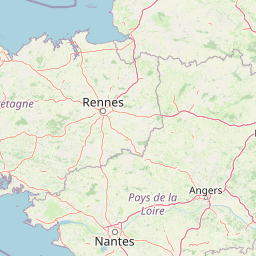
Use this park location map to pinpoint Réserve naturelle régionale des landes et tourbière des Égoutelles in France, understand its exact geographic position, and read its mapped placement within the surrounding landscape more clearly.

Pigeon | © OpenStreetMap contributors

Location context for Réserve naturelle régionale des landes et tourbière des Égoutelles

Pays de la Loire

Examine the rare peat bog habitats, wet heathland terrain, and recovering quarry scenery of a protected wetland

Visual Exploration and Landscape Photography of Réserve naturelle régionale des landes et tourbière des Égoutelles

Photographic collections reveal the distinct terrain, dark standing water, and specialized wetland vegetation of Réserve naturelle régionale des landes et tourbière des Égoutelles. Visual records offer clear insight into the protected ecosystems and recovering post industrial landscapes found within the Mayenne reserve.

A high-angle view of a nature reserve featuring a clearing of low vegetation and marshy ground bordered by a dense forest, with a small trail and a distant view of rolling countryside.

Park atlas

Discover related regional nature reserves and wetland landscapes across the surrounding French countryside.

Explore Protected Areas and Parks Near Réserve Naturelle Régionale des Landes et Tourbière des Égoutelles

Browse nearby protected landscapes and wetland habitats connected to the regional geography surrounding Réserve Naturelle Régionale des Landes et Tourbière des Égoutelles. Expanding the geographic comparison reveals broader ecological patterns across regional nature reserves and protected areas.
A pale watercolor landscape painting showing rolling green hills and distant mountain ridgelines against a white background.
Nature reservePays de la Loire
About 11 km away#1 closest

Northeast

Réserve naturelle régionale Mont des Avaloirs: Protected Landscape and Geographic Overview

Upland heath and summit geography of the Armorican Massif

Investigate the unique physical geography of Réserve naturelle régionale Mont des Avaloirs. This area acts as a biodiversity stronghold in northwestern France, defined by a dramatic interplay of stony blockfields, sheltered valley brooks, and protected peatland basins that create atypical ecological conditions across the Mayenne countryside.

Area
3.211 km²
Established
2020
IUCN
IV
Relief
Mountain
A horizontal watercolor painting depicting a soft-toned landscape with a rocky scree slope in the foreground and rolling hills under a pastel sunset sky.
Nature reserveNormandie
About 21 km away#2 closest

Northwest

Réserve naturelle régionale des pierriers de Normandie: Geographic Scree Slope Atlas

Examining rocky protected terrain in Normandy, France

The Réserve naturelle régionale des pierriers de Normandie protects one of the most distinctive natural scree slopes in northwestern Europe. This site preserves fragile rocky debris fields that support specialized vegetation and invertebrate communities. Our atlas data offers a close look at the boundaries and geological character of this significant protected landscape in the Orne department.

Area
0.009 km²
Established
2018
IUCN
IV
Scope
Terrestrial
Nature reserveFrance
About 32 km away#3 closest

Northeast

Réserve naturelle régionale géologique de Normandie-Maine: Geological Nature Reserve

A protected Ordovician limestone site in the Armorican Massif

Located in northwestern France, this reserve focuses on the geological preservation of the Carrière des Vaux. It is an essential site for understanding Paleozoic biostratigraphy, featuring well-exposed limestone sequences and significant microfossil deposits that allow for precise dating of regional strata within the Normandie-Maine landscape.

Area
0.006 km²
Established
2009
Relief
Lowland
Climate
Temperate
A watercolor painting showing a soft, pastoral landscape with green rolling hills, light yellow grasslands, and a tranquil pond in the foreground against a light, hazy sky.
Nature reservePays de la Loire
About 44 km away#4 closest

East

Réserve naturelle régionale du coteau et plateau de Tessé: Protected Limestone Geography

Calcareous grassland landscapes in the Sarthe department

Examine the geography of this regional nature reserve in Pays de la Loire. The site preserves a compact parcel of limestone plateau and slopes, offering a concentrated look at dry calcareous habitat conservation and the distinct geology of the Rutin valley area.

Area
0.056 km²
Established
2009
IUCN
IV
Relief
Upland
Nature reservePays de la Loire
About 50 km away#5 closest

West

Réserve naturelle régionale des prairie et boisement humides des Bizeuls: Regional Nature Reserve Atlas

Wetland habitat preservation in the Mayenne department of western France.

This reserve provides a compact, ecologically dense mosaic of wet meadows and wet woodland in the Pays de la Loire region. It serves as a vital protected area for maintaining wetland biodiversity within a predominantly agricultural landscape, offering a precise look at the terrain and hydrological features characteristic of western France.

Area
0.044 km²
Established
2019
IUCN
IV
Watercolor painting of a river flowing through a valley with gentle green hills and trees on the banks.
Nature reserveCalvados
About 60 km away#6 closest

North

Rochers des Parcs Nature Reserve: A Detailed Atlas and Protected Landscape Overview

Geographic boundaries and cliff terrain in Calvados, Normandy.

The Rochers des Parcs nature reserve features dramatic Cambrian conglomerate cliffs rising above the Orne river in the Calvados department. This site is defined by its steep wooded slopes, rare plant species, and established network of hiking paths. It represents a vital area of conservation, protected for its geological interest and ecological value, providing a clear window into the rugged terrain of the Suisse normande landscape.

Area
0.36 km²
Established
1977
Relief
Upland
Scope
Terrestrial
A watercolor painting showing a soft, stylized landscape with rolling green hills, small clusters of trees, and a winding waterway, with tall grass and flowers in the foreground.
Nature reservePays de la Loire
About 68 km away#7 closest

Southeast

Réserve naturelle régionale du bas-marais tourbeux de la Basse-Goulandière: Regional Wetland Mapping

A rare alkaline lowland peatland within the Pays de la Loire administrative region

Examine the mapped terrain and habitat structure of this protected peatland near Le Mans. This site preserves an uncommon alkaline mire environment, serving as an essential ecological bridge within the Roule-Crottes stream valley and demonstrating the significant conservation value of small, high-quality wetland pockets in agricultural landscapes.

Area
0.38 km²
Established
2011
IUCN
IV
Nature reserveNormandie
About 71 km away#8 closest

East

Réserve naturelle régionale de la clairière forestière de Bresolettes: Normandy Protected Landscapes

Mapping forest ecosystems and historic industrial water features in the Perche region.

Spanning roughly 780 hectares, this regional nature reserve serves as a vital biodiversity refuge in northwestern France. The landscape integrates mature woodland, wet meadows, and mire ecosystems that support rare flora and specialized fauna, offering a clear view of the complex environmental history of the Perche forest.

Area
7.8 km²
Established
2010
IUCN
IV

Common questions about visiting, size, designation, and location context for Réserve naturelle régionale des landes et tourbière des Égoutelles

Réserve naturelle régionale des landes et tourbière des Égoutelles FAQs for park facts, access, geography, and protected area context

Find quick answers about Réserve naturelle régionale des landes et tourbière des Égoutelles, including protected-area facts, park geography, trail and visitor context, and how the park fits into its surrounding country and regional landscape.
MoriAtlas Explorer

Continue Your Protected Areas Search Across the Global Atlas

Deepen your exploration by continuing the structured search for national parks and protected areas worldwide. Utilize the comprehensive filtering capabilities to compare different conservation landscapes and refine your understanding of global park geography. Discover more about the distribution and characteristics of protected natural areas.

Global natural geography