
Mori Atlas logo
Nature reserveRéserve naturelle régionale Mont des Avaloirs

Mapping the high-altitude heath, blockfields, and ancient forests of the Mayenne landscape

Réserve naturelle régionale Mont des Avaloirs: Geographic Atlas of an Armorican Upland Protected Area

Réserve naturelle régionale Mont des Avaloirs encompasses the highest natural summit of the Armorican Massif, presenting a distinct vertical range within the Pays de la Loire region. This protected landscape contains a complex mosaic of upland habitats including rocky blockfields, expansive peat bogs, and old-growth forest stands in free evolution. The site serves as a vital ecological core, anchoring rare biodiversity within its varied terrain of ridges, valleys, and traditional bocage networks.

regional nature reserveArmorican Massifupland heathpeat bogblockfieldsold-growth forest
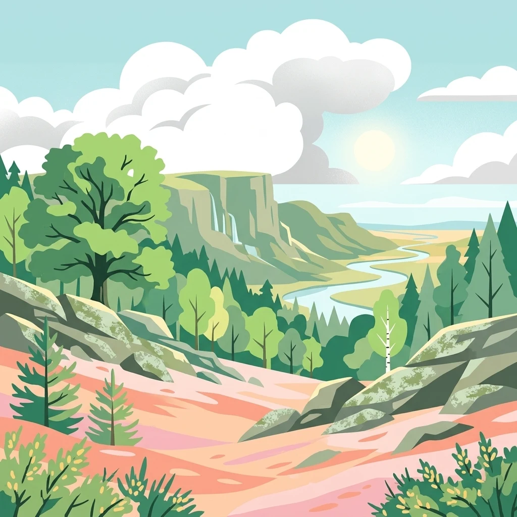
A stylized digital illustration of a mountainous park landscape with a rocky foreground, dense forests, a winding river, and distant cliffs under a partly cloudy sky.

Réserve naturelle régionale Mont des Avaloirs

Nature reserve

Park overview

Structured park overview, official facts, and landscape profile for Mont des Avaloirs Regional Nature Reserve

Mont des Avaloirs Regional Nature Reserve park facts, protected area profile, and essential visitor context

Review the core facts for Mont des Avaloirs Regional Nature Reserve, including designation, size, terrain, visitor scale, habitats, and operating context in one park-focused overview.

About Mont des Avaloirs Regional Nature Reserve

The Mont des Avaloirs Regional Nature Reserve protects a strategic biodiversity node on the eastern foothills of the Armorican Massif, where the highlands of the Mayenne reach their highest elevation. Although modest in continental terms, the summit's elevation of around 416 metres is exceptional for northwestern France and creates distinctive ecological conditions: exposed ridgelines, persistent mists, abundant rainfall, and pockets of snow in winter. These conditions have favoured the persistence of a complex of habitats that are otherwise rare in the region.

The reserve is organised around four complementary geographic units. In the west lies the Marais du Fourneau, the smallest unit, a wetland zone embedded in the broader landscape. To the north, the Prés des Loignières contribute a more open, meadow-like character. In the south, the Bois du Clairet forest and the valley of the Buisson de Malheur stream form a continuous wooded and riparian corridor. At the centre and east, the Souprat and the Mont des Avaloirs ridge dominate, encompassing extensive heaths, rocky scree on abrupt slopes, blocks of forest in free evolution, three peat bog complexes, and bocage enclosures. Together they form a coherent natural system centred on a high point that drains outward into the surrounding collines du Maine.

Ecologically, the reserve stands out for the concentration of rare habitats within a relatively small area: upland heaths interspersed with stony ground, forests left to natural dynamics that favour old trees and dead wood, peatlands accumulating carbon and supporting specialist flora, and traditional bocage landscapes shaped by long-standing agricultural use. Biodiversity interest is enhanced by the contrast between open and wooded environments and by the presence of running water in the Buisson de Malheur valley.

Administratively, the reserve was created following a concerted initiative by private landowners and the commune of Pré-en-Pail-Saint-Samson, coordinated over several years by the Parc naturel régional Normandie-Maine, and it is now managed by the same organisation under the 2020-2026 management plan. It sits within a particularly dense framework of conservation designations, including ZNIEFF inventories, Natura 2000 zones, and departmental sensitive natural area protections, making it one of the most heavily recognised biodiversity hotspots of inland Mayenne.

The site also carries cultural weight. The Mont des Avaloirs has long been a landmark of the region, visited since at least the early 20th century for its panoramic belvedere over the Armorican landscape. The reserve integrates this tourism and pedagogical tradition into its conservation approach, with walking trails departing from the historic viewing point that allow visitors to experience the diversity of habitats in a single outing.

Quick facts and research context for Mont des Avaloirs Regional Nature Reserve

The Mont des Avaloirs Regional Nature Reserve was classified on 25 September 2020 by the Pays de la Loire regional council. It covers about 321 hectares straddling the communes of Boulay-les-Ifs and Pré-en-Pail-Saint-Samson in Mayenne, Pays de la Loire. The reserve is organised into four geographic units: the Marais du Fourneau wetland in the west, the Prés des Loignières meadows to the north, the Bois du Clairet forest and Buisson de Malheur valley in the south, and the Souprat and Mont des Avaloirs summit area at the centre and east, which makes up the bulk of the protected area. Altitudes range from roughly 244 m in the north to 416 m at the Mont des Avaloirs summit. The site is part of two ZNIEFF type 2 ensembles and three ZNIEFF type 1 zones, is largely covered by Natura 2000 sites, and is managed by the Parc naturel régional Normandie-Maine under the 2020-2026 management plan.

Protection and recognition

Documented terrestrial protection scope, designation year, and official database records

Réserve Naturelle Régionale Mont des Avaloirs Protection Status and Designation History

Terrestrial protection status for Réserve naturelle régionale Mont des Avaloirs encompasses formal designation history established in the year 2020. Database records compile documented management scope and official administrative attributes for comprehensive geographic analysis.

Protection details

Protection scope
Terrestrial
Designated year
2020
Transboundary protection
No
WDPA ID
555702228
Park context

Deeper park guide and search-rich context for Mont des Avaloirs Regional Nature Reserve

Mont des Avaloirs Regional Nature Reserve history, landscape, wildlife, and travel context

Explore Mont des Avaloirs Regional Nature Reserve through its history, landscape character, ecosystems, wildlife, conservation priorities, cultural context, and seasonal travel timing in a structured park guide built for atlas discovery and search intent.

Why Mont des Avaloirs Regional Nature Reserve stands out

The reserve is best known for protecting one of the largest and richest upland heath and peatland complexes of the Armorican Massif, anchored on the summit that gives northwestern France its highest natural point. It is recognised as a key biodiversity core within the Parc naturel régional Normandie-Maine and a stronghold for habitats that are otherwise scarce at this latitude. Its mosaic of open heath, blockfields, peat bogs, old-growth forest in free evolution, and bocage hosts numerous protected and rare species, including sundews, bog asphodel, the Portuguese butterwort, black stork, Eurasian nightjar, and montagu's harrier. The site is also notable for integrating conservation, ecological inventory work, and tourism around the historic Avaloirs belvederes, where visitors have come to admire the Armorican panorama since 1914.
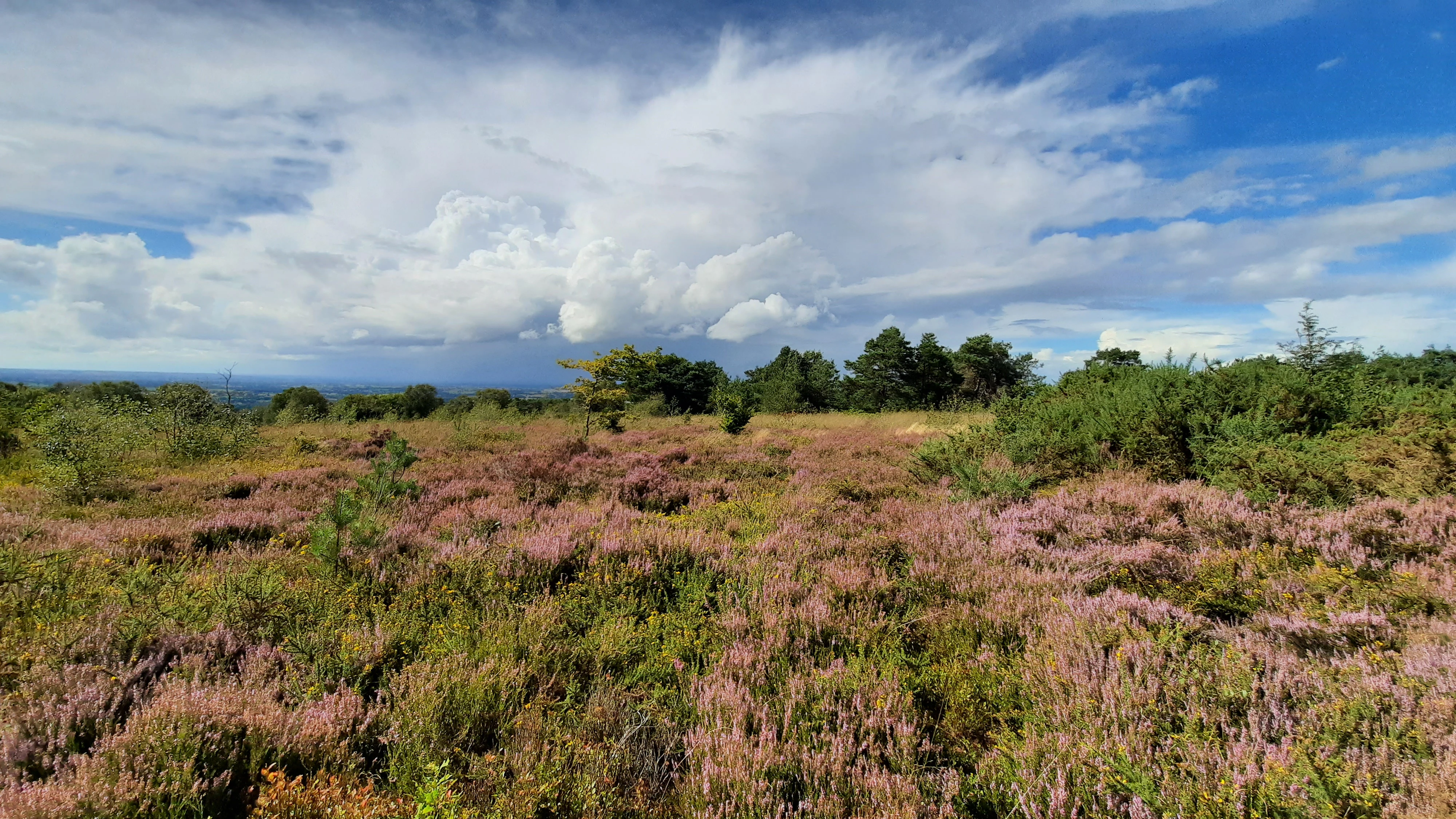
A wide shot of a rolling, purple-flowered heathland under a dramatic sky with white clouds, with a tree line in the middle distance.
A scenic view of the Lande du Souprat, featuring flowering heathland within the Mont des Avaloirs Regional Nature Reserve.

Mont des Avaloirs Regional Nature Reserve history and protected-area timeline

The history of the Mont des Avaloirs territory is shaped by its topographic position and by the use of its natural resources over many centuries. In the Middle Ages, the forests and heaths of the Avaloirs were considered wild and sparsely frequented zones. A path known as the 'Chemin de la procession', running along the eastern edge of the present reserve, served as a main access route for woodcutters and charcoal makers exploiting the area.

In the eighteenth century, the region experienced significant industrial activity from iron forges, in particular at Saint-Denis-sur-Sarthon. This activity shaped the local landscape and the historical management of the surrounding forests through demand for wood and charcoal. At the end of the same century, a Chappe telecommunications tower was installed on the Avaloirs ridge, close to the location of today's belvedere. The tower is believed to have been part of the Paris-Brest communication line placed in service in August 1798, and a written account from 1936 still mentioned remains of the structure among the heaths.

The first half of the twentieth century was marked by stone quarrying at the Bel-Air quarries, north of the present reserve. Once these activities ceased, only limited hunting-related modifications, such as the creation of small ponds and shooting rides, were made. A significant fire affected the area in 2001, burning approximately ten hectares of heath. Between 2015 and 2019, eight private owners and the commune of Pré-en-Pail-Saint-Samson, holding more than three hundred hectares together, came together to act collectively for the biodiversity of their land, a process that culminated in the official creation of the regional nature reserve on 25 September 2020 by the Pays de la Loire regional council.

Mont des Avaloirs Regional Nature Reserve landscape and geographic character

The landscape of the Mont des Avaloirs Regional Nature Reserve is defined by a high ridge rising above the surrounding Armorican countryside. Altitudes along the site vary from roughly 244 metres in the north to 416 metres at the summit, giving the reserve a notable vertical range for this part of France. The ridges and slopes support a strong contrast between open, rocky ground and forested valleys.

A defining feature is the Souprat area, where erosion and slope processes have produced blockfields: stony spreads where exposed rock fragments lie among vegetation. These stony outcrops break the continuity of the heaths and create microhabitats for specialised plants and animals. In the valley of the Buisson de Malheur, the landscape shifts to a more sheltered character, with brooks, wet meadows, and woodland giving way to smoother relief.

Beyond the main units, the bocage elements and small peatland basins soften the topography, while the tree stands at the Bois du Clairet and within the Souprat area add vertical structure to an otherwise open landscape. The overall impression is of a gentle but distinct massif park, in which breed, rocks, and forest interact across a compact but varied mosaic of relief.
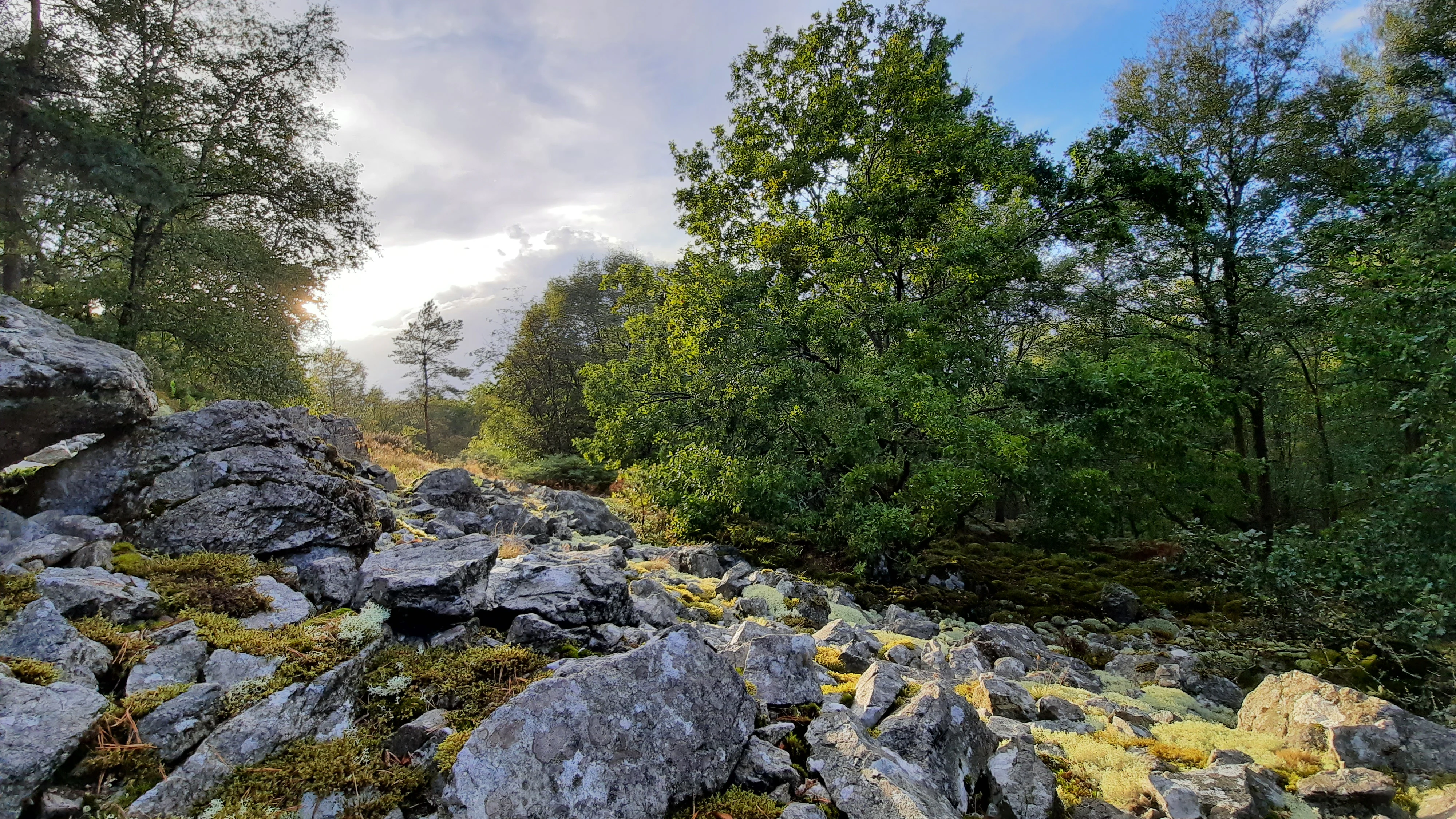
A rocky slope covered with light colored stones and patches of moss, surrounded by deciduous forest trees under a bright sky with soft sunlight.
The Souprat scree slope, a notable rocky terrain feature on the northern side of Mont des Avaloirs.

Mont des Avaloirs Regional Nature Reserve ecosystems, habitats, and plant life

Ecologically, the Mont des Avaloirs reserve functions as one of the principal biodiversity cores of the Parc naturel régional Normandie-Maine and of the Mayenne department. Its combination of high elevation, exposure to wind and weather, and a network of habitats has created an unusually rich endowment of plant and animal species for the region.

The reserve's ecological identity is built around four main habitat groups. The first is an extensive upland heath complex, dotted with rocky scree, that hosts specialist plants adapted to acidic, exposed, nutrient-poor conditions. A second grouping consists of two forest units in free evolution, which are allowed to follow natural dynamics, producing old trees, abundant dead wood, and a substratum favourable to saproxylic species, that is, organisms dependent on decaying wood. A third component comprises three peat bog complexes, where waterlogged, acidic conditions sustain highly specialised flora. Finally, a bocage landscape of hedgerows and small parcels links these core natural zones to the surrounding agricultural countryside.

The flora recorded on the reserve includes about 460 plant species, among them 14 species of regional priority, identified as ZNIEFF determinants, and 8 protected or regulated species. The bog flora is particularly distinctive, featuring round-leaved sundew (Drosera à feuilles rondes), bog asphodel (Narthécie des marais), the Portuguese butterwort (Grassette du Portugal), white beak-sedge (Rhynchospore blanc), heath rush (Jonc raide), deergrass (Scirpe cespiteux), and the marsh violet (Violette des marais). Together these species confirm the ecological distinctiveness of the peatlands and heaths with respect to the surrounding region.

Mont des Avaloirs Regional Nature Reserve wildlife and species highlights

The reserve hosts an exceptionally diverse fauna for its size. By the end of 2023, 2,441 animal species had been recorded, including 78 of regional priority and 90 protected at national or European level, plus 33 species of European interest. The group best represented is the invertebrates, with 2,271 species, including 2,235 insects, ranging across beetles, flies, hemipterans, hymenopterans, butterflies and moths, dragonflies, and grasshoppers.

The avifauna is particularly significant. Since 1980, 96 bird species have been observed on the reserve. The site supports breeding or wintering populations of several species of high conservation interest, including woodlark, western bonelli's warbler, willow warbler, Eurasian bullfinch, common linnet, yellowhammer, red-backed shrike, black woodpecker, black stork, European honey buzzard, Eurasian nightjar, and montagu's harrier. The latter two are focal species of the LIFE Avaloirs conservation programme, which has run from 2018 to 2024, demonstrating the site's role as a refuge for endangered breeding birds of open and edge habitats.

Among mammals, 36 species have been inventoried, including 13 bat species. Red squirrel, pine marten, and the hazel dormouse are also present. Reptiles are represented by 7 species, including slow worm, smooth snake, common European adder, grass snake, Aesculapian snake, and common lizard. Nine amphibian species have been recorded, notably midwife toad, marbled newt, agile frog, and fire salamander, confirming the importance of the wet habitats and brooks. The richness of fungi is similarly high, with 547 mushroom species and 78 lichen species documented on the reserve.

Mont des Avaloirs Regional Nature Reserve conservation status and protection priorities

The Mont des Avaloirs reserve has been recognised as one of the central biodiversity cores of inland Mayenne and of the Parc naturel régional Normandie-Maine for nearly a century and a half. Its formal protection as a regional nature reserve in 2020 represents the completion of a long-term convergence of ecological, institutional, and landowner interests, and reflects the site's exceptional concentration of rare habitats in this part of France.

Nearly the entire perimeter of the reserve lies within one or more Natura 2000 designations. The heart of the area is covered by two overlapping Natura 2000 sites, the Special Area of Conservation 'Forêt de Multonne, Corniche de Pail' and the Special Protection Area 'Corniche de Pail, Forêt de Multonne', the latter designated under the European Birds Directive. A further sector overlaps with the Special Area of Conservation 'Bocage de la Forêt de Monnaie à Javron-les-Chapelles'. Two departmental sensitive natural areas (Espace naturel sensible) of Mayenne, the 'Forêt de Multonne' ENS and the 'Bocage de la Forêt de Monnaie' ENS, reinforce these protections at local level.

The reserve is also integrated into the French ZNIEFF inventory system: it lies within two functional ensembles classified as ZNIEFF type 2, including the Massif de Multonne, and contains three homogeneous ecological zones classified as ZNIEFF type 1, explicitly the Mont Souprat, the peat bog and Buisson de Malheur valley, and the Marais du Fourneau. The 2020-2026 management plan, drafted by the Parc naturel régional Normandie-Maine and validated by the regional scientific council, lays out specific protective measures across twelve themes, including fauna protection, flora protection, forestry, geological heritage, agricultural activity, visitor use, domestic animals, motor vehicle access, and public works, providing a coherent regulatory framework for long-term biodiversity conservation.

Mont des Avaloirs Regional Nature Reserve cultural meaning and human context

The Mont des Avaloirs carries an unusually rich cultural resonance for a site of its size, largely tied to its role as a landmark summit. Since the installation of the first of three belvederes in 1914, the mountain has functioned as a classic stopping point for visitors and locals alike, a place for picnics, gatherings, and panoramic appreciation of the Armorican countryside. The integration of formal nature protection into this long-standing tourism tradition has allowed local cultural uses, such as hiking and scenic appreciation, to coexist with biodiversity conservation.

The reserve also incorporates subtle traces of older rural and industrial heritage. The route known as the 'Chemin de la procession' along its eastern edge recalls pathways used by woodcutters and charcoal-makers in the Middle Ages, while the nearby eighteenth-century iron forges at Saint-Denis-sur-Sarthon, the remains of the Chappe tower on the ridge, and the abandoned Bel-Air quarries bear witness to a long history of human intervention in the landscape. These layers of human activity frame contemporary conservation without dominating it.

Top sights and standout views in Mont des Avaloirs Regional Nature Reserve

The reserve's principal highlight is the combination of upland heath, blockfields, peat bogs, forests in free evolution, and bocage arranged around the highest point of the Armorican Massif, an exceptional ecological concentration for northwestern France. The dramatic diversity of habitats within a relatively compact area is rare for the region and translates into exceptional biodiversity indicators: more than 2,400 recorded animal species, nearly 500 plant species, and a notable richness in fungi and lichens.

Equally significant is the convergence of conservation instruments: Natura 2000 designations cover nearly 96% of the site, ZNIEFF inventories designate both type 1 and type 2 zones, departmental sensitive natural area protections reinforce local safeguards, and the LIFE Avaloirs programme has used the area as a priority site for the conservation of nightjar and montagu's harrier. Combined with its panoramic belvederes and scenic walking trails, the Mont des Avaloirs Regional Nature Reserve offers a rare blend of scientific interest, landscape value, and accessible discovery.

Best time to visit Mont des Avaloirs Regional Nature Reserve

The Mont des Avaloirs Regional Nature Reserve can be experienced throughout the year, and the season strongly shapes the character of the visit. Spring and early summer are especially rewarding for appreciating the open heaths and the breeding bird season, when species such as nightjar, woodlark, and red-backed shrike are most present, and the peat bogs show their characteristic flowering of bog asphodel, sundews, and cotton grasses.

Late summer and early autumn highlight the fruiting bodies of fungi and lichens, one of the site's less visible but ecologically important dimensions, and provide good conditions for panoramic views from the belvederes. Winter is the most atmospheric period for landscape: snow, fog, and strong winds accentuate the exposed relief of the Avaloirs ridge, and the absence of foliage improves visibility for birdwatching, particularly for species that winter on the site such as the woodpeckers and the bullfinch.

Monthly climate preview

Long-term representative point measurements tracking monthly temperature and precipitation cycles

Annual Climate Normals and Temperature Rhythms in Réserve naturelle régionale Mont des Avaloirs

Representative point coordinates for Réserve naturelle régionale Mont des Avaloirs record measured monthly temperature swings from sub-zero winter minimums to warm summer maximums alongside consistent daily precipitation rates. Examining the full twelve-month climate profile reveals granular shifts in long-term averages across the protected terrain.
Annual mean10 °C
4 °C18 °C
Jan
Feb
Mar
Apr
May13°
Jun16°
Jul18°
Aug18°
Sep15°
Oct11°
Nov
Dec
Warmest month
August

18.1 °C

Coolest month
January

3.5 °C

Wettest month
December

2.6 mm/day

Driest month
March

1.7 mm/day

Park location guide

Geography guide, regional context, and park location map for Mont des Avaloirs Regional Nature Reserve

Mont des Avaloirs Regional Nature Reserve park geography, regions, and map view in France

Understand where Mont des Avaloirs Regional Nature Reserve sits in France through a broader geographic reading of the surrounding landscape, nearby location context, and its mapped position within the national park landscape.

How Mont des Avaloirs Regional Nature Reserve fits into France

France is a unitary semi-presidential republic and one of the world's largest economies. It borders Belgium, Luxembourg, Germany, Switzerland, Italy, Monaco, Andorra, and Spain, with a maritime border to the United Kingdom. The country is known for its cultural influence, art, cuisine, and political history spanning centuries.

Wider geography shaping Mont des Avaloirs Regional Nature Reserve in France

France is located in Western Europe. Metropolitan France extends from the Rhine to the Atlantic Ocean and from the Mediterranean Sea to the English Channel and North Sea. The country borders Belgium, Luxembourg, Germany, Switzerland, Italy, Monaco, Andorra, Spain, and has a maritime border with the United Kingdom.

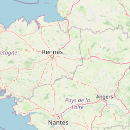
Map view of Mont des Avaloirs Regional Nature Reserve

Use this park location map to pinpoint Mont des Avaloirs Regional Nature Reserve in France, understand its exact geographic position, and read its mapped placement within the surrounding landscape more clearly.

Pigeon | © OpenStreetMap contributors

Location context for Mont des Avaloirs Regional Nature Reserve

Pays de la Loire

Visualizing the upland heaths, blockfields, and forest mosaics of the Armorican Massif high point.

Réserve naturelle régionale Mont des Avaloirs Photos, Landscape Scenery, and Protected Area Views

Visual records capture the rugged terrain, exposed upland heaths, and peat bog complexes defining Réserve naturelle régionale Mont des Avaloirs. Examining these protected habitats clarifies the ecological character and vertical relief shaping the highest summit in northwestern France.

A wide shot of a rolling, purple-flowered heathland under a dramatic sky with white clouds, with a tree line in the middle distance.

A wide, grassy meadow with a prominent, large oak tree in the foreground and a forested hillside in the background under a clear blue sky.

A rocky slope covered with light colored stones and patches of moss, surrounded by deciduous forest trees under a bright sky with soft sunlight.

Park atlas

Compare regional park geography, upland habitats, and connected conservation areas across northwestern France

Explore Parks Near Réserve naturelle régionale Mont des Avaloirs and Surrounding Protected Landscapes

Compare protected areas and regional reserves located near Réserve naturelle régionale Mont des Avaloirs to understand broader ecological patterns across the Armorican Massif. Evaluating adjacent park geography reveals shared upland habitats, woodland corridors, and regional conservation networks.
A watercolor illustration of a soft, rolling landscape with green hills, a winding path or stream, and hints of pink flora in the foreground, set against a light background.
Nature reservePays de la Loire
About 11 km away#1 closest

Southwest

Réserve naturelle régionale des landes et tourbière des Égoutelles Geographic Overview

Protected peat bog and wet heathland in Pays de la Loire

Located in Villepail, this nature reserve occupies a sheltered quarry depression in the Mayenne countryside. The site is a study in ecological resilience, featuring approximately one hundred plant species and a diverse fauna of dragonflies and amphibians that thrive in this compact, waterlogged habitat.

Area
0.013 km²
Established
2009
IUCN
IV
Relief
Lowland
Nature reserveFrance
About 21 km away#2 closest

Northeast

Réserve naturelle régionale géologique de Normandie-Maine: Geological Nature Reserve

A protected Ordovician limestone site in the Armorican Massif

Located in northwestern France, this reserve focuses on the geological preservation of the Carrière des Vaux. It is an essential site for understanding Paleozoic biostratigraphy, featuring well-exposed limestone sequences and significant microfossil deposits that allow for precise dating of regional strata within the Normandie-Maine landscape.

Area
0.006 km²
Established
2009
Relief
Lowland
Climate
Temperate
A horizontal watercolor painting depicting a soft-toned landscape with a rocky scree slope in the foreground and rolling hills under a pastel sunset sky.
Nature reserveNormandie
About 22 km away#3 closest

Northwest

Réserve naturelle régionale des pierriers de Normandie: Geographic Scree Slope Atlas

Examining rocky protected terrain in Normandy, France

The Réserve naturelle régionale des pierriers de Normandie protects one of the most distinctive natural scree slopes in northwestern Europe. This site preserves fragile rocky debris fields that support specialized vegetation and invertebrate communities. Our atlas data offers a close look at the boundaries and geological character of this significant protected landscape in the Orne department.

Area
0.009 km²
Established
2018
IUCN
IV
Scope
Terrestrial
A watercolor painting showing a soft, pastoral landscape with green rolling hills, light yellow grasslands, and a tranquil pond in the foreground against a light, hazy sky.
Nature reservePays de la Loire
About 37 km away#4 closest

East

Réserve naturelle régionale du coteau et plateau de Tessé: Protected Limestone Geography

Calcareous grassland landscapes in the Sarthe department

Examine the geography of this regional nature reserve in Pays de la Loire. The site preserves a compact parcel of limestone plateau and slopes, offering a concentrated look at dry calcareous habitat conservation and the distinct geology of the Rutin valley area.

Area
0.056 km²
Established
2009
IUCN
IV
Relief
Upland
Watercolor painting of a river flowing through a valley with gentle green hills and trees on the banks.
Nature reserveCalvados
About 55 km away#5 closest

Northwest

Rochers des Parcs Nature Reserve: A Detailed Atlas and Protected Landscape Overview

Geographic boundaries and cliff terrain in Calvados, Normandy.

The Rochers des Parcs nature reserve features dramatic Cambrian conglomerate cliffs rising above the Orne river in the Calvados department. This site is defined by its steep wooded slopes, rare plant species, and established network of hiking paths. It represents a vital area of conservation, protected for its geological interest and ecological value, providing a clear window into the rugged terrain of the Suisse normande landscape.

Area
0.36 km²
Established
1977
Relief
Upland
Scope
Terrestrial
Nature reservePays de la Loire
About 59 km away#6 closest

West

Réserve naturelle régionale des prairie et boisement humides des Bizeuls: Regional Nature Reserve Atlas

Wetland habitat preservation in the Mayenne department of western France.

This reserve provides a compact, ecologically dense mosaic of wet meadows and wet woodland in the Pays de la Loire region. It serves as a vital protected area for maintaining wetland biodiversity within a predominantly agricultural landscape, offering a precise look at the terrain and hydrological features characteristic of western France.

Area
0.044 km²
Established
2019
IUCN
IV
Nature reserveNormandie
About 61 km away#7 closest

East

Réserve naturelle régionale de la clairière forestière de Bresolettes: Normandy Protected Landscapes

Mapping forest ecosystems and historic industrial water features in the Perche region.

Spanning roughly 780 hectares, this regional nature reserve serves as a vital biodiversity refuge in northwestern France. The landscape integrates mature woodland, wet meadows, and mire ecosystems that support rare flora and specialized fauna, offering a clear view of the complex environmental history of the Perche forest.

Area
7.8 km²
Established
2010
IUCN
IV
A watercolor painting showing a soft, stylized landscape with rolling green hills, small clusters of trees, and a winding waterway, with tall grass and flowers in the foreground.
Nature reservePays de la Loire
About 69 km away#8 closest

Southeast

Réserve naturelle régionale du bas-marais tourbeux de la Basse-Goulandière: Regional Wetland Mapping

A rare alkaline lowland peatland within the Pays de la Loire administrative region

Examine the mapped terrain and habitat structure of this protected peatland near Le Mans. This site preserves an uncommon alkaline mire environment, serving as an essential ecological bridge within the Roule-Crottes stream valley and demonstrating the significant conservation value of small, high-quality wetland pockets in agricultural landscapes.

Area
0.38 km²
Established
2011
IUCN
IV

Common questions about visiting, size, designation, and location context for Mont des Avaloirs Regional Nature Reserve

Mont des Avaloirs Regional Nature Reserve FAQs for park facts, access, geography, and protected area context

Find quick answers about Mont des Avaloirs Regional Nature Reserve, including protected-area facts, park geography, trail and visitor context, and how the park fits into its surrounding country and regional landscape.
MoriAtlas Explorer

Continue Your Protected Areas Search Across the Global Atlas

Deepen your exploration by continuing the structured search for national parks and protected areas worldwide. Utilize the comprehensive filtering capabilities to compare different conservation landscapes and refine your understanding of global park geography. Discover more about the distribution and characteristics of protected natural areas.

Global natural geography