
Streams
Park geography
Detailed terrain, elevation, and regional context for a transboundary arid landscape
Comprehensive Geographic Profile and Mapped Boundaries of Richtersveld National Park
This geographic profile analyzes the 1624.45 square kilometer extent of Richtersveld National Park in Northern Cape, South Africa. Discover the mountainous terrain with elevations reaching 1377 meters, alongside major natural features including the Orange River and varied desert shrubland habitats.
A South African arid mountain desert where the Nama people still herd livestock across ancient succulent landscapes.
Richtersveld National Park
Richtersveld National Park is a vast arid protected area in the far north-western corner of South Africa's Northern Cape province, where the Orange River forms the international border with Namibia. The landscape is defined by rugged volcanic kloofs, jagged mountain ranges, sandy coastal plains, and the green ribbon of the Orange River valley, all set within what is widely regarded as the world's only arid biodiversity hotspot. The park is managed jointly by South African National Parks and the local Nama community, who continue to practice a traditional transhumant herding lifestyle within its boundaries. Together with the adjacent Richtersveld Community Conservancy, it forms part of a UNESCO World Heritage Site recognized for its intertwined cultural and botanical value, including one of the richest concentrations of succulent plant species on Earth. What makes the Richtersveld distinctive is the combination of extreme desert environment, extraordinary botanical endemism, and living indigenous land use. The area holds roughly 4,849 documented plant species, a substantial proportion of which occur nowhere else, alongside mammals, reptiles, and birds adapted to a landscape where survival depends on coastal fog rather than rainfall.
- Location
- South Africa
- Park type
- National park
- Established
- 1991
- Area
- 1,624.5 km²
- Highest point
- 1,377 m
Location overview
South Africa Regional Spread and Transboundary Status
Richtersveld National Park Geographic Overview and Location
Richtersveld National Park is situated within South Africa and the Northern Cape region. The recorded geographic data outlines the established transboundary status for regional analysis.
- Countries
- South Africa
- Regions
- Northern Cape
- Primary location
- Northern Cape
- Geographic setting
- Transboundary · Inland
Boundary and coordinates
Interactive boundary geometry and calculated area metrics
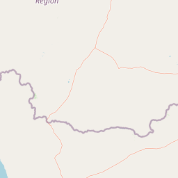
Richtersveld National Park Boundary Map and Geographic Extent
Mapped park outlines provide spatial context for exploring protected terrain boundaries. Accompanying measurements detail total area coverage, geographic center coordinates, and spatial extent spans.
- Boundary area
- 5,352.6 km²
- Boundary perimeter
- 339.7 km
- Northernmost point
- 28.0327° S
- Southernmost point
- 28.998° S
- Easternmost point
- 17.4722° E
- Westernmost point
- 16.777° E
- Geographic centre
- 28.5828° S, 17.1104° E
- North–south span
- 107 km
- East–west span
- 68 km
Elevation and terrain
Vertical range profile and recorded natural features
Richtersveld National Park Terrain and Elevation Summary
Recorded elevation ranges span from sea level to 1377 meters across mountain terrain. Mapped natural feature cards detail specific river valleys and peak locations within protected boundaries.
- Minimum elevation
- 0 m
- Maximum elevation
- 1,377 m
- Highest point
- 1,377 m
Selected named natural features
Rivers
Nuab
Peaks
Dolomite Peaks
Peaks
Talus Peak
852 m
Valleys
Valley of Desolation
Rivers
Orange River (Oranje)
Environmental setting
Arid desert terrain, mountain relief, and sparse forest classifications
Richtersveld National Park Environmental Setting and Physical Geography
Recorded classifications group the terrain features, desert habitats, and arid climate conditions into complementary physical categories. Component entries connect these recorded environmental properties directly to relevant atlas destinations where available.
- Relief
- Mountain
- Climate
- Arid
- Water
- Minor water
- Forest cover
- Sparse forest
Landscape features
Mountains · Cliffs · Rivers · Coast
Habitat types
Desert habitat · Shrubland
Park atlas
Compare surrounding desert reserves and regional transfrontier conservation areas
Parks Near Richtersveld National Park And Related Protected Landscapes
Browse nearby national parks and protected areas connected to the rugged terrain of Richtersveld National Park. Comparing adjacent desert landscapes provides broader geographic context for the arid biodiversity hotspot.
Wildlife reserveNamibia
Mapped location lies within the park boundary#1 closest
North

ǀAi-ǀAis Hot Springs Game Park: A Namibian Wildlife Reserve Bridging Desert and Geothermal Landscapes
Explore mapped boundaries and regional park geography.
ǀAi-ǀAis Hot Springs Game Park represents a vital protected area within Namibia's arid southern reaches. This wildlife reserve is characterized by its namesake hot springs, which foster unique riparian ecosystems against a backdrop of rugged desert mountains and the impressive Fish River canyon. Its inclusion in a transfrontier conservation effort underscores its significance for regional landscape mapping and the preservation of stark desert beauty and geothermal features.
- IUCN
- II
- Relief
- Mixed relief
- Climate
- Arid
- Access
- Remote access
Protected areaNamibia
Mapped location lies within the park boundary#2 closest
North
Ai-Ais/Richtersveld Transfrontier Park: Mapped Boundaries of a Southern African Protected Area
Exploring its desert terrain and cross-border conservation geography.
Ai-Ais/Richtersveld Transfrontier Park is a significant protected area that spans across Namibia and South Africa, embodying a vital component of Southern Africa's conservation efforts. This page focuses on the park's geographic identity, detailing its arid landscape characteristics and the mapped extent of its protected boundaries. Understanding this transfrontier park offers insight into cross-border ecological cooperation and the unique desert terrain it encompasses, providing a foundation for structured geographic discovery.
- Area
- 6,045 km²
- Established
- 2003
- IUCN
- II
- Relief
- Mountain
National parkNorthern Cape
101 km away#3 closest
South

Namaqua National Park: Protected Landscape and Geographic Atlas Details
Explore Northern Cape's National Park mapped context.
Gain insight into Namaqua National Park, a protected national park situated in the expansive Northern Cape region of South Africa. This resource provides detailed geographic context, focusing on its mapped protected landscape and unique regional features. Understand its role as a distinct natural area for atlas-based exploration and geographic discovery within South Africa's diverse terrain.
- Area
- 1,368.18 km²
- Established
- 2001
- Climate
- Arid
- Access
- Moderate access
National parkNamibia
175 km away#4 closest
Northwest
Namib-Naukluft National Park: Namibia's Iconic Desert Landscape and Protected Terrain
Explore its ancient dunes, Naukluft mountains, and coastal geography.
Namib-Naukluft National Park is a colossal protected area in Namibia, holding the distinction of being Africa's largest national park. This park is renowned for its iconic sand dunes, particularly at Sossusvlei, which are among the highest in the world and display dramatic colors due to iron oxidation. The landscape also features the rugged Naukluft Mountains and vital coastal fog zones, creating a diverse arid environment. Delve into the mapped geography and unique terrain of this ancient desert setting, understanding its protected landscape significance within Namibia's atlas.
- Area
- 49,768 km²
- Established
- 1907
- IUCN
- II
- Relief
- Mixed relief
Nature reserveNamibia
About 218 km away#5 closest
North
Tirasberge Nature Reserve: Geography and Protected Landscapes of Southern Namibia
A compact wilderness spanning mountain massifs and desert frontiers.
The Tirasberge region serves as a vital protected area in southern Namibia, showcasing a diverse intersection of mountain ridges, red sand dunes, and arid savanna plains. This reserve provides a unique look into a stratified landscape where high elevation terrain meets the lower reaches of the Namib dune sea, creating a complex corridor for ecology and history. Understanding the reserve reveals how mountain-to-savanna transitions define the rugged character of this southern African conservation zone.
- Area
- 1,250 km²
- Established
- 1998
- Relief
- Mountain
- Climate
- Arid
National parkNamibia
About 237 km away#6 closest
Northwest
Tsau ǁKhaeb National Park: Namibia's Protected Area and Geographic Identity
Mapped natural landscape and park boundaries in Namibia.
Tsau ǁKhaeb National Park represents a vital protected area within Namibia, offering deep insights into the country's unique arid environments. This park detail page serves as an atlas entry focused on its mapped geography, highlighting its protected boundaries and its role within the broader landscape of Southern Africa. Explore the inherent geographic characteristics and conservation significance of this national park.
National parkNorthern Cape
238 km away#7 closest
East
Augrabies Falls National Park: A South African National Park Defined by Granite Gorge and Semi-Desert Terrain
Explore the mapped natural landscape and protected boundaries.
Augrabies Falls National Park in South Africa's Northern Cape Province is a key protected area known for its thundering waterfall on the Orange River and the profound granite gorge carved over millennia. The park's semi-desert environment showcases the distinctive quiver trees and geological landmarks like Moon Rock, offering a unique landscape context. Understand its protected status and geographic significance within the arid Nama-Karoo biome through detailed mapping and landscape information.
- Area
- 820 km²
- Established
- 1966
- IUCN
- II
- Relief
- Upland
Marine protected areaNamibia
About 256 km away#8 closest
Northwest
Meob-Chamais Islands’ Marine Protected Area: Mapped Coastal and Marine Sanctuary
A protected Atlantic marine region in coastal Namibia
Spanning from Meob Bay to Chamais Bay, this expansive marine protected area preserves the vital intersection between Namibia's arid desert shoreline and the cold, productive waters of the Atlantic. The region comprises ten primary islands and numerous islets that provide essential breeding platforms for bank cormorants and African penguins. This site remains a foundational element of regional coastal conservation and marine geography.
- Area
- 20,000 km²
- Established
- 2009
- IUCN
- VI
- Scope
- Marine
MoriAtlas Explorer
Discover the Rugged Landscapes of Richtersveld National Park
Deepen your understanding of Richtersveld National Park through structured mapping of its volcanic kloofs and desert corridors. MoriAtlas provides a clear view of this biodiversity hotspot, enabling researchers and enthusiasts to trace the unique environmental features of this South African protected area.
Browse next
Global natural geography
Explore related park routes
Explore MoriAtlas Global ParksBrowse All MoriAtlas ParksGlobal Park Map DiscoveryMoriAtlas: Browse All CountriesBrowse All MoriAtlas ContinentsNational Park Environment AtlasGrand Canyon National Park AtlasYellowstone National Park AtlasYosemite National Park Atlas and GeographySerengeti National Park AtlasGalápagos National Park Protected LandscapeBanff National Park Geography and AtlasKruger National Park Atlas EntryUluṟu-Kata Tjuṯa National Park AtlasExplore Uluru-Kata Tjuta National Park GeographyPlitvice Lakes National Park AtlasFiordland National Park Protected LandscapeGreat Smoky Mountains National Park AtlasAfghanistan National Parks and Protected AreasAlbania National Parks and Protected AreasAlgeria National Parks and Protected AreasAmerican Samoa National Parks and Protected AreasAndorra National Parks and Protected AreasAngola National Parks and Protected AreasAntarctica National Parks and Protected AreasAntigua and Barbuda Park List