

Mori Atlas logo
Marine protected areaSanctuaire Pelagos

A large-scale maritime wilderness supporting critical cetacean habitats across international waters.

Sanctuaire Pelagos: Mapping the Vast Transboundary Marine Protected Area of the Mediterranean

(Accord relatif à la création en Méditerranée d'un sanctuaire pour les mammifères marins; sanctuaire Pelagos)

The Sanctuaire Pelagos encompasses a sprawling 87,500 square kilometer marine expanse in the northwestern Mediterranean Sea. Established through a tri-national agreement between France, Italy, and Monaco, this protected region serves as a vital corridor for whales and dolphins. Its complex bathymetry, including deep submarine canyons and varied seafloor structures, creates productive feeding grounds that define its unique role within the Mediterranean marine atlas.

marine sanctuarymarine protected areacetaceanswhalesdolphinsMediterranean Sea

Sanctuaire Pelagos

Marine protected area

Park overview

Structured park overview, official facts, and landscape profile for Sanctuaire Pelagos

Sanctuaire Pelagos park facts, protected area profile, and essential visitor context

Review the core facts for Sanctuaire Pelagos, including designation, size, terrain, visitor scale, habitats, and operating context in one park-focused overview.

About Sanctuaire Pelagos

The Sanctuaire Pelagos represents a pioneering example of international cooperation for marine conservation in the Mediterranean. Spanning roughly 87,500 square kilometers of sea between the French Riviera, the Ligurian Sea, Monaco, and northern Tuscany, it was established to safeguard one of the most cetacean-rich regions of the entire Mediterranean basin.

The area covered by Pelagos is ecologically significant because its waters combine deep submarine canyons, productive feeding zones, and migration routes used by multiple species of marine mammals. Cetacean presence in the region has long attracted scientific interest, and the agreement creating the sanctuary formalized a shared commitment by France, Monaco, and Italy to protect this marine megafauna across national maritime boundaries.

The legal foundation of the sanctuary is an international agreement signed on November 25, 1999, which entered into force on February 21, 2002. Through this treaty, the three neighboring states coordinate efforts to monitor populations, regulate activities that may disturb marine mammals, and promote scientific research. The framework draws on the earlier spirit of cooperation represented by the long-standing RAMOGE agreement, which fostered dialogue among the three countries on coastal maritime matters since 1975.

In addition to its direct conservation role, Pelagos has been recognized internationally. It is designated as a Specially Protected Area of Mediterranean Importance, a status that places it within a network of environmentally critical Mediterranean sites. It is also inscribed on the tentative list for UNESCO World Heritage status, with criteria relating to natural beauty, ecological processes, and biodiversity. Within the IUCN framework, the sanctuary falls under Category IV, recognizing it as a habitat and species management area.

Pelagos also functions as an experimental platform for marine conservation management. Unlike conventional marine protected areas with regulated zones and enforcement mechanisms, the sanctuary operates as a shared zone where member states collaborate on monitoring, awareness, and research, providing lessons that can inform broader marine governance strategies across the Mediterranean Sea.

Quick facts and research context for Sanctuaire Pelagos

Pelagos Sanctuary is a transnational marine protected area covering approximately 87,500 square kilometers in the northwestern Mediterranean Sea, shared by France, Monaco, and Italy under a tri-national agreement. Established in 1999 and legally in force since February 2002, it is dedicated to the conservation of marine mammals, particularly cetaceans such as dolphins and whales.

Designated as a Specially Protected Area of Mediterranean Importance (ASPIM) and classified under IUCN Category IV, the sanctuary combines legal recognition, scientific research, and tri-national cooperation. It is listed on the tentative list of UNESCO World Heritage Sites and serves as a reference framework for marine conservation initiatives throughout the Mediterranean region.

Protection and recognition

Examine the documented conservation scope, management framework, and recognized status.

Sanctuaire Pelagos Protection Status and Transboundary Marine Area Data

Sanctuaire Pelagos encompasses a documented marine protection scope with established transboundary status within international databases. Review official designation metrics, recognized boundaries, and structured conservation facts for this protected area.

Protection details

Protection scope
Marine
Transboundary protection
Yes
WDPA ID
365015
Park context

Deeper park guide and search-rich context for Sanctuaire Pelagos

Sanctuaire Pelagos history, landscape, wildlife, and travel context

Explore Sanctuaire Pelagos through its history, landscape character, ecosystems, wildlife, conservation priorities, cultural context, and seasonal travel timing in a structured park guide built for atlas discovery and search intent.

Why Sanctuaire Pelagos stands out

The Pelagos Sanctuary is best known for being the first transboundary marine protected area in the Mediterranean dedicated specifically to the conservation of marine mammals. Its waters host a notable diversity of cetaceans, including striped dolphins, bottlenose dolphins, sperm whales, fin whales, and other species that use the area for feeding and migration. The sanctuary's distinctiveness lies not only in its biodiversity but also in its international governance structure, with France, Monaco, and Italy jointly managing the protection of these waters through a legal agreement. This cooperative framework has made Pelagos an important reference point for Mediterranean marine conservation policy.
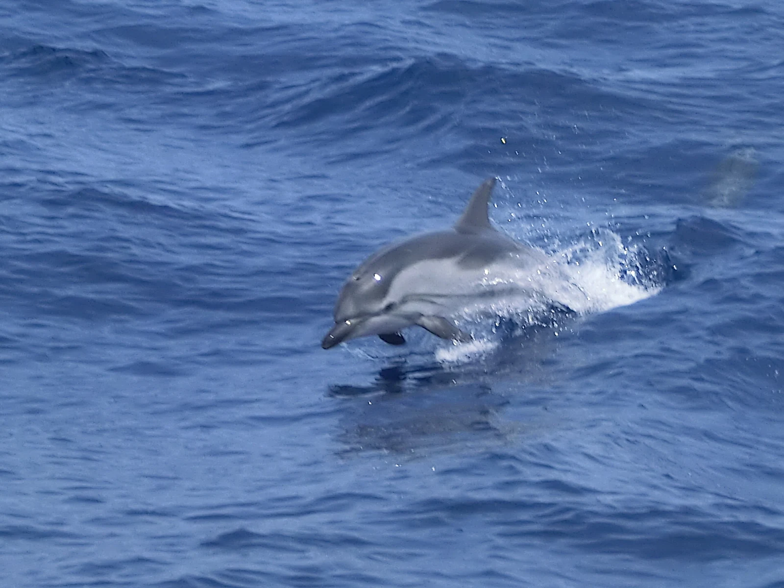
A grey and white striped dolphin partially breaching the surface of blue, rippling sea water.
A striped dolphin leaping from the surface of the Mediterranean Sea within the Pelagos Sanctuary.

Sanctuaire Pelagos history and protected-area timeline

The origins of the Sanctuaire Pelagos are closely linked to long-standing bilateral and trilateral cooperation among France, Monaco, and Italy in managing their shared Mediterranean waters. The RAMOGE agreement, in force since 1975, established a framework for dialogue among these states on coastal and maritime matters in the waters stretching approximately between Marseille and Genoa, providing a foundation of trust and cooperation that later enabled the creation of a transboundary sanctuary.

Building on this collaboration, the three countries signed the Agreement on the Creation of a Mediterranean Sanctuary for Marine Mammals on November 25, 1999. Following ratification procedures, the agreement was promulgated and entered into legal force on February 21, 2002, formally establishing the Pelagos Sanctuary as a tri-national marine protected area.

Since its establishment, the sanctuary has evolved into an important reference for Mediterranean conservation. Its inclusion on the tentative list of UNESCO World Heritage Sites in 2006 highlighted its international significance. Over the years, the sanctuary has also been the subject of scientific initiatives, and at times public debate, regarding human activities within or near its boundaries, including proposals tied to oil industry experimentation projects, illustrating both the opportunities and challenges of governing such a large and ecologically important maritime zone.

Sanctuaire Pelagos landscape and geographic character

The Pelagos Sanctuary encompasses a vast and varied marine landscape in the northwestern Mediterranean, characterized by deep waters, submarine canyons, and structurally complex seafloors that create highly productive zones for pelagic life. The bathymetry of the Ligurian Sea and adjacent waters includes significant depth contrasts between coastal shelves and offshore trenches, contributing to the concentration of nutrients and prey species on which marine mammals depend.

This seascape spans the transition between the Gulf of Lion, the Ligurian coast, the waters around Corsica, and the northern Tyrrhenian Sea approaches. Its geographic position places it at the meeting point of cooler northern waters and warmer southern Mediterranean currents, creating productive feeding grounds that sustain a wide range of marine life.

Although the sanctuary is a strictly maritime space, its perimeter and visibility are shaped by iconic coastal landmarks. The French Riviera, the Monaco coastline, the island of Corsica, and the northern Italian Riviera all frame the marine area, giving the sanctuary an exceptional setting that combines open-sea wilderness with some of the Mediterranean's most distinctive coastal scenery.

Sanctuaire Pelagos ecosystems, habitats, and plant life

The ecological value of the Pelagos Sanctuary is anchored in the exceptional biological richness of its waters, particularly for marine megafauna. The combination of deep topography, upwelling zones, and converging currents supports a robust food web, allowing the area to host sustained populations of cetaceans and other large marine species.

Beyond cetaceans, the sanctuary's marine environment supports a wide variety of Mediterranean biodiversity, including pelagic fish populations, seabirds, and other components of open-sea ecosystems. The conservation framework focuses on maintaining the integrity of these habitats and the ecological processes on which marine mammals depend, recognizing the sanctuary as a critical area for ecosystem-level protection rather than only single-species management.

The Mediterranean context makes this ecological richness especially notable. Compared to the open ocean, the Mediterranean is a relatively enclosed sea with limited productivity, making areas like Pelagos disproportionately important for biodiversity conservation in the region.

Sanctuaire Pelagos wildlife and species highlights

The Pelagos Sanctuary is internationally recognized for its population of marine mammals, particularly cetaceans, which form the principal focus of the sanctuary's conservation mission. Among the most characteristic species present is the striped dolphin (Stenella coeruleoalba), frequently observed in the sanctuary's waters and emblematic of its marine megafauna.

Other cetacean species recorded in the area include the bottlenose dolphin, the long-finned pilot whale, the sperm whale, and the fin whale, the latter being among the largest animals to inhabit the Mediterranean. Their presence throughout the year reflects the importance of the sanctuary as a feeding area and migration corridor in the northwestern Mediterranean basin.

These marine mammals are regarded as key indicators of the broader health of Mediterranean marine ecosystems, and their protection lies at the heart of the agreement that defines the sanctuary. As such, the wildlife profile of Pelagos is closely tied to its conservation framework, with population monitoring and research being central activities supported by the tri-national agreement.

Sanctuaire Pelagos conservation status and protection priorities

The Pelagos Sanctuary is a corner stone of Mediterranean marine mammal conservation, built on the principle that the protection of highly mobile marine species requires cross-border cooperation. By uniting the maritime jurisdictions of France, Monaco, and Italy under a single conservation framework, it addresses the fact that cetaceans and other large marine animals do not respect national boundaries.

The sanctuary is recognized as a Specially Protected Area of Mediterranean Importance (ASPIM), anchoring it within the broader Mediterranean system of protected marine sites. It is also classified under IUCN Category IV, as an area dedicated to the management of habitats and species. In 2006, the sanctuary was added to the tentative list of UNESCO World Heritage Sites, with potential criteria relating to natural beauty, ecological processes, and biodiversity.

Although the sanctuary does not impose a single, uniform zoning regime, it plays a critical role in coordinating national efforts, supporting scientific monitoring, and fostering public awareness. In this way, the sanctuary serves both as a practical conservation instrument and as a laboratory for marine protected area governance across the Mediterranean Sea.

Sanctuaire Pelagos cultural meaning and human context

The Pelagos Sanctuary sits within a maritime region shaped by deep cultural connections between coastal communities. The coasts that border the sanctuary, from the French Riviera to northern Italy and Monaco, have long histories of maritime activity, including fishing, navigation, and trade that have linked these shores for centuries.

The earlier RAMOGE agreement, which fostered collaboration among the three countries since 1975, reflects a tradition of regional cooperation on maritime matters. The Pelagos Sanctuary extends this tradition into the field of marine conservation, building on shared cultural and political connections across the northwestern Mediterranean to pursue a common environmental goal.

While the sanctuary itself is a purely marine area, it remains symbolically and institutionally tied to the cultural identity of the region, where the sea has long served as both a boundary and a bridge between neighboring peoples.

Top sights and standout views in Sanctuaire Pelagos

The Pelagos Sanctuary covers roughly 87,500 square kilometers of the northwestern Mediterranean Sea, making it one of the largest marine protected areas in the region. Its tri-national governance, shared among France, Monaco, and Italy under an agreement signed in 1999, is a hallmark of its identity.

Among its most notable qualities are the diversity of cetaceans present in its waters, the recognition of the area as a Specially Protected Area of Mediterranean Importance, and its tentative listing for UNESCO World Heritage status. The sanctuary also serves as a research and policy laboratory for Mediterranean marine conservation, where tri-national collaboration is applied to the protection of highly mobile marine species.

Best time to visit Sanctuaire Pelagos

The Pelagos Sanctuary is a marine area rather than a terrestrial park, so traditional season-based visiting guidance associated with inland parks is less relevant. However, cetacean watching and observation-related visits in the region are generally more rewarding during the warmer months, when calmer seas and increased marine mammal activity near the surface improve the chances of sightings. Summer and early autumn are typically associated with conditions favorable for boat-based wildlife observation along the sanctuary's coastal periphery.

Because the sanctuary is best experienced through guided boat excursions operating from coastal hubs in France, Monaco, and Italy, visitors generally align their interest in Pelagos with broader travel plans along the Riviera and Ligurian coast. The overall maritime character of the sanctuary means that the experience is shaped more by sea conditions than by terrestrial seasons.
Monthly climate preview

Long-term representative point measurements tracking monthly temperature and precipitation cycles

Sanctuaire Pelagos Climate Normals, Annual Temperature and Precipitation Rhythm

Sanctuaire Pelagos exhibits a recorded annual temperature range from a mean low of 11.6 °C to a high of 24.3 °C alongside shifting monthly precipitation patterns between 0.5 mm and 3.63 mm per day. Examining the complete twelve-month climatology profile reveals detailed variations in baseline thermal conditions across the protected marine area.
Annual mean17 °C
12 °C24 °C
Jan12°
Feb12°
Mar13°
Apr14°
May18°
Jun21°
Jul24°
Aug24°
Sep22°
Oct19°
Nov16°
Dec13°
Warmest month
August

24.3 °C

Coolest month
February

11.6 °C

Wettest month
November

3.6 mm/day

Driest month
July

0.5 mm/day

Park location guide

Geography guide, regional context, and park location map for Sanctuaire Pelagos

Sanctuaire Pelagos park geography, regions, and map view in France

Understand where Sanctuaire Pelagos sits in France through a broader geographic reading of the surrounding landscape, nearby location context, and its mapped position within the national park landscape.

How Sanctuaire Pelagos fits into France

France is a unitary semi-presidential republic and one of the world's largest economies. It borders Belgium, Luxembourg, Germany, Switzerland, Italy, Monaco, Andorra, and Spain, with a maritime border to the United Kingdom. The country is known for its cultural influence, art, cuisine, and political history spanning centuries.

Wider geography shaping Sanctuaire Pelagos in France

France is located in Western Europe. Metropolitan France extends from the Rhine to the Atlantic Ocean and from the Mediterranean Sea to the English Channel and North Sea. The country borders Belgium, Luxembourg, Germany, Switzerland, Italy, Monaco, Andorra, Spain, and has a maritime border with the United Kingdom.

Map view of Sanctuaire Pelagos

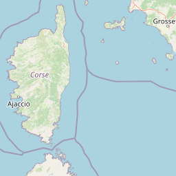
Use this park location map to pinpoint Sanctuaire Pelagos in France, understand its exact geographic position, and read its mapped placement within the surrounding landscape more clearly.

Pigeon | © OpenStreetMap contributors
Recorded earthquake history

Explore the Historical Earthquake Records for Sanctuaire Pelagos

Consult the MoriAtlas collection of historical seismic events associated with the marine geography of Sanctuaire Pelagos. Review documented epicentre data, event magnitudes, and location history to understand the seismic context of this transboundary protected area in the Mediterranean Sea.

Sanctuaire Pelagos Earthquake History

Catalogued events

584 events

Strongest magnitude

Magnitude 5.2

Most recent event

Aug 16, 2026

This history includes earthquakes recorded inside the park or within 50 km of its borders

Visual exploration of habitats and protected marine environments

Sanctuaire Pelagos Photos and Marine Landscape Scenery

Visual documentation reveals the expansive marine terrain and coastal settings that define the protected sanctuary waters. Examining these protected area views provides deeper insight into the ecological characteristics of the Mediterranean habitat.

A grey and white striped dolphin partially breaching the surface of blue, rippling sea water.

Park atlas

Compare adjacent marine reserves and regional conservation spaces

Explore Protected Areas and Parks Near Sanctuaire Pelagos in the Mediterranean

Browse other protected areas and marine reserves situated around the northwestern Mediterranean Sea. Comparing adjacent habitats provides broader regional context for marine mammal migration corridors.
National parkItaly
Park boundaries overlap#1 closest

South

Arcipelago di La Maddalena National Park: An Italian National Park Defined by Archipelago Geography

Discover mapped protected boundaries and regional landscape context.

Arcipelago di La Maddalena National Park stands as a vital protected area within Italy, characterized by its distinctive archipelago geography. This national park offers a unique lens through which to explore mapped natural landscapes, understand protected land distribution, and contextualize its regional geographic significance. Dive into the detailed mapping of its protected territories to appreciate the full scope of this significant natural asset for structured atlas discovery.

Area
201.46 km²
Established
1994
IUCN
II
Relief
Lowland
National parkTuscany
Park boundaries overlap#2 closest

East

Arcipelago Toscano National Park: Protected Islands and Mediterranean Landscape Atlas

Explore Tuscany's unique archipelago geography and protected natural terrain.

Arcipelago Toscano National Park offers a unique perspective on Mediterranean island ecosystems through its comprehensive atlas and mapped landscape context. Covering seven main islands and surrounding marine areas off the coast of Tuscany, this park protects dramatic granite cliffs, endemic flora, and vital habitats for marine and avian life. Understand its geographic scope, protected boundaries, and the distinctive natural terrain that defines this significant Italian conservation landscape.

Area
746.63 km²
Established
1996
IUCN
II
Relief
Mixed relief
Watercolor illustration of a coastal landscape with green hills, shoreline, and blue sea under a pale yellow sky
National parkSardinia
Park boundaries overlap#3 closest

South

Asinara National Park: National Park Protected Landscape and Geographic Setting

Explore mapped terrain and protected area context within Sardinia.

Asinara National Park stands as a key protected landscape within the Italian national park system, located off the coast of Sardinia. This entry provides detailed geographic context, focusing on its mapped boundaries and the unique natural terrain that defines this island sanctuary. MoriAtlas facilitates a structured discovery of Asinara National Park, enabling users to understand its protected area status and its significant position within the broader regional geography of Sardinia for atlas exploration.

Area
51.7 km²
Established
1997
IUCN
II
Relief
Mixed relief
A soft watercolor painting of a coastal landscape with rolling hills, distant mountains, and green vegetation against a light sky.
Marine protected areaProvence-Alpes-Côte d'Azur
Mapped location lies within the park boundary#4 closest

West

Parc maritime départemental Estérel-Théoule: Marine Protected Area and Coastal Geography

A vital Mediterranean corridor along the French Riviera coast

This marine protected area preserves a unique underwater mosaic where rocky shallows, sandy patches, and Posidonia seagrass meadows converge. Located offshore from the Estérel massif, the site provides a continuous conservation corridor between inland natural spaces and the Mediterranean Sea, offering insight into the littoral environment of the French Riviera.

Area
3.5 km²
Water
Water-dominated
Season
Seasonal
Biosphere reserveCorse
Mapped location lies within the park boundary#5 closest

Southwest

Vallée du Fango Biosphere Reserve: Geography and Protected Landscape Analysis

Mapping the natural features of the Corse watershed.

Vallée du Fango encompasses a significant protected watershed in western Corse. This reserve features a complete altitudinal gradient, ranging from Laricio pine-forested summits to a thriving coastal estuary. The site is characterized by exceptionally clear water, centuries-old holm oak woodland, and complex riparian systems that define the natural geography of this Mediterranean drainage basin.

Area
251.1 km²
Established
1977
Relief
Mountain
Climate
Mediterranean
A digital illustration of a valley featuring jagged mountain peaks, a waterfall, a winding river, and pine forests in the foreground.
Marine protected areaMonaco
About 0.1 km away#6 closest

Northwest

Larvotto and Portier Coastal Reserve: Marine Protected Area and Coastal Habitat Atlas

Mapped marine refuge along the dense Monaco shoreline.

The Larvotto and Portier Coastal Reserve represents a distinct marine protected area in Monaco, featuring significant seagrass meadows and transplanted rocky habitats. This coastal zone acts as an essential refuge for Mediterranean biodiversity, providing a rare example of structured marine conservation embedded within a highly developed urban landscape.

Area
0.23 km²
Watercolor painting of a park landscape with a foreground pond, grassy areas, and rolling hills in the background.
State or regional parkProvence-Alpes-Côte d'Azur
0.1 km away#7 closest

Northwest

Parc de Vaugrenier: Regional Protected Area and Archaeological Landscape in France

Wetland habitats and historic trails in Alpes-Maritimes

Parc de Vaugrenier protects a diverse hundred-hectare expanse between Antibes and Villeneuve-Loubet. Its terrain bridges Mediterranean woodland and lush freshwater meadows, distinguished by a rare collection of exotic trees and remnants of the ancient Via Julia Augusta. This park provides a quiet geographic contrast to the surrounding coastal urbanization of the French Riviera.

Area
1 km²
Established
1995
Visitors
500K annual
Relief
Lowland
Watercolor illustration of a mountainous coastal landscape with green vegetation and a body of water
National parkLiguria
About 0.3 km away#8 closest

North

Cinque Terre National Park: Protected Area Geography and Mapped Landscape

Explore its regional context in Liguria, Italy.

Examine Cinque Terre National Park as a key protected area within the rugged geography of Italy's Liguria region. This dedicated atlas entry provides essential geographic context, detailing the park's mapped boundaries and its significance as a national park. Understand how this protected landscape fits within the broader regional terrain, offering a structured view for geographic discovery and map-based exploration of Italy's protected areas.

Area
22 km²
Established
1999
IUCN
V
Relief
Mountain

Common questions about visiting, size, designation, and location context for Sanctuaire Pelagos

Sanctuaire Pelagos FAQs for park facts, access, geography, and protected area context

Find quick answers about Sanctuaire Pelagos, including protected-area facts, park geography, trail and visitor context, and how the park fits into its surrounding country and regional landscape.
MoriAtlas Explorer

Continue Your Protected Areas Search Across the Global Atlas

Deepen your exploration by continuing the structured search for national parks and protected areas worldwide. Utilize the comprehensive filtering capabilities to compare different conservation landscapes and refine your understanding of global park geography. Discover more about the distribution and characteristics of protected natural areas.

Global natural geography