

Mori Atlas logo
National parkShannon National Park

Explore the mapped boundaries and regional context of this Australian National Park.

Shannon National Park: Protected Landscape Identity and Western Australia Geography

Shannon National Park stands as a significant protected area within Western Australia, offering a distinct geographic identity for atlas exploration. As a national park, its mapped boundaries define a protected landscape that contributes to the rich regional geography of Western Australia. This entry provides structured insights into Shannon National Park, focusing on its place within the broader Australian atlas and the specific natural context it represents.

Karri ForestWetlandsWilderness AreaSouthwest AustraliaOld Growth ForestNature Reserve

Shannon National Park

National park

Park overview

Structured park overview, official facts, and landscape profile for Shannon National Park

Shannon National Park park facts, protected area profile, and essential visitor context

Review the core facts for Shannon National Park, including designation, size, terrain, visitor scale, habitats, and operating context in one park-focused overview.

About Shannon National Park

Shannon National Park occupies a significant position in Western Australia's conservation estate as a protected area that preserves both exceptional forest ecosystems and wetland habitats. The park's location on the south coast places it within one of the world's Mediterranean climate biodiversity hotspots, where the unique combination of rich soils, winter rainfall, and mild temperatures supports highly specialized plant and animal communities. The park's establishment in 1988 represented a critical step in protecting what remained of the region's original forest cover, much of which had been impacted by logging activities in the mid-20th century. Today, the park offers visitors an opportunity to experience a landscape where karri forests rise above wetland flats and heathland plains, creating a mosaic of habitats that support remarkable biodiversity. The Great Forest Trees Drive provides access to many of the park's key features, while campground facilities allow for extended exploration of this wilderness area.

Quick facts and research context for Shannon National Park

Shannon National Park spans 525.98 square kilometers along the south coast of Western Australia, situated within the larger Walpole Wilderness Area. The park centers on the Shannon River basin and contains a mosaic of karri forests, wetlands, and heathlands. Originally logging territory in the mid-20th century, the area was protected as national park in 1988 after the timber mill town of Shannon ceased operations. The park offers visitor facilities including campgrounds with amenities and a 48-kilometer scenic drive called the Great Forest Trees Drive.

Protection and recognition

Mapping the official terrestrial conservation designation and regional management scope

Shannon National Park Terrestrial Protection Status and Boundary Geography

Geographic records outline the terrestrial protection status and conservation framework governing Shannon National Park. Analyzing documented designation scopes helps researchers and conservationists understand the regional land preservation context and official environmental boundaries.

Protection details

Protection scope
Terrestrial
Transboundary protection
No
Park context

Deeper park guide and search-rich context for Shannon National Park

Shannon National Park history, landscape, wildlife, and travel context

Explore Shannon National Park through its history, landscape character, ecosystems, wildlife, conservation priorities, cultural context, and seasonal travel timing in a structured park guide built for atlas discovery and search intent.

Why Shannon National Park stands out

Shannon National Park is best known for its extensive karri forest ecosystems, which represent some of the most significant old-growth forest remaining in southwestern Australia. The park protects the entire Shannon River basin, encompassing biologically rich wetlands and heathlands that support exceptional biodiversity. The combination of towering karri trees, seasonal wetlands, and the park's wilderness character within the Walpole Wilderness Area makes it distinctive among Western Australia's protected areas.

Shannon National Park history and protected-area timeline

The history of Shannon National Park reflects the broader pattern of European settlement and resource extraction in southwestern Australia. The area remained largely untouched by commercial logging until the 1940s due to its relative inaccessibility. During World War II, a critical timber shortage prompted the establishment of a timber mill and the planned town of Shannon in the mid-1940s. At its peak, the town supported over 90 homes along with community facilities including a hall, post office, church, and nursing station. A dam was constructed in 1949 to ensure water supply during summer months. The timber operations continued until the mill closed in 1968, after which the houses were sold and relocated, leaving the townsite empty. The land was subsequently gazetted as national park in 1988 and incorporated into the Walpole Wilderness Area when that larger conservation reserve was established in 2004.

Shannon National Park landscape and geographic character

The landscape of Shannon National Park is characterized by a diverse topography that includes rolling terrain, river valleys, and extensive wetland systems. The park encompasses the entire Shannon River basin, with the river and its tributaries flowing through valleys that have carved pathways through the karri forest. The terrain supports a mosaic of vegetation types, from the towering karri trees that dominate the taller stands to the lower heathlands that occupy shallower soils and wetter areas. Wetland basins within the park fill during the winter wet season and provide seasonal habitat diversity. The landscape retains a wilderness character, particularly in the more remote areas accessible only via the unsealed Great Forest Trees Drive.

Shannon National Park ecosystems, habitats, and plant life

The ecological character of Shannon National Park is defined by its karri forest ecosystems, which represent one of southwestern Australia's most distinctive vegetation types. Karri trees can reach heights exceeding 60 meters, creating a towering forest canopy that supports a complex understory of smaller trees, shrubs, and groundcover plants. The park's wetlands and heathlands add ecological diversity, with different plant communities adapted to varying moisture regimes and soil conditions. The combination of forest, heath, and wetland creates a heterogeneous landscape that supports numerous species. The park's inclusion within the Walpole Wilderness Area recognizes its role in maintaining biodiversity in a region that has experienced significant land clearing and modification.

Shannon National Park conservation status and protection priorities

Shannon National Park contributes significantly to conservation in southwestern Australia, a region recognized internationally as a biodiversity hotspot. The park protects old-growth karri forest that would otherwise have been subject to continued timber extraction, preserving habitat for species dependent on mature forest structure. Wetlands within the park provide important habitat for waterbirds and contribute to catchment health. The park's inclusion in the Walpole Wilderness Area connects it with other protected areas, creating a larger conservation landscape that supports ecological processes and species movement. The protection of the Shannon River basin ensures that downstream ecosystems and water quality are maintained.

Shannon National Park cultural meaning and human context

The human history of the Shannon area reflects the patterns of European settlement and resource use that shaped much of southwestern Australia. The short-lived timber town of Shannon existed from the mid-1940s until 1968, leaving behind a legacy that is now largely absorbed into the park's natural landscape. The former townsite now serves as a campground area, with few visible remnants of the buildings that once stood there. This recent human chapter sits within a landscape that has been inhabited by Aboriginal peoples for thousands of years, though the source material does not provide specific cultural detail about indigenous connections to the area.

Top sights and standout views in Shannon National Park

The karri forests of Shannon National Park represent some of the finest examples of this iconic Australian tree species, with stands of mature trees creating impressive cathedral-like settings. The Great Forest Trees Drive provides a 48-kilometer route through the park's varied landscapes, with information stops and picnic areas that highlight key features. Wetland areas within the park provide seasonal interest, particularly during the winter months when water levels rise and waterbirds become more active. The campground facilities, including huts available on a first-come-first-served basis, enable visitors to experience the park over multiple days.

Best time to visit Shannon National Park

The best time to visit Shannon National Park is during the Australian autumn and spring months, from March through May and September through November, when weather conditions are generally mild and comfortable for outdoor activities. The winter months from June through August bring increased rainfall that can affect road conditions on the unsealed Great Forest Trees Drive, though this is also when wetlands are at their fullest and the forest landscape is lush and green. Summer months from December through February can be warm and dry, which may limit some activities but provides reliable access to all areas of the park.
Monthly climate preview

Trace thirty years of monthly temperature and precipitation patterns in Western Australia

Long Term Weather by Month and Climate Normals for Shannon National Park

Historical observations within Shannon National Park show a distinct annual rhythm with warm, drier conditions in January and cool, wet cycles around July. Reviewing the complete monthly profile provides deeper access to average daily maximums and long-term precipitation trends calculated from the local monitoring station.
Annual mean15 °C
11 °C21 °C
Jan20°
Feb21°
Mar19°
Apr17°
May14°
Jun12°
Jul11°
Aug11°
Sep12°
Oct14°
Nov16°
Dec18°
Warmest month
February

20.6 °C

Coolest month
July

11.2 °C

Wettest month
July

4.8 mm/day

Driest month
February

0.6 mm/day

Park location guide

Geography guide, regional context, and park location map for Shannon National Park

Shannon National Park park geography, regions, and map view in Australia

Understand where Shannon National Park sits in Australia through a broader geographic reading of the surrounding landscape, nearby location context, and its mapped position within the national park landscape.

How Shannon National Park fits into Australia

Australia is a constitutional monarchy and federal parliamentary democracy comprising six states and ten territories. With a population of nearly 28 million, it is one of the world's most urbanised countries, with most people concentrated on the eastern seaboard. The country has a high Human Development Index and is known for its cultural diversity, ancient Aboriginal heritage, and unique wildlife.

Wider geography shaping Shannon National Park in Australia

Australia occupies the entire Australian continent, the island of Tasmania, and numerous smaller islands. It is the world's flattest and driest inhabited continent, featuring vast deserts in the interior (the Outback), tropical rainforests along the eastern coast, and a coastline bordering the Indian and Pacific Oceans.

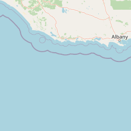
Map view of Shannon National Park

Use this park location map to pinpoint Shannon National Park in Australia, understand its exact geographic position, and read its mapped placement within the surrounding landscape more clearly.

Pigeon | © OpenStreetMap contributors

Location context for Shannon National Park

Western Australia
Recorded earthquake history

Browse the Recorded Earthquake History of Shannon National Park

Investigate the historical record of seismic events that have occurred in the geographic vicinity of Shannon National Park. MoriAtlas provides a clear, data-driven catalogue of recorded epicentres and magnitudes to assist in your regional research and geographic analysis of this Western Australian wilderness area.

Shannon National Park Earthquake History

Catalogued events

3 events

Strongest magnitude

Magnitude 5.3

Most recent event

Nov 8, 2018

This history includes earthquakes recorded inside the park or within 50 km of its borders

Park atlas

Explore the Surrounding Karri Forests, Wetlands, and Wilderness Areas of Southwest Australia

Discover Nearby National Parks and Protected Areas Beyond Shannon National Park

Continue your exploration from Shannon National Park by browsing other protected areas and national parks across the diverse landscapes of Southwest Australia. Compare regional karri forests, expansive wetlands, and unique wilderness zones to understand their ecological connections and geographic spread.
National parkAustralia
Park boundaries overlap#1 closest

Southwest

Boorara-Gardner National Park: Mapped Old Growth Forest and Protected Landscape

Western Australia's protected area and regional geography.

Boorara-Gardner National Park is a vital national park in Western Australia, recognized for its stands of old-growth forest and its stunning spring wildflower displays. Delve into the park's specific geographic features, mapped terrain, and its identity as a key protected area within the South West region. Understand its place in the contiguous network of conservation lands through detailed atlas-style exploration.

Area
110.08 km²
Established
2004
Relief
Mixed relief
Climate
Mediterranean
National parkShire of Manjimup
Park boundaries overlap#2 closest

Northeast

Boyndaminup National Park: Explore Protected Area Boundaries and Geographic Setting

An Australian national park with distinct mapped landscapes.

Boyndaminup National Park is a key protected area providing rich opportunities for geographic discovery. This atlas-focused entry details its mapped boundaries and situates it within the broader landscape context of the Shire of Manjimup. Understand the park's identity as a national park and its role in Australia's conservation network, offering specific insights for map-based exploration and regional geography.

Area
54.43 km²
Established
2004
IUCN
II
Scope
Terrestrial
National parkWestern Australia
Park boundaries overlap#3 closest

Southwest

D'Entrecasteaux National Park: Discover Western Australia's Protected National Park Landscape

Mapping protected boundaries and regional natural terrain.

D'Entrecasteaux National Park stands as a significant protected natural area, offering a focused lens for geographic discovery within Western Australia. This park's identity as a National Park provides a concrete point for understanding mapped landscapes and regional conservation efforts. Explore its specific boundaries and terrain to build a comprehensive picture of its role within the broader atlas of Western Australia's natural heritage.

Area
1,187.79 km²
Established
1980
IUCN
II
Visitors
168.5K annual
National parkAustralia
Park boundaries overlap#4 closest

Northwest

Greater Dordagup National Park: National Park Landscape and Geographic Context in Australia

Explore mapped boundaries and protected land identity.

Greater Dordagup National Park is presented as a distinct protected landscape within the Australian national park system. This entry focuses on its geographic setting and the structured information available for atlas exploration. Users can examine the park's mapped features and understand its contribution to Australia's collection of natural reserves and protected terrains.

Area
64.08 km²
Established
2004
Climate
Temperate
Access
Easy access
National parkAustralia
Park boundaries overlap#5 closest

West

Jane National Park: Western Australia's Protected Old-Growth Forest Landscape

Mapped forest ecosystems in the South West bioregion.

Jane National Park represents a key protected landscape in the South West of Western Australia, recognized for its significant old-growth forest ecosystems. This Class A reserve preserves mature stands of karri and jarrah trees, offering a glimpse into the region's undisturbed natural heritage. Its landscape is characterized by dense, ancient forests dominating gentle terrain, making it an important site for understanding the conservation value of this bioregion and exploring its mapped natural context.

Area
68.63 km²
Established
2004
IUCN
II
Scope
Terrestrial
National parkWestern Australia
Park boundaries overlap#6 closest

Southeast

Mount Frankland National Park: Explore Western Australia's Old-Growth Forested Landscape

Granite peaks and unique regional geography within a protected wilderness area.

Mount Frankland National Park in Western Australia is a protected area renowned for its exceptional old-growth karri and red tingle forests, some of the world's tallest tree species. The park's landscape is shaped by low granite hills and dramatic peaks, including the 411-meter Mount Frankland, offering expansive views across the wilderness. As a key component of the Walpole Wilderness Area, this national park provides a rich geographical context for understanding conservation and mapped natural landscapes in Southwest Australia.

Area
373.59 km²
Established
1988
IUCN
II
Relief
Upland
National parkWestern Australia
2.5 km away#7 closest

Southeast

Mount Frankland South National Park: Western Australia's Protected Natural Landscape

Explore its mapped boundaries and regional geographic context.

Mount Frankland South National Park is a critical protected area defined by its unique natural landscape and mapped boundaries within Western Australia. This entry provides detailed insights into its geographic setting and the protected land it encompasses, offering a focused view for atlas exploration. Understand the park's significance as a protected natural reserve and its contribution to the regional geography of Western Australia, with a clear emphasis on mapped terrain and conservation landscapes.

Area
422.99 km²
Established
2004
IUCN
II
Relief
Mixed relief
National parkAustralia
10 km away#8 closest

East

Mount Frankland North National Park: Protected Jarrah Forest Landscape Exploration

Explore mapped boundaries and regional geography of this Western Australian national park.

Mount Frankland North National Park offers an immersive exploration of one of Western Australia's most significant Jarrah forest ecosystems. As a protected national park and integral part of the Walpole Wilderness Area, it showcases the unique character of the Southwest Australia woodlands. The park's landscape is defined by its tall Jarrah trees and undulating terrain, providing critical habitat and representing a vital conservation effort in a globally recognized biodiversity hotspot. Discover its geographic spread and protected land identity.

Area
220.69 km²
Established
2004
IUCN
II
Relief
Mountain

Common questions about visiting, size, designation, and location context for Shannon National Park

Shannon National Park FAQs for park facts, access, geography, and protected area context

Find quick answers about Shannon National Park, including protected-area facts, park geography, trail and visitor context, and how the park fits into its surrounding country and regional landscape.
MoriAtlas Explorer

Continue Your Protected Areas Search Across the Global Atlas

Deepen your exploration by continuing the structured search for national parks and protected areas worldwide. Utilize the comprehensive filtering capabilities to compare different conservation landscapes and refine your understanding of global park geography. Discover more about the distribution and characteristics of protected natural areas.

Global natural geography