

Mori Atlas logo
National parkShei-Pa National Park

Discover mapped park boundaries and regional protected area context for Shei-Pa National Park.

Shei-Pa National Park: A National Park Within Taiwan's Miaoli County Geographic Landscape

Shei-Pa National Park stands as a significant protected area within Taiwan's Miaoli County, offering a crucial point for geographic discovery. This page provides detailed atlas-style insights into the park's mapped boundaries and its place within the regional landscape. Understand the protected land's unique geographic identity and explore its context as a national park.

Alpine EnvironmentsMountain ParksWatershed ProtectionOld-Growth ForestsGlacial GeologyTaiwania Forests

Shei-Pa National Park

National park

Park overview

Structured park overview, official facts, and landscape profile for Shei-Pa National Park

Shei-Pa National Park park facts, protected area profile, and essential visitor context
Review the core facts for Shei-Pa National Park, including designation, size, terrain, visitor scale, habitats, and operating context in one park-focused overview.

About Shei-Pa National Park

Shei-Pa National Park occupies a strategic position in central Taiwan's mountainous interior, protecting a landscape of exceptional geological and ecological significance. The Xueshan Range, running along the northern section of Taiwan's Central Range, forms the backbone of the park and consists of uplifted metamorphic rocks that have been carved by millions of years of erosion and glaciation. The park's establishment in 1992 reflected Taiwan's growing commitment to preserving its highland environments, which had long been subject to logging and development pressures. Today, the park serves multiple conservation functions, safeguarding watersheds that feed major river systems serving Taipei, Taichung, and surrounding communities while protecting unique alpine ecosystems found nowhere else in Taiwan. The headquarters are located in Dahu Township, Miaoli County, from which park management oversees visitor services, research programs, and conservation initiatives across this mountainous terrain.

Quick facts and research context for Shei-Pa National Park

Shei-Pa National Park covers 768.5 square kilometers in central Taiwan, protecting the Xueshan Range and Mount Dabajian. The park's elevation spans from 760 meters at the Da-an River Valley to 3,886 meters at Xueshan Peak, the second-highest mountain in Taiwan. Established in 1992, the park is categorized as IUCN II and serves as a crucial watershed, feeding the Danshui, Dajia, Da-an, and Touqian rivers. Annual rainfall ranges from 1,500 to 3,000 millimeters, supporting diverse forest types and high biodiversity.

Park context

Deeper park guide and search-rich context for Shei-Pa National Park

Shei-Pa National Park history, landscape, wildlife, and travel context
Explore Shei-Pa National Park through its history, landscape character, ecosystems, wildlife, conservation priorities, cultural context, and seasonal travel timing in a structured park guide built for atlas discovery and search intent.

Why Shei-Pa National Park stands out

Shei-Pa National Park is best known for its spectacular alpine scenery along the Xueshan Range, which forms the spine of central Taiwan. The park protects Taiwan's second-highest peak, Xueshan (Snow Mountain), rising to 3,886 meters with its distinctive glacial cirques and sharp ridgelines. The Holy Ridge Line, a celebrated trail through the park, offers hikers traverse through some of Taiwan's most dramatic high mountain terrain. The park is also renowned for its ancient Taiwania forests, home to trees exceeding 65 meters in height, including a 79.1-meter specimen documented in 2022, among the tallest trees recorded in Taiwan.

Shei-Pa National Park history and protected-area timeline

Shei-Pa National Park was officially established on July 1, 1992, following years of advocacy for protecting Taiwan's central mountain regions. The creation of the park represented a significant expansion of Taiwan's protected area network into the high-altitude zones of the Xueshan Range, which had previously lacked formal national park status. The park's headquarters were subsequently established in Fuxing Village, Dahu Township, Miaoli County, and the institution has since developed visitor facilities, trail maintenance programs, and research initiatives. An asteroid, 278956 Shei-Pa, discovered in astronomical surveys, was named in honor of the park, with the official naming citation published by the Minor Planet Center in 2018, reflecting the park's international recognition.

Shei-Pa National Park landscape and geographic character

The landscape of Shei-Pa National Park is defined by its dramatic altitudinal range and the锋利的山脊 and deep valleys of the Xueshan Range. From the Da-an River Valley at 760 meters, the terrain climbs steeply through forested slopes before ascending into the alpine zone above 3,000 meters. The park's highest summit, Xueshan (雪山), reaches 3,886 meters and ranks as Taiwan's second-highest mountain, characterized by sharp peaks, rocky ridgelines, and the characteristic glacial cirques carved by Pleistocene ice. Pintian Mountain displays a notable box fold geological structure, offering a window into the tectonic forces that uplifted Taiwan's Central Range. The park's rivers, including Takejin Creek flowing north to join the Danshui River system, have carved deep valleys that create complex terrain. The combination of high peaks, cirques, ridgelines, and forested valleys creates a landscape of outstanding natural beauty.

Shei-Pa National Park ecosystems, habitats, and plant life

Shei-Pa National Park encompasses a remarkable range of ecosystems across its elevation gradient, from subtropical forest in the lower valleys to alpine vegetation near the summits. The park's forest types include broadleaf evergreen forests at lower elevations, transitioning through coniferous zones to the alpine meadows and krummholtz that characterize the highest terrain. The Taiwania conifer, one of Taiwan's most ancient and economically valuable tree species, forms significant forests within the park at elevations around 2,000 meters. Research conducted in the park has documented an extraordinary density of exceptionally tall trees, with 941 trees measured at heights exceeding 65 meters as of recent surveys, including a specimen reaching 79.1 meters in height. This makes the park a living repository of Taiwan's ancient forest heritage.

Shei-Pa National Park wildlife and species highlights

While the source material provides limited specific wildlife detail, Shei-Pa National Park's diverse habitats across its substantial elevation range support a corresponding variety of fauna adapted to different ecological zones. The protected status of this central mountain region helps preserve habitats for species that depend on the island's highland environments, including endemic birds, mammals, and invertebrates found in the montane and alpine zones. The park's rivers and riparian corridors provide aquatic habitat, while the extensive forest cover offers shelter for numerous species.

Shei-Pa National Park conservation status and protection priorities

Shei-Pa National Park represents a critical conservation asset for Taiwan, protecting both unique geological features and irreplaceable forest ecosystems. The park's function as a watershed for multiple major river systems that supply freshwater to populated areas of northern and western Taiwan gives it particular significance beyond its ecological value. The protection of old-growth Taiwania forests, with trees exceeding 65 meters in height, preserves genetic material and habitat for species dependent on these ancient forest structures. The park's IUCN Category II designation reflects its primary purpose of protecting natural landscapes while allowing for sustainable visitor use. The presence of glacial cirques and other geological features of scientific interest adds to the park's conservation importance.

Shei-Pa National Park cultural meaning and human context

While the source material focuses primarily on the park's natural features, the protected area lies within traditional territories associated with indigenous communities of central Taiwan. The park's establishment required consideration of land use patterns and historical relationships between local communities and the mountain environment. The Hsinchu, Miaoli, and Taichung areas surrounding the park have long histories of human settlement and agricultural use, with the mountainous interior historically serving as hunting grounds and forest management areas.

Top sights and standout views in Shei-Pa National Park

Shei-Pa National Park's premier attraction is the Xueshan (Snow Mountain) summit trek, which offers hikers access to one of Taiwan's most spectacular alpine environments. The Holy Ridge Line provides a celebrated through-route for experienced hikers, traversing dramatic ridgelines with panoramic views of the Central Range. The park's exceptional Taiwania forests, with documented trees among the tallest in Taiwan, represent a unique opportunity to witness ancient forest ecosystems. The geological features including Pintian Mountain's box fold and numerous glacial cirques offer insights into Taiwan's geological history. The park's role as a critical watershed for major rivers serving millions of people adds to its significance beyond recreation.

Best time to visit Shei-Pa National Park

Shei-Pa National Park can be visited year-round, though the high mountain environment demands appropriate preparation for varying conditions. Summer months offer the most stable weather for hiking, with temperatures at higher elevations remaining comfortable, while the winter season brings cold conditions and potential snow at summit elevations. The monsoon season from May through September brings substantial rainfall, with annual precipitation ranging from 1,500 to 3,000 millimeters, creating lush conditions throughout the park but requiring visitors to be prepared for wet weather. Spring and autumn offer transitional conditions with moderate temperatures and colorful seasonal changes in the forest, though weather patterns can shift rapidly in the mountains.

Park location guide

Geography guide, regional context, and park location map for Shei-Pa National Park

Shei-Pa National Park park geography, regions, and map view in Taiwan
Understand where Shei-Pa National Park sits in Taiwan through a broader geographic reading of the surrounding landscape, nearby location context, and its mapped position within the national park landscape.

How Shei-Pa National Park fits into Taiwan

Taiwan is an island nation in East Asia situated between the East China Sea and South China Sea. With a population of approximately 23.3 million people, it is one of the most densely populated countries in the world. The island features mountain ranges dominating its eastern region and densely populated plains in the west, where major cities including Taipei and New Taipei City are located.

Wider geography shaping Shei-Pa National Park in Taiwan

Taiwan is located in the western Pacific Ocean, bordered by the East China Sea to the northwest and the South China Sea to the southwest. The People's Republic of China lies to the northwest across the Taiwan Strait, Japan is to the northeast, and the Philippines are to the south. The main island features mountain ranges dominating the eastern two-thirds of the territory, with plains concentrated in the western third where the majority of the population resides.

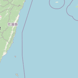
Map view of Shei-Pa National Park

Use this park location map to pinpoint Shei-Pa National Park in Taiwan, understand its exact geographic position, and read its mapped placement within the surrounding landscape more clearly.

Pigeon | © OpenStreetMap contributors

Location context for Shei-Pa National Park

Hsinchu CountyMiaoli CountyTaichung City
Park atlas

Discover nearby national parks and protected landscapes across Taiwan's central mountain region

Discover More National Parks and Protected Areas Near Shei-Pa National Park
Explore a curated selection of other national parks and protected areas within Taiwan's central mountain region, extending your discovery from Shei-Pa National Park. This view helps you compare high-altitude landscapes, trace watershed conservation efforts, and understand the regional distribution of protected natural environments.
National parkHualien County

Taroko National Park: Detailed National Park Geography and Protected Landscape Context

Explore mapped boundaries and natural terrain in Hualien County.

Taroko National Park represents a significant protected landscape within Taiwan, offering rich opportunities for geographical exploration and understanding protected-area distribution. As a designated national park, its mapped boundaries and unique terrain provide essential context for appreciating the natural geography of Hualien County and the surrounding region. This page supports detailed discovery of Taroko National Park's identity as a distinct protected area, ideal for atlas-based research and landscape comprehension.

Area
920 km²
Established
1986
IUCN
II
Relief
Mountain
National parkTaiwan

Yangmingshan National Park: Volcanic Terrain and Geothermal Features Atlas

Explore Taiwan's protected national park geography and mapped landscapes.

Yangmingshan National Park presents a striking example of volcanic geography, characterized by its rugged mountain terrain, active craters like Xiaoyoukeng, and ubiquitous geothermal features such as hot springs and sulfur deposits. As a protected national park within Taiwan, its landscape offers a rich context for understanding volcanic processes and alpine ecosystems. MoriAtlas provides detailed map exploration of Yangmingshan National Park, highlighting its unique geological formations and protected boundaries for an in-depth geographic discovery experience.

Area
113 km²
Established
1985
IUCN
II
National parkNantou County

Yushan National Park: Explore Taiwan's Highest Mountain and Alpine Protected Terrain

Mapped geography and dramatic peaks within Nantou County.

Yushan National Park is a crucial protected area in Taiwan, renowned for encompassing the island's highest mountain and a significant portion of the Central Mountain Range. This national park's dramatic geography spans over 103,000 hectares, with two-thirds of its territory lying above 2,000 meters. Its vertical ecological zones, from subtropical forests to alpine environments, offer a rich tapestry of landscapes ideal for atlas-style exploration of protected terrain and mountain peak geography.

Area
1,031.21 km²
Established
1985
IUCN
II
Visitors
1M annual
National parkTainan

Taijiang National Park: National Park Atlas and Protected Landscape Exploration

Discover mapped boundaries and regional geography.

Taijiang National Park offers a distinct look into protected natural landscapes within Tainan, Taiwan. This page details its identity as a national park, focusing on its mapped geographic features and its contribution to the regional atlas. Users can explore the specific protected area context and understand the landscape characteristics relevant to a structured geographic discovery approach.

Area
393.1 km²
Established
2009
IUCN
II
Relief
Lowland
National parkTaiwan

South Penghu Marine National Park: A Protected Volcanic Island Landscape in Taiwan's Penghu Archipelago

Mapped marine protected areas and unique geological features.

Discover the unique atlas value of South Penghu Marine National Park, Taiwan's protected national park renowned for its dramatic columnar basalt landforms and extensive coral reef systems. This marine protected area provides critical habitat for diverse species and showcases a rugged island geography shaped by volcanic activity. Explore its mapped boundaries and unique geological formations, including famous sea caves, offering a distinct context for landscape discovery.

Area
358.44 km²
Established
2014
IUCN
II
Visitors
8.4K annual
National parkPingtung County

Kenting National Park: Taiwan's Southern National Park Protected Landscape Identity

Mapped geography and regional context for this protected area.

Kenting National Park is a crucial protected area located in Pingtung County, Taiwan, representing a significant component of the nation's protected lands. This page provides detailed information ideal for atlas-driven exploration, focusing on the park's mapped geographic features, its role as a national park, and its contribution to understanding Taiwan's diverse landscapes. Discover the unique identity of Kenting National Park as a key element in regional conservation and geographic study.

Area
333 km²
Established
1984
IUCN
II
Visitors
5.8M annual
National parkOkinawa Prefecture

Iriomote-Ishigaki National Park: Subtropical Island Geography and Protected Landscape Atlas

Explore the unique terrain and mapped boundaries of this national park.

Dive into the geography of Iriomote-Ishigaki National Park, a protected national park situated in Japan's Okinawa Prefecture. This page provides a detailed atlas view of its characteristic subtropical island terrain, including extensive mangrove forests, distinct limestone karst features, and surrounding marine protected areas. Understand the park's unique landscape and its significance within the broader regional geography for comprehensive exploration.

Area
1,221.5 km²
Established
1972
IUCN
II
Climate
Subtropical
National parkKinmen County

Kinmen National Park: National Park Protected Landscape and Geographic Context

Mapped boundaries and regional park geography for atlas exploration.

Kinmen National Park stands as a significant protected area within Kinmen County, Taiwan. This page focuses on its identity as a national park, detailing its mapped boundaries and contributing to an understanding of its regional geographic context. It is designed for users seeking to explore the park's protected landscape features and its position within the broader atlas of natural areas.

Area
35.29 km²
Established
1995
IUCN
II
Relief
Upland

Common questions about visiting, size, designation, and location context for Shei-Pa National Park

Shei-Pa National Park FAQs for park facts, access, geography, and protected area context
Find quick answers about Shei-Pa National Park, including protected-area facts, park geography, trail and visitor context, and how the park fits into its surrounding country and regional landscape.
MoriAtlas Explorer

Continue Your Protected Areas Search Across the Global Atlas

Deepen your exploration by continuing the structured search for national parks and protected areas worldwide. Utilize the comprehensive filtering capabilities to compare different conservation landscapes and refine your understanding of global park geography. Discover more about the distribution and characteristics of protected natural areas.

Global natural geography