
Streams
Park geography
Detailed spatial data on alpine elevations, mountain peaks, and regional landscape features
Shey Phoksundo National Park: Comprehensive Geographic Boundaries and Terrain Analysis
This geographic profile details the physical scope of Shey Phoksundo National Park across Dolpa and Mugu districts. It provides a structured analysis of the 3555 square kilometer area, including measured boundaries, elevation extremes ranging from 2130 to 6885 meters, and a catalog of internal mountain peaks and mountain saddles.
Related tags
trans-Himalayan ecosystemalpine lakesnow leopard habitatRamsar siteglacial landscape
Nepal's largest trans-Himalayan park, guarding the sacred turquoise waters of Phoksundo Lake
Shey Phoksundo National Park
Shey Phoksundo National Park is the largest protected area in Nepal and the country's only trans-Himalayan national park, spanning the dramatic landscapes of the Dolpa and Mugu Districts in the Mid-Western Region. Established in 1984, the park encompasses 3,555 square kilometers of rugged terrain that transitions from the warm lower valleys of the southeast to the cold, arid Tibetan plateau-like conditions of the north. The park's defining feature is Phoksundo Lake, a stunning alpine lake renowned for its vivid turquoise coloration, which sits at an elevation of 3,612 meters and was designated a Ramsar site in 2007. This trans-Himalayan setting places the park in a unique ecological position, bridging the Himalayan mountain range with the expansive plateau regions beyond, creating a landscape of remarkable diversity that supports both temperate and alpine ecosystems within a single protected boundary.
- Location
- Nepal
- Park type
- National park
- Established
- 1984
- Area
- 3,555 km²
- Highest point
- 6,883 m
Location overview
District administration and regional mapping within Nepal
Shey Phoksundo National Park Protected Area Location and Geography
Shey Phoksundo National Park spans the Dolpa and Mugu districts within the Mid-Western Region of Nepal. Mapping the administrative layers clarifies how the protected territory aligns with local district boundaries.
- Countries
- Nepal
- Regions
- Dolpa District, Mid-Western Region, Mugu District
- Primary location
- Nepal
Boundary and coordinates
Interactive boundary geometry and derived spatial measurements
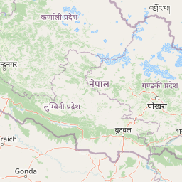
Shey Phoksundo National Park Boundary Map and Spatial Extent
Mapped park outlines provide clear spatial context for the protected area and its surrounding terrain. Accompanying boundary facts detail total surface area, coordinate limits, geographic center points, and regional spans.
- Boundary area
- 3,572.5 km²
- Boundary perimeter
- 304.5 km
- Northernmost point
- 29.7728° N
- Southernmost point
- 28.9728° N
- Easternmost point
- 83.1613° E
- Westernmost point
- 82.4934° E
- Geographic centre
- 29.4022° N, 82.8271° E
- North–south span
- 88.7 km
- East–west span
- 64.8 km
Elevation and terrain
Mountain relief metrics, peaks, and internal natural formations
Shey Phoksundo National Park Terrain, Elevation Range, and Physical Features
Recorded elevation data outlines a vertical range from 2130 meters to 6885 meters across mountain terrain. Individual feature cards detail named peaks, lakes, streams, and saddles positioned within the protected area.
- Minimum elevation
- 2,130 m
- Maximum elevation
- 6,885 m
- Highest point
- 6,883 m
Selected named natural features
Lakes
Phoksundo Lake
3,612 m
Peaks
4035
4,035 m
Peaks
Shel Rivo Drukdra
5,566 m
Lakes
Lungchung Tal
Mountain saddles
Nenla Bhanjan
5,380 m
Environmental setting
Alpine relief, glacial lakes, and riverine habitats across mountain terrain
Shey Phoksundo National Park Environmental Settings and Landscape Classifications
Recorded landscape features and climate categories group the physical terrain into complementary environmental settings. Stored classifications connect recorded categories to relevant atlas destinations where available.
- Relief
- Mountain
- Climate
- Alpine
- Water
- Major water bodies
Landscape features
Mountains · Plateau · Lakes · Rivers · Glacier · Wetland
Habitat types
Alpine meadow · Glacial habitat · Lacustrine habitat · Riverine habitat · Wetland
Park atlas
Discover connected Himalayan landscapes and compare protected areas across Nepal's diverse mountain terrain
Explore Other National Parks and Protected Areas Near Shey Phoksundo National Park
Continue your exploration of Shey Phoksundo National Park by browsing other national parks and protected areas in the surrounding Himalayan region and beyond. Comparing these diverse conservation landscapes provides crucial atlas-level insights into ecological corridors and regional protected area networks.
National parkNepal
33 km away#1 closest
West

Rara National Park: Nepal's National Park with Mapped Protected Landscape Context
Discover its geographic setting and park boundaries
Rara National Park is a key protected area within Nepal, offering a distinct focus for geographic exploration. This page details its identity as a national park, highlighting its mapped boundaries and its contribution to the country's atlas of natural landscapes. Understand the park's specific role and regional geographic context, providing a solid foundation for atlas-driven discovery of Nepal's protected areas.
- Area
- 106 km²
- Established
- 1976
- IUCN
- II
- Relief
- Mountain
National parkNepal
About 127 km away#2 closest
Southwest
Banke National Park: Nepal National Park with Distinct Protected Landscape Geography
Explore the mapped terrain and regional atlas context of Banke National Park.
Banke National Park represents a vital protected area within Nepal's diverse geography, offering a focused point for atlas and map-based discovery. As a national park, its designated status highlights its importance in conserving natural landscapes and understanding regional protected-area distribution across South Asia. This entry provides detailed geographic context, enabling users to explore the park's mapped boundaries and appreciate its role within Nepal's broader natural territory.
- Area
- 550 km²
- Established
- 2010
- IUCN
- II
- Relief
- Upland
National parkBardiya District
About 137 km away#3 closest
Southwest
Bardiya National Park: Nepal's Expansive Terai Protected Landscape and Atlas
Mapped geography, tiger habitat, and rhino conservation in Bardiya District.
Bardiya National Park represents a significant protected area within Nepal's Terai lowlands, providing an exceptional resource for geographic discovery. Its diverse terrain, including vast grasslands and dense forests bisected by major river systems like the Karnali and Babai, creates unique ecosystems. As the largest national park in Nepal, it is instrumental in mapping wildlife corridors and understanding regional landscape dynamics, particularly for endangered species such as Bengal tigers and Indian rhinoceroses. This park offers a profound glimpse into the mapped natural heritage of the Bardiya District.
- Area
- 968 km²
- Established
- 1988
- IUCN
- II
- Relief
- Mixed relief
National parkNepal
About 148 km away#4 closest
West
Khaptad National Park: Nepal's National Park Landscape and Protected Area Geography
Explore the mapped terrain and regional context of this protected landscape.
Khaptad National Park is a designated national park in Nepal, offering a unique entry point for exploring protected landscapes and regional geography. This entry details the park's mapped boundaries and its significance within the broader atlas of natural terrain. Users can delve into the specific geographic context of this protected area, understanding its role within Nepal and the wider South Asian context for structured landscape discovery.
- Area
- 225 km²
- Established
- 1984
- IUCN
- II
- Relief
- Mountain
National parkLakhimpur Kheri district
182 km away#5 closest
Southwest

Dudhwa National Park: Terai Grasslands and Alluvial Plain Geography within Lakhimpur Kheri
Discover the mapped protected landscape of this vital Indian national park.
Dudhwa National Park in Lakhimpur Kheri district stands as a crucial example of the Terai grassland ecosystem, characterized by its expansive alluvial plains and marshy habitats. This page provides an atlas-style exploration of its protected landscape, detailing the unique terrain and geographic context essential for understanding its conservation significance.
- Area
- 614 km²
- Established
- 1977
- IUCN
- II
- Visitors
- 26K annual
National parkNepal
188 km away#6 closest
Southeast
Chitwan National Park: Nepal's Designated National Park Landscape
Explore mapped boundaries and surrounding regional geography.
Chitwan National Park is a vital protected area offering critical insights into Nepal's natural geography. This entry provides detailed information on the park's specific landscape characteristics and its mapped boundaries, crucial for anyone interested in the atlas-level understanding of protected lands within South Asia. Discover the geographic context of this national park and its significance within the broader conservation framework of Nepal.
- Area
- 952.63 km²
- Established
- 1973
- IUCN
- II
- Relief
- Mixed relief
National parkNepal
About 219 km away#7 closest
Southeast
Parsa National Park: Mapped Protected Landscape Within Nepal's Geography
Explore its national park status and geographic setting.
Parsa National Park represents a significant protected area within the geographic framework of Nepal. This page provides critical atlas context, detailing the park's mapped boundaries and its role as a national park. It serves as an essential resource for understanding the specific landscape features and regional geographic positioning of Parsa National Park, contributing to a structured view of protected lands across South Asia.
- Area
- 627.39 km²
- Established
- 2017
- IUCN
- II
- Relief
- Lowland
National parkWest Champaran District
About 222 km away#8 closest
Southeast
Valmiki National Park: A Vital National Park and Protected Landscape in Bihar
Explore unique Sivalik terrain and mapped protected area boundaries
Valmiki National Park, located in the West Champaran District of Bihar, is a significant protected area renowned for its unique geography. Situated at the interface of the Himalayas and the Gangetic plains, the park showcases a varied terrain including ridges, gorges, dense forests, and extensive wetlands. As Bihar's only national park and a designated tiger reserve, it offers rich insights into conservation landscapes and regional biodiversity for atlas exploration.
- Area
- 898.45 km²
- Established
- 1990
- IUCN
- II
- Relief
- Mixed relief
MoriAtlas Explorer
Continue Your Atlas Exploration of Shey Phoksundo National Park's Geography
Deepen your understanding of Shey Phoksundo National Park by exploring its unique trans-Himalayan ecosystems and mapped landscape context. This protected area offers a singular perspective on Nepal's diverse geography, from alpine lakes to arid plateaus, providing rich data for comparative atlas discovery. Continue to uncover the distinct natural features and regional significance of this extraordinary national park.
Browse next
Global natural geography
Explore related park routes
Explore MoriAtlas Global ParksBrowse All MoriAtlas ParksGlobal Park Map DiscoveryMoriAtlas: Browse All CountriesBrowse All MoriAtlas ContinentsNational Park Environment AtlasGrand Canyon National Park AtlasYellowstone National Park AtlasYosemite National Park Atlas and GeographySerengeti National Park AtlasGalápagos National Park Protected LandscapeBanff National Park Geography and AtlasKruger National Park Atlas EntryUluṟu-Kata Tjuṯa National Park AtlasExplore Uluru-Kata Tjuta National Park GeographyPlitvice Lakes National Park AtlasFiordland National Park Protected LandscapeGreat Smoky Mountains National Park AtlasAfghanistan National Parks and Protected AreasAlbania National Parks and Protected AreasAlgeria National Parks and Protected AreasAmerican Samoa National Parks and Protected AreasAndorra National Parks and Protected AreasAngola National Parks and Protected AreasAntarctica National Parks and Protected AreasAntigua and Barbuda Park List