Mori Atlas logo
Marine protected areaSint Eustatius National Marine Park

A comprehensive look at the marine boundaries, submerged volcanic terrain, and shipwreck habitats around Statia.

Sint Eustatius National Marine Park: Mapping the Volcanic Reefs and Coastal Protected Landscapes

Sint Eustatius National Marine Park encompasses 27.5 square kilometers of nearshore waters, stretching from the island high-water mark to significant depths along its volcanic shelf. This protected area features a unique mosaic of coral reefs that have colonized ancient lava flows and historic shipwrecks, creating a layered underwater landscape. Our atlas data maps the Northern and Southern Marine Reserves, providing context on how these managed zones support sea turtle nesting beaches and seasonal migratory paths for humpback whales and dolphins within the Dutch Caribbean.

Caribbean marine parkcoral reefsvolcanic reefsshipwreck reefssea turtle nestingmarine reserves

Sint Eustatius National Marine Park

Marine protected area

Park overview

Structured park overview, official facts, and landscape profile for Sint Eustatius National Marine Park

Sint Eustatius National Marine Park park facts, protected area profile, and essential visitor context

Review the core facts for Sint Eustatius National Marine Park, including designation, size, terrain, visitor scale, habitats, and operating context in one park-focused overview.

About Sint Eustatius National Marine Park

Sint Eustatius National Marine Park is a marine protected area that surrounds the island of Sint Eustatius in the Caribbean, a special municipality within the Kingdom of the Netherlands. The island, often known locally as Statia, sits within the Lesser Antilles and is part of the Dutch Caribbean alongside Bonaire, Saba, and other islands. The park was established in 1996 under the former Netherlands Antilles, just before the dissolution of that political entity, and it falls within the broader Caribbean Netherlands administrative framework today.

The park protects a band of coastal and nearshore ocean extending from the high-water mark out to depths of roughly 30 meters and up to about three kilometers offshore. Within this larger protected zone, two specially managed marine reserves, the Northern Marine Reserve adjacent to the Quill/Boven National Park and the Southern Marine Reserve partially adjoining the Quill National Park, enforce no-take and no-anchor rules across a combined area of approximately 4.9 square kilometers. These restrictions are designed to preserve reef integrity and allow marine life to recover and persist without direct human extraction pressure.

The park's character is shaped by the volcanic geology of Sint Eustatius itself. Coral communities have grown on the submerged flanks of the island's northern and southern volcanic centers, producing natural reef structures that rise from the old lava flows. Artificial reef communities have also developed on shipwrecks and on the ruins of submerged colonial-era warehouses, adding structural complexity to the seascape. Three distinct reef typologies are therefore present: natural volcanic reefs, wreck-based reefs, and submerged ruin-based reefs.

In addition to its reef ecosystems, the park supports seasonal visitors including dolphins and humpback whales that pass through the surrounding waters from January to April. The island's beaches, particularly those within or adjacent to the marine park, host nesting sea turtles, and a dedicated conservation program has been operating to monitor and protect those nests for more than two decades. Together, the park's reefs, marine reserves, sea turtle habitats, and cetacean migration corridors make it a regionally significant component of Caribbean marine conservation.

Quick facts and research context for Sint Eustatius National Marine Park

Sint Eustatius National Marine Park is a marine protected area surrounding the Dutch Caribbean island of Sint Eustatius, established in 1996 by the former Netherlands Antilles. It covers approximately 27.5 square kilometers of coastal water from the shoreline down to roughly 30 meters in depth. The park contains two no-take, no-anchor marine reserves totaling about 4.9 square kilometers, and is administered by the St Eustatius National Parks Foundation (STENAPA), which also manages the island's terrestrial parks.

The park is home to coral reefs that have formed on ancient volcanic lava flows as well as on sunken shipwrecks, and serves as an important nesting ground for leatherback, green, and critically endangered hawksbill sea turtles. Migration season from January to April brings dolphins and humpback whales through park waters.

Protection and recognition

Examine documented marine protection scope and formal designation frameworks.

Sint Eustatius National Marine Park Protection Status and Governance Data

Marine conservation frameworks define the operational boundaries and protective scope established for Sint Eustatius National Marine Park. Structured governance records outline the formal designation parameters assigned to this protected marine environment.

Protection details

Protection scope
Marine
Transboundary protection
No
Park context

Deeper park guide and search-rich context for Sint Eustatius National Marine Park

Sint Eustatius National Marine Park history, landscape, wildlife, and travel context

Explore Sint Eustatius National Marine Park through its history, landscape character, ecosystems, wildlife, conservation priorities, cultural context, and seasonal travel timing in a structured park guide built for atlas discovery and search intent.

Why Sint Eustatius National Marine Park stands out

The park is best known for its coral reefs that have developed on submerged volcanic remnants and historic shipwrecks, creating a diverse mosaic of reef habitats around a small Caribbean island. It is also recognized for its sea turtle nesting beaches and its active conservation program protecting leatherback, green, and hawksbill turtles. Equally distinctive is the park's role as a seasonal passage for cetaceans, with dolphins and humpback whales moving through its waters each winter and early spring. The combination of volcanic reef foundations, wreck-based reef communities, sea turtle conservation, and cetacean migration makes it one of the more ecologically layered marine protected areas in the Lesser Antilles.
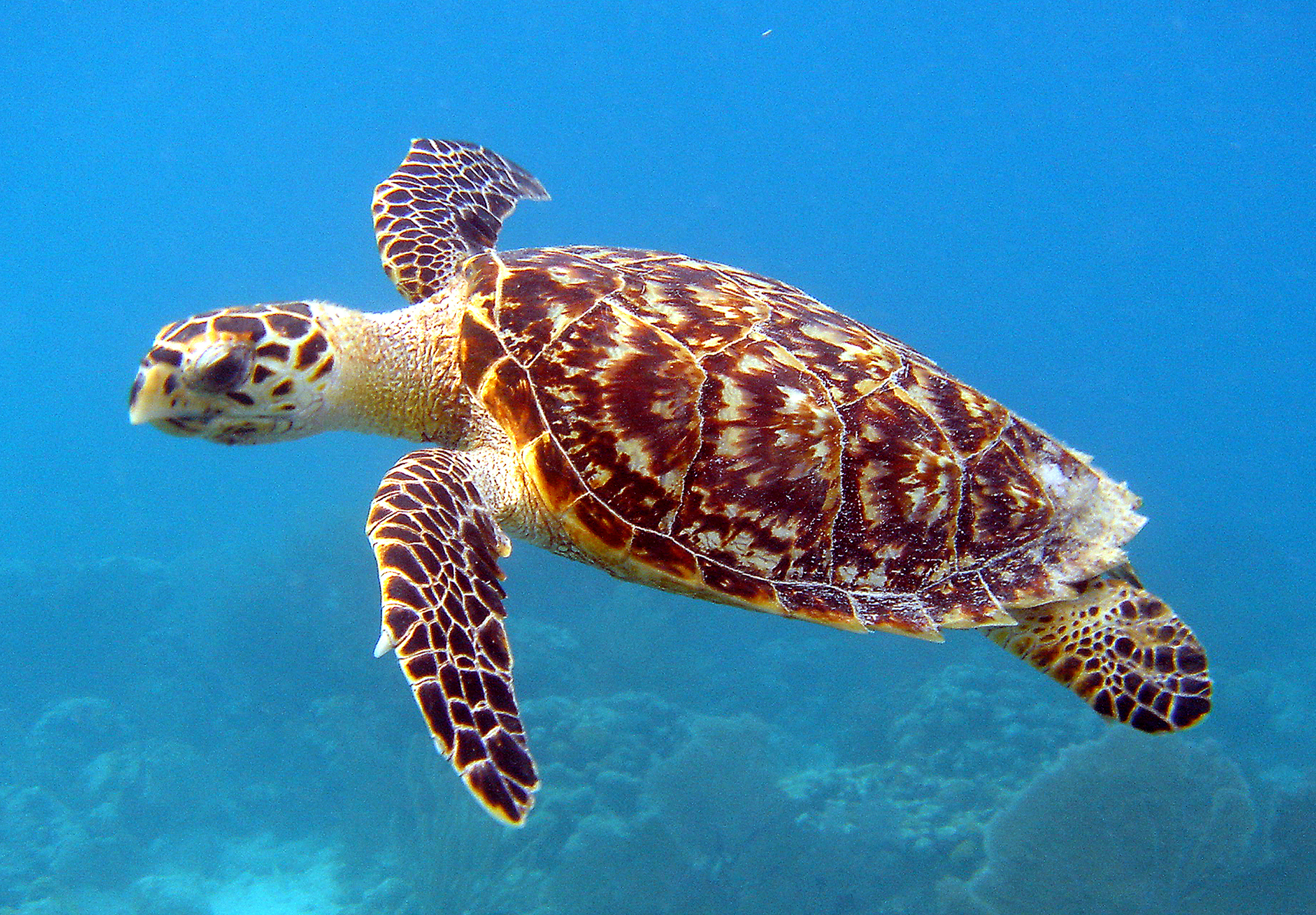
A Hawksbill sea turtle swimming underwater in clear blue water.
A Hawksbill sea turtle swimming through the clear waters of the Sint Eustatius National Marine Park.

Sint Eustatius National Marine Park history and protected-area timeline

The Sint Eustatius National Marine Park was designated in 1996 by the former Netherlands Antilles, which governed Sint Eustatius at the time. The park was established as a marine protected area of roughly 27.5 square kilometers, extending from the high-water line down to a depth of about 30 meters around the island. Its creation predated the dissolution of the Netherlands Antilles in 2010, after which Sint Eustatius became a special municipality within the Kingdom of the Netherlands, part of what is now referred to as the Caribbean Netherlands.

Management of the park was entrusted to the St Eustatius National Parks Foundation, known as STENAPA, a non-governmental organization that also administers the island's terrestrial protected areas, including the Quill/Boven National Park and the Miriam C. Schmidt Botanical Garden. Over time, the park's conservation scope expanded to include the two no-take marine reserves and, beginning in 2001, a sea turtle conservation program. This program, which has grown progressively since its launch, tracks nesting activity, protects nests from disturbance and coastal erosion, runs clean-up and anti-plastic-pollution campaigns, and supports public education. The program operates as part of the Wider Caribbean Sea Turtle Conservation Network (WIDECAST), connecting local efforts to regional sea turtle protection initiatives.

Sint Eustatius National Marine Park landscape and geographic character

The marine park's underwater landscape is shaped by the volcanic origins of Sint Eustatius itself, an island whose northern and southern volcanic centers extend below the sea. Coral reefs have grown over these submerged volcanic foundations, building reef structures on old lava flows and rocky outcrops that rise from the seafloor. This gives the park a distinctive reef-on-volcano character uncommon in many Caribbean marine protected areas.

In addition to the natural volcanic reefs, the park contains reef communities that have developed on a number of historic shipwrecks, which now function as artificial reef substrates colonized by corals, sponges, and other marine organisms. Reef has also formed on the ruins of submerged colonial-era warehouses, adding further structural diversity to the seascape. The result is a mosaic of reef habitats ranging from volcanic base reefs to wreck reefs and ruin reefs.

Onshore, the park's boundary extends from the high-water mark along the island's coastline, bordered by beaches that include important sea turtle nesting habitat. Above and adjacent to the marine park, the terrain of Sint Eustatius rises into the volcanic interior of the island, including the slopes of the Quill, where the marine park connects geographically with the island's terrestrial national park.
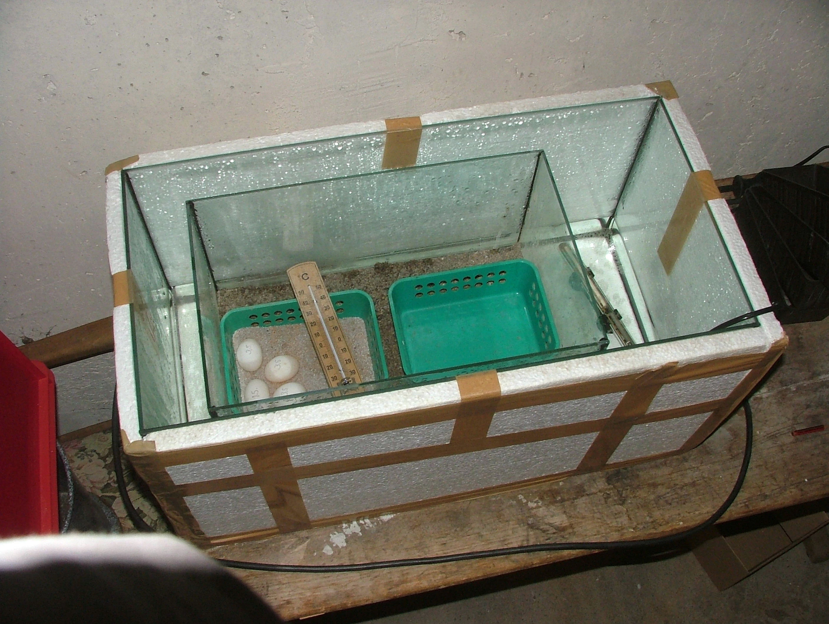
A rectangular glass enclosure containing two small green baskets, one holding several white rounded eggs and a thermometer, resting on a wooden surface.
A homemade incubator used for conservation efforts of sea turtle eggs.

Sint Eustatius National Marine Park ecosystems, habitats, and plant life

The park's ecological identity rests on its coral reef habitats, which span multiple reef typologies and occupy much of the park's nearshore seafloor. Natural reefs have formed on the volcanic remnants of the island's northern and southern volcanic centers, while additional reef communities have grown on shipwrecks and on the ruins of sunken warehouses. This combination produces varied reef structures, with associated communities of corals, sponges, and other reef-building and reef-associated organisms.

Sea urchins, including the long-spined sea urchin (Diadema antillarum), are a notable and ecologically important presence in the reef system, helping to shape algal dynamics on the reefs. Larger predatory and open-water species circulate through the park as well, with barracudas reported among the wreck-associated fish fauna. The broader reef environment supports a rich mix of reef fish, invertebrates, and mobile species typical of Caribbean reef ecosystems.

At the shoreline, the park's beach habitats function as important nesting grounds for sea turtles, an ecological role that has become central to the park's conservation identity. Together, the reefs, the wildlife corridors used by migratory cetaceans, and the nesting beaches give the park an unusually broad marine-terrestrial ecological profile for a small island.

Sint Eustatius National Marine Park wildlife and species highlights

The park's wildlife profile centers on the fauna associated with its coral reefs, sea turtle nesting beaches, and seasonal cetacean migrations. Around the reefs, divers and researchers regularly encounter angelfish such as the blue-faced angelfish, butterflyfish including the foureye butterflyfish, flying gurnards, moray eels, spotted drums, frogfish, seahorses, octopuses, lobsters, rays, sharks, and sea turtles. The presence of these species reflects the structural diversity of the reef habitats, which include natural volcanic reefs alongside wreck and ruin reefs.

Among larger pelagic and migratory species, dolphins and humpback whales pass through the park's waters between January and April, following broader Caribbean migration routes. These seasonal visitors add a dynamic megafauna element to the park's wildlife character.

The park's most emblematic wildlife feature, however, is its sea turtle nesting population. Three species nest on Sint Eustatius's beaches within or adjacent to the marine park: leatherback turtles, green sea turtles, and hawksbill turtles. The hawksbill is critically endangered, giving its local nesting population particular conservation significance. The nesting beaches and the surrounding waters together support feeding, resting, and migratory behavior, making the park a year-round habitat mosaic rather than a single-season resource.

Sint Eustatius National Marine Park conservation status and protection priorities

The park's conservation significance lies in its combined protections for coral reefs, marine wildlife, and sea turtle nesting habitat. Its two internal marine reserves, the Northern Marine Reserve and the Southern Marine Reserve, prohibit fishing and anchoring, reducing direct human pressure on sensitive reef communities and allowing marine life to recover where it has been disturbed. This no-take, no-anchor framework, combined with mooring buoys that direct boats to designated dive sites, helps limit anchor damage to reefs and concentrates diving activity in a controlled way.

The park plays a central role in Caribbean sea turtle conservation, particularly through the ongoing program run by STENAPA. This program monitors nests, relocates and incubates eggs where needed, removes debris and plastics from nesting beaches, and conducts public outreach. The program is part of the Wider Caribbean Sea Turtle Conservation Network (WIDECAST), connecting local nesting beach protection to a regional sea turtle conservation framework.

At a broader level, the park contributes to the integrity of the surrounding marine environment. Its reef habitats support reef-associated biodiversity, function as fish habitat, and provide resilience against environmental pressures facing Caribbean reef systems in general. The integration of the marine park with the island's terrestrial national park, Quill/Boven National Park, under shared STENAPA management, also creates a rare connected terrestrial-marine conservation landscape.

Top sights and standout views in Sint Eustatius National Marine Park

The park's standout qualities include its unusual combination of volcanic-base coral reefs and reef communities grown on shipwrecks and submerged colonial warehouses. Its two internal no-take marine reserves provide a meaningful refuge within the broader park area, while the surrounding waters host seasonal dolphin and humpback whale sightings from January to April.

Equally distinctive is the park's sea turtle conservation program, which has monitored nesting activity for more than two decades, protects leatherback, green, and critically endangered hawksbill turtles, and integrates the island into the wider WIDECAST network. Together, these features make the marine park a compact but ecologically rich expression of the Dutch Caribbean's natural heritage.

Best time to visit Sint Eustatius National Marine Park

The park can be experienced year-round, though its character shifts with the seasons. From January to April, migrating dolphins and humpback whales move through the surrounding waters, adding a marine megafauna dimension to any visit during these months. Sea turtle nesting activity occurs in defined nesting seasons on the island's beaches, particularly in the warmer months, and turtle-related conservation activity is most visible during those periods. For reef-focused visits, calm sea conditions typical of drier periods generally provide the best underwater visibility for diving and snorkeling.

Monthly climate preview

Long term temperature and precipitation measurements across twelve monthly records

Sint Eustatius National Marine Park Climate Normals and Annual Weather Rhythm

Sint Eustatius National Marine Park exhibits measured baseline temperatures ranging from 25.59 °C to 28.4 °C alongside varying daily precipitation rates from 0.61 mm up to 3.18 mm. Analyzing the complete monthly climate dataset provides structured baseline metrics for evaluating long term environmental patterns across the protected coordinate.
Annual mean27 °C
26 °C28 °C
Jan26°
Feb26°
Mar26°
Apr26°
May27°
Jun28°
Jul28°
Aug28°
Sep28°
Oct28°
Nov27°
Dec27°
Warmest month
September

28.4 °C

Coolest month
February

25.6 °C

Wettest month
October

3.2 mm/day

Driest month
March

0.6 mm/day

Park location guide

Geography guide, regional context, and park location map for Sint Eustatius National Marine Park

Sint Eustatius National Marine Park park geography, regions, and map view in Netherlands

Understand where Sint Eustatius National Marine Park sits in Netherlands through a broader geographic reading of the surrounding landscape, nearby location context, and its mapped position within the national park landscape.

How Sint Eustatius National Marine Park fits into Netherlands

The Netherlands is a low-lying coastal country in Northwestern Europe, famous for its extensive dike and canal systems that reclaim land from the sea. It consists of twelve provinces and is known for tulips, windmills, and cycling culture. The country is a founding member of the European Union with Amsterdam as its capital and The Hague as the seat of government.

Wider geography shaping Sint Eustatius National Marine Park in Netherlands

The Netherlands is located in Northwestern Europe along the North Sea coastline to the north and west. It borders Germany to the east and Belgium to the south. The country is notably flat, with a significant portion of its territory lying below sea level, protected by dikes and dune systems. It consists of twelve provinces and also includes overseas municipalities in the Caribbean.

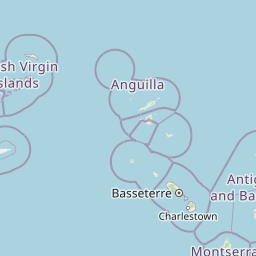
Map view of Sint Eustatius National Marine Park

Use this park location map to pinpoint Sint Eustatius National Marine Park in Netherlands, understand its exact geographic position, and read its mapped placement within the surrounding landscape more clearly.

Pigeon | © OpenStreetMap contributors

Location context for Sint Eustatius National Marine Park

Sint Eustatius
Recorded earthquake history

Review Documented Earthquake History for Sint Eustatius National Marine Park

Examine the historical catalogue of recorded seismic events linked by location to the marine protected waters of Sint Eustatius National Marine Park. MoriAtlas provides a clear, map-oriented perspective on earthquake occurrences to support your geographic understanding of the area's geological background.

Sint Eustatius National Marine Park Earthquake History

Catalogued events

76 events

Strongest magnitude

Magnitude 5.4

Most recent event

Aug 5, 2025

This history includes earthquakes recorded inside the park or within 50 km of its borders

Visual exploration of submerged volcanic foundations, shipwreck habitats, and coastal protected areas

Sint Eustatius National Marine Park Photos and Volcanic Reef Landscapes

Visual documentation reveals the complex underwater terrain and volcanic reef foundations that define Sint Eustatius National Marine Park. Detailed photography captures coral formations, coastal habitats, and protected marine environments across the Caribbean basin.

A Hawksbill sea turtle swimming underwater in clear blue water.

Two foureye butterflyfish, characterized by their white bodies with thin black diagonal stripes and a prominent black eye-spot near the tail, swimming above textured coral underwater.

A rectangular glass enclosure containing two small green baskets, one holding several white rounded eggs and a thermometer, resting on a wooden surface.

Park atlas

Compare adjacent marine habitats and connected terrestrial conservation zones across the region

Explore Protected Areas Near Sint Eustatius National Marine Park and Regional Reserves

Browse other protected areas and regional marine reserves connected to the broader geography of Sint Eustatius National Marine Park. Comparing nearby coastal landscapes provides deeper context for insular ecosystems and volcanic reef formations.
Marine protected areaFrance
21 km away#1 closest

Southeast

Sanctuaire Agoa: Exploring the Marine Protected Landscapes of the French Antilles

Regional marine mammal sanctuary and Caribbean oceanic geography

Sanctuaire Agoa represents a significant marine protected area spanning 143,000 square kilometers across the Caribbean. The sanctuary provides vital protection for humpback whales, dolphins, and various marine mammals while serving as a hub for regional cooperation in the Lesser Antilles. Mapping the sanctuary reveals a complex maritime space that stretches from shallow reef-fringed volcanic islands to deep ocean pelagic waters.

Area
143,256 km²
Established
2010
Climate
Tropical
Access
Access unknown
Marine protected areaSint Maarten
About 53 km away#2 closest

North

Man of War Shoal National Marine Park: Mapping the Protected Waters of Sint Maarten

A vital marine protected area on the edge of the Anguilla Bank.

Man of War Shoal National Marine Park represents a significant Caribbean marine sanctuary covering 3,100 hectares of coastal sea. The area is defined by its intact patch reefs, submerged 19th-century shipwrecks, and varied seabed topography, including vertical walls and expansive seagrass fields that support diverse pelagic and reef-dwelling marine life.

Area
31 km²
Established
2010
Relief
Lowland
Access
Easy access
Protected areaAntigua and Barbuda
About 118 km away#3 closest

East

Fort Barrington Protected Area: Historic Coastal Ruins and Mapping in Antigua and Barbuda

Coastal hilltop ruins and strategic Caribbean maritime defense geography

Fort Barrington occupies a commanding vantage point above St. John's Harbour in Antigua and Barbuda. The site preserves stone ruins from an 18th century battery, illustrating the strategic importance of this elevated coastal landscape. Our data mapping highlights the fort's relationship to the harbor entrance, providing clear context for its role in colonial maritime defense and its ongoing environmental exposure within the Lesser Antilles.

Established
1779
Relief
Upland
Access
Easy access
Scope
Terrestrial
National parkAntigua and Barbuda
About 124 km away#4 closest

East

Green Castle Hill National Park: Volcanic Landscapes and Archaeological Sites in Antigua

A preserved hilltop ridge within the Shekerley Mountains of Antigua.

Green Castle Hill preserves a significant volcanic landscape in the southwest of Antigua. Renowned for its circle of ancient standing stones and its status as the first national park within the Shekerley range, the site offers a unique intersection of cultural heritage and mountain geography. Access map-driven insights into the protected boundaries and regional terrain that define this Caribbean hilltop.

Established
2008
Relief
Mountain
Climate
Tropical
Scope
Terrestrial
Watercolor painting of a coastal landscape with green hills, trees in the foreground, and a calm sea, featuring a light and airy artistic style.
National parkAntigua and Barbuda
About 135 km away#5 closest

East

Nelson's Dockyard National Park: Protected Maritime Heritage and Caribbean Coastal Geography

Mapped terrain, historical dockyards, and Antiguan coastal trails

Nelson's Dockyard National Park preserves a critical maritime hub in Antigua and Barbuda, defined by the interplay between a natural hurricane-shelter harbour and the rugged hills of the south coast. The protected site encompasses substantial stone naval architecture from the Georgian era alongside a network of trails that trace the dry forest ridges above English Harbour. This geography offers a distinct perspective on how human historical impact and natural tropical landscape preservation coexist in the Caribbean Lesser Antilles.

Relief
Lowland
Scope
Mixed
Water
Major water bodies
Watercolor painting of mountains, a lake, and green hills
National parkGuadeloupe
173 km away#6 closest

Southeast

Guadeloupe National Park: Volcanic Rainforest and Protected Landscape Identity

Explore mapped boundaries and regional geography.

Guadeloupe National Park stands as a significant protected landscape, primarily defined by the dramatic volcanic terrain of Basse-Terre. This atlas entry focuses on the park's vital role in preserving one of the Caribbean's most extensive tropical rainforest ecosystems, centered around the active La Soufrière volcano. Understand its mapped boundaries, unique geographic setting within the Lesser Antilles, and its importance as a national park and UNESCO biosphere reserve.

Area
173 km²
Established
1989
IUCN
II
Relief
Mountain
National parkUnited States of America
199 km away#7 closest

Northwest

Virgin Islands National Park: Protected Landscape Atlas and Geographic Context

Explore volcanic terrain, tropical rainforests, and protected marine ecosystems.

Virgin Islands National Park offers an atlas-style view of protected Caribbean landscapes. The park encompasses volcanic uplands, dense tropical rainforests, and extensive coral reef systems surrounding Saint John island. Discover the mapped boundaries and geographic features that define this significant national park, providing crucial context for its unique ecosystems and historical significance.

Area
59.64 km²
Established
1956
IUCN
V
Visitors
112.3K annual
Wildlife reserveFederal Dependencies
About 209 km away#8 closest

South

Isla de Aves Wildlife Reserve: Map, Regional Geography, and Protected Island Landscape

A remote Venezuelan coral cay and essential marine wildlife sanctuary

Isla de Aves serves as a pivotal wildlife reserve, concentrating intense ecological activity within a tiny, fragile landmass. This protected area stands as a unique case study in maritime geography, featuring a shifting sand and coral terrain that supports globally significant turtle nesting and seabird roosting populations in the southeastern Caribbean.

Area
0.045 km²
Established
1972
Relief
Lowland
Climate
Tropical

Common questions about visiting, size, designation, and location context for Sint Eustatius National Marine Park

Sint Eustatius National Marine Park FAQs for park facts, access, geography, and protected area context

Find quick answers about Sint Eustatius National Marine Park, including protected-area facts, park geography, trail and visitor context, and how the park fits into its surrounding country and regional landscape.
MoriAtlas Explorer

Continue Your Protected Areas Search Across the Global Atlas

Deepen your exploration by continuing the structured search for national parks and protected areas worldwide. Utilize the comprehensive filtering capabilities to compare different conservation landscapes and refine your understanding of global park geography. Discover more about the distribution and characteristics of protected natural areas.

Global natural geography