Mori Atlas logo
National parkSirmilik National Park

Trace the mapped boundaries and regional context of this key protected area in Canada.

Sirmilik National Park: Nunavut National Park Protected Landscape Geography

Sirmilik National Park stands as a significant protected natural area within Nunavut, Canada. This detail page offers a focused exploration of its unique geographic identity and mapped landscape context. Understand where this national park fits within the broader regional atlas, examining its protected boundaries and contribution to Canada's network of conservation landscapes.

Arctic wildernessNational parkGlaciersSeabird coloniesPolar bearsBylot Island

Sirmilik National Park

National park

Park overview

Structured park overview, official facts, and landscape profile for Sirmilik National Park

Sirmilik National Park park facts, protected area profile, and essential visitor context
Review the core facts for Sirmilik National Park, including designation, size, terrain, visitor scale, habitats, and operating context in one park-focused overview.

About Sirmilik National Park

Sirmilik National Park represents one of Canada's most spectacular Arctic wilderness areas, protecting a complex landscape of mountains, glaciers, ice caps, wetlands, and dramatic coastlines along Lancaster Sound. The park encompasses most of Bylot Island, a large uninhabited island that ranks among the world's largest unpopulated landmasses, alongside portions of the Borden Peninsula on northern Baffin Island. The terrain is characterized by the Byam Martin Mountains, an extension of the Baffin Mountains forming part of the Arctic Cordillera system, with the highest peak Angilaaq Mountain rising 1,951 meters above sea level. Throughout the park, extensive glaciers and ice fields dominate the landscape, a testament to the area's polar climate and the legacy of past ice ages. The coastal areas feature towering vertical cliffs of Precambrian dolomite along Lancaster Sound, while unique hoodoo formations add geological interest to the interior. The marine environment surrounding the park's islands and peninsulas supports extraordinary concentrations of wildlife, making Sirmilik a critical area for Arctic biodiversity and one of Canada's most important protected wilderness regions.

Quick facts and research context for Sirmilik National Park

Sirmilik National Park is located in the Canadian Arctic on Bylot Island and the Borden Peninsula of Baffin Island in Nunavut Territory. The park was established in 2001, though it served as a bird sanctuary since 1965 due to its significant seabird colonies. The area is part of the Arctic Cordillera, featuring the Byam Martin Mountains with peaks reaching nearly 2,000 meters. The park contains extensive glaciers, ice caps, and unique geological features including hoodoos. Marine waters surrounding the park support polar bears, whales, and other Arctic marine mammals.

Park context

Deeper park guide and search-rich context for Sirmilik National Park

Sirmilik National Park history, landscape, wildlife, and travel context
Explore Sirmilik National Park through its history, landscape character, ecosystems, wildlife, conservation priorities, cultural context, and seasonal travel timing in a structured park guide built for atlas discovery and search intent.

Why Sirmilik National Park stands out

Sirmilik National Park is renowned for its extraordinary seabird colonies, particularly on Bylot Island where hundreds of thousands of thick-billed murres and black-legged kittiwakes nest on dramatic coastal cliffs. The park is one of eight Canadian national parks that contain polar bears, with the north shore of Bylot Island serving as a significant polar bear maternity denning area. The dramatic Arctic landscape of glaciers, ice caps, and the Byam Martin Mountains defines the park's visual identity, while the wetlands support significant populations of migratory birds including one of the largest greater snow goose colonies in the Arctic.

Sirmilik National Park history and protected-area timeline

The Sirmilik region has been inhabited by the Inuit for thousands of years, with archaeological evidence confirming continuous human presence in the area long before European contact. European exploration began in the 1610s when British explorers William Baffin and Robert Bylot surveyed the area while searching for the Northwest Passage, giving their names to Baffin Island and Bylot Island respectively. They documented key geographic features including Lancaster Sound in 1616, and subsequent exploration by John Ross in 1818 further confirmed the cartographic work of these early navigators. The Canadian Government conducted extensive aerial mapping of Northern Canada from the 1930s until the late 1950s, thoroughly documenting the region's geography. The area was first protected as a bird sanctuary in 1965 due to its significant seabird colonies, managed by the Canadian Wildlife Service. Sirmilik officially became Canada's 42nd national park in 2001, with the Inuit continuing their traditional hunting and fishing activities in the area as their ancestors did. The park gained additional cultural prominence through its inclusion in the 2011 National Parks Project, resulting in a short film directed by Zacharias Kunuk.

Sirmilik National Park landscape and geographic character

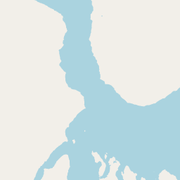
The physical landscape of Sirmilik National Park is defined by its Arctic mountain environment within the Arctic Cordillera, featuring the Byam Martin Mountains that traverse Bylot Island from east to west. These mountains are composed of ancient Archean-Aphebian igneous crystalline rock and Proterozoic metasedimentary and metamorphic rocks, including distinctive gneiss formations. Sharp peaks and ridges divided by deep glacier-filled valleys characterize the range, with elevations reaching nearly 2,000 meters at Angilaaq Mountain. The Borden Peninsula extends northward for 225 kilometers, with the Hartz Mountains in the northern portion rising over 914 meters above sea level. Throughout the park, evidence of past glaciation is visible in the form of extensive glaciers, icefields, and the unique hoodoo formations created by differential erosion. The coastal landscapes are equally dramatic, with vertical cliffs rising to 457 meters along Navy Board Inlet and the north shore facing Lancaster Sound. The marine components include Oliver Sound, a long narrow fjord flanked by towering cliffs and glaciers to the south of Pond Inlet, as well as the waters of Baillarge Bay.

Sirmilik National Park ecosystems, habitats, and plant life

The ecological character of Sirmilik encompasses a diversity of Arctic habitats including coastal wetlands, tundra uplands, marine environments, and glacial zones. Wetlands comprise approximately 10 percent of the park's area and support abundant vegetation including water sedge, white cottongrass, and tall cottongrass, along with various moss species. The southern Arctic environment supports approximately 360 documented plant species, considered notable for their rarity and productivity in this harsh environment. Upland areas on hillslopes and terraces feature Arctic heather, mountain avens, Arctic poppy, mountain sorrel, along with various grasses and shrubs including Arctic willow and northern bilberry. The marine waters of Lancaster Sound and surrounding areas form part of the Lancaster Sound Marine Region, supporting productive ecosystems that sustain significant populations of marine mammals and migratory fish species.

Sirmilik National Park wildlife and species highlights

Sirmilik National Park supports remarkable Arctic wildlife diversity across its terrestrial, wetland, and marine environments. The park is one of only eight Canadian national parks containing polar bears, with the north shore of Bylot Island serving as an important maternity denning area where females give birth in snow dens during winter. Marine mammals include beluga whales, narwhals that migrate through the area, walruses, and various seal species. On land, Arctic foxes, Arctic hares, Peary caribou, and Arctic wolves roam the islands and peninsula. The birdlife is particularly spectacular, with over 70 species recorded in the park and approximately 40 known to breed. The seabird colonies at Baillarge Bay and on Bylot Island are among the most significant in the Arctic, with an estimated 300,000 thick-billed murres and 80,000 black-legged kittiwakes nesting on the island's rugged cliffs. The park supports one of the largest greater snow goose colonies in the Arctic, with population estimates making these birds the most abundant herbivores on the island. Over 100,000 birds are reported to pass through the park during summer months.

Sirmilik National Park conservation status and protection priorities

Sirmilik National Park plays a critical role in protecting some of Canada's most significant Arctic ecosystems and biodiversity. The park was originally designated as a bird sanctuary in 1965 specifically to protect its remarkable seabird colonies, and Bylot Island within the park was declared a Migratory Bird Sanctuary due to the extraordinary concentrations of breeding and migratory birds. The protection of polar bear maternity denning areas along Lancaster Sound makes the park especially important for this threatened species in Canada. The representation of both the Northern Eastern Arctic Lowlands Natural Region and the Lancaster Sound Marine Region within the park ensures protection of key Arctic biomes. The Inuit continue to practice traditional hunting and fishing within the park boundaries, maintaining the cultural connection between humans and this Arctic landscape while operating under the park's conservation framework.

Sirmilik National Park cultural meaning and human context

The Sirmilik region has been continuously inhabited by the Inuit for thousands of years, with the park area containing significant archaeological evidence of this long human presence. The Inuit people of the Canadian Arctic have maintained a deep cultural connection to this landscape, referring to northern Baffin Island as Sirmilik long before the area received its protected status. While Bylot Island itself is uninhabited today, Inuit from Pond Inlet and other communities regularly travel to the island for seasonal hunting activities, maintaining an Inuit seasonal hunting camp southwest of Cape Graham Moore. The name Sirmilik, meaning "place of glaciers" in Inuktitut, reflects the cultural understanding of this glaciated Arctic landscape. The park's establishment in 2001 recognized both the ecological significance and the cultural importance of the area, allowing for the continuation of traditional activities while ensuring long-term conservation of the Arctic environment.

Top sights and standout views in Sirmilik National Park

Sirmilik National Park offers visitors access to one of the most spectacular Arctic wilderness areas in North America, with its dramatic combination of glaciers, ice caps, and the Byam Martin Mountains creating a landscape of exceptional beauty. The extraordinary seabird colonies on Bylot Island, with hundreds of thousands of nesting murres and kittiwakes, represent one of the most impressive bird spectacle areas in the Arctic. The opportunity to observe polar bears in their natural Arctic environment, particularly along Lancaster Sound where maternity dens are located, makes this park uniquely significant. The park's three distinct components of Bylot Island, the Borden Peninsula, and the Oliver Sound fjord system provide diverse landscapes to explore, from coastal cliffs to interior mountain terrain.

Best time to visit Sirmilik National Park

The optimal time to experience Sirmilik National Park is during the brief Arctic summer, typically from late July through early August, when average maximum temperatures reach around 10 degrees Celsius and the landscape is accessible. The spring transition in this polar maritime climate does not fully end until mid-June, meaning the summer season is remarkably short. Visitors during this period can witness the extraordinary bird migrations, with over 100,000 birds passing through the area, and observe marine wildlife including beluga whales and seals in the surrounding waters. The winter months are extremely harsh, with average maximum temperatures around -30 degrees Celsius in January, and the park receives very few visitors during the cold season. The dramatic change between seasons defines the character of this Arctic environment, with the brief summer offering the only practical window for most visitors to experience the park's natural wonders.

Park location guide

Geography guide, regional context, and park location map for Sirmilik National Park

Sirmilik National Park park geography, regions, and map view in Canada
Understand where Sirmilik National Park sits in Canada through a broader geographic reading of the surrounding landscape, nearby location context, and its mapped position within the national park landscape.

How Sirmilik National Park fits into Canada

Canada is a federal parliamentary constitutional monarchy spanning North America from the Atlantic to the Pacific and Arctic Oceans. With a population of over 41 million, it is officially bilingual in English and French at the federal level. The country gained independence from the United Kingdom through a gradual process culminating in 1982.

Wider geography shaping Sirmilik National Park in Canada

Canada occupies the northern portion of North America, sharing its longest international border with the United States. The country extends from the Atlantic Ocean to the Pacific Ocean and northward into the Arctic Ocean, giving it the longest coastline of any nation.

Map view of Sirmilik National Park

Use this park location map to pinpoint Sirmilik National Park in Canada, understand its exact geographic position, and read its mapped placement within the surrounding landscape more clearly.

Pigeon | © OpenStreetMap contributors

Location context for Sirmilik National Park

NunavutQikiqtaaluk Region
Park atlas

Compare the vast protected landscapes and unique Arctic wilderness of Northern Canada, extending beyond Sirmilik National Park's immediate geography.

Explore Related Arctic National Parks and Protected Areas Beyond Sirmilik National Park
Explore additional national parks and protected areas geographically linked to Sirmilik National Park, encompassing Canada's expansive Arctic wilderness and its distinct glaciated mountain landscapes. Compare varied conservation efforts and unique Arctic ecosystems within a wider regional context, revealing the diverse protected-area geography across the Canadian North.
National parkNunavut

Qausuittuq National Park: Explore Nunavut's Protected National Park Landscape and Geography

Mapped protected area boundaries and regional geographic context.

Delve into Qausuittuq National Park, a key protected area in Nunavut offering rich opportunities for geographic exploration. This destination provides detailed mapping of its protected boundaries and a comprehensive overview of its landscape context within the Arctic region. Discover how Qausuittuq National Park contributes to the mapped protected lands of Canada, ideal for users seeking structured geographic data and atlas-style discovery.

Area
11,000 km²
Established
2015
IUCN
II
Relief
Upland
National parkNunavut

Auyuittuq National Park: Nunavut National Park and Protected Landscape Atlas

Explore Arctic protected area geography and mapped boundaries.

Auyuittuq National Park is a key protected area within Nunavut, Canada, serving as a vital component of the national park system. This entry provides the essential geographic and atlas context for understanding Auyuittuq National Park, highlighting its status as a mapped protected landscape. Examine its role within the regional geography of Nunavut and its contribution to the broader atlas of Canadian conservation lands.

Area
21,470 km²
Established
1972
IUCN
II
Visitors
256 annual
National parkNunavut

Ukkusiksalik National Park: Nunavut Protected Area Geography and Map Context

Explore the protected landscape and mapped terrain of this Canadian National Park.

Ukkusiksalik National Park serves as a protected national park within Nunavut, offering a distinct geographic identity. This entry provides structured insights into the park's mapped boundaries and its surrounding regional landscape, facilitating a deeper understanding of its place within the broader atlas of protected areas. Examine the geographic context and discover the unique attributes of Ukkusiksalik National Park's protected territory.

Area
20,885 km²
Established
2003
IUCN
II
Relief
Mixed relief
National parkNunavut

Quttinirpaaq National Park: A Detailed Look at its Protected Landscape and Nunavut Geography

Mapped boundaries and regional context for this significant Arctic national park.

Gain a comprehensive understanding of Quttinirpaaq National Park, a protected national park located in the expansive region of Nunavut, Canada. This resource delves into the park's geographic identity, its mapped contours, and its position within the broader arctic landscape context. It is designed to support atlas-based exploration and a detailed appreciation of this protected area's unique setting within Northern Canada's geography.

Area
37,775 km²
Established
1988
IUCN
II
Visitors
7 annual
National parkNorthwest Territories

Aulavik National Park: Northwest Territories National Park Protected Landscape and Geographic Context

Explore the mapped boundaries and regional park geography.

Gain a clear understanding of Aulavik National Park's protected status and its placement within the Northwest Territories. This detail page offers focused atlas exploration of the park's geographic identity, mapped features, and its significance as a National Park within Canada's northern geography. Discover the unique landscape context of this protected area for in-depth geographic study and discovery.

Area
12,200 km²
Established
1992
IUCN
II
Visitors
34 annual
Watercolor illustration of green rolling hills and a body of water under a pale sky
National parkGreenland

Northeast Greenland National Park: Arctic Wilderness and Protected Landscape Atlas

Explore the world's largest national park and its mapped terrain.

Northeast Greenland National Park represents an extraordinary expanse of Arctic wilderness, renowned as the largest protected area globally. This national park protects a diverse landscape, from the interior Greenland Ice Sheet to dramatic glacial fjords and ice-free polar desert regions. Discover its extensive mapped boundaries and its significance as a sanctuary for vital Arctic megafauna, offering a profound case study in large-scale protected landscape geography.

Area
972,000 km²
Established
1974
IUCN
II
Relief
Mixed relief
National parkNorthwest Territories

Tuktut Nogait National Park: Northwest Territories Protected Landscape Atlas

Explore its mapped boundaries and regional geography.

Delve into Tuktut Nogait National Park, a protected national park situated within the vast geography of the Northwest Territories. This entry provides a focused view of the park's specific identity, its defined protected area boundaries, and its contribution to the regional landscape atlas. Understanding Tuktut Nogait National Park means grasping its geographic context and its role as a key natural landscape within the broader Canadian protected area network, ideal for detailed map-based study.

Area
18,100 km²
Established
1998
IUCN
II
Visitors
12 annual
National parkNorthwest Territories

Thaidene Nëné National Park Reserve: Northwest Territories National Park Atlas Overview

Mapped geography and protected landscape context.

Investigate Thaidene Nëné National Park Reserve, a key national park within the Northwest Territories. This detailed entry focuses on its protected area status, mapped geographic boundaries, and regional landscape context, crucial for understanding its role in the broader atlas of conservation lands.

Area
14,070 km²
Established
2019
IUCN
II
Relief
Highland

Common questions about visiting, size, designation, and location context for Sirmilik National Park

Sirmilik National Park FAQs for park facts, access, geography, and protected area context
Find quick answers about Sirmilik National Park, including protected-area facts, park geography, trail and visitor context, and how the park fits into its surrounding country and regional landscape.
MoriAtlas Explorer

Continue Your Protected Areas Search Across the Global Atlas

Deepen your exploration by continuing the structured search for national parks and protected areas worldwide. Utilize the comprehensive filtering capabilities to compare different conservation landscapes and refine your understanding of global park geography. Discover more about the distribution and characteristics of protected natural areas.

Global natural geography