
Why Somerset Levels stands out
The Somerset Levels are best known for their extensive lowland wetland landscape, where reclaimed peat moors and clay levels coexist with a network of rivers, drainage channels, and seasonal floods. The area is recognised internationally for its birdlife, including Bewick's swan, curlew, and snipe, as well as for the reintroduction of common cranes after an absence of around four centuries. Equally important is the Levels' archaeological significance. The preserved Neolithic timber trackways the Sweet Track and the Post Track are among the oldest known engineered roadways in the world, and the Glastonbury Lake Village and Meare Lake Village provide rare insights into prehistoric life on peat wetlands. Combined with sites like Burrow Mump, Brent Knoll, and Glastonbury Tor, the Levels form a continuous cultural and natural landscape shaped by thousands of years of human interaction with water.
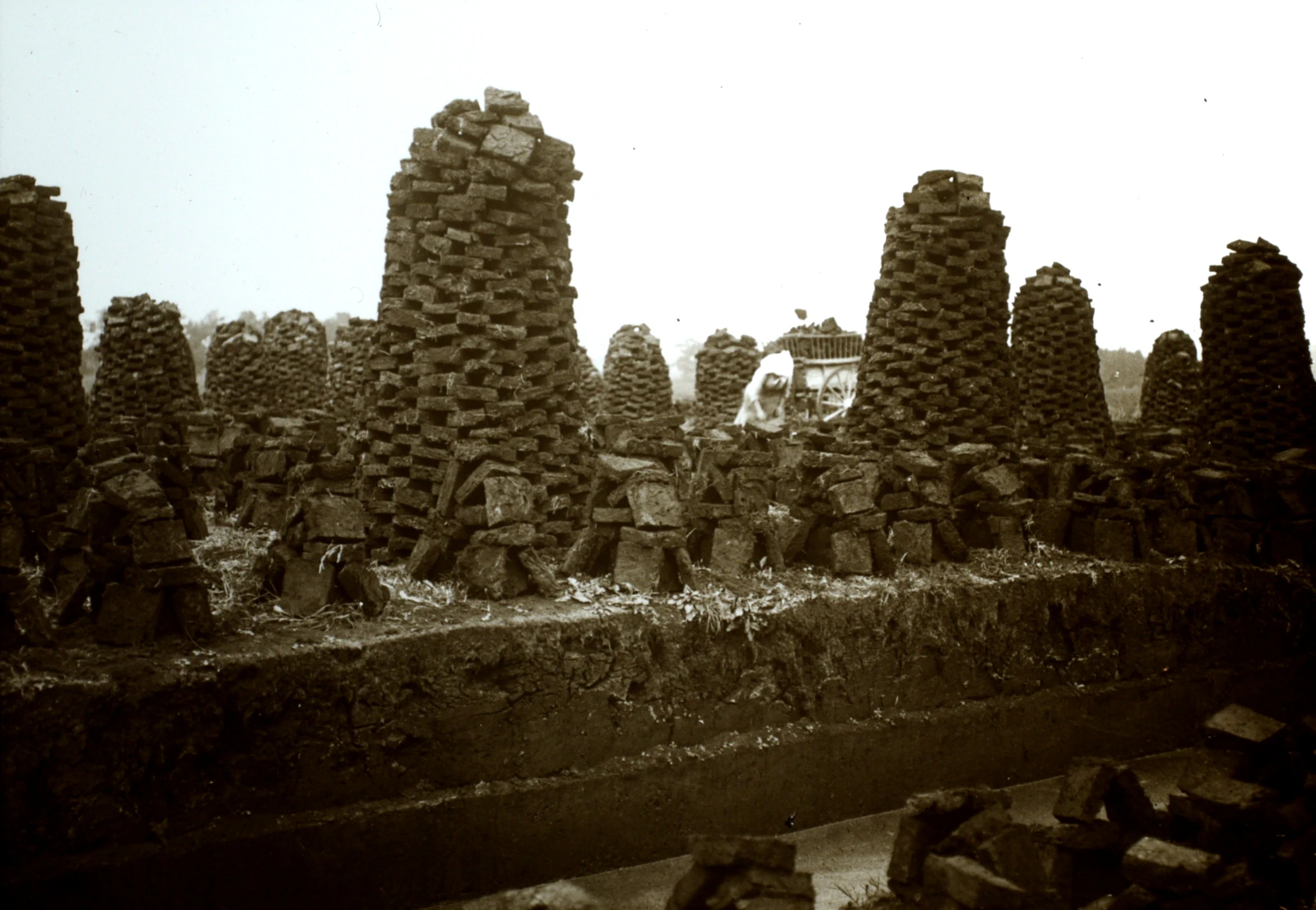
Somerset Levels history and protected-area timeline
Human presence on the Somerset Levels stretches back hundreds of millennia. A Palaeolithic flint tool from Westbury suggests occupation as long ago as half a million years, while Mesolithic communities left scatters of flints on higher ground that was safer from winter floods. Some interpretations of the county's name, including the suggestion that Somerset derives from the Old English term for "land of the summer people," reflect this long seasonal relationship between people and the wetland.
The Neolithic period brought much more visible evidence of human adaptation to the Levels. Communities exploited reed swamps for natural resources and began building wooden trackways to make the peatlands traversable. The Sweet Track, dating from the 3800s BC, and the Post Track from the same era are the oldest known timber trackways in the world, with the Sweet Track once considered the oldest engineered roadway. Nearby prehistoric villages at Glastonbury and Meare, built on artificial foundations within the marsh, give the area its claim to contain the best-preserved prehistoric villages in the United Kingdom.
Roman activity on the Levels included sea salt extraction and a chain of settlements along the Polden Hills, while the second-largest hoard of Roman silver coins ever found in Britain, the Shapwick Hoard, was unearthed in 1998. Anglo-Saxon charters document continued incorporation of moorland into estates, and legend places King Alfred in the marshes of Athelney before his decisive victory over the Danes. In 1685 the Levels were the site of the Battle of Sedgemoor, an engagement that ended the Monmouth Rebellion.
Drainage shaped the Levels for centuries. The Domesday Book records early efforts on the higher ground, and monastic communities at Glastonbury, Athelney, and Muchelney led significant reclamation from the Middle Ages onward. Dutch engineer Cornelius Vermuyden attempted large-scale drainage in the 1630s, though the English Civil War and local opposition limited progress. Steam pumping stations like Westonzoyland arrived in the nineteenth century, followed by the Huntspill River in the Second World War and the Sowy River in 1972. The twentieth and early twenty-first centuries brought major floods in 1981, 2012, and 2013 to 2014, each prompting renewed debate over dredging, tidal defences, and the future balance between farming, conservation, and flood management.
Somerset Levels landscape and geographic character
The Somerset Levels are a landscape of long, flat horizons, broken only by distant ridges, isolated hills, and the silhouettes of hay barns, pumping stations, and scattered villages. The area lies broadly around twenty feet above mean sea level, though inland the general elevation drops to about ten to twelve feet, making it one of the lowest-lying inhabited regions in England. Two shallow basins form the core of the Levels, ringed by higher ground, with runoff from those hills channelled into the rivers Parrett, Brue, and Axe across what was once a freely meandering floodplain.
Geologically, the modern wetland is a young landscape, formed mostly in the last ten thousand years since the retreat of the ice sheets. Peat accumulated in the Brue Valley and other low basins under swampy conditions, peaking roughly six thousand years ago. Older Triassic-age rocks protrude through this soft cover as small islands of higher ground, producing the distinctive landmarks of Glastonbury Tor, Burrow Mump, Brent Knoll, and the Isle of Athelney. Past sea level changes have continued to alter the balance between salt marsh, freshwater marsh, and peat bog, creating today's mosaic of clay levels, peat moors, and dune-fringed coast.
The coastline adds another dimension to the Levels' landscape. Along the Bristol Channel, a strip of sand dunes and clay barrier separates low-lying marshes from the sea, with settlements such as Berrow and Burnham-on-Sea sitting precariously at the edge of drained farmland. Man's attempts to control this margin, from Roman sea defences to the curved concrete wall at Burnham-on-Sea completed in 1988, form an important chapter in the landscape's visual and practical character. Inland, field boundaries made of ditches and pollarded willows, raised droves and causeways, and the long straight lines of drainage channels combine to give the Levels their quiet, planned texture.
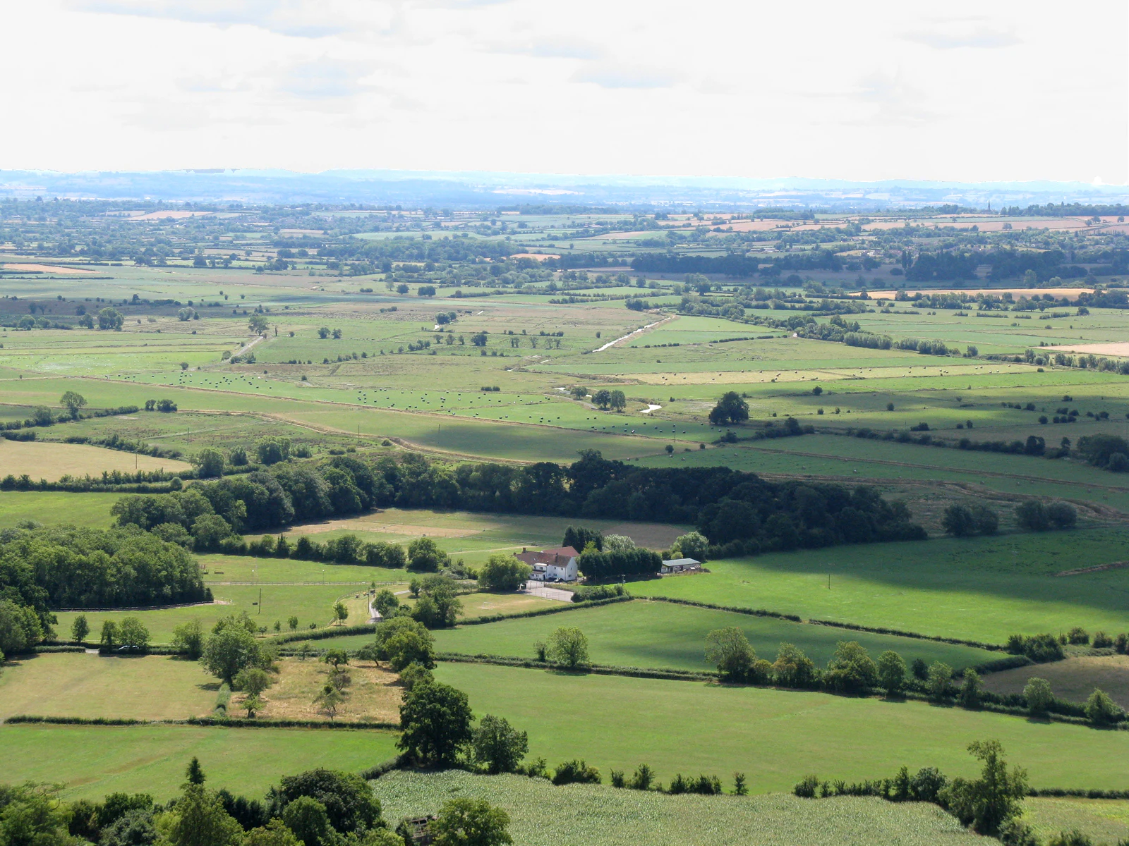
Somerset Levels ecosystems, habitats, and plant life
The wetland nature of the Somerset Levels supports an unusually rich mix of habitats within a relatively small area. Coastal clay levels blend inland into peat moors, traversed by a network of ditches, rhynes, and larger rivers that maintain moisture across much of the landscape year-round. Flood meadows, reedbeds, and remnant raised bogs each contribute distinct ecological conditions, and even the intensively farmed pastures retain wet ditches that act as wildlife refuges. This mosaic of wet and semi-wet grassland, combined with unimproved fen and patches of woodland such as Shapwick Heath, is the foundation of the Levels' biodiversity value.
Several reserves exemplify the ecological range of the area. Shapwick Heath and Ham Wall national nature reserves together form one of the most important wetland complexes in southern England, with a mix of open water, reedbed, carr woodland, and grazing marsh. Bridgwater Bay and the River Huntspill national nature reserves protect coastal and freshwater habitats of a different character. Smaller sites, including Westhay Moor, contribute raised bog and mire communities that are now rare across lowland Britain.
The Levels are also recognised as a national character area of regional significance, within a wider landscape of the Mendip Hills, the Blackdowns, the Mid Somerset Hills, and the Vale of Taunton and Quantock Fringes. Internationally, the Somerset Levels and Moors Ramsar Site formalises this recognition and supports landscape-scale initiatives such as the Brue Valley Living Landscape, which aims to restore, recreate, and reconnect habitat on a working farmland backdrop.
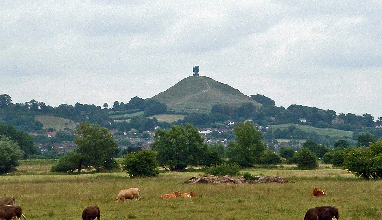
Somerset Levels wildlife and species highlights
Birds are the most conspicuous wildlife of the Somerset Levels, drawing visitors especially in winter when the wet grasslands fill with wildfowl and waders. Bewick's swans, Eurasian curlews, redshanks, lapwings, snipe, teal, wigeon, and whimbrels are regular visitors, while Eurasian skylarks are a familiar sight and sound over the open fields. Raptor sightings include marsh harriers hunting the reedbeds and peregrine falcons patrolling the coast, and the standing flocks of starlings across the Levels have become a regional wildlife spectacle.
Mammal populations reflect the recovering health of the wetland. European otters have returned to many of the rivers and rhynes, while water voles are being encouraged to recolonise areas from which they had disappeared, in part through control of invasive American mink. Most striking, however, has been the reintroduction of common cranes to the Levels beginning in 2010. After an absence of roughly four hundred years, a partnership project involving the Wildfowl and Wetlands Trust, the RSPB, and Pensthorpe Nature Reserve released young birds reared from German stock, with the goal of establishing a small but breeding population on the Levels.
Invertebrate life adds another layer of ecological richness. The Levels support rare beetles and other invertebrates such as the lesser silver water beetle, Hydrophilus piceus, and Valvata macrostoma, many of which depend on clean, unpolluted ditch networks. European eels are an important seasonal presence in the River Parrett, where elvers are caught by hand netting in spring as part of conservation efforts for a critically endangered species, and eel passes have been installed at key obstacles to help migration upstream.
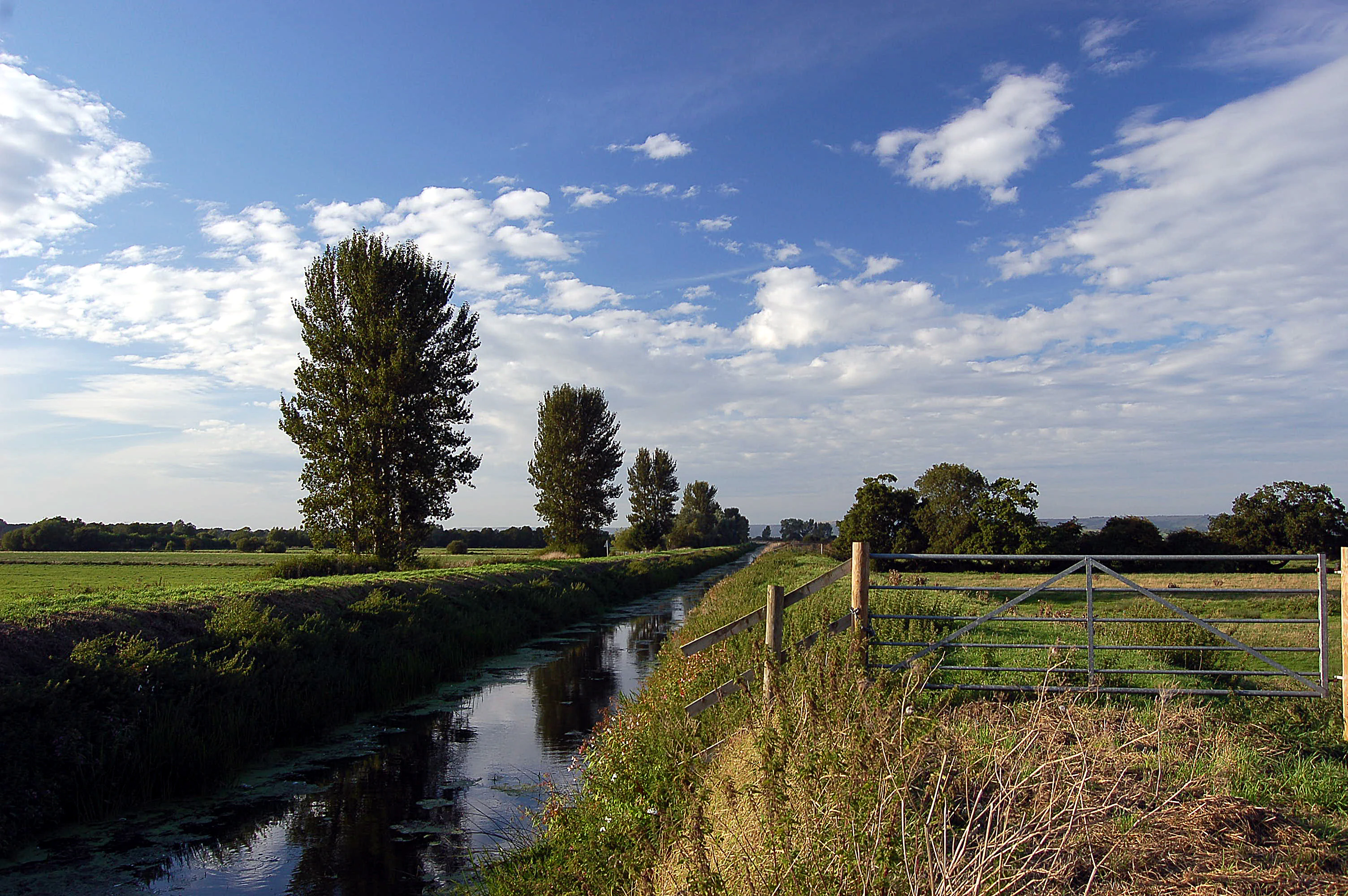
Somerset Levels conservation status and protection priorities
Conservation interest on the Somerset Levels is unusually layered, combining international, national, regional, and local designations. The Somerset Levels and Moors Ramsar Site underpins the area's global wetland significance, while 32 statutory Sites of Special Scientific Interest, twelve of which are also Special Protection Areas under the European Birds Directive, protect key bird and habitat features across the wetland. National nature reserves at Shapwick Heath, Ham Wall, the River Huntspill, and Bridgwater Bay add further protection, and much of the area is covered by additional local designations including Environmentally Sensitive Areas and Areas of High Archaeological Potential.
Beyond statutory protection, larger landscape-scale projects have shaped recent conservation direction. The Brue Valley Living Landscape, launched in 2009, aims to restore, recreate, and reconnect wildlife habitat across a working farmed landscape, with particular emphasis on resilience to climate change, water management, and the needs of local landholders. Internationally, the reintroduction of common cranes through the Great Crane Project signals the Levels' ambition to recover lost native species, while targeted efforts to restore hydrological conditions have benefited bird-rich floodplains such as Southlake Moor, which now functions as both a flood storage area and a seasonal refuge for water birds.
Conservation here is closely intertwined with archaeology. Lowered water tables over many decades have caused deterioration of ancient wooden trackways such as the Sweet Track by exposing preserved timbers to oxygen and aerobic decay. Active conservation of the Sweet Track has used clay banks, pumping, and careful water table management to preserve sections of the prehistoric roadway in situ, demonstrating that preserving the Levels' ecological function and protecting its prehistoric heritage are inseparable goals.
Somerset Levels cultural meaning and human context
The Somerset Levels are a deeply cultural landscape, in which water, settlement, and tradition have shaped each other for thousands of years. Prehistoric communities adapted the wetland by building trackways and lake villages, while much later medieval monasteries including Glastonbury, Athelney, and Muchelney played a central role in draining, reclaiming, and managing the marshes. Legendary figures from King Arthur to King Alfred have been tied to the Levels in folklore, with Athelney in particular serving as a symbolic refuge in the story of Alfred's resistance to Viking invaders.
More recent history is also inscribed in the land. The Battle of Sedgemoor in 1685, the last major battle fought on English soil, took place near Westonzoyland, and the Shapwick Hoard of Roman coins is a reminder of the long continuity of settlement and trade. Traditional Somerset crafts, including willow basket-making, cider production, thatching, and peat cutting, are part of the Levels' working identity, celebrated today in visitor centres, museums, and the towering Willow Man sculpture visible from the M5 motorway near Bridgwater. Modern debates over pylons, wind turbines, tidal sluices, and dredging have made the Levels a focal point for wider national discussions about energy infrastructure, flood management, and the future of rural landscapes.
Top sights and standout views in Somerset Levels
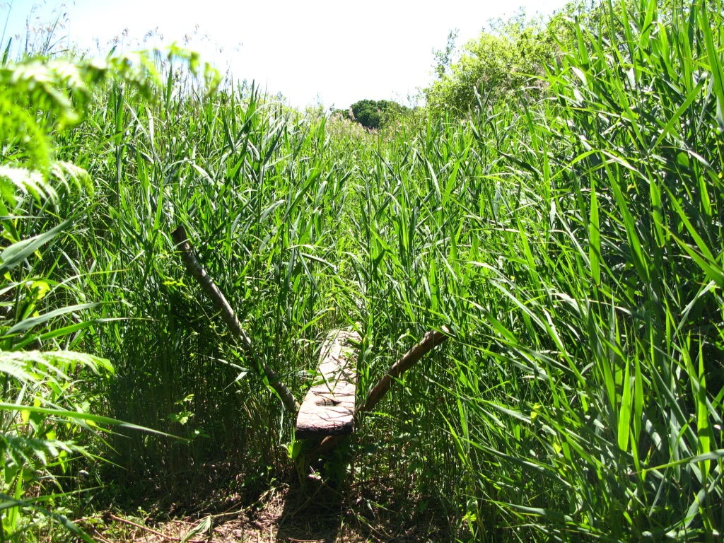
The Somerset Levels offer a uniquely layered experience where ancient archaeology, internationally important wetland habitat, and traditional rural industry meet on a single low-lying plain. Highlights include the preserved prehistoric trackways and lake villages, the rich birdlife of the Ramsar-designated wetland, scenic landmarks such as Glastonbury Tor and Burrow Mump rising out of the flat plain, and the distinctive landscape of ditches, pollarded willows, and gently flooded grazing marshes.
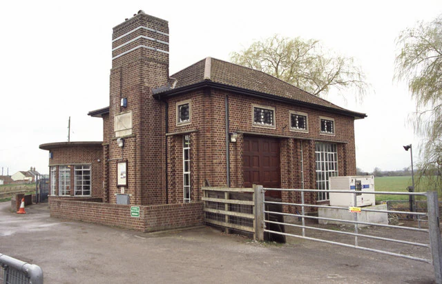
For visitors, standout features include the Avalon Marshes Centre and Willows and Wetlands Visitor Centre, historic pumping stations like Westonzoyland, the cycle routes and long-distance paths that criss-cross the area, and the rare opportunity to see landscape-scale conservation and traditional farming coexist. Together these elements make the Somerset Levels one of the most distinctive wetland landscapes in Britain.
Best time to visit Somerset Levels
The Somerset Levels change character markedly with the seasons, and visiting at different times of year offers different rewards. Late spring and early summer are often the most pleasant months for outdoor activity, with mild temperatures, longer days, and growing numbers of breeding birds and wildflowers along the rhynes and field edges.
Winter is the season most associated with the Levels' wetland identity, when large numbers of wildfowl and waders gather on flooded fields, and starlings form spectacular evening roosts. However, winter can also bring prolonged flooding, particularly after heavy rain, when some villages and minor roads become cut off and visitors should be prepared for wet conditions. Late summer and early autumn tend to bring drier conditions and a calmer atmosphere, with agricultural activity, harvest, and a quieter experience of the landscape. Snowfall is rare but possible in midwinter.