Mori Atlas logo
Nature reserveSomuncurá Provincial Reserve

Mapping the basalt terrain and high altitude lagoons within this distinct Patagonian nature reserve

Somuncurá Provincial Reserve: An Atlas of Volcanic Plateaus and Protected Patagonian Steppe

(Area Natural Protegida Provincial Meseta de Somuncurá)

Somuncurá Provincial Reserve protects a vast volcanic plateau located between Río Negro and Chubut provinces in Argentine Patagonia. This high tableland features a complex landscape of eroded basalt plains, layered mesas, and seasonal stream systems that define the regional geography. The reserve preserves vital steppe wetlands and remains a significant site for understanding the geological and biological evolution of remote Patagonian ecosystems.

Patagonian plateauvolcanic steppebasalt landscapeendemic amphibianssteppe wetlandslagoon lakes

Somuncurá Provincial Reserve

Nature reserve

Park overview

Structured park overview, official facts, and landscape profile for Somuncurá Provincial Reserve

Somuncurá Provincial Reserve park facts, protected area profile, and essential visitor context

Review the core facts for Somuncurá Provincial Reserve, including designation, size, terrain, visitor scale, habitats, and operating context in one park-focused overview.

About Somuncurá Provincial Reserve

Somuncurá Provincial Reserve occupies a vast and remote section of the Patagonian interior, where the provinces of Río Negro and Chubut meet atop the wide Somuncurá plateau. The plateau itself is a geological landmark: an elevated, semi-arid landscape made of layered basalt and volcanic deposits that have been reshaped over time by wind, water, and temperature swings into broad stepped plains, eroded basins, and rugged volcanic features.

Rivers and streams are unusual features in this part of Patagonia, yet the reserve contains several, including La Ventana, Los Berros, El Verde, and the Velcheta, which eventually connects to the larger Río Negro drainage. These waterways sustain isolated lagoon-lakes that have aquatic vegetation growing beneath the surface, creating pockets of wetland habitat in an otherwise arid steppe environment. The contrast between the dry volcanic uplands and these wet pockets defines much of the reserve's ecological character.

Although it is officially a provincial protected area, Somuncurá remains a place where traditional Patagonian land uses continue. Livestock grazing is part of the local economy, and the underlying geology has attracted petroleum exploration interest. The challenge for the reserve is balancing these extractive or productive uses with the need to safeguard the endemic frogs, nesting birds, and cultural sites that have earned the area its protected status.

For visitors interested in remote landscapes, the reserve offers a sense of Patagonia far from the better-known Andes: an open, windswept plateau under enormous skies, where the visible traces of geological time and the small, surviving populations of highly localized wildlife give the place a quiet but profound scientific and cultural weight.

Quick facts and research context for Somuncurá Provincial Reserve

Somuncurá is a provincial-level protected area in Argentina, located on the Somuncurá plateau where Río Negro Province meets Chubut Province. The protected landscape covers an extensive high steppe formed by ancient volcanic activity, with basalt plains, erosion features, scattered lagoons, and several named streams.

The reserve supports endemic amphibians that depend entirely on its isolated wetland systems, and it preserves archaeological sites linked to indigenous inhabitants of Patagonia. Although protected at the provincial level, it remains a working landscape where livestock raising and oil prospecting continue alongside conservation efforts.

Protection and recognition

Documented terrestrial boundaries, management scope, and recognition history

Somuncurá Provincial Reserve Protection Status and Governance Data

Somuncurá Provincial Reserve maintains a documented terrestrial protection status within its regional conservation framework. Official records compile administrative boundaries and designation details without assigned international recognition programs.

Protection details

Protection scope
Terrestrial
Transboundary protection
No
Park context

Deeper park guide and search-rich context for Somuncurá Provincial Reserve

Somuncurá Provincial Reserve history, landscape, wildlife, and travel context

Explore Somuncurá Provincial Reserve through its history, landscape character, ecosystems, wildlife, conservation priorities, cultural context, and seasonal travel timing in a structured park guide built for atlas discovery and search intent.

Why Somuncurá Provincial Reserve stands out

Somuncurá is best known as the only remaining home of the El Rincon stream frog, a critically endangered Patagonian amphibian that exists nowhere else in the world. The reserve also protects the majority of the remaining population of another rare frog species, giving this plateau an outsized importance for amphibian conservation in South America. Beyond its frogs, the reserve is recognized for its volcanic steppe scenery, its clusters of shallow lagoons, and its collection of archaeological sites that document indigenous presence in one of Patagonia's harshest plateaus.

Somuncurá Provincial Reserve history and protected-area timeline

The protected area was formally established to conserve the plateau's distinct combination of volcanic landforms, remote wetland habitats, and the cultural traces left behind by the region's earliest inhabitants. The reserve's designation reflects growing recognition that the Somuncurá plateau harbors biodiversity and archaeological heritage that would not survive without active protection.

Archaeological sites scattered across the plateau bear witness to long-term indigenous presence in this part of Patagonia, tying the reserve to a much deeper history of human occupation of the steppe. The establishment of Somuncurá as a provincial reserve is also closely linked to scientific discoveries about its endemic frog populations, which made clear that the plateau's seemingly harsh landscape supported unique evolutionary lineages found nowhere else on the continent.

Despite its protected status, the reserve has not been removed from productive land use. Livestock grazing and petroleum prospecting remain permitted activities, a reflection of the broader Patagonian economy and the long-standing tension between conservation objectives and regional resource development in Argentine Patagonia.

Somuncurá Provincial Reserve landscape and geographic character

The Somuncurá plateau is a high, isolated tableland in northern Patagonia where the provinces of Río Negro and Chubut come together. Its surface is shaped by ancient volcanic activity: extensive basalt plains stretch across the reserve, broken by large basalt steps and eroded volcanic features that give the terrain a layered, almost staircase-like appearance in places.

Sprinkled across this volcanic platform are numerous shallow lagoons and small lakes, many of them fed by limited rainfall and the few streams that cross the plateau. These lakes are unusual for their underwater vegetation, which gives them a distinctive character compared to the dry steppes surrounding them. Streams such as La Ventana, Los Berros, and El Verde wind across the plateau, while the Velcheta ultimately leaves the reserve to join the broader Río Negro watershed.

The combination of elevation, basalt geology, sparse plant cover, and scattered wetlands produces a landscape that feels simultaneously barren and ecologically rich. Wind erosion has carved some areas deeply, producing badland-like terrain, while in other places the volcanic plains remain broad and remarkably flat.

Somuncurá Provincial Reserve ecosystems, habitats, and plant life

The reserve's ecology is defined by the contrast between its dry volcanic steppe and its network of lagoons and streams. The plateau receives limited rainfall, and most of the visible vegetation reflects a classic Patagonian steppe adapted to wind, cold, and arid conditions. Yet the lagoons and slow streams sustain aquatic plant communities beneath the surface, supporting a small but biologically critical aquatic ecosystem.

These wetland pockets are the heart of the reserve's biodiversity. They provide the breeding and survival habitat for amphibians that are entirely dependent on the Somuncurá plateau, and they also support waterbirds that find rest and food at the lagoons across an otherwise harsh landscape. The surrounding steppe, meanwhile, sustains plant communities and small fauna adapted to extreme temperature ranges and persistent winds.

Somuncurá Provincial Reserve wildlife and species highlights

Somuncurá's most famous wildlife residents are its frogs. The reserve protects the entire known remaining population of the El Rincon stream frog, an endemic amphibian found only in this part of Patagonia. It also holds most of the surviving population of Atelognathus reverberii, another endangered frog species whose continued existence depends on the reserve's isolated wetland systems.

The lagoons also attract birds typical of Patagonian wetlands. Chilean flamingos are known residents of the reserve, and researchers believe other characteristic Patagonian steppe and wetland species, including the Patagonian tinamou, are also present. Beyond these highlighted species, the reserve is understood to support an assemblage of small steppe animals and additional birdlife adapted to the plateau's particular combination of dry uplands and scattered wetlands.

Somuncurá Provincial Reserve conservation status and protection priorities

Somuncurá's conservation importance far exceeds its provincial-level designation. The reserve is the single most important site for the survival of the El Rincon stream frog and a critical refuge for Atelognathus reverberii, two amphibian species that would likely disappear if the plateau's wetland systems were degraded. Protecting these frogs effectively means protecting the specific combination of geology, hydrology, and isolation that defines the Somuncurá plateau.

The reserve's archaeological sites add a second major conservation objective. Indigenous cultural traces across the plateau represent an important part of Patagonia's human heritage, and their preservation is part of the rationale for protecting the area as a whole.

A continuing challenge for conservation in Somuncurá is the coexistence of protected status with extractive land use. Livestock raising and petroleum prospecting still occur within the reserve, and managing these activities in ways that do not harm the endemic frogs, the lagoons, or the cultural sites remains central to the reserve's long-term effectiveness.

Somuncurá Provincial Reserve cultural meaning and human context

The Somuncurá plateau has been inhabited or traversed by indigenous peoples for centuries, and the reserve's archaeological sites document that long-standing human relationship with the Patagonian steppe. These sites connect the protected landscape to the broader indigenous heritage of Argentina and underline the cultural, not just ecological, value of safeguarding the plateau.

In modern times, the reserve sits within a working Patagonian landscape in which ranching families and resource exploration shape daily life on and around the plateau. The reserve's cultural context is therefore both ancient and contemporary, linking deep indigenous history with the ongoing rural economy of northern Patagonia.

Top sights and standout views in Somuncurá Provincial Reserve

Somuncurá's defining highlights are its endemic frogs, its volcanic plateau scenery, and its pockets of wetland life in an otherwise arid steppe. The reserve offers a rare example of how a seemingly barren Patagonian landscape can harbor evolutionary lineages found nowhere else on Earth, and it pairs that ecological uniqueness with significant indigenous archaeological heritage.

Best time to visit Somuncurá Provincial Reserve

The Somuncurá plateau has a harsh Patagonian climate, with cold winters that limit access and milder summers that bring slightly more wildlife activity around the lagoons and streams. Visiting in the warmer months generally offers better conditions for exploring the high plateau, observing wetland birdlife such as flamingos, and reaching the more remote archaeological and geological sites without winter weather risks.

Seasonal timing also matters for amphibians, which depend on the plateau's wetland systems during their active periods. Travelers interested in the reserve's unique frog populations should be aware that their visibility in the landscape is closely tied to the wet season and the condition of the lagoons and streams. Outside of these favorable windows, the reserve's exposed, windswept terrain becomes considerably more difficult to experience.
Monthly climate preview

Long-term temperature ranges and monthly precipitation records across representative terrain

Somuncurá Provincial Reserve Climate Normals and Annual Weather Patterns

Historical climate data for Somuncurá Provincial Reserve records measured monthly temperature swings and consistent precipitation averages from representative coordinate sampling between 1991 and 2020. Examining the complete twelve-month profile provides detailed meteorological context regarding long-term thermal rhythms across regional elevations.
Annual mean9 °C
0 °C18 °C
Jan18°
Feb16°
Mar13°
Apr
May
Jun
Jul
Aug
Sep
Oct
Nov12°
Dec16°
Warmest month
January

17.5 °C

Coolest month
July

0.4 °C

Wettest month
June

0.9 mm/day

Driest month
December

0.4 mm/day

Park location guide

Geography guide, regional context, and park location map for Somuncurá Provincial Reserve

Somuncurá Provincial Reserve park geography, regions, and map view in Argentina

Understand where Somuncurá Provincial Reserve sits in Argentina through a broader geographic reading of the surrounding landscape, nearby location context, and its mapped position within the national park landscape.

How Somuncurá Provincial Reserve fits into Argentina

Argentina is a federal republic located in the southern cone of South America, bordering Chile, Bolivia, Paraguay, Brazil, Uruguay, and the Atlantic Ocean. With an area of 2,780,085 km², it is the second-largest country in South America and the eighth-largest globally. The capital and largest city is Buenos Aires, and the official language is Spanish. The country claims sovereignty over the Falkland Islands, South Georgia and the South Sandwich Islands, and a portion of Antarctica.

Wider geography shaping Somuncurá Provincial Reserve in Argentina

Argentina occupies the southern portion of South America, sharing the Southern Cone region with Chile to the west. The country borders Bolivia and Paraguay to the north, Brazil to the northeast, Uruguay and the South Atlantic Ocean to the east, and the Drake Passage to the south. The Andes mountain range runs along the western border, while the Pampas plains dominate the central region. Argentina also claims territories in Antarctica.

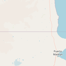
Map view of Somuncurá Provincial Reserve

Use this park location map to pinpoint Somuncurá Provincial Reserve in Argentina, understand its exact geographic position, and read its mapped placement within the surrounding landscape more clearly.

Pigeon | © OpenStreetMap contributors

Location context for Somuncurá Provincial Reserve

Chubut ProvinceRío Negro Province
Park atlas

Compare adjacent volcanic steppes and regional Patagonian protected landscapes

Explore Parks Near Somuncurá Provincial Reserve and Surrounding Protected Areas

Browse other protected areas near Somuncurá Provincial Reserve to examine connected Patagonian steppe ecosystems and basalt terrain. Comparing regional reserves expands geographic context across arid plateaus and remote wildlife habitats.
National parkRío Negro Province
About 154 km away#1 closest

East

Islote Lobos National Park: Coastal Archipelago National Park in Río Negro Province

Mapping the dynamic intertidal zones and unique Patagonian marine geography.

Islote Lobos National Park is a notable national park on the Atlantic coast of Río Negro Province, Argentina. This protected area preserves a distinctive landscape of six rocky promontories emerging from San Matías Gulf, creating unique island ecosystems. The park's coastal and marine environments, characterized by significant tidal fluctuations and important habitats for marine fauna, are vital to the Patagonian natural heritage. Its mapped geography offers critical insights into regional conservation efforts.

Area
19.079 km²
Established
2020
IUCN
II
Relief
Lowland
Nature reserveChubut Province
About 330 km away#2 closest

Southeast

Punta Tombo Nature Reserve: Coastal Geography and Protected Peninsula Map

A critical Magellanic penguin habitat in Chubut Province

Punta Tombo is a narrow, low-lying peninsula extending into the Atlantic, characterized by soft, sandy soils and arid Patagonian steppe terrain. As a major protected faunal and marine reserve, it maintains a essential buffer for migratory seabirds and regional wildlife. This site offers a clear look at how protected land boundaries safeguard sensitive coastal nesting grounds from the broader steppe environment of Argentina.

Area
2.1 km²
Established
1972
Visitors
100K annual
Relief
Lowland
National parkRío Negro Province
About 350 km away#3 closest

West

Nahuel Huapi National Park: Protected Area Landscape and Geographic Context in Río Negro

Explore mapped natural terrain and park boundaries within Patagonia.

Nahuel Huapi National Park is a crucial protected area offering a deep dive into the Patagonian landscape. Situated in Argentina's Río Negro Province, this national park provides a detailed view of mapped natural terrain and its environmental context. Users can explore the park's geographic identity and protected boundaries, making it an essential stop for understanding the regional geography and conservation significance of this part of South America.

Area
7,050 km²
Established
1934
IUCN
II
Relief
Mountain
National parkNeuquén Province
About 365 km away#4 closest

West

Lanín National Park: Volcanic Landscapes and Ancient Forests in Neuquén Province

Explore the protected area's mapped terrain and glacial lakes.

Lanín National Park offers a deep dive into the dramatic geography of Argentine Patagonia, centered around the prominent Lanín volcano. This national park preserves ancient araucaria forests, diverse ecosystems, and breathtaking glacial lakes like Huechulafquen and Lácar. Its extensive protected landscape provides critical habitat and opportunities to explore unique Andean terrain through map-driven discovery.

Area
3,790 km²
Established
1937
IUCN
II
Relief
Mountain
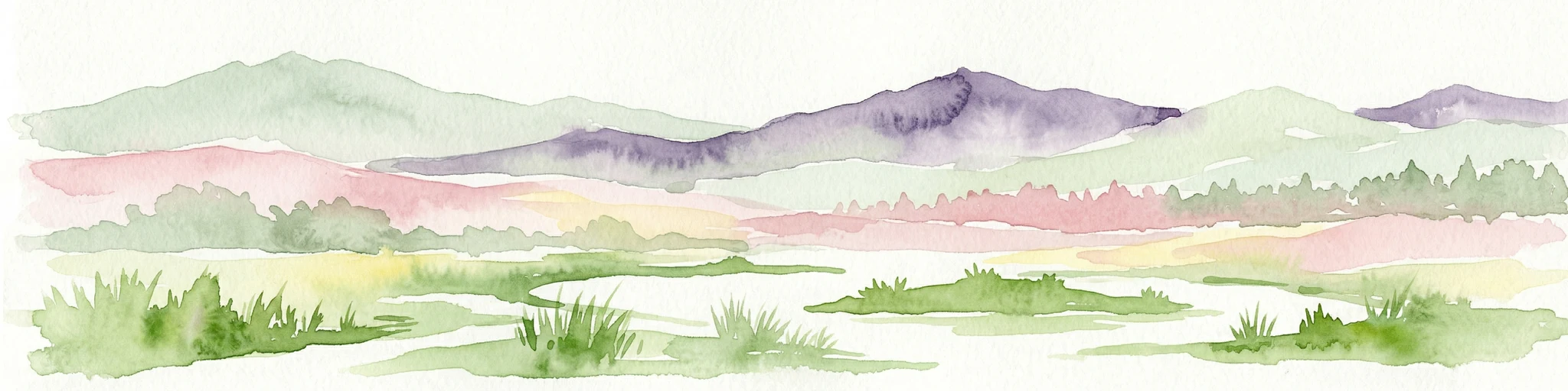
Watercolor illustration showing layered mountains in green, purple, and pink hues, grassy foregrounds, and small water bodies
National parkLa Pampa Province
About 382 km away#5 closest

North

Lihué Calel National Park: Argentinian National Park and Protected Landscape Geography

Explore La Pampa Province's unique protected terrain and mapped park boundaries.

Lihué Calel National Park is a designated national park in Argentina's La Pampa Province, offering a focused entry for atlas exploration of protected landscapes. Understand its geographic context within the region, investigate its mapped boundaries, and appreciate its role as a distinct natural terrain feature. This page provides the foundational geographic and protected-area data for users interested in the park's landscape identity.

Area
324 km²
Established
1977
IUCN
II
Relief
Mixed relief
National parkNeuquén Province
About 383 km away#6 closest

Northwest

Laguna Blanca National Park: National Park in Neuquén Province, Patagonia

Mapped protected area and regional landscape context.

Laguna Blanca National Park represents a key protected landscape within the expansive geography of Neuquén Province, located in the Patagonia region of Argentina. This national park entity serves as a critical node for atlas exploration, allowing users to understand its specific protected boundaries and its contribution to the regional protected-area network. Investigate Laguna Blanca National Park to gain insight into its unique geographic setting and its role within the mapped natural areas of Western Argentina.

Area
112.5 km²
Established
1940
IUCN
II
Relief
Upland
National parkNeuquén Province
About 398 km away#7 closest

West

Los Arrayanes National Park: Neuquén Province's Protected Arrayán Forest Atlas

Explore the ancient arrayán forest and mapped terrain.

Los Arrayanes National Park, nestled in Neuquén Province, is celebrated for its exceptional arrayán forest, one of the world's most concentrated stands of Luma apiculata. This protected area showcases a unique landscape where ancient, gnarled trees with striking cinnamon bark thrive on the Quetrihué Peninsula, overlooking Nahuel Huapi Lake. Its protected status ensures the preservation of this botanical marvel, offering a distinct geographical and ecological profile within the Patagonian region.

Area
17.53 km²
Established
1971
IUCN
II
Relief
Upland
Watercolor illustration showing a lake surrounded by forested hills and mountains
National parkChubut Province
About 399 km away#8 closest

West

Lago Puelo National Park: A Unique Protected Landscape at the Intersection of Biomes

Explore its glacial terrain and Andean-Patagonian geographic context.

Lago Puelo National Park, located in Argentina's Chubut Province, stands out as a significant protected area due to its remarkable ecological diversity. This park is distinguished by its rare transition zone where the Patagonian forest converges with the Andean steppe, incorporating flora typically found in the Valdivian temperate rainforest. The mountainous landscape, carved by glaciers, features the striking turquoise waters of Puelo Lake and surrounding river systems. Understanding Lago Puelo National Park's geography provides insight into the complex natural systems of Patagonia and its unique protected biomes.

Area
276.74 km²
Established
1971
IUCN
II
Relief
Mountain

Common questions about visiting, size, designation, and location context for Somuncurá Provincial Reserve

Somuncurá Provincial Reserve FAQs for park facts, access, geography, and protected area context

Find quick answers about Somuncurá Provincial Reserve, including protected-area facts, park geography, trail and visitor context, and how the park fits into its surrounding country and regional landscape.
MoriAtlas Explorer

Continue Your Protected Areas Search Across the Global Atlas

Deepen your exploration by continuing the structured search for national parks and protected areas worldwide. Utilize the comprehensive filtering capabilities to compare different conservation landscapes and refine your understanding of global park geography. Discover more about the distribution and characteristics of protected natural areas.

Global natural geography