
Mori Atlas logo
Protected areaStagno di San Giovanni

Mapping the brackish lagoon network and Mediterranean coastal terrain of southwestern Sardegna

Stagno di San Giovanni: Geographic Atlas and Protected Coastal Wetland Landscape of Sardegna

Stagno di San Giovanni represents a vital brackish wetland environment within the coastal geography of southwestern Sardegna. Situated near the municipalities of Arbus and Terralba, this protected area features a complex system of shallow lagoons, mudflats, and dune systems fed by the Rio Mogoro and Rio Sitzerri. As a long-recognized Ramsar site, the lagoon serves as a cornerstone of the regional coastal network, connecting with neighboring ponds to form an extensive habitat for diverse waterbird populations.

coastal lagoonbrackish wetlandRamsar siteSardiniaMediterranean wetlandSpecial Protection Area
A minimalist, flat-style vector illustration of a valley featuring a cascading waterfall between cliffs, surrounded by pine forests, under a soft sun.

Stagno di San Giovanni

Protected area

Park overview

Structured park overview, official facts, and landscape profile for Stagno di San Giovanni

Stagno di San Giovanni park facts, protected area profile, and essential visitor context

Review the core facts for Stagno di San Giovanni, including designation, size, terrain, visitor scale, habitats, and operating context in one park-focused overview.

About Stagno di San Giovanni

Stagno di San Giovanni is a coastal brackish lagoon on the southwestern coast of Sardinia, set between the municipalities of Arbus and Terralba in the province of Oristano. The lagoon sits in the low-lying coastal belt that runs along the western side of the island, an area defined by sandy plains, dune cordons, intermittent stream mouths, and a chain of brackish wetlands that together form one of the most important lagoon complexes in Italy. With a surface of roughly seven square kilometers and a salinity profile that is brackish rather than fully marine, the stagno is fed by the freshwater inputs of the Rio Mogoro and Rio Sitzerri, which mix with seawater along its margins.

The wetland is notable both for its ecological significance and for its long history of human use. It has been on the international Ramsar list of important wetlands since the 1970s, and it was later confirmed as a Special Protection Area under the European Union Birds Directive, which makes it part of the formal Natura-style network for the protection of migratory and threatened bird species. The lagoon does not exist as an isolated site. It shares its broader designated zone, coded ITB034004, with Stagni di Santa Maria, the smaller Pauli Biancu Turri pond, and the lagoons of Marceddì and Corru S'Ittiri, creating a continuous corridor of brackish habitats along this part of the Sardinian coast.

As a working landscape, Stagno di San Giovanni is part of the regional demesne of Sardinia, and the regional administration grants professional fishing rights within its waters. This legal and cultural arrangement, in which a recognized international wetland continues to support traditional fisheries, distinguishes the site from purely preserved natural areas. Local fishers target species such as sea bream, mullet, sea bass, eel, crab, sole, and clams, including the traditional arselle, a small venerid shellfish typical of Sardinian lagoon fisheries. This combination of a Ramsar and EU-protected ecological designation with an active artisanal fishing economy gives the lagoon a particularly layered identity, in which conservation and traditional livelihood coexist within the same body of water.

Quick facts and research context for Stagno di San Giovanni

Stagno di San Giovanni is a coastal brackish lagoon in southwestern Sardinia, Italy, situated near the border between the communes of Arbus and Terralba within the province of Oristano. It covers roughly 7 square kilometers and is fed primarily by the Rio Mogoro and Rio Sitzerri streams, which together maintain its character as a low-salinity brackish basin rather than a fully marine inlet.

The lagoon has been on the Ramsar list of internationally important wetlands since the 1970s and was later designated as a Special Protection Area under the EU Birds Directive, sharing its ZPS code ITB034004 with several neighboring wetlands. Although it functions as a natural protected site, the lagoon is also a productive fishery that is part of the regional demesne of Sardinia.

Protection and recognition

Examining documented protection scope, management frameworks, and official records.

Stagno di San Giovanni Protection Status and Terrestrial Area Records

Stagno di San Giovanni maintains a documented terrestrial protection scope within its regional conservation framework. Official records compile available designation history, management parameters, and recognition data for structural analysis.

Protection details

Protection scope
Terrestrial
Park context

Deeper park guide and search-rich context for Stagno di San Giovanni

Stagno di San Giovanni history, landscape, wildlife, and travel context

Explore Stagno di San Giovanni through its history, landscape character, ecosystems, wildlife, conservation priorities, cultural context, and seasonal travel timing in a structured park guide built for atlas discovery and search intent.

Why Stagno di San Giovanni stands out

Stagno di San Giovanni is best known as one of the long-recognized Ramsar wetlands of Sardinia, having been listed as a wetland of international importance already in the 1970s. Its other defining trait is its position within a large cluster of lagoons and coastal ponds along the Oristano coast, where it shares a combined Special Protection Area designation with Stagni di Santa Maria, Pauli Biancu Turri, and the Marceddì and Corru S'Ittiri lagoons.
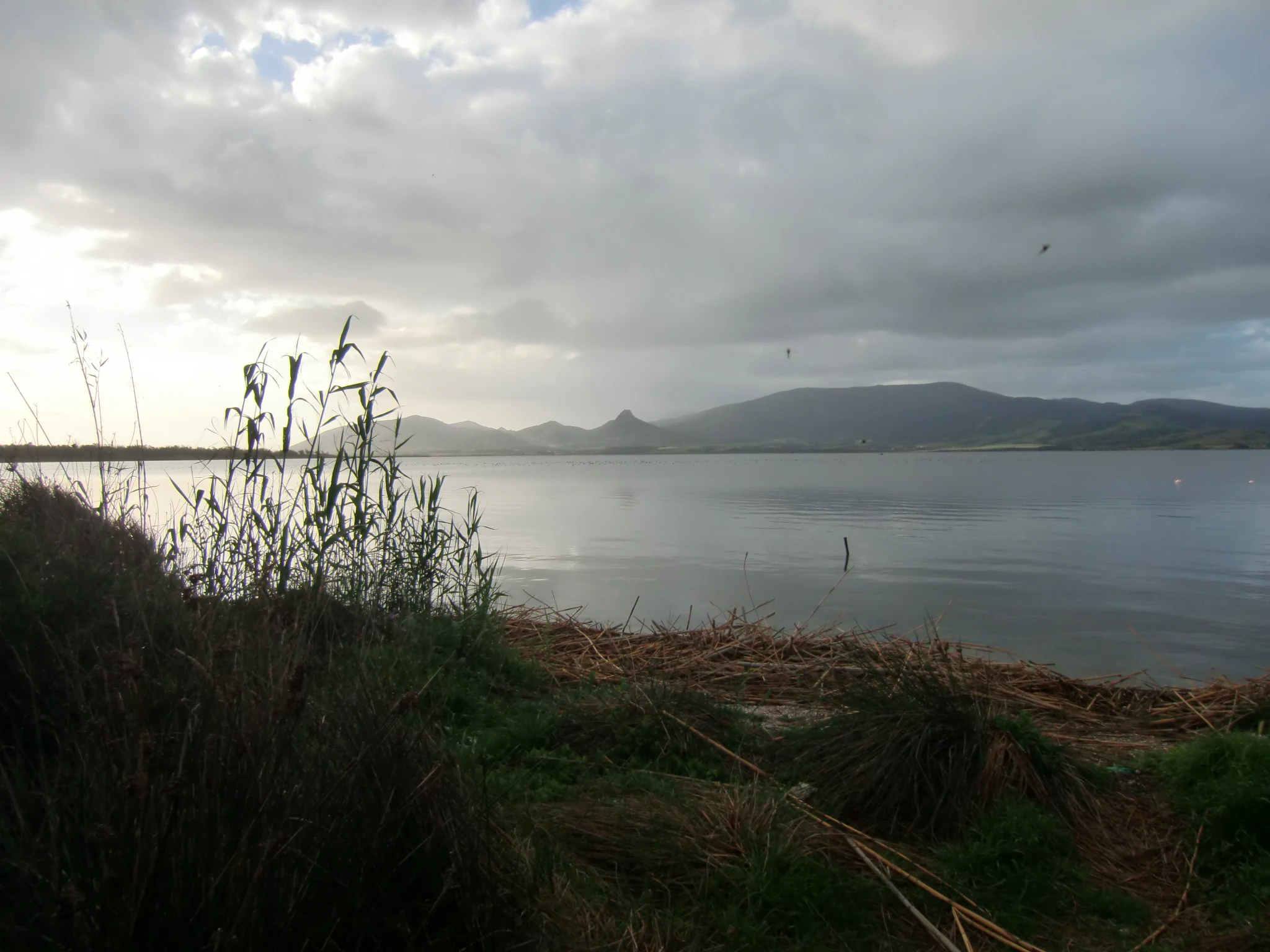
Wide landscape shot of a calm, reflective lagoon under a cloudy sky, with tall grasses in the foreground and distant hills.
A view across the Stagno di San Giovanni wetlands in Sardinia, Italy.

Stagno di San Giovanni history and protected-area timeline

Stagno di San Giovanni already in the 1970s was placed on the list of internationally important wetlands developed under the Ramsar Convention, marking it as one of the early Italian sites recognized for its significance to waterbirds and wetland ecology. With the later adoption of the European Union Birds Directive, the lagoon was classified as a Special Protection Area, extending its international profile into the formal EU conservation framework and grouping it with neighboring brackish waters under a single ZPS designation.

Alongside this ecological recognition, the lagoon has long been treated as a productive fishery. It belongs to the demesne of the Region of Sardinia, which grants professional exploitation rights for its fish resources, an arrangement that reflects both the cultural importance of lagoon fishing in Sardinia and the administrative tradition of treating such wetlands as shared regional assets rather than purely protected zones.

Stagno di San Giovanni landscape and geographic character

Stagno di San Giovanni lies in the low coastal plain that runs along western Sardinia, between Oristano and the southern part of the coast. The surrounding terrain is characterized by flat-to-gently-undulating terrain, sandy soils, and dune cordons built up by longshore marine processes. Inland, the lagoon is bordered by agricultural lowlands and Mediterranean scrub vegetation typical of the Sardinian coast.

The waters of the lagoon itself are brackish rather than fully saline, shaped by the inflow of the Rio Mogoro and Rio Sitzerri, which deliver freshwater from the inland catchment. The combination of shallow brackish water, exposed muddy and sandy margins, and adjacent coastal flats defines the visual character of the site, where wide horizons of still water, exposed sediments, and reed-edged shores dominate the view.

Stagno di San Giovanni ecosystems, habitats, and plant life

As a Ramsar-listed coastal lagoon, Stagno di San Giovanni represents a classic Mediterranean brackish-water habitat, where freshwater inflows mix with seawater to produce salinity conditions intermediate between a true lagoon and a coastal pond. The site forms part of an interconnected group of similar wetlands along the southwestern Sardinian coast, which collectively provide habitat for waterbirds, shorebirds, and a range of estuarine and lagoon-dependent species.

The ecological value of the site rests on the mosaic of shallow water, exposed mudflats, fringing reedbeds, and adjacent salt- and freshwater transitions that characterize these Sardinian coastal systems. Such habitats support seasonal cycles of migratory and resident birdlife, while the brackish conditions sustain fish and invertebrate communities that have long supported traditional lagoon fisheries. The lagoon therefore functions simultaneously as a refuge for wildlife and as a productive natural system.

Stagno di San Giovanni wildlife and species highlights

The lagoon's designation under the EU Birds Directive reflects its role as habitat for a community of waterbirds and shorebirds typical of Mediterranean brackish environments. Although detailed species inventories are not the focus of the source documentation, the site's inclusion in a network of protected wetlands covering Stagni di Santa Maria, Pauli Biancu Turri, and the Marceddì and Corru S'Ittiri lagoons indicates that the area is recognized for hosting populations of migratory and wintering birds that rely on this chain of coastal wetlands.

The presence of commercial species within the lagoon, including sea bream, mullet, sea bass, eel, crab, sole, clams, and arselle, also highlights the broader estuarine and lagoon fauna of the site. These species are characteristic of the brackish-water ecology of Sardinian coastal ponds and form an important part of the lagoon's overall biodiversity.

Stagno di San Giovanni conservation status and protection priorities

Stagno di San Giovanni has been recognized at international level as a wetland of importance since the 1970s through its Ramsar listing, which marked it as part of the global network of sites considered significant for waterbirds and wetland ecosystems. Its later designation as a Special Protection Area under the EU Birds Directive expanded its conservation framework, embedding the site in the European Union's wider strategy for the protection of wild birds and their habitats.

The broader protected area that the lagoon belongs to is not an isolated designation. The ITB034004 zone links Stagno di San Giovanni with Stagni di Santa Maria, Pauli Biancu Turri, and the Marceddì and Corru S'Ittiri lagoons, reinforcing the ecological connectivity between these wetlands and underlining their combined importance for migratory species. The conservation framework also explicitly intersects with the lagoon's productive use, recognizing that regional fishing rights and wetland protection operate alongside one another as part of the long-term management of the site.

Stagno di San Giovanni cultural meaning and human context

The cultural identity of Stagno di San Giovanni is closely linked to the artisanal fishing traditions of southwestern Sardinia. The lagoon belongs to the regional demesne and is professionally fished for species such as sea bream, mullet, sea bass, eel, crab, sole, clams, and arselle, a small venerid shellfish characteristic of Sardinian lagoon fisheries. This fishing activity reflects a centuries-long local relationship with the brackish coastal wetlands of the island.

The shared municipal territory of Arbus and Terralba further embeds the lagoon in the everyday landscape and identity of local communities, where the stagno functions both as a natural area and as a working resource. The coexistence of Ramsar-level recognition and regional fishing rights is itself a notable cultural fact, illustrating how Sardinian lagoon management integrates cultural and ecological values within the same tradition.

Top sights and standout views in Stagno di San Giovanni

Stagno di San Giovanni's strongest distinguishing features are its long-standing Ramsar status, dating from the 1970s, and its inclusion in the shared Special Protection Area ITB034004 that links it to the Stagni di Santa Maria, Pauli Biancu Turri, and the lagoons of Marceddì and Corru S'Ittiri. Its brackish, river-fed character, sustained by the Rio Mogoro and Rio Sitzerri, sets it apart from marine-only inlets and gives it the properties of a true Mediterranean coastal lagoon.

Best time to visit Stagno di San Giovanni

As a Mediterranean coastal lagoon in southwestern Sardinia, Stagno di San Giovanni sits within a region characterized by mild winters and hot, dry summers. Cooler months, when migratory and wintering waterbirds are most likely to be present on the wetland, are widely regarded as the most rewarding period for observing lagoon birdlife, reflecting the broader seasonal pattern of Mediterranean coastal wetlands. Summer brings higher temperatures and low water levels, conditions under which the site reads more strongly as a working fishing landscape than a wildlife-rich environment.
Monthly climate preview

Long term representative measurements of monthly temperature and precipitation for Sardegna

Stagno di San Giovanni Climate Normals and Annual Temperature Rhythm

Representative coordinates record measured monthly temperature and precipitation values across a multi year baseline for Stagno di San Giovanni. Detailed monthly climate normals reveal broader seasonal patterns for this Sardegna location when viewed through complete twelve month profiles.
Annual mean17 °C
9 °C27 °C
Jan
Feb
Mar11°
Apr14°
May18°
Jun23°
Jul26°
Aug27°
Sep22°
Oct18°
Nov14°
Dec10°
Warmest month
August

26.6 °C

Coolest month
January

8.9 °C

Wettest month
November

2.3 mm/day

Driest month
July

0.1 mm/day

Park location guide

Geography guide, regional context, and park location map for Stagno di San Giovanni

Stagno di San Giovanni park geography, regions, and map view in Italy

Understand where Stagno di San Giovanni sits in Italy through a broader geographic reading of the surrounding landscape, nearby location context, and its mapped position within the national park landscape.

How Stagno di San Giovanni fits into Italy

Italy is a unitary parliamentary republic in Southern and Western Europe, located on the Italian Peninsula with the Alps to the north. It borders France, Switzerland, Austria, Slovenia, Vatican City, and San Marino, and shares maritime boundaries with several Mediterranean countries. The country has approximately 59 million residents and uses the Euro as its currency.

Wider geography shaping Stagno di San Giovanni in Italy

Italy occupies a boot-shaped peninsula in southern Europe, bordered by the Alps to the north. It shares land borders with France, Switzerland, Austria, Slovenia, Vatican City, and San Marino. The country includes the Mediterranean islands of Sicily and Sardinia, along with approximately 800 smaller islands.

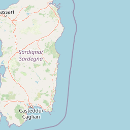
Map view of Stagno di San Giovanni

Use this park location map to pinpoint Stagno di San Giovanni in Italy, understand its exact geographic position, and read its mapped placement within the surrounding landscape more clearly.

Pigeon | © OpenStreetMap contributors

Location context for Stagno di San Giovanni

Sardegna

Visualizing the brackish wetlands, coastal dunes, and protected habitats of western Sardinia

Stagno di San Giovanni Photos and Landscape Scenery

Examine detailed photography highlighting the shallow brackish waters, muddy margins, and expansive horizons that define the protected landscape. Visual documentation reveals the distinct terrain features, wetland ecosystems, and coastal habitats spanning the regional environment.

Wide landscape shot of a calm, reflective lagoon under a cloudy sky, with tall grasses in the foreground and distant hills.

Park atlas

Compare connected coastal lagoons, regional nature reserves, and wetland habitats.

Other Parks Near Stagno di San Giovanni and Protected Wetlands Across Sardinia

Browse protected areas near Stagno di San Giovanni to examine related coastal wetlands and regional wildlife habitats across the surrounding Sardinian landscape. Analyzing these adjacent ecosystems provides broader geographic context for the Mediterranean basin.
A watercolor illustration showing a horizontal landscape with a light-colored lagoon or wetland in the foreground and soft purple mountains in the background.
Protected areaSardinia
About 2.7 km away#1 closest

Northwest

Laguna di Marceddì Protected Area: Sardinia Coastal Geography and Wetland Mapping

A Ramsar-listed brackish wetland on the Sardinian coast

Laguna di Marceddì serves as a critical protected area along the western Mediterranean coast of Sardinia. The landscape features a complex mosaic of tidal channels, shallow pools, and brackish basins. Fed by inland streams, this wetland supports diverse waterbird populations and long-standing professional fisheries while remaining a distinct, low-lying geographic feature within the surrounding agricultural plains of the Oristano province.

Area
9 km²
Relief
Lowland
Scope
Mixed
Water
Water-dominated
Watercolor painting of a mountainous landscape with green forests and distant hills
National parkItaly
About 74 km away#2 closest

Northeast

National Park of the Gulf of Orosei and Gennargentu: Italy's Coastal and Mountain Protected Terrain

Mapped geography of a unique Sardinian protected landscape.

Delve into the atlas-level details of the National Park of the Gulf of Orosei and Gennargentu, a protected area in Italy renowned for its stark contrast between dramatic coastal cliffs bordering the Gulf of Orosei and the wild, mountainous interior of the Gennargentu massif. This page provides structured geographic context, mapping the park's boundaries and showcasing its distinctive karst landscape, hidden beaches, and rugged peaks for comprehensive protected-area exploration.

IUCN
II
Marine protected areaFrance
About 124 km away#3 closest

North

Sanctuaire Pelagos Marine Protected Area: Mediterranean Geography and Seascape

A transboundary conservation zone spanning 87,500 square kilometers.

Sanctuaire Pelagos represents a unique collaborative effort in marine conservation across the Mediterranean. Spanning the waters between France, Italy, and Monaco, this protected maritime area is defined by its deep-sea canyons and nutrient-rich currents that sustain diverse cetacean populations. Its immense scale and international governance make it a focal point for understanding Mediterranean marine biodiversity and environmental policy.

Area
87,500 km²
Established
1999
IUCN
IV
Relief
Lowland
Watercolor illustration of a coastal landscape with green hills, shoreline, and blue sea under a pale yellow sky
National parkSardinia
About 145 km away#4 closest

North

Asinara National Park: National Park Protected Landscape and Geographic Setting

Explore mapped terrain and protected area context within Sardinia.

Asinara National Park stands as a key protected landscape within the Italian national park system, located off the coast of Sardinia. This entry provides detailed geographic context, focusing on its mapped boundaries and the unique natural terrain that defines this island sanctuary. MoriAtlas facilitates a structured discovery of Asinara National Park, enabling users to understand its protected area status and its significant position within the broader regional geography of Sardinia for atlas exploration.

Area
51.7 km²
Established
1997
IUCN
II
Relief
Mixed relief
National parkItaly
About 173 km away#5 closest

Northeast

Arcipelago di La Maddalena National Park: An Italian National Park Defined by Archipelago Geography

Discover mapped protected boundaries and regional landscape context.

Arcipelago di La Maddalena National Park stands as a vital protected area within Italy, characterized by its distinctive archipelago geography. This national park offers a unique lens through which to explore mapped natural landscapes, understand protected land distribution, and contextualize its regional geographic significance. Dive into the detailed mapping of its protected territories to appreciate the full scope of this significant natural asset for structured atlas discovery.

Area
201.46 km²
Established
1994
IUCN
II
Relief
Lowland
National parkBizerte Governorate
About 291 km away#6 closest

South

Jebel Chitana-Cap Négro National Park: National Park Protected Area & Landscape Identity

Explore the mapped geography of Jebel Chitana-Cap Négro National Park.

As a designated national park, Jebel Chitana-Cap Négro National Park represents a key protected area for understanding the regional geography of Bizerte Governorate. This entry provides structured information focused on the park's geographic scope, its mapped boundaries, and its significance as a protected landscape. It is designed for users seeking detailed, atlas-style context on Jebel Chitana-Cap Négro National Park's natural setting and its place within Tunisia's protected lands network.

Area
101.2 km²
Established
2010
Relief
Mountain
Scope
Terrestrial
National parkTunisia
About 293 km away#7 closest

South

Ichkeul National Park: Tunisia's Key Protected Landscape for Geographic Discovery

Explore the mapped geography and regional context of this Tunisian national park.

Ichkeul National Park is a crucial protected area located in Tunisia, offering a distinct focal point for geographic exploration and atlas-based understanding. This park's mapped boundaries and protected status are central to appreciating its role within Tunisia's natural landscapes and the wider North African region. Through structured data and detailed geographic context, users can gain insight into Ichkeul National Park's unique environmental identity and its significance as a protected natural resource.

National parkEl Tarf Province
About 306 km away#8 closest

South

El Kala National Park: Protected Wetlands and Barbary Stag Habitat

Explore its mapped geography and vital ecosystem context.

El Kala National Park represents a crucial protected landscape within El Tarf Province, Algeria, recognized internationally for its extensive Mediterranean wetlands and rich biodiversity. This national park is a vital ecological zone, comprising six major lakes and a significant stretch of coastline, offering a unique mosaic of aquatic and terrestrial environments. Its role as a sanctuary for the Barbary stag and migratory birds highlights its importance in regional conservation efforts. Exploring El Kala National Park provides insight into the mapped terrain, protected boundaries, and distinct geographic features that define this significant North African natural area.

Area
764 km²
Established
1993
IUCN
II
Visitors
30K annual

Common questions about visiting, size, designation, and location context for Stagno di San Giovanni

Stagno di San Giovanni FAQs for park facts, access, geography, and protected area context

Find quick answers about Stagno di San Giovanni, including protected-area facts, park geography, trail and visitor context, and how the park fits into its surrounding country and regional landscape.
MoriAtlas Explorer

Continue Your Protected Areas Search Across the Global Atlas

Deepen your exploration by continuing the structured search for national parks and protected areas worldwide. Utilize the comprehensive filtering capabilities to compare different conservation landscapes and refine your understanding of global park geography. Discover more about the distribution and characteristics of protected natural areas.

Global natural geography