
Streams
Park geography
A structured overview of spatial boundaries, relief features, and environmental zones
Taroko National Park Geographic Profile, Boundary Mapping, and Terrain Analysis
The geographic profile of Taroko National Park details its expansive 920 square kilometer area across Hualien County. This analysis captures essential landscape characteristics including mountainous relief, temperate forest habitats, and significant river systems. Browse the recorded internal topography, encompassing notable peaks and canyon formations situated within the protected territory.
Related tags
marble gorgemountain parkgeological heritageTaiwan national parksindigenous heritage
Taiwan's iconic marble gorge and mountain wilderness protecting one of the world's rarest geological formations
Taroko National Park
Taroko National Park is one of Taiwan's nine national parks, renowned for its spectacular Taroko Gorge, a river-carved canyon cut entirely through pure marble. Located in eastern Taiwan across Xiulin Township in Hualien County, with extensions into Taichung City and Nantou County, the park encompasses over 92,000 hectares of rugged mountain terrain. The park's defining geological feature ranks among only three river-carved gorges worldwide formed entirely in marble, alongside similar formations in India and Bulgaria. The landscape rises from tropical deciduous forests at lower elevations through temperate coniferous zones to alpine peaks exceeding 3,000 meters, creating remarkable ecological diversity within a relatively compact area. The park holds potential World Heritage Site status and represents Taiwan's most significant protected landscape, combining dramatic scenery with deep cultural significance tied to the indigenous Truku people.
- Location
- Taiwan
- Park type
- National park
- Established
- 1986
- Area
- 920 km²
Location overview
Regional distribution across Hualien, Nantou, and Taichung counties
Geographic Location and Regional Setting of Taroko National Park
Taroko National Park covers territories in Taiwan and American Samoa, including Hualien, Nantou, and Taichung. Records detail its administrative boundaries and status as a terrestrial, non-transboundary reserve.
- Countries
- Taiwan
- Regions
- Hualien County, Nantou County, Taichung
- Primary location
- Hualien County
- Geographic setting
- Inland
Boundary and coordinates
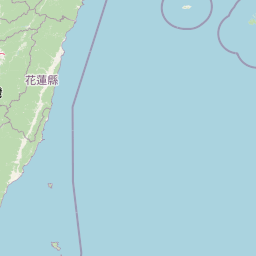
Taroko National Park’s stored boundary frames 920 km²
Taroko National Park mapped boundary and 920 km² area
Taroko National Park's stored boundary geometry conveys the shape and scale of its recorded 920 km² protected extent. The area appears as a single total, without separate land or marine values, and the database provides no perimeter measurement.
- Boundary area
- 980.5 km²
- Boundary perimeter
- 198.2 km
- Northernmost point
- 24.3843° N
- Southernmost point
- 24.0423° N
- Easternmost point
- 121.716° E
- Westernmost point
- 121.2337° E
- Geographic centre
- 24.2008° N, 121.4538° E
- North–south span
- 37.9 km
- East–west span
- 49 km
Terrain and natural features
Explore recorded mountain terrain and associated natural features within boundaries
Taroko National Park Terrain Classification and Named Natural Features
Taroko National Park encompasses mountainous terrain classifications alongside numerous recorded natural features. Linked feature cards supply specific types and spatial relationships for each location.
Selected named natural features
Ponds
月形池
Peaks
饅頭山
1,118 m
Peaks
千里眼山
1,623.7 m
Rock formations
摩埃
Streams
耳無溪
Environmental setting
Subtropical climate zones, mountain relief, and forest cover
Taroko National Park Environmental Setting and Landscape Classifications
Recorded classifications group the physical setting into broad landscape, habitat, and water categories across the protected terrain. Connected atlas destinations link these environmental attributes to related geographic records throughout the region.
- Relief
- Mountain
- Climate
- Subtropical
- Water
- Major water bodies
- Forest cover
- Mostly forested
- Seasonality
- Seasonal
Landscape features
Mountains · Valleys · Canyon · Cliffs · Rivers · Forest
Habitat types
Temperate broadleaf forest · Montane forest
Park atlas
Trace Taiwan's protected landscape geography and compare adjacent national parks, offering a broader atlas view.
National Parks and Protected Areas to Explore Beyond Taroko National Park
After exploring Taroko National Park's unique marble gorge and mountain terrain, continue your protected area discovery by browsing other significant national parks and natural reserves in the surrounding region. Comparing these diverse landscapes provides valuable geographic context for Taiwan's conservation efforts and high-elevation protected areas.
National parkMiaoli County
2.3 km away#1 closest
Northwest

Shei-Pa National Park: Explore Taiwan's National Park Protected Landscape in Miaoli County
Mapped geographic boundaries and regional park context.
Shei-Pa National Park is a vital protected area in Miaoli County, Taiwan, offering rich opportunities for geographic and atlas-based exploration. Delve into the specifics of its mapped park boundaries and understand its role within the broader regional landscape. This destination provides essential context for discovering Taiwan's protected natural areas and their unique geographic characteristics.
- Area
- 768.5 km²
- Established
- 1992
- IUCN
- II
- Relief
- Mountain
National parkNantou County
57 km away#2 closest
Southwest
Yushan National Park: Explore Taiwan's Highest Mountain and Alpine Protected Terrain
Mapped geography and dramatic peaks within Nantou County.
Yushan National Park is a crucial protected area in Taiwan, renowned for encompassing the island's highest mountain and a significant portion of the Central Mountain Range. This national park's dramatic geography spans over 103,000 hectares, with two-thirds of its territory lying above 2,000 meters. Its vertical ecological zones, from subtropical forests to alpine environments, offer a rich tapestry of landscapes ideal for atlas-style exploration of protected terrain and mountain peak geography.
- Area
- 1,031.21 km²
- Established
- 1985
- IUCN
- II
- Visitors
- 1M annual
National parkTaiwan
About 87 km away#3 closest
North
Yangmingshan National Park: Volcanic Terrain and Geothermal Features Atlas
Explore Taiwan's protected national park geography and mapped landscapes.
Yangmingshan National Park presents a striking example of volcanic geography, characterized by its rugged mountain terrain, active craters like Xiaoyoukeng, and ubiquitous geothermal features such as hot springs and sulfur deposits. As a protected national park within Taiwan, its landscape offers a rich context for understanding volcanic processes and alpine ecosystems. MoriAtlas provides detailed map exploration of Yangmingshan National Park, highlighting its unique geological formations and protected boundaries for an in-depth geographic discovery experience.
- Area
- 113 km²
- Established
- 1985
- IUCN
- II
National parkTainan
157 km away#4 closest
Southwest
Taijiang National Park: National Park Atlas and Protected Landscape Exploration
Discover mapped boundaries and regional geography.
Taijiang National Park offers a distinct look into protected natural landscapes within Tainan, Taiwan. This page details its identity as a national park, focusing on its mapped geographic features and its contribution to the regional atlas. Users can explore the specific protected area context and understand the landscape characteristics relevant to a structured geographic discovery approach.
- Area
- 393.1 km²
- Established
- 2009
- IUCN
- II
- Relief
- Lowland
National parkTaiwan
178 km away#5 closest
Southwest
South Penghu Marine National Park: A Protected Volcanic Island Landscape in Taiwan's Penghu Archipelago
Mapped marine protected areas and unique geological features.
Discover the unique atlas value of South Penghu Marine National Park, Taiwan's protected national park renowned for its dramatic columnar basalt landforms and extensive coral reef systems. This marine protected area provides critical habitat for diverse species and showcases a rugged island geography shaped by volcanic activity. Explore its mapped boundaries and unique geological formations, including famous sea caves, offering a distinct context for landscape discovery.
- Area
- 358.44 km²
- Established
- 2014
- IUCN
- II
- Visitors
- 8.4K annual
National parkOkinawa Prefecture
186 km away#6 closest
East

Iriomote-Ishigaki National Park: Subtropical Island Geography and Protected Landscape Atlas
Explore the unique terrain and mapped boundaries of this national park.
Dive into the geography of Iriomote-Ishigaki National Park, a protected national park situated in Japan's Okinawa Prefecture. This page provides a detailed atlas view of its characteristic subtropical island terrain, including extensive mangrove forests, distinct limestone karst features, and surrounding marine protected areas. Understand the park's unique landscape and its significance within the broader regional geography for comprehensive exploration.
- Area
- 1,221.5 km²
- Established
- 1972
- IUCN
- II
- Climate
- Subtropical
Nature reserveTaiwan
About 189 km away#7 closest
Southwest
Shoushan National Nature Park: Protected Nature Reserve Landscape and Mapped Geography
Taiwan's protected nature reserve with distinct geographic features.
Shoushan National Nature Park is identified as a protected nature reserve, providing a focal point for exploring Taiwan's natural geography. This page offers insights into its specific landscape character and mapped protected boundaries, situating it within the broader context of the island's natural terrain. Discover the atlas-level details of this reserve and its role in regional conservation landscapes.
National parkPingtung County
219 km away#8 closest
South
Kenting National Park: Taiwan's Southern National Park Protected Landscape Identity
Mapped geography and regional context for this protected area.
Kenting National Park is a crucial protected area located in Pingtung County, Taiwan, representing a significant component of the nation's protected lands. This page provides detailed information ideal for atlas-driven exploration, focusing on the park's mapped geographic features, its role as a national park, and its contribution to understanding Taiwan's diverse landscapes. Discover the unique identity of Kenting National Park as a key element in regional conservation and geographic study.
- Area
- 333 km²
- Established
- 1984
- IUCN
- II
- Visitors
- 5.8M annual
MoriAtlas Explorer
Continue Exploring Taroko National Park's Mapped Geography and Protected Landscape
To deepen your understanding of Taroko National Park, investigate its specific geographic features and the extent of its protected boundaries. This detailed view helps situate the park within Hualien County and provides a foundation for comparative atlas exploration of Taiwan's diverse natural landscapes. Discover the factual context that defines this protected area for a comprehensive geographic perspective.
Browse next
Global natural geography
Explore related park routes
Explore MoriAtlas Global ParksBrowse All MoriAtlas ParksGlobal Park Map DiscoveryMoriAtlas: Browse All CountriesBrowse All MoriAtlas ContinentsNational Park Environment AtlasGrand Canyon National Park AtlasYellowstone National Park AtlasYosemite National Park Atlas and GeographySerengeti National Park AtlasGalápagos National Park Protected LandscapeBanff National Park Geography and AtlasKruger National Park Atlas EntryUluṟu-Kata Tjuṯa National Park AtlasExplore Uluru-Kata Tjuta National Park GeographyPlitvice Lakes National Park AtlasFiordland National Park Protected LandscapeGreat Smoky Mountains National Park AtlasAfghanistan National Parks and Protected AreasAlbania National Parks and Protected AreasAlgeria National Parks and Protected AreasAmerican Samoa National Parks and Protected AreasAndorra National Parks and Protected AreasAngola National Parks and Protected AreasAntarctica National Parks and Protected AreasAntigua and Barbuda Park List