

Mori Atlas logo
Protected landscapeTongass National Forest

Mapping the vast island archipelagos, glacial fjords, and old growth ecosystems of Southeast Alaska

Tongass National Forest: An Atlas of Temperate Rainforests and Coastal Mountain Wilderness

Tongass National Forest stands as a colossal protected landscape spanning the Alaska Panhandle, defined by the intricate Alexander Archipelago and the rugged western slopes of the Coast Mountains. This dataset provides a detailed geographic overview of the largest remaining temperate rainforest on Earth, tracing its complex mosaic of deep fjords, tidewater glaciers, and moss-draped old growth forests. Navigate the boundaries of this wilderness to understand the intersection of marine channels and mountain terrain that shape one of the most ecologically significant regions in North America.

temperate rainforestold growth forestfjordstidewater glaciersCoast MountainsAlexander Archipelago
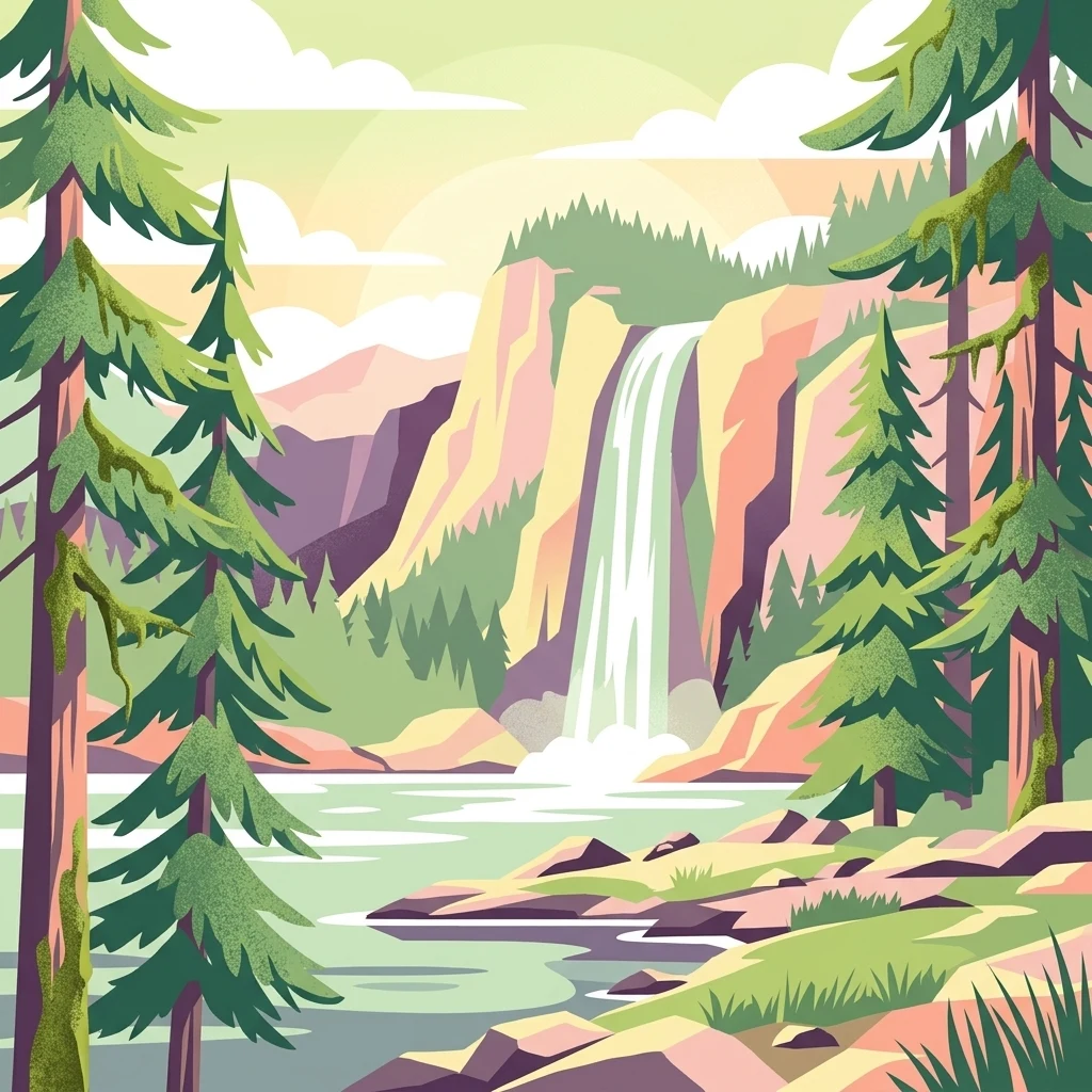
An illustration in a flat, vector-art style showing a waterfall flowing down a rocky cliff into a lake, framed by tall evergreen trees in the foreground.

Tongass National Forest

Protected landscape

Park overview

Structured park overview, official facts, and landscape profile for Tongass National Forest

Tongass National Forest park facts, protected area profile, and essential visitor context

Review the core facts for Tongass National Forest, including designation, size, terrain, visitor scale, habitats, and operating context in one park-focused overview.

About Tongass National Forest

Tongass National Forest is a vast federally managed landscape stretching across the Alaska Panhandle, a narrow strip of islands, fjords, and coastal mountains in the far northwest of North America. Its territory covers nearly all of Southeast Alaska's Alexander Archipelago, including major islands such as Prince of Wales, Chichagof, Kupreanof, Kuiu, Zarembo, and Baranof, and extends eastward to Yakutat. The boundary with British Columbia runs along the crest of the Boundary Ranges of the Coast Mountains, putting the Tongass at the heart of the larger North Pacific coastal rainforest system.

Ecologically, the Tongass is a global reference point for temperate rainforest conservation. The forest falls within the Northern Pacific coastal forests ecoregion and, together with Canada's Great Bear Rainforest, makes up the world's largest perhumid rainforest zone. Western hemlock, Sitka spruce, and western red cedar form the backbone of the forest, with soil and drainage shaped by the underlying geology of karst limestone on one hand and poorly drained granite on the other.

The forest also functions as a living cultural landscape. Three Alaska Native nations, the Tlingit, Haida, and Tsimshian, have inhabited this region since time immemorial, and thirty-one communities, including the state capital Juneau, lie within its boundaries. While the timber industry once dominated the regional economy, tourism, recreation, subsistence harvesting, salmon fisheries, and the carbon value of intact old growth now contribute the majority of the roughly two billion dollars the forest generates annually.

Quick facts and research context for Tongass National Forest

Tongass National Forest covers about 16.7 million acres in Southeast Alaska, an area larger than ten U.S. states. It is administered by the United States Forest Service and headquartered in Ketchikan, with ranger district offices scattered across communities including Juneau, Sitka, Petersburg, Wrangell, Craig, Hoonah, Thorne Bay, and Yakutat.

Roughly 10 million acres of the forest are forested, and about 5 million acres of that are considered productive old growth, much of it protected within nineteen designated wilderness areas. The forest takes its name from the Tongass group of the Tlingit people, who inhabited the southern end of Southeast Alaska around present-day Ketchikan.

Protection and recognition

Documented terrestrial protection scope and conservation management context

Tongass National Forest Protection Status and International Recognition

Comprehensive protected area records outline the terrestrial conservation scope and official status established for Tongass National Forest. Structured geography facts provide clear insight into international recognition details and documented management frameworks.

Protection details

Protection scope
Terrestrial
Transboundary protection
No
Park context

Deeper park guide and search-rich context for Tongass National Forest

Tongass National Forest history, landscape, wildlife, and travel context

Explore Tongass National Forest through its history, landscape character, ecosystems, wildlife, conservation priorities, cultural context, and seasonal travel timing in a structured park guide built for atlas discovery and search intent.

Why Tongass National Forest stands out

The Tongass is most renowned for being Earth's largest remaining temperate rainforest, a perhumid coastal ecosystem of giant Sitka spruce, western hemlock, and western red cedar draped in moss and sustained by the region's persistent maritime rainfall. It is equally known for its island archipelago geography, with deep fjords, tidewater glaciers, and forested peaks of the Coast Mountains defining a landscape of inlets, channels, and wilderness islands. The forest also stands out for its unusually high concentration of wilderness; no other U.S. national forest contains as many designated wilderness areas or as much wilderness acreage as the Tongass.
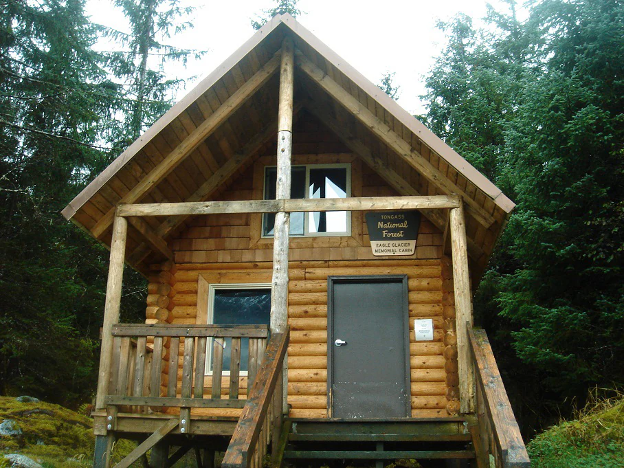
A rustic wooden cabin with a gabled roof set among dense evergreen trees, featuring a sign identifying it as a National Forest facility.
The Eagle Glacier Memorial Cabin in Tongass National Forest, Alaska.

Tongass National Forest history and protected-area timeline

The federal protection of the Tongass landscape began with President Theodore Roosevelt's 1902 proclamation creating the Alexander Archipelago Forest Reserve over islands including Chichagof, Kupreanof, Kuiu, Zarembo, and Prince of Wales. A second Roosevelt proclamation on 10 September 1907 formally established the Tongass National Forest, and in 1908 the two reserves were merged to cover most of Southeast Alaska. Further expansions under Roosevelt in 1909 and under President Calvin Coolidge in 1925 enlarged the forest to its present scale.

Aboriginal title became a defining legal chapter of the forest's history. After the Tongass was created, the Central Council of the Tlingit and Haida Indian Tribes of Alaska formed in 1935 to challenge federal authority over the land. In the resulting case, Tlingit and Haida Indians of Alaska v. United States, the courts recognized that Alaska Natives had established aboriginal title through exclusive use and occupancy from time immemorial. The case was eventually settled in 1968 with a payment of 7.5 million dollars, a value based on 1902 land prices without accumulated interest.

The twentieth century also brought industrial-scale logging shaped by long-term contracts with two pulp mills, the Ketchikan Pulp Company and the Alaska Pulp Corporation. Congressional and judicial interventions, including the National Forest Management Act of 1976, the Stein v. Barton salmon buffer rulings, the Tongass Timber Reform Act of 1990, and repeated battles over the Roadless Rule, repeatedly reshaped those contracts. In 2021 the Biden administration announced the end of large-scale old growth timber sales in the Tongass, redirecting management toward forest restoration, recreation, and non-commercial uses, and in January 2023 the 2001 roadless protections were fully restored.

Tongass National Forest landscape and geographic character

The Tongass landscape is defined by the meeting of sea, forest, and mountains along the Alaska Panhandle. The forest covers the heavily indented islands of the Alexander Archipelago, separated by twisting channels and deep fjords that were carved by glaciers and now fill with ocean water. Beyond the islands rise the peaks and icefields of the Coast Mountains, whose eastern ridges form the international border with British Columbia.

Tidewater glaciers pour from the mountains toward the sea, creating fjords like those of Misty Fjords and Tracy Arm. The underlying terrain is split between well-drained karst limestone areas with caves and springs and poorly drained granite uplands, a contrast that shapes where the largest trees grow. Upland zones host alpine tundra and icefields, while lower elevations support the dense old growth rainforest for which the Tanders and travelers.
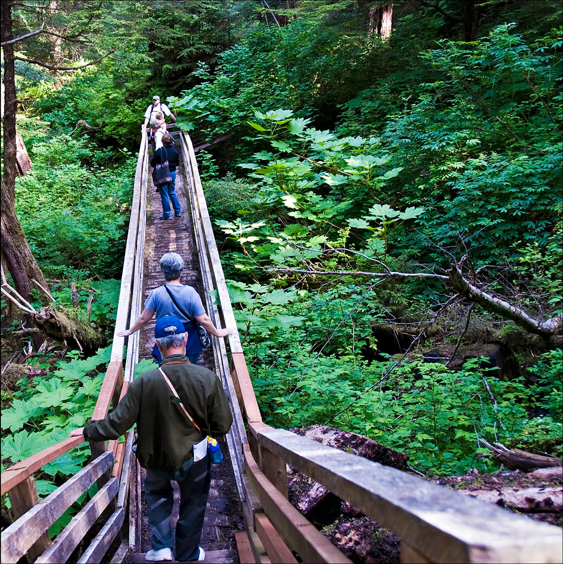
A group of hikers walking away from the camera along a narrow wooden elevated boardwalk winding through dense, bright green forest foliage.
Hikers traverse a wooden boardwalk path through the lush, dense temperate rainforest of the Tongass National Forest.

Tongass National Forest ecosystems, habitats, and plant life

Vegetation across the Tongass is dominated by temperate rainforest in which western hemlock, Sitka spruce, and western red cedar form a multilayered canopy often choked with mosses and ferns. Because much of the terrain receives extremely high rainfall along the Pacific coast, the forest qualifies as perhumid, supporting unusually massive old growth trees, particularly in the karst landscapes where soil depth and drainage favor large cedars and spruces.

Roughly four in every ten acres of the forest are not forested at all, but consist of wetlands, rock, ice, snow, and non-forest alpine vegetation. The remaining forested area includes around five million acres of productive old growth, much of it preserved within nineteen designated wilderness areas such as Misty Fjords, Kootznoowoo, Tracy Arm-Fords Terror, and Stikine-LeConte. Disturbance regimes are part of the natural ecology: the region is regularly shaped by winter Takus windstorms that topple individual trees, as well as by landslides on steep slopes.
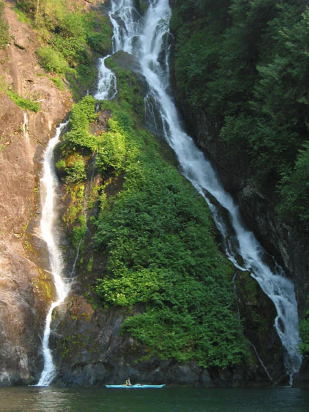
A lone kayaker floats in dark water at the base of a tall, split waterfall cascading down a steep, mossy rock cliff.
A kayaker paddles beneath a waterfall in the Misty Fjords area of Tongass National Forest.

Tongass National Forest wildlife and species highlights

The Tongass supports a striking range of coastal and island wildlife. Five species of Pacific salmon return to its streams, joined by steelhead, and salmon in turn feed the forest's brown bears, black bears, and bald eagles. The endemic Alexander Archipelago wolf, mountain goats, ravens, and Sitka black-tailed deer populate the islands and mountains, while the rare Haida ermine, an endangered weasel subspecies, survives only in a few Tongass islands and on Canada's Haida Gwaii.

The marine environment around the Tongass is equally rich. Orcas and humpback whales feed in the channels, with sea lions, seals, sea otters, river otters, and porpoises common in coastal waters. Migratory birds, including Arctic terns, nest across the archipelago each summer. These combined terrestrial and marine populations make the Tongass one of the most important intact wildlife landscapes in North America.
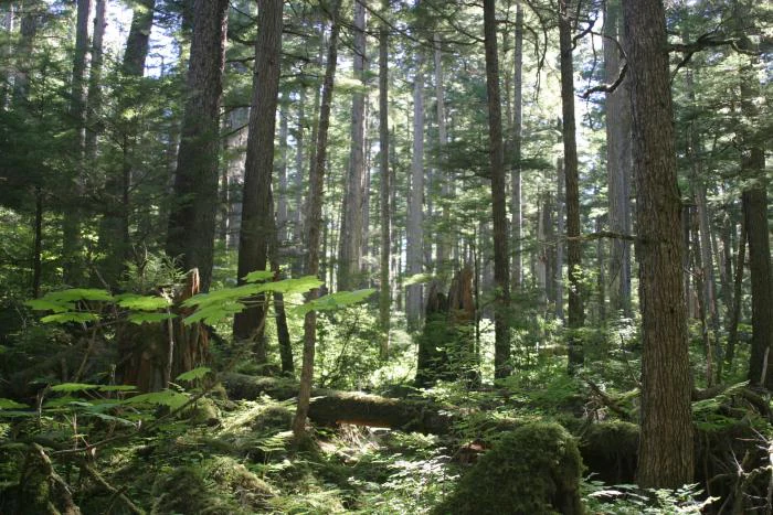
A dense temperate rainforest with tall conifer trees, mossy logs on the forest floor, and filtered sunlight filtering through the canopy.
A view into the lush understory and dense canopy of the Tongass National Forest.

Tongass National Forest conservation status and protection priorities

The Tongass is internationally significant for conservation because it protects the Earth's largest remaining temperate rainforest and a corresponding suite of old growth dependent species. Its nineteen designated wilderness areas collectively protect more wilderness acreage than those of any other U.S. national forest, and roughly seventy percent of the forest's most ecologically valuable big tree, low elevation old growth lies in reserves that are permanently off limits to harvest.

Conservation policy for the Tongass has been shaped by long-running conflicts over roadless area protections, old growth logging, salmon stream buffers, and land transfers to private native corporations. The 1990 Tongass Timber Reform Act ended an annual logging subsidy and closed additional forest to harvesting, after which both major pulp mills closed by the late 1990s. The 2021 decision to phase out large-scale old growth timber sales, followed by the 2023 restoration of the 2001 Roadless Rule, marked a major shift toward prioritizing climate resilience, carbon storage, recreation, and subsistence use over industrial timber extraction.

Tongass National Forest cultural meaning and human context

The Tongass is the ancestral homeland of three Alaska Native nations, the Tlingit, Haida, and Tsimshian, whose presence in the region long predates any federal designation or state boundary. The forest itself takes its name from a Tlingit group based near present-day Ketchikan, and the entire landscape is interwoven with indigenous place names, traditional use sites, and continuing subsistence practices such as salmon fishing, deer hunting, and cedar harvesting.

Alaska Native corporation inholdings also remain a defining cultural feature: lands conveyed under the Alaska Native Claims Settlement Act of 1971, including old growth tracts administered today by the Sealaska Corporation, sit within the broader national forest. The question of additional land selections through measures such as the Sealaska Lands Bill has generated sustained local debate, reflecting the complex overlap of indigenous rights, regional communities, and federal forest management in Southeast Alaska.

Top sights and standout views in Tongass National Forest

The Tongass is unusual among U.S. national forests for combining an immense geographic footprint with a globally rare ecosystem type, holding the largest tract of temperate rainforest left on Earth. Its combination of rugged islands, deep fjords, tidewater glaciers, and coastal old growth forest creates a landscape found nowhere else in the country at this scale.

The forest also stands out for its extraordinary concentration of wilderness, with nineteen designated wilderness areas exceeding five million acres, and for the depth of its human history, including Tlingit, Haida, and Tsimshian homelands, a major aboriginal title case, and a century of national debate over logging, road building, and the future of Southeast Alaska's communities.

Best time to visit Tongass National Forest

The Tongass is a year-round landscape, but the most rewarding seasons tend to be summer, when longer daylight, milder temperatures, and accessible ferry and cruise routes open up the islands for hiking, kayaking, fishing, and wildlife viewing. Summer is also when migratory birds are nesting, salmon runs are active, and visitor facilities such as the Mendenhall Glacier Visitor Center and the Southeast Alaska Discovery Center operate full programming.

Winter brings quieter conditions and a different scenic character shaped by snowfall, frozen inlets, and dramatic storm weather, though access becomes more limited and many services reduce their hours. Shoulder seasons offer a balance of fewer visitors and changing scenery, with spring freshening the forest and autumn deepening the character of the rainforest's evergreens against the season's first storms.
Monthly climate preview

Long-term representative point measurements tracking monthly temperature and precipitation rhythm

Tongass National Forest Climate Normals, Annual Temperature and Precipitation Patterns

Representative point records outline the measured annual temperature and precipitation rhythm for Tongass National Forest from long-term climatology data. Exploring the complete twelve-month profile provides detailed monthly averages for deeper geographic and environmental analysis.
Annual mean7 °C
1 °C13 °C
Jan
Feb
Mar
Apr
May
Jun11°
Jul13°
Aug13°
Sep11°
Oct
Nov
Dec
Warmest month
August

13.4 °C

Coolest month
January

1 °C

Wettest month
October

9.9 mm/day

Driest month
June

3.5 mm/day

Park location guide

Geography guide, regional context, and park location map for Tongass National Forest

Tongass National Forest park geography, regions, and map view in United States of America

Understand where Tongass National Forest sits in United States of America through a broader geographic reading of the surrounding landscape, nearby location context, and its mapped position within the national park landscape.

How Tongass National Forest fits into United States of America

The United States of America is a federal presidential republic and one of the world's largest countries by area and population. It consists of 50 states across a vast territory spanning multiple time zones, with its capital in Washington, D.C. and largest city in New York City. The nation has a diverse economy, influential political system, and significant cultural and military presence globally.

Wider geography shaping Tongass National Forest in United States of America

The United States occupies a vast territory in North America, bordered by Canada to the north and Mexico to the south. The 48 contiguous states stretch from the Atlantic to the Pacific Ocean, while Alaska occupies the northwestern region and Hawaii is an archipelago in the Pacific. The country encompasses diverse terrain including the Rocky Mountains, Appalachian Mountains, Great Plains, and extensive river systems.

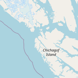
Map view of Tongass National Forest

Use this park location map to pinpoint Tongass National Forest in United States of America, understand its exact geographic position, and read its mapped placement within the surrounding landscape more clearly.

Pigeon | © OpenStreetMap contributors

Location context for Tongass National Forest

Alaska

Visualizing temperate rainforests, deep fjords, and coastal wilderness islands

Tongass National Forest Photos, Landscapes, and Scenery Visual Explorer

Visual records reveal the vast scale of temperate rainforests, ancient Sitka spruce canopies, and glacier carved channels across Southeast Alaska. Examining these protected landscapes provides direct insight into remote island terrain, coastal habitats, and wild mountain topography.

A rustic wooden cabin with a gabled roof set among dense evergreen trees, featuring a sign identifying it as a National Forest facility.

A rushing creek flows over dark, moss-covered rocks through a dense green temperate rainforest.

A group of hikers walking away from the camera along a narrow wooden elevated boardwalk winding through dense, bright green forest foliage.

A lone kayaker floats in dark water at the base of a tall, split waterfall cascading down a steep, mossy rock cliff.

A dense temperate rainforest with tall conifer trees, mossy logs on the forest floor, and filtered sunlight filtering through the canopy.

A wide landscape view of a rocky, grass-covered shoreline bordering a calm lake, with dense coniferous forest on the right and distant mountains under a cloudy sky.

Park atlas

Compare surrounding regional geography and connected coastal wilderness landscapes

Explore Protected Areas and Parks Near Tongass National Forest

Browse nearby national parks and protected areas sharing the rugged coastal terrain of the Alexander Archipelago. Regional comparison reveals broader ecological patterns across the northern temperate rainforest zone.
Wildlife reserveAlaska
About 80 km away#1 closest

East

Kootznoowoo Wilderness: Coastal Rainforest and Island Protected Area Map in Alaska

A vast temperate wilderness within the Tongass National Forest

Kootznoowoo Wilderness stands as a landmark protected landscape in Southeast Alaska, spanning the majority of Admiralty Island. Its geography is characterized by towering old-growth conifers, fern-covered understories, and a rugged coastline carved by glacial forces. This wildlife reserve provides a vital refuge for dense brown bear populations and remains one of the most intact examples of a maritime temperate rainforest in North America.

Area
3,962.19 km²
Established
1980
IUCN
Ib
Relief
Mixed relief
National parkAlaska
About 144 km away#2 closest

Northwest

Glacier Bay National Park and Preserve: Alaska National Park Geographic Atlas

Mapped protected area context within Alaska's natural landscapes.

Glacier Bay National Park and Preserve serves as a vital protected landscape in Alaska, offering deep insights into regional geography and park boundaries. This detail page provides an atlas-centric view of the park, focusing on its role as a protected natural area and its unique position within the geographic tapestry of Alaska. Engage with structured data that illuminates the park's mapped terrain and its significance as a conservation landscape.

Area
13,045 km²
Established
1980
IUCN
V
Visitors
545.8K annual
A minimalist watercolor painting showing layered hills and coastal terrain in soft shades of green, gray, and pink, resembling the Alaskan wilderness.
Wildlife reserveAlaska
About 164 km away#3 closest

Southeast

Kuiu Wilderness: An Alaska Protected Area of Temperate Rainforest and Fjord Geography

A remote wilderness expanse within the Alexander Archipelago

The Kuiu Wilderness serves as a primary example of coastal conservation in Alaska, offering a vast roadless territory that spans from sea level to alpine elevations. Mapped through a series of deep fjords and temperate rainforests, this reserve provides a critical look at the complex landscape transitions that define the ecology of the Alexander Archipelago.

Area
245.16 km²
Established
1990
Relief
Mountain
Climate
Temperate
State or regional parkBritish Columbia
About 257 km away#4 closest

East

Great Glacier Provincial Park: Glacial Geography and Protected Wilderness in Northern British Columbia

A rugged mountain landscape within the Stikine River corridor.

Great Glacier Provincial Park protects a compact, visually intense glacial environment along the Stikine River. Established to preserve the dramatic Great Glacier as it descends from the Boundary Ranges, this protected area features deep river valleys, steep mountainous slopes, and a unique ecological transition zone near the international border.

Area
93 km²
Established
2001
IUCN
II
Relief
Mountain
National parkYukon
About 306 km away#5 closest

North

Kluane National Park and Reserve: Yukon National Park Protected Area and Landscape Geography

Explore mapped boundaries and regional context for this Yukon national park.

Kluane National Park and Reserve represents a vital protected national park within Yukon. This detail page focuses on its geographic identity and mapped features, offering insight into its regional landscape context and its role within the broader Canadian protected areas atlas. Discover the park's specific topography and its location within Yukon.

Area
22,013 km²
Established
1972
IUCN
II
Visitors
47.1K annual
Wildlife reserveAlaska
About 320 km away#6 closest

Southeast

Forrester Island Wilderness: Mapped Protected Landscapes and Wildlife Reserve Geography

Isolated island terrain in the Alaska Maritime National Wildlife Refuge

This remote wilderness area in Alaska features a mountainous, forested profile and sheer coastal cliffs that drop directly into the Pacific Ocean. Its protected boundaries are vital for maintaining undisturbed marine mammal habitat and temperate coastal forest ecosystems, offering a distinct example of isolated island geography within the United States.

Area
10.29 km²
Established
1912
Relief
Upland
Climate
Temperate
State or regional parkBritish Columbia
About 324 km away#7 closest

East

Lava Forks Provincial Park: Geological Mapping and Protected Area Overview

Remote volcanic wilderness in northern British Columbia

This protected area preserves the fresh geological features created by the 1904 eruption of The Volcano. The site offers a detailed look at ash dunes, lava flows, and water-filled potholes within a remote northern British Columbia setting. Use this atlas resource to examine the park boundaries and the unique terrain that characterizes this significant transboundary conservation landscape.

Area
74.63 km²
Established
2001
IUCN
III
Relief
Mountain
National parkAlaska
About 347 km away#8 closest

Northwest

Wrangell, St. Elias National Park and Preserve: Alaska's Expansive National Park Geography

Mapped protected lands and regional landscape context.

Dive into the detailed geography of Wrangell, St. Elias National Park and Preserve, a prominent national park located in Alaska. This resource focuses on its extensive mapped boundaries and its role as a protected landscape, offering insights valuable for understanding regional geography and the distribution of natural areas.

Area
53,320.6 km²
Established
1980
IUCN
II
Visitors
79.5K annual

Common questions about visiting, size, designation, and location context for Tongass National Forest

Tongass National Forest FAQs for park facts, access, geography, and protected area context

Find quick answers about Tongass National Forest, including protected-area facts, park geography, trail and visitor context, and how the park fits into its surrounding country and regional landscape.
MoriAtlas Explorer

Continue Your Protected Areas Search Across the Global Atlas

Deepen your exploration by continuing the structured search for national parks and protected areas worldwide. Utilize the comprehensive filtering capabilities to compare different conservation landscapes and refine your understanding of global park geography. Discover more about the distribution and characteristics of protected natural areas.

Global natural geography
