
Mori Atlas logo
National parkParc national de Tzoumérka-Achelóos-Ágrafa-Météores

Explore the expansive mountainous terrain, river systems, and dramatic rock formations of central Greece.

Parc national de Tzoumérka-Achelóos-Ágrafa-Météores Protected Landscapes and Pindus Geography

(National Park of Tzoumerka, Acheloos Valley, Agrafa and Meteora)

Spanning the core of the central Pindus Mountains, Parc national de Tzoumérka-Achelóos-Ágrafa-Météores protects a unique mosaic of high-altitude alpine ridges, deep river gorges, and historical cultural landmarks. The protected area reaches from the rugged Lákmos massif to the striking sandstone pillars of Meteora, creating a massive geographic corridor for diverse raptor populations and endemic Pindus flora. This atlas resource provides a structured look at the complex mountainous relief, freshwater corridors of the upper Acheloos, and the interconnected highland systems that define this essential conservation territory.

mountain national parkPindus Mountainsraptorsbiodiversity hotspotMeteora monasteriesLake Plastiras
A stylized vector illustration of towering rocky cliffs with a waterfall cascading between them, set against a background of snow-capped mountains and a sunset sky, with a foreground of colorful trees.

Parc national de Tzoumérka-Achelóos-Ágrafa-Météores

National park

Park overview

Structured park overview, official facts, and landscape profile for Tzoumerka-Acheloos-Agrafa-Meteora National Park

Tzoumerka-Acheloos-Agrafa-Meteora National Park park facts, protected area profile, and essential visitor context

Review the core facts for Tzoumerka-Acheloos-Agrafa-Meteora National Park, including designation, size, terrain, visitor scale, habitats, and operating context in one park-focused overview.

About Tzoumerka-Acheloos-Agrafa-Meteora National Park

Tzoumerka-Acheloos-Agrafa-Meteora National Park sits at the geographical heart of mainland Greece, occupying a long stretch of the central Pindus range and the river basins that drain it. Its territory bridges the high mountains of Epirus in the west, the agricultural plains and uplands of Thessaly in the east, and the hill country of Central and Western Greece to the south. The result is a vast, discontinuous mosaic of peaks, valleys, river gorges, beech and oak forests, alpine meadows, and lake landscapes unified under a single conservation framework.

The foundation of the park in its modern form was laid in 2009 with the creation of the earlier Tzoumerka-Peristeri-Arachthos National Park, focused on the Athamanian mountains, the Lákmos massif, and the Arachthos gorge. The 2018 expansion dramatically enlarged the protected area, adding the forested transition zone of Kóziakas, the wild and largely roadless Agrafa highlands, the dramatic rock formations and monasteries of Meteora, and the artificial Lake Plastiras with its surrounding ecosystems. This made it the largest national park focused entirely on terrestrial landscapes in Greece.

Ecologically, the park functions as a refuge for species that depend on extensive, connected mountain environments. Brown bears roam here at the southwestern edge of their Greek range, while Balkan chamois occupy the higher, more remote crags of Agrafa and Tzoumerka. River corridors along the Acheloos, Arachthos, and their tributaries support endemic freshwater fish and otters. The mosaic of habitats from low Mediterranean oak woodland to subalpine pasture also supports one of the densest concentrations of breeding raptors in Europe.

For visitors, the park offers a remarkable combination of experiences: the iconic monastery-capped rocks of Meteora, traditional stone villages of the Tzoumerka and Agrafa uplands, the lakeside recreation around Lake Plastiras, and more adventurous hiking in the gorges of the Arachthos. This blending of natural and cultural heritage, combined with the park's sheer size, gives it a significance that extends well beyond its borders within the Greek Natura 2000 network.

Quick facts and research context for Tzoumerka-Acheloos-Agrafa-Meteora National Park

Tzoumerka-Acheloos-Agrafa-Meteora is a national park in central Greece, classified as IUCN Category VI, covering a large and discontinuous area across four administrative regions, primarily Thessaly and Epirus. Created through the 2018 extension and renaming of the earlier Tzoumerka-Peristeri-Arachthos National Park (originally established in 2009), it is managed by a dedicated body headquartered in Ioannina with visitor information centers in villages such as Pramanta, Chouliarades, Agnanta, Vourgareli, Neraida, and Kallirroi.

The park encompasses multiple major mountain massifs, including Lákmos with Mount Peristeri, the Athamanian Mountains (Tzoumerka), the Agrafa range, the Kóziakas massif, and the Antichasia massif that hosts Meteora. It also includes the artificial Lake Plastiras and the upper valley of the Acheloos, one of Greece's longest rivers, which originates inside the protected area. Thirteen of its constituent sites overlap with Natura 2000 Special Protection Areas for birds and Special Areas of Conservation for habitats, and six are recognized as Important Bird Areas by BirdLife International, underscoring its role as a stronghold for European raptor populations.

Protection and recognition

Explore terrestrial protection records, designation history, and WDPA identifiers.

Parc national de Tzoumérka-Achelóos-Ágrafa-Météores Protection Status

Terrestrial protection records for Parc national de Tzoumérka-Achelóos-Ágrafa-Météores span designated status metrics established in 2018. Official database identifiers and conservation frameworks provide structured context for regional terrain management.

Protection details

Protection scope
Terrestrial
Designated year
2018
Transboundary protection
No
WDPA ID
392911
Park context

Deeper park guide and search-rich context for Tzoumerka-Acheloos-Agrafa-Meteora National Park

Tzoumerka-Acheloos-Agrafa-Meteora National Park history, landscape, wildlife, and travel context

Explore Tzoumerka-Acheloos-Agrafa-Meteora National Park through its history, landscape character, ecosystems, wildlife, conservation priorities, cultural context, and seasonal travel timing in a structured park guide built for atlas discovery and search intent.

Why Tzoumerka-Acheloos-Agrafa-Meteora National Park stands out

The park is best known for combining several of mainland Greece's most iconic landscapes into one protected area: the high Pindus mountains of Tzoumerka, the deep gorges of the Arachthos, the pastoral remoteness of Agrafa, and the world-famous sandstone pillars of Meteora crowned by centuries-old monasteries. It is equally recognized for its exceptional raptor fauna, including golden eagle, Egyptian vulture, griffon vulture, peregrine falcon, and short-toed snake eagle, making it one of the key sites in Europe for birds of prey. The park is also notable for hosting the southwestern-most population of brown bear in Greece, isolated populations of Balkan chamois, and a remarkable number of plant species endemic to the Pindus Mountains. Lake Plastiras and Meteora together give the park a strong blend of freshwater habitat and high-profile cultural tourism that distinguishes it from other Greek national parks.
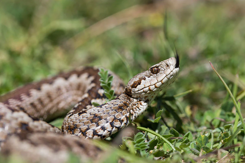
A close-up photograph of a Greek Meadow Viper showing its distinctive patterned scales, raised head, and dark tongue extended in low green grass.
A Greek Meadow Viper (Vipera graeca) in its natural habitat in the Pindos mountains.

Tzoumerka-Acheloos-Agrafa-Meteora National Park history and protected-area timeline

The current national park traces its origins to the establishment of the Tzoumerka-Peristeri-Arachthos National Park in 2009, which initially covered a more limited area focused on the Athamanian mountains, Mount Peristeri, and the gorge of the Arachthos river. This original park was Greece's response to growing recognition of the ecological importance of the central Pindus, particularly for raptors, large mammals, and endemic plants.

In 2018, the Greek state undertook a major restructuring of protected-area governance in central Greece, effectively extending and renaming the park to incorporate the forested Kóziakas massif, the largely untouched Agrafa mountains, the Antichasia range including Meteora, and Lake Plastiras. The new name, Tzoumerka-Acheloos-Agrafa-Meteora National Park, reflects this vastly expanded territory and unites previously fragmented conservation efforts under a single management framework.

The park is administered by a dedicated management body with headquarters in Ioannina, working in coordination with the surrounding municipalities and local communities. Visitor centers have been established in traditional villages such as Pramanta, Chouliarades, Agnanta, Vourgareli, Neraida, and Kallirroi, helping to integrate conservation with rural development and cultural tourism. This institutional evolution mirrors a broader shift in Greek conservation policy toward larger, landscape-scale protected areas connected through the Natura 2000 network.

Tzoumerka-Acheloos-Agrafa-Meteora National Park landscape and geographic character

The park's landscape is defined by the spine of the central Pindus Mountains and the river systems that descend from them. In the northwest rises the Lákmos massif, crowned by Mount Peristeri reaching above 2,200 meters, whose bare, windswept ridges give way gradually to pastoral landscapes traditionally used for transhumant grazing. The massif is the cradle of the Acheloos, one of the longest rivers in Greece, whose upper valley forms a defining corridor through the protected area.

To the south and east stretches the Athamanian range, the Tzoumerka mountains, dominated by the peak of Kakarditsa. Running roughly north to south for about 40 kilometers, the Tzoumerka range creates a natural boundary between Epirus and Thessaly, with steep slopes, deep ravines, and traditional stone villages perched on terraced hillsides. Its southern edge meets the shores of the large artificial Lake Kremasta, which marks the boundary of the protected area.

Further east and south, the Agrafa highlands offer a wilder, more sparsely populated terrain, with Voutsikáki as one of the prominent summits. Between the Acheloos and Pineios valleys, the Kóziakas massif forms a heavily forested transitional zone. The Antichasia range in the northeast hosts the Meteora complex, where sandstone and conglomerate pillars rise abruptly from the surrounding plain, creating one of the most distinctive rock landscapes in Europe. The artificial Lake Plastiras, nestled among wooded hills, softens the park's predominantly mountainous profile with open water and managed shoreline habitats.
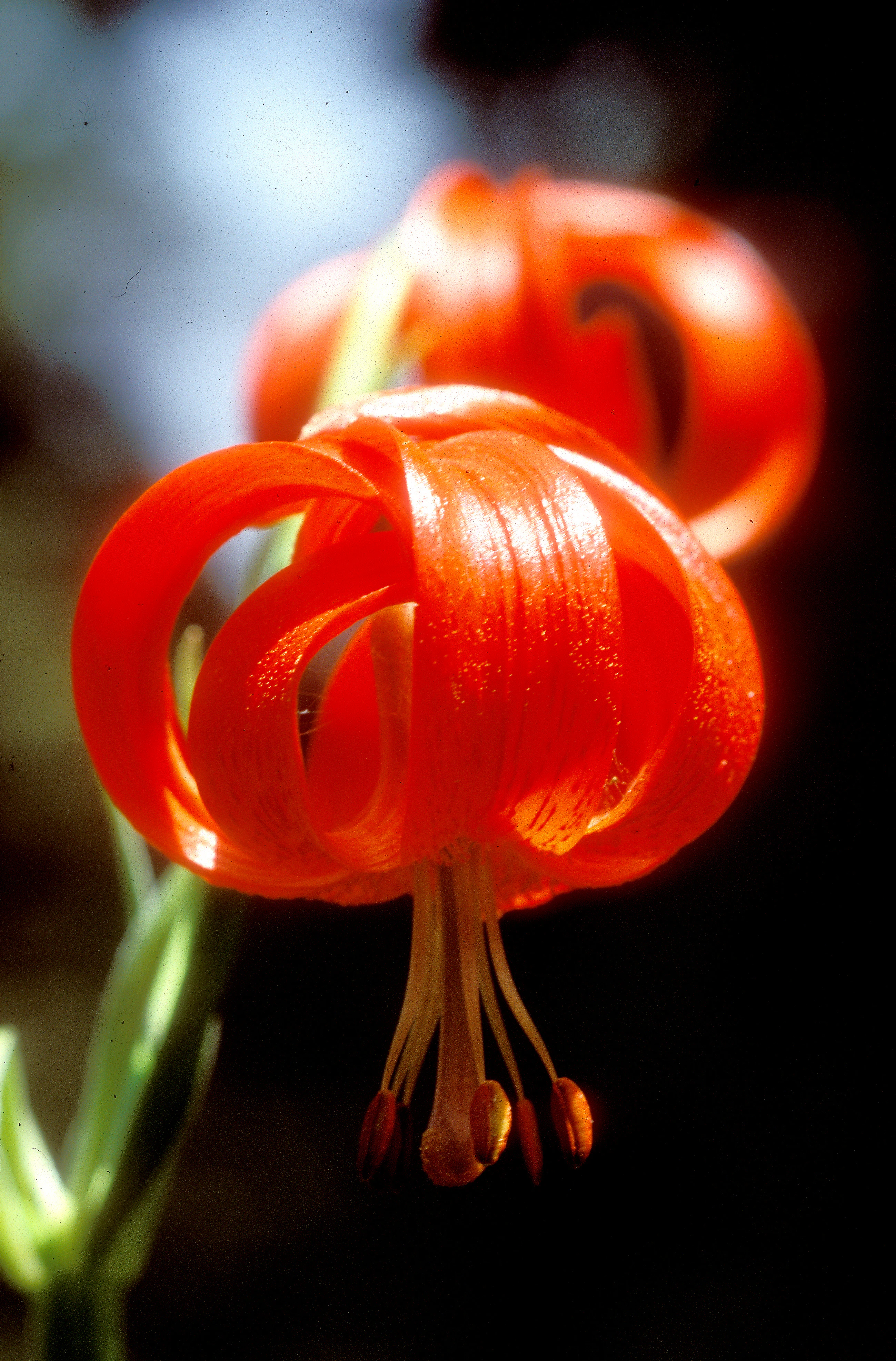
A close-up of a bright red Turk's cap lily flower with recurved petals and prominent stamens against a dark, blurred background.
A close-up view of a vibrant red Lilium chalcedonicum, known as the Chalcedonian lily, in its natural environment.

Tzoumerka-Acheloos-Agrafa-Meteora National Park ecosystems, habitats, and plant life

Ecologically, the park encompasses a vertical gradient that spans Mediterranean broadleaf forests at lower elevations through montane beech and oak woodlands, subalpine grasslands, and rocky alpine zones near the summits. The Athamanian mountains and Kóziakas massif carry the most extensive forest cover, while the higher Lákmos and Agrafa ridges remain comparatively open, supporting rich meadow and heath communities.

River valleys are a defining ecological feature. The upper Acheloos, the Arachthos and its tributaries (Kallaritikos, Metsovitikos), and the headwaters of the Pineios in the Thessalian sector create linear freshwater corridors through the park. These systems, combined with Lake Plastiras, sustain fish populations adapted to western Greek river systems as well as wetland-edge habitats that concentrate waterbird and amphibian diversity. Gorges cut by the Arachthos add microclimatic habitats of high botanical value.

The park's flora includes more than 700 recorded plant species, with around twenty endemics restricted to the Pindus or to Greece more broadly. Among these are hawkweeds, knapweeds, and campanulas tied to specific mountain massifs, alongside broader Greek and Balkan endemics such as the Chalcedonian lily. Two knapweed species of the Meteora and Antichasia rocks are particularly noteworthy for their extremely narrow ranges and vulnerability to disturbance.
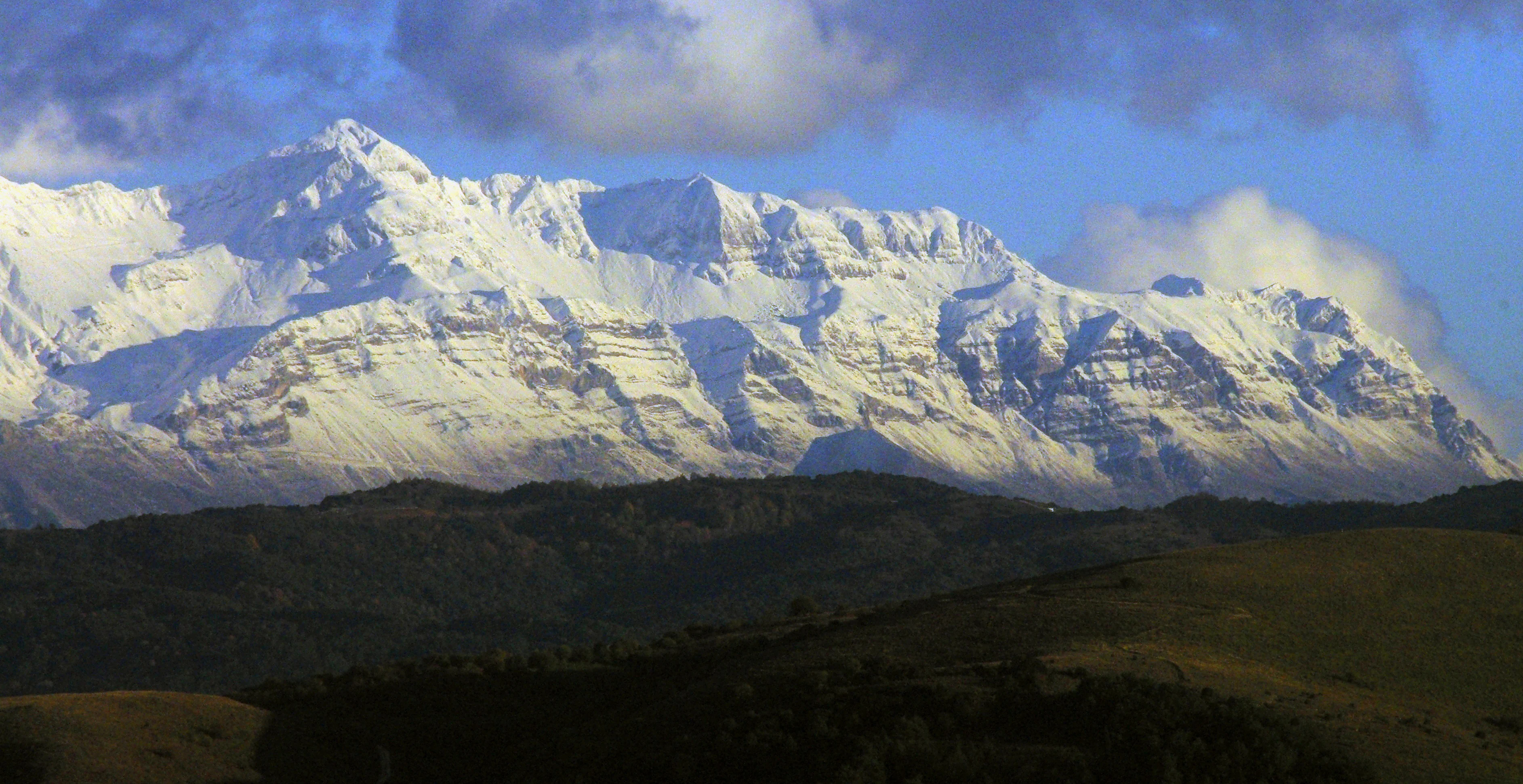
Panoramic view of a jagged, snow-covered mountain range towering above dark green foothills under a partially cloudy blue sky.
The snow-capped peaks of the Athamanika mountain range in the Tzoumerka region.

Tzoumerka-Acheloos-Agrafa-Meteora National Park wildlife and species highlights

Wildlife is one of the park's most prominent strengths, especially for birds. More than 160 bird species have been recorded, including 36 raptors, among them golden eagle, Bonelli's eagle, short-toed snake eagle, European honey buzzard, peregrine falcon, and griffon vulture. The Egyptian vulture, a globally threatened species, remains present in the northern half of the park, and the rocky partridge persists as a near-threatened upland gamebird.

Mammals are similarly significant. Around 30 species inhabit the park, representing more than a quarter of Greece's mammal fauna. Brown bears occupy the western forests at the southwestern edge of their national range, while wildcats and Balkan chamois find refuge in the more remote uplands. Eighteen bat species have been documented in the Meteora area alone, with the Melissotrypa cave hosting several of them, alongside a rich assemblage of endemic cave invertebrates.
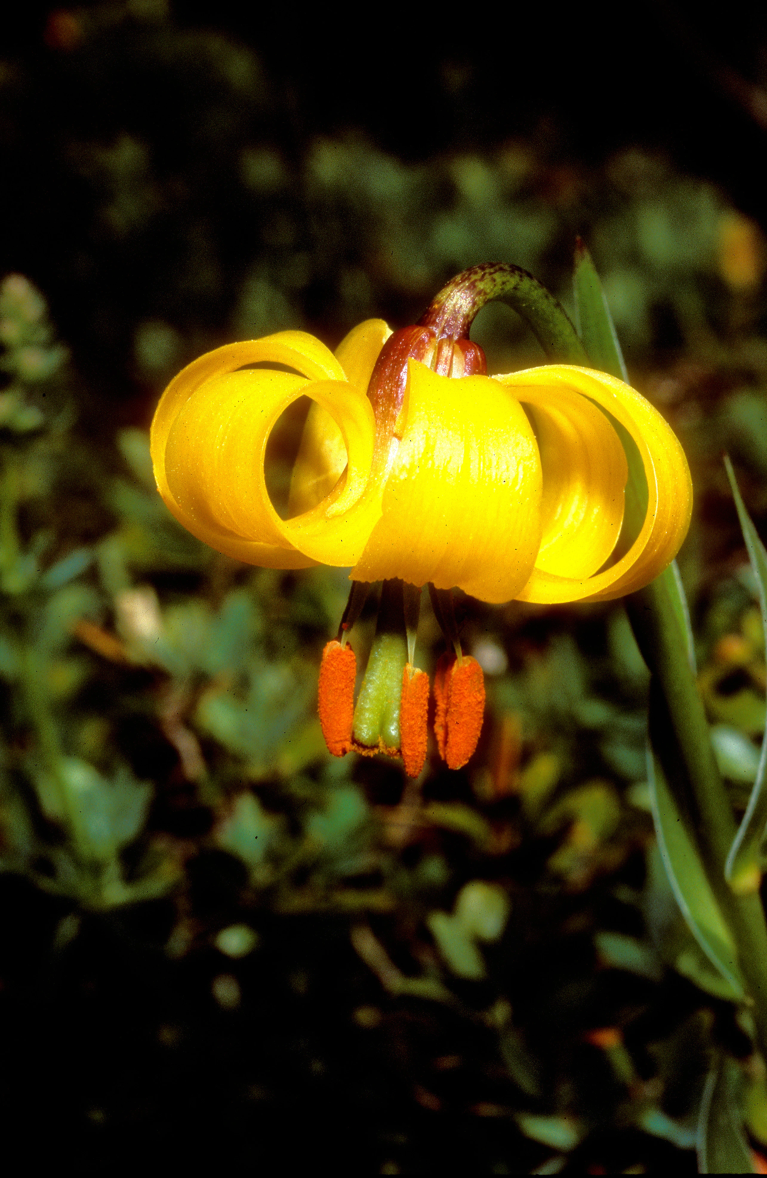
A close-up photograph of a vibrant yellow, downward-facing Albanian lily flower with curved petals and orange-tipped stamens, set against a dark, out-of-focus green background.
An Albanian lily, Lilium albanicum, in its natural mountain habitat.

Tzoumerka-Acheloos-Agrafa-Meteora National Park conservation status and protection priorities

Conservation in the park operates on overlapping international and national scales. Thirteen sites within its area are designated as Special Protection Areas for birds and Special Areas of Conservation under the European Natura 2000 network, highlighting the park's role in protecting habitats and species of EU importance. Six of these areas are also listed as Important Bird and Biodiversity Areas by BirdLife International, acknowledging their priority status for raptor and forest bird conservation.

The management body based in Ioannina coordinates protection, monitoring, visitor infrastructure, and engagement with local communities through information centers in mountain villages. The park is also a refuge for species of special concern, including the Greek viper (endemic to the Pindus and recently recognized as a distinct species), Hermann's tortoise, European otter, and the Apollo butterfly. Endemic freshwater fish in the Acheloos and Arachthos basins, along with threatened plant species like Centaurea lactiflora and Centaurea kalambakensis of the Meteora rocks, give the park a disproportionate share of Greece's narrow-range conservation responsibility.

Tzoumerka-Acheloos-Agrafa-Meteora National Park cultural meaning and human context

The park's cultural identity is inseparable from its geography. Historic stone villages of the Tzoumerka and Agrafa mountains preserve a tradition of pastoral life, transhumant shepherding, and vernacular architecture that has long shaped these uplands. Communities such as Pramanta, Chouliarades, Agnanta, Vourgareli, Neraida, and Kallirroi serve as gateways to the protected landscapes and host the park's visitor centers.

The Meteora complex adds a globally recognized cultural layer, with Orthodox monasteries built atop soaring rock pillars since the Byzantine era and now a UNESCO World Heritage Site. This juxtaposition of remote mountain pastoralism and world-famous monastic heritage gives the park a distinctive dual character: a working rural landscape sustained for centuries and a globally iconic spiritual and architectural landmark. Greek environmental management increasingly treats these communities and traditions as integral to the long-term viability of the protected area itself.
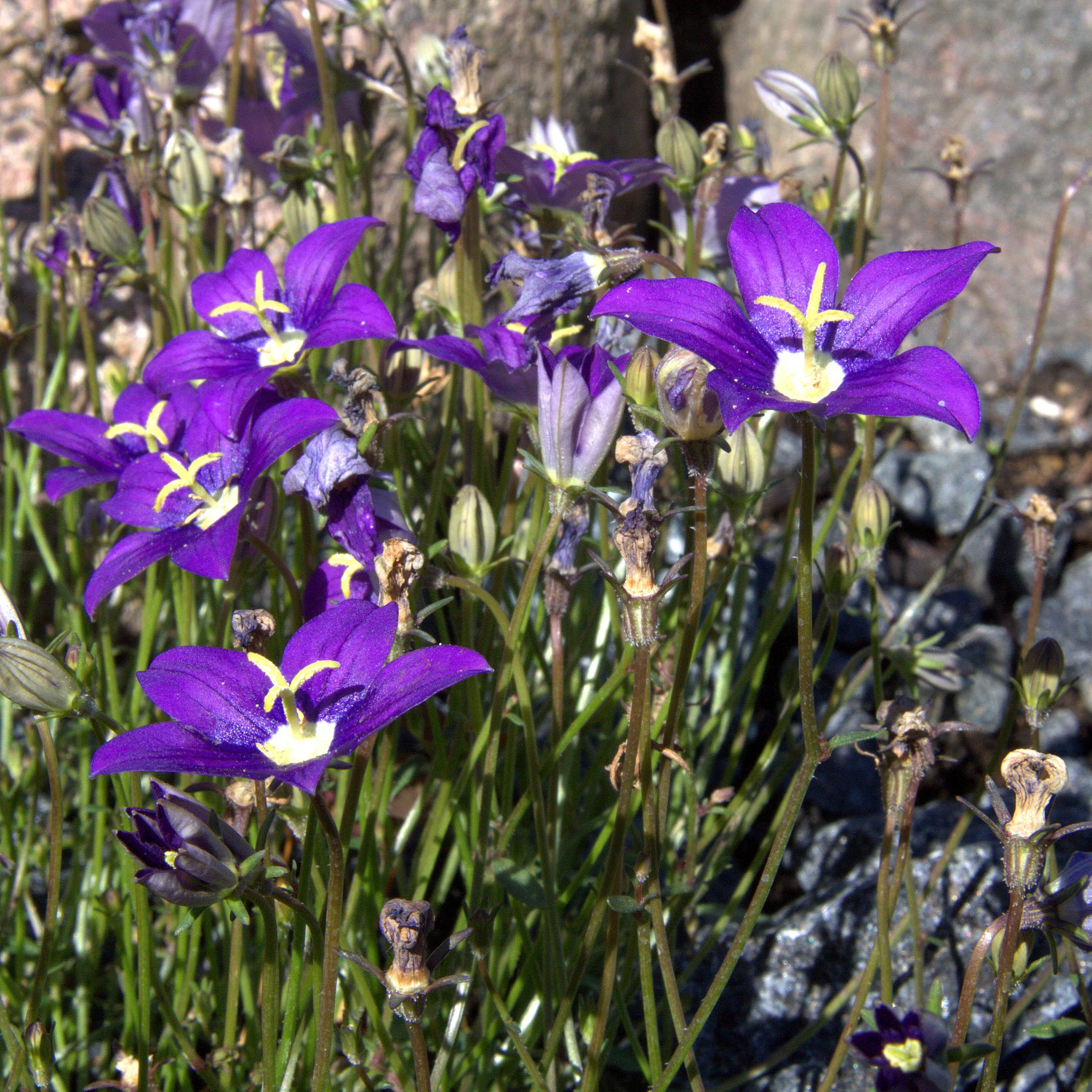
A close-up shot of several bright purple Campanula hawkinsiana flowers with yellow centers growing in a rocky alpine environment.
The vibrant purple Campanula hawkinsiana, a species endemic to the mountain ranges of the Tzoumérka-Achelóos-Ágrafa-Météores National Park.

Top sights and standout views in Tzoumerka-Acheloos-Agrafa-Meteora National Park

Tzoumerka-Acheloos-Agrafa-Meteora combines three of central Greece's most compelling assets in a single framework: the high Pindus mountain wilderness of Lákmos, Tzoumerka, and Agrafa; the dramatic rock and monastery complex of Meteora; and the freshwater landscapes of the upper Acheloos valley and Lake Plastiras. Among these, the Athamanian mountains and the Arachthos gorge stand out for their combination of scenery, biodiversity, and traditional settlement patterns.

The park is also distinguished by its ecological density. Few protected areas in Europe encompass such a concentration of breeding raptors, a population of brown bears near the edge of their range, endemic freshwater fish restricted to western Greek rivers, and a remarkable catalog of Pindus-endemic plants, all set within one continuous conservation strategy. The inclusion of Meteora brings a cultural weight that complements, rather than competes with, the natural values, making the park a model of integrated landscape protection in Greece.
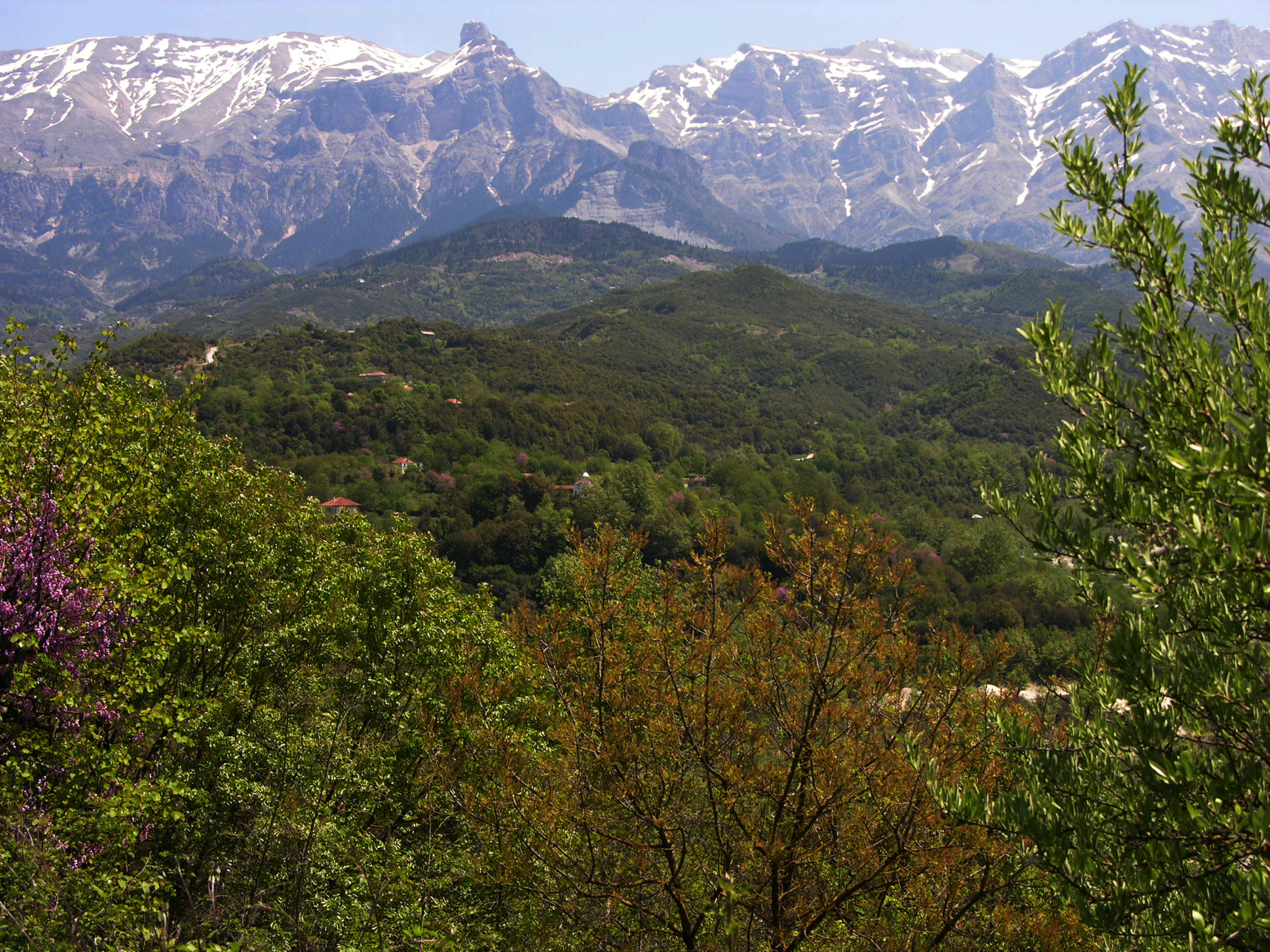
A panoramic view of snow-capped mountains above a dense, green forested valley in the Pindus mountain range.
A scenic view of the Tzoumerka mountains in the Pindus range.

Best time to visit Tzoumerka-Acheloos-Agrafa-Meteora National Park

Spring and early summer are generally the most rewarding periods to experience the park's natural character. From late April through June, wildflowers peak across the meadows and forest edges, the rivers run full from snowmelt, and raptor activity is at its most visible as birds establish breeding territories along the cliffs of Tzoumerka, Agrafa, and Meteora.

Late summer and early autumn bring stable weather, clearer mountain views, and warmer conditions around Lake Plastiras, though higher peaks can feel exposed and some upland trails become dry. Winter transforms the higher parts of the Pindus into a snowy landscape, with potential access limitations and shorter daylight hours, while lower villages and Meteora remain accessible year-round. For visitors interested in birdlife, late spring is particularly favorable, while those drawn to the cultural landscape of Meteora may find the cooler shoulder seasons more comfortable for exploring the rock formations and monasteries.
Monthly climate preview

Long-term temperature ranges and precipitation patterns across the representative coordinate

Parc national de Tzoumérka-Achelóos-Ágrafa-Météores Climate Normals and Weather by Month

Historical climate records outline the measured annual temperature rhythm and monthly precipitation averages recorded across the representative park coordinate. Examining the complete twelve-month normals provides detailed baseline data for tracking long-term weather variations within the protected area.
Annual mean10 °C
1 °C22 °C
Jan
Feb
Mar
Apr
May13°
Jun18°
Jul22°
Aug22°
Sep16°
Oct11°
Nov
Dec
Warmest month
July

21.7 °C

Coolest month
January

0.6 °C

Wettest month
December

2.8 mm/day

Driest month
July

0.7 mm/day

Park location guide

Geography guide, regional context, and park location map for Tzoumerka-Acheloos-Agrafa-Meteora National Park

Tzoumerka-Acheloos-Agrafa-Meteora National Park park geography, regions, and map view in Greece

Understand where Tzoumerka-Acheloos-Agrafa-Meteora National Park sits in Greece through a broader geographic reading of the surrounding landscape, nearby location context, and its mapped position within the national park landscape.

How Tzoumerka-Acheloos-Agrafa-Meteora National Park fits into Greece

Greece, officially the Hellenic Republic, is a country in Southeast Europe occupying the southern Balkans. It borders Albania, North Macedonia, Bulgaria, and Turkey, with coastlines on the Aegean, Ionian, and Mediterranean seas. The country has over 10 million people and is renowned for its ancient Greek heritage, philosophy, democracy, and the Olympic Games.

Wider geography shaping Tzoumerka-Acheloos-Agrafa-Meteora National Park in Greece

Greece occupies the southern tip of the Balkan peninsula in Southeast Europe. It shares land borders with Albania to the northwest, North Macedonia and Bulgaria to the north, and Turkey to the east. The Aegean Sea lies to the east of the mainland, the Ionian Sea to the west, and the Sea of Crete and Mediterranean Sea to the south. The country spans thousands of islands across nine traditional geographic regions and has the longest coastline in the Mediterranean basin.

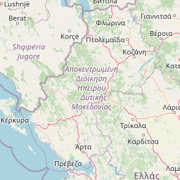
Map view of Tzoumerka-Acheloos-Agrafa-Meteora National Park

Use this park location map to pinpoint Tzoumerka-Acheloos-Agrafa-Meteora National Park in Greece, understand its exact geographic position, and read its mapped placement within the surrounding landscape more clearly.

Pigeon | © OpenStreetMap contributors

Location context for Tzoumerka-Acheloos-Agrafa-Meteora National Park

EpirusThessaly

Visual reference collection showcasing mountain terrain, deep river gorges, and protected habitats

Parc national de Tzoum rka-Achel os- Agrafa-M é tores Photos and Landscape Scenery

Visual records capture the rugged topography and diverse habitats of Parc national de Tzoum rka-Achel os- Agrafa-M é tores across the central Pindus Mountains. Photographic documentation reveals the geological formation of sandstone pillars, alpine ridges, and protected ecosystems.

A close-up photograph of a Greek Meadow Viper showing its distinctive patterned scales, raised head, and dark tongue extended in low green grass.

A low angle view of massive, vertical sandstone rock pillars at Meteora, Greece, featuring golden sunlight on the rock face and pink flowering trees in the foreground.

A close-up of a bright red Turk's cap lily flower with recurved petals and prominent stamens against a dark, blurred background.

Panoramic view of a jagged, snow-covered mountain range towering above dark green foothills under a partially cloudy blue sky.

A close-up photograph of a vibrant yellow, downward-facing Albanian lily flower with curved petals and orange-tipped stamens, set against a dark, out-of-focus green background.

A panoramic mountain range under a clear blue sky, viewed over a grassy alpine slope with earthy, reddish-brown tones.

A close-up shot of several bright purple Campanula hawkinsiana flowers with yellow centers growing in a rocky alpine environment.

A panoramic view of snow-capped mountains above a dense, green forested valley in the Pindus mountain range.

Panoramic landscape view overlooking a large, calm, turquoise lake with several tree-covered islands and green mountainous shores under a clear sky.

Close up of a tall, thin orchid stalk covered in distinctive purple and white flowers with long, trailing petals.

A downward-facing, bell-shaped Fritillaria graeca flower with dark purple and greenish-yellow petals, growing from a slender stem with long green leaves against a soft-focus green background.

Park atlas

Discover related protected areas and mountain landscapes across the surrounding region

Parks near Parc national de Tzoumérka-Achelóos-Ágrafa-Météores for Regional Comparison

Compare protected areas near Parc national de Tzoumérka-Achelóos-Ágrafa-Météores by examining adjacent mountain ranges, river valleys, and conservation zones. Expanding the geographic view helps trace regional ecological links across the Pindus highlands.
Watercolor illustration of a mountainous landscape with a river, forests, and distant hills
National parkGreece
About 38 km away#1 closest

North

Pindus National Park: A Protected Greek Mountain Wilderness with Ancient Forests

Explore its rugged terrain, biodiversity, and alpine landscape.

MoriAtlas presents Pindus National Park, a significant protected area in Greece known for its dramatic mountainous terrain, deep valleys, and ancient old-growth forests. This page details its geographic context, featuring rugged highland landscapes, serpentine soils, and vital habitats for species like the Eurasian brown bear. Understand its place within the Pindus mountain range and its importance as a mapped wilderness area for conservation.

Area
69.27 km²
Established
1966
IUCN
II
Relief
Mountain
National parkGreece
About 61 km away#2 closest

Northwest

Vikos-Aoös National Park: Deepest Gorge and Protected Mountain Landscape Atlas

Discover protected area boundaries and regional geography in Epirus.

Vikos-Aoös National Park in Greece's Pindus mountains is a premier destination for exploring dramatic natural geography. Best known for the Vikos Gorge, considered the world's deepest canyon relative to its width, the park also features towering alpine peaks like Mount Tymphe, glacial lakes such as Drakolimni, and rich botanical diversity. As a UNESCO Geopark and part of the Natura 2000 network, it safeguards critical habitats, including significant brown bear populations. This park offers a profound look into protected landscapes, offering detailed geographic context and mapped terrain for atlas-based discovery.

Area
126 km²
Established
1973
IUCN
II
Visitors
100K annual
A watercolor painting showing a river winding through a mountainous gorge with a stone arch bridge on the right bank.
National parkEpirus
About 61 km away#3 closest

Northwest

Northern Pindus National Park: A Geographic Survey of Mountain Landscapes in Epirus Greece

Mapped terrain, karst river gorges, and alpine forest ecosystems.

Northern Pindus National Park preserves an extensive mountain environment characterized by steep limestone ridges, the profound Vikos Gorge, and glacial lake basins. Located in the Pindus range of Epirus, this area offers deep insight into the intersection of geological processes, rare wildlife habitats, and traditional human settlements integrated into the mountainous terrain.

Area
157.4 km²
Established
2005
IUCN
II
Relief
Mountain
Protected areaAetolia-Acarnania
About 90 km away#4 closest

South

Lake Amvrakia Protected Area: Atlas of a Tectonic Freshwater Basin in Aetolia-Acarnania

Mapped geography of a unique karstic semipolje in western Greece.

Lake Amvrakia is a distinct tectonic basin located in western Greece. This protected area represents a complex karstic landscape formed in Mesozoic limestone, supporting diverse birdlife and endemic species. The geography reveals a stark contrast between agricultural eastern shores and the preserved riparian zones of the west, marking it as a significant case of human-environment interaction in the region.

Area
13.6 km²
Relief
Lowland
Climate
Mediterranean
Access
Access unknown
A soft, horizontal watercolor painting showing a serene landscape with a body of water in the foreground, surrounded by grasses and bushes, with rolling hills in the background.
Natural monumentVlorë County
About 95 km away#5 closest

Northwest

Blue Eye Natural Monument: Protected Karst Geography in Vlore County

A study of Albania's most prominent karst spring and woodland ecosystem.

The Blue Eye is a protected natural monument in southern Albania featuring a powerful, deep karst vent and vivid blue basin. This site acts as the headwater for the Bistrice River and supports a diverse forest ecosystem of oak and sycamore. The surrounding karst terrain and hydrology offer a focused look at the environmental geography of the Ionian watershed.

Area
1.8 km²
Established
1996
IUCN
III
Relief
Upland
Watercolor landscape painting showing a lake, distant mountains, and vegetation
National parkVlorë County
About 97 km away#6 closest

West

Butrint National Park: Archaeological Heritage and Mediterranean Wetland Landscape

Explore its unique geography and protected park boundaries.

Butrint National Park presents a singular opportunity for geographic and protected-area discovery, showcasing an unparalleled fusion of ancient history and ecological richness. Located in Albania's Vlorë County, this national park encompasses Lake Butrint, coastal lagoons, and vital wetland habitats, recognized internationally for their biodiversity. Through MoriAtlas, users can explore the mapped extent of this unique landscape, understand its role within regional geography, and uncover the interplay between its preserved archaeological sites and the surrounding Mediterranean environment.

Area
94.244 km²
Established
2000
IUCN
II
Relief
Lowland
Watercolor painting of a landscape with green fields, scattered trees, and rolling hills under a light sky
National parkGjirokastër County
About 106 km away#7 closest

Northwest

Fir of Hotovë-Dangëlli National Park: Ancient Forests & Mountain Wilderness Atlas

Explore a premier protected landscape in Gjirokastër County, Albania.

Fir of Hotovë-Dangëlli National Park stands as a monumental protected area, celebrated for its exceptional old-growth Hotova Fir forests, which are a rare Mediterranean plant relic. This national park in Gjirokastër County offers a detailed look at a vast mountainous terrain, featuring dramatic canyons like Lengarica Canyon, and serving as a critical habitat for diverse wildlife. MoriAtlas provides structured geographic context for this significant landscape, highlighting its mapped boundaries and role as a key component of regional protected area networks.

Area
360.038 km²
Established
2008
IUCN
II
Relief
Mountain
A soft watercolor painting of a coastal lagoon featuring dunes, grassy vegetation, and a distant treeline under a light sky.
Protected areaIonian Islands
About 112 km away#8 closest

West

Korission Lagoon Protected Area: Coastal Wetlands and Dune Geography in Corfu, Greece

A coastal landscape defined by sand dunes, freshwater, and juniper forests

Korission Lagoon represents a rare ecological convergence on the Ionian Islands, where a tall sand dune barrier separates a freshwater lagoon from the open sea. This protected area supports an intricate mosaic of reed beds and unique juniper woodlands, providing a crucial habitat for a vast array of bird species and endemic wildlife within the coastal plains of Corfu.

Area
4.27 km²
Relief
Lowland
Climate
Mediterranean
Access
Easy access

Common questions about visiting, size, designation, and location context for Tzoumerka-Acheloos-Agrafa-Meteora National Park

Tzoumerka-Acheloos-Agrafa-Meteora National Park FAQs for park facts, access, geography, and protected area context

Find quick answers about Tzoumerka-Acheloos-Agrafa-Meteora National Park, including protected-area facts, park geography, trail and visitor context, and how the park fits into its surrounding country and regional landscape.
MoriAtlas Explorer

Continue Your Protected Areas Search Across the Global Atlas

Deepen your exploration by continuing the structured search for national parks and protected areas worldwide. Utilize the comprehensive filtering capabilities to compare different conservation landscapes and refine your understanding of global park geography. Discover more about the distribution and characteristics of protected natural areas.

Global natural geography