
Mori Atlas logo
Nature reserveWadi al-Hujeir

Analyzing the geographic terrain and ancient forest heritage of this Southern Lebanon valley

Wadi al-Hujeir Nature Reserve: Mapping the Protected Mediterranean Woodland Landscapes

(Wadi al-Hujeir Nature Reserve)

Wadi al-Hujeir represents a vital protected area within the Jabal Amil highlands of Southern Lebanon. This valley spans 26 square kilometers, featuring a dense mosaic of 300-year-old olive groves and native Valonia oak forests. The landscape demonstrates a complex intersection of historic Mediterranean agroforestry, steep slope terrain, and deep-rooted cultural significance within the Nabatieh District.

nature reservevalleyancient olive grovesValonia oak forestsemi-Mediterranean woodlandSouthern Lebanon
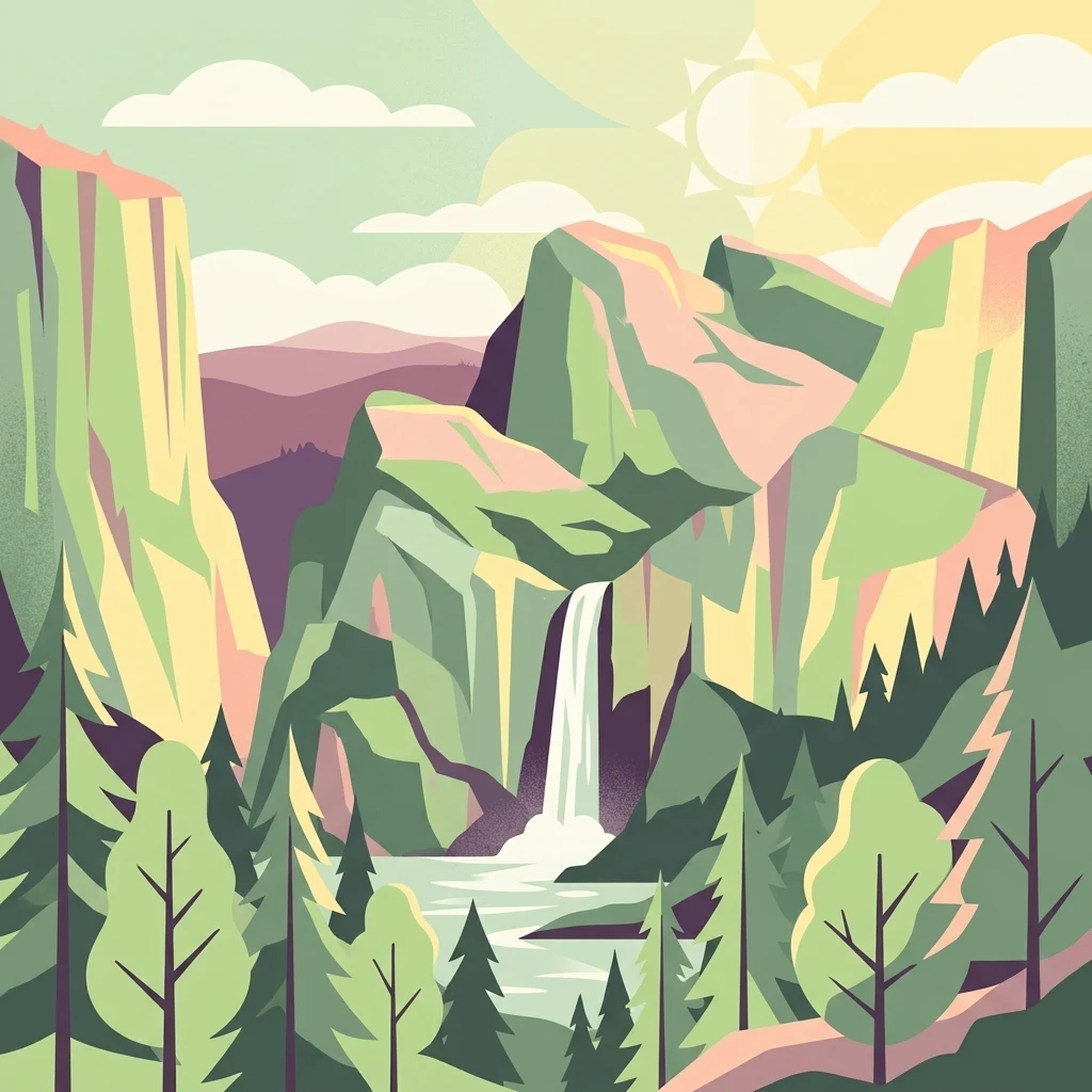
A graphic illustration depicting a valley with steep, stylized rock cliffs, a waterfall dropping into a pool, and surrounding pine trees under a stylized sun.

Wadi al-Hujeir

Nature reserve

Park overview

Structured park overview, official facts, and landscape profile for Wadi al-Hujeir

Wadi al-Hujeir park facts, protected area profile, and essential visitor context

Review the core facts for Wadi al-Hujeir, including designation, size, terrain, visitor scale, habitats, and operating context in one park-focused overview.

About Wadi al-Hujeir

Wadi al-Hujeir occupies a central position in the Jabal Amil region of Southern Lebanon, where the country's mountainous terrain gives way to a system of valleys that have long supported agriculture, settlement, and trade. Designated as a nature reserve by law in 2010, the valley covers an area of approximately 26 square kilometers and spans three administrative districts: Nabatieh, Bint Jbeil, and Marjeyoun.

Ecologically, the reserve is notable for the continuity and age of its tree cover. Ancient olive groves, with individual trees estimated to reach 300 years in age, form a cultural-natural layer that connects the landscape to centuries of traditional farming. Complementing these groves are forests of Valonia oak, a Mediterranean deciduous species valued both ecologically and historically for its tannin-rich acorn cups. Emerging carob plantations add a further dimension, linking contemporary land use to the area's deep-rooted relationship with hardy, drought-adapted tree crops.

Beyond its natural assets, Wadi al-Hujeir holds a prominent place in Lebanese historical memory. In the early twentieth century, the valley served as a gathering point for political resistance during the French Mandate, and in the early twenty-first century it became a focal point of the Israeli–Lebanese conflict. These layers of history sit alongside the reserve's environmental purpose, giving the valley a distinct identity that combines ecological protection, cultural heritage, and regional significance.

Quick facts and research context for Wadi al-Hujeir

Wadi al-Hujeir is a nature reserve in Southern Lebanon, established by law in 2010 and extending across parts of the Nabatieh, Bint Jbeil, and Marjeyoun districts in the Jabal Amil region.

Its protected landscape of roughly 26 square kilometers features old-growth olive groves, Valonia oak forests, and developing carob cultivation, making it a key site for semi-Mediterranean woodland conservation in Lebanon.

Protection and recognition

Documented terrestrial protection scope, designation timeline, and official recognition records

Wadi al-Hujeir Protection Status and Designated Conservation History

Wadi al-Hujeir maintains a documented terrestrial protection scope established in the year 2010. Structured conservation records provide official designation history and management parameters for international atlas research.

Protection details

Protection scope
Terrestrial
Designated year
2010
Transboundary protection
No
Park context

Deeper park guide and search-rich context for Wadi al-Hujeir

Wadi al-Hujeir history, landscape, wildlife, and travel context

Explore Wadi al-Hujeir through its history, landscape character, ecosystems, wildlife, conservation priorities, cultural context, and seasonal travel timing in a structured park guide built for atlas discovery and search intent.

Why Wadi al-Hujeir stands out

Wadi al-Hujeir is primarily recognized for its ancient olive trees and Valonia oak forests, which together define the valley's ecological character and its identity as a Mediterranean woodland reserve.
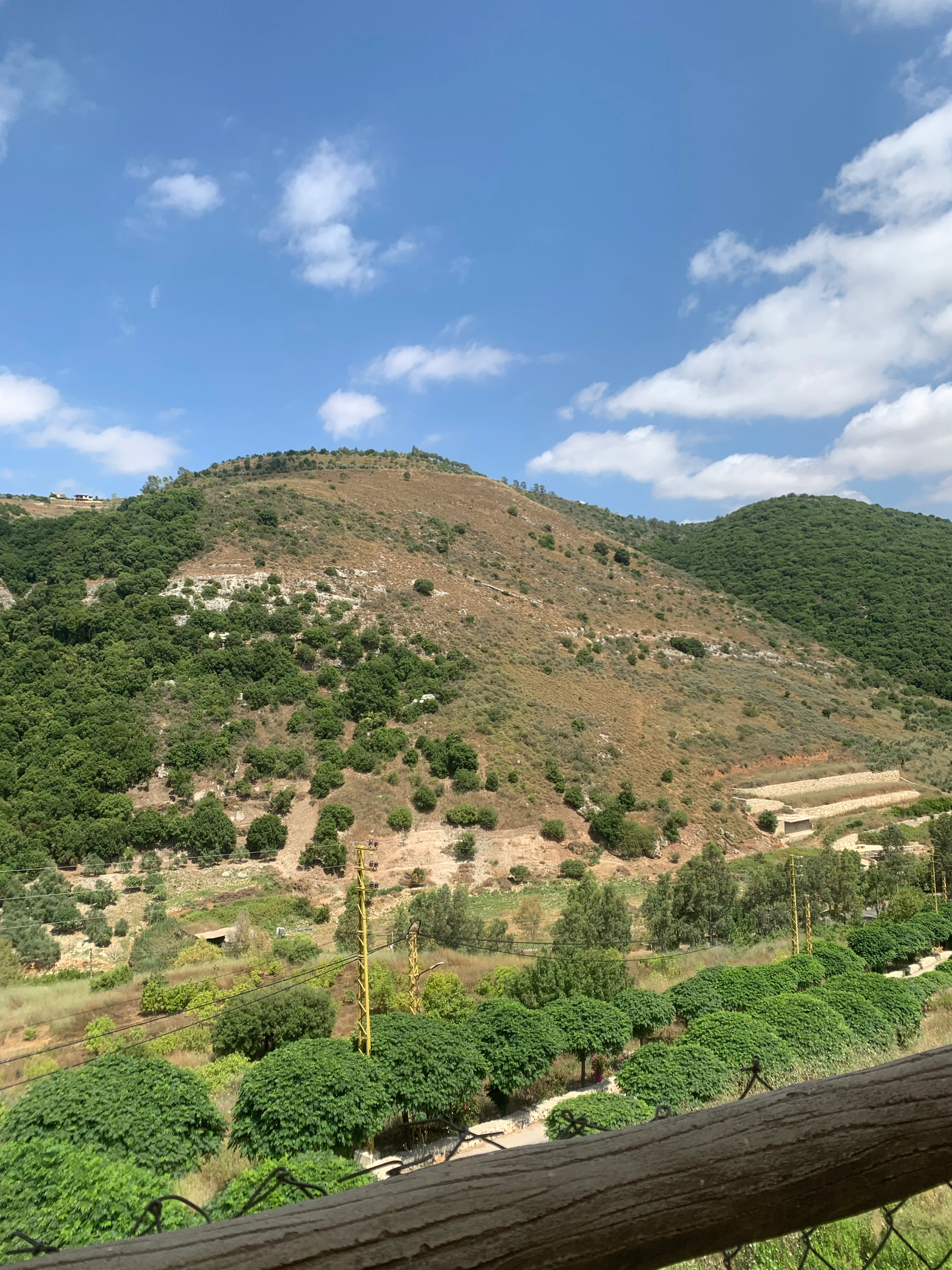
A wide shot looking across a valley toward rolling hills covered in shrubs, trees, and terraced agricultural sections under a bright blue sky.
A scenic view of the verdant hills and terraced landscapes within Wadi al-Hujeir, Southern Lebanon.

Wadi al-Hujeir history and protected-area timeline

The history of Wadi al-Hujeir extends well beyond its formal designation as a nature reserve. In the aftermath of the French occupation of Lebanon and Syria in 1920, the valley hosted a conference of anti-French revolutionaries organized by Abd al-Husayn Sharaf al-Din. The gathering called for resistance against French colonial forces and for participation in the wider Arab Revolt. Sharaf al-Din used the occasion to emphasize the importance of unity and mutual respect between Christian and Muslim communities, leaving the valley a place associated with both political mobilization and cross-confessional solidarity.

In the early twenty-first century, the valley was drawn into the wider Israeli–Lebanese conflict. During the final phase of the 2006 Lebanon War, Wadi al-Hujeir and the adjacent Wadi Saluki became the site of a major battle as part of Operation Change of Direction 11. The fighting centered on Hezbollah's effort to halt an Israeli advance toward the Litani River, with intense engagements that resulted in significant Israeli casualties and the destruction of multiple Merkava tanks. The episode earned the valley the grim label of the 'Merkava graveyard', reflecting both its strategic position and the scale of armored losses suffered there.

In 2010, recognizing the valley's ecological value and its ancient olive and oak woodlands, the Lebanese government formally declared Wadi al-Hujeir a nature reserve. This designation marked a shift toward protecting the area's natural heritage while preserving a landscape already shaped by centuries of human activity and historical events.

Wadi al-Hujeir landscape and geographic character

Wadi al-Hujeir lies within the hilly terrain of Jabal Amil in Southern Lebanon, an area where ridges, valleys, and seasonal streams define the regional geography. The reserve itself follows the course and surrounding slopes of a major valley, producing a mix of valley floor, mid-slope woodland, and elevated terrain that together create varied microhabitats within a relatively compact area.

The landscape is shaped by long-established tree cover. Olive groves occupy significant portions of the terrain, with mature trees contributing to a patchwork of cultivated and semi-wild vegetation. Above and around them, Valonia oak forests climb the slopes, lending the valley a distinctly Mediterranean character. Carob cultivation, still developing in parts of the reserve, further integrates human land use into the natural topography, reflecting an environment where agriculture and wild vegetation coexist across centuries.

Wadi al-Hujeir ecosystems, habitats, and plant life

The ecological identity of Wadi al-Hujeir is rooted in its semi-Mediterranean woodland systems, which combine elements of cultivation, ancient forest, and recovering vegetation. The valley's olive groves are not merely agricultural features; they represent living archives of tree genetics, with individuals potentially several centuries old. Valonia oak forests add a distinctive deciduous layer, producing shaded canopies that support a wide range of associated plant and animal communities in a region where such woodland is increasingly rare.

Carob plantations, though newer in the reserve's management, reflect an effort to extend traditional agroforestry practices. Together these vegetation types form a mosaic that provides habitat continuity across the valley, linking ancient trees to active land use and giving the protected area a strong sense of ecological resilience rooted in long-term human stewardship.

Wadi al-Hujeir conservation status and protection priorities

The 2010 designation of Wadi al-Hujeir as a nature reserve reflects recognition of its ecological importance within the broader context of Southern Lebanon. The reserve places formal protection around ancient olive groves, Valonia oak forests, and emerging carob cultivation, encompassing a landscape where traditional Mediterranean woodland is increasingly threatened by development, land-use change, and conflict-related pressures.

By safeguarding these habitats under a single legal framework, the reserve helps maintain habitat continuity for native flora and fauna while preserving cultural-natural landscapes shaped by centuries of human activity. The focus on oak and olive woodlands gives it a particular conservation value, as such mature Mediterranean tree systems are rare and slow to regenerate if lost.

Wadi al-Hujeir cultural meaning and human context

Wadi al-Hujeir is deeply embedded in the cultural identity of Jabal Amil and Southern Lebanon. Its ancient olive groves, some maintained across multiple generations, link the valley to long-standing traditions of Mediterranean agriculture. The 1920 conference held at the site, organized by Abd al-Husayn Sharaf al-Din, gave the valley a place in the political and social memory of the region, particularly as a symbol of resistance and of Christian-Muslim solidarity during the French Mandate period.

The valley's more recent wartime history has further shaped how it is perceived locally, reinforcing its significance as a landscape where natural heritage, agricultural tradition, and political memory intersect.

Top sights and standout views in Wadi al-Hujeir

The protected olive groves of Wadi al-Hujeir, with trees estimated to reach 300 years in age, stand among the reserve's defining features, alongside extensive Valonia oak forests that give the valley its Mediterranean woodland character.

The valley also stands out for its layered human history. From the 1920 anti-French resistance conference to its role as a battlefield in 2006, Wadi al-Hujeir combines ecological value with strong regional and political significance, making its 2010 nature reserve designation particularly meaningful.
Monthly climate preview

Long-term representative monthly temperature ranges and precipitation rhythm for Wadi al-Hujeir

Wadi al-Hujeir Climate Normals, Annual Temperature and Precipitation Patterns

Representative coordinates record measured long-term monthly temperatures alongside shifting precipitation averages across twelve distinct periods for Wadi al-Hujeir. Detailed monthly climate normals provide deeper statistical context regarding annual temperature variation and rainfall distribution.
Annual mean16 °C
7 °C25 °C
Jan
Feb
Mar10°
Apr14°
May19°
Jun23°
Jul25°
Aug25°
Sep23°
Oct19°
Nov13°
Dec
Warmest month
July

24.6 °C

Coolest month
January

6.8 °C

Wettest month
January

3.1 mm/day

Driest month
July

0 mm/day

Park location guide

Geography guide, regional context, and park location map for Wadi al-Hujeir

Wadi al-Hujeir park geography, regions, and map view in Lebanon

Understand where Wadi al-Hujeir sits in Lebanon through a broader geographic reading of the surrounding landscape, nearby location context, and its mapped position within the national park landscape.

How Wadi al-Hujeir fits into Lebanon

Lebanon is a unitary parliamentary republic under confessionalism with a population of over 5 million. Located on the Mediterranean coast at the crossroads of ancient trade routes, it has a diverse religious composition with Islam and Christianity as the main faiths. The country has historical roots dating to Phoenicia and has been ruled by Romans, Byzantines, Ottoman Empire, and France.

Wider geography shaping Wadi al-Hujeir in Lebanon

Lebanon is located in the Levant region of West Asia on the eastern Mediterranean coast. It is bordered by Syria to the north and east, Israel to the south, and the Mediterranean Sea to the west. The country has a small territory of 10,452 square kilometres, with a narrow coastal plain and mountainous interior including the Lebanon Mountains.

Map view of Wadi al-Hujeir

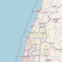
Use this park location map to pinpoint Wadi al-Hujeir in Lebanon, understand its exact geographic position, and read its mapped placement within the surrounding landscape more clearly.

Pigeon | © OpenStreetMap contributors

Location context for Wadi al-Hujeir

Bint Jbeil DistrictMarjeyoun DistrictNabatieh District

Explore valley terrain, ancient olive groves, and Valonia oak woodland imagery.

Wadi al-Hujeir Photos and Landscapes: Visual Guide to Southern Lebanon Reserve

Visual records capture the rugged topography and semi-Mediterranean woodland habitats defining Wadi al-Hujeir. Photographic documentation reveals the intricate mosaic of ancient groves and valley slopes shaping the protected area.

A wide shot looking across a valley toward rolling hills covered in shrubs, trees, and terraced agricultural sections under a bright blue sky.

Park atlas

Discover other protected areas and regional reserves near Jabal Amil

Parks Near Wadi al-Hujeir and Related Protected Landscapes to Compare

Browsing other parks near Wadi al-Hujeir reveals connected Mediterranean woodland terrain and comparable highland geography across Southern Lebanon. Comparing these protected areas provides broader regional context for valley habitats, ancient oak forests, and shared ecological patterns.
Biosphere reserveLebanon
About 19 km away#1 closest

Northeast

Jabal Rihane Biosphere Reserve: Exploring Lebanon's Protected Mountainous Geography

Discover mapped boundaries and regional landscape context.

Jabal Rihane Biosphere Reserve is a protected natural area vital to Lebanon's conservation efforts. Situated in the mountainous north, it showcases the region's characteristic terrain and Mediterranean hillside environments. Understanding Jabal Rihane's geographic identity through its mapped boundaries and ecological role provides crucial context for exploring Lebanon's protected lands and natural heritage within the eastern Mediterranean.

Area
184.3 km²
Established
2007
IUCN
VI
Relief
Mountain
Watercolor painting with green, pink, yellow, and white areas depicting terrain and water
National parkIsrael
About 20 km away#2 closest

Southeast

Hurshat Tal National Park: Ancient Valonia Oak Forest and Protected Landscape Identity

Explore mapped boundaries and geographic context in Israel's Hula Valley.

Hurshat Tal National Park is a protected area in northern Israel’s Hula Valley, distinguished by its extraordinary grove of ancient Valonia oak trees, some dating back 350 to 400 years. This site offers a rare look at a living forest heritage, serving a dual role as a crucial nature conservation zone and a popular family recreational destination with facilities like accommodation and swimming areas, making it a unique feature on any park atlas.

Area
0.765 km²
Established
1968
IUCN
V
Relief
Lowland
Nature reserveLebanon
About 22 km away#3 closest

West

Tyre Coast Nature Reserve: Lebanon's Protected Nature Reserve Geography and Atlas Mapping

Discover the mapped natural landscape and regional context.

Tyre Coast Nature Reserve represents a distinct protected area within Lebanon, offering a unique focus for geographic exploration. This entry provides detailed insights into its mapped boundaries, situating it within the broader natural landscape and regional geography of the country. Engage with the structured atlas data to understand the specific protected land identity and geographic characteristics of this nature reserve.

Area
3.8 km²
Established
1998
Relief
Lowland
Climate
Mediterranean
National parkGolan Heights
About 25 km away#4 closest

East

Hermon National Park: National Park with Distinct Protected Landscape in Golan Heights

Explore its mapped boundaries and regional geographic context.

Hermon National Park is a designated national park contributing to the rich tapestry of protected landscapes within the Golan Heights. This entity offers a focused entry into understanding its specific geographic setting, mapped terrain, and its significance as a protected area. Users can explore the natural features and regional context that define Hermon National Park, enhancing their atlas-based discovery of Israel's conservation lands.

IUCN
V
Watercolor illustration of green mountains, a river, and trees with distant hills under a yellow sky
National parkIsrael
About 26 km away#5 closest

East

Nimrod Fortress National Park: Protected Landscape and Geographic Context in Israel

Explore the mapped boundaries and natural terrain of this Israeli national park.

Nimrod Fortress National Park is a protected area in Israel offering a unique lens through which to explore its regional geography and landscape character. This atlas-focused presentation details the park's protected status and its place within the broader mapped terrain. Understand the significance of its geographic setting and the extent of its protected boundaries for landscape discovery.

Relief
Mountain
Access
Easy access
Scope
Terrestrial
Water
Minor water
National parkIsrael
About 29 km away#6 closest

South

Bar'am National Park: Preserving Ancient Jewish Heritage and Galilee Landscape

Explore significant Talmudic-era synagogues and borderland geography.

Bar'am National Park is an important archaeological site in Israel's upper Galilee, renowned for its remarkably preserved ancient Jewish synagogues dating to the Talmudic period. These structures represent significant tangible evidence of Jewish religious life and architectural styles from late antiquity. Situated amidst the rolling hills of the Galilee countryside, the park's landscape offers a unique combination of historical reflection and scenic views towards the Lebanese border, making it a key destination for understanding regional heritage and geography.

Relief
Upland
Access
Moderate access
Scope
Terrestrial
Water
No major water
National parkIsrael
About 34 km away#7 closest

South

Tel Hazor National Park: Protected Landscape Details and Geographic Atlas Context

Explore the mapped boundaries and regional character of this Israeli national park.

Tel Hazor National Park is a protected national park entity situated within the geography of Israel. This page provides detailed information on its protected landscape, emphasizing its mapped boundaries and contribution to regional natural landscape context. Discover the geographic identity of Tel Hazor National Park and its significance for atlas exploration of protected areas in the Levant.

Relief
Upland
Scope
Mixed
Water
Minor water
National parkIsrael
About 40 km away#8 closest

Southwest

Yehi'am Fortress National Park: National Park with Protected Landscape Identity in Israel

Discover its mapped geographic boundaries and regional landscape context.

Yehi'am Fortress National Park is a key protected area situated within the geographic landscape of Israel. This national park entry provides structured insights into its distinct natural features and its role as a mapped protected zone. Explore the regional context and unique geographic identity of Yehi'am Fortress National Park, contributing to a broader understanding of Israel's conservation landscapes.

Relief
Upland
Access
Moderate access
Scope
Terrestrial
Water
No major water

Common questions about visiting, size, designation, and location context for Wadi al-Hujeir

Wadi al-Hujeir FAQs for park facts, access, geography, and protected area context

Find quick answers about Wadi al-Hujeir, including protected-area facts, park geography, trail and visitor context, and how the park fits into its surrounding country and regional landscape.
MoriAtlas Explorer

Continue Your Protected Areas Search Across the Global Atlas

Deepen your exploration by continuing the structured search for national parks and protected areas worldwide. Utilize the comprehensive filtering capabilities to compare different conservation landscapes and refine your understanding of global park geography. Discover more about the distribution and characteristics of protected natural areas.

Global natural geography