

Mori Atlas logo
National parkWapusk National Park

Explore the mapped boundaries and protected landscape of Wapusk National Park in Manitoba.

Wapusk National Park: Manitoba National Park Protected Area & Geographic Context

Wapusk National Park represents a key protected natural landscape within the Canadian province of Manitoba. As a designated national park, it serves as a vital entity for geographic discovery, offering insights into mapped park boundaries and the regional landscape context. This park is central to understanding Manitoba's protected areas and contributes significantly to the broader atlas of Canadian natural environments, emphasizing its role in conservation and geographic mapping.

polar bearssubarctic wildernesspeatlandsmaternity densHudson Baycoastal tundra

Wapusk National Park

National park

Park overview

Structured park overview, official facts, and landscape profile for Wapusk National Park

Wapusk National Park park facts, protected area profile, and essential visitor context

Review the core facts for Wapusk National Park, including designation, size, terrain, visitor scale, habitats, and operating context in one park-focused overview.

About Wapusk National Park

Wapusk National Park protects one of Canada's most remote and ecologically significant subarctic landscapes. The park's location along the Hudson Bay coastline places it at the boundary between several distinct ecological zones, creating a complex and biologically important transition zone. The terrain consists primarily of flat to gently rolling muskeg and peatlands, interspersed with coastal marshes, beach ridges, and freshwater sedge meadows. Ancient glacial processes have shaped this landscape, leaving behind characteristic features such as moraines, eskers, and strand lines that influence contemporary habitat patterns. The underlying geology consists of Palaeozoic limestone and dolomite formations. The park's extreme remoteness contributes to its ecological integrity but also creates significant challenges for management and research. Climate change is profoundly affecting this ecosystem, with earlier sea ice breakup on Hudson Bay disrupting polar bear foraging patterns and forcing bears ashore with inadequate fat reserves. The park's management emphasizes ecological integrity monitoring and collaboration with Indigenous communities whose traditional territories encompass the region.

Quick facts and research context for Wapusk National Park

Wapusk National Park is located 45 kilometres south of Churchill, Manitoba, along the western shores of Hudson Bay. The park encompasses the Hudson Plains ecozone, a subarctic region dominated by wet peatlands and muskeg that overlays ancient limestone bedrock. It represents a critical intersection of three biomes: arctic tundra, marine coastal environments, and boreal forest. The park contains Cape Churchill, widely regarded as the world's premier location for observing and photographing wild polar bears in their natural habitat. The area has a rich human history spanning indigenous occupation and the fur trade era, with the park's territory traditionally belonging to the Cree of York Factory, Fox Lake, Sayisi-Dene, and Inuit communities.

Protection and recognition

Understanding the official conservation boundaries and legal frameworks governing the wilderness.

Documented Protection Status and Conservation Profile of Wapusk National Park

Researchers can verify the official protection status, management scope, and documented designation criteria established for Wapusk National Park. Accessing verified administrative records provides essential geographic context regarding how the ecological boundaries are officially preserved and monitored.

Protection details

Protection scope
Mixed
Transboundary protection
No
Park context

Deeper park guide and search-rich context for Wapusk National Park

Wapusk National Park history, landscape, wildlife, and travel context

Explore Wapusk National Park through its history, landscape character, ecosystems, wildlife, conservation priorities, cultural context, and seasonal travel timing in a structured park guide built for atlas discovery and search intent.

Why Wapusk National Park stands out

Wapusk National Park is best known as one of the most significant polar bear maternity denning areas in the world. The park's Cape Churchill area is internationally recognized as the premier location for viewing wild polar bears, offering visitors the extraordinary opportunity to observe these apex predators in their natural tundra environment. The park also protects critical habitat for declining caribou populations and supports remarkable bird diversity, with over 250 species documented. The subarctic peatland landscape, with its extensive muskeg and bog systems, represents a distinctive and ecologically important ecosystem type that is increasingly vulnerable to climate change impacts.

Wapusk National Park history and protected-area timeline

Wapusk National Park was established in 1996 as Canada's 37th national park, created specifically to protect the unique transitional ecosystem and the significant biodiversity it supports. The establishment of the park followed decades of ecological research documenting its importance as a polar bear maternity denning area and the discovery of remarkable biodiversity across plant and animal species. Prior to national park designation, the region had a long human history dating to indigenous occupation, with evidence of use by Cree and Chipewyan communities spanning centuries. During the fur trade era, the area lay between two major trading centres: York Factory and Prince of Wales Fort. In the mid-twentieth century, the Churchill Research Range conducted rocket launch testing in the region during the 1940s through 1980s. The park's creation was also influenced by the need to protect Cree traditional practices and knowledge. The 2017 management plan aims to strengthen Indigenous participation in park governance and incorporate traditional ecological knowledge into conservation strategies.

Wapusk National Park landscape and geographic character

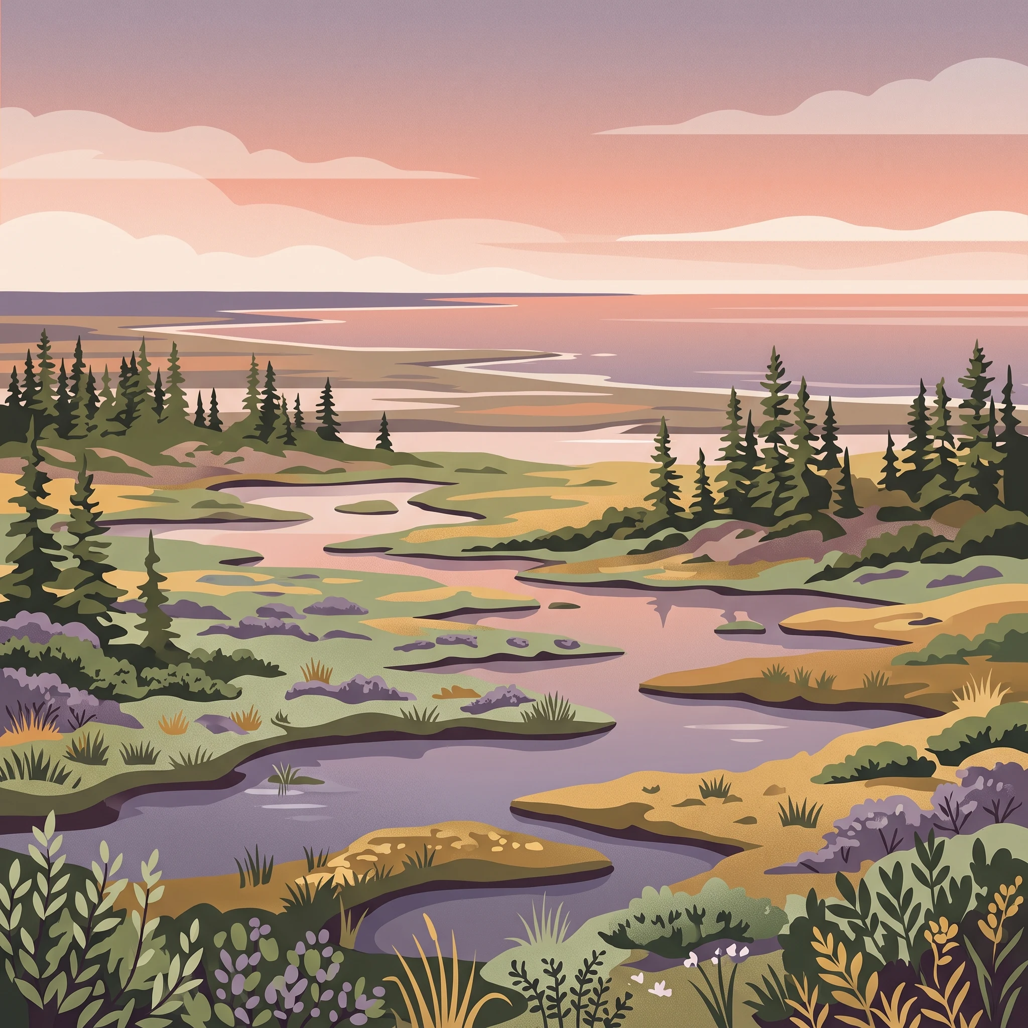
The physical landscape of Wapusk National Park is defined by its position within the Hudson Bay Lowlands, a vast subarctic wetland region. The terrain is predominantly flat and poorly drained, consisting of extensive muskeg and peat bog systems that cover approximately 27 percent of the park's surface. These peatlands, formed over millennia in the cold, wet subarctic climate, store significant carbon and provide unique habitat for specialized plant and animal species. The coastal zone features beach ridges, salt marshes, and freshwater sedge meadows that transition into the inland peatlands. Glacial deposits have created subtle topographic variation, with occasional moraines and eskers providing slightly elevated terrain. The landscape extends as far-reaching coastal plains that dip gently toward Hudson Bay. Summer brings a surprising contrast, with small stunted trees, wild berries, and ponds dotting the otherwise vast treeless tundra. The winter landscape transforms dramatically, with snow covering the peatlands and creating a stark white environment that polar bears traverse as they await the freeze-up.

Wapusk National Park ecosystems, habitats, and plant life

Wapusk National Park lies within the Hudson Plains ecozone, one of Canada's most extensive wetland regions. The park's ecological significance stems from its position as a transition zone between three major biomes: arctic tundra, marine coastal ecosystems, and boreal forest. This intersection creates diverse habitats supporting species adapted to each environment as well as species requiring the ecotone between them. The peatland ecosystems dominate the interior, with their unique hydrology supporting specialized vegetation adapted to waterlogged, nutrient-poor conditions. The coastal marshes and beach ridges provide important habitat for migratory birds and marine-influenced plant communities. The subarctic climate is characterized by cool temperatures, short summers, and long cold winters. Climate change is altering this ecosystem significantly, with warming temperatures affecting permafrost stability, vegetation composition, and the timing of seasonal events that many species depend upon.

Wapusk National Park wildlife and species highlights

Wapusk National Park supports remarkable wildlife diversity, with the park perhaps best known for its polar bear populations. The park serves as a critical maternity denning area, with pregnant females using the peatland terrain to excavate dens where they give birth in December or January, emerging with cubs in March. In summer, as Hudson Bay ice melts entirely, polar bears come ashore and wait on the tundra until freeze-up in November, providing the famous viewing opportunities at Cape Churchill. The park is also home to significant caribou populations, though these have declined substantially from approximately 500,000 in 1994 to around 288,000 in 2017. Birdlife is exceptionally diverse, with over 250 species documented, including significant populations of shorebirds and waterfowl. Notable species include short-billed dowitchers, snow geese, great grey owls, peregrine falcons, arctic loons, and Caspian terns. Grizzly bears have recently been documented expanding into the area, with seven individuals recorded between 2003 and 2008, representing a notable range shift likely linked to climate change.

Wapusk National Park conservation status and protection priorities

Wapusk National Park plays a critical role in protecting some of Canada's most ecologically significant subarctic habitats. The park was established specifically to preserve the unique transitional ecosystem between tundra, marine, and boreal environments, along with the significant biodiversity it supports. As a designated IUCN Category II protected area, the park prioritizes ecosystem preservation while permitting limited sustainable use. The park's Ecological Integrity Monitoring Program works to establish baseline data for monitoring climate change impacts and ecosystem restoration. Significant conservation challenges include the effects of climate change on polar bear denning success, earlier sea ice breakup disrupting foraging patterns, and warming temperatures affecting caribou populations and their lichen food sources. The park also addresses overpopulation of Lesser Snow Geese, a keystone species whose exploding populations are degrading vegetation and increasing water salinity. Management efforts include collaboration with Indigenous communities to incorporate traditional ecological knowledge and support collaborative caribou protection initiatives with forestry companies.

Wapusk National Park cultural meaning and human context

Wapusk National Park lies within the traditional territories of multiple Indigenous communities, including the Cree of York Factory First Nation, Fox Lake First Nation, Sayisi-Dene First Nation, and Inuit. These communities have maintained deep connections to the land for generations, relying on local species including rabbit, geese, caribou, and bears for sustenance. Traditional practices included techniques for preserving food such as smoking and drying, and utilizing all parts of harvested animals. The fur trade brought European settlers to the region in the 1600s, with the Hudson Bay Company establishing trading posts that relied on the ecological knowledge of First Nations. Treaty 5 was signed in 1910, affecting traditional resource management practices. Contemporary Indigenous involvement in park management includes participation in decision-making processes regarding polar bear management and other conservation strategies. The 2017 management plan emphasizes greater collaboration with Indigenous communities and integration of traditional ecological knowledge into park governance.

Top sights and standout views in Wapusk National Park

Wapusk National Park offers unparalleled polar bear viewing at Cape Churchill, the world's premier location for observing these apex predators in the wild. The park protects critical polar bear maternity denning habitat within its extensive peatland landscape. The subarctic transition zone where tundra, boreal forest, and marine environments meet creates remarkable ecological diversity. Over 250 bird species inhabit the park, including significant breeding populations of shorebirds and waterfowl. The park's remote wilderness character and limited access preserve its ecological integrity while providing extraordinary experiences for the few visitors who access it. The landscape's dramatic seasonal transformations, from summer tundra blooms to winter polar bear territory, showcase the resilience of subarctic ecosystems.

Best time to visit Wapusk National Park

The optimal time to experience Wapusk National Park depends on the desired activity. For polar bear viewing, late October through November offers the best opportunities as bears congregate along the coast awaiting freeze-up. Pregnant females begin entering maternity dens in the peatlands during December. Spring provides access to the denning area, though this is primarily through organized scientific tours or specialized wildlife excursions. Summer months bring warmer conditions, with the tundra blooming and waterfowl nesting, though polar bears are less visible as they wait inland. The extreme remoteness and limited access, combined with the sensitivity of tundra vegetation to trampling, means visitor numbers remain very low year-round. The park's subarctic climate means temperatures can be severe in winter, while summer offers relatively mild conditions by comparison.
Park guides

Targeted answers for navigating subarctic terrain and seasonal polar bear habitats

Wapusk National Park Focused Guides and Subarctic Wilderness Questions

Focused park guides provide structured answers for understanding complex subarctic wetland ecosystems and protected wildlife ranges. Published resources examine optimal visitor timing for viewing polar bear dens across the Hudson Bay coastline.
Monthly climate preview

Comparing multi-decade temperature averages and daily precipitation trends in Manitoba

Climate Normals and Monthly Weather Averages for Wapusk National Park

Historical weather observations from the representative coordinate in Manitoba capture extreme sub-zero averages during colder periods alongside light daily precipitation across the seasons. Exploring the complete monthly climate normals for Wapusk National Park offers deeper insights into the precise shifts in minimum and maximum temperatures.
Annual mean-6 °C
-27 °C12 °C
Jan-27°
Feb-24°
Mar-17°
Apr-9°
May
Jun
Jul12°
Aug12°
Sep
Oct-1°
Nov-13°
Dec-23°
Warmest month
July

11.9 °C

Coolest month
January

-26.7 °C

Wettest month
August

3.1 mm/day

Driest month
February

0.6 mm/day

Park location guide

Geography guide, regional context, and park location map for Wapusk National Park

Wapusk National Park park geography, regions, and map view in Canada

Understand where Wapusk National Park sits in Canada through a broader geographic reading of the surrounding landscape, nearby location context, and its mapped position within the national park landscape.

How Wapusk National Park fits into Canada

Canada is a federal parliamentary constitutional monarchy spanning North America from the Atlantic to the Pacific and Arctic Oceans. With a population of over 41 million, it is officially bilingual in English and French at the federal level. The country gained independence from the United Kingdom through a gradual process culminating in 1982.

Wider geography shaping Wapusk National Park in Canada

Canada occupies the northern portion of North America, sharing its longest international border with the United States. The country extends from the Atlantic Ocean to the Pacific Ocean and northward into the Arctic Ocean, giving it the longest coastline of any nation.

Map view of Wapusk National Park

Use this park location map to pinpoint Wapusk National Park in Canada, understand its exact geographic position, and read its mapped placement within the surrounding landscape more clearly.

Pigeon | © OpenStreetMap contributors

Location context for Wapusk National Park

Manitoba
Natural feature types

Explore Natural Features and Geographic Landmarks of Wapusk National Park

Continue geographic discovery by examining the documented natural features, landforms, and hydrologic systems associated with Wapusk National Park. MoriAtlas provides detailed context for the complex peatland and tundra terrain that characterizes this vast protected landscape along the Hudson Bay coastline.
Park atlas

Trace the regional protected landscapes and subarctic geography surrounding Wapusk National Park.

Discover Other National Parks and Protected Areas Near Wapusk National Park

Discover national parks and protected areas geographically connected to Wapusk National Park, exploring the broader subarctic wilderness and Hudson Bay Lowlands ecosystems. Compare diverse conservation landscapes, examine their shared ecological features, and trace patterns of protected geography across the Canadian North.
National parkNunavut
736 km away#1 closest

North

Ukkusiksalik National Park: Nunavut Protected Area Geography and Map Context

Explore the protected landscape and mapped terrain of this Canadian National Park.

Ukkusiksalik National Park serves as a protected national park within Nunavut, offering a distinct geographic identity. This entry provides structured insights into the park's mapped boundaries and its surrounding regional landscape, facilitating a deeper understanding of its place within the broader atlas of protected areas. Examine the geographic context and discover the unique attributes of Ukkusiksalik National Park's protected territory.

Area
20,885 km²
Established
2003
IUCN
II
Relief
Mixed relief
Wildlife reserveSaskatchewan
754 km away#2 closest

Southwest

Neely Lake Migratory Bird Sanctuary: Boreal Wetland Geography and Protected Landscapes

Essential protected area data for the eastern Saskatchewan boreal fringe

Neely Lake Migratory Bird Sanctuary encompasses a shallow freshwater environment defined by marshy shorelines, wet meadows, and small islands. Situated within the Mid-Boreal Upland, this protected landscape provides crucial stopover habitat for waterfowl moving through the Prairie and Boreal flyways. Gain insight into the terrain, water-body structure, and ecological role of this significant Canadian wildlife reserve.

Area
5.02 km²
Established
1952
IUCN
IV
National parkManitoba
793 km away#3 closest

Southwest

Riding Mountain National Park: Manitoba National Park Protected Landscape and Geography

Discover mapped boundaries and regional context for this national park.

Delve into the geography of Riding Mountain National Park, a protected national park located in Manitoba. This page provides detailed insights into its mapped boundaries and its significance as a protected landscape within the region. Understand its place within the broader natural terrain and atlas context of Manitoba, offering a focused view for geographic exploration and conservation landscape study.

Area
2,969 km²
Established
1933
IUCN
II
Visitors
336.6K annual
Wildlife reserveNunavut
815 km away#4 closest

Northeast

Refuge d'oiseaux de la baie Est: Protected Coastal Landscapes on Southampton Island

Wildlife reserve in the Nunavut territory of Canada

Refuge d'oiseaux de la baie Est functions as a federally protected sanctuary within the Hudson Strait ecosystem. The terrain is characterized by broad intertidal flats, coastal saltmarshes, and low-lying tundra that supports migratory birds at the edge of their Arctic breeding range. This site maps as a cornerstone of conservation in the Kivalliq region, safeguarding seasonal habitats from the coast to the inland wetlands.

Area
1,128.11 km²
Established
1959
IUCN
Ib
Relief
Lowland
National parkSaskatchewan
822 km away#5 closest

West

Prince Albert National Park: Saskatchewan National Park and Protected Area Geography

Mapped Landscape Boundaries and Regional Natural Terrain Context

Prince Albert National Park represents a distinct national park entity within Saskatchewan, vital for understanding regional geography and protected landscapes. This page offers detailed insights into its mapped boundaries and the surrounding natural terrain. It is designed to help users comprehend the park's specific protected area identity and its contribution to the broader geographic atlas of Canada's natural spaces.

Area
3,874 km²
Established
1927
IUCN
II
Visitors
287.4K annual
Protected areaEstonia
About 876 km away#6 closest

Southwest

Zugvogelschutzgebiet Upper Rousay Lake Protected Area: Regional Map and Geography

Examining the protected landscapes and territorial extent in Estonia.

This resource provides a comprehensive view of the Zugvogelschutzgebiet Upper Rousay Lake protected area in Estonia. Focus on the defined boundaries, mapped terrain, and regional geographic context that identify this site. We provide a structured overview for researchers and geography enthusiasts to understand the spatial distribution and protected land status of this specific wetland environment.

Area
5.73 km²
Established
1948
Relief
Lowland
Climate
Temperate
Wildlife reserveSaskatchewan
About 886 km away#7 closest

Southwest

Raven Island National Wildlife Area: Geographic Overview and Protected Island Landscape

Essential conservation geography within Saskatchewan

Located in the saline prairie basins of central Saskatchewan, Raven Island National Wildlife Area is a 112-hectare protected habitat. This site plays a strategic role in the Lenore Lake migratory bird complex, preserving crucial island breeding grounds within a gentle prairie landscape. Explore the physical boundaries and ecological context of this Canadian wildlife reserve.

Area
1.12 km²
Established
1982
IUCN
IV
Scope
Terrestrial
National parkNorthwest Territories
About 937 km away#8 closest

Northwest

Thaidene Nëné National Park Reserve: Northwest Territories National Park Atlas Overview

Mapped geography and protected landscape context.

Investigate Thaidene Nëné National Park Reserve, a key national park within the Northwest Territories. This detailed entry focuses on its protected area status, mapped geographic boundaries, and regional landscape context, crucial for understanding its role in the broader atlas of conservation lands.

Area
14,070 km²
Established
2019
IUCN
II
Relief
Highland

Common questions about visiting, size, designation, and location context for Wapusk National Park

Wapusk National Park FAQs for park facts, access, geography, and protected area context

Find quick answers about Wapusk National Park, including protected-area facts, park geography, trail and visitor context, and how the park fits into its surrounding country and regional landscape.
MoriAtlas Explorer

Continue Your Protected Areas Search Across the Global Atlas

Deepen your exploration by continuing the structured search for national parks and protected areas worldwide. Utilize the comprehensive filtering capabilities to compare different conservation landscapes and refine your understanding of global park geography. Discover more about the distribution and characteristics of protected natural areas.

Global natural geography
