
Viewpoints
Park geography
Technical data on park boundaries, regional distribution, and natural land features.
Wellington National Park Geographic Profile and Mapped Regional Landscape Context
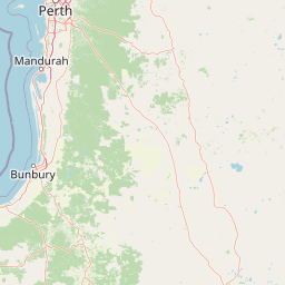
This geographic profile provides a structured analysis of Wellington National Park in Western Australia. It covers key spatial metrics, including a recorded boundary area of 170 square kilometers and a perimeter of 361.78 kilometers. The data explores regional terrain, including internal rivers, forest cover, and upland peaks within this Mediterranean climate zone.
Related tags
National ParkJarrah ForestWestern AustraliaOld-Growth ForestEucalyptus Forest
Western Australia's jarrah forest wilderness with Wellington Dam at its heart
Wellington National Park
Wellington National Park is a protected wilderness area in the south-west of Western Australia, situated approximately 215 kilometers south of Perth near the town of Collie. The park encompasses roughly 17,000 hectares of rugged bushland within the Jarrah Forest bioregion, characterized by rolling hills, dense eucalyptus forests, and the meandering Collie River valley. Central to the park is Wellington Dam, a large reservoir that serves as both a scenic focal point and popular recreation destination. The landscape sits within the ancient Yilgarn craton, a geological province of metamorphosed sedimentary and volcanic rocks with significant granite exposures. Established as a national park in 2000, the area was substantially expanded in 2001 under the state government's old-growth forest protection policy, more than quadrupling its original size to preserve one of Western Australia's most significant remaining tracts of jarrah forest.
- Location
- Australia
- Park type
- National park
- Established
- 2000
- Area
- 170 km²
Location overview
Tracking administrative territory and regional placement within Australia
Wellington National Park Regional Geography in Western Australia
Wellington National Park is situated within the state of Western Australia under Australian jurisdiction. Geographic records trace its precise regional alignment and core administrative status.
- Countries
- Australia
- Regions
- Western Australia
- Primary location
- Western Australia
Boundary and coordinates
The geometry spans roughly 0.253° north–south and east–west
Wellington National Park’s mapped outline covers 247.997 km²
Wellington National Park’s boundary geometry calculates to 247.997 km², while its separate entity and fact records each state 170 km²; the values are reported without forcing a match; the polygon centres near 33.40547° S, 115.95841° E, spans 115.85271°–116.10578° E and 33.52959°–33.27473° S, and has a 361.78 km perimeter. These are map measurements, not a legal survey.
- Boundary area
- 248 km²
- Boundary perimeter
- 361.8 km
- Northernmost point
- 33.2747° S
- Southernmost point
- 33.5296° S
- Easternmost point
- 116.1058° E
- Westernmost point
- 115.8527° E
- Geographic centre
- 33.4055° S, 115.9584° E
- North–south span
- 28.3 km
- East–west span
- 23.5 km
Terrain and natural features
Upland terrain classifications and recorded landscape features
Wellington National Park Terrain and Named Natural Features
Upland relief classifications define the protected landscape alongside recorded named natural features located inside the park boundaries. Linked feature cards supply specific names, types, and spatial relationships for streams, peaks, and reservoirs.
Selected named natural features
Reservoirs
Glen Mervyn Dam
Viewpoints
Wellington Dam Lookout
Cliffs
Quarry Abseil Site
Peaks
Mount Lennard
335 m
Streams
Hamilton River
Environmental setting
Temperate broadleaf forest, upland relief, and mediterranean climate classifications
Wellington National Park Environmental Classifications and Physical Setting
Recorded categories group hills, valleys, rivers, lakes, and dominant forest cover into complementary ways to read the physical setting. Connected data links each classification to relevant atlas destinations for regional comparison.
- Relief
- Upland
- Climate
- Mediterranean
- Water
- Major water bodies
- Forest cover
- Dense forest cover
Landscape features
Hills · Valleys · Rivers · Lakes · Forest
Habitat types
Temperate broadleaf forest
Park atlas
Discover the regional geography and protected areas surrounding Wellington National Park, comparing diverse landscapes.
Explore Other National Parks Near Wellington National Park, Western Australia
Browse a curated selection of national parks and protected areas located geographically near Wellington National Park in Western Australia's Jarrah Forest bioregion. This allows for immediate comparison of landscape features, conservation priorities, and regional protected area networks, enhancing geographic understanding.
National parkAustralia
4.1 km away#1 closest
Southeast

Greater Preston National Park: Explore Old-Growth Jarrah Forest and Protected Landscape Boundaries
National Park in Western Australia's Jarrah Forest region.
Greater Preston National Park is a significant conservation area safeguarding extensive old-growth jarrah forests in Western Australia's South West region. As a national park within the Jarrah Forest bioregion, it offers a protected landscape characterized by mature woodland ecosystems. This page facilitates exploration of the park's geographic setting, its mapped boundaries, and its importance as a preserved natural environment for understanding regional forest ecology.
- Area
- 113.73 km²
- Established
- 2004
- Climate
- Mediterranean
- Access
- Moderate access
National parkAustralia
26 km away#2 closest
Southwest
Tuart Forest National Park: Discover Australia's Most Significant Pure Tuart Woodland Landscape
Explore the unique limestone terrain and vast eucalyptus geography.
Tuart Forest National Park in Western Australia is a critical protected area dedicated to preserving the world's largest remaining pure tuart forest. This unique ecosystem, found on coastal limestone soils, features some of the most immense Eucalyptus gomphocephala trees globally. The park's geography is characterized by its undulating limestone terrain, supporting a vital habitat for endangered wildlife like the Western Ringtail Possum, offering unparalleled insight into Australia's rare woodland environments.
- Area
- 20.49 km²
- Established
- 1987
- IUCN
- II
- Relief
- Lowland
National parkWestern Australia
28 km away#3 closest
Northwest
Yalgorup National Park: National Park Protected Landscape and Geographic Atlas Entry
Explore the mapped terrain and regional natural context of this Western Australian park.
Yalgorup National Park is a key protected area in Western Australia, designated as a national park to preserve its natural landscape and geographic features. This MoriAtlas entry provides structured insight into its mapped boundaries and regional context, contributing to a broader understanding of Western Australia's diverse geography. It serves as a vital component for exploring the natural landscapes and protected areas that define this significant Australian region, offering a foundation for detailed atlas-based discovery.
- Area
- 131.41 km²
- Established
- 1966
- IUCN
- II
- Relief
- Lowland
National parkWestern Australia
39 km away#4 closest
Southwest
Whicher National Park: Exploring Western Australia's Protected Landscape Geography
A national park with distinct mapped boundaries and natural terrain.
Delve into the geographic profile of Whicher National Park, a designated national park situated within the vast landscapes of Western Australia. This entry provides an atlas-focused view of the park's protected land identity, its position within the regional geography, and the characteristics of its mapped natural terrain. Understand the park's specific role as a protected area and its contribution to the broader natural landscape context of Western Australia.
- Established
- 2019
- IUCN
- II
- Relief
- Upland
- Climate
- Mediterranean
National parkAustralia
47 km away#5 closest
South
Dalgarup National Park: Protected Forest Landscape and Regional Geographic Context in Western Australia
Mapped boundaries of protected areas within the Jarrah Forest bioregion.
Dalgarup National Park serves as a crucial protected area, safeguarding the characteristic jarrah-marri forest ecosystems of southwestern Australia. Located within the Jarrah Forest and Warren bioregions, its terrain reflects the undulating topography and Mediterranean climate prevalent in the South West land division. This national park offers a unique opportunity to explore mapped natural landscapes and understand the conservation efforts within a region historically shaped by forest ecology and development.
- Area
- 23.77 km²
- Established
- 2004
- Scope
- Terrestrial
- Water
- Minor water
National parkWestern Australia
52 km away#6 closest
Southwest
Blackwood River National Park: Protected Area in Western Australia's Geography
Explore mapped boundaries and natural terrain.
Blackwood River National Park is a key protected area within the vast geographic expanse of Western Australia. This park's designation as a national park underscores its importance for conservation and landscape preservation. Users can explore its precisely mapped boundaries to understand its footprint and its contribution to the regional natural landscape context, offering a grounded perspective on protected lands within Australia.
- Area
- 204.75 km²
- Established
- 2004
- IUCN
- II
- Relief
- Upland
National parkAustralia
57 km away#7 closest
Southwest
Wiltshire-Butler National Park: Mapped Jarrah Forest Landscape in Western Australia
Explore protected boundaries and regional geographic context
Wiltshire-Butler National Park stands as a protected natural area celebrated for its representation of Western Australia's iconic jarrah forest ecosystems. This National Park, created in 2004, offers rich opportunities for atlas-based discovery, focusing on its distinct landscape character, mapped park boundaries, and its geographical placement within the broader South West region. Understanding its terrain and conservation significance provides valuable insight into the protected lands of the Jarrah Forest bioregion.
- Area
- 116.45 km²
- Established
- 2004
- IUCN
- II
- Relief
- Highland
National parkWestern Australia
58 km away#8 closest
South
Greater Kingston National Park: A National Park in Western Australia's Diverse Geography
Explore mapped boundaries and regional landscape context.
Greater Kingston National Park represents a protected landscape within the vast expanse of Western Australia. As a national park, it contributes to the structured understanding of conservation areas and natural terrain across the state. This dedicated entry provides essential geographic context, allowing for detailed exploration of the park's mapped boundaries and its role within the broader regional geography of Western Australia. Discover its identity as a protected natural area.
- Area
- 210.92 km²
- Established
- 2004
- Climate
- Temperate
- Scope
- Terrestrial
MoriAtlas Explorer
Continue Exploring Wellington National Park's Protected Landscape & Geography
Deepen your understanding of Wellington National Park by exploring its specific mapped boundaries, terrain features, and geographic context within Western Australia. MoriAtlas provides detailed information to appreciate the park's role as a protected natural landscape, offering insights into its unique regional setting and ecological importance for further atlas-driven discovery.
Browse next
Global natural geography
Explore related park routes
Explore MoriAtlas Global ParksBrowse All MoriAtlas ParksGlobal Park Map DiscoveryMoriAtlas: Browse All CountriesBrowse All MoriAtlas ContinentsNational Park Environment AtlasGrand Canyon National Park AtlasYellowstone National Park AtlasYosemite National Park Atlas and GeographySerengeti National Park AtlasGalápagos National Park Protected LandscapeBanff National Park Geography and AtlasKruger National Park Atlas EntryUluṟu-Kata Tjuṯa National Park AtlasExplore Uluru-Kata Tjuta National Park GeographyPlitvice Lakes National Park AtlasFiordland National Park Protected LandscapeGreat Smoky Mountains National Park AtlasAfghanistan National Parks and Protected AreasAlbania National Parks and Protected AreasAlgeria National Parks and Protected AreasAmerican Samoa National Parks and Protected AreasAndorra National Parks and Protected AreasAngola National Parks and Protected AreasAntarctica National Parks and Protected AreasAntigua and Barbuda Park List