
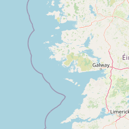
Lakes
Park geography
Examine the regional terrain, environmental classifications, and natural landmarks within park limits
Structured Geographic Profile and Mapped Boundaries of Wild Nephin National Park, County Mayo
This geographic profile details the physical characteristics of Wild Nephin National Park in County Mayo, Ireland. The data covers boundary dimensions, spanning 150 square kilometers, alongside a comprehensive list of interior natural features including peaks like Nephin Beg and Slieve Carr, plus local lakes and riverine systems.
Ireland's Atlantic blanket bog wilderness and dark sky park
Wild Nephin National Park
Wild Nephin National Park is a protected wilderness area in northwest County Mayo, Ireland, encompassing much of the Nephin Beg Mountains and one of the largest expanses of Atlantic blanket bog in Europe. Established in 1998 as Ballycroy National Park and expanded and renamed in 2018, the park covers approximately 150 square kilometres of peatland, making it one of the most significant blanket bog conservation sites in Western Europe. The park includes the most remote point on the Irish mainland, offering a landscape of remote, windswept moors, dramatic mountain terrain, and coastal cliffs that face the Atlantic Ocean. The park's ecological significance is substantial, supporting a unique habitat with diverse flora and fauna adapted to the harsh blanket bog environment. Conservation designation includes Special Area of Conservation (cSAC) status as part of the Owenduff/Nephin Complex, Special Protection Area classification, and membership in the Natura 2000 network. In 2016, Wild Nephin became Ireland's first International Dark Sky Park, achieving Gold Tier certification and recognition as one of the world's premier locations for stargazing. The park represents Ireland's commitment to both habitat preservation and ecological restoration, with ongoing rewilding initiatives in former industrial forest areas that are being returned to natural bog and mountain ecosystems.
- Location
- Ireland
- Park type
- National park
- Established
- 1998
- Area
- 150 km²
Location overview
Mapping the regional and national context within County Mayo
Geographic Location of Wild Nephin National Park in Ireland
Wild Nephin National Park is located entirely within County Mayo in the sovereign territory of Ireland. The established terrestrial reservation remains a single-country entity with no transboundary or marine designations.
- Countries
- Ireland
- Regions
- County Mayo
- Primary location
- County Mayo
Boundary and coordinates
Interactive protected perimeter and area measurements
Wild Nephin National Park Boundary Map and Spatial Extent
Mapped park geometry establishes clear spatial context for the protected area and surrounding terrain. Derived measurements outline the total surface area, coordinate spans, and geographic center points.
- Boundary area
- 170.5 km²
- Boundary perimeter
- 264.2 km
- Northernmost point
- 54.2089° N
- Southernmost point
- 53.9428° N
- Easternmost point
- 9.4326° W
- Westernmost point
- 9.8362° W
- Geographic centre
- 54.0597° N, 9.6273° W
- North–south span
- 29.6 km
- East–west span
- 26.4 km
Terrain and natural features
Explore recorded lakes, rivers, peaks, and streams within the park landscape.
Wild Nephin National Park Terrain and Recorded Natural Features
Browse registered natural features located within Wild Nephin National Park, including lakes, rivers, and peaks. Each feature card displays specific names, types, and recorded spatial relationships.
Selected named natural features
Rivers
Tarsaghaunmore River
Peaks
Glennamong
628 m
Streams
Tarsaghaunmore River
Lakes
Lough Nambrock
Streams
Altacooney River
Environmental setting
Temperate climate zones, sparse forest cover, and major water presence across protected terrain
Wild Nephin National Park Environmental Classifications and Physical Setting
Stored landscape features, temperate habitats, and major water presences frame the physical setting of Wild Nephin National Park. Recorded categories connect directly to relevant atlas destinations for structured environmental analysis.
- Climate
- Temperate
- Water
- Major water bodies
- Forest cover
- Sparse forest
Landscape features
Mountains · Cliffs · Rivers · Wetland · Bog
Habitat types
Temperate broadleaf forest · Riverine habitat · Wetland · Peatland · Grassland
Park atlas
Trace the connected protected landscapes and regional park geography around Wild Nephin National Park in Ireland.
Discover Nearby National Parks and Protected Areas Beyond Wild Nephin National Park
After exploring Wild Nephin National Park, browse other national parks and protected areas across Ireland to compare diverse Atlantic blanket bog systems and mountain landscapes. Examine the regional spread of conservation efforts and unique ecological niches, tracing how these protected areas connect within Ireland's broader natural geography.
National parkCounty Galway
About 46 km away#1 closest
South

Connemara National Park: A Mapped Protected Landscape in County Galway
Explore national park geography and protected terrain details.
Delve into Connemara National Park, a distinct national park located in the western region of County Galway, Ireland. This entry serves as a gateway to understanding its protected landscape, mapped boundaries, and its role within the broader geographic context of Connacht. Explore how this protected area contributes to the diverse natural terrain of Ireland, viewed through an atlas-driven discovery lens.
- Area
- 20 km²
- Established
- 1980
- IUCN
- II
- Relief
- Mountain
National parkCounty Kerry
About 46 km away#2 closest
South
Páirc Náisiúnta na Mara National Park: Protected Landscape Atlas for County Kerry
Explore mapped protected areas and regional geography.
This entry details Páirc Náisiúnta na Mara National Park, offering insights into its protected landscape character and geographic setting within County Kerry. As a significant protected area, it contributes to the atlas of Southwest Ireland, providing context for its natural terrain and mapped boundaries. Discover the park's unique identity and its position within the broader regional geography for structured exploration.
- Area
- 280 km²
- Established
- 2024
- IUCN
- II
- Relief
- Mixed relief
National parkIreland
104 km away#3 closest
Southeast
Burren National Park: A Distinctive Karst Protected Landscape in County Clare
Explore its unique limestone pavement and geological formations.
Burren National Park offers a profound exploration of karst geology, featuring Ireland's most extensive and visually striking limestone pavement. The park's terrain displays a unique mosaic of exposed rock, swallow holes, and surprising pockets of vegetation, including rare Arctic-alpine and Mediterranean flora. As a protected national park, it preserves this scientifically significant landscape and offers a window into the dynamic interplay of geological forces and ecological adaptation within Western Ireland's regional geography.
- Area
- 15 km²
- Established
- 1991
- IUCN
- II
- Relief
- Mountain
National parkCounty Donegal
115 km away#4 closest
Northeast
Glenveagh National Park: A Protected Landscape in the Heart of County Donegal
Mapped geography and natural terrain for Ireland's national park.
Delve into the geographic specifics of Glenveagh National Park, a protected area situated in County Donegal. This section provides detailed information on its mapped boundaries and regional landscape context. Understand how this national park fits within the natural geography of Ulster, offering a structured atlas view for detailed exploration of its unique terrain and protected status.
- Area
- 169.58 km²
- Established
- 1986
- IUCN
- II
- Relief
- Mixed relief
Protected landscapeCounty Fermanagh
About 116 km away#5 closest
Northeast

Castle Archdale Protected Landscape in County Fermanagh: Geography and Map Overview
Lakeside woodland and historic terrain on Lower Lough Erne
Located on the shores of Lower Lough Erne, Castle Archdale represents a unique protected landscape in County Fermanagh. The area features a complex mosaic of sheltered inlets, mature woodland, and open parkland that characterises the Fermanagh lakelands. Beyond its physical terrain, the site is defined by its historical significance, from seventeenth century estate remnants to its role as a pivotal wartime flying boat base, providing a rich context for geographic and environmental exploration.
- Relief
- Lowland
- Climate
- Temperate
- Access
- Easy access
- Scope
- Terrestrial
Nature reserveCounty Fermanagh
About 130 km away#6 closest
East
Crom Estate Nature Reserve and Upper Lough Erne Geographic Landscape Overview
Riparian forest and island geography in County Fermanagh
Deeply connected to the shores of Upper Lough Erne, Crom Estate is a sprawling nature reserve defined by its ancient riparian woodlands and intricate maze of bays and islands. The terrain preserves a distinct mix of old-growth forest, open grassland, and historic castle ruins, providing a valuable case study in the regional geography of County Fermanagh and the conservation of water-influenced ecosystems.
- Area
- 5.5 km²
- Established
- 1987
- Relief
- Lowland
- Climate
- Temperate
Nature reserveCounty Londonderry
About 189 km away#7 closest
Northeast
Roe Estuary Nature Reserve: Coastal Geography and Protected Estuarine Landscapes
Lough Foyle coastal terrain in County Londonderry
Explore the structured geography of Roe Estuary Nature Reserve, a primary coastal protected area in County Londonderry. This atlas entry details the reserve's intertidal mudflats, salt marshes, and riverine channels. Understand its unique position between the Binevenagh escarpment and the waters of Lough Foyle, highlighting its role as a vital corridor for migratory species and aquatic life within the Northern Ireland coastal landscape.
- Relief
- Lowland
- Climate
- Temperate
- Access
- Access unknown
- Scope
- Mixed
Nature reserveNorthern Ireland
192 km away#8 closest
Northeast
Ballynahone Bog: Northern Ireland Lowland Raised Peatland and Wetland Geography
Intact active bog dome and protected wetland landscape
Examine the geography of Ballynahone Bog, one of the largest remaining lowland raised bogs in Northern Ireland. This protected landscape preserves an active peat-forming surface, intricate hummock and pool complexes, and marginal fen habitats, offering insight into the ecological history and hydrological patterns of the Lough Neagh lowland region.
- Area
- 2.432 km²
- Established
- 1995
- Relief
- Lowland
- Climate
- Temperate
MoriAtlas Explorer
Continue Exploring Wild Nephin National Park's Geographic Context
Delve deeper into the structured geographic data for Wild Nephin National Park, understanding its role as a protected landscape within County Mayo. MoriAtlas provides a map-focused lens to appreciate the park's natural terrain and its position in the regional atlas, facilitating a more informed exploration of Ireland's protected areas.
Browse next
Global natural geography
Explore related park routes
Explore MoriAtlas Global ParksBrowse All MoriAtlas ParksGlobal Park Map DiscoveryMoriAtlas: Browse All CountriesBrowse All MoriAtlas ContinentsNational Park Environment AtlasGrand Canyon National Park AtlasYellowstone National Park AtlasYosemite National Park Atlas and GeographySerengeti National Park AtlasGalápagos National Park Protected LandscapeBanff National Park Geography and AtlasKruger National Park Atlas EntryUluṟu-Kata Tjuṯa National Park AtlasExplore Uluru-Kata Tjuta National Park GeographyPlitvice Lakes National Park AtlasFiordland National Park Protected LandscapeGreat Smoky Mountains National Park AtlasAfghanistan National Parks and Protected AreasAlbania National Parks and Protected AreasAlgeria National Parks and Protected AreasAmerican Samoa National Parks and Protected AreasAndorra National Parks and Protected AreasAngola National Parks and Protected AreasAntarctica National Parks and Protected AreasAntigua and Barbuda Park List