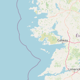

Why Wild Nephin National Park stands out
Wild Nephin is best known for its extensive Atlantic blanket bog, one of the largest remaining examples of this habitat in Europe, which provides critical ecological niches for rare plant species including Hamatocaulis vernicosus. The park is also distinguished as Ireland's first International Dark Sky Park, achieving Gold Tier certification in 2016 and now recognised among the world's best stargazing locations. The Owenduff River within the park is unique as the only river in Western Europe that still drains a relatively intact and extensive blanket bog system, supporting important salmon and sea trout populations. The area serves as a significant breeding and feeding site for migratory birds including the Greenland white-fronted goose, whooper swan, and peregrine falcon.
Wild Nephin National Park history and protected-area timeline
The establishment of Ballycroy National Park in 1998 came as a result of Ireland's obligations under the European Union Habitats Directive, which was transposed into Irish law in 1997. The Directive required the designation of Special Areas of Conservation to protect certain listed habitats and species, and the blanket bog at Ballycroy was identified as particularly significant due to its exceptional size and relatively intact condition. The park was formally established on 1 November 1998 and is managed under the State Property Act of 1954.
A significant expansion occurred in 2017 when 4,000 hectares of commercial forest and mountain land controlled by the state forestry company Coillte were transferred to the National Parks and Wildlife Service. This addition nearly doubled the park's area and created the framework for what has become an ambitious rewilding project. The former Nephin Forest had been planted with lodgepole pine and spruce as part of industrial forestry operations, with forestry roads traversing the landscape. The identification of this area's potential for ecological restoration led to its incorporation into the national park and the decision to pursue rewilding approaches.
In 2018, the expanded park was officially renamed Wild Nephin National Park, reflecting both its expanded geography and its enhanced conservation mission. The same year brought additional recognition when the park was designated as Ireland's first International Dark Sky Park, achieving Gold Tier status in May 2016. This designation followed a rigorous certification process and positioned Mayo as an internationally recognised destination for astronomy and nocturnal environment preservation.
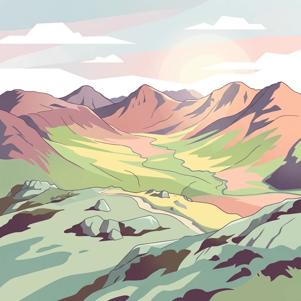
Wild Nephin National Park landscape and geographic character
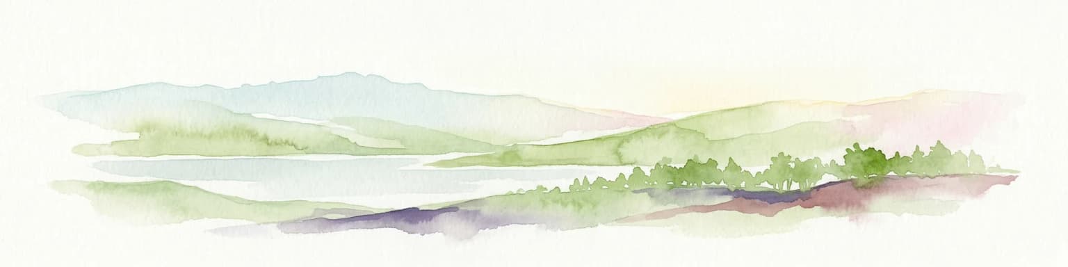
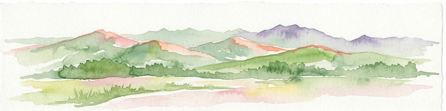
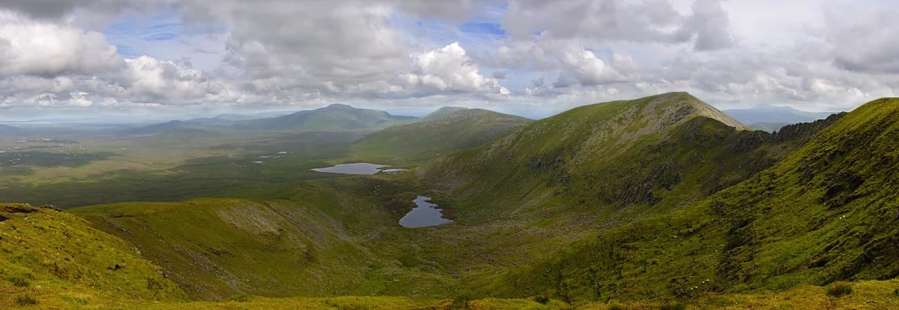
The landscape of Wild Nephin National Park is defined by the interaction between the mountainous terrain of the Nephin Beg Range and the vast, waterlogged expanses of Atlantic blanket bog that cloak the lower slopes and valley floors. The Nephin Beg Mountains, though not among Ireland's highest peaks, present a rugged and remote character, with rocky outcrops, steep slopes, and cliffs that create visual drama against the often grey Atlantic sky. The mountains run roughly east-west across the park, forming a barrier between the inland bog landscapes and the coastal areas.
The blanket bog represents the most distinctive and ecologically significant landscape element, forming one of the largest continuous expanses of this habitat type in Europe. This peat-forming ecosystem develops in areas of high rainfall and cool temperatures, where the slow decomposition of plant material over millennia has created deep peat deposits. The bog surface is characterised by a mosaic of wet pools, flushes, and slightly elevated hummocks, supporting distinctive vegetation adapted to waterlogged, nutrient-poor conditions. The landscape has a wild, windswept quality, with few trees or human structures interrupting the open horizons.
The park's coastline features dramatic cliffs where the mountains meet the Atlantic, while inland the Owenduff River and its tributaries have carved valleys through the bog, creating riparian habitats and providing drainage channels for the extensive peatland system. The combination of mountain, bog, river, and coast creates a landscape of considerable variety within a relatively compact area.
Wild Nephin National Park ecosystems, habitats, and plant life
The nature of Wild Nephin is defined by the Atlantic blanket bog ecosystem, which represents one of Europe's most distinctive and ecologically important habitats. This peatland environment supports a specialised flora adapted to the acid, waterlogged conditions, including cross-leaved heath, ling heather, cottongrasses, and mosses that form the characteristic bog vegetation. The wet, nutrient-poor conditions create an environment where decomposition is extremely slow, allowing peat to accumulate over thousands of years and creating a habitat that is both fragile and irreplaceable.
The ecological significance of this bog extends beyond its size to include the presence of rare species that depend on these conditions. Hamatocaulis vernicosus, a rare moss species listed under the EU Habitats Directive, occurs in the park's flushes and wet areas, making the conservation of the bog ecosystem critical for the survival of this and other specialist species. The Owenduff River system adds further ecological value, being the only river in Western Europe that still drains a relatively intact and extensive blanket bog, creating unique water chemistry and habitat conditions that support populations of salmon and brown trout.
The bird life of the park is particularly notable, with the Owenduff area serving as an important roosting, feeding, and breeding site for species protected under the EU Birds Directive. The Greenland white-fronted goose uses the area as a key wintering site, while whooper swans breed in the wetlands and peregrine falcons nest on the cliff faces. The combination of blanket bog, mountain, river, and coastal habitats creates a diverse ecological matrix that supports populations of both resident and migratory species.
Wild Nephin National Park wildlife and species highlights
Wild Nephin supports a diverse wildlife community shaped by its mosaic of habitats, from the open blanket bog to the mountain slopes, river valleys, and Atlantic coastline. The bog itself, while appearing hostile to casual observation, supports a specialised invertebrate fauna including rare spider species and insects adapted to the wet, acidic conditions. The rare moss Hamatocaulis vernicosus represents one of the park's most significant botanical treasures, occurring in the flushes where mineral-rich groundwater emerges onto the peat.
The bird communities are particularly well-documented and significant. The Greenland white-fronted goose, a subspecies with a limited global population that winters primarily in Ireland, relies on the park's bog and wetland habitats as critical feeding and roosting areas. Whooper swans nest in the park's wetlands during the summer months, while the peregrine falcon hunts the open terrain and nests on the cliff ledges. The skies above the park are also significant, with the dark sky designation reflecting both the low light pollution and the resulting excellent conditions for astronomical observation of celestial wildlife.
The Owenduff River system supports important populations of Atlantic salmon and sea trout, with the river's condition as one of the few remaining relatively intact blanket-bog river systems in Europe making it ecologically significant for these species. The river's water quality, influenced by the bog's filtering capacity, provides suitable spawning and nursery habitats. While larger mammals may be less conspicuous, the rewilding of former forest areas is expected to create conditions favourable for the return of native species to the park.
Wild Nephin National Park conservation status and protection priorities
Wild Nephin National Park represents one of Ireland's most important conservation designations, with international significance due to the ecological rarity and condition of its blanket bog habitats. The park is designated as a candidate Special Area of Conservation (cSAC) as part of the Owenduff/Nephin Complex, recognising the habitat and species interests under the EU Habitats Directive. This designation specifically protects the blanket bog habitat, which is listed as a priority habitat under the Directive due to its limited distribution and the threat of degradation across its European range.
The Special Protection Area designation adds bird species protection, particularly for the Greenland white-fronted goose and other migratory species that depend on the park's habitats. Together with the SAC designation, this places the park within the Natura 2000 network, Europe's network of protected areas that aim to ensure the long-term survival of Europe's most valuable and threatened species and habitats. The conservation framework requires management that maintains or restores the favourable conservation status of the protected habitats and species.
The rewilding initiative in the former Nephin Forest represents a modern conservation approach that aims to restore ecological processes and native biodiversity rather than simply preserving a static landscape. By removing non-native plantation trees and allowing the natural recovery of bog ecosystems, the park is contributing to climate resilience, carbon storage in peat soils, and the restoration of natural heritage values that had been diminished by industrial forestry.
Wild Nephin National Park cultural meaning and human context
Wild Nephin occupies a landscape that has been shaped by human activity over millennia, though the park's remote character has meant that intensive agriculture and settlement have remained limited. The name Nephin derives from the Irish "Néfin," potentially referring to a mountain or celestial phenomenon, while the Irish name "Néifinn Fhiáin" directly translates as "Wild Nephin." The area has historically been used for extensive grazing, with the low population density of northwest Mayo reflected in the sparse settlement within the park boundaries.
The park's recent history includes the industrial forestry period when large areas were planted with conifer species as part of Ireland's timber production programme. The transfer of these lands to the National Parks and Wildlife Service and their incorporation into the national park represents a shift in how the landscape is valued, from timber production to ecological conservation and public benefit. The visitor centre in Ballycroy village provides a connection to local communities and offers interpretation of the park's natural and cultural heritage.
Top sights and standout views in Wild Nephin National Park
Wild Nephin National Park combines several outstanding features that distinguish it within Ireland's protected areas. The Atlantic blanket bog, spanning approximately 150 square kilometres, represents one of the largest and most intact examples of this habitat in Europe, making the park globally significant for peatland conservation. The dark sky designation, achieved through Gold Tier certification in 2016, adds an extraordinary nighttime dimension, positioning the park as one of the world's premier stargazing locations where the Milky Way is visible to the naked eye.
The Owenduff River's distinction as Western Europe's only river draining a relatively intact blanket bog system provides unique ecological value, supporting salmon and trout populations in water of exceptional quality. The mountain terrain of the Nephin Beg Range offers walking opportunities through remote landscapes, while the park contains Ireland's most geographically remote mainland point. The ongoing rewilding of former plantation forest demonstrates practical conservation in action, with the gradual restoration of native ecosystems to land that had been degraded by industrial forestry.
Best time to visit Wild Nephin National Park
Wild Nephin can be visited throughout the year, though the experience varies considerably with the seasons. The summer months from June to August offer the longest daylight hours and the most reliable weather for walking and outdoor activities, with the bog displaying its full range of wildflowers and the birdlife most active. However, this is also the period when the midnight sun effect means dark sky viewing is limited, as true darkness never fully descends. The visitor centre operates from mid-March until early November.
The autumn and winter months from September through February offer the best conditions for experiencing the park's dark sky designation, with true darkness returning and the night sky offering views of the Milky Way, meteor showers, and potentially the northern aurora on favourable nights. The winter landscape, with its moody skies and dramatic light over the bog and mountains, has a particular beauty, though weather conditions can be challenging. Spring brings the return of migratory birds including the Greenland white-fronted goose and whooper swan, adding wildlife viewing opportunities to the park's attractions.