


Mori Atlas logo
Protected landscapeWuyishan Scenic and Historic Interest Area

Mapping the red sandstone peaks and river valleys of this Fujian regional landmark

Wuyishan Scenic and Historic Interest Area: A Protected Landscape Map of Danxia Terrain

(武夷山国家重点风景名胜区)

The Wuyishan Scenic and Historic Interest Area serves as a prime example of classic Danxia geomorphology, characterized by vivid red sandstone cliffs, deep river valleys, and isolated peaks. This geographic record maps the complex arrangement of the Nine Bend Stream and surrounding mountainous ridges that define the protected landscape. Users can examine the physical distribution of prominent landmarks and the interplay between historical heritage sites and the natural terrain across this northern Fujian environment.

Danxia landscapesred sandstone cliffsriver and gorge scenerysubtropical foresttea heritageWorld Heritage landscape
A flat-style digital illustration showing a winding river flowing between steep, green-toned cliffs and mountains with small boats visible on the water.

Wuyishan Scenic and Historic Interest Area

Protected landscape

Park overview

Structured park overview, official facts, and landscape profile for Wuyishan Scenic and Historic Interest Area

Wuyishan Scenic and Historic Interest Area park facts, protected area profile, and essential visitor context

Review the core facts for Wuyishan Scenic and Historic Interest Area, including designation, size, terrain, visitor scale, habitats, and operating context in one park-focused overview.

About Wuyishan Scenic and Historic Interest Area

The Wuyishan Scenic and Historic Interest Area is one of China's most iconic protected landscapes, situated in northern Fujian Province at the border zone where Fujian meets Jiangxi. Designated in 1979 and elevated to National Key Scenic Area status in 1982, it represents both the geological character of the Wuyi mountain range and the cultural traditions that have grown alongside it for thousands of years. The park is organized around six main scenic zones, each highlighting different aspects of the area's terrain, religious history, tea culture, and literary heritage.

The landscape is fundamentally shaped by Danxia geomorphology. Rather than soaring alpine peaks, Wuyishan consists of rolling low mountains and hills of iron-rich red sandstone, sculpted by erosion into isolated cliffs, domes, and steep-walled ravines. This distinctive terrain creates the visual signature long celebrated in Chinese poetry:

Quick facts and research context for Wuyishan Scenic and Historic Interest Area

The Wuyishan Scenic and Historic Interest Area lies in central Wuyishan City within Nanping Prefecture, Fujian Province, China. Established as a scenic reserve in 1979, it was among the first batch of National Key Scenic Areas officially designated in 1982.

Its core landscape is built on Danxia geology, a striking red sandstone terrain shaped by tectonic uplift and erosion. The defining river is the Jiuqu Xi (Nine-Bend Stream), which flows east from Huanggang Mountain through the heart of the area. The protected zone also serves as a major component of the larger Wuyishan World Heritage site and is recognized as a national 5A tourist attraction.

Protection and recognition

Terrestrial conservation scope, designated protection year, and structured recognition data.

Wuyishan Scenic and Historic Interest Area Protection Status and Designation History

Wuyishan Scenic and Historic Interest Area maintains a documented terrestrial protection status established in 1982. Structured conservation records outline the official designation history and management scope for this protected landscape.

Protection details

Protection scope
Terrestrial
Designated year
1982
Transboundary protection
No
Park context

Deeper park guide and search-rich context for Wuyishan Scenic and Historic Interest Area

Wuyishan Scenic and Historic Interest Area history, landscape, wildlife, and travel context

Explore Wuyishan Scenic and Historic Interest Area through its history, landscape character, ecosystems, wildlife, conservation priorities, cultural context, and seasonal travel timing in a structured park guide built for atlas discovery and search intent.

Why Wuyishan Scenic and Historic Interest Area stands out

Wuyishan is best known for its classic Danxia scenery, a vivid tableau of red cliffs, sculpted peaks, and clear meandering rivers, anchored by the Nine-Bend Stream winding dramatically through the heart of the range. It is equally famous as the birthplace of Wuyi Yancha (rock tea), one of China's most storied tea traditions, and specifically as the home of the legendary Da Hong Pao mother trees clinging to the cliffs of Jiulongke. Equally central to its identity is its deep cultural lineage, including ancient Minyue cliff tombs, the historical worship of the mountain spirit Wuyi Jun, and the Southern Song Neo-Confucian academy of Zhu Xi at Wuyi Jingshe. The area embodies the classical Chinese pairing of natural splendor and layered scholarly, religious, and artisanal heritage.
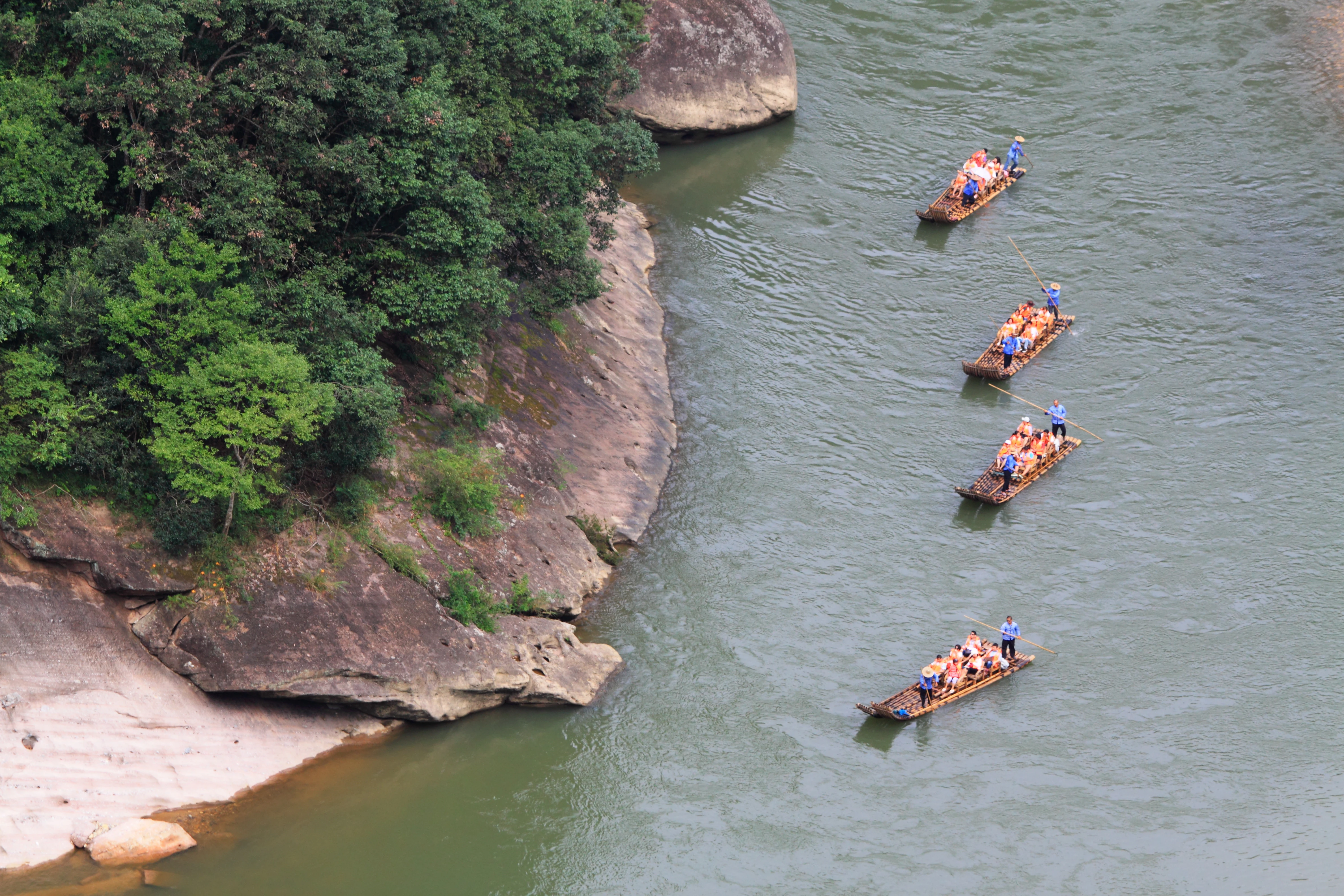
A high-angle view looking down at a river winding past rocky, tree-covered cliffs, with four bamboo rafts carrying tourists floating downstream.
Traditional bamboo rafting on the Nine-bend Stream in Wuyishan, viewed from above.

Wuyishan Scenic and Historic Interest Area history and protected-area timeline

The human history of the Wuyishan landscape stretches back to the Bronze Age, when ancestors of the Minyue people inhabited the area and left the cliff tomb complexes that still survive along the river gorges. By the Western Han dynasty, the spiritual significance of the mountains was already established: Emperor Wu sent envoys to set altars on the southern slopes of Dawang Peak to perform sacrifices to the mountain deity Wuyi Jun, an act from which the mountain range takes its name.

During the Tang dynasty, Wuyi was formally elevated as

Wuyishan Scenic and Historic Interest Area landscape and geographic character

The landscape of the Wuyishan Scenic and Historic Interest Area is defined by Danxia geomorphology, a distinctive terrain of red sandstone uplifted, fractured, and eroded into rugged cliffs, isolated peaks, and deeply incised valleys. The dominant tones of the rock are warm reds and ochres, layered and weathered into dramatic vertical faces, domes, and ridges. Forestry and mist soften these geometries and lend the area its celebrated atmosphere of layered natural color.

The topographic backbone of the scenic area is the Jiuqu Xi, the Nine-Bend Stream. Originating on the southern slopes of Huanggang Mountain in the broader Wuyi range, the river flows eastward through the scenic heart for roughly 62.8 kilometers, across a basin area of approximately 534 square kilometers. Within the protected scenic area, the river traces nine pronounced bends between Xingcun and Wuyi Gong, an arcing distance of about 9.5 kilometers compressed from a straight-line distance of only about 5 kilometers. This extreme sinuosity creates the constantly shifting vistas that make a downstream bamboo raft journey the classic Wuyishan experience.

Surrounding the stream is a constellation of named rocky outcrops. Classical tradition counts thirty-six prominent peaks, including Dawang Peak, the tallest visual landmark at the foot of Wuyi Gong; Yuyun Peak and Tianyou Peak commanding sweeping views over the middle bends; Sanyang Peak, the highest point within the scenic area at about 717.7 meters; and the slender spires of Huxiao Rock and Ling Rock. Beyond the named peaks, the landscape includes legendary features such as the extreme fissure of Yixiantian (Skyline), barely 0.3 meters wide at its narrowest but extending roughly 178 meters into the rock; the great concave cliff face at Shuiliandong with its seasonal waterfall; and the steeply enclosed Jiulongke canyon where the famous Da Hong Pao tea bushes grow directly from the rock face.

Forested ridges, bamboo groves, and tea plantings interlace with these rocky forms throughout the area, while cave systems and old cliff dwellings, such as the Qing-era
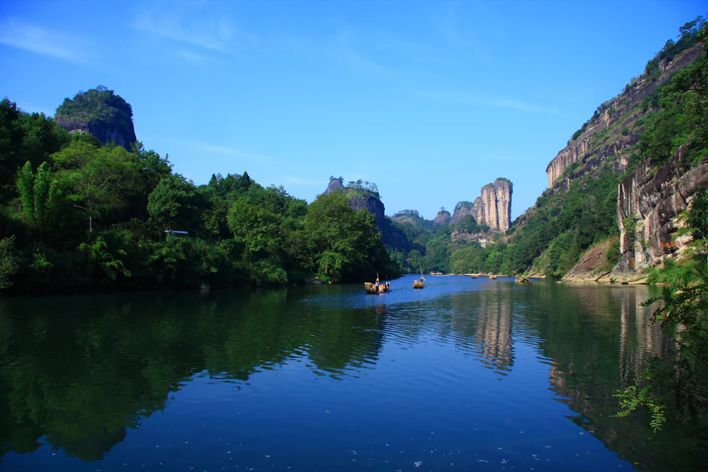
A wide view of a calm, reflective river flowing between steep, lush, rocky mountains in Wuyishan, with small wooden boats carrying passengers in the distance.
A peaceful boat trip along the Nine Bend Stream, surrounded by the distinctive Danxia peaks of Wuyishan.

Wuyishan Scenic and Historic Interest Area ecosystems, habitats, and plant life

Beyond its dramatic geology, the Wuyishan Scenic and Historic Interest Area hosts a rich ecological environment shaped by warm, humid subtropical climate conditions and abundant rainfall. The combination of deeply dissected terrain and well-watered valleys supports a wide range of vegetation zones, from riverine forest along the Nine-Bend Stream to mixed broadleaf forest, bamboo groves, and the more open rocky slopes higher into the ridge system.

Vegetation patterns closely track elevation and topography. Lower elevations and sheltered valleys favor dense evergreen broadleaf growth and bamboo, while exposed rocky cliffs host specialized plant communities adapted to thin soils and seasonal drought. The shaded ravines and canyon floors, in particular, retain humidity through much of the year, creating microhabitats that harbor mosses, ferns, and moisture-loving understory plants. The forest cover across the broader Wuyishan region, extending beyond the scenic area itself, is well known for its biodiversity and is a primary reason for the area's inscription as a mixed natural and cultural World Heritage site.

The rivers and streams of the area are also central to its ecological identity. The Jiuqu Xi and its tributaries maintain clean, well-oxygenated water flowing over rocky beds, conditions that have historically supported a healthy freshwater ecosystem. The stream valleys also serve as ecological corridors linking the surrounding forested hills, while the cliff faces, rock crevices, and cave systems create distinct microhabitats for cliff-dwelling plants and smaller fauna.

These ecological conditions underpin the area's significance beyond its scenic beauty. Wuyishan is recognized not only as a cultural landscape but also as a reservoir of subtropical biodiversity in southeastern China, where habitat fragmentation in nearby lowlands makes protected upland landscapes increasingly important refuges for native flora, resident birdlife, and a wide range of forest-dwelling animal species.
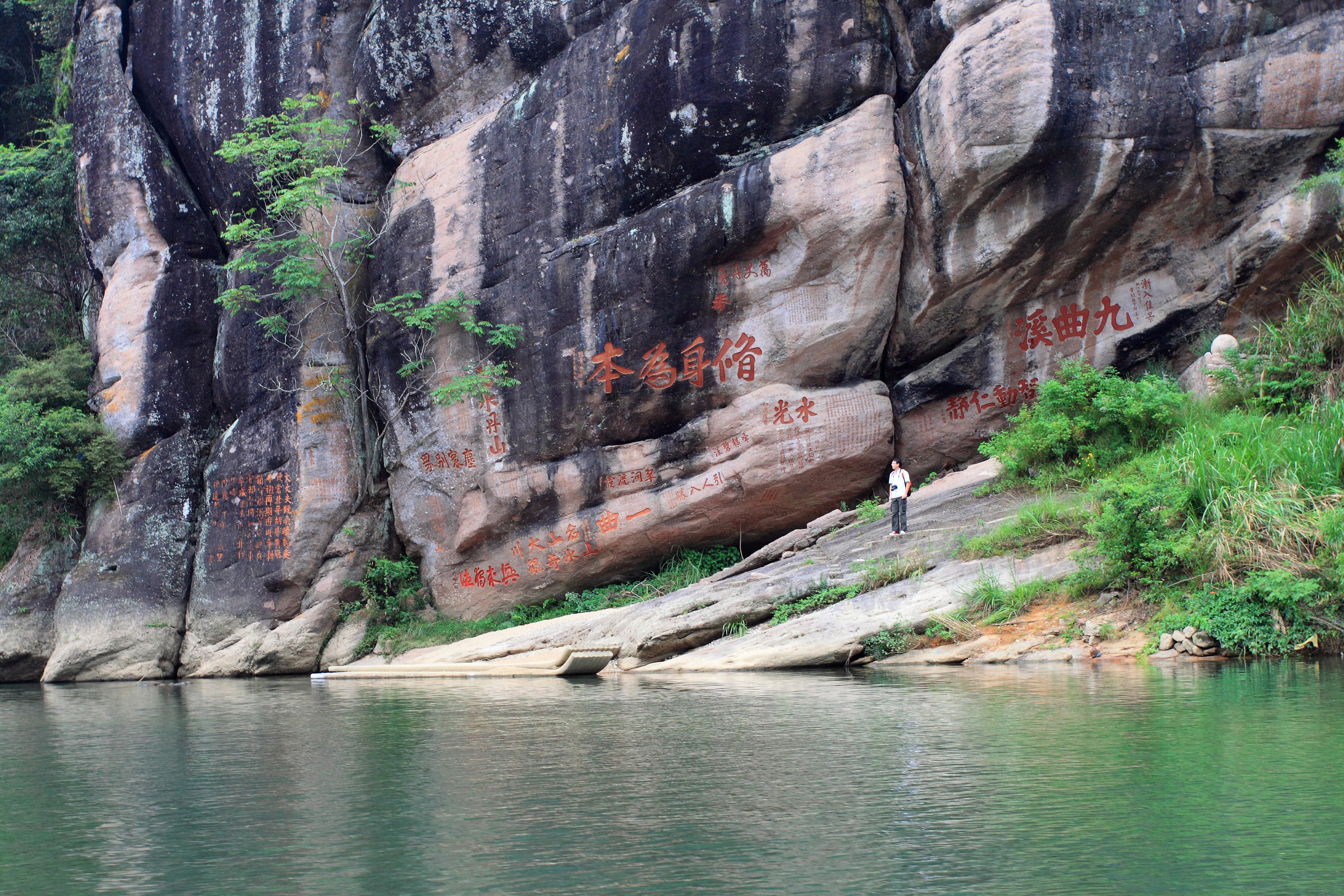
A wide view of a calm green river flowing past a large, dark-colored cliffside featuring reddish Chinese calligraphy carved directly into the rock face.
The first bend of the Nine Bend Stream at Wuyishan, showing the Shuiguang Rock with historical calligraphy carvings.

Wuyishan Scenic and Historic Interest Area wildlife and species highlights

The biodiversity of the Wuyishan region is a key part of its natural value, with the scenic area itself sitting within a larger landscape recognized for rich subtropical flora and fauna. While the scenic reserve is best known for its geology and tea culture, its forests, streams, and cliffs sustain varied wildlife populations, including a substantial community of resident forest birds and seasonal migrants passing through the river valleys.

The forested ridges and bamboo groves near the Jiuqu Xi corridor are particularly important for birdlife. The narrow valleys, sheltered vegetation, and mix of habitats along the Nine-Bend Stream attract diverse songbirds, waterbirds along flats and tributaries, and raptors that use the higher ridges and cliff faces as hunting perches. Birdwatchers visiting the area can encounter species typical of southeastern China's broadleaf and mixed forest ecosystems, making Wuyishan a valued site for bird-based discovery within a primarily scenic-cultural destination.

Stream environments support freshwater fauna adapted to clean, flowing water, while the rocky cliffs and cave systems host small mammals, bats, and specialized invertebrate communities. Larger mammals associated with broader Wuyishan forest ecosystems also range through connected habitat beyond the strictly bounded scenic area, with the integrity of nearby forest reserves complementing the protected character of the scenic zone itself.

The interplay of climate, topography, and ecological diversity ensures that even within a landscape often framed in cultural and aesthetic terms, the Wuyishan Scenic and Historic Interest Area remains a living, biologically meaningful environment as well as a cultural one.
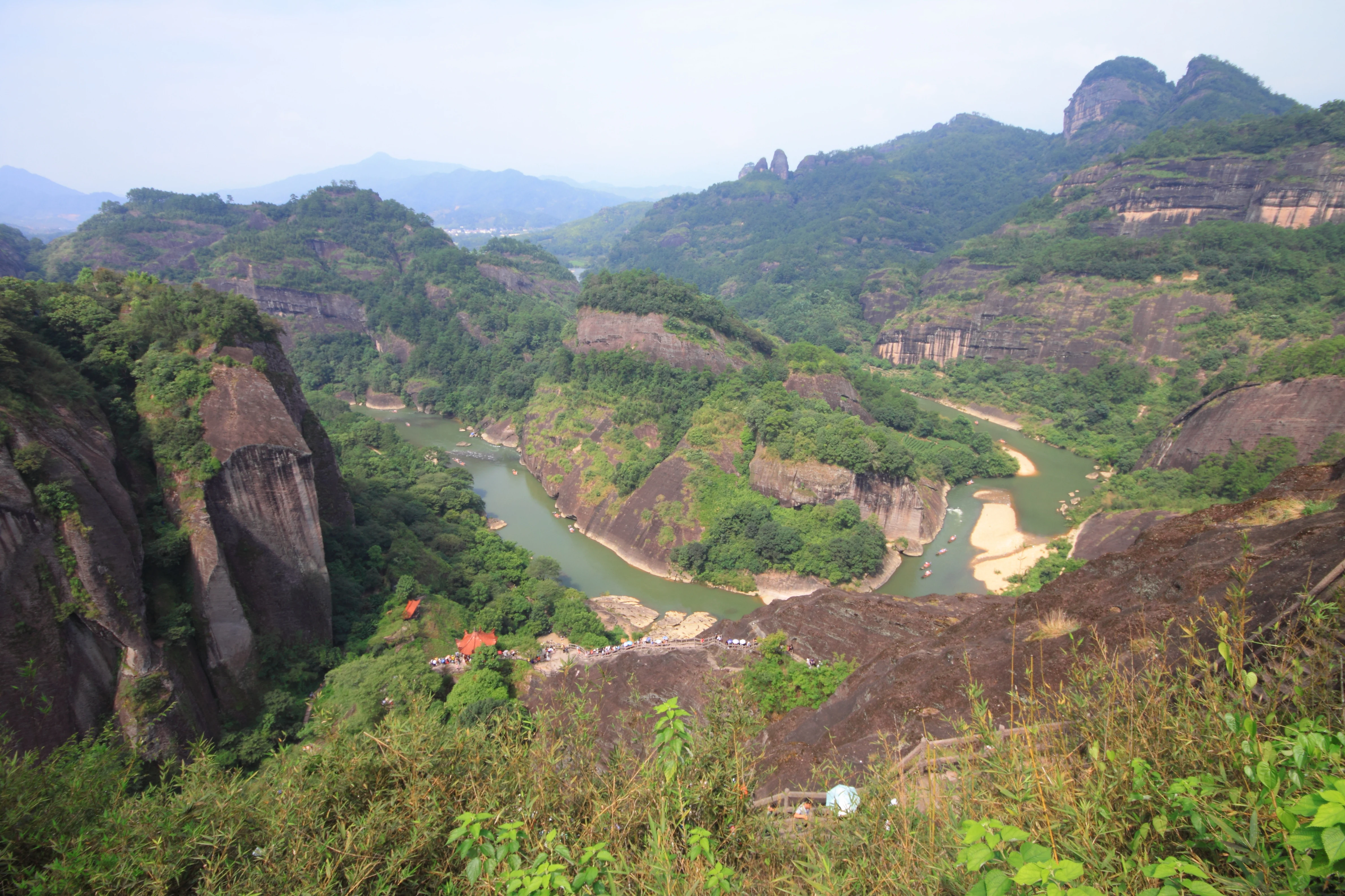
A high angle view looking down at a river curving through deep, green-covered rocky valleys and steep sandstone cliffs.
A view of the Nine Bend Stream winding through the Danxia landforms of Wuyishan.

Wuyishan Scenic and Historic Interest Area conservation status and protection priorities

The Wuyishan Scenic and Historic Interest Area has been a focal point of formal conservation in China for more than four decades. Its designation as one of the first National Key Scenic Areas in 1982 set the foundation for systematic protection of its Danxia landforms, river systems, vegetation cover, and cultural heritage. The scenic area is also a core component of the broader Wuyishan World Heritage inscription, recognized for both its natural and cultural outstanding universal value.

From a conservation perspective, the area's significance lies in the interlinked protection of geology, ecology, and cultural antiquities. The Danxia formations, the Jiuqu Xi watershed, the surrounding subtropical forests, and the historic inscriptions, cliff tombs, temples, and kiln sites are all protected under Chinese national and provincial-level frameworks. Several key cultural assets within the area have been formally listed as cultural heritage protection units, including the Danxia嶂 cliff dwellings at the provincial level and the Tianxin Yongle Temple site at the municipal level.

Habitat protection within and around the scenic area contributes to broader biodiversity conservation in southeastern China. By preserving a corridor of forested, well-watered terrain, the scenic reserve helps sustain habitat continuity for forest birds, small mammals, and aquatic species at a landscape scale, while limiting the kind of disturbance that affects less-protected areas elsewhere in the region. The protected status of the scenic area also regulates tourism pressure on fragile cliff and stream environments, an especially important function given the area's high visitor numbers.

Equally important is the conservation of intangible and historic values tied to the landscape. The cliffs and hidden ravines of Wuyishan carry deep religious, philosophical, and artisanal meaning, and their protection safeguards the physical context in which Zhu Xi's academy, the Wuyi君 worship sites, the Yulinting kilns, and the Da Hong Pao mother trees can be understood and appreciated as a unified cultural-ecological heritage.

Wuyishan Scenic and Historic Interest Area cultural meaning and human context

Wuyishan occupies a singular place in the cultural memory of China, standing at the meeting point of indigenous Minyue heritage, imperial ritual tradition, Daoist sacred geography, Buddhist temple culture, Neo-Confucian scholarship, and the long arc of Chinese tea culture. Each layer of meaning is encoded not just in texts but in the physical features of the landscape itself, from cliff tombs and altar sites to ancient academies, kilns, and tea gardens.

The earliest attested cultural presence is that of the Minyue ancestors during the Bronze Age, whose cliff-bound boat-coffin burials can still be seen along the gorges. By the Western Han, the mountain spirit Wuyi Jun had become a focus of state ritual, an unusual elevation that gave the entire mountain range its name. In the Tang and Five Dynasties eras, Wuyi was formalized into the Daoist system of grotto heavens, while Buddhist monasteries like Tiancheng Chansi took root on its peaks. The Southern Song Neo-Confucian renaissance anchored at Zhu Xi's Wuyi Jingshe transformed the area into a pilgrimage destination for scholars, an identity still felt in the many cliff inscriptions preserved on the peaks flanking Wuyi Jingshe.

If any single cultural thread ties all these strands together, it is tea. Song-dynasty Yulinting kilns produced the dark-glazed bowls that shaped how tea was consumed across East Asia, while the Yuan imperial tribute garden on the Fourth Bend initiated centuries of court preference for Wuyi rock tea. The Da Hong Pao mother trees clinging to Jiulongke's cliffs stand as living relics of this heritage, drawing continuous admiration from tea devotees. Together, these layers make Wuyishan a landscape in which geology, ecology, and centuries of human thought have grown into a single coherent cultural-natural identity.
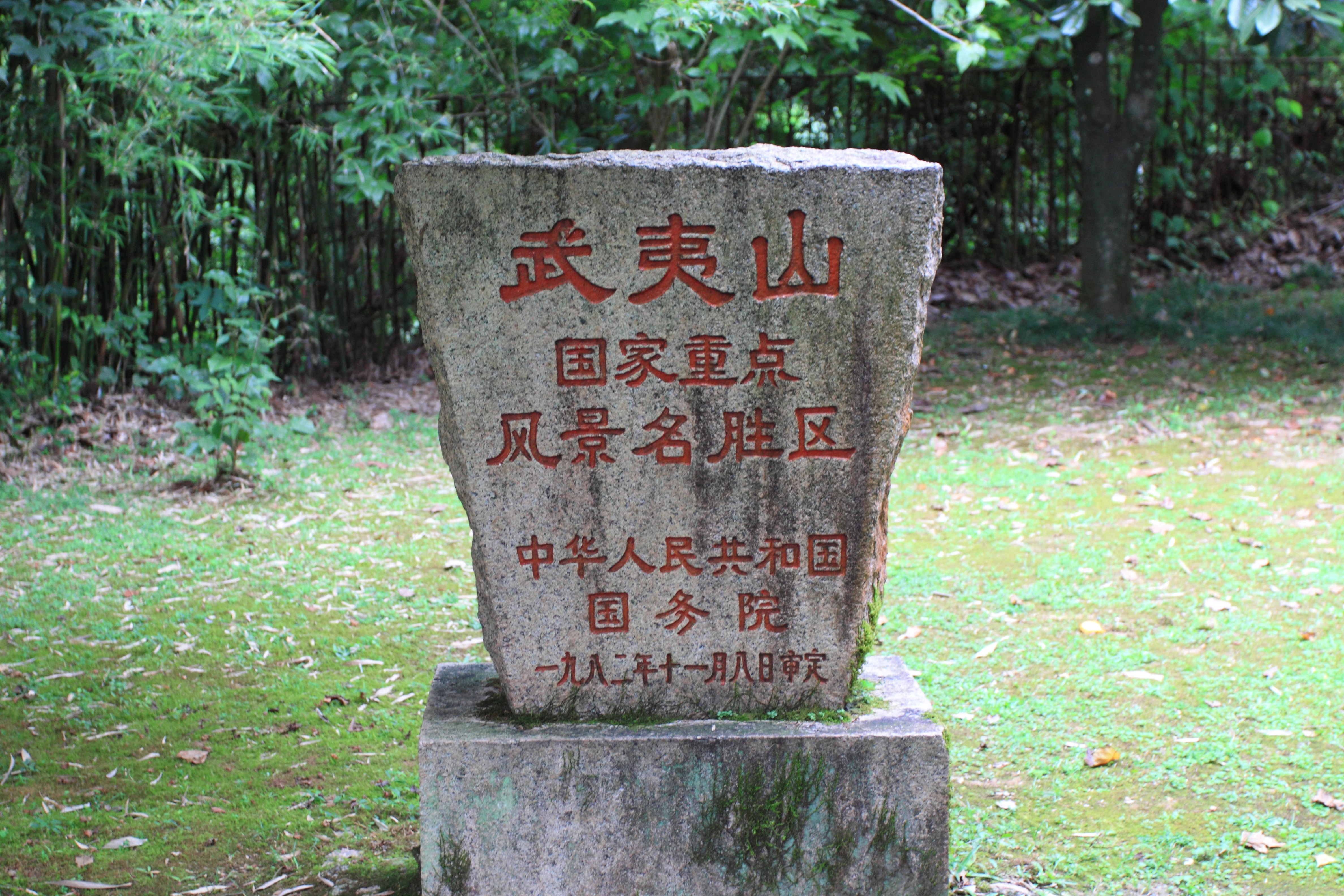
A weathered stone monument featuring red-painted Chinese characters set in a lush, green outdoor area.
A stone monument marking the Wuyishan Scenic and Historic Interest Area.

Top sights and standout views in Wuyishan Scenic and Historic Interest Area

Within the Wuyishan Scenic and Historic Interest Area, several features define its character and visitor identity. The Jiuqu Xi, with its nine dramatic bends traced by traditional bamboo rafts, is the visual and experiential heart of the area, while the surrounding Danxia peaks, especially Dawang Peak, Yuyun Peak, and Tianyou Peak, give the river its framed vistas.

Cultural anchors include the Dawang Peak and Wuyi Gong complex at the eastern end of the river, dating in origin to the Tang dynasty; the Wuyi Jingshe academy of Zhu Xi at the foot of Yinping Peak; the Yixiantian fissure, one of the most striking narrow-rock formations in China; the ancient cliff tombs of the Minyue ancestors along the gorge walls; and the Da Hong Pao mother trees in Jiulongke canyon, a global touchstone of Chinese tea heritage.

The scenic area's internal organization into six interconnected zones (Jiuqu Xi; Wuyi Gong and Dawang Peak; Yunwo and Tianyou; Huxiao and Yixiantian; Shuiliandong and Da Hong Pao; Yulinting and Lianhua Peak) makes these highlights accessible as a coherent whole rather than scattered sights, reinforcing Wuyishan's identity as a landscape in which every cliff, bend, and ravine weaves together natural drama and centuries of human meaning.
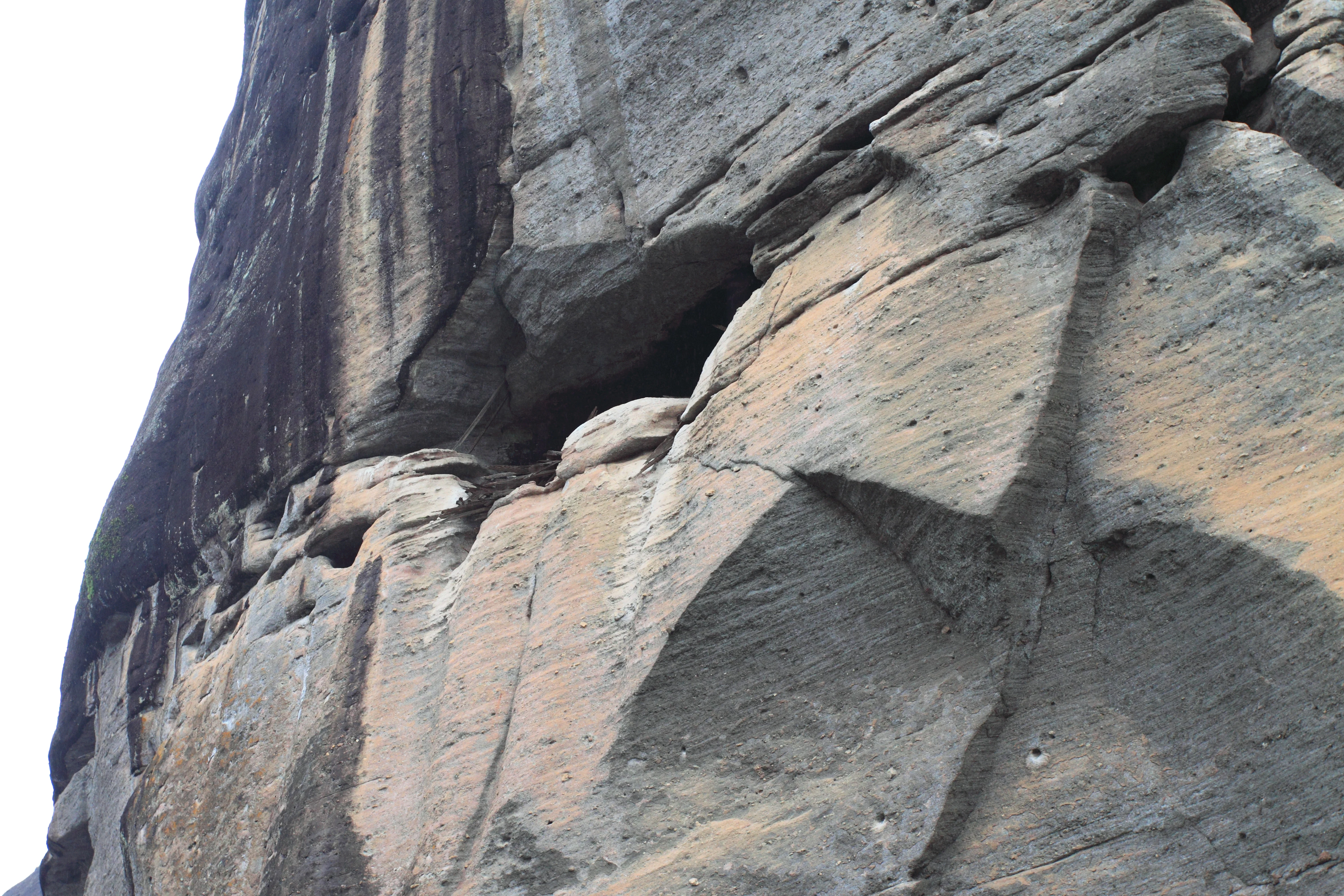
A steep, weathered cliff face composed of layered rock, with a shadowed recess suggesting the location of an ancient tomb.
A close view of the Dazang Peak rock formation, featuring ancient cliff tombs embedded in the face of the mountain.

Best time to visit Wuyishan Scenic and Historic Interest Area

Wuyishan's subtropical climate gives it a generally mild, humid character year-round, but the visual and experiential atmosphere shifts significantly with the seasons. Spring and autumn are widely regarded as the most rewarding periods, when temperatures are comfortable and vegetation colors are balanced: spring brings fresh greenery and flowing water, while autumn deepens the tones of the forest and often produces the clearest views of the Danxia cliffs.

Summer is lush and active, with high humidity and frequent rain that can both freshen the streams and create dramatic mist and cloud effects around the peaks, but also bring hotter, wetter conditions that can obscure distant views. In winter, the area quiets considerably: cooler air reduces haze and crowds thin out, allowing a more contemplative view of the landscape, though the famous Da Hong Pao tea harvest and many active cultural programs are tied instead to the warmer months.

These seasonal differences shape the kind of experience a visitor can expect, from the mist-wrapped peaks and vibrant greens of late spring and early summer, to the saturated colors of autumn, to the stillness of winter when the Danxia cliffs stand out against clearer skies and lighter crowds. Choosing a season therefore depends less on operability than on the atmosphere and pace a traveler seeks.

Monthly climate preview

Long-term representative point measurements tracking annual temperature and precipitation rhythms

Wuyishan Scenic and Historic Interest Area Climate Normals and Weather by Month

Wuyishan Scenic and Historic Interest Area records measured monthly variations in average temperatures and daily precipitation across a representative coordinate. Reviewing the complete twelve-month climatology profile provides deeper analytical context for long-term regional weather patterns.
Annual mean17 °C
6 °C27 °C
Jan
Feb
Mar12°
Apr17°
May21°
Jun25°
Jul27°
Aug27°
Sep23°
Oct18°
Nov13°
Dec
Warmest month
July

26.9 °C

Coolest month
January

6.2 °C

Wettest month
June

11.9 mm/day

Driest month
October

1.7 mm/day

Park location guide

Geography guide, regional context, and park location map for Wuyishan Scenic and Historic Interest Area

Wuyishan Scenic and Historic Interest Area park geography, regions, and map view in China

Understand where Wuyishan Scenic and Historic Interest Area sits in China through a broader geographic reading of the surrounding landscape, nearby location context, and its mapped position within the national park landscape.

How Wuyishan Scenic and Historic Interest Area fits into China

China is a unitary communist state in East Asia, governed by the Chinese Communist Party. The country's capital is Beijing, while Shanghai is the largest city by urban population. China has 33 province-level divisions including provinces, autonomous regions, municipalities, and special administrative regions. The nation has a long history spanning thousands of years, with achievements including the invention of gunpowder, paper, printing, and the compass.

Wider geography shaping Wuyishan Scenic and Historic Interest Area in China

China is located in East Asia, bordering fourteen countries: Russia, North Korea, Vietnam, Laos, Myanmar, India, Bhutan, Nepal, Pakistan, Afghanistan, Tajikistan, Kyrgyzstan, Kazakhstan, and Mongolia. The country spans diverse terrain including deserts, mountains, plateaus, and river valleys. Major river systems include the Yellow River and Yangtze River. The coastline stretches along the East China Sea, South China Sea, and Yellow Sea.

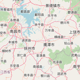
Map view of Wuyishan Scenic and Historic Interest Area

Use this park location map to pinpoint Wuyishan Scenic and Historic Interest Area in China, understand its exact geographic position, and read its mapped placement within the surrounding landscape more clearly.

Pigeon | © OpenStreetMap contributors

Location context for Wuyishan Scenic and Historic Interest Area

Fujian

Visual reference for Danxia landforms, red sandstone cliffs, and winding river valleys

Wuyishan Scenic and Historic Interest Area Photos and Landscape Scenery

Visual records reveal the striking red sandstone cliffs, deep river gorges, and subtropical forest cover defining Wuyishan Scenic and Historic Interest Area. Photographic documentation captures the distinct Danxia landforms and meandering waterways that shape the protected terrain.

A high-angle view looking down at a river winding past rocky, tree-covered cliffs, with four bamboo rafts carrying tourists floating downstream.

A wide angle view of massive, steep rocky cliffs covered in patches of forest, characteristic of the Danxia landforms in Wuyishan Scenic and Historic Interest Area.

A wide view of a calm, reflective river flowing between steep, lush, rocky mountains in Wuyishan, with small wooden boats carrying passengers in the distance.

A wide view of a calm green river flowing past a large, dark-colored cliffside featuring reddish Chinese calligraphy carved directly into the rock face.

A high angle view looking down at a river curving through deep, green-covered rocky valleys and steep sandstone cliffs.

A towering, vertical cliff face of dark, weathered rock with green vegetation clinging to the top and base, set within a lush forest landscape.

A weathered stone monument featuring red-painted Chinese characters set in a lush, green outdoor area.

A steep, weathered cliff face composed of layered rock, with a shadowed recess suggesting the location of an ancient tomb.

A carved stone statue of the Buddhist figure Guanyin standing on a lotus base, integrated into a rough, reddish-brown rock cliff face.

A traditional Chinese arched gateway with tiled, upturned eaves, set in a garden with lawn and trees, framing a path leading to a building.

A traditional Chinese temple complex sits in front of a steep, tree-covered rocky mountain cliff, with a pond in the foreground.

Ancient dwellings tucked into a large, rocky cliffside cave overhang in the Wuyishan Scenic Area, featuring wooden support scaffolding.

A traditional Chinese temple building with dark tiled roofs sits at the base of a lush, forest-covered hill, with a large, sheer granite-colored peak rising prominently in the background under a hazy sky.

A close-up view of the legendary Da Hong Pao tea bushes growing on a steep, dark, textured cliff face, featuring a small stone terrace and red Chinese calligraphy carved into the rock.

A traditional Chinese wooden building with dark tiled roofs, a central courtyard, and a large bronze tripod vessel sitting on a stone pedestal in the foreground, surrounded by cycad plants and lawn.

A close-up view of red Chinese calligraphy carved into a natural mossy rock face.

Park atlas

Compare surrounding Danxia landscapes, mountain ranges, and regional reserves

Explore Protected Areas and Parks Near Wuyishan Scenic and Historic Interest Area

Continue your geographic exploration by browsing other protected areas and reserves located near Wuyishan Scenic and Historic Interest Area. Comparing adjacent regional terrain helps place classic red sandstone geomorphology and winding river valleys into a broader conservation context.
Protected landscapeFujian
About 27 km away#1 closest

West

Wuyi Mountains Protected Landscape: A Geographic Atlas of Subtropical Forests and Danxia Terrain

Mapped boundaries, regional geography, and ancient landscape context.

The Wuyi Mountains in Fujian, China, are a crucial protected landscape, recognized for their exceptional subtropical forest biodiversity and iconic Danxia landforms. This destination offers a detailed exploration of its mapped geography, including the striking red sandstone cliffs, meandering river valleys, and significant cave systems. Understand the park's protected boundaries and its role as a vital natural and cultural heritage site within China's regional geography, perfect for atlas-based discovery.

Area
1,278.63 km²
Established
1999
IUCN
II
Relief
Mountain
National parkKinmen County
About 349 km away#2 closest

South

Kinmen National Park: National Park Protected Landscape and Geographic Context

Mapped boundaries and regional park geography for atlas exploration.

Kinmen National Park stands as a significant protected area within Kinmen County, Taiwan. This page focuses on its identity as a national park, detailing its mapped boundaries and contributing to an understanding of its regional geographic context. It is designed for users seeking to explore the park's protected landscape features and its position within the broader atlas of natural areas.

Area
35.29 km²
Established
1995
IUCN
II
Relief
Upland
National parkTaiwan
About 453 km away#3 closest

Southeast

Yangmingshan National Park: Volcanic Terrain and Geothermal Features Atlas

Explore Taiwan's protected national park geography and mapped landscapes.

Yangmingshan National Park presents a striking example of volcanic geography, characterized by its rugged mountain terrain, active craters like Xiaoyoukeng, and ubiquitous geothermal features such as hot springs and sulfur deposits. As a protected national park within Taiwan, its landscape offers a rich context for understanding volcanic processes and alpine ecosystems. MoriAtlas provides detailed map exploration of Yangmingshan National Park, highlighting its unique geological formations and protected boundaries for an in-depth geographic discovery experience.

Area
113 km²
Established
1985
IUCN
II
National parkMiaoli County
About 466 km away#4 closest

Southeast

Shei-Pa National Park: Explore Taiwan's National Park Protected Landscape in Miaoli County

Mapped geographic boundaries and regional park context.

Shei-Pa National Park is a vital protected area in Miaoli County, Taiwan, offering rich opportunities for geographic and atlas-based exploration. Delve into the specifics of its mapped park boundaries and understand its role within the broader regional landscape. This destination provides essential context for discovering Taiwan's protected natural areas and their unique geographic characteristics.

Area
768.5 km²
Established
1992
IUCN
II
Relief
Mountain
National parkHualien County
About 500 km away#5 closest

Southeast

Taroko National Park: Detailed National Park Geography and Protected Landscape Context

Explore mapped boundaries and natural terrain in Hualien County.

Taroko National Park represents a significant protected landscape within Taiwan, offering rich opportunities for geographical exploration and understanding protected-area distribution. As a designated national park, its mapped boundaries and unique terrain provide essential context for appreciating the natural geography of Hualien County and the surrounding region. This page supports detailed discovery of Taroko National Park's identity as a distinct protected area, ideal for atlas-based research and landscape comprehension.

Area
920 km²
Established
1986
IUCN
II
Relief
Mountain
National parkTaiwan
About 503 km away#6 closest

South

South Penghu Marine National Park: A Protected Volcanic Island Landscape in Taiwan's Penghu Archipelago

Mapped marine protected areas and unique geological features.

Discover the unique atlas value of South Penghu Marine National Park, Taiwan's protected national park renowned for its dramatic columnar basalt landforms and extensive coral reef systems. This marine protected area provides critical habitat for diverse species and showcases a rugged island geography shaped by volcanic activity. Explore its mapped boundaries and unique geological formations, including famous sea caves, offering a distinct context for landscape discovery.

Area
358.44 km²
Established
2014
IUCN
II
Visitors
8.4K annual
National parkTainan
About 521 km away#7 closest

Southeast

Taijiang National Park: National Park Atlas and Protected Landscape Exploration

Discover mapped boundaries and regional geography.

Taijiang National Park offers a distinct look into protected natural landscapes within Tainan, Taiwan. This page details its identity as a national park, focusing on its mapped geographic features and its contribution to the regional atlas. Users can explore the specific protected area context and understand the landscape characteristics relevant to a structured geographic discovery approach.

Area
393.1 km²
Established
2009
IUCN
II
Relief
Lowland
National parkNantou County
About 542 km away#8 closest

Southeast

Yushan National Park: Explore Taiwan's Highest Mountain and Alpine Protected Terrain

Mapped geography and dramatic peaks within Nantou County.

Yushan National Park is a crucial protected area in Taiwan, renowned for encompassing the island's highest mountain and a significant portion of the Central Mountain Range. This national park's dramatic geography spans over 103,000 hectares, with two-thirds of its territory lying above 2,000 meters. Its vertical ecological zones, from subtropical forests to alpine environments, offer a rich tapestry of landscapes ideal for atlas-style exploration of protected terrain and mountain peak geography.

Area
1,031.21 km²
Established
1985
IUCN
II
Visitors
1M annual

Common questions about visiting, size, designation, and location context for Wuyishan Scenic and Historic Interest Area

Wuyishan Scenic and Historic Interest Area FAQs for park facts, access, geography, and protected area context

Find quick answers about Wuyishan Scenic and Historic Interest Area, including protected-area facts, park geography, trail and visitor context, and how the park fits into its surrounding country and regional landscape.
MoriAtlas Explorer

Continue Your Protected Areas Search Across the Global Atlas

Deepen your exploration by continuing the structured search for national parks and protected areas worldwide. Utilize the comprehensive filtering capabilities to compare different conservation landscapes and refine your understanding of global park geography. Discover more about the distribution and characteristics of protected natural areas.

Global natural geography